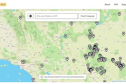
These days there’s a website or app for just about anything, and you can now add firewood to that list. Stacked.camp is a new “community-focused project” (website database) that was created to help campers find firewood, quickly and easily. Stacked was specifically built as a “lite-weight” webapp to facilitate quick loading of information, even when…
Get your tickets to THE BIG THING 2026!

The Mojave Desert MDHCA has Elected a Prominent Overland Explorer as President
This is excellent news for us desert lovers. Billy Creech has been elected President of the Mojave Desert Heritage and Cultural Association (“MDHCA”) non-profit which was formed in 1993 with the mission to research, conserve and share the natural and cultural history of the Mojave Desert. The MDHCA runs the 75 acre Goffs facility and…
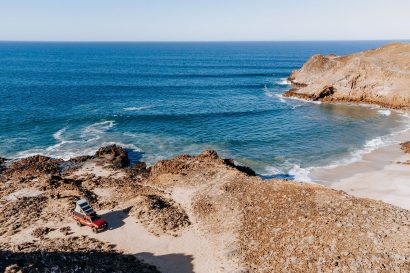
11 Tips for Visiting Baja, Mexico, This Winter
Photography by Richard Giordano From sunseekers to snowbirds, surfers, and off-roaders, it seems like nearly everyone I’ve talked to is planning to visit Baja this winter. The promise of warmer temperatures, beach camping, and finding solace in remote desert locations has mass appeal. Waking up to the sound of coyotes chattering, frolicking in sparkling bioluminescence…
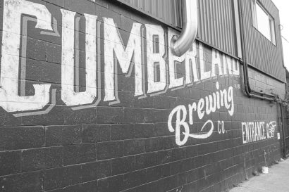
Destinations :: Cumberland, British Columbia
On the east coast of central Vancouver Island, British Columbia, you’ll find Cumberland, a gateway to Comox Lake 60 miles northwest of Nanaimo. What makes Cumberland and its 3,000-plus residents unique is the welcoming community and world-class recreation possibilities. Unlike other touristy stops on Vancouver Island, like Tofino and Coombs, Cumberland has kept its quaint…
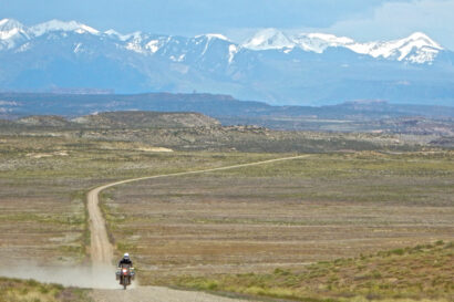
10 Years, 10 Routes, 10,000+ Miles—A Decade Anniversary for Backcountry Discovery Routes (BDR)
Backcountry Discovery Routes (BDR) are one of the best ways to adventure-road trip around the U.S. And what better way to celebrate Motorcycle Awareness month and National Road Trip day (May 28) than with the 10-year anniversary of BDR—an organization that literally defined the phrase “adventure riding.” What is BDR? Using double-track, forest service, and…
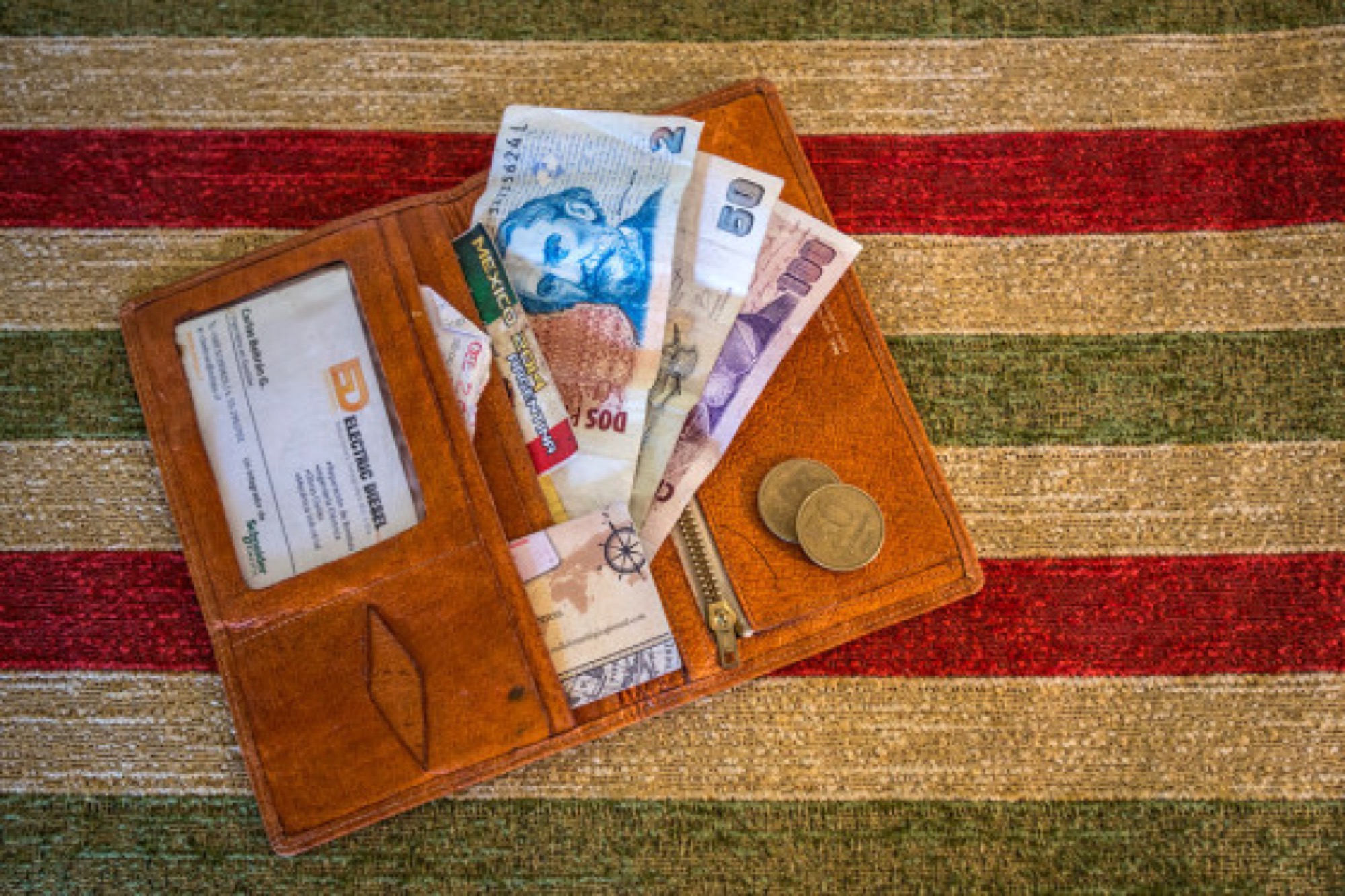
Managing Your Money on the Road
Words by Lisa Morris, photography by Jason Spafford A learned friend advised that if I were to raise funds for a big two-wheeled trip successfully, I’d have to adopt the mantra Don’t be too stupid to be poor. Being frugal is the easy part—surrendering the daily caffè latte, monthly subscription to premium television, and…

South Africa Overland
There are countries within continents which are quite unlike those surrounding them: Uruguay and Turkey are good examples. And South Africa is unique on the African continent. It is a land of extremes: wealth and poverty, desert and tropical coast, cities and wide-open spaces. Yes, it has its challenges, but the crime and political instability…

Backcountry Discovery Routes’ Holiday Auction
Backcountry Discovery Routes (BDR) is holding its fifth annual Holiday Auction. Head over right now until December 20 to place bids on items that will no doubt increase your fun factor—or someone else’s. Choose from brands such as Touratech, Klim, and Mosko Moto. Custom adventure rides are also on the auction block, along with skills…

One for the Road
Editor’s note: This article was originally published in Overland Journal’s Fall 2020 Issue. Let’s accept that adventure motorcycling means long, unsupported journeys across the world’s developing nations, lately redefined as the Global South. Overlanding is another word for it, as distinct from regular touring vacations or even gnarly domestic adventures that aren’t hard to have…

Overland Across Eurasia by Bus
Article by Martyn Davies “The Overland” From 1957 until 1979 a steady stream of people travelled from Europe to the East. They were a mixed bag seeking a change of lifestyle and a little adventure, including students, artists, Vietnam Vets, and hippies. The road from Europe to India and beyond was called “The Overland” or…

How We Began Our Overland Journey and What We Learned
Two weeks before the start of our overland adventure, my mother and I went to Spain for a week. Coen was flabbergasted. Buried in a list of things he felt needed to be done, he couldn’t understand why I went on vacation. On the other hand, I didn’t understand what all the fuss was about….

A Journey to the Arctic Circle
We put our finger on the map, packed the car, and left the UK on a rainy Thursday evening. Not the most memorable start to an adventure, but after spending the previous two weeks converting the inside of our Land Rover Defender from a tired utility truck into a home on wheels, we couldn’t wait…

Overlanding Southern New Brunswick
Sleep beside the highest tides in the world, and drive on the ocean floor to an island in one of Atlantic Canada’s most underrated provinces, New Brunswick. While Prince Edward Island (PEI) and Nova Scotia are more popular destinations for overlanders, New Brunswick offers some unique experiences. As a New Brunswicker from the northeast region,…

It Was the Dog That Barked
Published in Overland Journal Europe, Summer 2019 Time travel to Portugal—2,000 kilometres forward; 100 years back. Daylight was fading fast as we took a last exploratory walk through the twisted alleys in the almost deserted village of Antigo de Sarraquinhos. We stopped in front of the only house with a dim light shining through an…
Interview With Rachelle Croft of Expedition Overland
In 2011, Rachelle Croft was in the midst of an intense period of motherhood. Her youngest of three sons had just turned one. Her husband, Clay, was on the road and traveling frequently. “Honestly, I was definitely a little depressed. I loved our boys but missed adventure. At that time, I didn’t realize that being…
Arctic Adventures: Rallying the 2020 Alcan 5000
Long hours on ice-covered roads coupled with continual concentration seeped deeply into our bodies. After nearly 30 tanks of diesel and 10 days of white wonderlands, we neared the end of our Arctic journey, completing the 2020 Alcan 5000 Rally. What started as a pipe dream to pilot an old, right-hand-drive diesel deep into the…

Nova Scotia | Overland Routes
Editor’s Note: This article was originally featured in the Spring 2020 issue of Overland Journal As a child, there were a few things I “knew” about what lay beyond the borders of Texas. In the States, the Southeast was a land of sugary sand beaches and muggy afternoons; the Northeast was home to big cities,…

Caught Up in the COVID-19 Crisis in Saudi Arabia
A life on the street, a life in a van—after more than four years in Africa, we thought that nothing and nobody could stop us. But then came coronavirus. Africa We spent 1,561 formative days on the African continent, and every country left its mark—a total of 36 countries, 49 border crossings, and countless roadblocks…

Across the Deserts in Kazakhstan
The world was gray without any visible contours of clouds, making it impossible to see where the horizon separated the earth and the sky. It was a depressing start to our off-road journey across the Aralkum Desert and the Mangystau Plateau to the Caspian Sea in Kazakhstan. Driving Around and Across the Aral Sea Our…

Expedition Portal Celebrates 15 Years of Adventure
June 25, 2020 :: Press Release In late June 2005, expeditionportal.com (known as ExPo) went live, serving initially as a community forum, and now as one of the world’s largest online overland resources for the vehicle-based adventure traveler. While the website has grown continually since 2005, growth has accelerated in recent years because of the…