
Editor’s Note: This article was originally featured in the Spring 2020 issue of Overland Journal
As a child, there were a few things I “knew” about what lay beyond the borders of Texas. In the States, the Southeast was a land of sugary sand beaches and muggy afternoons; the Northeast was home to big cities, cold weather, and lots of trees; while the Midwest was filled with corn, and well, more corn. The West, though, that was a place of legends—home to Arizona’s immense canyons, Colorado’s raging rivers, California’s vast deserts. Extending into Canada and beyond were mountains so majestic in British Columbia and Alaska that they defied comprehension. With such childhood perceptions, I suppose it’s no surprise that when I finally left Texas, I spent the next decade exploring the western side of North America without the slightest interest in turning my sights back east. That was, at least, until a chance conversation with a traveler at a bar, and two simple words that piqued my interest: Nova Scotia.
General Information
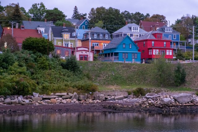
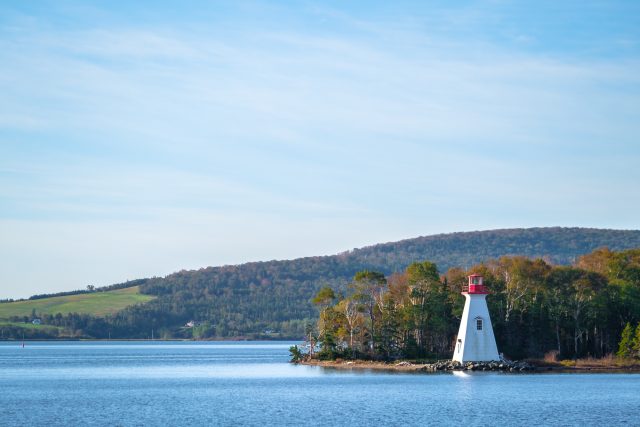
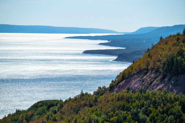
Nova Scotia is tucked neatly along the southeast coast of Canada and connected to the mainland by the Isthmus of Chignecto. At 21,300 square miles, it’s the country’s second-smallest province and is fondly known as Canada’s Ocean Playground. The title is earned from picturesque coastlines abutting four main bodies of water: the Atlantic Ocean to the east, the Bay of Fundy to the west, the Gulf of Saint Lawrence to the north, and the Gulf of Maine to the southwest. There are roughly 3,800 islands off its shores, and no matter where you stand in the province, you will never be farther than 42 miles from the ocean. As you’d expect for a region surrounded by so much water, its culture is steeped in maritime tradition. Small and colorful port towns dating back hundreds of years still bustle with local fishermen and ships coming and going. World-renowned sailing vessels can be found floating at Unesco World Heritage Sites on the eastern coast, and enormous cargo ships lumber in and out of Halifax’s port facilities.
The topography is surprisingly diverse considering the region’s size, owing to a tumultuous geological history that took over a billion years to create the masterpiece seen today. The lands in the north broke off from Scandinavia and Scotland, which makes the province’s name particularly apt (New Scotland in Latin). Nova Scotia’s terrain is marked by craggy coastal cliffs, rolling green hills, lush river valleys, and flat-topped mountains worn down by the relentless pressure of receding glaciers. The southern mainland, on the other hand, originates from Africa, and its bedrock base is marked by a flatter, more mellow terrain with sheltered coves and low marshes. Plant and animal life is bountiful, and you’ll find rivers flush with trout and seasonal salmon flowing throughout the landscape. Endless forests of evergreens and deciduous trees paint the countryside in brilliant shades of red, yellow, and orange in autumn. Elk, moose, bear, and deer roam throughout the province, and a cornucopia of sea life lives offshore. Whether flora, fauna, geography, geology, or history pique your interest, you’ll find your fill in Nova Scotia.
The Drive
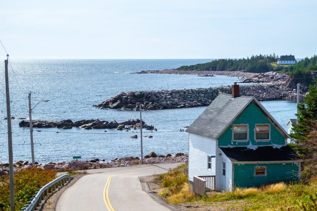
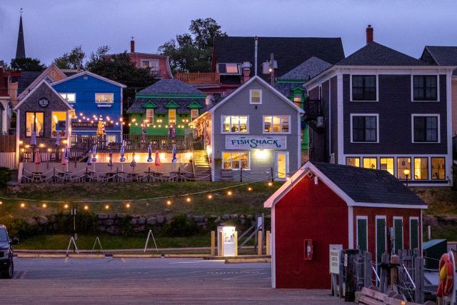
Although our route begins in the north, your journey will likely start in one of two ways: a crossing of the Isthmus of Chignecto by road, or a ferry from Maine or New Brunswick. Regardless of which method you choose, you’ll want to explore the mainland of Nova Scotia to experience all the province has to offer. The landmass is home to five Unesco World Heritage Sites, over 160 historic lighthouses, countless wineries, two national parks, and one national park preserve, along with enough kayaking and cycling to keep you occupied for a lifetime. You can visit towns like Lunenburg, which is often regarded as the best-surviving example of a British colonial settlement in North America; discover its wooden buildings dating back to the 18th century, charming waterfront, delicious restaurants, and weekly farmers market. Peggy’s Cove provides an idyllic view of a colorful fishing village in Atlantic Canada, while Halifax offers a lively night scene and plenty of cultural opportunities. Narrowing down your choices will be a challenge, but make sure you do, because Cape Breton Island awaits, and that’s where our route officially begins.

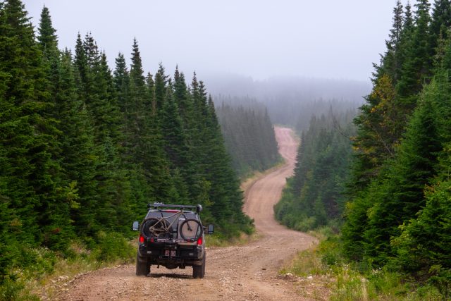
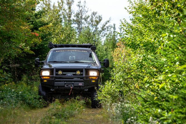
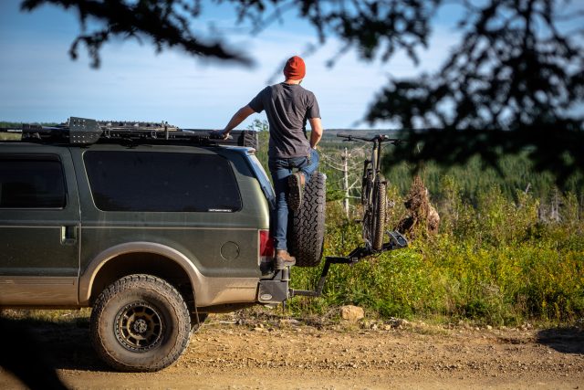
You’ll find yourself starting the dirt portion of the drive on the wide logging roads of the cape’s interior. The surface is dusty and smooth, enabling you to cruise along at a fast pace without the worry of large rocks or dips. It is important to use caution, though, as you’re sure to encounter massive trucks carrying lumber, and if the season is right, Christmas trees, of which the province exports roughly one million every year. These dirt thoroughfares span across many portions of the island and can be used to get around quickly, but it’s the surrounding access roads that you’ll want to investigate—a web of interesting and unpredictable trails. Many of them are snowmobile tracks in the winter and become so narrow and technical that you can’t make it through. Others, like the one we took down to the tiny town of Big Intervale, are a joy to explore and will pose a lively challenge. Just come prepared with a chainsaw if you have it, or an ax and gloves if you don’t; downed trees can be a big challenge.

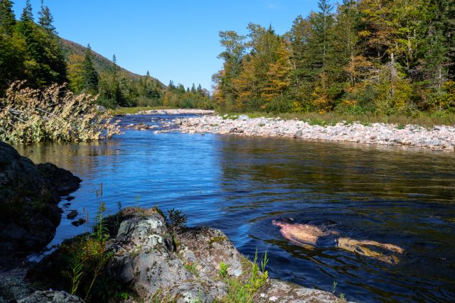
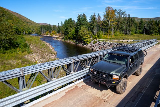
By the time you reach the bottom of the Margaree River Valley, you’ll be greeted by a wood and metal bridge spanning the wide yet shallow river. If you come prepared to fly-fish, you’ll find the water filled with trout and salmon in the right season. In the warm-weather months, escape the heat by heading south to stop by the swimming hole for a dip. When you’re done, the Big Intervale Fishing Lodge is just down the way, and a perfect stop for a hot coffee, cold beer, or a delicious meal. I went for the apple pie and coffee.

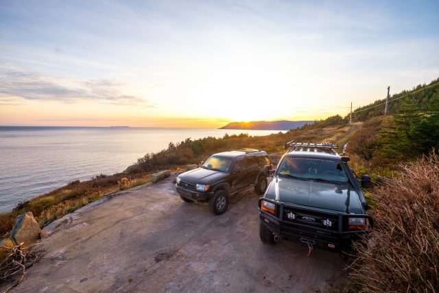
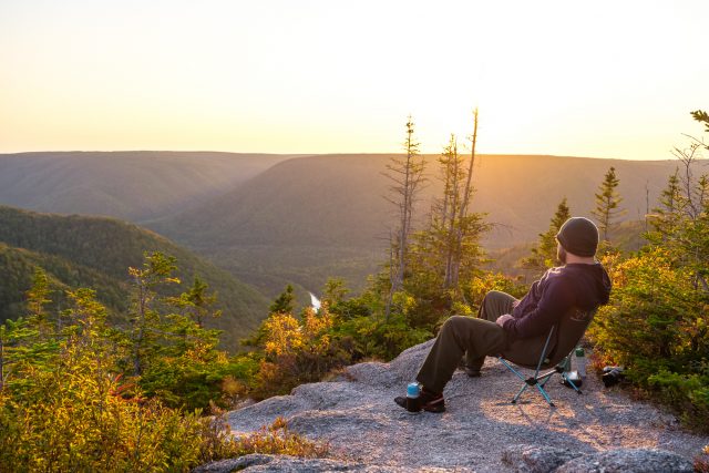
After leaving the lodge and passing by the Margaree Valley supply store, the trail heads back up into the highlands for Cape Clear. This lookout was recommended by some locals, and despite being well-marked, only one other visitor was present when we arrived. During clear skies, the location provides an unmatched vista over the river valley for watching the sunset, but even if the conditions are poor, it’s still worth the visit. When the mists are rolling through the trees, and the rain covers the road with deep puddles, the drive becomes even more enjoyable.
After Cape Clear, it’s time to turn toward the west coast of the island, and there are several options to make it there. Those looking for a quick route can hop on the main logging road, while anyone seeking a more extended adventure can follow a mixture of two-tracks and rocky trails until they find their way out. Our route falls somewhere in between the two, mixing various types of dirt roads, skirting by a lake, and eventually dumping out at St. Joseph du Moine just south of the town of Chéticamp on the Cabot Trail.
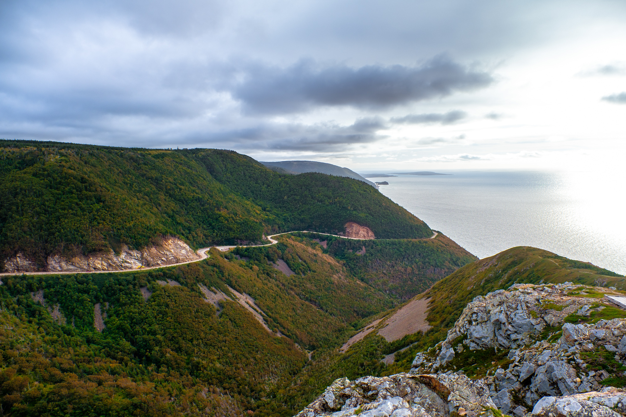
For the rest of the trip, visitors will jump on and off of the Cabot Trail, a 186-mile highway. While the road is paved, it is undoubtedly one of the world’s best driving roads, and something you simply cannot miss when visiting the area. Its serpentine lanes flow along dazzling shorelines, climb over and descend through the mountains of Cape Breton Highlands National Park, and segue numerous charming and historic towns. Towns where you can stop at restaurants like the Doryman to grab a pint and listen to a Saturday afternoon fiddle session, share a cup of coffee with residents whose Scottish accents are so thick you’ll wonder if you may have crossed the pond, or drop into a seafood market for a fresh catch or some mind-blowing chowder.

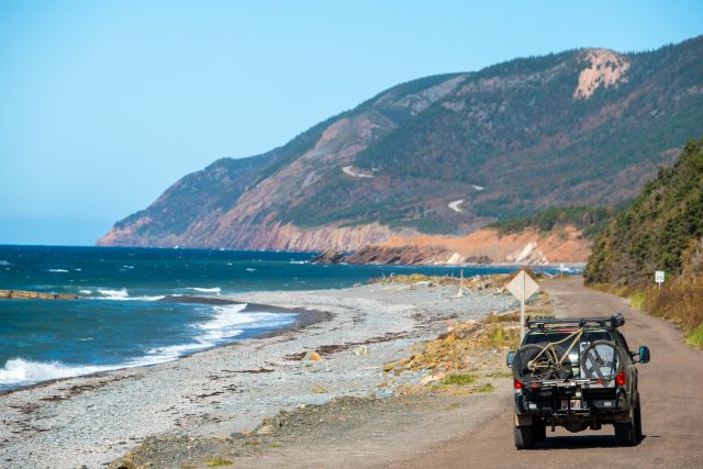
If you’re searching for more off-pavement adventures, don’t worry, there are still plenty of dirt-road side trips along the way. One, in particular, should be considered mandatory, and that’s the drive to Meat Cove. This track winds its way along the coastal cliffs of Cape Breton’s north shore and is lined with loads of beautiful camping spots sporting unbelievable ocean views. Visit during the right time of year, and you might see whales passing by.

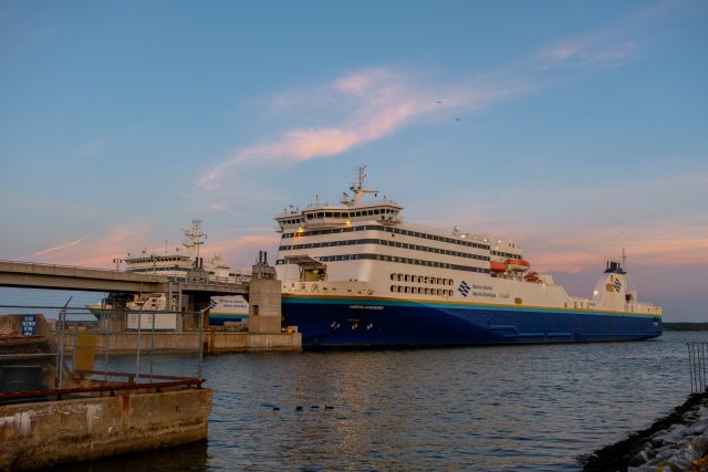
The final leg of the track leads you around the east side of the Cabot Trail toward Nova Scotia’s Highway 105. Here visitors are left with a choice: Head south to explore Bras d’Or Lake and return to the start. Or continue east to the town of Sydney, where the Marine Atlantic ferry system can take you to an even more fantastic and underrated destination, the island of Newfoundland.
Access
North Entrance From the North Sydney ferry terminal, hop on Highway 105/Trans-Canada Highway East and proceed 21.7 miles. Turn right on Route 312 Cabot Trail and continue on the route.
South Entrance From Rod’s One Stop on Highway 105, head 19 miles north to the Cabot Trail, and turn left. Proceed for another 3.4 miles, then turn right on Crowdis Mountain Road.
Logistics
Total Miles 300
Suggested Time 3-7 days (not including mainland Nova Scotia)
Longest Distance Without Fuel 75 miles
Fuel Sources
Rod’s One Stop, Whycocomagh 45°58′13.2″N 61°08′01.1″W
Hart’s Service Center, Margaree Valley 46°19′35.9″N 61°00′17.3″W
Chéticamp, various sources 46°38′00.3″N 61°00′35.0″W
Ultramar, Bras d’Or 46°15′11.7″N 60°17′56.7″W
Difficulty
The majority of this route is easily done and can be completed by stock vehicles. However, many of the secondary access roads can become narrow and technical. If conditions are wet, deep mud and water may become an issue in places, and downed trees are a common problem on smaller trails.

When To Go
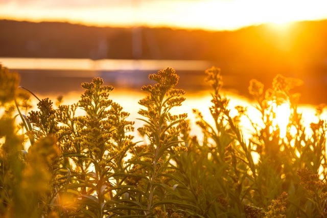
Early fall is an ideal time to visit Nova Scotia, as there are fewer tourists, temperatures are still warm, and you can see some of the region’s spectacular fall colors. Summer is a suitable time as well, but spring can be a gamble depending on how much snow has accumulated. Trails are closed in winter.

Permits and Fees
No permits or fees are required to visit Nova Scotia, although US citizens will need a passport, and residents of other countries should check entry requirements. There are several national and provincial parks in the area, and they are well worth the modest entry fees required.
Suggested Campsites
Chéticamp
Accommodates several vehicles
An overnight stop just outside of town, but not a multi-day campsite
46°36′24.2″N 61°03′19.6″W
The Turret
Accommodates 1-2 vehicles
Flat parking with fantastic views of the ocean and shoreline
47°01′35.8″N 60°32′10.0″W
Wreck Cove
Accommodates large groups
Coastal beach access, relatively flat parking with room for tents
46°31′50.9″N 60°25′04.1″W
There is a range of campsites to be found on the dirt section of the track. Pick a side road and explore.
Contacts
Cape Breton Regional Police cbrps.ca/
Road Conditions 511.novascotia.ca/en/map
Cape Breton Regional Hospital nshealth.ca
Cape Breton Highlands National Park pc.gc.ca/en/pn-np/ns/cbreton
Resources
For paper maps, the Nova Scotia and PEI Backroads Mapbook is an excellent option, available digitally through Gaia. There are also the Cape Breton snowmobile trail maps, which you can pick up at local stores. For campsites, I found iOverlander to be extremely useful.
This track, along with all other Overland Routes, can be downloaded on our website at overlandjournal.com/overland-routes/.