

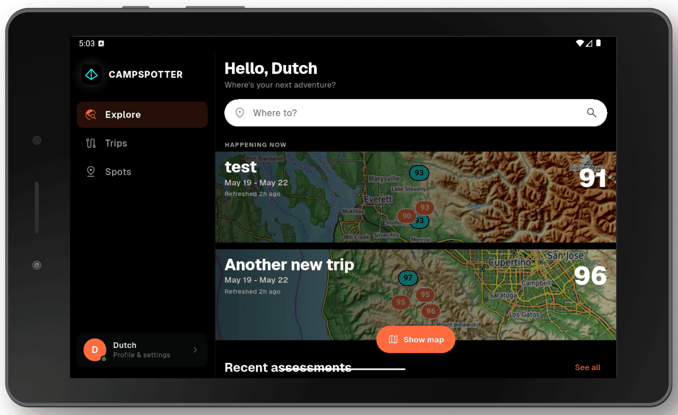
Michiel Pruijssers thought he had planned the perfect camping trip. The weather forecast looked good, the campspot ideal. But when a powerful storm rolled in and ruined the experience, Michiel, a longtime outdoorsperson and SAR volunteer, felt unprepared. Thus, he built Campspotter, an app with a simple mission: to make finding and planning your next adventure as easy as possible.
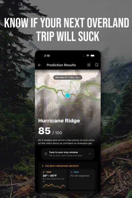
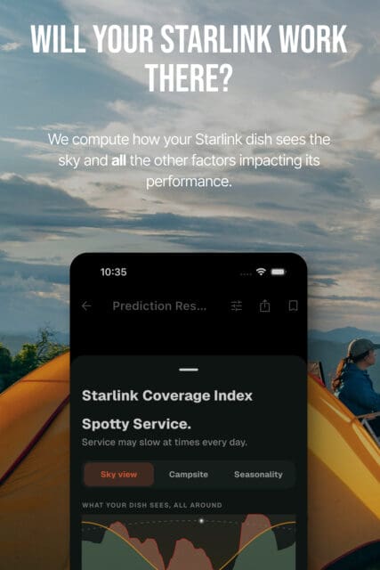
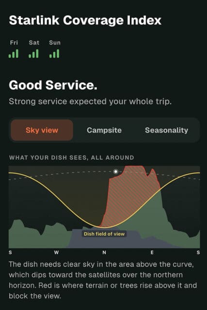
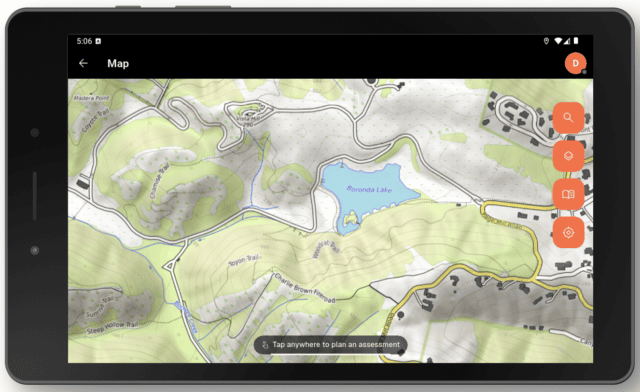
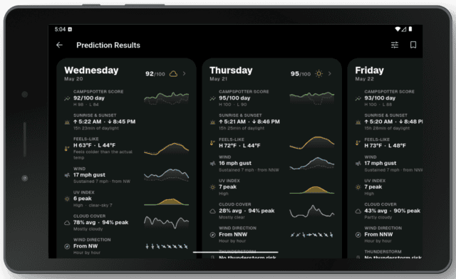
To get started, tap anywhere on the app’s map (or enter GPS coordinates) and select the dates you plan to visit up to a year in advance. Campspotter then crunches the numbers and generates an extensive data report, including an overall rating out of 100. The assessment considers daylight hours, “feels like” temperatures, wind speed, direction, and gusts, UV index, precipitation, cloud cover, wildfire and smoke risk, thunderstorm potential, freezing levels, solar radiation, air quality, ground-level ozone, humidity, pressure, and visibility. It also includes a Starlink coverage index, live minute-by-minute weather forecasts, and a campsite analysis with accurate slope information and a 3D model of the exact coordinates. Yes, that’s an incredible amount of data—and it’s available worldwide with cached scores, forecasts, and trips accessible offline.
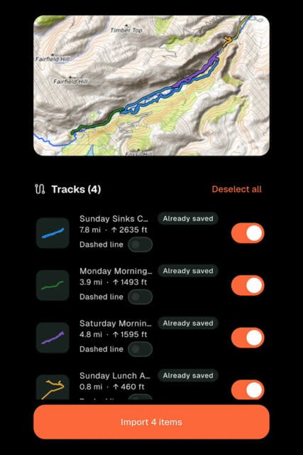
Campspotter is built for iPhone, iPad, and Android users, while the browser version is better suited to those who prefer planning routes on a computer monitor. Recent updates include a route-building feature that lets users import files from onX Off-road, Google Earth, or Gaia GPS while preserving colors, icons, and line styles. You can also build a route directly within Campspotter; the provided elevation data, such as incline and switchback severity, offers helpful intel for anyone piloting a large rig or towing a trailer.
The app is free to download and includes 20 assessments. The Pro Plan offers unlimited assessments, global coverage, and longer-range planning. But does Campspotter deliver on its promises? Intrigued, Luisa Bell, Steve Edwards, and I put it to the test. (AG)
Campspotter Testing in Oregon, Luisa Bell
We spent two weeks testing Campspotter across Oregon while planning and researching remote camping trips, and I found it to be a genuinely useful tool for bringing a lot of information together in one place. I particularly liked being able to open the map, select a single day, or look at a specific date range when planning a trip. That flexibility makes it much easier to assess conditions before heading into an area.
The wildfire information is one of the app’s strongest features. It clearly shows where wildfires are located and provides warnings when a fire is nearby, giving you an early heads-up about potential problems. The live containment updates, sourced from Watch Duty, are particularly useful when deciding where to travel.
I also found the weather information impressively accurate, in particular for temperature and wind. For remote trip planning, having that information alongside precipitation, snow levels, and terrain is a real advantage.
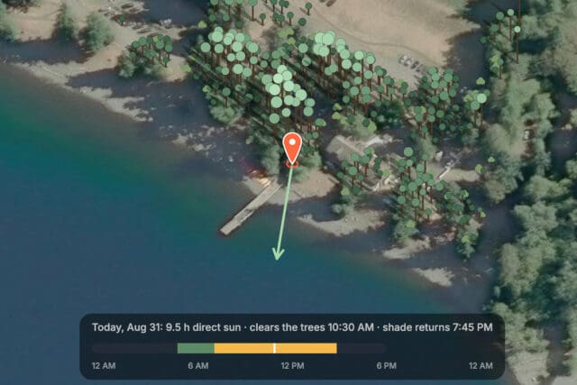
The campsite analysis was reasonably accurate, although it has some limitations. Starlink coverage was useful as a general guide, but a compass and more directional information would make it considerably more practical when choosing a campsite. Terrain information can also be less useful in heavily forested areas, where dense treetops make the actual campsite conditions difficult to assess.
A few areas could still be improved: Two campgrounds we were researching could not be located, and some locations were marked as “campsite.” Map data can also take some time to load when zooming in.
Overall, Campspotter has plenty of potential and is particularly useful for remote trip planning. It brings together information that would otherwise require several different apps, and I found it valuable during my testing. Improving campsite data, mapping coverage, and a few of the more detailed planning features would make it an even stronger tool for people heading into remote areas. (LB)
Campspotter Testing in Montana, Stephan Edwards
Sometimes, like Odysseus lost on the wine-dark sea, the overlanding gods choose to curse you. At the moment, I am furiously rowing between the Scylla of a full engine rebuild for my Defender and the Charybdis of a frozen fuel pump on my BMW GS ADV bike. Doomed to be stranded in my own garage, what can a beached explorer do other than live vicariously through his more mobile friends? I settle onto the couch with my iPhone and open the Campspotter app.
Campspotter’s tagline is “Will your next campsite suck?” and as I bring up the sites currently occupied by my fellow travelers around the globe, the jealous part of me secretly hopes for headwinds and gloomy skies—among Campspotter’s “Grind Factors” that drag down a campsite’s positive vibes and its overall score. Are they cursed with sloping ground and spotty shade? Or maybe they’ve foolishly chosen to pitch camp at the entirely wrong time of year for that spot? Campspotter’s panopticon of data offers that level of fine-grained analysis of any particular location within the larger historical weather and sun-exposure contexts that other apps just can’t. My thumbs appreciate Campspotter’s slick and easily navigable UX that expertly manages the boatload of information the app synthesizes. Kudos, too, for Campspotter’s crystal-clear TOS.
But at what cost? In recent years, overwhelmed by data, I feel more inclined to turn these kinds of tools off on my own travels. Whether or not your campsite sucks depends on what you make of it, whether you wash up into the clutches of a Cyclops or the arms of Calypso. The unknown often makes the adventure. (SE)
Campspotter Testing in Mongolia and China, Ashley Giordano
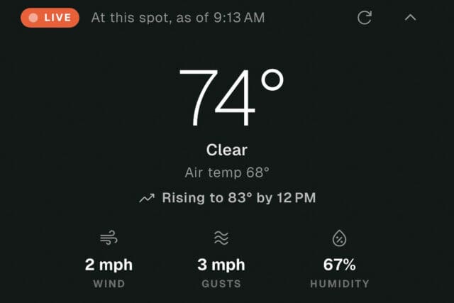
While Steve Edwards was navigating the Campspotter app from Montana, I was 8,000 kilometers away in Central Mongolia, trying to sleep through a bone-shaking, heart-stopping thunder and lightning storm. I typically use several weather apps to monitor forecasts and conditions, so for this review I added Campspotter to the mix. The app draws on more than 40 environmental sources and over 20 meteorological and research institutes to provide 365 days of forecasting, making it a potential one-stop source for weather information.
As an international traveler who rarely sticks to a schedule, the app’s most helpful feature is the data report, particularly its information on wind speed, precipitation, thunderstorm risk, and freezing level. Modifying preferences (such as “I don’t like thunder/rain/heat, etc.”) improved the report’s accuracy, with scores dropping significantly after I toggled my specific weather nemeses. I ran assessments up to a week out, tested the hour-by-hour weather feature, and the Starlink coverage index, and found them all useful.
As a naturally curious person, I enjoyed nerding out over the data but was less drawn to route planning or individual camp assessments. When you’re overlanding abroad, you have to let go of the desire for certainty. The weather will be bad, your camp will suck, and it will likely be too cold, too hot, with a heinous UV index or poor air quality. That’s just life on the road.
The app really shines, though, for vacation planning, backcountry hiking, bike trips, and other activities where the weather window really counts. Overall, Michiel’s ability to pull data together is very impressive, and I continue to use Campspotter throughout Mongolia, China, and beyond. (AG)
$35/Pro Plan, free to download + 20 assessments | campspotter.io
Our No Compromise Clause: We do not accept advertorial content or allow advertising to influence our coverage, and our contributors are guaranteed editorial independence. Overland Collective may earn a small commission from affiliate links included in this article. We appreciate your support.
