Editor’s Note: This article was originally published in Overland Journal, Fall 2017.
When most people envision New Mexico, they picture the outlines of rocky plateaus, desert sunsets, and Native American culture. It’s understandable, as you can certainly find these things in abundance throughout the state, but there is also something more: the Continental Divide. Drivers can climb to towering heights, weave through dense forests, and walk amongst ancient lava beds. There are hot springs carved from cliffsides, and clear streams just waiting to be fished or swam. In many ways, the region is a less-trafficked version of Colorado—one that is underappreciated by, or unknown to four-wheel drive enthusiasts. Last summer we set out to change this with Hema Maps by bringing the area together with some of the most famous trails along the divide.
GENERAL INFORMATION
The Continental Divide, or Great Divide, is a hydrological boundary that stretches from Cape Prince of Wales, Alaska, to the southern reaches of Argentina in Tierra del Fuego. It is the dividing line between all water sources flowing to either the Pacific or Atlantic oceans, and thus encompasses some of the most mountainous terrain in the Americas, including the Andes and the Rockies.
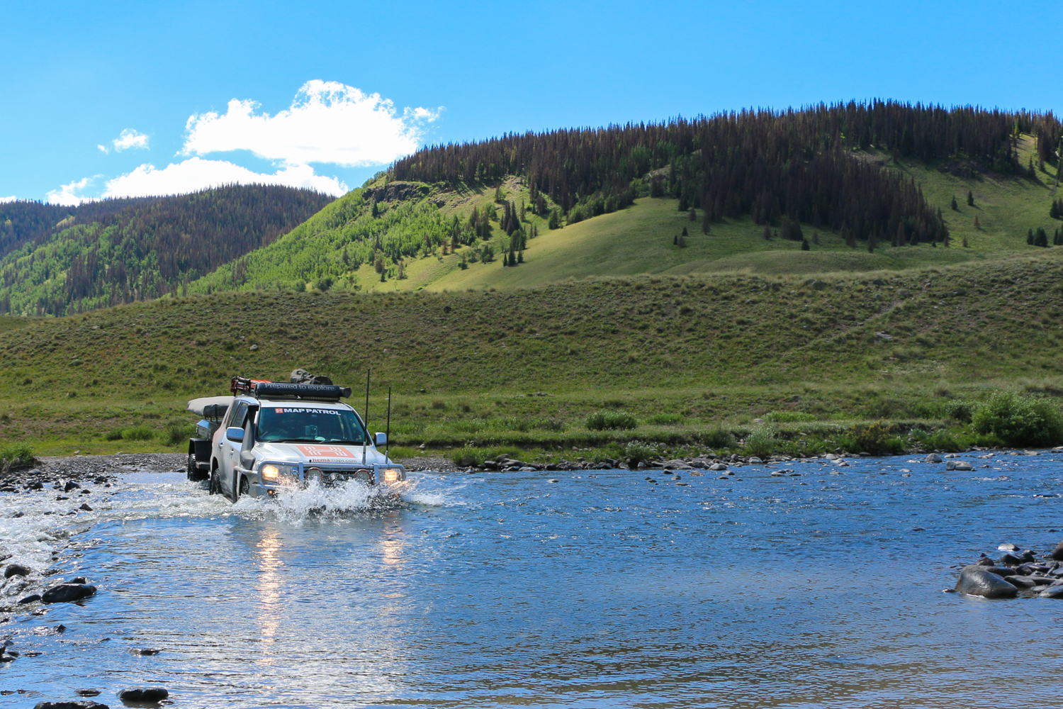
The original Continental Divide Trail (CDT) is a 3,100- mile trek extending through the United States from Canada to Mexico. It was first scouted by a group of enthusiasts called the Rocky Mountain Trails Association, which was largely comprised of the same men and women who founded the Appalachian Trail. As the team worked, they nailed blue cans to trees in order to mark the proposed path for approval by the U.S. Forest Service. This earned the track the nickname of the Blue Can Trail until its official commencement as the Continental Divide National Scenic Trail in 1978. The track was also popularized for 4WD enthusiasts when Tom Collins drove several Range Rover Classics (Great Divide Expedition) along the route in 1989. Although the routes differ in many places, our new track loosely follows the CDT throughout its length, often crossing it several times a day. During the portion covered here—northern New Mexico and southern Colorado—drivers will encounter elevations ranging from a few thousand feet to over 13,000. Terrain can change from a sandy two-track to rocky shelf roads in an instant, and each bend holds a view surprisingly different from the last.


As you’d expect with such a wide swing of elevations, climates change from arid deserts to lush forests and alpine slopes in rapid succession. This gives travelers access to an astonishing array of flora and fauna in a relatively short period of time. In New Mexico’s warmer regions you’ll encounter species like cactus, rattlesnake, and wild turkey, but that quickly transitions to spruce and fir, with elk, bear, and even bighorn sheep in the higher reaches.
THE DRIVE
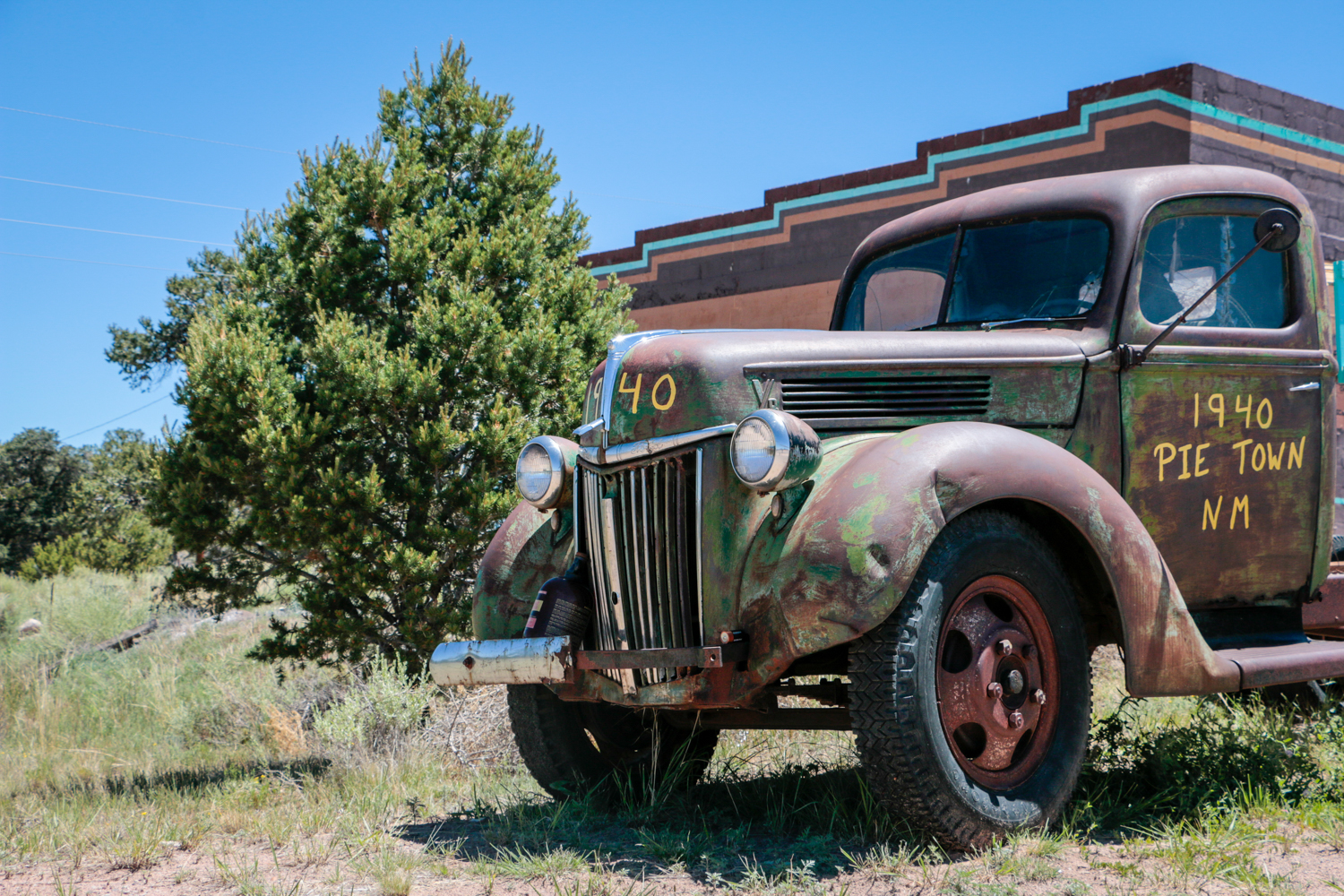
Our journey begins in Pie Town, New Mexico, a well-known stop for CDT travelers to acquire, you guessed it, pie. While there’s no fuel for your vehicle here, the few cafés make it the perfect place to fill your own tank with savory New Mexican cuisine. Afterward, hop onto NM-603 and head north.
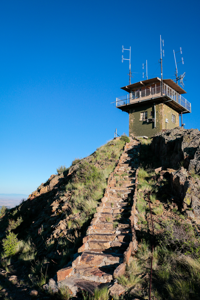
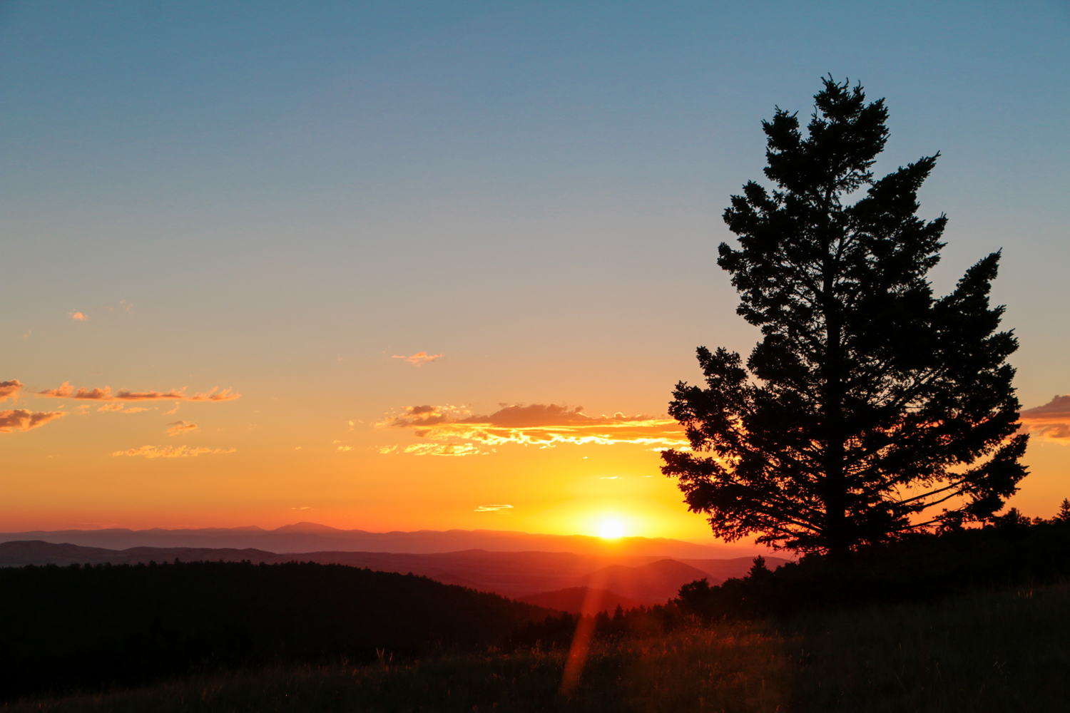
The first stretches of the route include iconic desert landscapes, distant horizons, and dusty gravel roads, but before long the dark colors of ancient lava beds begin to surround the road, marking a fundamental shift in terrain. Here the land is richer, and larger vegetation grows more prolifically. The hills turn from a faded brown to pale green, and then to deep emerald as you make the steep ascent toward La Mosca Lookout. This small outpost is precariously positioned at the tip of a mountain peak, and can only be accessed by a narrow rock staircase at the end of a shelf road. From the summit, an expansive view of thick forests and winding tracks can be seen stretching out far below you, and the reds of the distant desert paint the horizon. We were fortunate enough to have the view to ourselves, and it shattered every preconceived notion of New Mexico we had.
The descent down the opposite slope is no less stunning, and curves its way through meadows of tall grass intertwined with the white trunks of aspen. There are many great campsites along this stretch of road, and though they can be rocky, there are few better places to witness a sunrise.
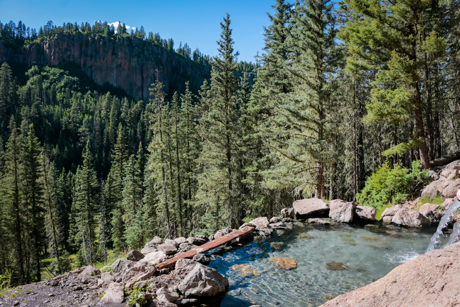
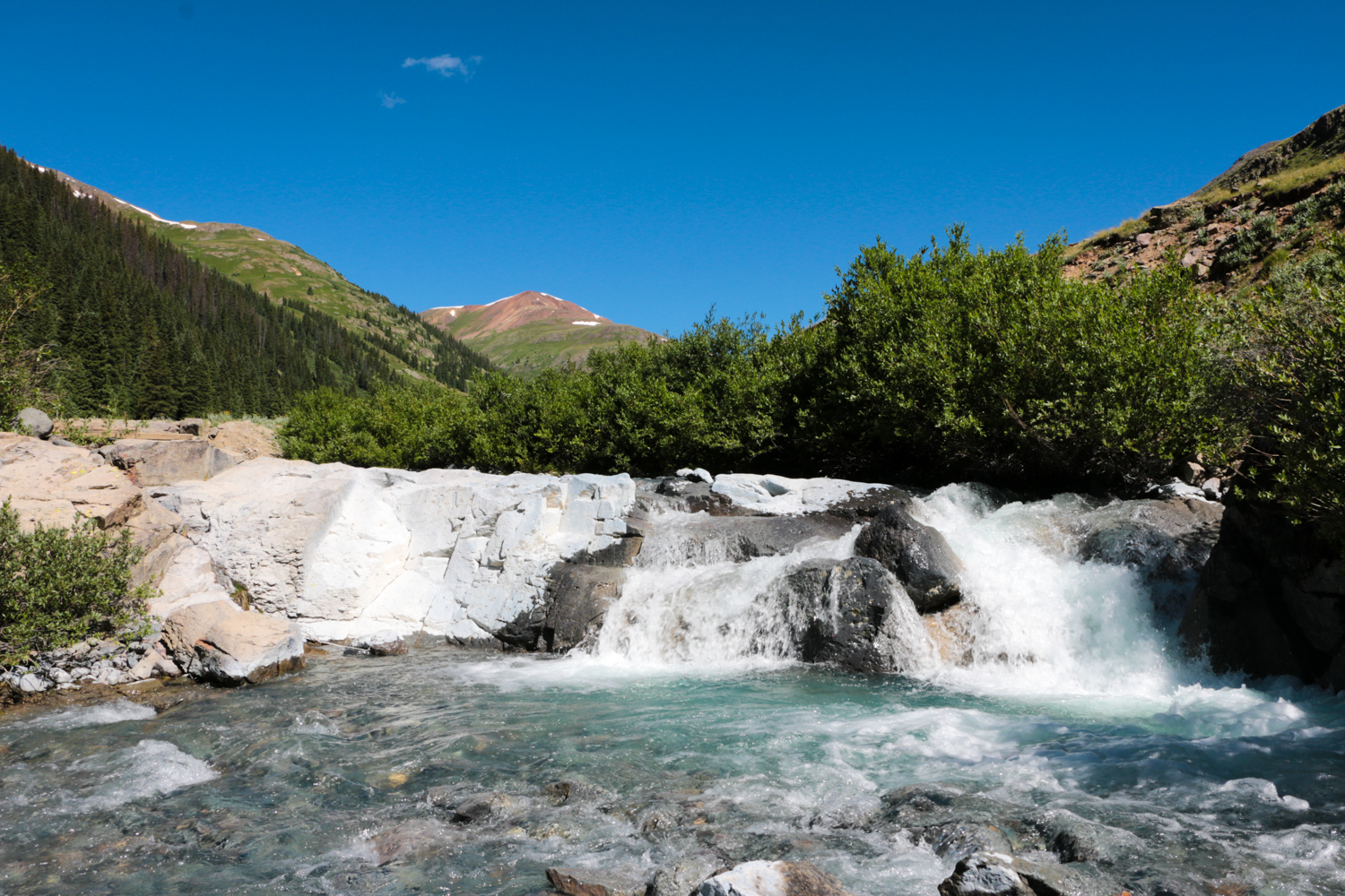
The next stop is Santa Fe National Forest, a 1.6-million-acre region that became a team favorite on the trip. It’s one of those pleasant places that surprises you with its tranquility, and certainly defies the stereotype of its surrounding countryside. Cool streams filled with fish run through shaded valleys into small lakes, and wildflowers bloom in bright colors along the banks. There are hiking trails everywhere, and for those willing to look, secluded hot springs can be found along the cliff walls. The roads here are not technical or challenging, but their epic views and cliffside dropoffs are exciting all the same.

The last of New Mexico’s trails run out in the Carson National Forest, just south of the Colorado border. It’s an enchanting blending point of the Rocky Mountain’s foothills with the arid plains, and the result is a fast and dusty drive with wide sweeping curves and distant mountain views.
As you continue into the Conejos River Valley, the road follows the water’s edge past small ranches and fly-fishing destinations. The river is clear, the grass is green, and yet despite its beauty, there’s hardly any traffic to be seen. This is likely a result of its proximity to so many popular off-pavement trails to the west, making it a perfect place to escape the crowds and enjoy the mountains in relative peace.
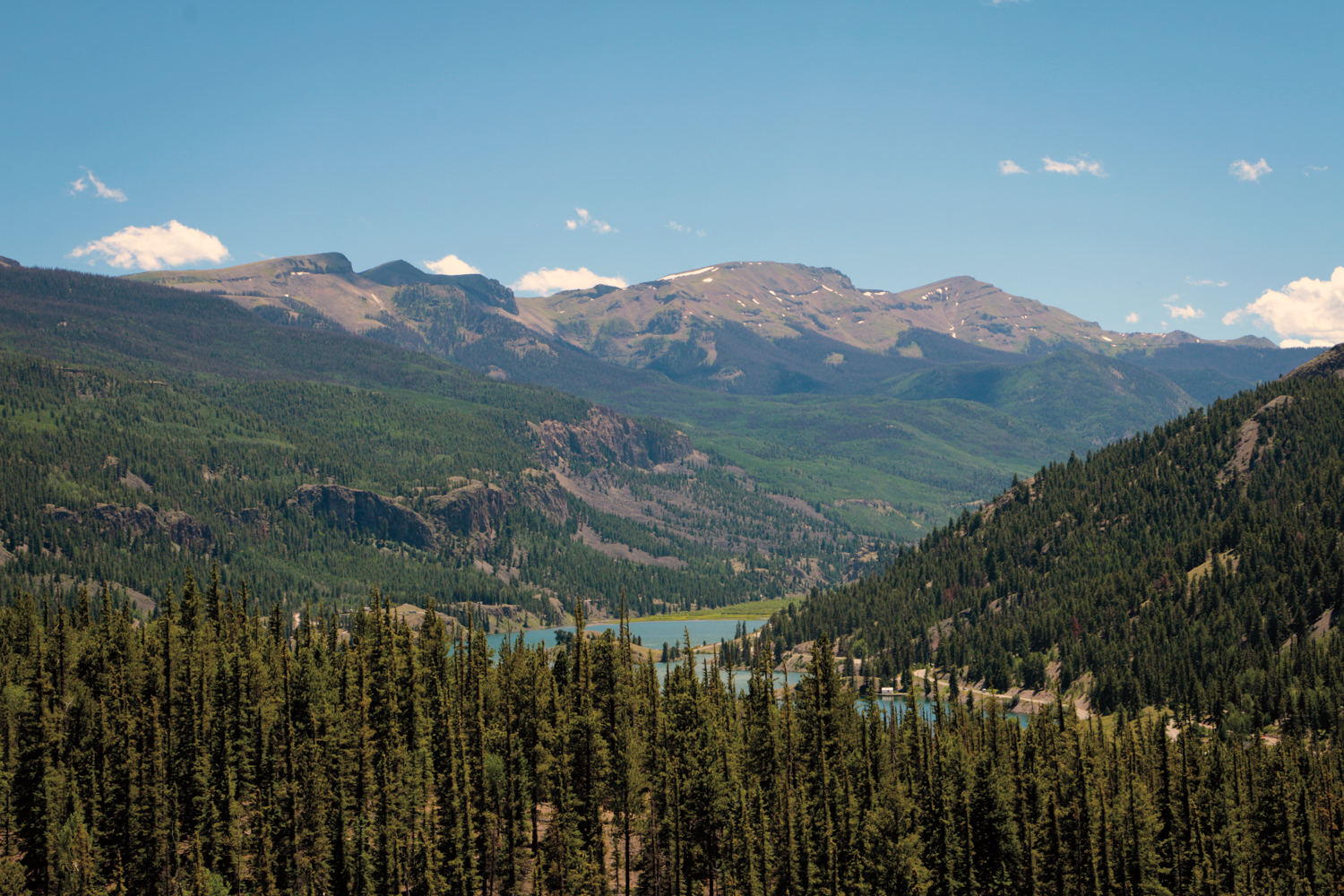
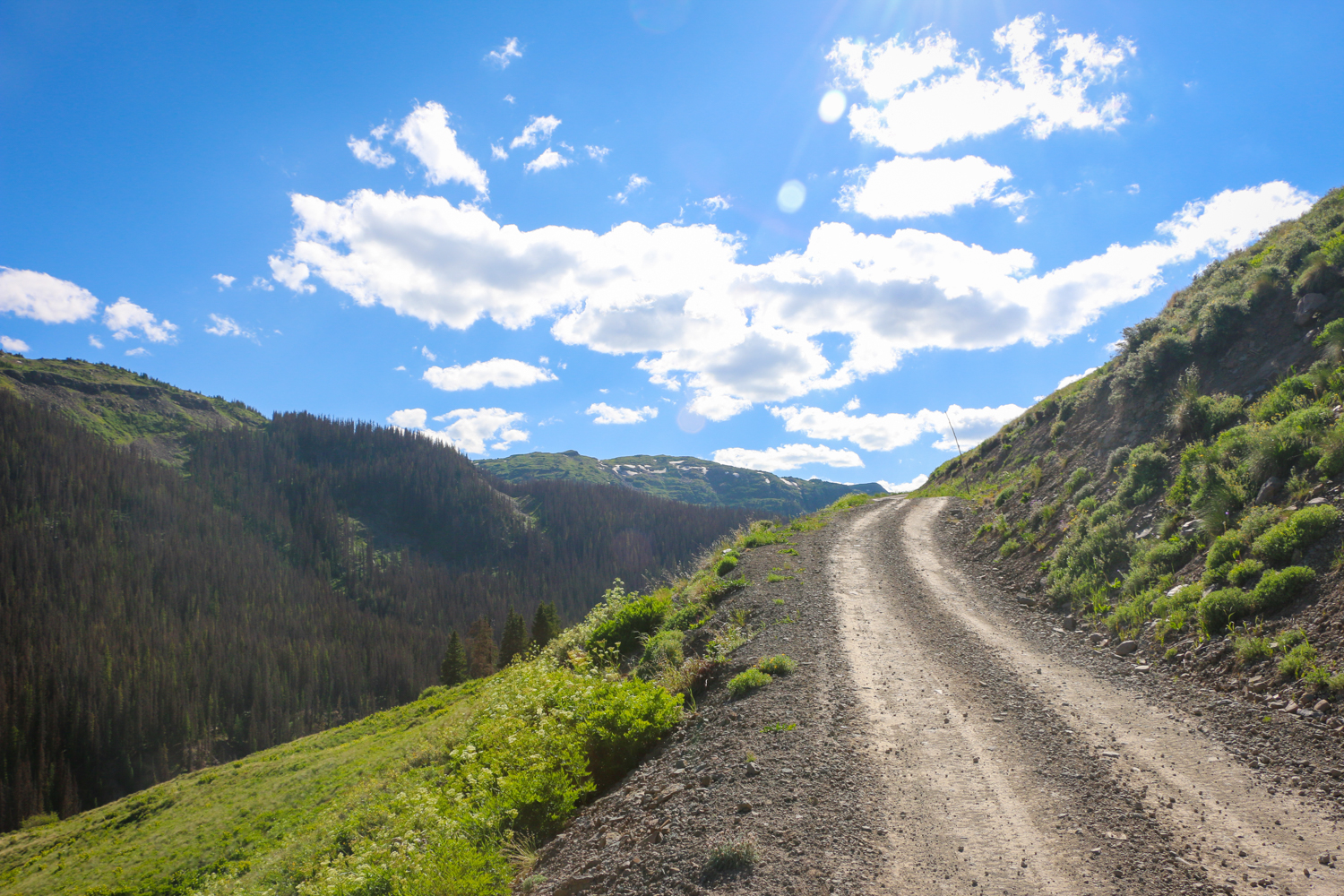
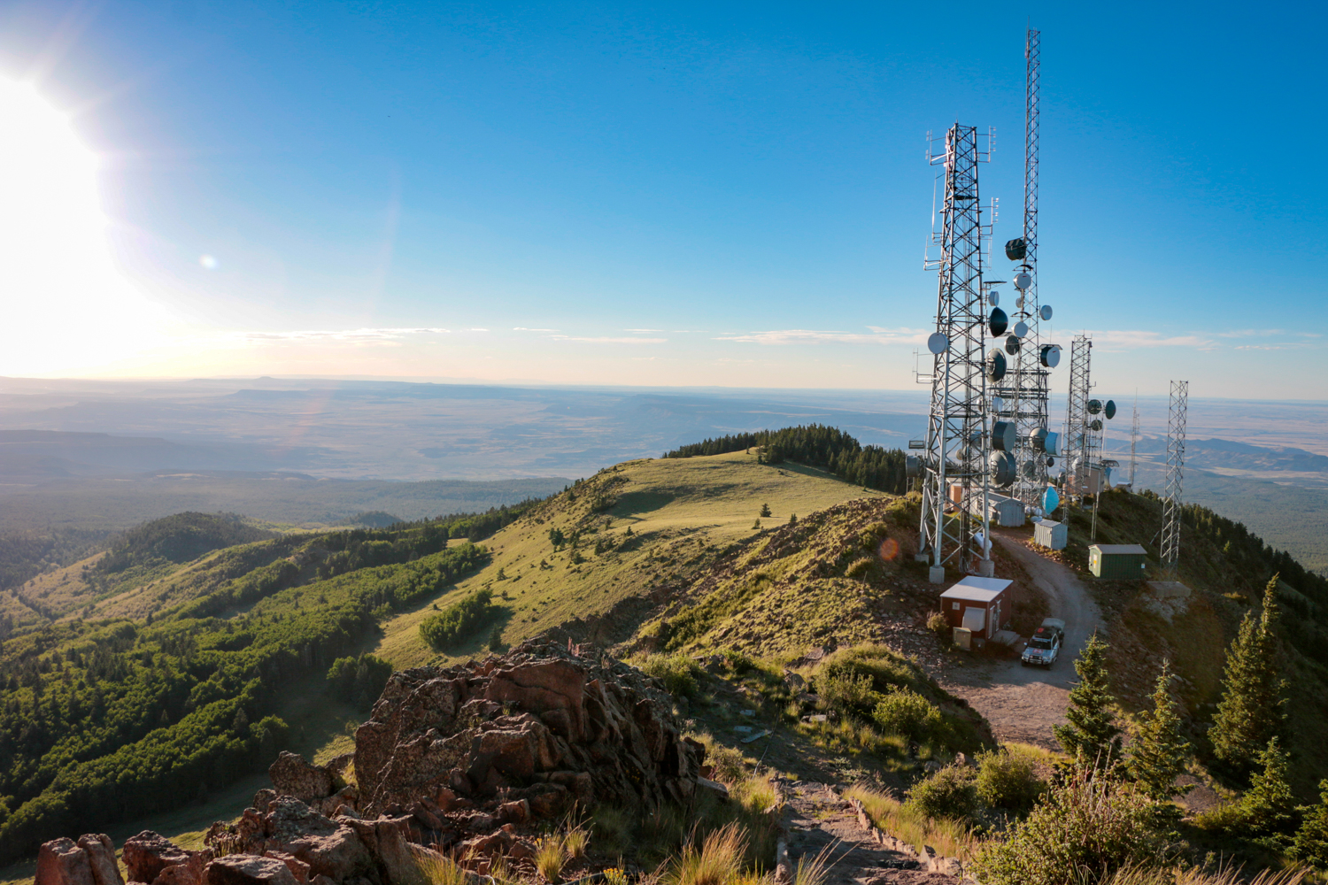
Our route now turns into one of Colorado’s most famous regions: the San Juan National Forest. Here you’ll find more traffic, challenging terrain, and a few roads that will undoubtedly make your heart race. We began with Stony Pass, an exciting series of switchbacks that summits at 12,650 feet. You then descend into Silverton, a small town with fuel, food, and just enough grit to keep things interesting—always a crowd favorite.
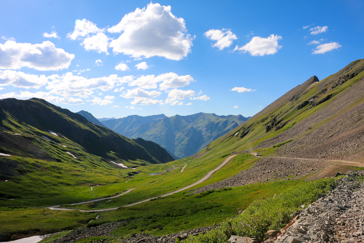
The next piece of the trail is arguably the most scenic, and certainly the most popular: the Alpine Loop. Unfortunately, a single paragraph cannot do these trails justice, which is why we published an independent Overland Routes article on them in our Spring 2016 issue and on expeditionportal.com.

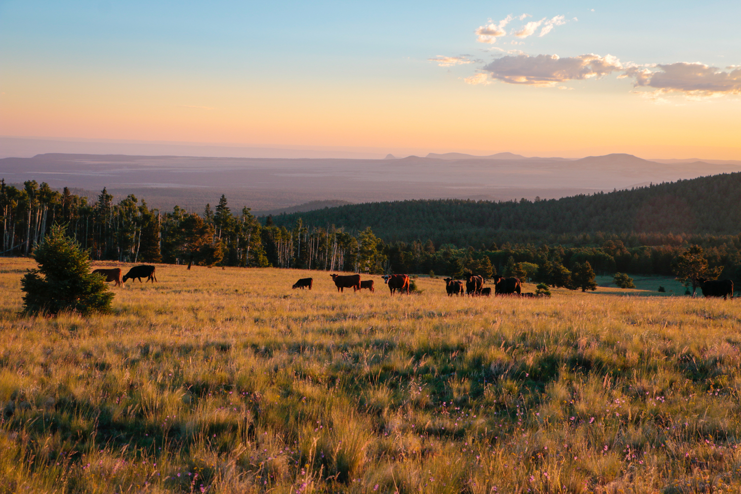
From the packed tracks and rugged peaks of the San Juans, the Great Divide continues north onto the quiet back roads of central Colorado. You would expect any landscape to fall short after witnessing the majesty of so many 13,000- to 14,000-foot peaks, but somehow this area manages to be almost as beautiful and even more charming. Small towns tucked behind hills are hidden along the route, and with each comes a series of waves and smiling faces as you pass by. Pitkin, in particular, earned our affection, and we highly recommend stopping for a hot coffee at the corner store before heading out onto the plains.
The final stretches of this route along northern Colorado reach across gently rolling hills and snake between expansive ranches. The roads are perfectly graded with excellent visibility, making it a perfect place for drivers to open up the throttle and make a little time. Just be sure to watch out for bighorn sheep and other wildlife, which are far more likely to be seen on the road than another four-wheel drive.
ACCESS
NORTH ENTRANCE
From Highway 24 in Buena Vista, Colorado, head west on Main Street/County Road 306. Proceed on route.
SOUTH ENTRANCE
From Highway 60 in Pie Town, New Mexico, turn north onto Highway 603. Proceed 3 miles, then bear right onto York Ranch Road. Proceed on route.
LOGISTICS
TOTAL MILES 908
SUGGESTED TIME 7-10 days
LONGEST DISTANCE WITHOUT FUEL 220 miles
FUEL SOURCES
QUEMADO, NEW MEXICO 34°20′35.6″N, 108°29′48.8″W
GRANTS, NEW MEXICO 35°09′11.8″N, 107°51′16.7″W
CUBA, NEW MEXICO 36°01′16.6″N, 106°57′32.8″W
ESPAÑOLA, NEW MEXICO 36°00′46.3″N, 106°05′20.6″W
SOUTH FORK, COLORADO 37°40′11.0″N, 106°38′29.6″W
CREEDE, COLORADO 37°50′53.5″N, 106°55′30.8″W
SILVERTON, COLORADO 37°48′19.2″N, 107°40′15.6″W
LAKE CITY, COLORADO 38°01′24.1″N, 107°19′00.2″W
PITKIN, COLORADO 38°36′40.2″N, 106°30′47.4″W
BUENA VISTA, COLORADO 38°50′27.3″N, 106°08′08.1″W
DIFFICULTY
The Continental Divide route is largely comprised of graded gravel roads with mild washouts and stream crossings. Most of it can be done in an all-wheel-drive vehicle, howeve,r there are a few sections of steep shelf road, loose rock, and deep water that require more care. We would rate the entire journey as easy to moderate.
WHEN TO GO
Most of the trails and roads contained within the route are closed during winter months, and the mountain passes are generally blocked through spring. We therefore recommend that travelers undertake this journey during summer or fall.
PERMITS AND FEES
No permits are required. We would recommend all visitors consider purchasing a Colorado Outdoor Recreation Search and Rescue (CORSAR) card to insure against expensive rescue fees. colorado.gov/dola/search-and-rescue-fund
SUGGESTED CAMPSITES
MEADOW VIEW
Many sites, will accommodate large groups throughout Flat parking, trees, wildlife 35°16′18.2″N, 107°34′33.0″W
SAN LUIS
Accommodates 3-6 vehicles Flat parking 35°33′59.9″N, 107°15′25.4″W
FENTON LAKE STATE PARK
Accommodates large groups Flat parking, trees and shade, protection from wind, bathrooms 35°52′49.3″N, 106°44′05.5″W
TRAIL CREEK
Accommodates large groups Flat parking, water access, multiple sites, scenic views 7°16′01.9″N, 106°28′16.8″W
CREEK CAMPS
Accommodates 2-3 vehicles, multiple sites Hiking, fishing, wind protection, scenic views 37°24′23.7″N, 106°49′21.4″W
HIDDEN VALLEY CAMPGROUND(dispersed camping)
Accommodates 1-2 vehicles per site, multiple sites Hiking, scenic views, water access 38°02′29.6″N, 107°07′57.3″W
CONTACTS
COLORADO BLM blm.gov/contact/colorado, 303-239-3600
USFS REGION 2 fs.usda.gov/main/r2
RESOURCES
We recommend the Benchmark Maps New Mexico and Colorado Atlas, as well as our team’s GPS track, which can be found by visiting the overland routes home page here.