

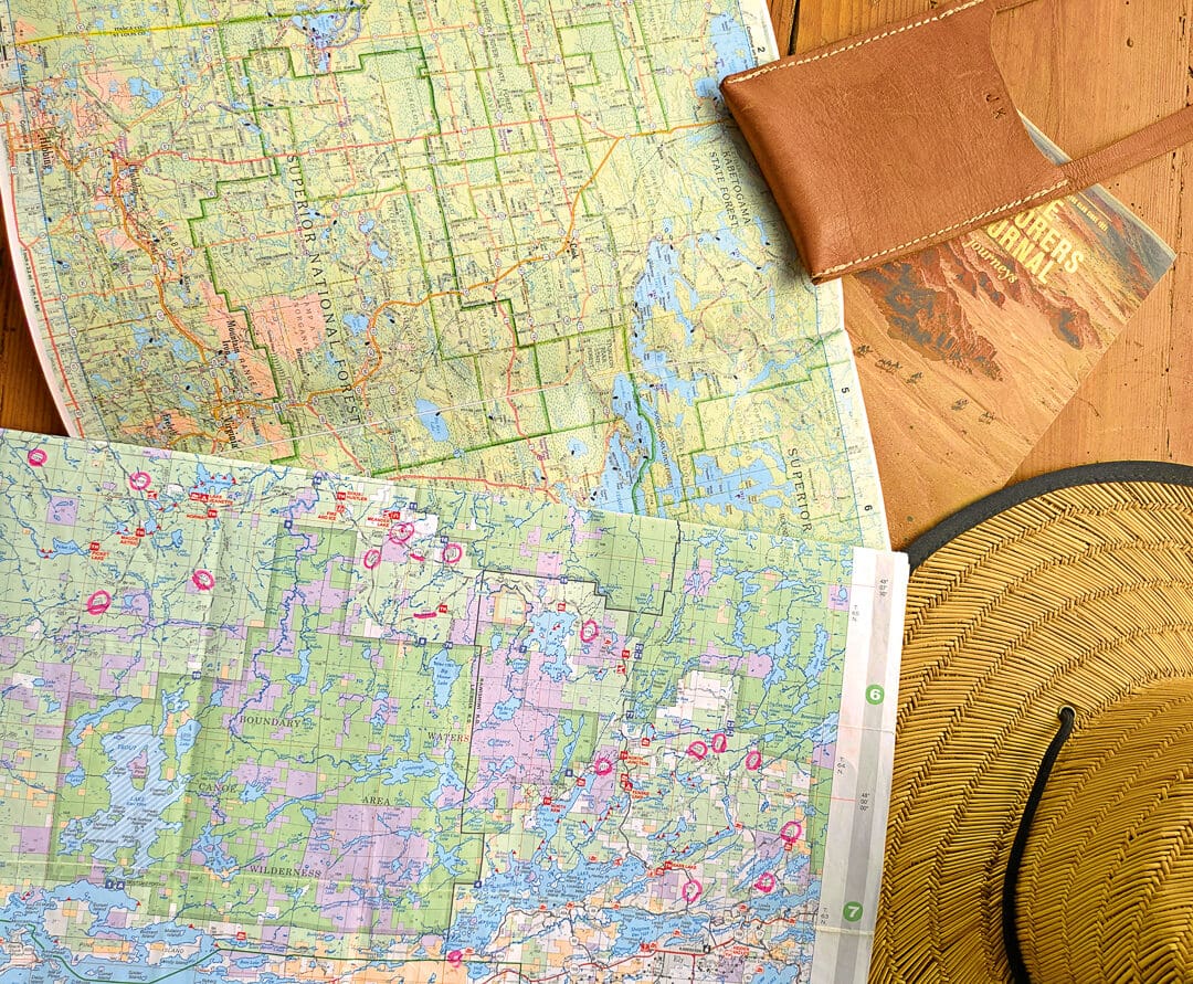
My first proper job in the mid-1990s was as a salesperson working out of a major city. Prospective clients were scattered across the urban center, the surrounding suburbs, and as far as the platinum-rich west, often a half-day’s drive away. Each morning began with cold calls and confirmed appointments, followed by time spent at my desk unfolding well-worn paper maps and plotting the day’s route. Before setting off, I would study the roads carefully, committing them to memory so I could navigate confidently through traffic without constantly glancing down. At the time, it felt like a practical necessity rather than a learned skill.
Only years later did I realize how valuable my early map-reading experience would become. Navigating unfamiliar territory with a paper map taught powerful habits that now feel instinctive when overlanding, whether weaving through congested streets in search of Land Rover parts or exploring remote trails far from paved roads. Reading topography, recognizing landmarks, tracking sun position, and mentally recording the route just driven have all become second nature. A paper map can reveal alternative routes, shortcuts, and connections that invite exploration and often lead to unexpected places.
When GPS arrived, so went the quiet disappearance of analog navigation skills. Paper maps were pushed aside, along with cursive handwriting, mental arithmetic, and memorizing phone numbers, on the growing list of abilities many people no longer practice.
Spend enough time overlanding, however, and the limitations of digital navigation eventually become apparent. Dead batteries, cracked screens, lost satellite signals, or the familiar “No Service” warning have a way of appearing precisely when conditions are most demanding. Even with tablets loaded with offline maps, dedicated GPS units mounted to dashboards, and phones grabbing a signal whenever possible, experienced overlanders still keep paper maps tucked into a door pocket or map sleeve, as their absolute reliability sets them apart.
Unlike digital devices, paper maps never freeze, reboot, or need a power source. By laying out a topographic map, you gain a level of context no app can match: immediate awareness of the land’s shape, relationships among terrain features, and the web of roads and tracks beyond your current route. Alternate exits, forgotten routes, and unexpected options are brought to light—critical insights for long or complex journeys, especially with family or across unfamiliar public lands.
An effective approach is to begin with the big picture and then progressively narrow the focus. A road atlas or state-specific mapbook makes it easy to outline general routes. Once that framework is established, larger-scale topographical maps provide critical detail, revealing geographic features that may slow or halt progress. When paired with Motor Vehicle Use Maps, this process ensures that a route is not only physically passable but also legally accessible for the type of vehicle being used.
Routes marked with non-bleed pens, fuel distances noted in advance, and multiple alternate options reduce stress when conditions change or plans unravel. Keeping maps folded, organized, and easily accessible in the cab allows them to be consulted quickly without interrupting travel. While digital tools such as onX Offroad can serve as a valuable offline backup, paper maps remain the foundation of our navigation system, encouraging situational awareness, deliberate decision-making, and a deeper understanding of the landscape you are moving through—long after the signal drops.
Route Planning
When setting out on an expedition, spreading out a large paper map and plotting a route makes the trip feel more adventurous and soon becomes a foundational part of the planning process. Tracing a line across unfamiliar terrain on another continent feels exciting, but there is also intent behind it. When we began talking about our first journey, the paper map became our starting point and constant reference, shaping not just where we would go but how we thought about the adventure itself. It was placed on the wall as our motivator, prompting conversations about distances, terrain, fuel availability, border crossings, and realistic daily progress.
Large-format maps are invaluable for fleshing out the big picture. It is easier to understand how mountain ranges, river systems, political boundaries, and road networks interact. Paper maps are always our first step in route planning, whether we are navigating the remote forests of the Boundary Waters in Minnesota, the winding backroads of Arkansas’ Ozarks, or the wilds of Africa. They allow us to see the land as it lies, anticipate challenges before we encounter them, and build a route that is both ambitious and achievable.
Navigating Without a GPS
When traveling in remote areas, paper maps (as current as possible) are often more reliable than GPS systems. Many roads are unnumbered, and digital data can be inaccurate, outdated, or simply wrong. Without connectivity, contours, rivers, and points of interest may not display at all, and offline downloads may be corrupted or incomplete.
Learning how to read and navigate using a paper map builds the confidence needed to make informed decisions when technology fails unexpectedly: a mobile phone can overheat, get wet while trying to capture the perfect photo or video, or fail at the worst moment. It is often only in truly remote places that you realize just how dependent you have become on technology and why traditional navigation still matters.
The Pros and Cons of Different Types of Maps (Topo Versus Road Atlas)
Topographical maps are best used for off-pavement, remote adventures. They show elevation data, terrain features, and contour lines. With a topo map, you can assess gradients, rivers, and mountain passes to judge whether a trail is too risky and if your vehicle is equipped for the conditions. Topographic maps help you plan safe, realistic routes in challenging terrain.
Road atlases, on the other hand, offer regional details: road networks, distances, towns, fuel stops, natural features, campsites, and sometimes outdoor recreation areas. We often use a road atlas with topographic detail for mapping rural routes. While less precise than dedicated topo maps, it still shows whether a road is paved, gravel, or unmaintained.
Unfortunately, no paper mapping system is accurate enough to reflect whether a Forest Service road has been recently maintained, raising the constant question of whether a road is truly suitable to drive on at all.
Rand McNally/DeLorme Road Atlases
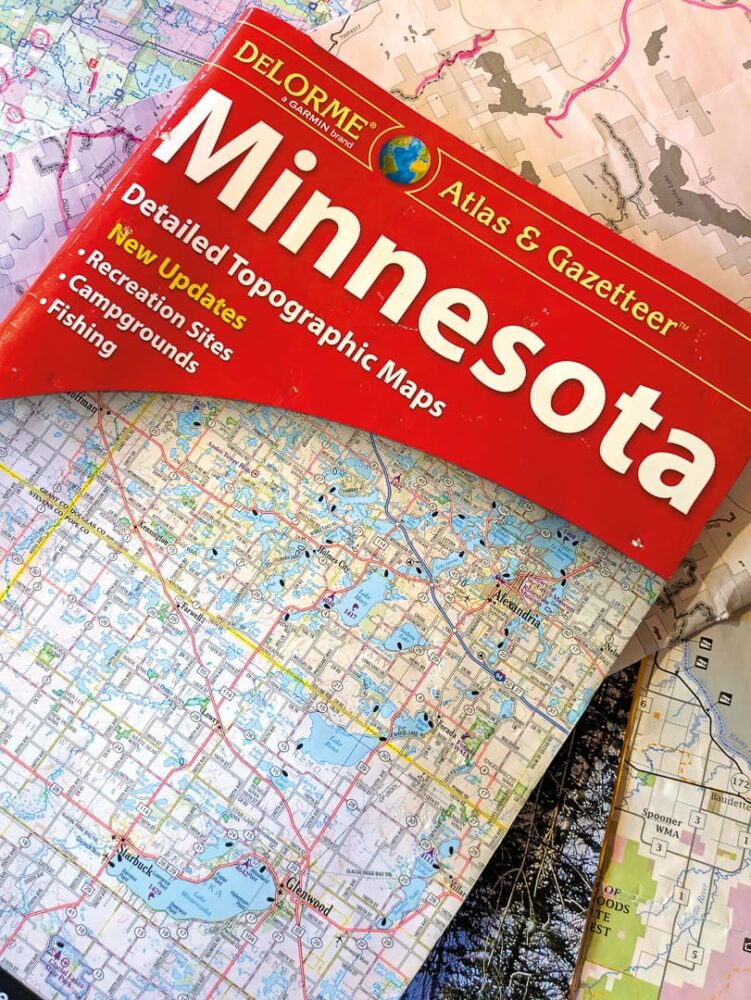
We love our DeLorme road atlases and have a wide range of them tucked neatly away in the Landy. We use these maps primarily for initial route planning in remote areas, and most of our pages are marked up with non-bleed markers for easy reference in the field.
Each mapbook features detailed topographical maps and includes a comprehensive amount of supporting information, such as:
- A detailed map index
- Suggested recreation and outing ideas
- Lists of recreation areas with notes on available activities, including camping, hiking, horseback riding, boating, biking, fishing, winter activities, hunting, and historical sites
- Outdoor adventure areas
- Unique natural features
Clearly marked boundaries for national forests and state land, along with points of interest such as campgrounds, water access, wildlife management areas, airports, Native American reservations, and more.
Some states use maps at scales of 1:250,000 or lower, making fine details hard to see—especially in complex terrain or dense networks.
$11 and up |randpublishing.com
National Forest Maps
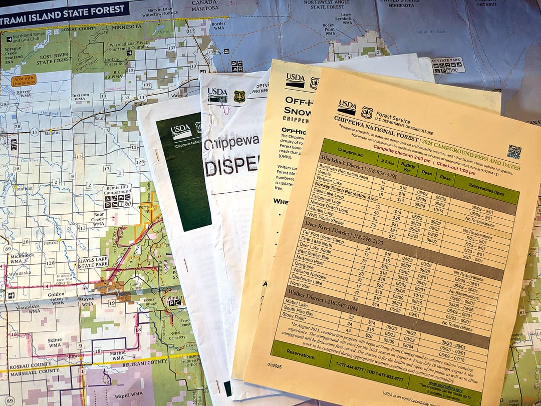
When visiting national forests, these maps are invaluable and are generally our first resort for planning any remote adventure. We usually use them in conjunction with Motor Vehicle Use Maps, which clearly indicate what types of vehicles are permitted on specific forest roads and trails. National Forest maps are available online or through local ranger offices and typically include the following information:
- General information about the area, including historic sites, scenic byways, day trips, fishing access, visitor centers, and accessibility details
- Lists of campgrounds
- Lists of designated trails for hiking, auto travel, skiing, cycling, snowmobiling, hunting, and horseback riding
Comprehensive symbol keys identifying rest areas, picnic sites, drinking water, restrooms, hiking, horse, and bicycle trails, fishing piers, boat ramps, all-terrain vehicle routes, and more.
Some National Forest maps may be outdated and miss closed or unmaintained roads. Check the publication date on the back before relying on it for planning.
$14 and up | fs.usda.gov
Butler (and BDR) Maps
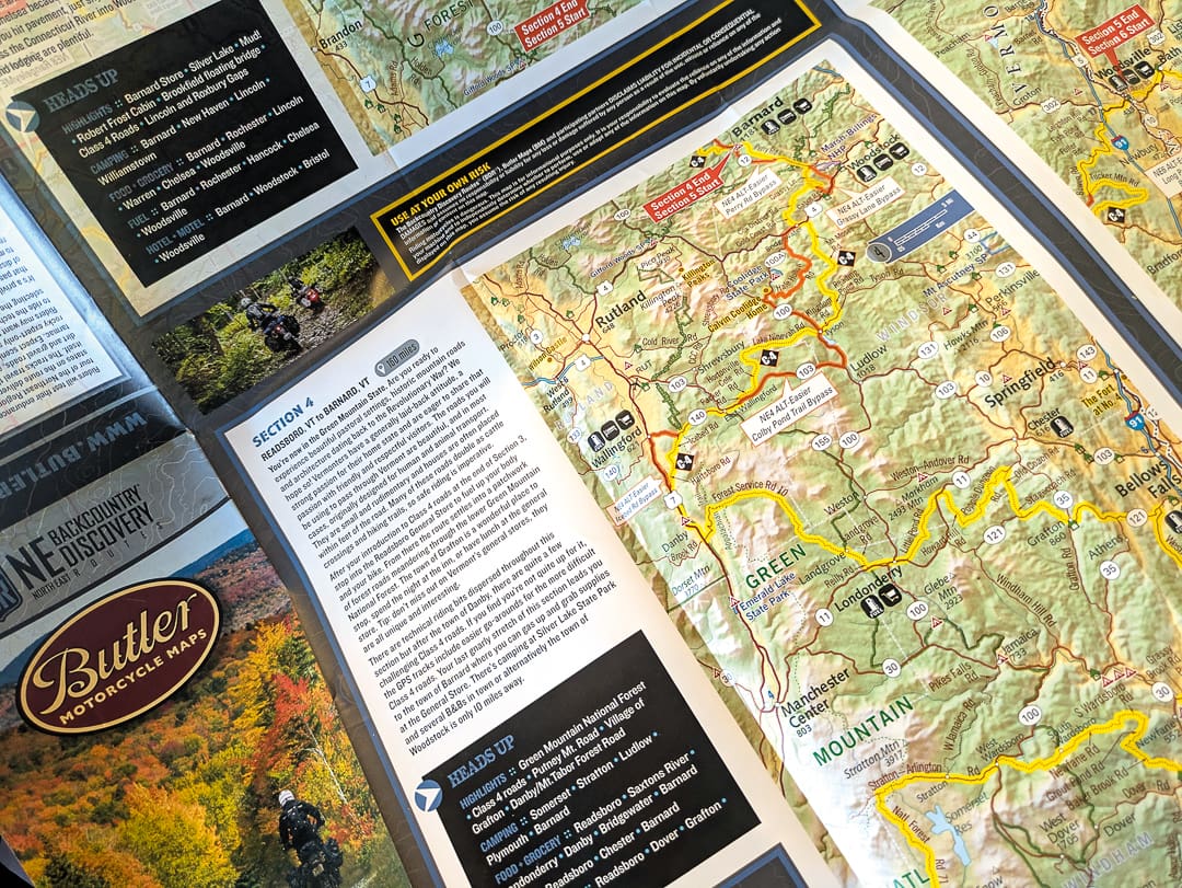
Butler Maps offers a wide range of choices aimed primarily at motorcycle riders, but they can also be used effectively by overlanders in 4WDs. They are waterproof and tear-resistant, making them well-suited for travel on backcountry roads. You can choose between maps focused on paved roads, dirt roads, or the company’s Backcountry and Adventure Series, which guides you along established routes. While Butler also produced and sold Backcountry Routes (BDR) maps for years, note that they are now only available at BDR’s online store, store.ridebdr.com. The BDR maps are useful, as they clearly highlight each section of the route and include key information such as:
- Points of interest
- Fuel stops
- Camping options
- Grocery resupply
They are a great option for anyone looking to remove some of the guesswork from a shorter trip across the States, without having to do the hard work of planning an entire route from scratch.
From $17 | butlermaps.com
Benchmark Maps
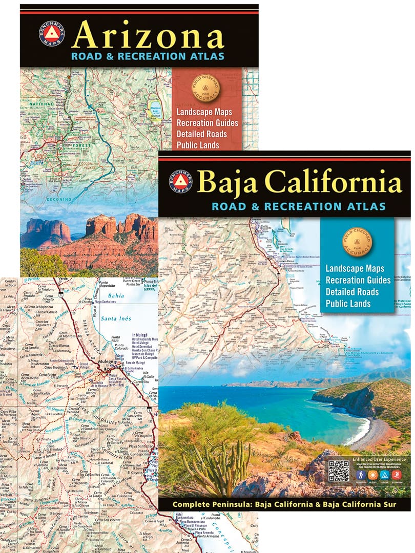
We use Benchmark Road and Recreation Atlases when traveling through large, open states with extensive public lands and backcountry access. These atlases are useful once I’ve moved past initial planning and are most often referenced when navigating remote areas within a single state. We do prefer Benchmark maps, as they are easy to read and mapped at a larger scale, making the topographical detail more legible with less information condensed into a single area.
Most maps include the following information:
- Clearly indexed road networks, which include paved, gravel, and unmaintained roads
- Public land boundaries, including BLM, National Forest, state land, and other managed areas
- Campgrounds with dispersed camping areas
- Recreation areas and points of interest for hiking, hunting, fishing, boating, and general outdoor use
- Unique natural features and landmarks
The drawback is that some minor spurs or trails aren’t marked, complicating remote trail planning.
From $10 |benchmarkmaps.com
Bureau of Land Management (BLM) Maps
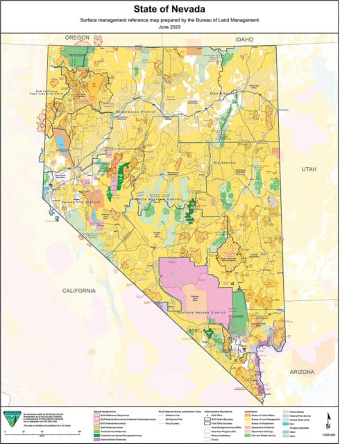
We use these maps most often when traveling through the Western United States, where the BLM manages large portions of land. They are useful in understanding land ownership and access, as state land trust parcels can sometimes overlap or border BLM land and may require a permit, and for identifying wildlife refuges, conservation areas, and national monuments managed by the BLM.
Most BLM maps include the following information:
- Public land boundaries showing BLM, private, state, and other federally managed lands
- Limited topographical detail to help interpret terrain, washes, and elevation changes
- Recreation sites such as campgrounds, trailheads, and day-use areas
- Points of interest relevant to backcountry travel
In this case, BLM maps are often most effective when accessed digitally through the BLM website, as printed maps can be limited in detail and may not reflect recent changes in access or management.
$6, free online | blm.gov
BackRoad Mapbooks
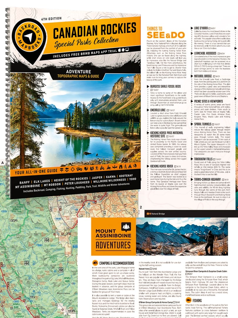
BackRoad Mapbooks are our go-to when traveling through Canada. They are full of comprehensive information about each region, provide the history of the province, and suggest trails in the area.
Each mapbook features topographical maps with:
- Highway, logging roads, and other off-road trails
- Land and water features
- Park and adventure points
- Campgrounds
- Hiking trails and motorized trails such as ATV, snowmobile, and winter-specific trails
- Paddling routes
- Hunting and fishing areas
- Historical information
BackRoad Mapbooks are available in spiral-bound editions, large-format paper maps, and digital versions, with bundle options to help save some money. The two downsides are that coverage doesn’t extend into the United States and that purchasing the full range of mapbooks for all of Canada can get costly if you’re traveling extensively across multiple regions.
From $20 | backroadmapbooks.com
US Geological Survey (USGS) Topo Maps
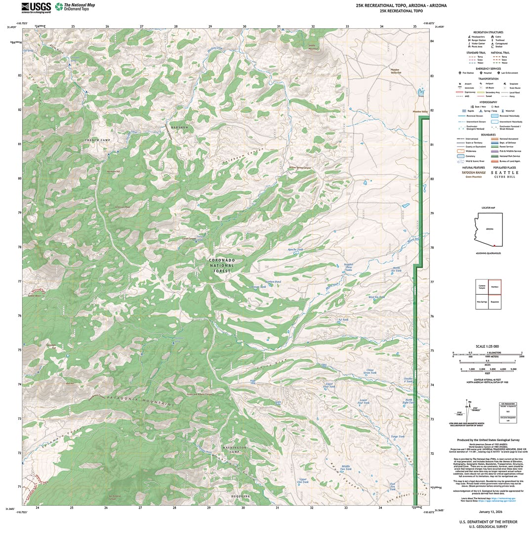
The USGS is a federal scientific agency within the Department of the Interior that collects and publishes scientific data about the country’s landscape and more. The USGS allows you to create your own topographical map within a set number of scales that you can download and print for your own use, thereby eliminating the need to purchase any large maps or map books. They offer a select number of maps you can download or purchase from their store, including state maps, national parks, US Forest Service maps, and county and national atlas maps, among others.
The DIY detailed topographical maps include:
- Roads such as highway, local, secondary, and 4WD
- Recreation structures
- Trail surfaces
- Emergency services
- Transportation
- Hydrography, such as dams, waterfalls, springs, etc.
- Boundaries for state land, BLM, Forest Service, US Fish and Wildlife Service, and the US Department of Defense, to name a few
However, such a detailed topographical map can be distracting to read in mountainous terrain.
From $9/maps for purchase, free/DIY topo maps | usgs.gov
National Geographic Maps
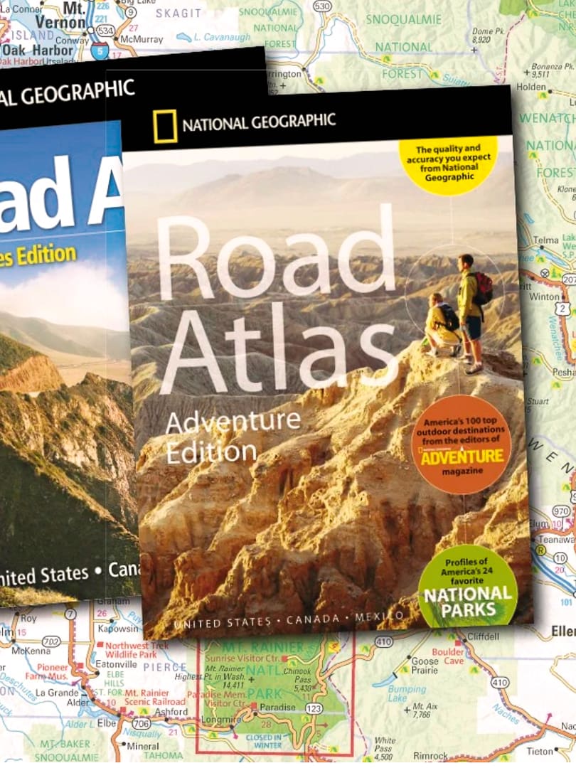
In years past, we have used National Geographic maps and mapbooks when traveling to national parks and large recreation areas. They offer clear views of the terrain, give close attention to roads, tracks, and trails, and can be a little intimidating when planning a route, given the amount of information provided. The maps are waterproof and tear-resistant, making them ideal for backcountry adventuring, and feature detailed topographical information:
- Clearly marked trail charts for hiking, riding, biking, snowmobiling, cross-country skiing, and horseback riding
- Roads and access routes relevant to the park or recreation area
- Land and water features such as rivers, lakes, valleys, and summits
- Campgrounds, trailheads, boat launches, fishing access, and day-use areas
- Points of interest, including viewpoints, historic sites, and landmarks
- Park boundaries, wilderness areas, and protected land designations
Each map’s coverage is limited to specific parks and recreation areas rather than states, so you’ll need to purchase a new map for each area.
From $15 | natgeomaps.com
Editor’s Note: This article was originally published in Overland Journal’s Fall 2026 Issue.
