

Gaia GPS has launched Gaia Overland, a new global base map designed to provide the information you need to plan and navigate your next overland or off-pavement adventure. Map features include updated roads and trails, including those from OpenStreetMap, road and trail data from the US Forest Service (USFS) and Bureau of Land Management, and USFS Motor Vehicle Use Maps (MVUM). Additional details such as road surface type, vehicle constraints, road closure dates, road numbers, and permitted vehicles help users plan trips effectively, while clear public land boundaries indicate where users can find dispersed camping. This map also includes gas stations, campsites, scenic overlooks, and other points of interest.
“We set out to solidify Gaia GPS as the premier overlanding tool by building a map that contains the most crucial backroad information for exploring in a safe and informed way no matter where you are in the world,” said Gaia GPS cartographer Lee France. “We removed the need to stack multiple maps and created one complete source designed specifically for the backroad adventurer.”
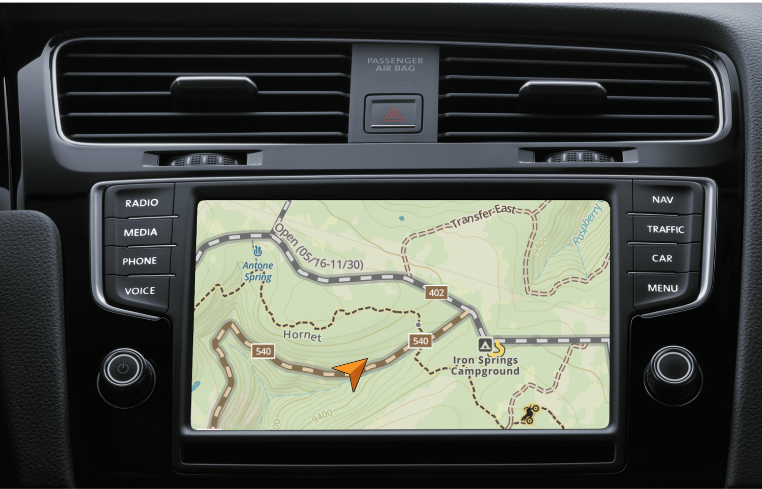
Gaia Overland strives to be file efficient, so users can download large sections of the map offline without using up phone storage. The map is Apple Carplay and Android Auto compatible for dashboard navigation. Check out the comparison between the original Gaia Topo map (left) and the new Overland map (right) here.
Visit blog.gaiagps.com/gaia-overland-map/ to learn more about Gaia Overland.
Our No Compromise Clause: We carefully screen all contributors to ensure they are independent and impartial. We never have and never will accept advertorial, and we do not allow advertising to influence our product or destination reviews.