
Ford and Google have partnered to bring the full length of the TransAmerica Trail into the digital domain via Street View. The TransAmerica Trail, a cross-country, largely unpaved route spanning from the Oregon coast to the shores of North Carolina, has long been regarded as one of the most challenging and remote overland journeys in the United States. The new collaboration equips the trail with high-resolution, panoramic imagery so that users anywhere can virtually navigate the route.
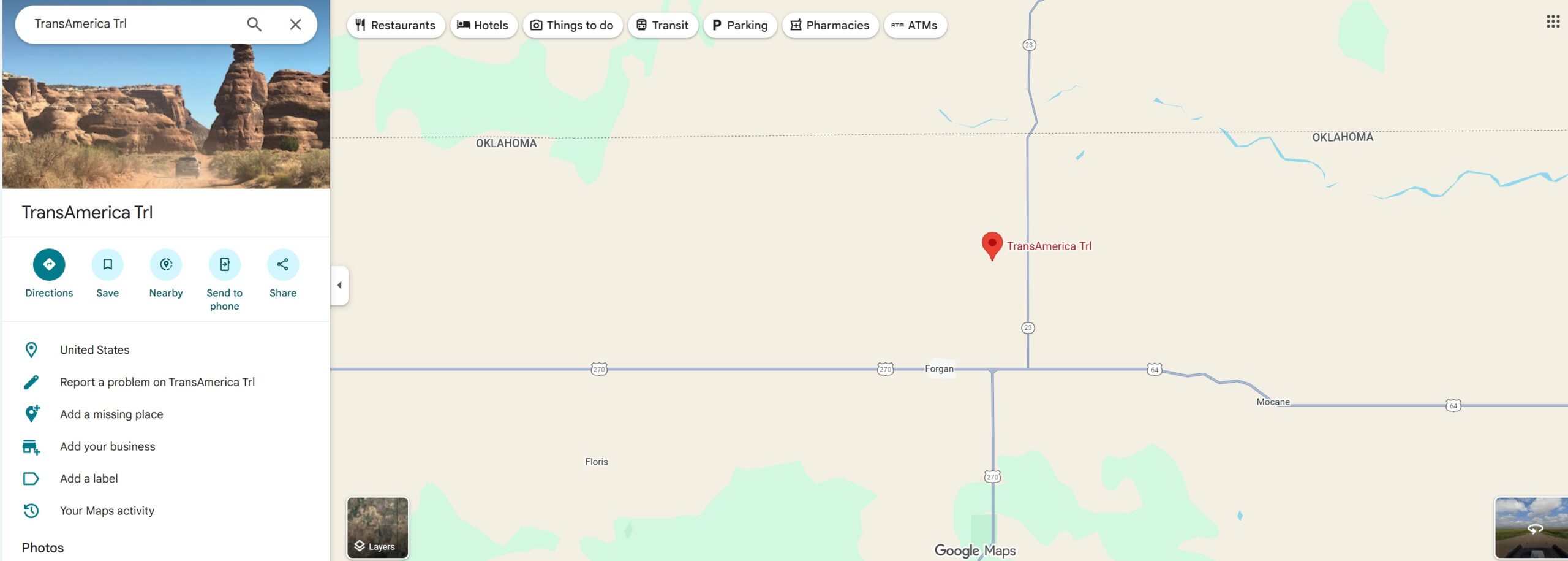
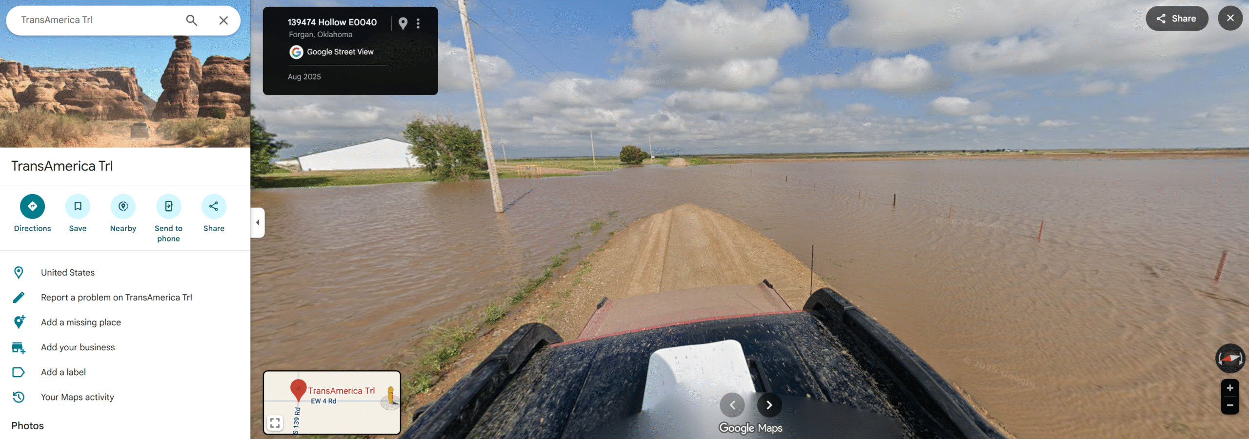
To better understand the concept, let’s try a quick experiment. Type “TransAmerica Trail Google Maps” into your search bar and click on Maps. You’ll find yourself looking at the satellite view of EW 4 Rd—also known as Hollow E0040 Rd—near Forgan, Oklahoma, an ordinary stretch of rural gravel road. Switch to Street View, drag right, and you’ll see the black roof and red hood of the Ford Bronco. Follow the road a couple of miles down, and you’ll notice the area is partially flooded. Eventually, the Bronco reaches a submerged section of the trail, and the trail ends abruptly, so the team had to backtrack and find a better route.
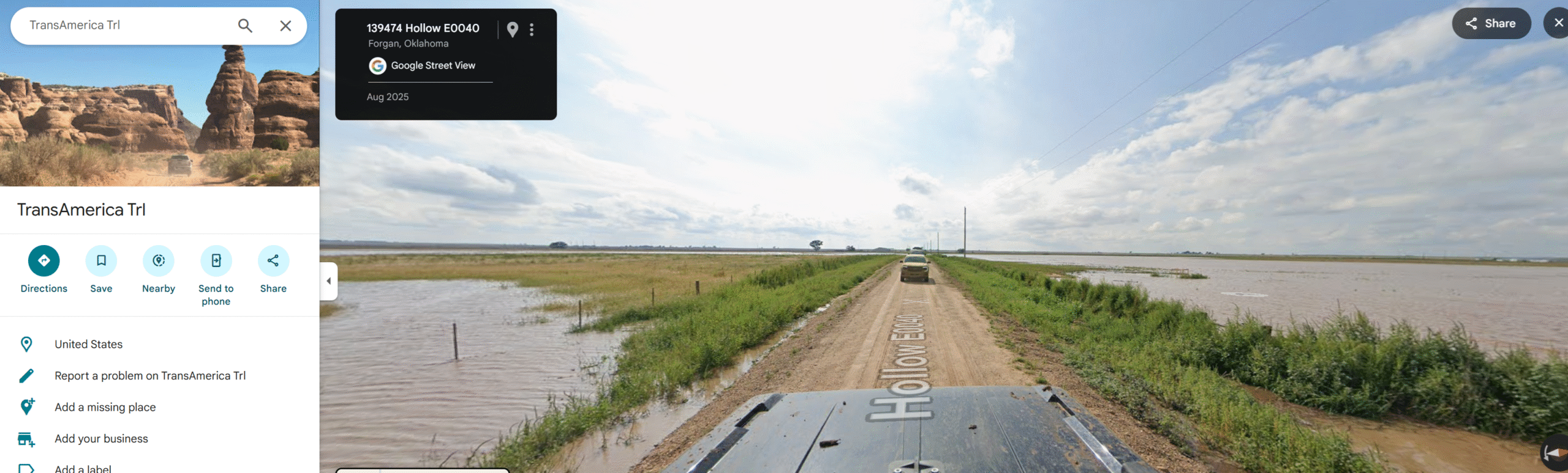
This small but telling example highlights a key point: Ford’s TransAmerica Trail route on Google Maps will include forced deviations, and there is no complete, downloadable map of the route. Due to Google Maps limitations, the full trail will display as a continuous line only when the link is opened on a mobile device. It’s best used as a general guide rather than a definitive path, and travelers should remain flexible and prepared for deviations along the way (for the official route and detailed navigation resources, visit transamtrail.com).
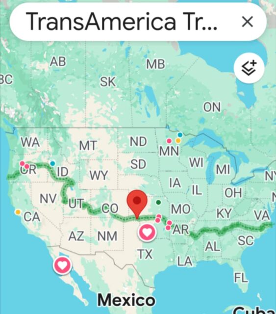
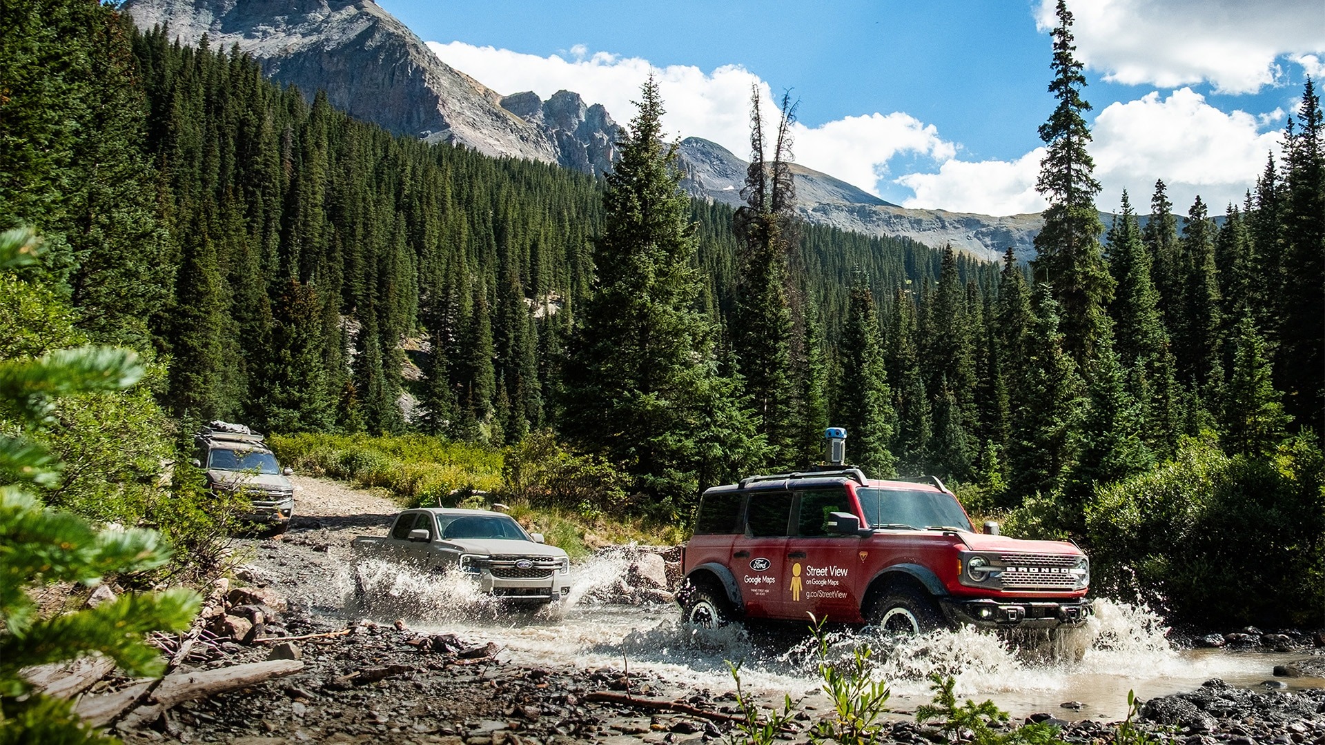
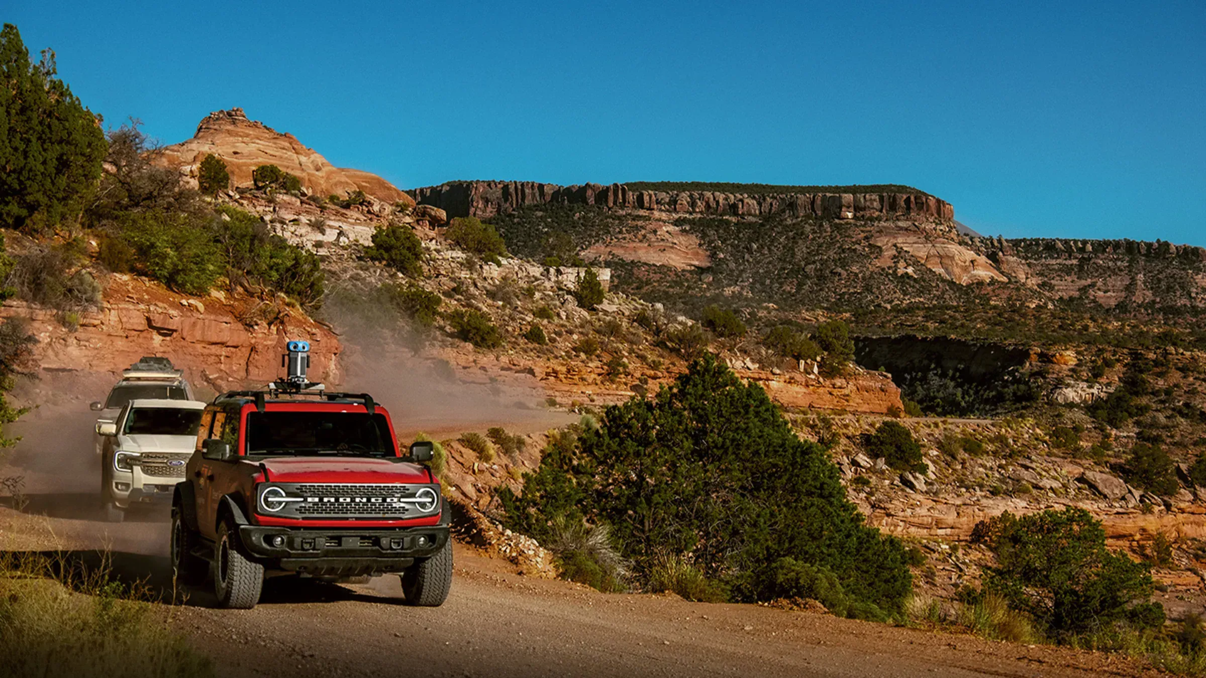
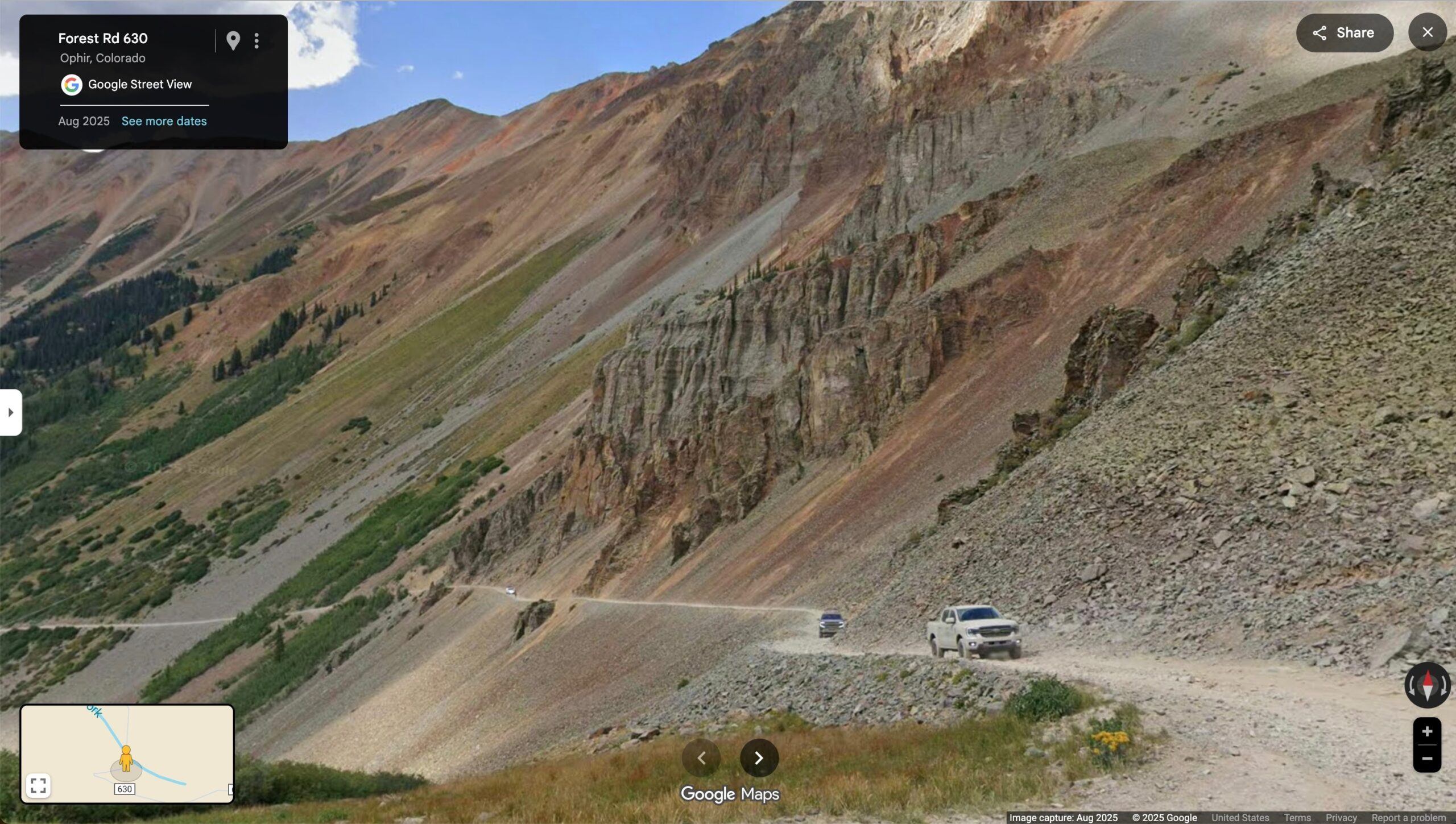
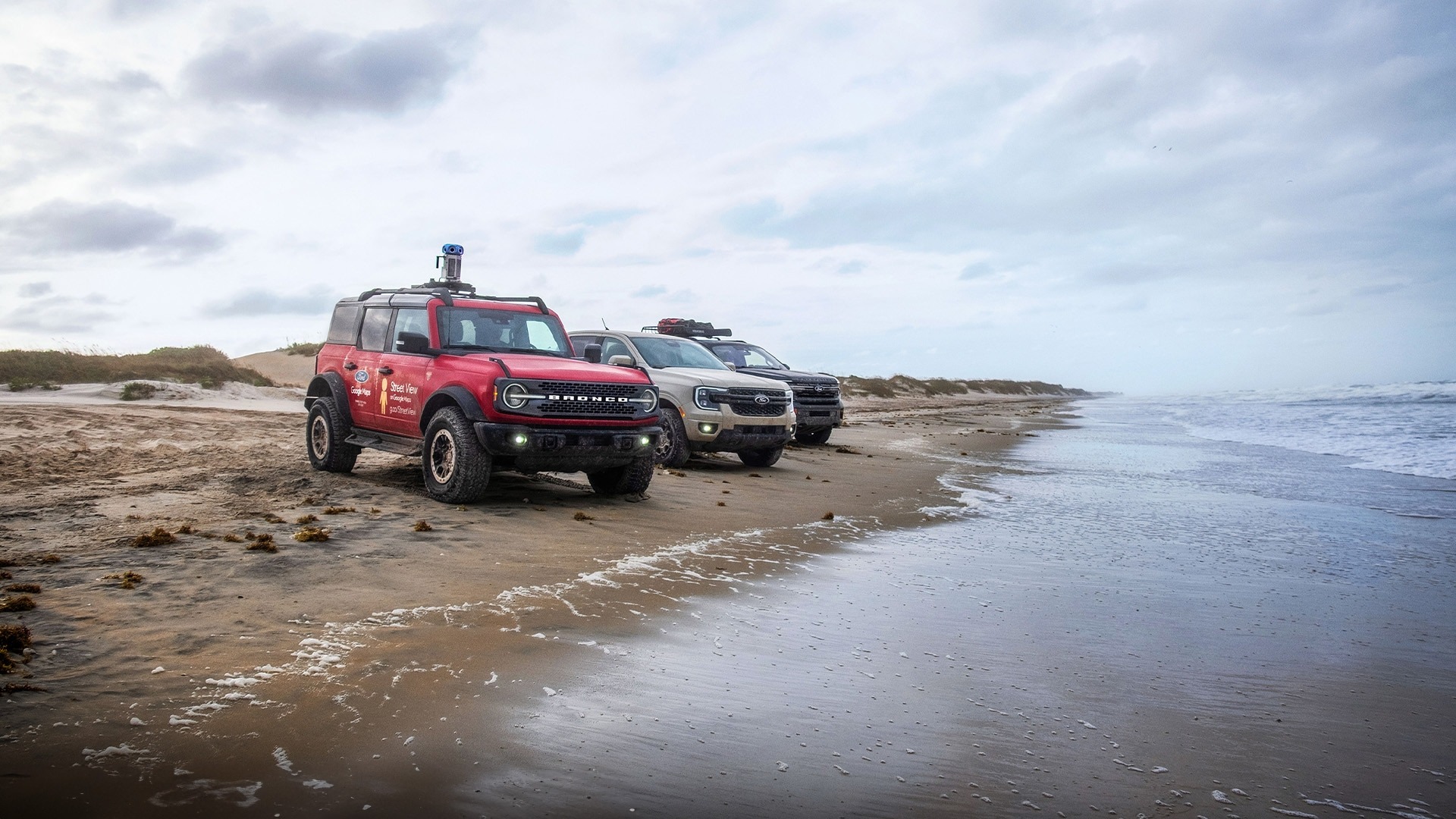
To capture the route, Ford provided one of its Bronco models outfitted with Google’s Street View camera rig. The vehicle, operating alongside a support convoy, traversed the entire length of the TAT. The mapping mission covered more than 5,900 miles (approximately 9,500 kilometers), spanning 13 states. The ride included a variety of terrain—from desert expanses and dirt tracks to forested backroads and mountain passages—and aimed to minimize use of paved surfaces to reflect the spirit of the trail.
Ford and Google say the aim is to give overland travelers, off-road enthusiasts, and digital explorers alike the ability to preview terrain, assess obstacles, and plan routes with greater clarity, as evidenced by our earlier experiment. According to Ford’s “From The Road” blog, their teams partnered with Google Maps to put the entire trail into Street View “for anyone to explore from anywhere.” The Google blog post similarly described the route as “one of America’s most scenic,” with its mapping extending “from the forests of Oregon to the shores of North Carolina.”
The imagery captured allows users to virtually traverse the entire route, effectively turning what once was accessible only by a dedicated vehicle, careful planning, and perhaps some nerves, into a virtual experience. Ford’s commentary highlights that the newly-mapped route presents “hundreds of thousands of images” of terrain that many adventurers had only ever encountered in person.
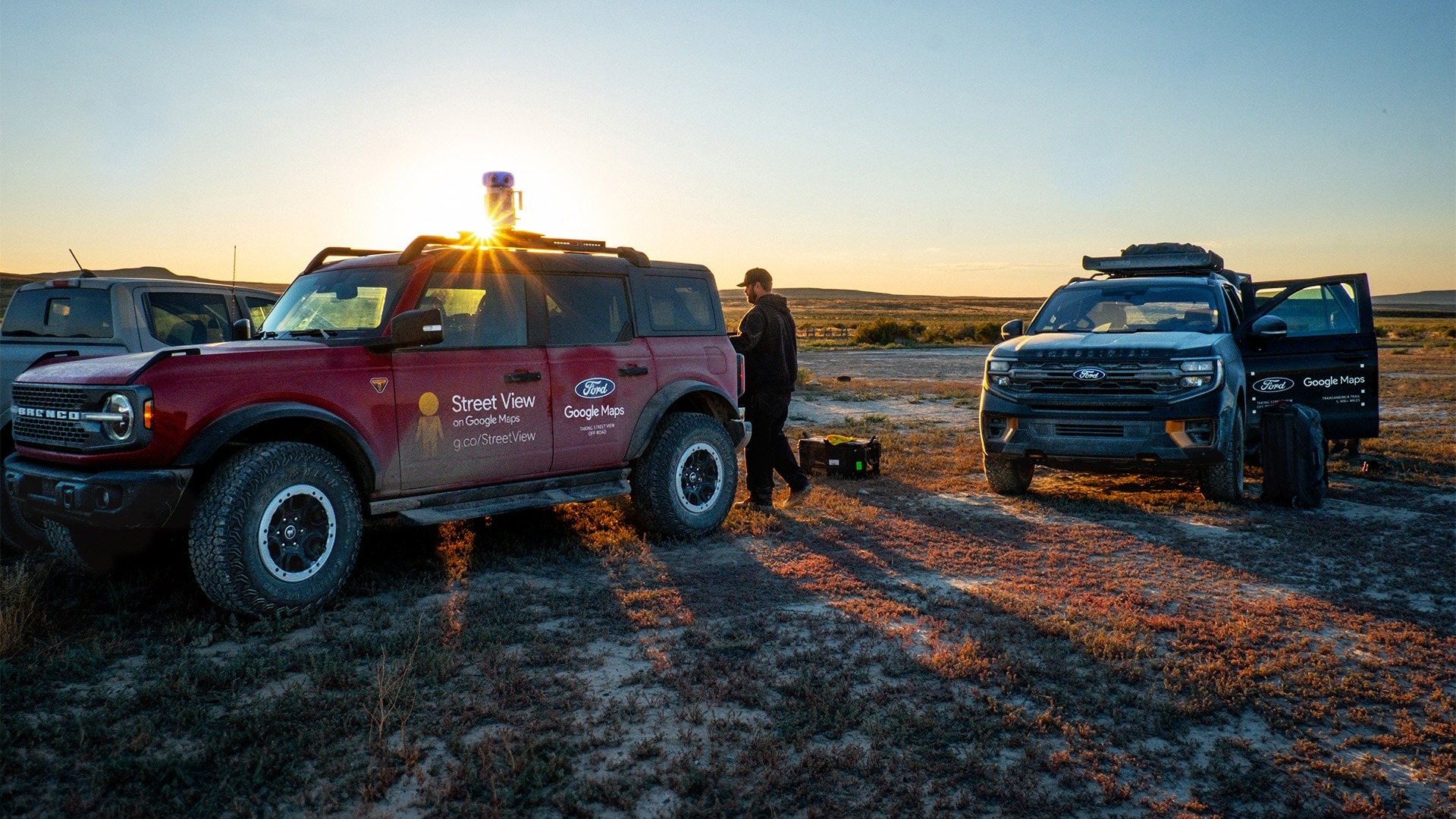
In executing the project, Ford’s team traveled in a convoy. The Bronco carried the camera gear, while other vehicles in the team provided support functions—logistics, crew, gear, and supplies. The terrain reached elevations of more than 11,700 feet in the San Juan Mountains of Colorado, and included stream crossings, remote backroads, and desert flats. The mission reportedly took 32 days to complete. Ford emphasized that this was not simply a publicity exercise, but a tool aimed at empowering explorers: “Whether you’re an overlander planning your next trip or an adventurer who’s simply curious, you can now travel the TransAmerica Trail on Street View.”
The decision to map the TransAmerica Trail reflects both companies’ interest in expanding access to remote and off-road places. It also underscores Ford’s commitment to enabling overland exploration and Google’s mission to map the world, including terrain beyond the paved highways. The trail now joins more traditional road-based Street View routes, but unlike standard highway captures, this one covers a deliberately rugged, off-pavement journey, a sign of things to come.
Our No Compromise Clause: We do not accept advertorial content or allow advertising to influence our coverage, and our contributors are guaranteed editorial independence. Overland International may earn a small commission from affiliate links included in this article. We appreciate your support.