

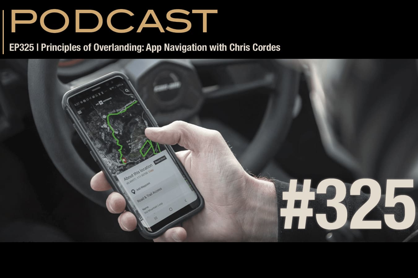
Overland Journal Podcast host Scott Brady discusses the core principles of overlanding navigation with Chris Cordes, highlighting primary, secondary, contingency, and emergency backups. They compare three main app categories: turn-by-turn tools like Google Maps, reference/layer apps like iOverlander and Tracks4Africa, and hybrid discipline-specific platforms such as onX and Gaia. While Google excels at everyday routing and real-time traffic, onX offers specialized backcountry features, including land ownership layers, trail data, weather updates, offline mapping, and off-road turn-by-turn routing. The pair emphasize thorough pre-planning, downloading maps for offline use, re-evaluating routes after navigation mistakes, and carrying redundant devices alongside paper maps. Finally, they explore responsible land stewardship, onX’s trail-verification process, global expansion, AI planning tools, and the Overwatch Rescue evacuation add-on.
Overland Journal Podcast Episode #325
Tune in Apple Podcasts | Spotify | YouTube
The Overland Journal Podcast is brought to you this week by Hankook Dynapro Tire and GME Radios
New to Overland Journal and want to grab a subscription? Visit Overland Journal and enter code: overlandpodcast at checkout for 20% off. We thank you for being a subscriber.
Guest Bio:
Chris Cordes is an overlanding journalist, photographer, and backcountry driver known for his work as senior editor for Expedition Portal and contributor to Overland Journal. Raised in Texas, Chris developed a passion for the outdoors after moving to Arizona in 2009. While completing his business degree and pilot training, he began exploring the Southwest’s remote deserts and mountain trails. This passion evolved into a career in automotive journalism, gear testing, and off-road driver training. For over a decade, Chris has provided real-world evaluations of off-road equipment and 4×4 vehicles. He lives full-time on the road, testing vehicle-dependent travel limits from his custom diesel rig. Today, Chris shares his expertise in vehicle preparation, travel philosophy, and backcountry navigation through editorial work, photography, and consulting with leading off-road mapping platforms.
Host Bios:
Scott Brady
Scott Brady is an adventurer, author, and publisher, and the first person in history to cross all seven continents. Brady is executive publisher of the Overland Collective, home to Overland Journal, the Overland Journal Podcast, and expeditionportal.com—the world’s largest vehicle-dependent adventure community. Scott wrote Overlanding 101 (Simon & Schuster) and is currently riding around the world on his BMW GS. He also led Expeditions 7, the first expedition to drive the same vehicle on all seven continents. Brady’s polar crossings include Antarctica and a south–north crossing of the Greenland ice sheet. Scott is a fellow of the Explorers Club and lives in Prescott, Arizona.
 Our No Compromise Clause: We do not accept advertorial content or allow advertising to influence our coverage, and our contributors are guaranteed editorial independence. Overland Collective may earn a small commission from affiliate links included in this article. We appreciate your support.
Transcript
Scott: [00:00:00] Hello and welcome to the Overland Journal Podcast. I’m your host Scott Brady, and I’m here with my longtime friend Chris Cordes, and we’re gonna talk about the principles of overlanding navigation apps. We’ve had Chris on the podcast before. We talked about the history of his travels and his experience in lots of areas of the industry.
In fact, we worked together for about eight years, and then he moved over to onX, where you’ve been for how long?
Chris: Six years now.
Scott: Yeah. Amazing. So we’re gonna talk a lot about navigation. Certainly onX will be part of the conversations ’cause it’s such an important tool that we all use. This podcast isn’t sponsored or paid for by onX, but we’re gonna talk about lots of other apps as well because of Chris’s experience over all this time with navigation apps.
Chris: Yeah, I mean, most people use a combination of a lot of different things, including myself, so it’s good to know all the options and [00:01:00] how you use them and where their strengths are.
Hankook Dynapro Tires: And a special thanks to Hankook Dynapro Tire for supporting this week’s Overland Journal podcast. Be sure to visit expeditionportal.com to see our features on the recent Hankook experience at the fourth annual Bronco Stampede in Pigeon Forge, Tennessee.
We took a look at the full line of Dynapro tires and some great Ford Broncos from all over the country as they gathered at this community event of enthusiasts and top brands. Thanks again, Hankook Yeah. Part of being a prepared traveler is we need to have a primary, secondary, a contingency, and an emergency form of all of our primary tools.
So that would include communication, it would include navigation. So in, in my mind you’re gonna wanna have lots of backups. And we use navigation in different ways. [00:02:00] So from my perspective, and I’d love to get your thoughts or tweaks on this, Chris, but from my perspective, there’s really three different kinds of apps that we integrate with when we’re traveling.
The one that we all use the most often, which would be a navigation app, and that’s gonna be its primary goal. We use that for turn-by-turn navigation to go to the coffee shop or in my case, we’re gonna be leaving Minnesota here in a little bit and heading into the Upper Peninsula of Michigan and we’re gonna be navigating through Duluth and to a little place we’re gonna stay for the night.
We’re gonna use a tool like Google Maps or Apple Maps for that. And there’s lots of advantages to that, and we’ll talk through those, and there’s also lots of downsides. The second form of app that we tend to integrate with a lot is an app that has either regional specific or topic specific [00:03:00] information layers.
And a good e-example of that would be like iOverlander. Very much so. So iOverlander has a, a map. You don’t really use it much as a map, but you certainly use it to find where something is in relationship to where you are. Yep. Like a reference. It’s– Yeah, it’s generally in the right direction of travel, and– But it’s got lots of really important information, so that’s the primary purpose of the app is that.
And another good example of that would be a region-specific app, like Tracks4Africa, where their map layer is not very useful for navigation. It does show a dot on a map. Also Hema does a really great job of that in Australia.
Chris: Mm-hmm.
Scott: But the reason why those apps are so helpful is it has tons of really important information.
Like Tracks4Africa might say, “Hey, there are mines in this area.”
Chris: Yeah, it’s a level of local expertise that you’re not gonna get [00:04:00] usually from those big global apps.
Scott: I, I like that. And then the last kind of app is more of a hybrid app, and those are the things that we’re seeing more and more from an OnX, for example, Gaia to a degree does that where they combine a little bit of all of the above but then they tend to be more discipline-specific.
So OnX, for example, has multiple products because a hunter oftentimes needs things that are a little different than an overlander. So it allows OnX, for example, to emphasize data layers and information that are useful to an overlander or an off-roader. So when you think about those three kinds of apps, what- What do you tend to use the most, and what do you find to be some of the strengths and weaknesses of each?
Chris: Yeah, it’s a really good question. I mean, I think when you say the most, it kinda depends on, like, how you’re referencing it, right? ‘Cause I think [00:05:00] most of us probably use Google Maps the most, to be honest. Mm-hmm. And that’s just because it’s useful in your daily life, right? Google has an advantage in the size of their customer base and the size of their network of data that they get that it’s just hard to replicate.
You’re not gonna be able to truly get traffic updates and things like that from any other app because you just don’t have the presence of customers in order to produce that in a map. But I usually find that for overlanding off-roading I am using onX primarily because it gives me the combination of things that I really look for when I’m planning my trips.
Mm-hmm. You know, you’ve got the lands information, your, the trails information, you’ve got your weather information, and all of that gives you a solid enough picture to really build from. And then I begin to use, just like you said, some of those other sources for reference. No matter what I do, onX is not going to be the ultimate source of information for where the best taco stand is in Baja.
Yeah. You gotta look [00:06:00] other places for those kinds of things, right?
Scott: Well, and iOverlander’s great for that. And also there are other tools like Gaia, for example, that has… They have really interesting map layers. Gaia has these historic maps- Yeah … that I reference often in where I live in Arizona because you know, n- you figure Arizona was hopping in the late 1800s and early 1900s when these maps- Mm-hmm
are referenced. And it’ll have an old town site that’s not shown anywhere else.
Chris: Yep.
Scott: And you can actually see where the buildings were located, and it’s interesting to see where some of the old roads, you know, may be close to a current highway, and you can, you can drive on these four-wheel drive routes and you’re, and you can realize this is, this is the old highway that went up to Flagstaff, for example.
And it’s fun because it’s called the Overland Road. But there, there are all of those kinds of p- pieces of information that you can get. Now of course onX has a satellite layer, and then it has a, a, [00:07:00] a regular data l- layer that is a little bit easier for reading. But one of the things that makes Google Maps really powerful is and a, a lot of people don’t realize this, but when you’re using Google Maps, you’re actively communicating with the cloud your rate of travel.
Mm-hmm. So your pace of travel. So if you and everyone around you slows down they’re… It’s not s- They’re not tr- tracking you necessarily. Yeah. Like, where is Scott Brady so much. It’s, it’s really about this, this instance of the app that’s currently traveling down the road. Mm-hmm. Mm-hmm.
It’s a 55 mile an hour road, and this instance and everyone around them is traveling now 25 or 10 or five or stopped. And that’s why when you activate a traffic layer in Google Maps, you’ll see green, which means traffic is flowing at the rated speed. [00:08:00] Yellow means people are slowing down a little bit or maybe there’s some congestion.
And then of course red is when people are really moving slow or stopped.
Chris: Right. Yeah, and that’s what I mean with the cust- you have to have a customer base sizable enough- Mm … to do that, right? Because otherwise you would have to get down to tracking individual people at that point. And not only that, but like one person in a road in the middle of the desert isn’t truly gonna give you a good…
They may be slowing down because there’s something interesting, right? That’s a good point. There’s traffic. Yeah, that’s a good point. So you have to have a large enough signal in order to produce something like that.
Scott: Yeah, you have to have a pretty significant sample set, and that is the case for Google Maps.
Google Maps now offers, like those features now work internationally. When I was just driving down West Africa, I was surprised how often there was enough… There’s a lot of people in Africa, they may not use iPhones, but they may use an Android device, which means they’re gonna be on Google Maps. Mm-hmm.
And it’s still collecting that [00:09:00] data actively. And the number of times that it saved us from getting caught in a really bad traffic jam. That’s how an app like Waze works, is it uses c- cloud-sourced you know, aggregated data of lots of individuals, and it says Ah, this is slow. Maybe try this other route.”
Yep. So it can offer additional routes, and if, if I’m not mistaken, Waze and Google are now the same. Yeah. Doesn’t… Yeah, I think they, I think they are. I think they, they bought ’em up, which was a good idea. It’s probably how they integrated a lot of that, those solutions in there. But then I’ll also use Google Maps, like on this this trip that Tavia and I are doing across the US right now on the motorcycles.
Like we need to go find a great little coffee shop. Mm-hmm. Because it’s like, it’s how both of us like start our day, is we wanna go find a great little coffee shop, and that’s super useful. I’m not gonna find that on Gaia.
Chris: Right.
Scott: You may find it on iOverlander.
Chris: Yeah, if you get… You can get some really good [00:10:00] local recommendations from other travelers- Mm-hmm
who have been through those zones. But it, it’s once again, it’s that hard part of the amount of signal you’re getting. Yeah. Because you might get those good recommendations, and so it’s good to reference those ’cause you’re gonna find some hidden gems, but you won’t have the number of options and the recency of reviews that you’re gonna get with a Google.
It’s just, it’s hard for anyone to compete with that.
Scott: Or even operating hours.
Chris: Yeah.
Scott: Those kinds of things. How do you… When you use an app like Apple Maps, which we can talk about, ’cause Apple Maps has gotten a- Yeah. It’s gotten a lot– It’s gotten so much better, to be fair. Yeah. O- one of our, our, my longtime friends and longtime subscriber to the magazine does work for Apple, and we got into a conversation around that.
He’s like, “Scott, you really should try it again. To just give it a shot.” And I did. I opened it up, and I started using it for a couple days, and to be fair, like it, it has improved a lot, a lot from when [00:11:00] it, when it… Like we be- we were all beta testers- Yeah … when it first launched. Yeah. Absolutely. So to be fair, it has improved a lot.
And what Tavia and I are doing now, because every once in a while these things lose their mind, and they’re wrong.
Chris: Yeah.
Scott: 100%. Including Google Maps So we, the other day we were going to we were gonna go to the Theodore Roosevelt Library. It’s this new, very cool histor- around the history of Theodore Roosevelt.
It’s in, it’s in s- it’s in North Dakota in the national park there. And we pulled up Google, you know, navigate us to the Teddy Roosevelt Library. Yep. And we ended up in a farmer’s field an hour and five minutes away- … from the actual location. Now, there’s, everybody has some culpability in that, what happened.
So I should have double-checked it. Yep. And that [00:12:00] was a lesson that we both learned is I have gotten complacent in just trusting what Google says And it’s very unusual, especially for a prominent location like that, to get bad data. That’s the only time I’ve ever experienced a, a place that is so significant.
And, and it’s brand new, very significant. Thousands of people go there- Yeah … a week. So it’s very uncommon for that kind of thing to happen, but it literally… And it was close enough where it made sense. Yeah. We’re in North Dakota, we’re kind of in the same region but it literally went to the middle of a farmer’s field.
And so on a motorcycle, that’s exhausting to sp- ’cause we rode past where the other one was. Oh,
Chris: that’s, that’s rough.
Scott: An hour and five minutes away, or maybe even a little bit more, turned around and had to ride all that distance back, which is really fatiguing on a motorcycle. So that was an important lesson for us of, like if it’s some- if it’s an important part of your [00:13:00] day if it’s a very specific place you’re trying to get to or like we had an appointment, you know, we had a, a time to go to the museum, I should have validated it.
Chris: Yeah.
Scott: And Apple Maps got it right. Mm. Google Maps got it wrong. So we decided that when we’re gonna go to something like that, Tavia’s gonna run the Apple Map and I’ll run the Google Map.
Chris: It’s interesting that you say that because I have found myself double-checking sources in the past. And it’s actually for similar reasons.
We’ve had Google route us into some unfavorable spots, I would say. And, you know, much like a motorcycle or a vehicle, if you have limited range, for example, like going an hour out of your way could be a big problem if you, you know- Great point … needed to reach a fuel stop.
Scott: Great point.
Chris: With a trailer, if you get it routed into the wrong situation, you could have a precarious sit- like having to back up, having to get into I mean, we, we had the [00:14:00] trailer in a tight spot in a, a farmer’s field actually as we were crossing the Dakotas as well, where we weren’t even routing to a specific place. We were going down to Texas, and it gave us like we were doing the route, and it just decided that we should get off the highway and take this side road, and it was trying to route us down these really narrow dirt roads with a lot of barbed wire fencing and You know, you just, you need to do a double check to say, “Does this make sense or not?”
Yeah. And trust your gut too when you look at that, because if you’re, if you know that you’re traveling to the west and it all of a sudden it has you getting off the highway at a random point, you probably wanna ask the question of, “Do I actually wanna get off this highway, or should I actually be continuing on it?”
Scott: And they do that all the time, where it’ll have you get off at an exit, go along a frontage road, and then get right back on the same- Yep … highway. So when a, when a turn’s coming up, zoom out a little bit and just see Oh, it’s putting me right back on I-90. I’m just gonna stay on the freeway, and I just saved myself 10 minutes- Yeah
and a bunch of frustration.” [00:15:00] And you brought up a really good point. We ended up leaving a small town, and it put us right on a dirt road, and it, and it was being bladed, so like it was a combination of gravel, muddy in spots you know, and we did it, but it was uncomfortable for a little bit. Mm-hmm.
When you’re, when you just don’t know how much worse it’s gonna get. Yeah. And you have riders with varying degrees of experience, and these are heavy, big travel bikes. And you start to realize oh, like you can really easily get yourself into t- into trouble with some of these apps. So that’s a really good point, and I think that that’s probably one of the more important things that the listener should think about any time they use any of these apps.
If you’re doing– If you’re getting yourself really remote, or you’re going, trying to get to some place on time, just spend an extra 30 seconds to do a double check.
Chris: Yeah And I think as travelers who wanna [00:16:00] experience the places we’re going it’s just important to be thinking about how you want to arrive at- Mm-hmm
your destination anyway, right? Because all of these products, they’re trying to generally route you in the most efficient path to that. Yeah. And sometimes the most direct path is not always the best path. Mm-hmm. It may not even be the fastest path, as you found out with that construction zone.
Scott: Yeah.
Chris: So you may be going through an area where you could change your route by 10 minutes- Yeah … and experience something amazing. And if you don’t do that, I mean, you’re just gonna be on that highway. And I think the technology we have today has really trained us to be, I don’t know, maybe a little lazy in the way that we think about these things.
You know, you enter your destination, you hit go, and you don’t even give it a second thought about where that is taking you. And you could pass some pretty phenomenal things.
Scott: Well, the other day you’re like, “Scotty, you got three ways to get to the house. I recommend this one [00:17:00] ’cause it takes you right by the headwaters of the Mississippi.”
I would’ve never known it.
Chris: Yeah.
Scott: And so that’s the power of local knowledge, which we always have to take into consideration, especially when you’re traveling internationally. If a local that you know is telling you You probably don’t wanna do that,” you really wanna take their advice quite seriously, or, “Hey, you really wanna go see this ’cause it’s super special.”
And if we had just put into Google, it would’ve taken us on a route that was maybe eight minutes faster-
Chris: Yeah …
Scott: but we would’ve missed a really significant stop. Fit- something cool to see along… I mean who gets to go see the headwaters of the Mississippi? It’s- Yeah … so cool. It’s so cool-
Chris: Very much
Scott: that, that we gotta do that. And I’m also realizing that on this trip is, like when we did West Africa, we used Google Maps a lot ’cause it had so many advantages, but we were, we were having to push. It, it was really… The goal of the expedition was to get [00:18:00] these vehicles to show that you could use a hybrid Tacoma down West Africa.
Chris: Yep.
Scott: So, and we were on a limited timeframe, so it was all about efficiency. Mm-hmm. But what we have found on this motorcycle trip where we have a little bit more flexibility and a little more time, like I… a couple times I wish I had just zoomed out and seen oh, it’ll be 15 minutes longer, but you go along the lake the whole time.
Chris: Right. Exactly.
Scott: And it is nice to slow down on a bike. Even if it adds an extra 15 minutes or 20 minutes to the trip, just being able to take, scrub 10 miles an hour off your travel speed, your fatigue goes way down- Yeah … ’cause you’re not getting buffeted. The, the noise goes down. The bike’s just kind of- Mm-hmm
cruising, and you got something beautiful to look at So we’re, we’re learning. It’s funny w- how long you and I have been doing this stuff, and I’m still I’ve, again, made, made a mistake. I ended up in the middle of a farmer’s field the other day because I wasn’t… I [00:19:00] didn’t take the extra moment to really validate something, so.
Chris: Yeah. And I mean, I think it’s just a lesson, right? Like, all of us, no matter how experienced we get, no matter how many times we’ve done something you can make a really easy mistake.
Scott: Yeah.
Chris: And you can not think about something. You can trust your equipment too much, and it will happen again- Yeah … and after one.
It’s just gonna be a thing.
Scott: It will. And it’s good to have a couple apps open. I tend to route navigate with, with Google Maps, but then I always have Gaia running as another app layer because I wanna record a GPX track- Yep … of my travels. And i- if, if I’m not mistaken, I believe onX does a really good job of that now too, where they, they have a way to record- Mm
a track. I- when it first came out, it wasn’t that great at it. It would drop it a lot. Yeah. And so did Gaia for– There was a period of time where Gaia was also very unreliable [00:20:00] around tracks. And it may have been that there was actually more of a hardware issue or a integration with Apple software issue for both of those apps for a period of time.
But it’s, they tend to be more persistent, and one of the things that I really like that Gaia does now is it warns you if it stops recording. It can have a notification come up. That’s
Chris: a great feature.
Scott: And I don’t… Ga- onX may do that. But it’s really nice to be notified that the track has stopped recording.
And then Tavia runs it on her phone as well, so we’ve got redundancy But that’s where we talk about like primary, secondary. So primary form of navigation is obviously Google Maps. Secondary is I’ve got Gaia runnings and, and I use that as a reference, a point of reference. I can zoom out a little bit, but then I always have a Garmin device running, also recording a track, also has a map up.[00:21:00]
I also use speed over ground with that as a check ’cause my speedometer on the GS is off quite a bit.
GME Sposnor: When you’re miles from cell service, communication isn’t a luxury, it’s
essential. Introducing the new GME XRS-660-U, a premium handheld GMRS radio built for serious overlanders. It’s made in Australia, and I’ve used these radios all over Australia, and they’re engineered for the harshest conditions.
It features built-in GPS, Bluetooth connectivity, a sunlight readable full color display, class leading two watt speaker, and rugged IP67 protection. Whether you’re leading the convoy, spotting your mates on the trail, or exploring off the grid, the XRS-660-U keeps you connected when it matters most.
Upgrade your communications game and [00:22:00] discover the XRS today at gmeus.com. Again, that’s gmeus.com. Thanks again, GME Do you tend to use physical GPSs anymore or just tablets or a couple different tablets? Or how do you, how do you set up your, your system?
Chris: I’m pretty much using a phone primarily with Apple CarPlay, and then I carry a Garmin inReach in addition to that.
I do believe that, you know, it’s really important that you have multiple backup devices. And even if I do view them truly as a backup, I don’t use them that often. It’s good to have because, you know, I’ve been on trips where I fling open the car door and my phone goes flying out- Same … and I smash the screen.
Same. And then where– like, if you don’t have another option what are, what are you gonna do, right? Yeah. And so I do use them. I also think, you know, it’s really situational dependent on what your primary or your [00:23:00] secondary is. Mm-hmm. You know, because where Google is really going to excel in large highways, cities, like the areas-
Scott: Traveling
Chris: that you are getting. Yeah, truly traveling, and you’re in areas where they have a lot of customers giving you that signal, what is the traffic, what are those things like. Mm-hmm. That’s gonna be my primary every single time. When I get into the backcountry… I say backcountry. Yeah. When we get off onto the-
Scott: Secondary
Chris: roads, dirt roads
yeah, onto secondary roads, dirt roads, like those areas, I find Google’s information to be less reliable. I’ve not used- For sure … Apple, so I would like to actually play with that more now. But I find it to be less reliable and have just less depth of detail than OnX would. So in those situations, I pivot what my primary is- Mm
over to OnX, and then I use the Google Maps as a secondary. And I will still run Google Maps and get that secondary signal, but I can at least have a primary of I am actually physically viewing where I’m going and sometimes using the turn-by-turn directions, et cetera. Same that I would do in- Yeah
Australia [00:24:00] using Hema- Right … or Tracks for Africa in Africa. You choose your local-dependent system.
Scott: And on in North America, OnX, they, they really have leapfrogged. And I, I think it’s just because they continue to invest in the product. I just haven’t seen as much investment in Gaia even though I– like, I’ve used Gaia on seven continents now.
Yeah. It’s it’s, it’s been– it’s such a familiar tool. But every time I get into OnX and I open it up, it’s, it gives me a– ’cause it’s done an update, and it tells me all the cool new stuff- … that they’ve, that they’ve done. So I’m really impressed with how– the rate of improvement for that app. It’s if you come into an area, like just like you would know where the local trails were, but if I was just at a hotel and I wanted to go ride some dirt roads today, onX would be the best way to do that because I can zoom out a little bit.
I can give it– I can select several [00:25:00] features like, like I only wanna do four-wheel drive trails or dirt roads or, and it can even, you can even limit it based upon the width if you’ve got a dirt bike or a- Mm-hmm … or a UTV or quad or whatever. And then it shows you all of these options in the area.
And you can follow right along with a really bright line of like exactly where you wanna go, and I think it even has some turn-by-turn now.
Chris: Yeah, so we even have the turn-by-turn now where you can route, you know, either by just selecting a point and having it route your however it deems the most efficient way is.
Yeah. Or you can now build a route, and it will follow that route, or you can select a specific trail and navigate turn by turn on that. So I think those are gonna be important features for people who are newer to the space, who do want that, like familiarity of a Google Maps experience and do want that comfort of this thing is telling me, so I don’t miss my turn.
I know- Mm … this is the track that I need to follow. And all [00:26:00] of this still is, you know, you gotta download offline maps and be thoughtful about where that is, but checking cell service layers, all that can help you understand.
Scott: Well, that’s a good, and that’s a good point, Chris, is, All this requires pre-planning.
Yeah. So if we’re gonna leave infrastructure, which means we’re gonna be leaving cell coverage some people will have Starlink, for example, but you’re still way better off, and I recommend that you do whatever offline map downloading you need to when you’re in a place where you have infrastructure and support, where you’ve got multiple lines of communication, where you have 5G and your Starlink or some version of that.
Do all the dow- the downloading of maps. You can do that on Gaia by selecting an area on the map and downloading that map layer. On onX, you can also download offline maps. You can even do that on Google Maps. A lot of people don’t realize that you can download entire [00:27:00] regions for o- Now, it doesn’t have all of the same functionality or all of the same nuances as when it’s connected, but you can download offline maps on Google Maps as well.
So we’ve all run into that where Google Maps is re- rerouting, rerouting- Yeah … and it just loses its mind. You can avoid some of that by downloading those offline maps.
Chris: Absolutely.
Scott: So we wanna do that before we leave. And I also find myself, anytime I’m in the US, I use onX to find new trails, and I think that onX has done– At first glance, I thought, “Well, man, it’s gonna…
Like, all these little gems people are gonna now know where they’re at.” But what I realize is One of the best things that we can do is distribute use over- Yeah … a wider range. And it does a couple things that are important for us as a community, is people have a better experience because the same trails [00:28:00] just aren’t overrun, where you have– you’re dealing with a lot of noise and a lot of dust, human waste, et cetera.
So by distributing the use over a larger area, it reduces all of that. But then it also has a side function of when trails are being used, they tend to stay open.
Chris: Yep.
Scott: So I believe that onX has done a good job of distributing use over a, a wider range of area. Trails are being used. Even, like, when something’s remote, you’re not gonna run into 1,000 people.
You’re just not.
Chris: No, you won’t.
Scott: But it’s really nice that people are getting out and using these trails, because then the Forest Service or the BLM sees that they’re being used. Yep. And they tend to not get you know, earmarked for closure.
Chris: Yeah, and I think that’s something that a lot of people don’t understand, it just has never been clear, is that trails get closed primarily for underuse and not necessarily overuse.
Overuse closure absolutely [00:29:00] occurs. Yeah. It’s, you know, the thing that we’re, most people are more familiar with, and they’re more, I don’t know. The– It’s a touchier subject, right? Because I think if you’re running a trail and there’s lots of people there, it’s less enjoyable, and then there is that chance, right?
But The reality we live in now is that most of these land managers are s- short of resources. Yep. They don’t have the funding to truly staff, maintain, manage, and go scout all of these different places. So if there’s an area that’s just not seeing use, from their perspective, that’s not valuable to people out there.
Scott: Yep.
Chris: And the ironic part is that we teach people to tread lightly. We teach people to not leave an impact when we go to these places, and we’ve seen instances where we know for a fact that people are going. We have pictures. We have people telling us that they love these different places, and because they’re using it so responsibly, the Forest Service or the BLM may not actually think that people go there- Gotcha
and they close it. [00:30:00] Gotcha. And so this is one of those instances where you do need to document all these places, and you need people going out and experiencing them and dispersing that impact because if you had, you know, 20 years ago, right you have 100 trails in a guidebook- Yeah … those 100 trails are gonna see all the traffic.
Right. And all of those trails are now having more impact. It takes more management and expense to keep them open, and if you now have 10,000 trails that people can go and experience there’s a much wider range. You’ll see less people. You have interest in those different places, and land managers understand that there is still value there and people are using it.
Scott: Mm-hmm. And does onX now have a setting where you can say a Sprinter can’t get there, so you know you can go to no Sprinter zones?
Chris: Yeah. So, I mean- I mean, anything that’s a high-clearance road- … man, that’s more difficult, for sure.
Scott: Yeah. I’m, I’m just kidding. Sprinters are awesome. There’s just a lot of them out there.
It’s, it’s interesting when you go to Sedona, and you go, [00:31:00] I used to go… You… Well, we would go down 525- Yeah … and go shoot some content or whatever, and there would be- Nobody … nobody out there. And you take 525 out of Sedona, and there are 1,000 Sprinters parked there, right? Yeah. Even every campsite is now…
It looks like a group because everybody is taking up space.
Chris: Well, because it is. Because they’ve changed the regulations there because of the amount of traffic that was there and because people were just getting off into every nook and cranny- Mm … so that it’s designated dispersed camping only. So now you o- you’ve gone from this area that had all these sites to- Right
just a couple hubs. And I think in the case of Sedona, you see the traffic there.
Scott: Yeah, it’s insane.
Chris: It, it’s the right move. You have to have some management. It was
Scott: overall, yeah.
Chris: Yeah, for sure. And so that’s, you know, one of the other interesting things is when you look at that and you do have some of these apps that only tag specific sites that people go to- For the, the newcomer to [00:32:00] dispersed camping, to off-roading, like they’re gonna go where they know someone has been specifically.
Yeah. And so everyone’s gonna go to that one specific spot that was tagged.
Scott: Yeah.
Chris: Even if the entire forest has dispersed camping options, they don’t have the confidence and the knowledge- Mm … to get there, which was actually why we started doing it differently with the onX Dispersed Camping layers is that you can see everywhere you can legally camp so that you’re not just driving people only to the one site.
You see everywhere you can go and have confidence in where that is- Yeah … so that people can go find their own site in that area.
Scott: That’s a good point, and I, you know, w- it, obviously iOverlander comes to mind. If it’s very close to a road, you may wanna skip that for a bunch of reasons. Someone that’s new or doesn’t have a lot of confidence or maybe their vehicle has limited capabilities, just drive past that spot- Mm
and save that for that family or the single mom with a couple kids that’s just trying to, you know, make it work, and go a [00:33:00] little bit deeper. You’re gonna have a better experience. Again, we’re gonna distribute some of that. And then especially if you camp in a high traffic or a, a designated spot on an app like iOverlander, I believe that everyone has a responsibility, pull out the trash bag and clean that space up because of closures that I’m seeing, that’s where a lot of these brand-new no camping signs are coming from is because- Yeah
people are literally trashing these spots. Oh, yeah. And I understand that in general, overland travelers are not the ones that are doing it.
Chris: Yeah.
Scott: But if we wanna keep these places open, we have to take some personal responsibility, and, you know, grab a pair of gloves- Open up the trash bag and at least fill up a trash bag- Yep
be- before you leave. Take some time to do that or else those places will rapidly continue to close, and then that concentrates more and more use in other spaces which will accelerate the rate of closure. But we really need [00:34:00] to be mindful of that because these tools do allow people to get out easier.
Yep. There’s less friction. You know, figure 20 years ago it was a lot more difficult to know where to go. It was. And you had to, you had to be a lot more prepared, and there lo- because of that, a lot fewer people did it, so.
Chris: Yeah, absolutely. And, you know, I think that to your point, like most of the time the impact isn’t coming from overlanders.
It’s not coming from the people using iOverlander or OnX- No … or Gaia. It’s coming from the people who have just seen the ads for the car commercials of people ripping up hills and just going out, and they have no concept of, like, how to actually treat that area. You know, they think, “Oh, this is probably biodegradable,” and they just throw it out on the side- So-
and leave it, right? But we have to be the the trail fairies who come in and clean everything up
Scott: for them. We do. We do. I mean, it’s just part of the, it’s part of the deal especially with the rate at which things [00:35:00] are, are growing.
Chris: Yep.
Scott: So when it comes to… I, ’cause I really wanna kind of zoom in a little bit on what I believe are the apps that most overlanders are using- You know, iOverlander, I just wanna say, is, is very useful.
It’s a super… It’s a effective planning tool, particularly internationally. But it doesn’t have a lot of ways to kinda interact and navigate and everything else like that on it. You, if you find something that you like, you actually end up opening up Google Maps. You-
Chris: Yep.
Scott: I mean- Take, get directions there via Google Maps
Chris: they, they’ve built it into the product, right? Yeah. It is, in my opinion, like an indispensable tool when you’re- Yeah … when you’re overlanding, especially internationally-
Scott: Yep …
Chris: Where you don’t have the insights from government maps and from- Yep … apps like ONX and things. But they are reliant on other third-party navigation apps.
Mm-hmm. So when you open that site, you copy the coordinates, you open it in Google, you open it in [00:36:00] ONX. You do other things in order to navigate that.
Scott: That’s right. That’s right. So the ones that most of the listeners are gonna be using is gonna be ONX and Gaia. Gaia’s been around a very, very long time but it…
again, it’s been slow to innovate. So I’m finding myself more and more often, when I want to go exploring, I use ONX. So let’s talk a little bit around that process. Let’s begin from the planning stage. You open up the app. What… I mean, ’cause you’re a super user you know, we’ll get into it a little bit.
You’re, you know, you’re coming to the end of your career at ONX, but you have spent how many years now? Six years. Six years. So six years at this company, and you’ve learned a lot about how this tool works. So we have– we get a masterclass today. So when you open up- onX and you’re starting to plan of where you wanna go for the day, what, what tools do you use?
[00:37:00] What little hacks can you let people know about how to go find a great trail?
Chris: Yeah, it’s really interesting. I find that it’s really dependent on what my purpose is, and we’re actually thinking about this a lot at onX about there’s an assumption, I think, from a lot of people of oh, I’m trying to find a trail, and that could be true.
Yeah. That could be your purpose is to go run a trail, but it could also be to find a camping site. It could also be to, you know, we lived in Phoenix for a long time. Mm-hmm. We just might wanna get out of the heat. Yeah, agreed. And so depending on what your point of reference is for how you’re planning makes a big difference in how you enter the product and start the app.
So, you know, I’ll give you the example of when we lived in Phoenix. You know, it’s summertime, it’s hot, we wanna get out. We wanna just have a good weekend out and away. So the first things I’m doing in that case is not starting from what trail am I gonna go run. It’s opening up our temperature layers and looking at the entire state to see where are the temperature ranges- That’s cool
and getting us started there. Where are the cool zones where I can go seek out something? Then I’m diving further into [00:38:00] looking at, okay, what trails are in this region? Mm-hmm. Turning on dispersed camping layers. Where can I camp in relation to those things? And you kinda drive through that process. For some people, you may really want the actual experience of I want a specific trail.
For that, of course, you can search the trail, you can filter the map, you can go to difficulties. You can limit the types of vehicles, to your point. You can– If you’re on a four-wheel drive, you’re gonna wanna turn off the dirt bike tracks- Mm-hmm … the ATV trails, things like that. And then there’s also, you know, the opportunity of looking for an experience, right?
So most people don’t actually know that this is a thing in onX, but if you’re looking for a trail that’s gonna bring you to a lake or a waterfall or something like that, we actually have quick search tools where you can tap those different things in the search bar- Oh … and it’s going to only pop trails on your map that have those types of features somewhere along that path.
Scott: Oh, wow.
Chris: So you can actually go and have that experience of- I’m looking for a destination, not just the trail itself as an experience to [00:39:00] get there.
Hankook Dynapro Tires: And a special thanks to Hankook Tire for supporting this week’s podcast. What’s it like when over 20,000 Jeeps and more than 50,000 people get together in Pigeon Forge, Tennessee?
We joined Hankook Dynapro Tire to capture the awesome energy of the 2026 14th Annual Jeep Invasion. Keep an eye on expeditionportal.com for
our upcoming event recap and get inspired. Thanks again, Hankook.
Scott: Yeah, I, I think that those planning tools are really… I, I think they’re really important because one of the things that we, all of us experience is we have limited time.
Chris: Mm-hmm.
Scott: So if you spend half a day just trying to find the right area to play in or this trail was a miss or this was closed by a gate or whatever-
Chris: Yeah …
Scott: having those kinds of tools, I believe, improves our experience because we don’t have lots of extra time. Sometimes people only have a Saturday.
Chris: Right.
Scott: And where they’re gonna camp out on Saturday night, and they’ve gotta be [00:40:00] home, home on Sunday for stuff with family. So I think that one of the powerful attributes of onX is that you can do a lot of planning ahead of time. You can sit on a Wednesday night, and you can dig around, and you can find oh this trail looks really amazing.
And then I like to switch over to the satellite view. It’s something that we use a lot when we’re traveling on the motorcycles because if this route is, let’s call it 45 miles I can zoom in and I can see oh, the first 10 miles of it is paved, and then it turns into what looks to be like a wide maintained gravel road.
Chris: Yep.
Scott: But if it was gonna be 40 miles of Jeep two-track, it would be a different consideration for us. Very much. We would need to take more time, or maybe we need to avoid it entirely because you know, we need to get someplace else or whatever. So I find that satellite view is still really [00:41:00] important to look for conditions to kind of see what the vegetation looks like in the area.
It’s surprising how much you miss just with a standard, you know, graphical layer.
Chris: Very much. And it, you know, it’s, it’s interesting too where we live in a rapidly changing world. There’s a lot of natural events happening. There’s a lot of development happening. Mm. And conditions can change pretty fast these days.
I mean, you look at this area, like we had that huge blowdown last year where, you know, we lost I think it was like nine million trees in a zone. Oh, wow. And I mean, that can completely shut down an entire trail systems, right? And so one of the things that you can do too is as you get into our layers, if you have like elite access, for example, you have recent satellite imagery which updates every two weeks.
Scott: Oh,
Chris: wow. And so we’ve had customers who are going into areas who are finding things like, oh, there’s a… This area’s actually flooded now because the lake got too high and it over washed the trails, or there was a giant washout. A beaver
Scott: dam or whatever, [00:42:00] sure. Yeah. Yeah, it can, it can flood stuff, yeah.
Chris: Yeah, washed out trails. There’s a section in Mojave that traversed like a, a mountain basically that went over and that had a huge washout in the middle, and it required you to do a 40 mile like loop around, right?
Scott: Yeah.
Chris: And that could be pretty substantial. I mean, if I’m in my LJ, super limited range-
Scott: Yep
Chris: that might be a big deal.
Scott: Yeah, sure. No, that’s a really good point. So those, that sounds like how you’re doing planning with OnX. When I use Gaia for planning, I do like to zoom out. This is where a tablet is actually really nice.
Chris: Mm-hmm.
Scott: And a paper map is even nicer, ’cause you can kind of spread it out-
Chris: Yep
Scott: on a hood or on a table like this. And you can really get a sense of where you are in space and where you’re traveling to. And, and also if you’ve got a topo map or you, like I said, if you [00:43:00] have a, if you have a tablet, you can see oh, there’s some ruins over here, or there’s an old town site or whatever, and it’s easy to miss those things when you’re really focused in on the size of a of an, of a phone.
And that’s where I’ll bring up different layers of maps, and I’ll look at the original 7.5 topo maps. I look at those all the time on Gaia because it has information that their overland layer doesn’t have. Yep. And then I’ll bring up satellite For looking for topography or looking for the conditions of the roads and things like that, I think it’s really helpful to have those different layers.
So that’s how I’ll, I’ll plan on Gaia. And Gaia is starting to now also feature routes, so they do, it does have featured routes. And just the other day we were traveling through South Dakota, which is amazing by the way. I, I want to apologize to everyone in South Dakota. I never said this out loud, but I just never thought there was a reason to go [00:44:00] there.
And I was wrong. Boy, it was like com- Oh, it’s stunning … I was completely wrong. The Black Hills and like I tho- I don’t know why I thought like Sturgis was gonna be like a dusty, like Texas town is like what I, it… I had in my mind. Yeah. Filled with Harleys.
Chris: Old Westerns and Harleys.
Scott: Yeah. But it’s not.
It’s a, it’s there’s pine trees, and it’s up in the mountains, and it’s, it’s a beautiful area. I mean, the hail tried to kill us, but- Mm … It was gorgeous.
Chris: Yeah.
Scott: And it showed this route that went around, and we ended up not taking it because the storm came in. But we were planning on like this amazing like 17-mile dirt route through the mountains that popped up on a layer in Gaia that I thought was really helpful.
So it is nice to see them starting to do some, some some changes to the app. So that’s how I’ll do planning. I look at a bunch of different layers, get myself kind of oriented in space, look for backcountry [00:45:00] routes that I can take, ’cause I don’t wanna be on the highway if I can avoid it. Right. Or if I have time.
So I think that we can use these apps really, really effectively for planning. I think once you’re traveling on a trail, I just haven’t found anything as good as ONX for that, ’cause of the way that the moving map works and the way that it will basically provide you with turn-by-turn-
Chris: Mm-hmm …
Scott: on one of their cate- categorized trails.
And I, I also have to say that the, the amount of trail information that ONX has… Now, do they, do they have, do they just kind of follow you like, like Google Maps does? Is it like they’re actively kind of tracking you as you go along and it, and gathering GPS tracks from the users? Or do you guys ha- I know you have some ONX like trail guides and stuff.
Like how do, how do you guys determine like what’s a trail, what to recommend how do you filter that stuff out?
Chris: It’s a good question. So first of all, like despite what almost [00:46:00] everyone thinks, we actually do no tracking of people at all. So we mo- like almost every app out there is doing telemetry, right?
They have some kind of version to like, to Google or anyone else, like they’re getting not necessarily your location, but like the sum of people’s locations in order to generate traffic and other things. Because we come out of the hunting space- Mm … where your hunting grounds and where you choose to go are a very private matter, onX has never done that.
We have never tracked customers. We don’t know where they are. It’s just not how we do it. So in addition to that, there are a lot of UGC apps out there where like anyone can submit anything into the product, and one of the differentiators that we wanted to have when we started this, in order to make sure that we’re being careful about what trails are kept open or closed-
Scott: Mm
Chris: was that we won’t just publish anything. Mm. We only get it through our trail guides who are enthusiasts out in the community and also paid experts who like [00:47:00] professionally map trails, and we will have them go through an application process. They go through Tread Lightly training, and then they start submitting content.
All of that comes into our system and is reviewed by geospatial engineers and curators on our team and then
Scott: goes through- So you guys do ground truthing, like Hema did.
Chris: Mm-hmm.
Scott: Like we, we did that with Hema. Yeah. And Hema is famous for that in Australia- Mm-hmm … for providing that kind of ground truthing data that is so valuable.
Chris: Yeah. We, we have quite a few people. I mean, in total, we probably have, I would say 700 people in a, in a year who are active mapping with us. Of those, there is a smaller subset who almost does it full time. The Bells actually- Mm-hmm … Graham and Louisa are some of our mappers. They operate in different regions of the country depending on-
Scott: Amazing
Chris: what they’re looking to do. They spent a lot of time up here in Minnesota last year and bless them for it. I apologize to them for-
Scott: Yeah …
Chris: the storms they endured- … and the [00:48:00] mosquitoes, but they did a great job up here. And yeah, so we, we do believe that ground truthing is really important. Mm. And as much as we can validating with land managers, which is continuing to be more of a challenge these days as their resources get more limited.
Scott: Yeah, that makes sense. Well, and if you look in Australia Hema generated so much detail that they actually eclipsed the Australian government- Mm-hmm … for accuracy, and it became the source of truth. Y- so where the government was referring to Hema-
Chris: Yep …
Scott: not the other way around. So it is interesting when you guys can have 700 people actively tracking-
Chris: Yeah
Scott: and, and recording trail data. That’s, that’s pretty, that’s really impressive. And I’ve met- You know, onX trail mappers on the trail before. And they’re very proud of it. Yeah. They’re like, they’re like… I’m like, “Hey, what do you got here doing?” They’re like, “I, I’m on a, I’m an onX trail, trail guy” or whatever.
Trail guy, yeah. Yeah, yeah, exactly. [00:49:00] Whatever they say. And but what a cool thing for onX to be able to give back to the community, give back to content creators and influencers and travelers that are out there finding a way to either give them a sense of purpose or even maybe generate a little bit of income.
Like what a, what a neat way to be able to bring that all back to the community. Once you get– Once you decide on a trail in onX, what are some of the, the features that you enable, or how do you start tracking? How accurate have you found the tracking to be, or reliable have you found the tracking to be?
Or what has onX done in recent updates to improve that? What’s your experience when you’re on the trail?
Chris: Yeah. So I mean, there’s a couple things. Like one we’ve done– we have done a lot in tracking improvements. To your point earlier, there’s– it’s not usually just a matter of what is your app doing, but it’s [00:50:00] also what is the phone manufacturer doing?
How is the cellular carrier treating it? And there’s a lot of things that have rules written in of how it should switch between offline and online edge of service situations. Right. So there’s been a lot of optimization around that. The other-
Scott: Edge of service has been the most, the biggest cause of unreliability for that- Yeah
in my experience.
Chris: Yeah. For, I mean, and it’s a struggle for all apps, and it’s something that we’ve spent a lot of time trying to refine and hone in, and I think we’re in a lot better place now. I’ve had a lot better success with the tracking being more online and accurate and not having those dropped points.
So it’s been really good. For me, like I’m usually Honestly, looking out the window and enjoying my drive using turn-by-turn navigation in onX when I’m doing this. I’m looking for- Does it
Scott: give audible indicators- Yes … Turn right in 100 meters or whatever?
Chris: It does. Oh, cool. Yeah. Which you can turn on and off.
I will fully say that I’m not ashamed that [00:51:00] onX’s voice is not my favorite. It feels, it feels very early days of navigation. Yeah, I got you. I think that we could use some improvement there. But you know, for me to- Do you get
Scott: the British accent?
Chris: Oh, it does, absolutely. Or maybe the choice, the British, the Australian- Yeah, sure
and all of it. But I will say the, some of the interesting things with tracking recently for those of us who usually go out and like with a couple other people, small groups, big groups we’ve been doing like group location sharing. So you can now actually, when you go into your tracking menu, there’s an option to share your location.
And so- Oh, wow … you can share that with anyone who has a link to it, and they can view where your location is in the app, and you can view their location in the app.
Scott: And Starlink makes that possible. You can be in the middle of
Chris: nowhere- Correct. Yep. So you can, you can do it with service right now. We’re still working on the out of service, but if you have Starlink 2, it’s gonna work regardless of if you have any cell service or not.
Scott: Yeah. I mean, it, it’s almost if onX was thinking about how to make that work, [00:52:00] you could do some kind of PTT, push to talk- Mm-hmm … like communication from within the app-
Chris: Oh, yeah …
Scott: to other users. That’d be kind of cool. But that’d be, how useful is that? Especially when you start to get spread out on a dusty road and you’re like, “I haven’t seen, you know, Joe in a while,” and you’re waiting at an intersection for him and you realize Oh, he’s actually four miles back, and he hasn’t moved.”
Chris: Yeah.
Scott: And you know, so you’re probably out of GMRS range- Mm-hmm … and you’re not able to communicate, don’t have cell coverage or whatever. Yeah, that’s really, that’s a pretty cool feature to be able to see where everybody is at in your group. Or if someone’s meeting up with you later- Yeah … in the day and they’re coming from a different direction, you can see how they’re going and, you know ah, maybe you get to spend an extra 10 minutes in the spot ’cause they’re behind schedule or whatever.
Chris: Yeah. It’s been really useful because, you know, Brittany and I have traveled a lot. We’ve lived full-time on the road, and most of our friends are dispersed all over the world. Mm-hmm. And so when we do get to meet up with people, it’s usually that both of us are [00:53:00] traveling, we’re gonna try to meet up in some location.
And so now if you’re out in the middle of the desert and you’re waiting on somebody, it’s like, “Oh, where are they?” You could actually see like they’re on their way, this is the path they’re taking.
Scott: That’s
Chris: cool. And if you do see them, you know, stopped in one position in a wash somewhere, like for a long period of time, you might have the instinct to go, “Maybe we should go check on them-” Yeah, maybe they’re
Scott: stuck-
see what’s going on” … or something. Yeah, for sure. Yeah. Those are… What are some other features, updates that you’ve noticed or, I mean, I’m sure you’re aware of all of them, but what are, what- If onX could list a top three, four, five things that we haven’t already discussed that wish people knew about, what are some features of the app that we, you guys wish people knew about?
Chris: You know, there’s one that’s kind of hot off the presses that we’re talking about, and one that was, like, a little sneaky release that we haven’t talked about at all.
Scott: I know. I’m
Chris: excited
Scott: about that one.
Chris: Yeah. So, the, the sneaky release, we’ll, we’ll cover that first. And that’s that we released global base [00:54:00] maps.
So for a long time we were very North American-focused. That’s primary where, primarily where our audience is, but we have a lot of people who do travel globally. And so we decided to make a global base map update, so now you can get all the roads information and topo maps and the satellite maps all
Scott: over the world.
And it tracks, too.
Chris: Mm-hmm.
Scott: So it’s very cool. I mean, it’s, it’s getting very close to being able to use onX like I would use Gaia internationally. It’s very cool to see that international maps are available now.
Chris: Yeah. So for people who are out and about traveling, and even people who, you know, have come to the US and they wanna use us to access trail information, like global overlanders visiting here, we are kind of the resource for where you can go and what to do.
But now they can also take that and continue to use that product elsewhere, so.
Scott: And you may not be able to talk about this, but if, if you look at a playground like Baja, which is the vast majority of people overlanding in Baja are people from [00:55:00] the United States.
Chris: Yep.
Scott: Does it make sense for onX to ever consider expanding into those tangential regions?
Chris: We are, actually. So I would… This is my personal opinion, but I think that we have one of the better solutions for mapping data and trails in Baja at the moment. Oh, wow.
Scott: So
Chris: We, one, are adding a lot of camping information there, but our trail data has expanded exponentially over the last two years.
Scott: Mm.
Chris: So I’ve gotten a call from people recently I’ve used it as my primary resour- resource down there.” We access trails that even though Brittany and I have been going down there for a while we still discover new routes, new places to go. And having the visual reference of the pictures of the trails, the difficulty ratings- Mm-hmm
gives us a lot more confidence, especially because in recent years we’ve been towing the Airstream down there.
Scott: Oh, sure.
Chris: But we’ve gotten calls from a lot of folks recently who have gone down to Baja for years, and they’re like- Mm … “I just discovered this new place because this route took me down there, and I was able to go [00:56:00] experience that.
I was able to go buy fish from this guy-” That’s awesome … and give them some, you know, influx of money into that economy. So it’s, it’s been really cool to invest in that space. And I would never say it was, like, an intentional We’re gonna go do Baja Play, but I think the nature of having trail guides and adventurers who are your mappers, they migrate down there in the wintertime, and so if you open the door to that, you’re gonna end up with something pretty cool.
Scott: But, and how cool that ONX is trying to support the community by continuing to expand, and obviously it’ll make sense for them con- to continue to do that. Let’s, let’s dig into other apps. We’ve, we’ve obviously we’ve talked about Gaia a lot, we’ve talked about ONX a lot. You know, there’s another app that’s kind of a little more motorcycle-centric called Rever.
Mm-hmm. What are some other ones that you’ve been like, “Oh, they’re doing a, a cool job”? Maybe they don’t do everything that ONX does, but maybe [00:57:00] pay attention to these or give it a try. Download it and see if, if you like it. What are some other ones you think are good?
Chris: Yeah, I would’ve included Rever in there for sure.
I mean, you can’t talk about GPS four-wheel drive apps without mentioning Trails Offroad in the US. Yep. They’ve been doing a great job for a long time. I wouldn’t say that they’re the, the epitome of a fantastic navigation app. They specialize more in the trail data. Yeah. And I think that if you’re looking for very detailed information on specific trails that you wanna run, they have a level of depth that no one else is gonna touch, right?
Scott: Yeah, really good descrip- trail descriptions, difficulty.
Chris: Mm-hmm.
Scott: Yeah. Yeah, they do- Yeah … a good job of that. A lot of times they have imagery-
Chris: Mm-hmm …
Scott: to support that. I, I don’t know if they do on the app, but they do on their web interface.
Chris: Yeah, they do on the app as well. Yeah. And I think they’ve been doing…
That was a, the app was a great move for them to expand into. And you know, it’s, it’s really that frame of reference of if you’re looking to run trails, that’s a good one. If you’re looking to build your own adventure and plan [00:58:00] a route and go do all the other stuff it’s probably not the best solution- Yeah
but certainly a resource you can use. I view ’em in a lot of ways like I would view an iOverlander for campsites. It’s like- Makes
Scott: sense …
Chris: specific pieces of data that you might take into other products.
Scott: Mm-hmm. Or, you know, when you’re, again, Wednesday evening, you’re sitting on the couch, you’re trying to plan your adventure for that weekend, you could go through and read descriptions and look at photos and really get a sense of Do I really wanna take my brand new Jeep over that or not?”
Chris: Yeah.
Scott: Yeah, that’s good. Those are, those are good frames of reference. Any others that come to mind around that?
Chris: There’s not a lot of other apps- Mm-hmm … but one thing that I do think we haven’t touched on that is interesting, and it’s… I feel like you can’t talk about anything these days without talking about AI- Yeah
in some fashion. But when you look at Google Maps and the Ask function that has come into Google for planning, I think that is in very intriguing direction of where the industry may be going, right?
Scott: Oh, I sure hope so, ’cause I’d love to be able to say, “I need to, I wanna [00:59:00] go to Duluth Do you have a recommended route that would be the most beautiful?
Chris: And you can do that.
Scott: Like- If- You can now?
Chris: You can.
Scott: Oh,
Chris: wow. It’s- There you go … so I’ve messed around- I haven’t tried it yet … with this. I’m not an expert in this, but I have messed around with Google’s ask functions a bit, right? And much like you see in Google searches and other stuff, these zero-click search results where it’s giving you the summary, you can go into Google Maps and tell it, “I really want to go to this destination.
I would like to go to a coffee shop on the way. I’m looking for a scenic route. What are some good stops that I can make?” And it will give you a list- What? … and a planned route for that. Now, the caveat here is that it’s sometimes wrong, right? Mm-hmm. Much like AI can be wrong in any situation, it’s worth double-checking.
It’s a good starting point. And that’s especially true if you’re getting into anything off pavement. Mm-hmm. So I have tried in a couple instances in Arizona and in Utah of trying to feed it, I specifically [01:00:00] want to do this trail on my route, for example, and it can sometimes get it right, but it won’t be the whole trail.
It’ll be an awkward point of getting somewhat to something along that trail. So there’s limitations, but it is a really interesting thing now as we look at where is the future going, how do we interact and search and build trip functions? I think there’s probably a day on the horizon soon where the panning, scanning of the map, all the self-building stuff that we do today, starts to be replaced by the same way that people think about Google searching or Google Maps and just typing in, “I would like to do all of these things”- Yeah
and it giving you a result.
Scott: Yeah, putting in a really good prompt. Well, all of my trip logistics our, our day-to-day travels on this first segment of our trip is all… I’m doing it all [01:01:00] through… I mean, I use a, a solution called Little Bird that pulls from a bunch of different AI applications and integrates with all of my Apple devices, but, you know, I…
It builds out our day-to-day itinerary. It has a link on there that takes us right to the Google Map that comes up in the morning. It knows how long it would take to drive the route. It tells me how many miles are in there. Like Tavia wants to check out these super cool trolls along the way. It’s this artist that you know, builds these rad wooden trolls and, and they’re, they’re along the route and it would take…
It would’ve taken me days to- Yeah … figure out which ones are there, and it refers to the website, and it knows our route, and it knows oh, this one would be 20 miles out of the way, that doesn’t make sense, but this one’s only six miles out of the way, and it gets it right almost all the time. So we’re able to actively update our trip planning document by using AI, and it would’ve taken me hours and hours and hours to do [01:02:00] that every time.
Yeah. Whereas a couple prompts say, “Hey, we only made it this far today,” or, or, “We decided not to stay an extra day here,” or, “We made it an extra 100 miles. Can you just update the route?” Or Hey, we wanna spend an extra day in Salem,” or whatever, and it just, boom.
Chris: Yep.
Scott: Like three minutes, four minutes later, it’s done.
Chris: Yeah, and I think, you know, this is gonna be personal preference for everyone on how deep they dive, right? But I think that it’s going to be a really powerful resource as a first step- Mm-hmm … and a base from which to build. Yeah. It’s a foundation, right? Because all these tools are only as good as the materials they can reference.
Yeah. So at the end of the day, if you wanna get out and you wanna see unique things and different things, you’re never going to be able to truly capture the local knowledge that you- Mm … can get from talking to people, from doing the research to get further out. There’s going to be things that these tools just don’t reference.
Yeah. I mean, you even see that onX versus using that Google function, right? It’s not [01:03:00] gonna be able to access the trail data that we have. So at the end of the day, I can use it as a s- solid resource if I’m planning a trip from Minnesota to Baja.
Scott: Mm-hmm.
Chris: But when I really get into the weeds of where I’m going in Baja, I’m certainly not gonna be trusting that tool, right?
Yeah. And I’m probably gonna get a better recommendation from you or someone that I’ve met locally who’s been in that area to tell you, “Oh, yes, but this beach is actually where you wanna go to hit the best, like, fishing,”
Scott: for example. Yeah, that’s cool. And I, I do that with– Because I have this itinerary, you know, like I’ll send it to you or I’ll send it to Dave Harriton helped us.
Hey, you wanna actually go this side of the lake?” And but it, I do use it as a framework.
Chris: Mm-hmm.
Scott: And at least it lets us know that’s feasible, because I can tell it things like, “I don’t wanna ride more than 350 miles in a day.” Yeah. And I definitely don’t wanna do that day after day. So you can give it all of these personal preferences.
Chris: Mm-hmm. [01:04:00] And then you can ignore it and still ride more than 350 miles a day- Yeah. You,
Scott: you can …
Chris: because
Scott: you Yeah …
Chris: because you want to see the other things. But-
Scott: Totally … yeah. Yeah. It’s f- you’re right about… I mean, AI is gonna continue to permeate all the things that we do around travel. Around everything.
And but it all, I think, it comes back to, and we talked about this in the very beginning of the chat, is we have primary, secondary contingency and emergency- Yeah … ways of navigating, and we always wanna come back to that. The more that we get focused on AI and AI solutions, we can become very myopic, we can become very focused on what the AI tells us to do, and that puts us at great risk.
Chris: Very much so.
Scott: So if you think about explorers of old, they would go to the Explorers Club in New York, and they would pull the maps out and the journals- Mm-hmm … of the explorers, and they would learn about oh, this is the cultural imp- implications. This is oh, actually this [01:05:00] guy tried this route and, and half of his crew was killed by, you know, y- headhunters or whatever
Yeah. You know, and it’s not to that same degree because we understand the world a lot better now, but I think that the risks are still present. We need to be looking at the weather. Mm-hmm. What’s the weather gonna be doing? W- what, are these trails open? What are, what’s, what are the local cultures in our area, and how do we make sure that we’re being respectful of that?
So maybe we use AI for a high-level planning or kinda give us some structure, and then we do some deeper dive into onX and, and websites and doing some proper research. But when we’re traveling, you know, if we’ve got our phone working, that’s one thing, but I on the motorcycle, I do have my phone running, but I also have a Garmin GPS.
It’s an, it’s an H1X. It’s a new unit that they’ve got that has a built-in [01:06:00] inReach, but this built-in inReach can now actually send photos. Fair. So because I don’t have Starlink if, if something is broken on the bike, if I need a part I can take a photo of the part, and I can send it to someone to bring to me.
Yeah. This is what’s broken. And you can also record voice messages and send those and receive voice messages back which can be really helpful if an emergency exists. But it also is actively tracking our route, so I have redundancy on the GPX file. And then it provides really, really good base maps.
If you’re traveling in Africa, Garmin’s really the only way to go because you can put tracks for Africa-
Chris: Yep …
Scott: on your Garmin device, and you can get the level of detail. You need to know, like, when you’re going through Mozambique, this is where the minefield is, and you gotta stay on this route.
And you wouldn’t see that on Google. It won’t say- Yeah … on Google Maps. And a lot of times those routes won’t even come up. So you really do need to have the right [01:07:00] tools. And then when you consider emergency forms of navigation or even contingency forms of a navigation, have a paper map-
Chris: Mm-hmm …
Scott: with you.
Have some way to navigate if, you know, you have a fire or electrical system failure of your vehicle or whatever, and your, your devices aren’t working. It used to be that we were always worried about what was called selective availability. And the government, the US government could shut down GPS use at any time in the case of a national emergency or war or whatever else like that.
That’s actually no longer the case. That’s been removed. It doesn’t mean that they probably couldn’t if they really needed to, but- Yeah … They understand the implications. Like the government understands that if you were to shut down GPS, like people, a lot of people would die.
Chris: Yeah. ‘
Scott: Cause people would- Without a doubt
be lost. They wouldn’t… They’d end up in the wrong spot. They wouldn’t know where to go. They- nobody has maps anymore.
Chris: You end up being that plane in, what was it? New Mexico- Yeah … the [01:08:00] other week.
Scott: Yeah. That’s scary stuff-
Chris: Mm-hmm …
Scott: yeah, where people get lost-
Chris: Yeah …
Scott: and they run into the side of a mountain. So I- you do always wanna be mindful of having multiple ways of navigating, like Tavia and I do now, where I’m on Google Maps and she’s on Apple Maps, and we’re just double…
We’re starting to double-check- Yeah … ’cause it’s caught us a couple times so far. So we’re learning as we go along, too.
Chris: Yeah. And you know, it’s, it’s changing rapidly, too, where, you know, I still think regardless of what functions of satellite capability that phones are beginning to have in terms of connectivity-
Scott: Mm-hmm
Chris: you still should have a secondary option of either another GPS device and/or paper maps. I am always carrying paper maps, and I think it’s a good idea to understand, like we teach self-reliance, right? Mm-hmm. It’s part of the attraction of what we do. You should be able to understand how to navigate using a map.
Scott: And there’s something… It- we just talked about AI. There’s like the other, the, the opposite of that is analog.
Chris: Mm-hmm.
Scott: And there’s [01:09:00] something very special about that. There’s something very special about learning how to use a sun compass. There’s something very special about just even reading about what it, what it takes to use to do celestial navigation.
Chris: Yeah.
Scott: These are… I’m not suggesting everybody needs to learn how to use a sextant, but tr- try To use those things- Yeah … or at least understand how they work and how people navigated through the millennia using tools other than an iPhone.
Chris: Yeah.
Scott: I think that that’s part of the charm of being a traveler is to understand how those analog systems work.
Chris: And I think that you do come to know and understand a place more deeply through looking at those things and looking at your map. You, you start to take notice more of the terrain around you- True … and what that looks like and how to reference where you are versus, you know, following the line on the, on the GPS- Mm-hmm
is easy, and you don’t have to worry [01:10:00] about what that mountain is and what its name might be. But when you need to start actually navigating and figuring out where you are on a map, the name of that plateau might mean a g- big difference.
Scott: And just the fact that you even paid attention to it. You know- Yeah
it’s the reason why sailors still chart their progress on a paper map.
Chris: Mm-hmm.
Scott: Because those devices do stop working. You know, for years when I would travel with Sinwa, every once in a while he’d be like, “We’re not using the GPS today.” And we would only use a gazetteer, and then you’re trying to triangulate your position.
You’re looking at it. You’re looking at these different- Absolutely … features, and you start to really pay attention. Like, all of those… Human beings are… We’re, we’re… We know how to navigate. Mm-hmm. In some of those w- and there’s a great book called Wayfinders, but human beings are incredible navigators.
We just have lost a lot of the skills about how to do that. So absolutely ask ChatGPT and, you know, use, use all these great [01:11:00] apps, but be thinking about how to use a paper map too.
Chris: Yeah. So we wandered a little bit. I did promise… It was like there’s two things that- Yes … were new, and we wandered a bit as we do.
Scott: But-
Chris: Thanks for
Scott: bringing it back.
Chris: Yeah, of course. The other big thing that we are talking about a little bit more is our new partnership with Overwatch Rescue. Yeah. So as you know, we always want to be prepared for best and worst case. We hope for the best and that we never have to use these things, but there is the possibility that you need an e- evac, right?
And there’s been lots of stories about concerns recently with what is the cost of an evacuation of a helicopter. I mean, there was a guy recently who was- I don’t want to get too graphic, but fell and had a hiking pole impale him on part of his body. Oof. And he chose to hike 10 miles out rather than call for an evac, right?
And so this partnership that we’ve introduced allows you [01:12:00] to get global rescue anywhere you are-
Scott: Oh, wow …
Chris: through Overwatch, and they will cover all the evacuation costs. They coordinate your rescue. You have former military and first responders who are on the staff of the team, and they coordinate the rescue, figure out how to get you out, and then cover all of the costs included with that.
And it, it’s all baked into the Onyx app. So when you hit-
Scott: And what’s the cost on that per year?
Chris: I think it’s $49 a year. Mm. So it’s an additional add-on package, which, you know, it’s, it’s not dissimilar from what you would find through a Garmin device- Mm-hmm … or anything else. It’s a little more affordable than some of the other op- evac package- Oh, for sure
options out there.
Scott: Yeah.
Chris: But the nice thing is, is that if you’re already using Onyx to navigate, you can hit that button and it immediately will send that message. So it can use through either text message or the satellite connectivity of your phone in order to reach out, and it can even pair with secondary devices, like if you message through Garmins or other things.
Oh. So if you don’t have a phone [01:13:00] capable of that, you could pair it through there.
Scott: And is it available only in North America, or is it international?
Chris: International.
Scott: Oh,
Chris: wow. Anywhere you go, they will coordinate a rescue for you.
Scott: Yeah, that’s pretty amazing. Yeah, that’s a great feature. Thanks for-
Chris: Yeah
Scott: reminding me of that. So you’ve had an amazing- career with, with onX and you’ve learned a lot and you’ve shared a lot on this podcast. We’ve talked about some of these things before. What’s next for Chris Cordes?
Chris: Oh, man, this is, it’s crazy to even be having this conversation- Yeah … ’cause onX has been an amazing place to work, and I didn’t see myself leaving anytime soon, but I had a pretty fantastic opportunity to get involved with my family and- Yeah
start some business there. And so we’re gonna be making some new products in the outdoor, overlanding, and traveling space. Awesome. I don’t wanna get too deep into it yet- Yeah … but we’re pretty excited to bring something out that still works with our same [01:14:00] people that we know, the same community that we love, and provide them with something that really solves some problems and is a unique option.
Scott: You know, I, I’m so proud of you, Chris. I mean when I first met you, I was an adjunct professor at Embry-Riddle and you had a senior project, a business. You’re part of the business degree program there, and we got to work together and I’m like, “This guy is gonna go someplace.” And we, we couldn’t really afford to hire you at the time, but we did find a way to hire you, and you ended up, we ended up working together for eight years.
And to watch the arc of your career and the good that you’ve done in the community and the way that you conduct yourself and the reputation that you’ve built you know, both through your time with Overland International and with onX is really awesome to see. And now Brittany and you are traveling around the world.
We’re sitting in your rad cabin here in Minnesota and, and getting to spend time together talking about a, a subject that we both really [01:15:00] enjoy. So thanks for being on the podcast, Chris. I really appreciate it.
Chris: Absolutely. It’s been a wild journey and I’ll keep going.
Scott: It’s good, man. Appreciate it, man. It’s definitely good.
And we thank you all for listening, and we’ll talk to you next time