Even if you’ve never traveled on the continent, you are likely familiar with Tracks4Africa, the pioneering crowd-sourced GPS mapping software and paper map publisher. Its co-founder, the enigmatic Wouter Brand, died last week at the age of 69.
When GPS technology was made available to civilians at the end of the twentieth century, new travel opportunities in Southern Africa also were opening up for adventurous spirits. Africa’s youngest country, the Republic of Namibia was particularly enticing with its vast network of gravel tracks, towering dunes, and seemingly endless deserts and coastlines where desert elephants and lions roamed. But this corner of the world was scarcely mapped, and almost no on-the-ground information existed to guide travelers.

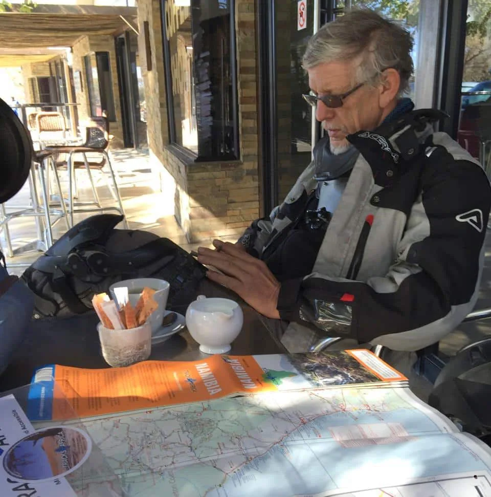
Wouter Brand in Namibia.
A few undaunted explorers, including Wouter Brand, began using primitive GPS devices to record new tracks through the sands. He also had the remarkable inspiration to launch the Tracks4Africa (T4A) forums at the same time (founded in 2001—even before Expedition Portal), so like-minded voyagers could share their GPS routes with one another. As this thoroughly vetted crowd-sourced data set grew to encompass all of Southern Africa, Tracks4Africa began aggregating it into a comprehensive regional map. But there was no way to conveniently use it on the go.
The big leap came in 2003 when Garmin GPS hardware hit the market that could upload the data sets and overlay them onto viewable maps on user-friendly devices—specifically the Garmin GPS V. By 2005 Tracks4Africa was really off and running, selling its digital maps to explorers from all over the world. As the technology evolved, so did the company, and it continued to leverage the information and experiences of its users to create more richly detailed resources.

The Garmin GPS V personal navigator.
Realizing that map data was only a fraction of the story, Tracks4Africa launched the Padkos guide in 2008, a structured online forum where the T4A community could share more advice and ideas about campsites, roads, restaurants, and other points of interest featured on the maps. Tracks4Africa’s paper maps debuted in 2009 and are still the go-to physical cartographic tool for travelers on the continent. Of course, a T4A app is available, but their digital mapping products are still primarily Garmin-based. The user community remains vibrant and continues to keep Tracks4Africa up-to-date and expanding to all corners of Africa. They now also offer a range of atlases, guidebooks, and hiking maps for the region.
In many ways, Wouter Brand’s brainchild laid the groundwork for many of the GPS-based navigation aids we rely on today, including crowd-sourced sites and apps like iOverlander, maps.me, and onX. T4A navigation and maps were my constant companions on all my adventures in Africa for the two years I lived and traveled there. It’s hard to imagine my life there without them, and I know many of my fellow travelers feel the same.

My well-thumbed T4A Mozambique & Malawi map still lives in my Land Rover.
Wouter Brand is survived by his wife, Hester, and his five children and eight grandchildren. Johann Groenewald, Tracks4Africa co-founder, writes,
“Wouter was a legend in his own time, and those who knew him were lucky to have met an interesting and strong individual, not to mention eccentric. His strong will and determination had no small part to play in the establishment of Tracks4Africa, and although Wouter retired from active involvement about a decade ago, we would never have been where we are without his relentless pursuit of excellence. Wouter laid the foundation of our Tracks4Africa map, and we will continue with his work.”
Read more: 10 Things to Know About Overlanding Botswana
Images: Johann Groenewald, Tracks4Africa, tramsoft.ch, Stephan Edwards
Our No Compromise Clause: We do not accept advertorial content or allow advertising to influence our coverage, and our contributors are guaranteed editorial independence. Overland International may earn a small commission from affiliate links included in this article. We appreciate your support.


