
It was the end of summer, and the sun hung over the far end of Muchalat Lake a bit later than it would in a month from now, but not as late as it had the month before. I was sitting on a log on the beach overlooking the water about 15 kilometers from Gold River, British Columbia—the nearest town of any significance. Gold River, in turn, was 90 kilometers from Campbell River, the biggest city this side of Nanaimo. I’d racked up 500 kilometers of driving in the past few days, much of it on dirt and all of it on an island.
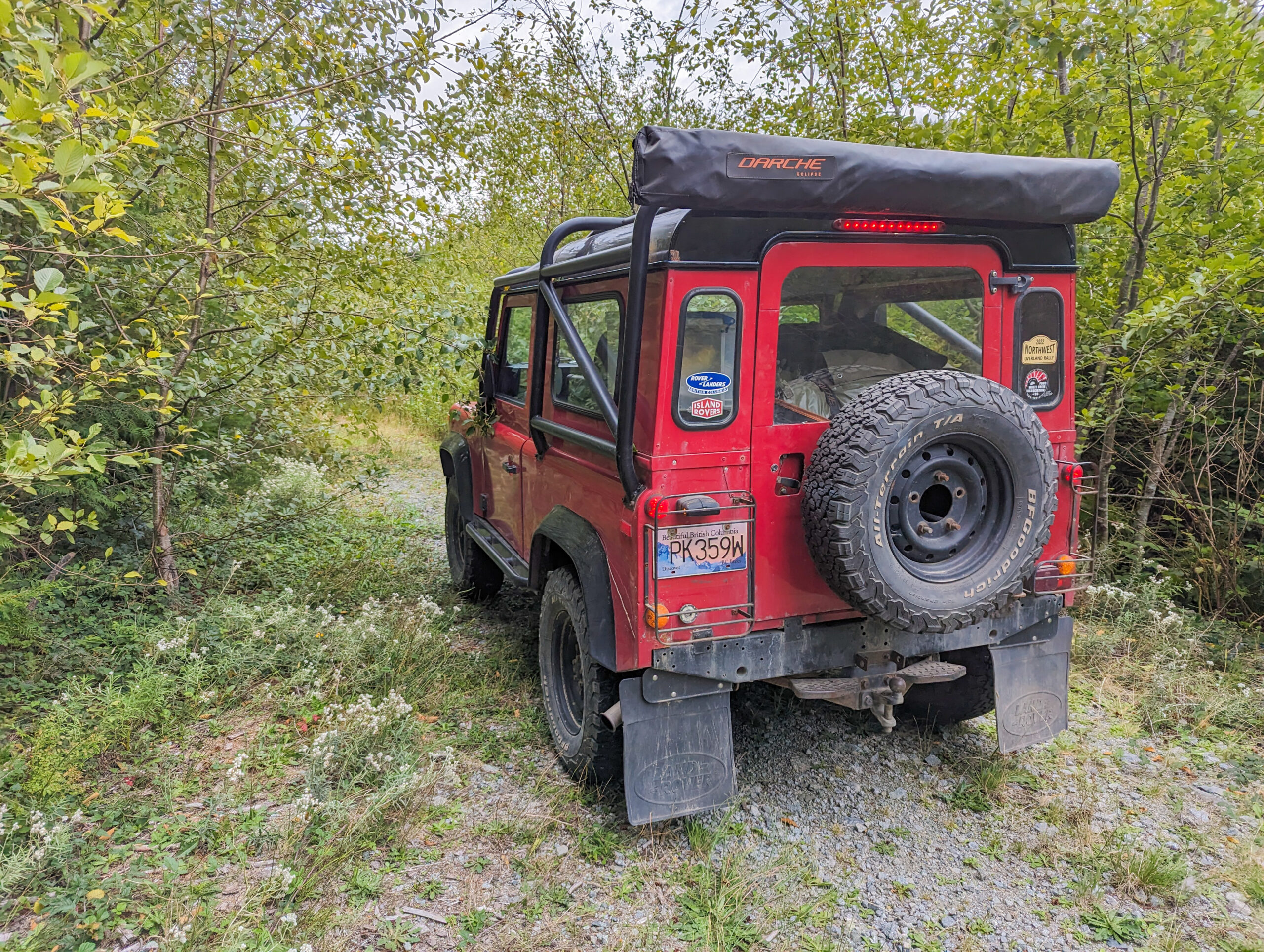
The borrowed 1996 Land Rover Defender 90 was parked at camp just through the trees. My friends Nick and Tina had lent me the keys for two weeks. I’d hopped on a plane to Vancouver the day after quitting my job of the past 15 years, and I figured that some time spent overlanding my way across Vancouver Island was a good way to hit the reset button. I’ve fallen in love with British Columbia over the past few years, finding it a place that both wows and challenges me on my overland adventures there. I’m a lifelong New Jerseyan, and BC is the perfect counter to life in suburbia in the shadow of New York—still wild, but with the cosmopolitan global city of Vancouver to anchor every trip. I figured that the scenic beauty of the “Best Place on Earth” would help me find clarity as I navigated the next steps on my career path. And hey, if not, I was going camping, and that’s never a bad thing.
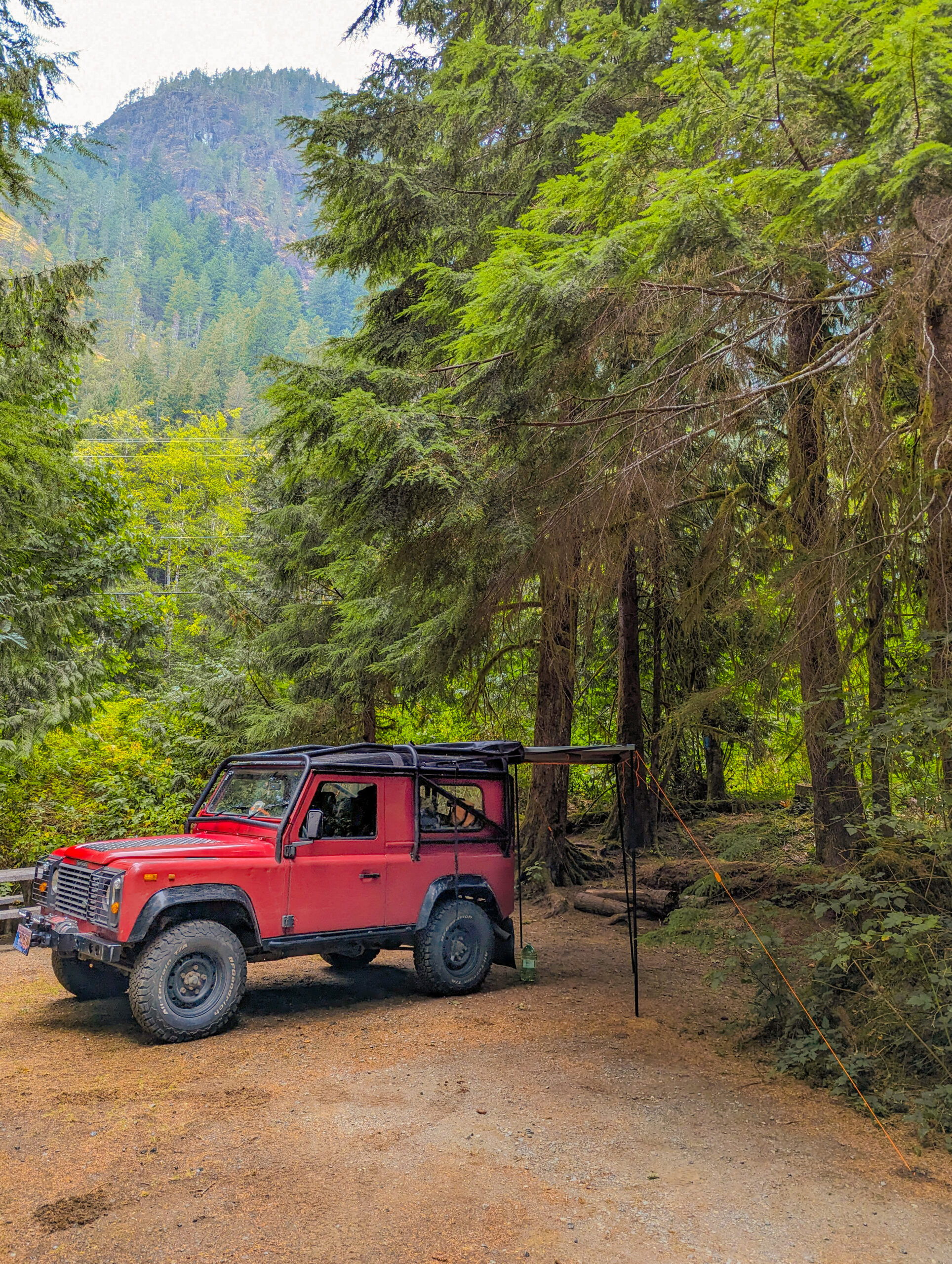
The bright red Defender 90 was small enough to force me to pack efficiently. A commercial model that saw its first service with a British utility company, Nick and Tina shipped it to Canada a few years ago and made it their trusty adventure wagon. They often tow a small overland trailer, but I was going solo and looking for a smaller footprint. I went with a Darche swag supplied by our mutual friends at Brigade Overland in Vancouver, a Darche 180-degree awning hanging off the back, and a fridge and kitchen gear. It made a fantastically light and fast one-man rig, the 300Tdi diesel engine still performing in its sweet spot with the minimalist load.
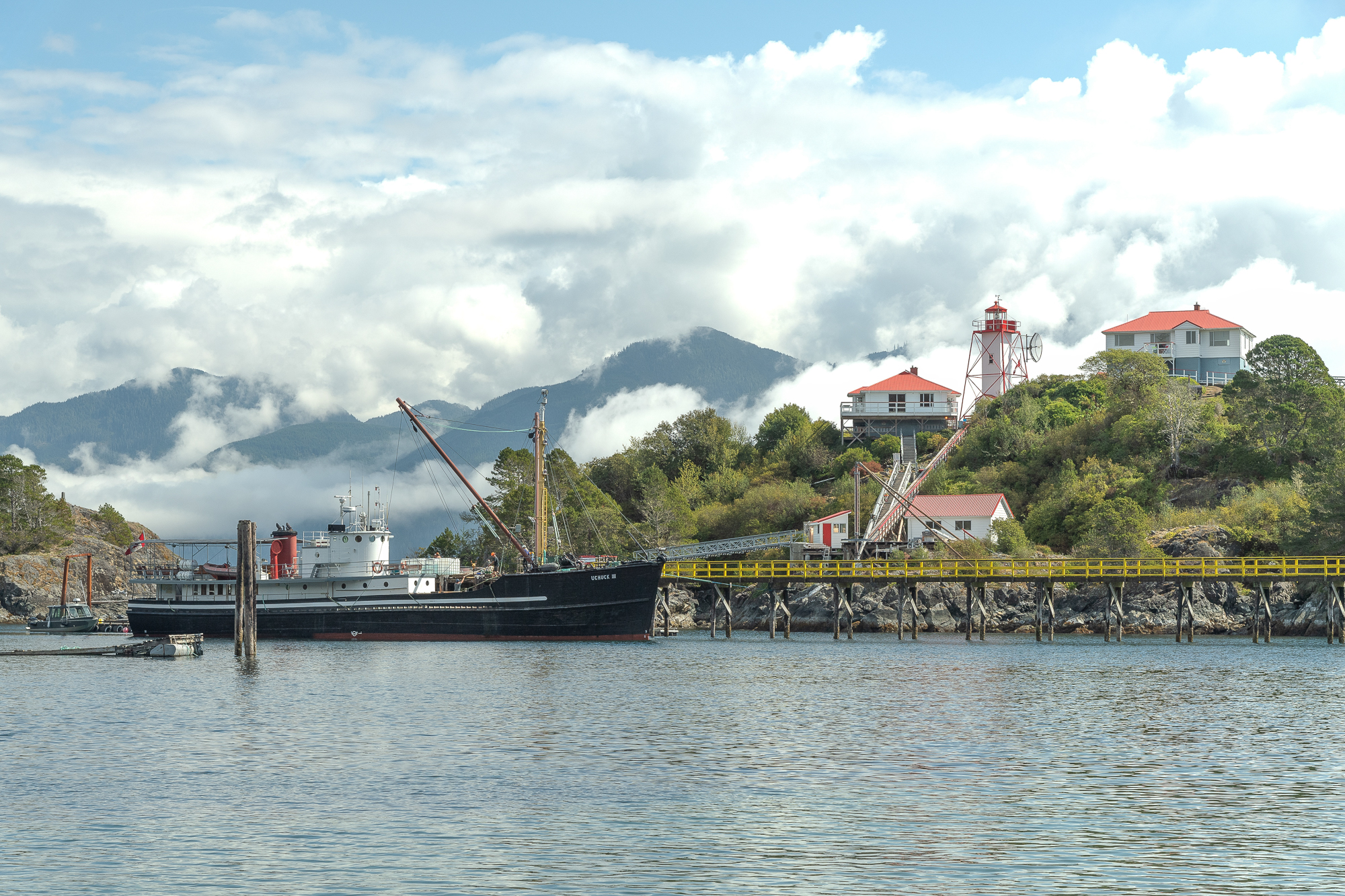
The MV Uchuck III calls at Kyuquot, where it’s been bringing supplies and visitors to this remote community in Nootka Sound, Vancouver Island, since 1960.
Vancouver Island is the largest island on the west coast of the Americas and is about half the size of Ireland. Most tourists visit Victoria on the massive cruise ships bound for Alaska and stop for a few hours to enjoy the quaint city described as more British than Britain. Mainlander British Columbians take the ferry over for the weekend, but many end up in the Victoria area or exploring the famous surf town of Tofino on the west coast.
It’s the north of the island that really shines, though, especially as an overland destination. At the Campbell River, about halfway up the east coast, the four-lane divided highway from Victoria turns into a two-lane road weaving through the mountains. The road leading all the way to Port Hardy, the northernmost city on the island, wasn’t finished until 1980.
While the highway runs up the east, the west coast is punched through with fjords, valleys, and alpine lakes, bringing the waters of the Pacific deep into the interior of the island. From the main road, you can meander west and explore logging towns, fishing villages, and First Nations communities. A combination of pavement and dirt logging roads build a rugged second highway network, and with a 4WD, you can connect these to link up tens of kilometers of backcountry exploration in any one go.
I started my exploration of the North Island at Gold River, a small town on the inland reaches of Nootka Sound. Gold River lived and died as a logging town in a single generation; it was built in 1967, and the mill closed in 1998. The road west from Campbell River winds around the edge of Strathcona Provincial Park, and as I drove west, the candle-worthy smell of fresh rain on pine trees mixed with the acrid smoke from forest fires in the park.
Gold River is a wonderful example of one of the most brilliant things about travel in BC: the abundance of affordable municipally and provincially run camping. For just $18, the Defender and I had a spot nestled in the pine trees, the last drops of rain smacking on the awning as I whipped up a pot of that all-Canadian meal, boxed mac and cheese, on the tailgate table. It was the perfect spot to overnight before heading out on a day trip to Nootka Island the next morning on the 1943-built cargo ship MV Uchuck III, a lifeline service that provides cargo to several remote coastal towns.
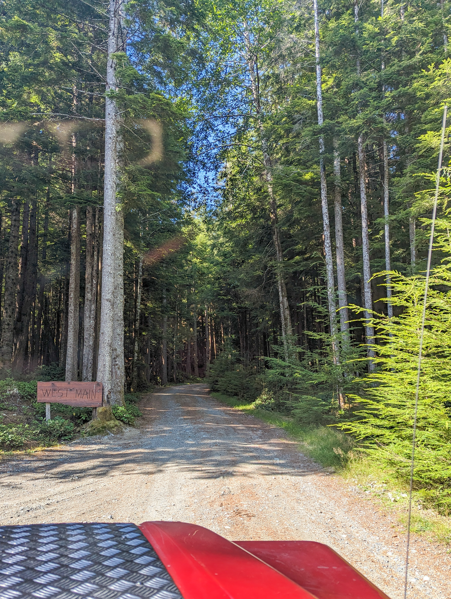
From Gold River, I began what became a repeating theme for the next few days: opening up my Backroad Mapbook gazetteer of Vancouver Island on the flat front fender of the Defender, finding the dotted tendrils that showed the logging road network leading from wherever I was to wherever I was going, and making it a personal challenge to spend as much time as possible on dirt. My first goal was the small logging town of Woss, a ride down fire roads for almost 80 kilometers. If you don’t have a backroad-ready vehicle, the alternative is a 216-kilometer pavement run threading back through Campbell River.
Most of these roads are shared with logging trucks since British Columbia is one of North America’s most productive timber regions. For safety reasons, a VHF radio is more or less required to drive up here, and every road sector has the common communication frequency posted at the start. Rocking down the road, I called each milepost (red Land Rover, 21 up), allowing myself and the truckers to track how far we were from each other. Now and then, I came across a tractor-trailer loaded to the brim with raw logs, heading to a pile to begin its journey through the lumber-making system. These trucks have the absolute right of way, and the radio countdown gave me plenty of time to pull the Land Rover over and roll the windows up before they passed me in a cloud of dust.
About two-thirds of the way to Woss, I noticed the Defender acting squirrely. The rear axle wasn’t rebounding the same way the front one did, and as I sailed across the washboard, it became more and more noticeable. I found a place to pull over and take a look. Sure enough, what I dreaded might have happened had happened; the rear shock had separated at the top mount, and the piston was now dancing against the side of the chassis. The downside: I had a very broken shock. The upside: I knew Nick was getting ready to replace them anyway and had two new ones on his workbench. The downside: that workbench was a six-hour drive and a ferry ride away.
There was no option but to move forward. The vehicle still drove, so I coaxed it the last 20 kilometers. I popped onto pavement and pulled into the general store at Woss, where I grabbed a pile of highly processed comfort food and used the sugar high to figure things out. After a bit of brainstorming, Nick sent the new shocks on the next flight to Port Hardy as cargo on Pacific Coastal Airlines, which runs a frequent service across remote parts of BC. Two hours of pavement later, I was at the cargo terminal picking them up.
Port Hardy is every bit one of those towns at the end of the world with its transient aura, the prominent signage for the ferry docks to move onward, and the abundant last-stop supplies. The summer Alaskan travelers were now making their way south. On this postcard-perfect day, I swapped the shocks on the Defender alongside European-plated motorhomes and cracked open an ice-cold Lucky beer to celebrate—the unofficial elixir of Vancouver Island.
.
I needed a break from the drama of the past few days, and the solution was a low-key day of island hopping. While BC Ferries is well-known for its robust service connecting the island to the mainland, it also runs several services to smaller inhabited islands off of Vancouver Island. Malcolm Island is one of the gems of the Inside Passage, with the main town of Sointula heavily influenced by the Finnish settlers who came here in the early 20th century.
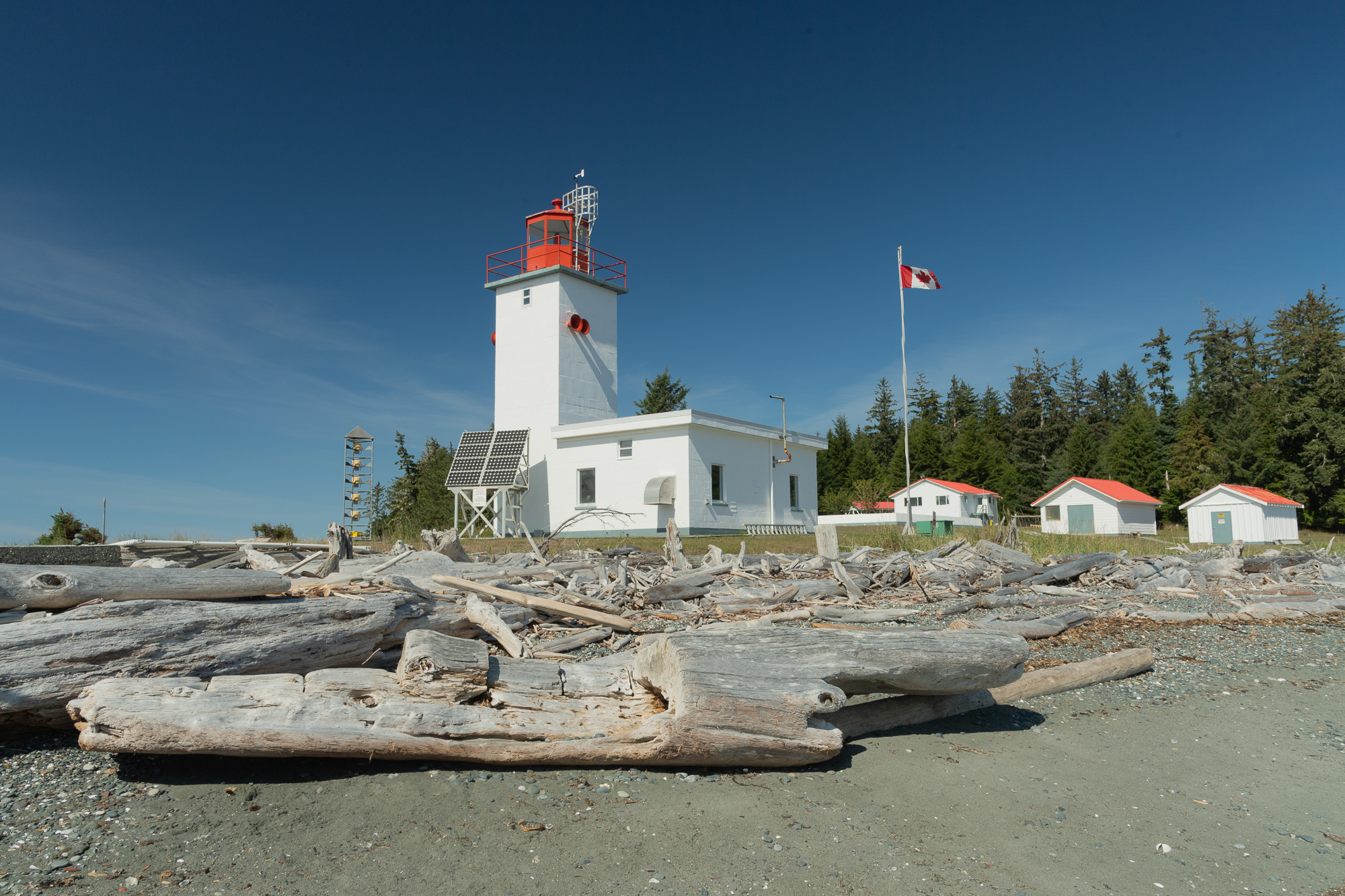
As the tires clank-clanked on the ferry ramp, I realized this place provided the scene for exactly the life shift I needed. Puttering the little red Defender down winding roads clinging to the seaside, past fishing shacks built over the harbor, the fresh pine and sea air mixed in an entrancing potion. At the end of the road, a narrow hiking trail through the woods led to a quiet, rocky beach, the Pulteney Point Lighthouse standing watch at its end. As I sat to eat lunch on a sea-bleached log in front of the strong and solid beacon, the sound of sea birds and a Canadian flag snapping in the wind for a soundtrack, everything in my head was reset.
After a break back in Port Hardy, it was time to head out to the extreme tip of the island: San Josef Bay. Though not the northernmost point, thanks to the island’s Manhattan-esque, off-kilter cant, it is the furthest point from Victoria at the other tip. San Josef Bay is a 64-kilometer all-gravel journey from Port Hardy, with an overnight stop in the middle if you want to see it the right way.
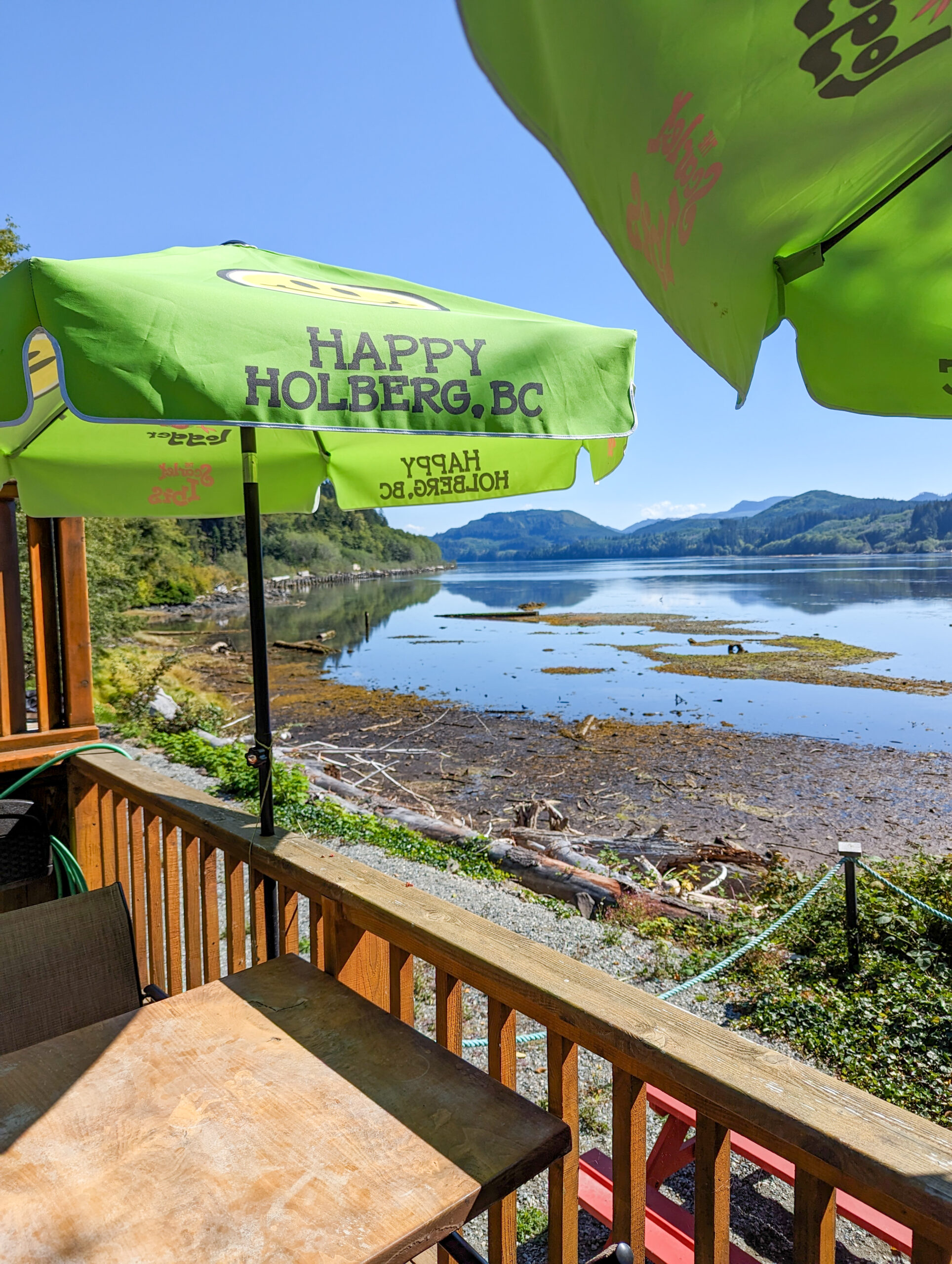
The road to San Josef was, in essence, a master class on everything else I’d experienced until now. I wound through kilometer after kilometer of forest service land, the pines towering high above the Defender as it merrily puttered across rivers as salmon jumped upstream. The only major civilization up here is the small town of Holberg, home to logging operations and the Scarlet Ibis Pub, a remote oasis with another cold Lucky on tap. The remoteness of this area made it the ideal home for the westernmost of NORAD’s radar bases for its Cold War-era Pinetree Early Warning Line, designed to detect incoming Soviet aircraft to North America.
I parked the Land Rover for the night at the San Josef Heritage Campsite. The privately owned campground is the back forty of Doug’s land, which has been in his family for generations; he’s trying hard to keep his land successful without selling it to the nearby provincial park. A $10 bill exchanged for the night, I headed to hike the 4 kilometers out to the bay. The vast high tide overlooked by rock outcroppings and topped by trees all around was the ideal BC coastal scene and the very end of the road on Vancouver Island.
.
Never a fan of repeating the same route on the way out, I headed south via Coal Harbour to tackle part of my return to Vancouver on new dirt, cranking Jimmy Buffett on a portable Bluetooth speaker shoved in the dashboard pocket. Some might consider the location of a “Cheeseburger in Paradise” to be at a beach bar in Cozumel or Grand Cayman. For me, it would be cooked on the back of the Land Rover in this beautiful place.
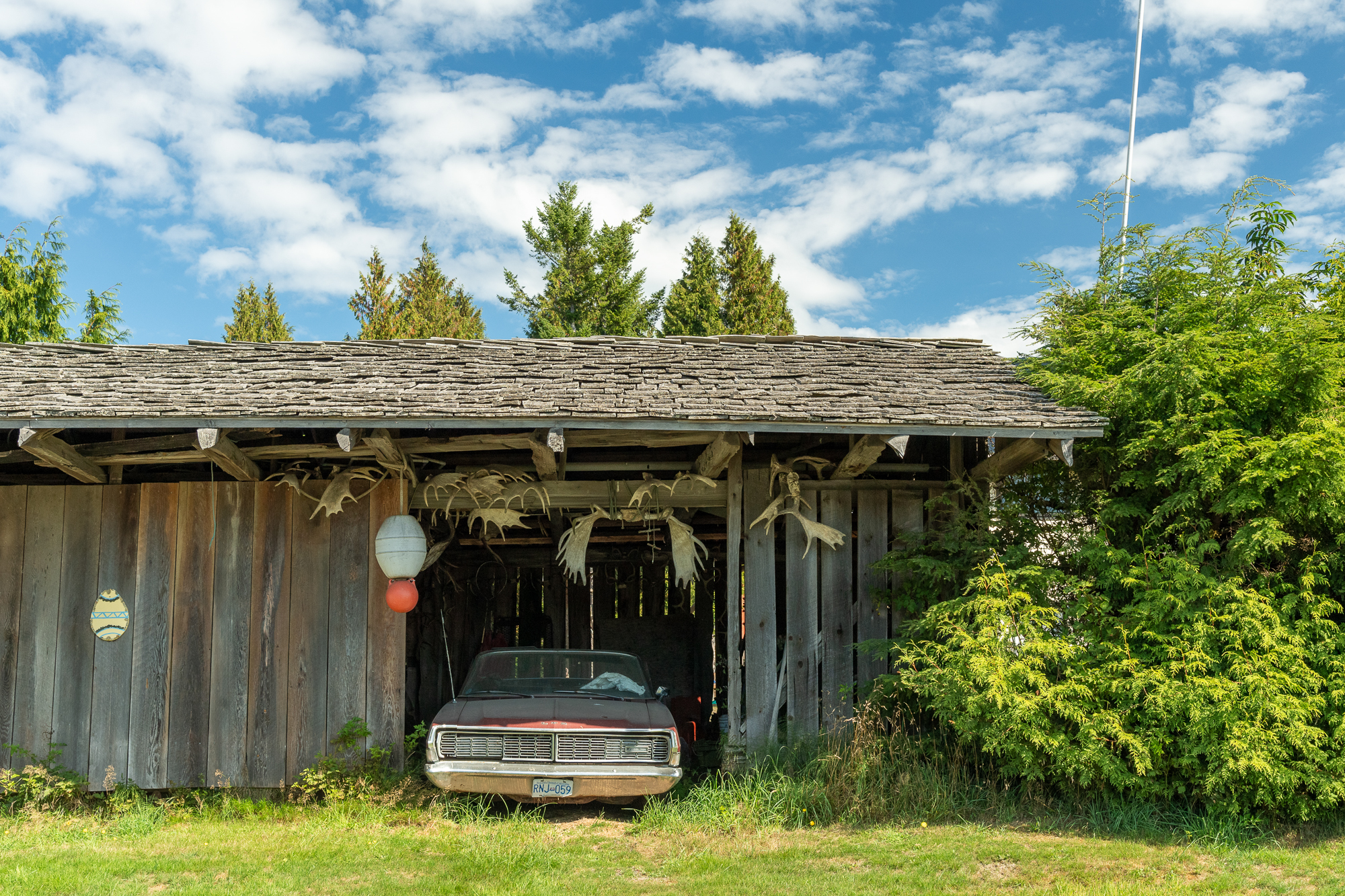
At Joey’s Coal Harbour Historical Collection Museum, a series of rooms in the back of an aviation hanger documents the history of the region, from aviation to logging (the room of chainsaws was a vibe) to fishing to communications. My fascination with British Columbia extends to its industrial archaeology as much as its natural scenery, and many of my past trips here have focused on mining and mechanical relics. Joey’s museum, housing the cherished items of a life-long Coal Harbour resident, brought all these stories together for me, putting a capstone on my adventure.
I pounded the pavement, cranking the 300Tdi to its limits to maintain 100 km/h south. I’d completed my dirt journey and was ready to return to Vancouver. I’d never visited the Sunshine Coast of BC, which is two stretches of road across the Georgia Strait from Vancouver Island that are physically attached to the mainland but accessible only by a series of ferries. Again, looking for a different route home, I went to Comox and took the ferry to Powell River. I spent the night in the historic Rodmay Hotel, originally built by the Powell River Paper Company to house high-level business associates visiting the mill that operated here until 2021. The following day, I headed to the end of the mainland Pan-American coastal highway at Lund and ended up in Vancouver by night.
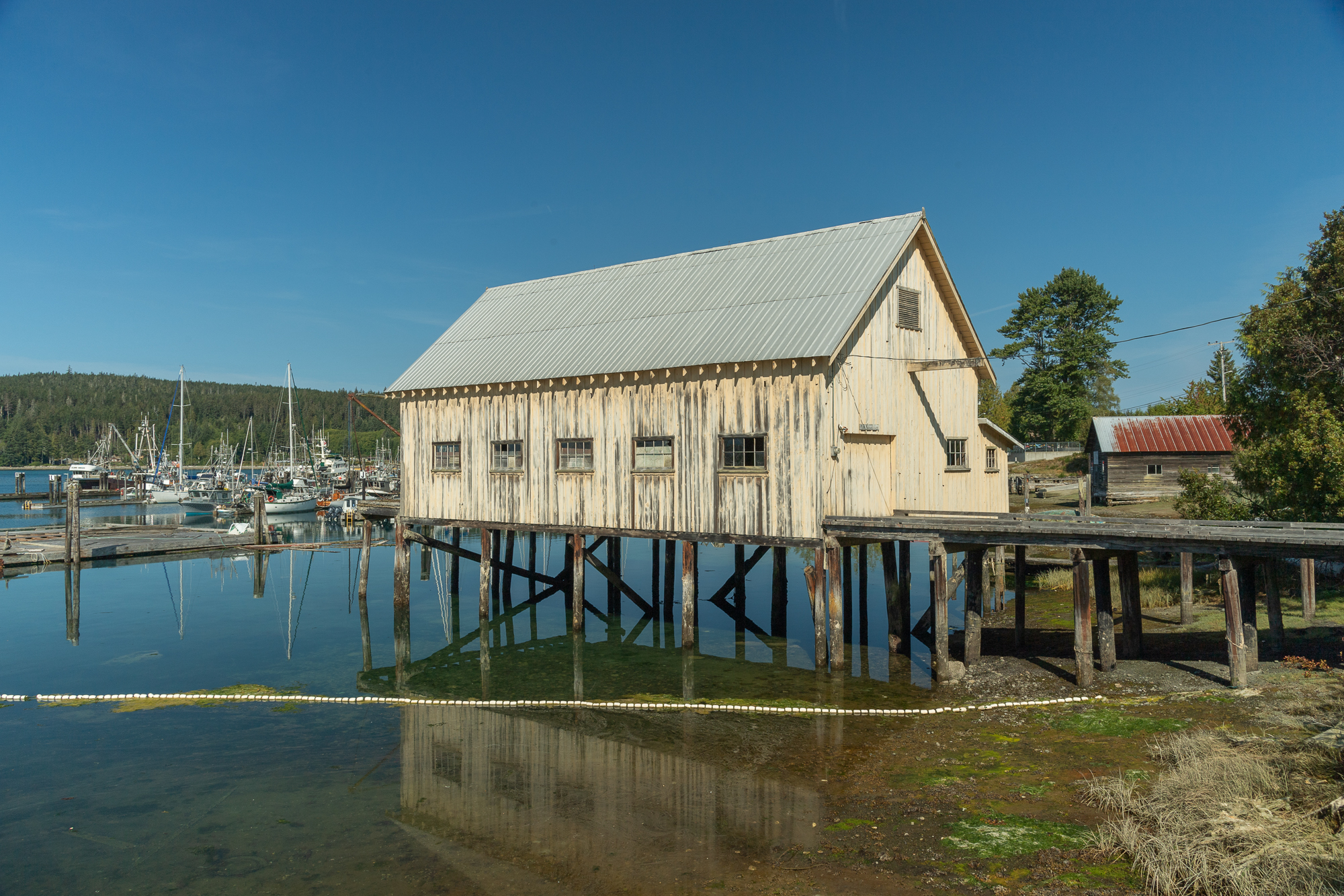
Fisheries form the backbone of Sointula’s economy, with a vibrant harbor full of classic fish shacks.
It had been a week in the Land Rover, with a major crisis, hundreds of kilometers of dirt roads, backcountry camps, and incredible cultural experiences. Had I come any closer to finding my purpose? Probably not. These trips never end that way, even if we intend them to. Or maybe I’d already found it because there is, after all, nothing that makes me happier than spending a week meandering in the Best Place on Earth.
Editor’s note: This Northern Vancouver Island article was originally published in Overland Journal’s Gear 2025 Issue.
Our No Compromise Clause: We do not accept advertorial content or allow advertising to influence our coverage, and our contributors are guaranteed editorial independence. Overland International may earn a small commission from affiliate links included in this article. We appreciate your support.