In March, after months of meticulous planning and preparation, the Georgia Jeep Alliance Jeep Club took on the challenge of the legendary Georgia Traverse—a 390-mile route that passes through Georgia, North Carolina, Tennessee, and ultimately, Alabama, across some of the most breathtaking landscapes in the southern US. Charted by the overlanding pioneers at Georgia Overland, this route winds through the heart of the state’s scenic roads and off-road trails, starting on the Georgia/South Carolina border and taking you through the Nantahala National Forest, across the Chattahoochee-Oconee National Forest, and into the rugged beauty of the Cohutta Wilderness, ending at the Georgia/Alabama border.
Day 1 – Entering North Carolina
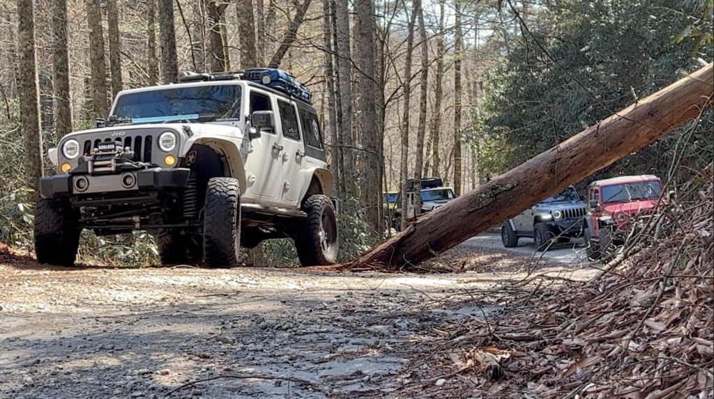
Enjoy a smooth two-hour drive from South Carolina into Georgia through North Carolina’s Nantahala National Forest. The forest roads were mostly tame, though we did have to dodge a few downed trees from a recent storm. Luckily, there was an explorer ahead of us with a chainsaw clearing the path. We arrived in Dillard, Georgia, just in time for a hearty lunch at the famous Dillard House Restaurant—their southern fried chicken is a must-try.
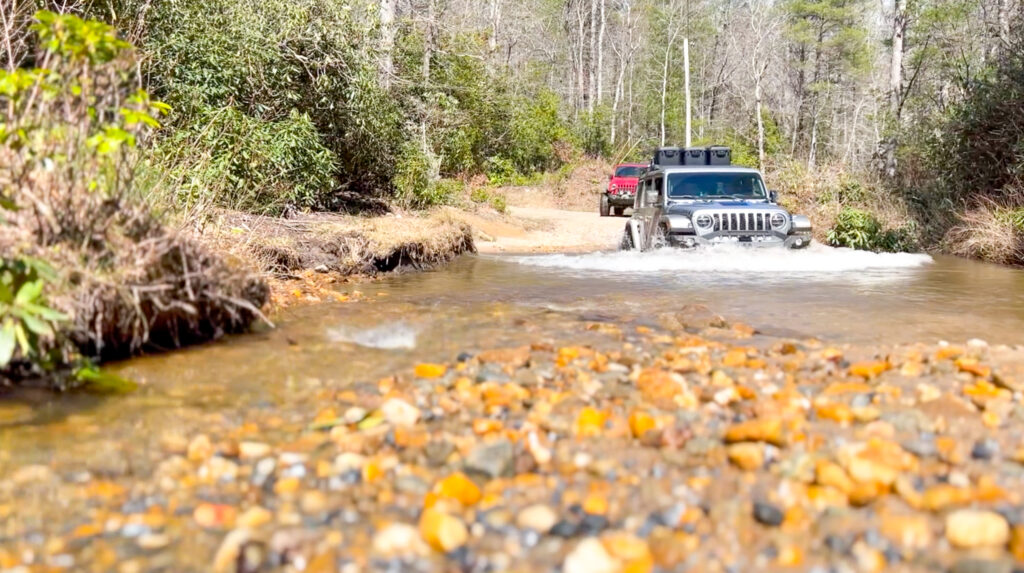
After fueling up, we headed for Charlie’s Creek, known for its river crossings and water forging. This road alone makes a trip to North Georgia worth it. Tread Lightly, sticking to the main road, as unauthorized off-trail driving is damaging this beautiful area, and there is already talk of possible road closures in the future.
As day one drew to a close, we set up camp near Unicoi State Park in Helen, Georgia. With the campfire going and burgers sizzling, we wound down the day to the rumble of stories from previous adventures before crashing in our rigs for the night.

Day 2 – Navigating Coopers Creek
Continuing west toward Coopers Creek, as we gained elevation, mist and rain started to settle in. Nearing Blood Mountain, we paused for a quick lunch stop, unable to linger since we had a lot of ground to cover before camp. Lush tree cover running alongside creeks and the occasional waterfall created stunning backdrops.
After a few hours of exploring, we found the perfect campsite hidden in the trees—sheltered from the wind and close to running water. With rigs leveled, Michael fired up the grill, and soon, cold drinks accompanied good company under the stars.
Day 3 – Chattahoochee National Forest
Waking up to a wet camp, we set off toward the Chattahoochee National Forest. Entering the forest, the scenery dramatically changed to mountain ridges with sweeping views of the valleys below. Midway through the day, we stopped at a waterfall to stretch our legs,
Later, we met up with my good friend and fellow YouTuber Bradley (aka Jeepin Bubba), who led us into the Cohutta Wilderness to a massive dispersed campsite called the Ball Field. Here, campers spread out across the open field, setting up wherever they liked.

Day 4 – Cohutta Wilderness
We awoke to freezing temperatures at the Ball Field and took our time packing up, trying to stay warm with coffee in hand, preparing for the final leg through the Cohutta Wilderness and its breathtaking mountain views. After several hours of exploring, we continued westward, feeling the bittersweet end of the trail drawing closer. We rolled out of the mountains and into the hills, finally crossing the border into Alabama—the official end of the Georgia Traverse. Here, we celebrated our victory, standing next to our muddy rigs with a group photo.
Georgia’s wilderness is a thrilling, soul-refreshing escape from the hustle and bustle of everyday life. Whether you’re a seasoned off-roader or new to overlanding, the Georgia Traverse has something to offer for everyone. It’s an easy yet rewarding route that offers stunning views, exciting trails, and peaceful campsites and delivers some of the best exploration in the southeastern US. Don’t forget to grab the free .GPX files from georgiaoverland.com; consider leaving a donation to help them continue their awesome work.

Route Details
- Total Length: 390 miles
- Time Without Fuel: The longest stretch between fuel stations is around 75 miles.
- Difficulty Rating: Easy/Moderate. While much of the route is graded gravel roads, several sections feature water crossings and rough terrain that require high-clearance 4WD vehicles. The deepest water crossing is about 30 inches deep.
Access
- Starting Point (South Carolina Border): 34.977500, -83.128900; this is the trailhead at the South Carolina/Georgia border near Cherry Hill Campground.
- Ending Point (Alabama Border): 34.343376, -85.475508; the Alabama side of the border near Piney Grove Campground.
Fuel Stops Longitude/Latitude
- Dillard, GA (Day 1 Fuel Stop): 34.972100, -83.384800; fuel and supplies available.
- Ellijay, GA (Day 2 Fuel Stop): 34.694200, -84.483200; good stop for fuel and any extra supplies.
- Dalton, GA (Day 3 Fuel Stop): 34.769400, -84.970200; final reliable fuel station before entering Alabama.
Best Time to Go
Late spring (April-May) and fall (September-November) offer the best weather for overlanding the Georgia Traverse. Summers can be hot and muggy, and winters can make river crossings more difficult due to ice and flooding.
Permits and Fees
No specific permits are required to drive the Georgia Traverse. However, some campsites along the way, particularly within national forest areas, may have small fees or require reservations. Always check the USDA Forest Service website for the latest updates.
Suggested Campsites
Unicoi State Park (Day 1): 34.721500, -83.720800; nearby facilities
Blood Mountain (Day 2): 34.739100, -83.957500; backcountry camping site
The Ball Field, Cohutta Wilderness (Day 3): 34.972300, -84.653100; dispersed camping area with plenty of space to set up.
Resources
Chattahoochee-Oconee National Forest: (770) 297-3000, fs.usda.gov/conf/
Cohutta Wilderness: (706) 695-6736, fs.usda.gov/detail/conf/specialplaces/?cid=stelprdb5229076
Images: Kevin Swan
Read more: Nobody Puts Baby in a Corner :: Pan-Am Highway With an Infant
Our No Compromise Clause: We do not accept advertorial content or allow advertising to influence our coverage, and our contributors are guaranteed editorial independence. Overland International may earn a small commission from affiliate links included in this article. We appreciate your support.


