

Descending the steep switchback into the canyon below, we heard the sudden and distinct noise of metal clanging against metal. I prayed it was nothing serious, but instinctively knew it was. Taking stock of the rear shock mounts, we discovered one had cracked to a dangerous degree, the other snapped in half. We were 55 hard miles from the nearest point of civilization with one of the most remote and barren stretches of our route before us. For the first time, we realized our trip could be in jeopardy. The year of research, countless hours of planning, and efforts coordinating with the Bureau of Land Management (BLM) and local authorities to recreate this 660-mile route would be for naught if we couldn’t repair this problem. Repair it, and then finish the more than 300 miles of trail that still lay ahead. We were in the thick of it, and the East Mojave Heritage Trail (EMHT) wasn’t done with us yet.

Many overlanders have either heard of or explored the historic 140-mile-long Mojave Road located in the East Mojave Desert in California. One of the original settler trails West, in 1975 it was rediscovered, documented, and popularized by renowned Mojave Desert explorer and historian Dennis Casebier. Since then, it has been considered one of the top overland routes in North America. However, ask those same overlanders if they’ve heard of the East Mojave Heritage Trail and you’ll most likely get a blank stare in response.
I stumbled across the Heritage Trail several years ago but didn’t pay it much mind. That changed two years ago when I was reviewing my research from that trip and found my scribbled note “EMHT?” on the corner of a page. It turns out that the East Mojave Heritage Trail, 660 miles of forgotten track, winds through the heart of the East Mojave Desert’s historical and geological treasures. It’s not a straightforward A to B route like Mojave Road, but instead meanders through the region, coiling back on itself like a mad as hell Mojave green rattlesnake—and it can be just as deadly. The EMHT traverses every type of desert terrain offered: hard pack dirt, soft sand, granite, and lava rock while slithering through massive sand dune areas, sprawling dry lake beds, twisting mountain passes, jagged lava and cinder fields, dry washes, expansive Joshua tree forests, and vast swaths of open desert with jaw-dropping vistas. To paraphrase Quint in the movie Jaws, if you go after the EMHT, you’re gonna get the head, the tail, the whole damn thing.

The East Mojave Heritage Trail was created by Dennis Casebier in the 1980s as an alternative to his popular Mojave Road to mitigate the ecological impact from its potential overuse. Four years of effort resulted in four volumes of books, each dedicated to a specific segment of the comprehensive tour of the East Mojave Desert. Those individual segments and corresponding guidebooks are Needles to Ivanpah, Ivanpah to Rocky Ridge, Rocky Ridge to Fenner, and Fenner to Needles. Included are four summary maps, 71 individual detailed maps, and about 1,200 pages of text containing vital route information, history, key personalities, and flora and fauna in each area.
Soon after the final book was published, wilderness areas (designated lands typically for wildlife habitat protection in which no vehicle may enter) came into effect cutting the trail in 13 places, impacting at least 75 miles of the route. Given the guidebooks are laid out in precise cumulative miles using geographic landmarks as the primary direction finders, any deviation from the original route rendered the guidebooks useless. Dennis had been working in conjunction with the BLM to develop the trail and felt betrayed by the move to cut off the track. Casebier abandoned the effort, but not before an initial run of books had been published. It was a set of these books that I found, inspiring me to recreate the track in 2019, its 30th anniversary.
THE PREPARATION
While the trail exists in many areas on current maps, several sections did not appear at all—the dreaded (or revered) “blank space.” The Heritage Trail is so large that no single map exists that can display its full length, so I made my own. Each of the four summary maps were copied, changing their size to get them scaled equally, and then carefully pasted together, lining up key roads and highways. I color coded each of the segments and marked refueling points. I now had a single view of the EMHT that corresponded to each of the guidebooks. By using a combination of guidebooks, a summary map, paper maps, satellite imagery, and a specialized web application provided to me by the BLM to identify the wilderness areas, I was able to recreate the Heritage Trail with reroutes accounting for new restrictions. The length is now a daunting 724 miles. When done, I had a fully legal and compliant updated version of the East Mojave Heritage Trail.

Conversations with the BLM resulted in recommendations for information and tools, and an agreement to assist them with documenting wildlife, particularly desert tortoise sightings and sizes, any nefarious activities, trail conditions, Mylar balloon locations for a National Park Service project, etcetera. With the intent to publish the new route along with the additional geographic and ecological observations and reporting tasks set, I now had the framework for a desert expedition—a journey with purpose.
Rarely does one read about long-distance remote desert overland treks in North America. People might think that because the Mojave Road is so well-trafficked that this desert is relatively small and safe—it is not. For comparison, the Mojave Desert is 35 percent larger than Africa’s Namib Desert and comparable in size to South America’s legendary Atacama Desert.
During the past 30 years, many people used small portions of the trails, a few had tried an entire segment or two, none had traversed the entire EMHT, and certainly, no one had attempted to update it to make it compliant. In his guidebooks, Casebier warns that no single vehicle should attempt the Heritage Trail. He also advises that each segment should take 3 days to complete, 12 days in total. I was attempting to complete this expedition in just six days, solo. My good friend Tony Talbert heard about my crazy idea and decided he wanted to be a part of it, traveling from North Carolina via Overland Expo West to ride shotgun.

THE JOURNEY
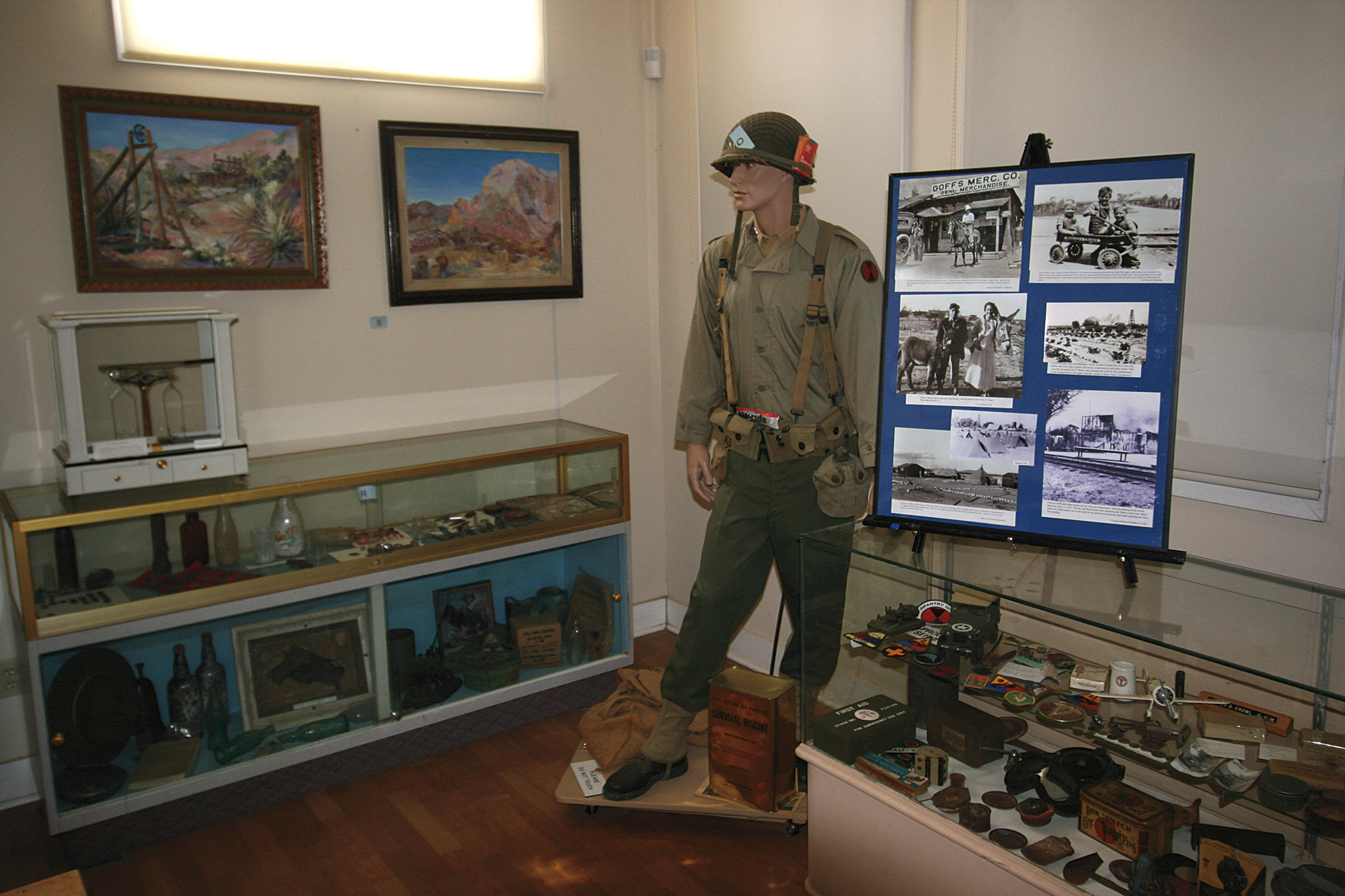
High on adrenaline in anticipation of a grand adventure, we arrived at our starting point in front of the abandoned El Garces Train Station in Needles, California. From there we quickly left pavement and wound our way through Eagle Pass to the Goffs Schoolhouse Museum. Old mining equipment, the museum, and WWII artifacts make this an intriguing stop. The entire area was once the training ground for the US Army in preparation for North African and Italian desert warfare in WWII. Departing Goffs across relatively open desert, we found our first desert tortoise a few miles past the Leiser Ray Mine. It was then onto the Mojave Road to check on the impressive petroglyphs at Indian Hill and up Caruthers Canyon to the New York Mountains. Crossing over Lanfair Road, the trail became more rugged and less defined, until the big blank spot on the map where our foot recces began. Plodding our way forward between the Castle Mountains and the Piute Range, we finally made it to a key geographic landmark in Casebier’s book: Razorback Butte and the California– Nevada State Line marker. Our excitement continued to build as we aimed for the next landmark: Heritage Trail Mailbox 1.

Like Mojave Road, Casebier installed a mailbox on each of the four EMHT segments for people to sign in to monitor usage and gauge ecological impact. Back in the 1980s, Dennis was mentioning overlanding, Tread Lightly, and Leave No Trace decades before they became well-known. The man was ahead of his time in his care and concern for the environment and espousing proper stewardship.
Transiting narrow washes and steep ascents and descents of lightly used trail, we arrived at the first mailbox. I sat in my truck for a while just staring at it, and yes, there were a few tears involved— don’t judge me. Inside the mailbox was the book with signatures dating from 2003, averaging just one sign-in per month. In contrast, the Mojave Road averages about 250 names per month.
Almost immediately after the mailbox, the EMHT started hissing and rattling as the track became far more difficult with steep ascents that required low range, locker, and a bit of courage. Based on the trail, it became obvious that most of those few people who had previously ventured to the mailbox had turned around. Pressing on, we finally dropped out of the mountains into a big wash and headed east across the open desert to make camp. Grilling steaks and drinking coldies we celebrated the day’s adventure, progress, and success as the Milky Way rose above us.
Bright sun and deep blue skies greeted us the next morning as we crossed the desert to Searchlight, Nevada, for our first refueling point. From here, the trail coils back west and climbs into the New York Mountains traversing beautiful Joshua tree forests. Our path took us into Nipton, California, a town reminiscent of a trading post. The EMHT runs on pavement west of Nipton for a few miles until bending north along the edge of a dry lake bed to cross I-15. From there, skirting the solar farm, we wound our way to Ivanpah, the first mining town if not the first settlement in the Mojave Desert, and the endpoint of Segment 1.
The trail then climbs steadily and steeply to the picturesque Colosseum Mine, a massive open-pit gold and silver mine where you can drive down to its water-filled base 500 feet below. Descending the mountain, the EMHT deviates from the main path and snakes its way to Kelly Field, an emergency landing field established by the US Post Office Department in the 1930s to support the original airmail route from Los Angeles to Las Vegas to Salt Lake City. The bulk of the former airfield now sits within wilderness boundary, so we used Excelsior Mine Road to the Kingston Wash trailhead to get back on the original Heritage Trail. Winding and slogging our way through the deep sand wash, evidence of exceptional winter rains and floods, we used Casebier’s geographic descriptions and eventually came to Heritage Trail Mailbox 2.
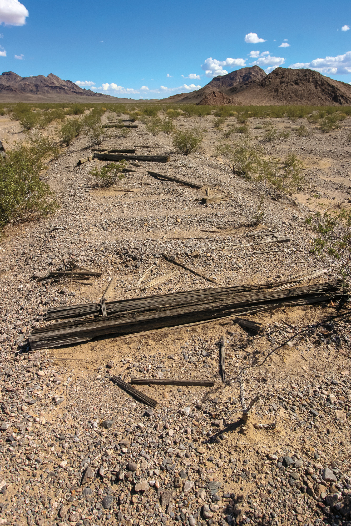
Pleased with our success, we continued out of the wash to the old Tonopah and Tidewater Railroad berm. Started by Francis “Borax” Smith in the early 1900s until 1940, the T&T supported the hauling of mined borax across the desert. The berms, beams, and some spikes are still present, but the US Government requisitioned all of the steel rails in 1942 to support WWII efforts.
Traversing the berm, the EMHT started rattling and threatening its first real strike as we faced sudden dropoffs, square ledges, and steep-angled climbs where winter storms had ravaged the area. More low range and locker work, as well as foot recces, got us off the berm and up to our camping spot with a sprawling valley view. The onsite cabin was clean, but hantavirus is a real thing, so we opted for our normal arrangements— Tony sleeping in the back seat of my truck, and me in the rooftop tent. The indigo night sky provided us with a magnificent view of Jupiter rising above the eastern horizon while shooting stars danced across the heavens.


The next morning, we took the opportunity to sleep in, knowing we only had a short trek to our next refueling point, the town of Baker, California. Before cars got 20+ mpg, Baker was the stopping point between Southern California and Las Vegas. Now, it’s a jumping-off point when headed into Death Valley. Tourists delight in the World’s Tallest Thermometer and get their alien fix at Alien Fresh Jerky (my personal favorite is the Abducted Cow jerky—I said no judging). Soon we were back on dirt, paralleling the western edge of I-15 before leaving the well-defined trail, angling into the Turquoise Mountains and across Shadow Valley.
Crossing over I-15 and trekking along the eastern side of the Ivanpah Mountains and Kokoweef Mine, we came to a magnificent viewpoint to the south. The tale of the “Kokoweef Lost Underground River of Gold” has persisted for almost a century having neither been proven nor disproven, earning its status as a legitimate legend. It contains the elements of a good old-fashioned mystery, and no one can enter the mine unless they wish to become a part of the story. “Missing persons, Indian superstition, bearded and heavily-armed prospectors guarding against claim jumpers, courtroom drama, and death itself have all become part of the Kokoweef legend.” –Casebier, EMHT Guide Book 2
Departing the viewpoint, we were forced to negotiate a tight, twisty, rocky watershed while working our way to John Riley Bembry’s gravesite. Bembry was a World War I veteran, medic in the US Army, and an explosives instructor. These were skills put to good use upon arriving in the Ivanpah Mountain Range in the late 1920s. Bembry passed away in 1984, and the Heritage Trail passes next to his gravesite. A short distance away is Riley’s Camp, a noteworthy cultural landmark and worth the short side trip.
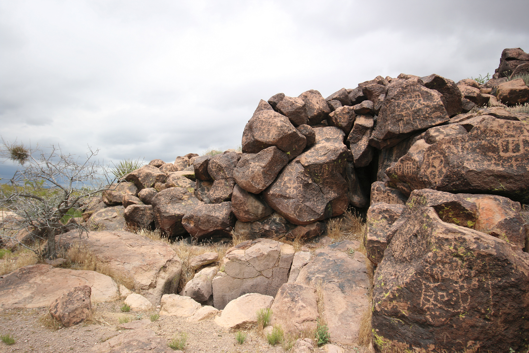
Crossing over Cima Road put us into familiar territory. Meandering through a Joshua tree forest, we stopped at an abandoned ranch, corral, and the site of the old Mojave Phone Booth. The booth became such a cultural phenomenon in the late 1990s and early 2000s that the phone company removed it due to so many people hanging out waiting for the phone to ring. There is an award-winning movie about it, aptly titled, The Mojave Phone Booth. Just a short distance away is a hike to Cow Cove and the most heavily concentrated petroglyphs in the Mojave Desert.
From there, the terrain abruptly switches from sand and Joshua trees to jagged lava rock and red cinder, climbing onto the Mars-like terrain of the Aiken Cinder Mine. When Casebier created the trail, the mine was active, so the original route avoided it. With the designation of the Mojave National Preserve in the 1990s, the mining company decided to walk away, leaving all of their equipment behind. As you drive this area, mind your sidewalls due to the sharp lava rock.
We stopped at the Lava Tube so we could descend and explore it a bit. Time it right, and you’ll witness a bright beam of sunlight through a small ceiling opening reminiscent of Raiders of the Lost Ark. Moving along, the trail enters Willow Wash along the leading edge of an ancient 8-feet-high lava flow and into an isolated culde- sac surrounded by cinder/lava domes. Exiting the way we came, we hit the blacktop of Kelbaker Road for a short distance and turned south, reentering open desert and ascending to the EMHT Segment 2 endpoint atop Rocky Ridge.


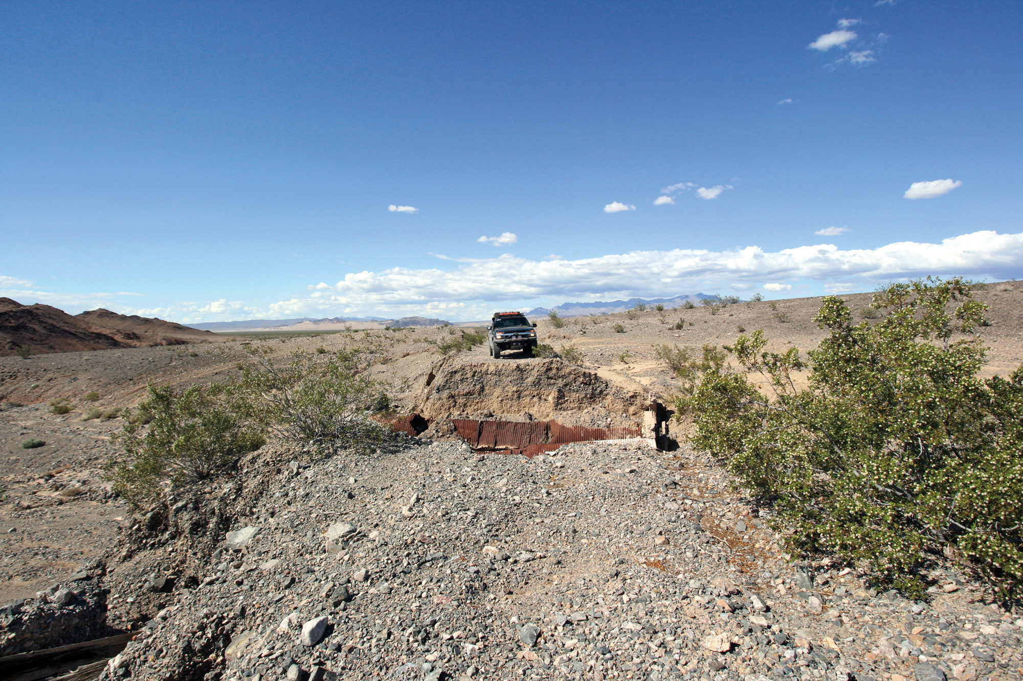
Looking down from the ridge, our route through Jackass Canyon was obvious. But so was the area I feared most: the stretch of pure white sand from the canyon exit to Crucero Dry Lake, residing in one of the most remote regions in the East Mojave Desert. The weather had been in our favor with recent rain and cool temperatures, so I was hoping that the sand would be fairly packed. I could hear the EMHT starting to rattle, slight ticks just daring us to come closer and warning us that we’d better not. From Rocky Ridge, it is a steep descending shelf road with a very tight switchback. If you miss, it’s game over, so don’t miss. We shifted into low range second gear and eased off the brake— game on.
Crawling down the steep switchback into Jackass Canyon, the Heritage Trail suddenly coiled and struck with a vengeance. Our hearts sank as we discovered the snapped rear shock mount and noticed the other cracked as well. We realized our journey was now in jeopardy as we had 55 hard miles to the nearest point of civilization on one of the most remote stretches of our route. We removed the shock to avoid further damage and pushed on into the bleach-white sand, eyeballing the massive sand dunes looming to our right. I carry an InReach, so I texted my friend Jay Waxler, a mechanic with solid welding skills, and asked him to meet us in Ludlow. Though I do have an onboard welder, this was beyond my ability. With less confidence but more determination, we started across the sand area. Portions were very soft, but it wasn’t anywhere near as bad as I had feared; traveling in hot, dry months could drastically change those conditions.
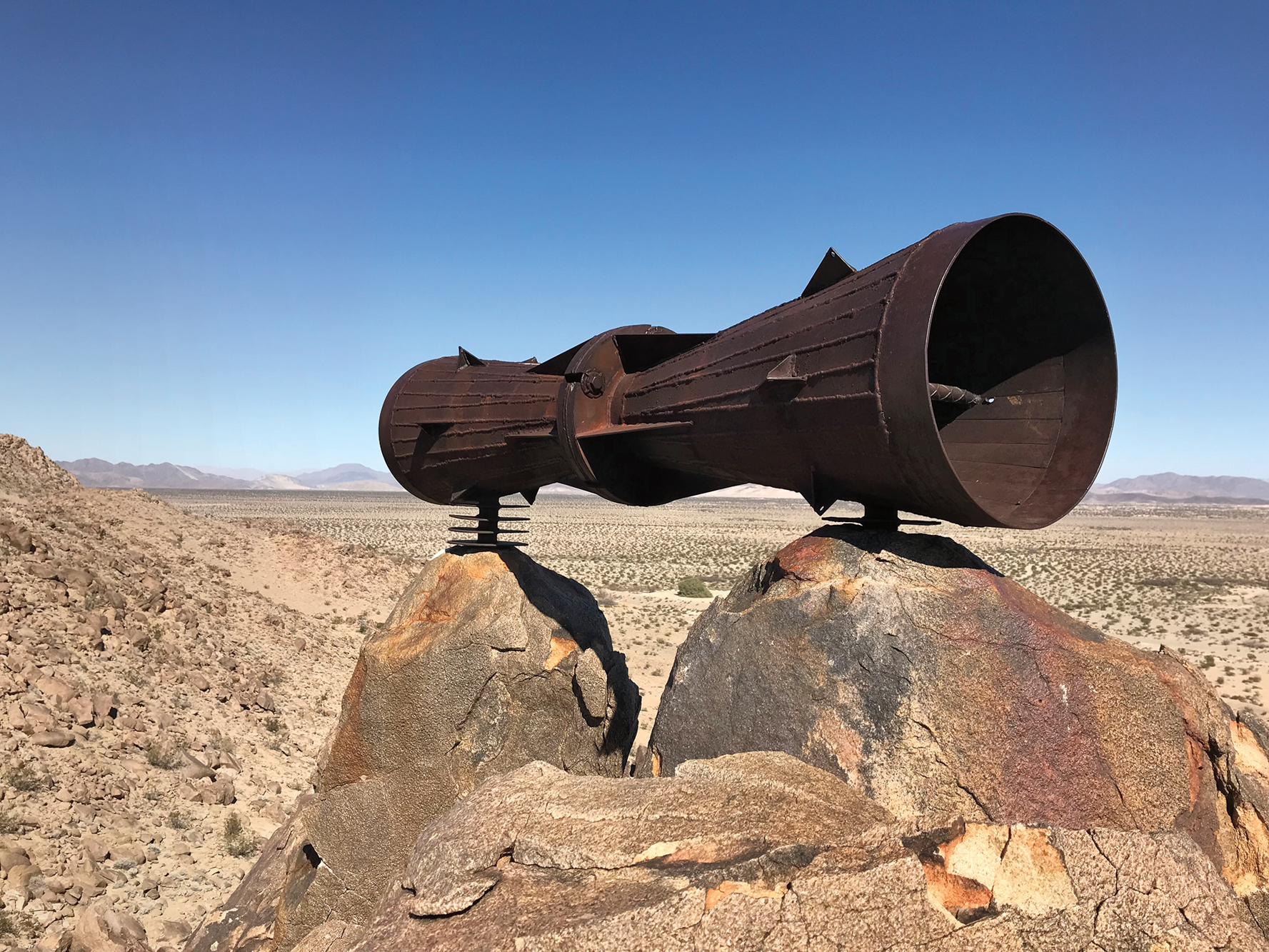
Turning west, skirting and parallelling the massive, rugged dunes, we soon found ourselves on the hardpacked lake bed—what a relief. Once again on familiar turf, one of the great mysteries of the East Mojave Desert, the Mojave Megaphone, was just a short jaunt north.
The Heritage Trail decided she was ready for the next round; damage from flooding turned the previously smooth drive to Broadwell Dry Lake into a quagmire of ruts and washes. Typically, deep ruts are no cause for concern, but with the current state of my vehicle and rapidly dwindling sunlight, our angst level was pegged on 11. That all changed as we drove onto the dry lake’s smooth golden surface, and the rest of the drive into Ludlow was painless. Thus far, the EMHT was doing an excellent job of turning my expectations on their head. What I knew was easy was now hard, and what I feared would be hard, wasn’t.

Ludlow, California, was once a thriving Route 66 town but is now reduced to just a few gas stations and a café. Two hours from the time we removed the shock, we limped into Ludlow and met Jay (Friend of the Year) in a parking lot; he decided that the broken mount was beyond even his skill. I shouldn’t have given him the deep-fried gas station burrito until after he made his assessment. But hey, the guy drove 110 miles (one way) on a moment’s notice on the Friday night of a holiday weekend to help us. One of the critical attributes of overlanding is being resourceful, and that includes having a good contact list and great friends.
Behind the gas station, we found ourselves laying under my truck trying to weld the cracked rear shock tower to keep moving forward. The other shock tower was broken in half with only the coil spring holding up that side, and we still had more than 300 miles of the Heritage Trail ahead of us. We chose to press on. After 10:00 p.m., we headed across I-40 for what should have been a one-hour cruise over easy terrain to Heritage Trail Mailbox 3 where we would camp. Two hours later, we were still trying to find a way through what appeared to be a post-apocalyptic wasteland from Mother Nature’s fury. The sand trail was now a 30-feet-deep, 100-feet-wide, square-walled flood chasm. It was past midnight, but we couldn’t stop because we had only recently come through Ash Hill, which per Casebier is a former toxic waste dump. A safe distance away, we made camp on relatively high ground and called it a night. Sleep would not come as exhaustion and fatigue did battle with my emotions and thoughts. This was by far the most challenging overland trek I had ever undertaken. Somewhere around 2:00 a.m., I fell asleep thinking of what other strikes would be delivered and how we would deal with them, because we would have to deal with them—we’d come too far not to.
As the sun rose, we broke camp and surveyed our surroundings, determining that our newfound ability to see only marginally improved things. After a few dozen foot recces trying to find a way to get to the actual trail, we determined that the chasm was the trail and it was just plain gone. We could see the mailbox, but couldn’t get to it the way we had intended. We rerouted to the railroad siding and followed that to a wash that would take us where we wanted to go. Climbing the embankment and turning into a secluded cove, there it was, Heritage Trail Mailbox 3.


The third mailbox is interesting in that it is the closest to a road and therefore the easiest to access, yet not many people know about it. The sign-in book is the original, with signatures dating from 1992. Casebier intentionally placed the mailboxes in locations that only those traveling the EMHT would spot so he could accurately monitor the usage of his specific trail. It was truly special to hold, read, and sign the original book. At this point, we figured we were three for three on the mailboxes as Heritage Trail Mailbox 4 was originally located in what is now the center of a large wilderness area. Since emplacements are illegal, the BLM would have known about it and removed it decades ago.
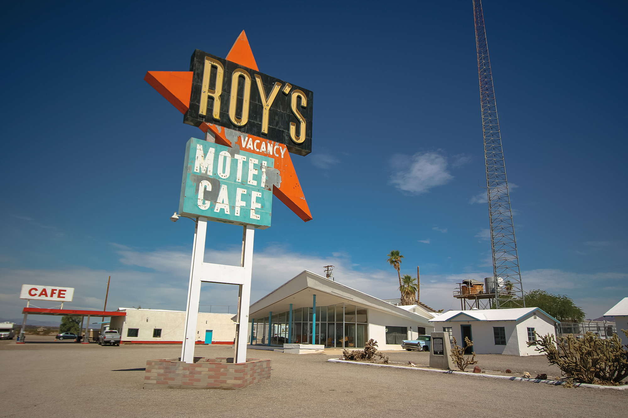
Due to the past winter’s severe storms, the current ground conditions were not suitable on the planned route. We rerouted and angled our way to Siberia (yes, Siberia) and then out onto Route 66 where we got our kicks and headed for Amboy and the famous Roy’s Motel and Café site. Along our way, we passed Amboy Crater (a great hike in cool weather months) and came across a land speed world record attempt with a human-powered vehicle. There were five cyclists in a low-slung, highly polished, cigar-shaped tube, er, vehicle. We stopped and chatted and watched them take their shot, but they came up a bit short as they had a mechanical issue and had to abandon the attempt, achieving only 70 mph.
From Amboy, our plan was to head up a trail back into the mountains to connect with the EMHT—what’s that saying about best-laid plans? The Heritage Trail struck with fury as we entered a pure rock garden with no discernable trail. Low range in earnest, we continued on, progressing only six miles before deciding that it was getting worse, and we needed to turn around. For two hours we had been in low range first gear crawling over softball- and soccerball- sized rocks, dropping into washes trying to work our way to any form of a smoother path. Countless foot recces that held some hope of an easier way turned out to be stymied a short distance later. But now we had to drive the same route back out.
Back at Roy’s, we filled up on $6/gallon petrol because the four hours in low range chewed up more than we had planned for. It was decided to continue on Route 66 to Kelbaker Road, then up to the other side of I-40. Having enjoyed the respite the pavement brought, we skirted the wilderness area, venturing into the Granite Hills area to the spectacular Kelso Dunes. There we found more desert tortoise and rejoined the original Heritage Trail.
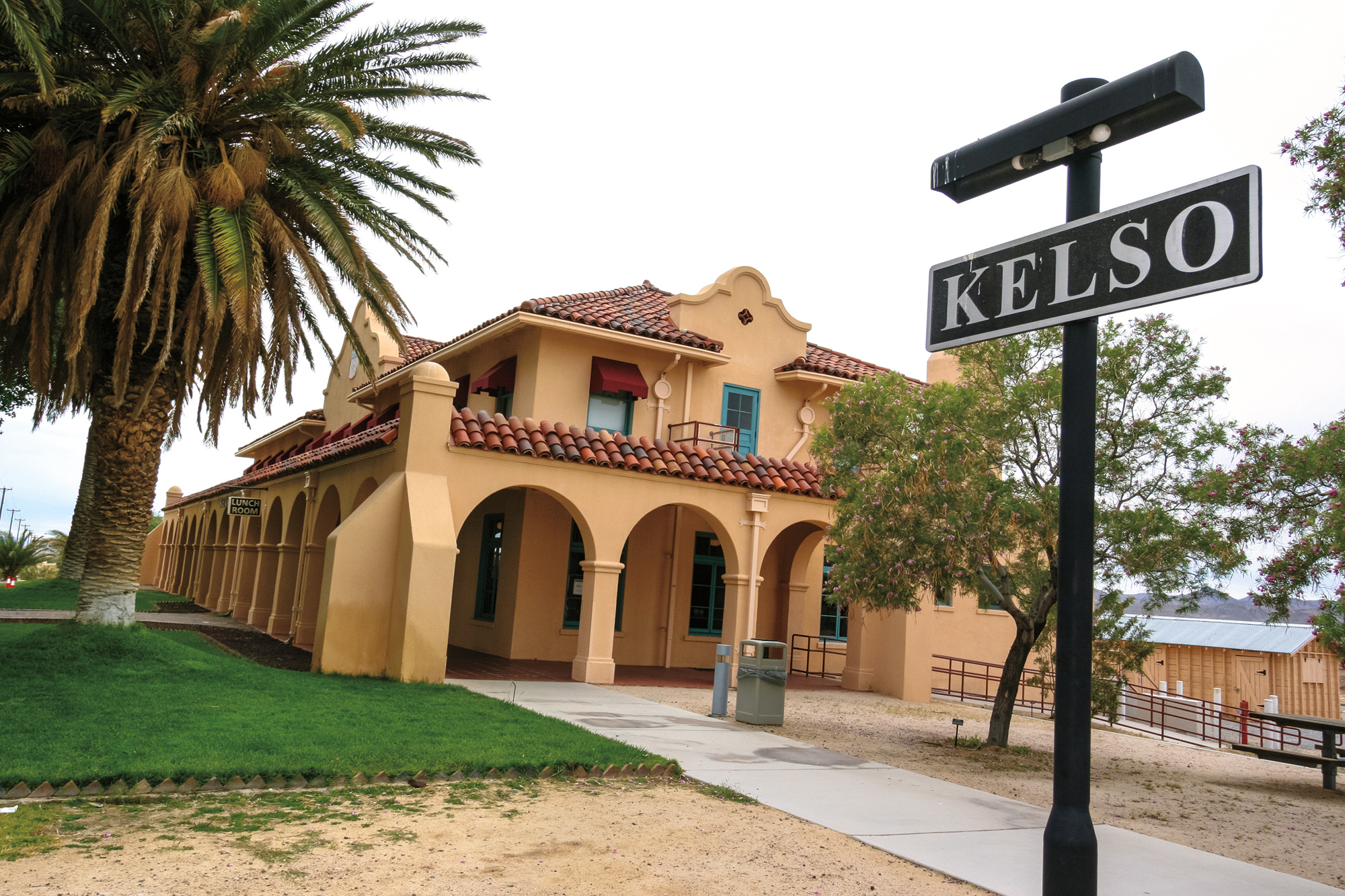
From Kelso Dunes, we visited the Kelso Depot, an oasis with deep green grass and tall palm trees. The Kelso Depot was the main Union Pacific Railroad depot in the area, but it was abandoned. Local citizens successfully lobbied for its refurbishment and use as the National Park Service headquarters and Visitor Center for the Mojave National Preserve. Leaving Kelso Depot, Vulcan Mine Road has a steep low range climb over Foshay Pass and then turns up to the Hole in the Wall campground. At Hole in the Wall, plan time to do the Rings Trail loop hike as it is spectacular. The campground is at high elevation; temps this night plunged to close to freezing. A raging windstorm brewed and manifested, attempting to send me to the Land of Oz in my rooftop tent. Meanwhile, Tony was snugly sleeping inside of my truck. Not wanting him to miss out on all the fun, I convinced him to help me remove the rainfly on my tent that was now acting like a parachute. Then the rain started. I just chuckled—you can’t make this stuff up. A steady stream of tent campers could be seen packing it in and exiting the campground posthaste.

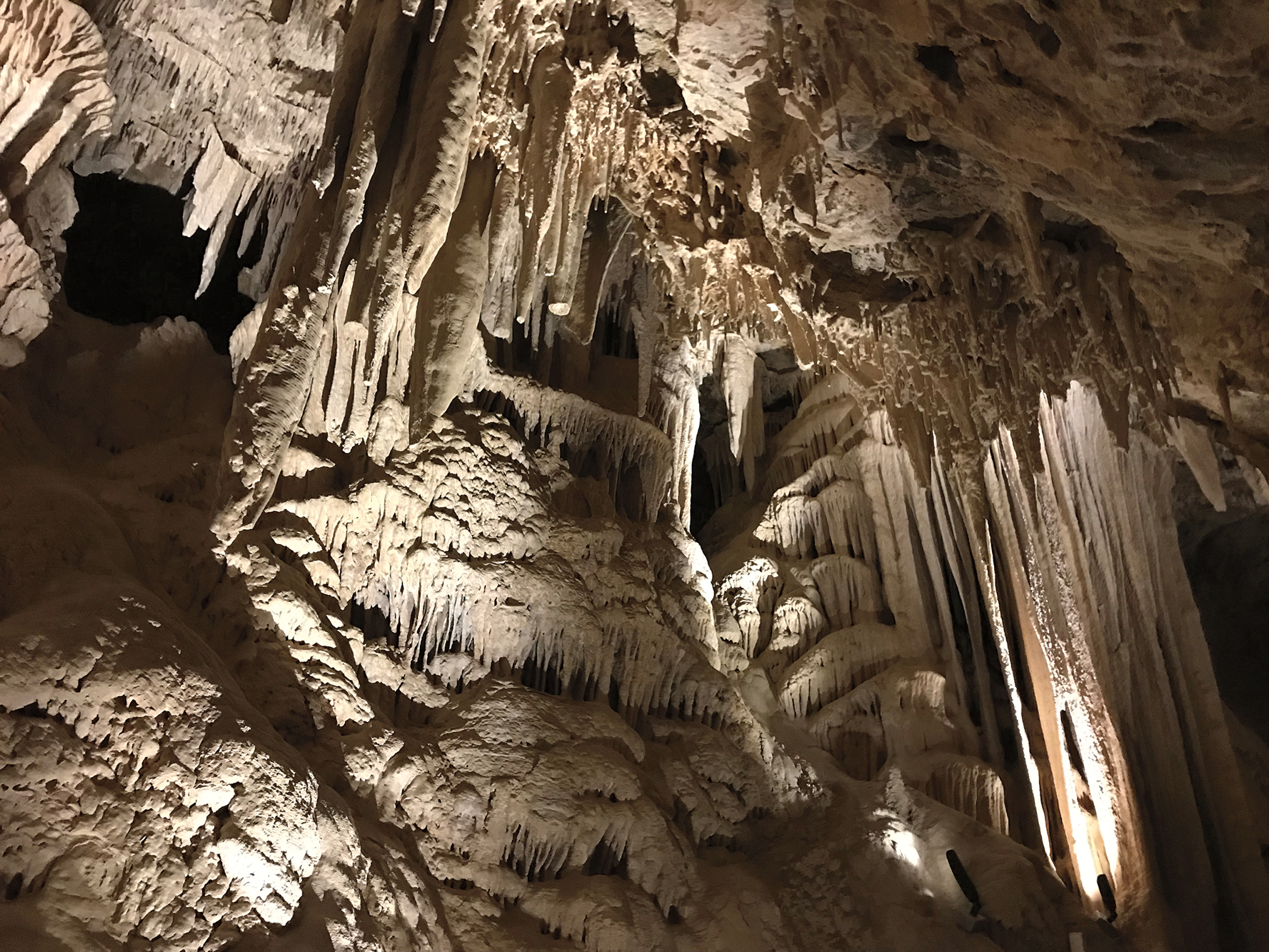
The wind subsided as dawn broke on day five and we were up early—not hard when you haven’t been to sleep. I dragged my bleary-eyed self out of the tent to eat breakfast. We broke camp quickly, as we had a morning meeting with the California State Park Rangers at Mitchell Caverns. With their stalactites and stalagmites, the caverns are impressive—made even more dramatic with effect lighting and the history lesson imparted from the rangers. The caverns recently reopened after having been closed to the public for more than six years, and are the only limestone ones in the California Park System. They are also home to two unique species: the tawny-hued Niptus beetle and a species of pseudoscorpions. We got to see a gopher snake attempt to eat a rock squirrel, but the squirrel had other plans and left that snake bloody and battered. Perhaps a hopeful sign for the rest of our match with the EMHT.


We left the Providence Mountains behind and headed across flat desert to our last refueling point and the Heritage Trail 3 endpoint in Fenner. A check of the truck revealed that not only was the one remaining rear shock mount cracking again, but we had snapped the rear sway bar in two. Our only protection against losing a coil spring was now combat ineffective. Realizing we were only about 35 miles from Jay’s house, I called him and arranged to meet at his shop where we could utilize his MIG welder, then get back on the trail. After boxing and reinforcing not only the existing mount but doing the same for the one that had broken, we now had four fully functioning shocks welded stronger than ever. I decided I didn’t need the sway bar since I hadn’t noticed my truck driving any differently after it had snapped. We had delivered a very effective counterblow to the Heritage Trail and had her reeling for once, returning to the starting point of Segment 4 with a solid vehicle underneath us.
Our final day with 130 miles to go kicked off with rejuvenated spirits and renewed confidence. For hours we drove on smooth, hard-packed sand two-track, enjoying the scenery and sights of the Old Woman Mountains. This area has a pretty huge reroute due to the wilderness area, and I knew the mailbox had been removed. Imagine our surprise when we came upon Heritage Trail Mailbox 4. Someone had erected a replacement mailbox outside of the wilderness area. Complete joy swept over us—we were four for four and cheering loudly like high schoolers being told their final exams have been canceled. It felt as if our fortunes had turned. Little did we know that the Heritage Trail was only biding her time.
As the planned route once again diverged from the main trail, we began entering another rock garden. In my quest to rejoin the EMHT as soon as it exited wilderness area, I had put us on what the satellite images indicated was a clear path. It was now a ravaged mess of bowling ball-sized (and larger) rocks strewn everywhere. The Heritage Trail struck again. With low range engaged and crawling with foot recces every 10 minutes or so for the hundredand- some-odd time, we slowly found our way, constantly yearning for a smooth patch of dirt or pavement. Finally, we made our way to US Route 95 and the short jog south to rejoin the EMHT. Note: Any attempt at this section should reroute using Turtle Mountain Road to Route 95 south, then east on the Heritage Trail.
Once across the highway, the rocks diminished, but now there were sudden washouts and massive holes. We made our way to our final stopping point to check the condition of the petroglyphs at West Well and observed a herd of wild burros. As we crested a steep, short hill, I looked over my hood and could see the ground angle out in front on the left. All was fine, until bang! We dropped into a hole on the right side of my truck; the momentum had both the front and rear taking the full brunt of the massive hits. We stopped to investigate the carnage: the rear right shock mount was torn completely from the frame (Jay’s welds held), the right front shock was blown, and the front stabilizer bracket cracked in half. Assessing the damage, we figured we were no worse off than we were before. With that, I told Tony my truck wouldn’t fail, and he replied, “Neither will we.” I set my jaw, tucked my chin, and mounted up—pressing on for the last 70 miles.
Normally, powerline roads or pavement are to be avoided at all costs in my book. But now we were yearning for any form of smooth stretch, seeking a break from the pounding of rocks, washboard, and humps to a vehicle with only two usable shocks, both on the same side. We finally hit a 14.5-mile stretch of smooth powerline road that helped us regain some pace and sanity. Excitement came back in full force as we found two more desert tortoise along the trail. Then it was back to a crawl in rugged terrain. We were waiting for the next strike, but it never came. As we reentered Eagle Pass and joined our outbound route, retracing our steps back to the starting point in Needles, we began to realize we had done it. We had completed the East Mojave Heritage Trail in just six days, and we did it on our own.
As we rounded the corner onto Broadway and pulled up to the painted Route 66 logo on the street that marked both our starting and finishing points, I looked at my odometer. It read 861.4 miles—deduct exactly 100 miles for the round trip to Jay’s for repairs and our route had covered 761.4 miles—a 15-percent increase from Dennis Casebier’s original route. I thought I would be completely elated at the finish, but it was just the opposite— sadness washed over me. The research, project goals, and build-up were all over. There was nothing left to do but air up the tires and drive the four hours home.
Sophocles once wrote, “One must wait until the evening to see how splendid the day has been.” As the sun set, I reflected on all that had happened; it was a most splendid day. Would I do it again? Tough to say right now as I’m still patching up my vehicle, but the short answer is yes, absolutely.
