

If I could travel through time, I’d go back 160 years to Indian Territory in days antebellum. There, concrete and steel would dissolve into wagon ruts and stone, hewn logs and flowing springs, a landscape familiar in its essence but alien in its rawness. Though I lack a time machine in the H.G. Wells sense, I’ve found a surrogate: a road as old as the territory itself and a vintage Toyota FJ40 for traveling it. My path lies within the eastern reaches of the 2,800-mile route of Butterfield’s Overland Mail service, which began near St. Louis, Missouri, and traveled southwest through Arkansas, Indian Territory, and Texas, skirting the Mexico border before turning north for San Francisco. Operating from 1858 until the outbreak of the Civil War in 1861, it was the United States’ first successful attempt to deliver the mail from east coast to west over land, rather than via a months-long sea voyage. Completion of the transcontinental railroad was still a decade in the future. In present-day Oklahoma, many sections of the trail still exist in some form: a swale running through a pasture or a cutdown creek bank. Little of the original segment remains accessible for driving, though many modern roads are built along or upon the route. Access is complicated by fences and locked gates, sequestering trail fragments on private property. Nevertheless, remnants exist, and I am determined to find them.
In September 1857, Congress gave veteran stage man John Butterfield a year to put the mail service into operation. It was an impressive feat; Butterfield arranged coaches, wagons, drivers, and teams, and established 141 relay stations along the route in only 12 months’ time. He used existing byways where possible and built others as needed. The 192 miles crossing Indian Territory first followed the Fort Smith– Boggy Depot Road, a path through the Sans Bois and Winding Stair mountains. Its roadbed was probably used by natives long before the Native American removals to the territory in the 1830s, when it became an important east-west thoroughfare. Near present-day Atoka, Oklahoma, the Butterfield trail converged with the Texas Road, a major north–south highway until the coming of the railroad in 1872.
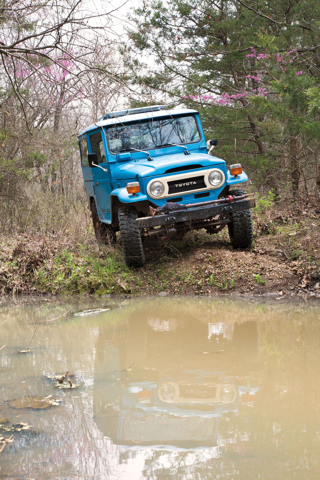
It’s a cold day in April 2018 when my husband, Bill, and I head east in the FJ40 from our central Oklahoma home to Fort Smith, Arkansas, to pick up the trail. The Toyota is relatively sound, but primitive and cantankerous enough to connect us, at least in our imaginations, with the essence of stagecoach travel. It is happy at 45 or 50 mph and strains at 60, so we stay off the interstate for the 200-mile drive to the trailhead.
The Cruiser’s cabin, lacking a headliner or decent gaskets, leaks spray from the steady rain. I cover up with a blanket as the heater struggles. We chuckle at our efforts to stay warm but consider ourselves lucky— stage passengers had no heater at all. Eventually, Bill stops on the roadside and collects a slab of wet cardboard, stuffing it in the grille in front of the radiator to inhibit airflow and allow the engine, and the cabin heater, to warm up. Sure enough, it works. But the engine fails to start at our first gas stop in Wetumka; Bill diagnoses a loose wire, reattaches it to the starter, and we continue, feeling every bit the able travelers.

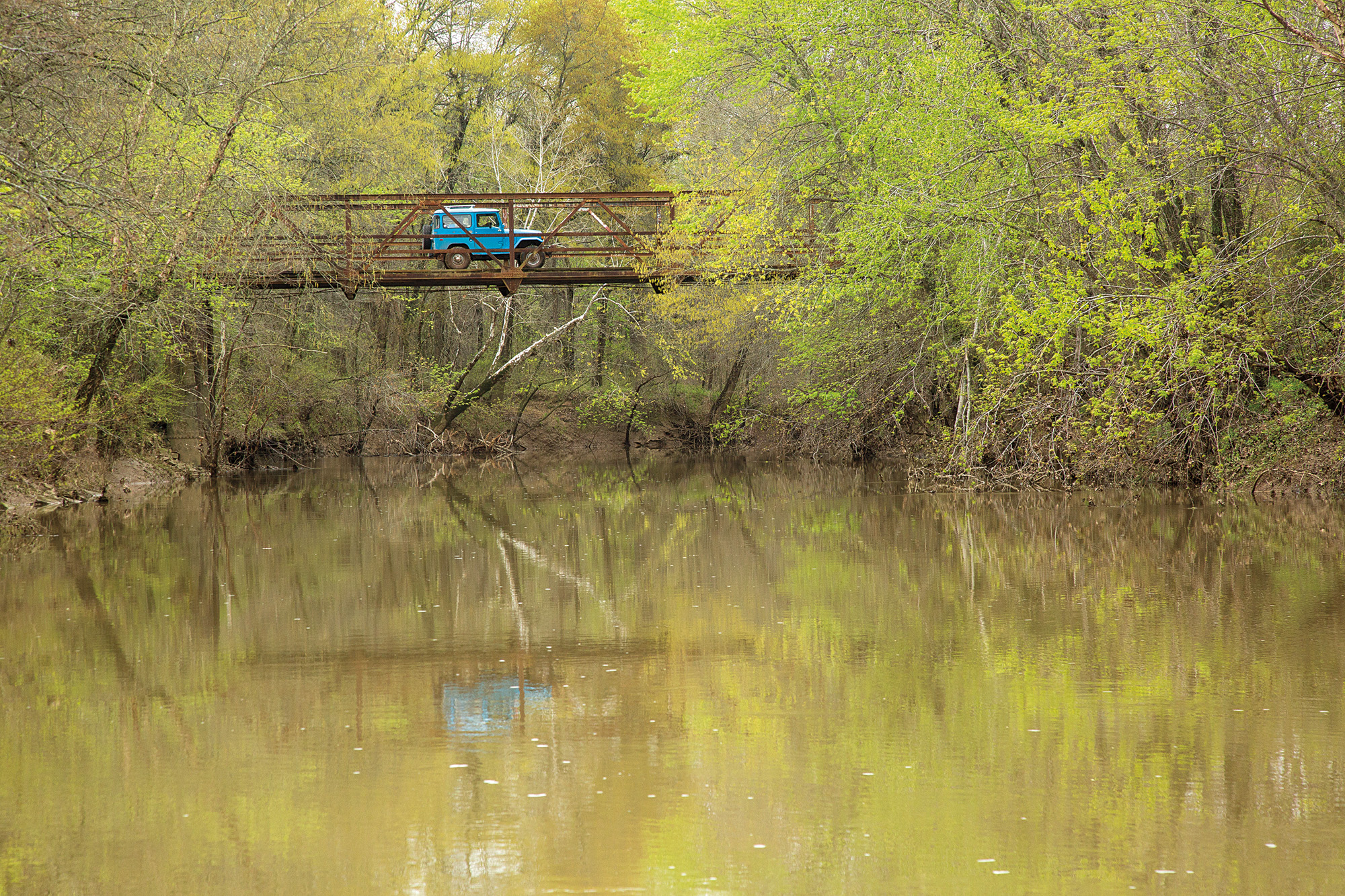
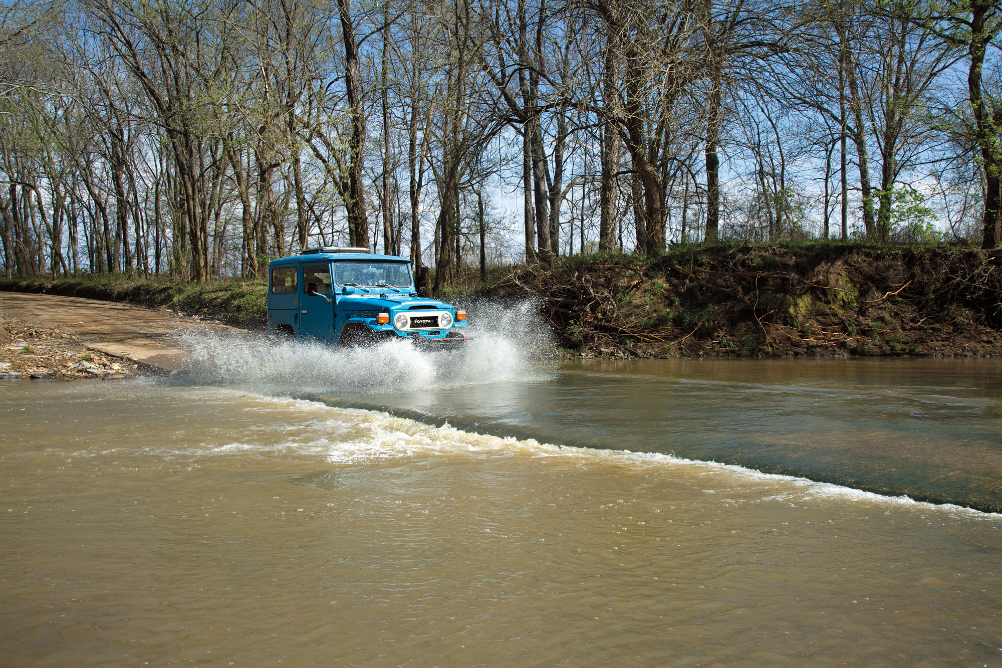
At Fort Smith, we turn back into southeastern Oklahoma, a sparsely populated, mountainous country of pine forests and clear flowing streams. The Butterfield stage—actually a celerity wagon, not a coach—had to ford the Poteau River, but conveniently, we have the use of a bridge. The celerity wagon, named for its swiftness of movement, was a smaller, lighter alternative to the taller, more bulbous Concord coach which pervades the popular imagination. The wagons were designed for the rugged country west of Arkansas and used on 70 percent of the route.
If such a thing can be said, these were halcyon days for Indian Territory, a semi-autonomous enclave established in the early 1830s for Native American peoples displaced from their eastern homelands. It was also a place of mystery to outsiders, “protected” from intrusion by the US Army. This leg of the Butterfield fell within the domain of the Choctaws and Chickasaws who, after removal, had carved prosperous lives from the wilderness. They had established thriving communities and a system of government, with churches and schools, ranches and farms. Some operated large cotton plantations. All of this would be decimated during the Civil War.

The Overland Mail Company contracted with Choctaw and Chickasaw citizens living along the road to maintain a dozen stage stations about 16 miles apart, where horses and mules could be traded for fresh teams. The first Butterfield station in Indian Territory was at Skullyville, the home of Choctaw Governor Tandy Walker who, according to Waterman Ormsby, “dressed like a well-to-do farmer.” A correspondent for the New York Herald and a passenger on the first westbound Butterfield stage, Ormsby reflected the prevailing attitude when he wrote the Native Americans along the road looked “squalid and miserable generally, though occasionally we met some very fine specimens of the red men of the forest.”
Bill and I bump over potholed pavement to Walker’s Station along a quiet country road northeast of Spiro. In 1958, the Oklahoma Historical Society placed markers at each of the Butterfield stations in the state to commemorate the trail’s centennial. We find the granite marker and bronze plaque for Walker’s Station at the roadside in a trace of the trail. A deep depression in the earth leads southwest from the marker, one of the few Butterfield swales so easily visualized in present-day Oklahoma. Walker and other Choctaw leaders are buried a few hundred yards away in the historic Skullyville cemetery, a silent place shaded by stately oaks.


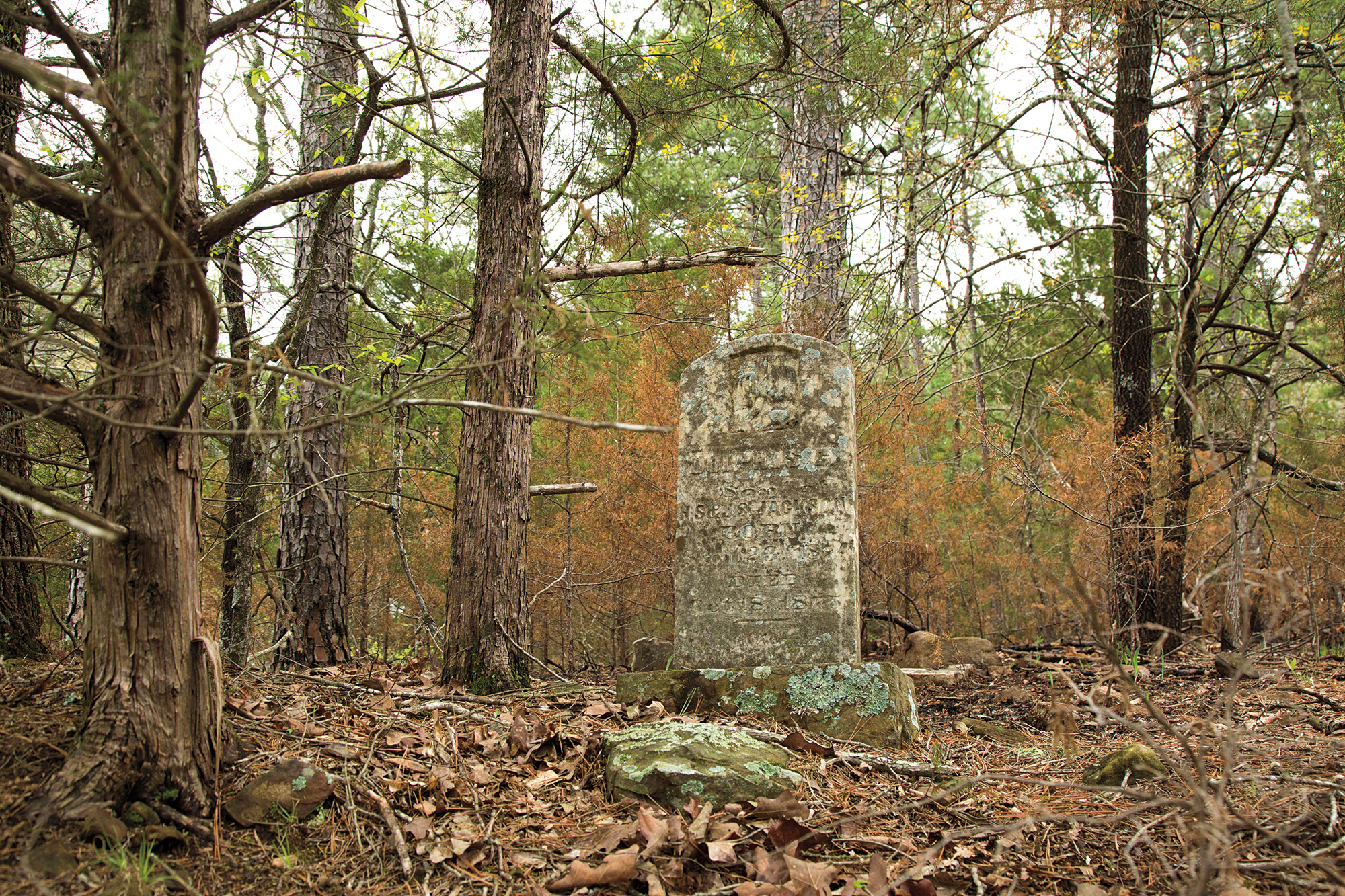
Leaving the pavement, we set off on muddy back roads, climbing over Buck Creek Mountain and crossing Brazil Creek on a rusty steel truss bridge. We meet Karen Looper at Brazil Station, a stop between official Butterfield stations. Looper’s Toyota Tacoma is studded with auxiliary lighting for encounters with poachers, and we’re quickly convinced she’s not someone to mess with. This land has been in her family for generations, and she typifies the ornery self-sufficiency of folks around here, though she is kind enough to us and generous with her time and family yarns. Looper leads us to a trail crossing of Brazil Creek which a later check of the map reveals to have been some distance from the actual Butterfield crossing. But mossy gravestones in a wrought-iron-fenced cemetery dating to Overland Mail days make the stop worthwhile, as if meeting Looper weren’t enough.
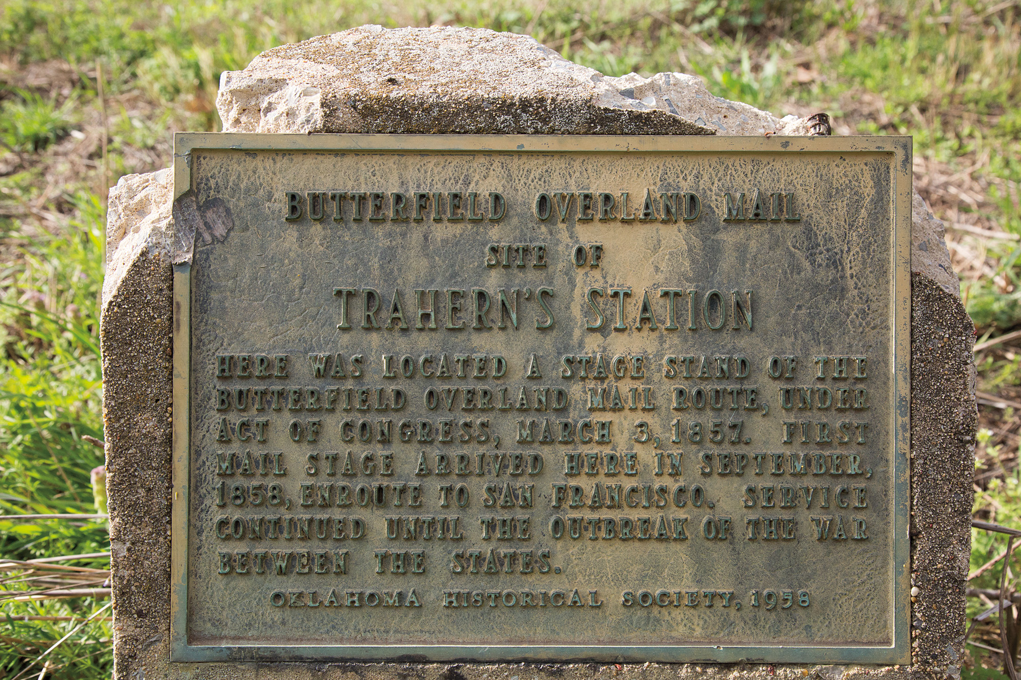
A few miles farther we stop at Trahern’s Station, once also the site of the Council House of the Mushulatubbee District of the Choctaw Nation. Council House Spring still flows, surrounded by a crumbling stone wall near the banks of Brazil Creek. As we walk to the spring, keeping watch for snakes, we spot a trace of the wagon road entering the property from the northeast.

Night is falling, and our headlights are dim, but we’re better off than a stage driver, who had to rely on moonlight and his knowledge of the road. Since Butterfield’s contract stipulated delivery of the mail within 25 days, coaches traveled around the clock and often beat the deadline. Passengers slept as best they could. The wagon served as a sleeper of sorts, with its seats converting into a bed. Its body was supported by leather straps, allowing it to swing and flex as the stiff, hardwheeled chassis rattled along. Ormsby reports not sleeping for the first three nights of the journey, saying it took time to “get accustomed to the jolting over the rough road, the rocks, and log bridges.”
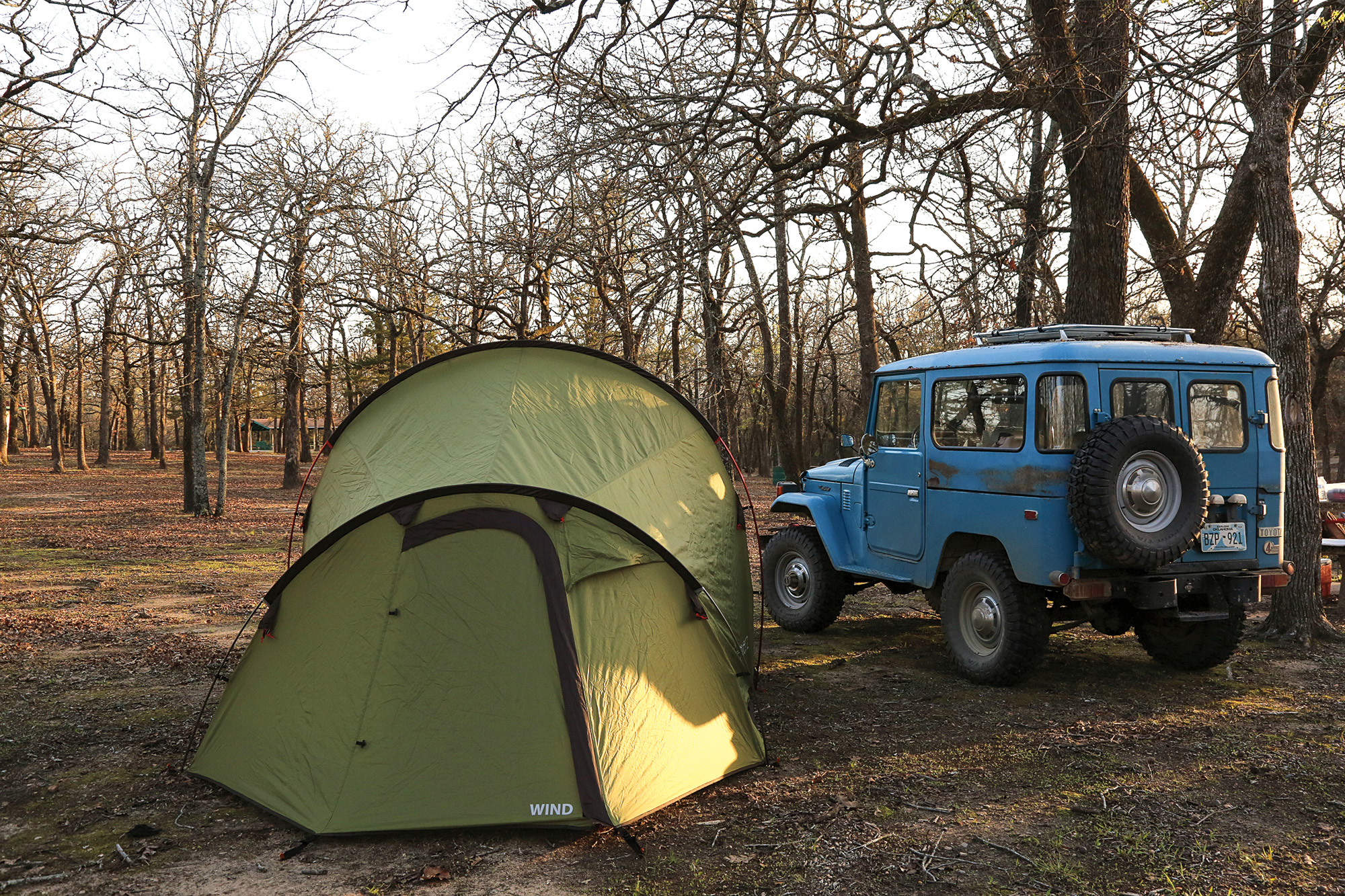
In contrast, our primitive-by-modern-standards leaf spring and shock suspension seem like cheating as we roll down county roads. And we enjoy a comfortable guest room at The Ranch at Latham, an event center at Trahern’s owned by Kelly and Jonathan Watson, whose family has held the property for generations. A replica Concord coach is the centerpiece of their popular cowboy-themed weddings.
Next morning, we hit the trail again. From Trahern’s and across the Dog Creek Ranch to Red Oak, the dirt and gravel roads wind through mountain ridges, closely following the old trace. If I squint to blur the fences and power lines, little of human existence is apparent. We’re in no hurry but still far exceed the speed of a stage wagon, which averaged 3 to 5 mph.
About 13 miles out of Trahern’s, we pull off the road and up the hill to an old log cabin in the dog-trot style—two rooms connected by a breezeway. This is Edwards’ Store, the only physical structure in Oklahoma surviving intact from Butterfield days. The two stone chimneys are still solid, and the craftsman-fit, hewn logs stout. Built before 1858 and occupied as late as 1974, it is now abandoned, the detritus of household cast-offs littering the porch. A graveyard on the hillside gives way to a view of the Sans Bois (French for “without trees”) mountains to the north, which are dark green with pines, belying their name.
At Edwards’, passengers could buy a good meal, a luxury on the frontier when the twice-daily fare provided by the stage line for an additional charge consisted of bread, tea, and fried steaks of bacon, venison, antelope, or mule flesh—“the latter tough enough,” according to William Tallack, an 1860 passenger.
We continue along the stage route to Holloway’s Station and then to Riddle’s Station, just east of Wilburton. West of town, the trail ascends to Mountain Station, not an official Butterfield stop but a community which probably owed its existence to the Butterfield and now is only a cemetery. We rarely see another vehicle as we pass through the open country on the winding road. Nearing Mountain Station, a trace of the Overland Mail trail is easily visible just feet from the county road, luring us off the pavement to discover how much of it is passable.
We drive several hundred yards along the trace before reaching a swollen creek. With its large wheels, a celerity wagon could probably ford the stream, but we’re not prepared to, though we have a Hi-Lift jack to use as a come-along if necessary. We return to the road, happening quickly upon a sign advertising the Mountain Station Spring as a stop along the Butterfield. Just beyond the iron-stained streambed is a rocky extension of the trail we just drove, confirming my belief that it is an original section of the route. I’m sure treasure hunters have already scoured the place for artifacts, but still, I wish I had a metal detector and permission to prospect.

Descending from Mountain Station, the county road and wagon trail diverge, and we detour via highway to an obscure section-line road where we cross a low-water bridge to Pusley’s Station. Here the only sign of the historical marker is its broken base, but the remnant sits directly in a trace of the trail. A gate prohibits our driving on it, but I hike it to the abandoned Pusley family graveyard, many of its headstones broken by deadfalls.
Soon our progress is frustrated by a locked ranch gate, and we detour, picking up the trail in Ti Valley and crossing a bridge over the Indian Nation Turnpike. The speeding cars below disturb our reverie to a surprising degree, as immersed as we’ve been at our dawdling pace in this remote country. Just beyond the turnpike, we find the Blackburn’s Station marker, bronze plaque missing. We splash across Brushy Creek at a low-water crossing and continue on a tree-canopied tunnel of dirt road, following the trail past Waddell’s Station and into the Atoka Wildlife Management Area. The sharp flint gravel here is notorious for puncturing tires, but the BFGoodrich KM2s on our FJ40 crunch through the slivers without a whimper.
The next station is Geary’s, which was situated at a crossing of North Boggy Creek. The site was inundated when the Atoka Reservoir was built in 1959, but a trace of the old road is accessible on foot off Lakeshore Road, and a station marker is embedded in the dam.
A few miles south, we stop at the Atoka Museum and Civil War Cemetery, which claims a stretch of wagon road as a trace of the Butterfield line. Some disagree, saying the pre-Civil War trail would have run more westerly from Geary’s. Wherever it was exactly, none of the Overland Mail trace is accessible between Atoka and the next station, Boggy Depot, now a recreational area operated by the Chickasaws. It’s a peaceful place to camp and a perfect spot to open the bottle of Butterfield Station chardonnay we brought to enjoy by the campfire. The wine is from California, at the far end of the Butterfield line, but apropos nonetheless.


From Boggy Depot the road turns nearly due south toward the Red River, but first, it crosses the Blue at Nail’s Station. We are unable to reach the station marker on the east bank of the river, but I’ve contacted a property owner on the west bank, and he has agreed to show us around. We meet Jack Risner at his place, also the site of Fort McCulloch, the main Confederate fortification in southern Indian Territory during the Civil War.
“You’ll feel the road,” Risner assures us as he sends us through a barbed-wire fence on foot into the river bottom. I chuckle, considering we’ve been feeling quite a bit of road the past 150 miles. The trace is barely discernible, and we track it only briefly before it disappears. Soon we’re bushwhacking through dense undergrowth. The mud is soft and deep where we turn north along the riverbank toward the trail crossing. Bill takes a long step across a gap, trying to avoid the mud altogether, but slips off, burying his foot up to the ankle in brown muck. His boot is sucked off when he retrieves his foot, and he looks at me like it’s my fault. Eventually, still not feeling much road, we find a cut in the bank, steep for a wagon crossing but 160 years of erosion would have changed the spot considerably, so who knows?
As we return to the Risner place, an opening in the trees starts to feel very much like a road, and we realize we’re probably back on the Butterfield trace. Risner said large flat stones stood up on edge are an indicator and we see these along the clear, level path. When we return to his house, our host shows us a table full of artifacts he’s collected in the area. “What do you think this is?” he asks, pointing to a circular piece of metal stamped with the words, “Merry Widow Perfectos.” I guess cigars. Wrong—reusable condoms. Ugh. That and Risner’s pot-bellied pig, Ophelia, make for an entertaining visit.
Between Nail’s and the Red River, the land flattens out and little of the road is visible or accessible, long ago obscured by the cultivation of crops. Fisher’s is the next stage station, and south of there the FJ40 starts losing power. We pull off at a construction site and once again Bill goes to work. This time he repurposes a return fuel filter for the main filter, and within minutes we’re rolling.

We pause at the final marker for Colbert’s Station, then drive down the red dirt road toward the ferry landing at the river, where the wagons crossed into Texas. Pilings from a 1908 bridge still stand in the Red River, but our trail is blocked by a locked gate marked: “Private Property/No Trespassing.” At this point, we don’t want any of these rugged individuals taking potshots at us, so we call it a day, perhaps less than a hundred yards from the Red River.
We’ve taken three leisurely days to drive what the stage wagon traveled in a little more than 30 hours, “whizzing and whirling over the jagged rock…bouncing—now on the hard seat, now against the roof, and now against the side of the wagon,” wrote Ormsby. My thirst for reliving the era of stage travel has been quenched for the moment, and the quirks and crankiness of the Land Cruiser have given the trip enough of an edge.
Just 30 miles from home, the old Cruiser offers one more protest, spitting and backfiring, then running clean for a bit. We nurse it into a gas station. The gauge shows a quarter tank, but suspecting a dying fuel pump, Bill fills it up, thinking gravity may provide enough pressure to help keep the engine running. With a fresh tank of gas, we make it to our driveway just as a leaking clutch master cylinder sucks in a gulp of air, rendering the clutch null and void.
Impeccable timing and a fitting end to an overlanding journey well described by Ormsby 160 years ago: “…the new scenes which constantly meet the view, the variegated aspect of the country, the curious characters to be met, and the novelty of roughing it overland, are, I think, quite a recompense for any slight inconvenience which may be experienced.” Some things never change.
