

It takes a life-changing experience to change the way we live our lives. This is exactly what happened to our family in 2010 when our youngest daughter, Sephine, at age 4, was diagnosed with a rare form of cancer. This circumstance quickly became uncharted territory with countless rough roads. Cancer is a perfect combination of halting your life and accelerating it at the same time. Torn in both directions, a family has the opportunity to hold on tight for the ride or shatter into a million pieces.

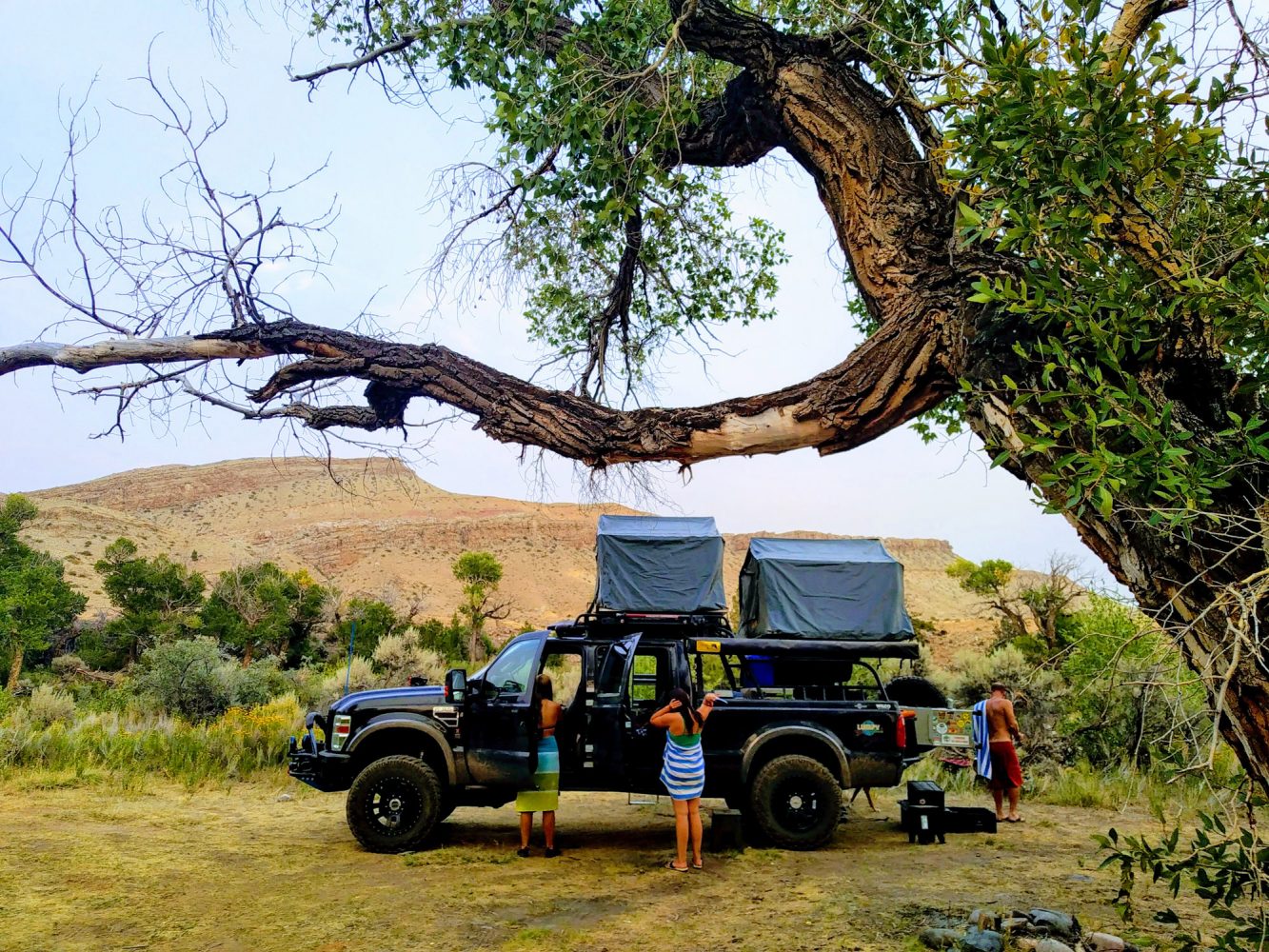
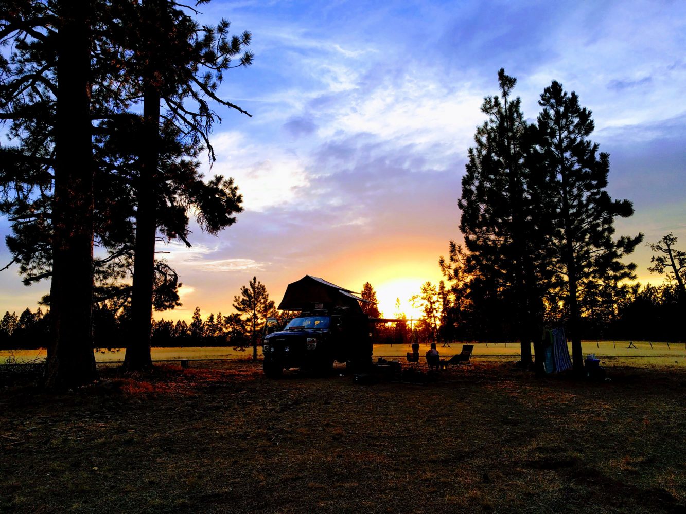
We chose the ride, and his name is Lumpy. The 2008 Ford F350, complete with two EeziAwn tents and 240º Manta awning, ComeUp winch in the front, SuperWinch in the back, Wilco tire gate, ARB fridge, and much more. Lumpy has been the designated tangible memento for our family adventure travels since 2011. We have managed to enjoy this world we live in with four large tires, two spares, five humans, and one dog.
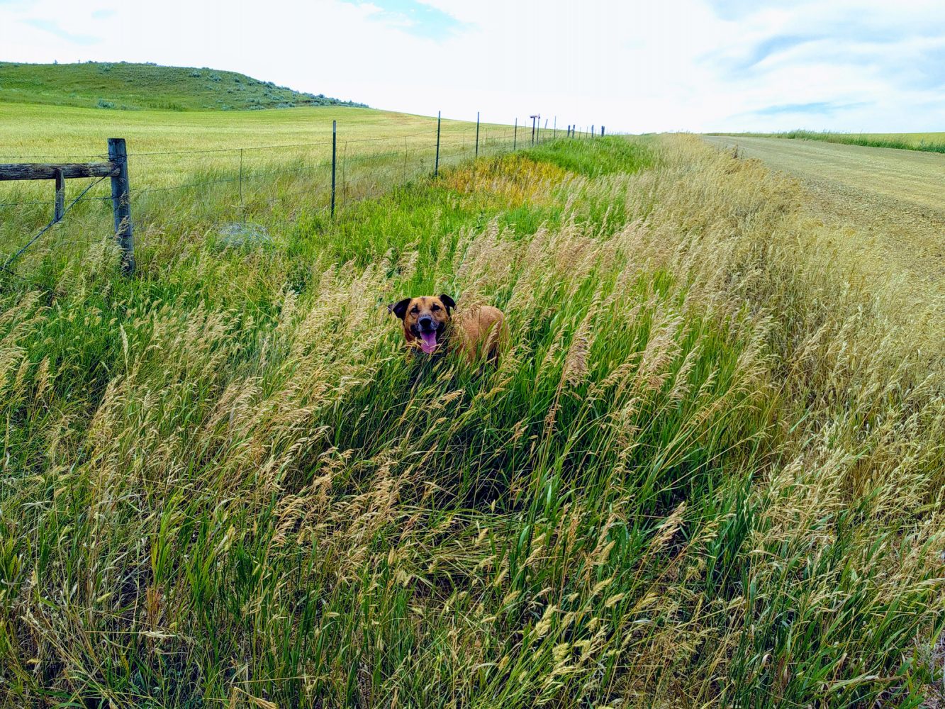
Lumpy Land Roaming, for us, is all about the experience. Our family of five, Doug, me (Louisa), Kora, Jilly, Sephine, and our dog, Trip, enjoy the unknowns that each road or day brings. We relish in the constant unexpected twists and turns and absolutely treasure the new friends we make along the way. We find reassurance in the unexpected, knowing we can map out our plans and ideas all we want, but really we have no idea where it will take us. The truth is, much like life, it is a perfect balance of letting go and hanging on as we adventure through places we have never been before, and most likely, will never be again. In reality, overlanding is a lot like having children. We go through these once in a lifetime places and experiences, and if we do it again, it’s never the same. Most likely, we are never to return to the same place, at the same time, in our life.
While successfully embracing the beautiful region of Baja, Mexico, in January of this year, we hoped that the summer would bring us our much-anticipated journey to Alaska, which would take us away for at least 2 months. We teeter-tottered the subject matter carefully, realizing that our girls, now ages 14, 15, and 16, were really wanting to spend their time and their summer with friends, jobs, and time away from their parents.
We have been overlanding North America in the last nine years. In addition to Baja and Chihuahua, Mexico, we have completed the Trans-America Trail and twice the border run of Mexico and the states that divide it, especially Texas. We have traveled most of California and Southern Oregon, ALL of Utah, and surrounding states. Our travels have brought us north into Quebec, the Trans-Taiga Road, and the “Loneliest Road” across Alberta, Saskatchewan, Manitoba, and Ontario. We have driven the Trans-Labrador Highway, all through Newfoundland, Nova Scotia (eight times), New Brunswick, and Prince Edward Island. We live on the East Coast and have adventured through New England, and all the Eastern states down through Florida.
When our lives became officially pandemic stricken this year, Doug and I knew we wanted to carpe diem the hell out of COVID-19, and the conversations about Alaska became more prevalent. But the desire to stay home “for once,” as the girls argued, also became more desirable. We pushed Alaska as much as we lovingly could, welcoming all opinions but all the while acknowledging the deep undercurrent that we WILL go on this adventure, and we WILL try and get to Alaska.
So we did. We left in mid-July, and nobody went kicking and screaming. In fact, the few weeks before we left, the minor revolt slowly dissolved as the truck came out of storage, the stackable storage boxes crept into the hallway, and the fridges in the house became more and more empty—usually a good sign that we are going somewhere for a while.
Crossing over the Cape Cod Canal is usually the first indication that we are bound for adventure, then once we hit a road we have never been on, we can welcome another clear and vibrant sign. Our travels took us to the Upper Peninsula of Michigan, sauntering through the region, followed by our first time in Wisconsin and Minnesota. When we hit the Dakotas, we made family history. This marked the final two states of the lower 48 our family had adventured/overlanded/traveled since 2011. Heading for the panhandle of Idaho, our hearts and minds thought longingly ahead to what might be awaiting us at the Canadian border. From the stories we had been told, we knew we had a slim chance of getting through to Alaska, but we relied on our feelings of optimism.
After a beautiful river stay in Idaho, we cautiously approached one of the few border crossings to Canada open during this time. I am sure I heard crickets as we arrived at the cold, stagnant border buildings that separate this country from another land entirely. The first border agent was kind, understanding, and talkative. We might have been the only activity he would see that day. He gave us hope as he advised us to drive through to the other side of the building, where we would have to speak with his superior.
Crushing our Alaska dream in one single stamp “Denied,” the second border agent wasn’t as kind. We drove back to Idaho with our hearts heavy. We were in silence for quite some time when one of our daughters snapped us back to reality, piping in, “Well, where to now?” We had taught her well. She was there, reminding us that we still were adventuring, exploring, and enjoying togetherness. So we decided to continue west. This time our west would be different; we would go Northwest.
As we entered Washington’s Cascade Mountains, while looking for a place to camp for the night, we came across a rather disheveled man trying to help his equally disheveled vehicle with a recent flat tire. Amidst the heavy breathing and curse words, he explained the dirt road we had found ourselves on was the only road that led to the highest point you can drive in the state of Washington. We quietly jumped up and down with excitement as we learned of this. After helping him with his tire, we ascended up the windy corridor of Hart’s Pass. Officially named Hart’s Pass Road 5400, this unpaved amazingness has steep side cliffs and spectacular views. It is located on the border of Okanogan and Whatcom counties of Washington. The road was built in 1893 for access to the gold and silver mines. It ends near Timberline, opening up to the heart of the Northern Cascades, at an elevation exceeding 6,000 feet. From Mazama, Washington, it is approximately a 35-mile single-track drive to the end of the road, where there is a gate to Slate Peak Lookout, which sits at 7,200 feet.
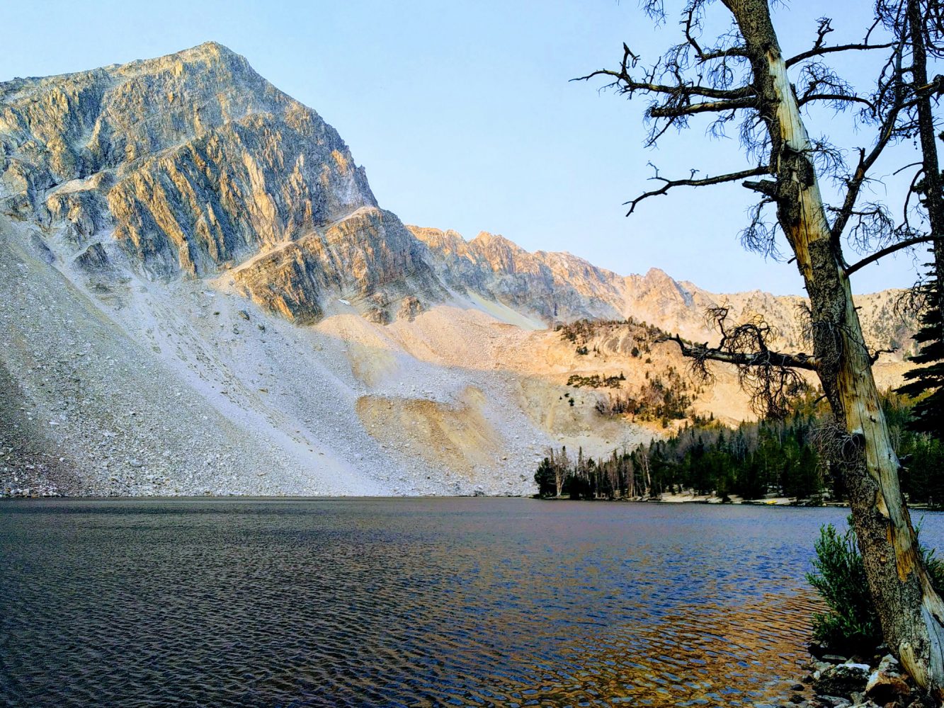
Camping at the top is possible, but we opted for the alpine meadow that sits about 1,000 feet below the top. As the wind howled through the fire-stricken trees, the evening brought a beautiful sunset atop this hidden treasure that can only come when adventuring this way. We felt grateful as we settled in for the night.
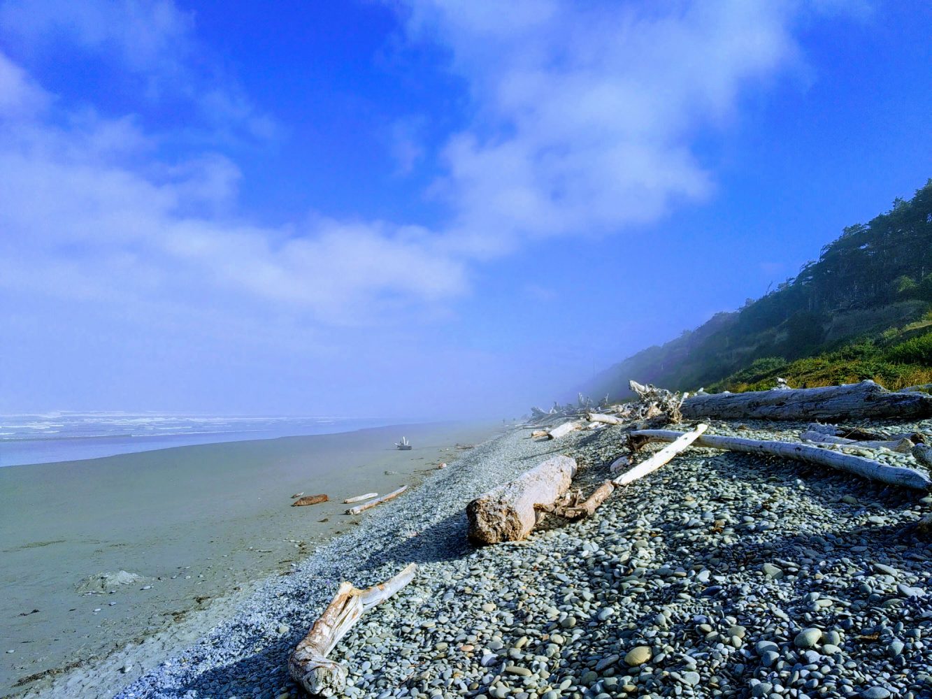
The Cascades had us anticipating the next mountain range in Washington, the Olympic Mountains. Never ceasing to amaze us, as these adventures always do, a few days later, this range also provided many extravagant roads as we continued to the left coast and then down toward Oregon. We enjoyed the very cold northern coast, continuing to journey inward to new regions of exploration.
Soon finding ourselves in the Wallowa-Whitman forest region of Oregon, we trudged ahead to Buckhorn Lookout, a destination recommended to us earlier on. From Enterprise, Oregon, it is a 42-mile quest to the lookout. Well worth the dirt road, the view of the Imnaha region and Hell’s Canyon makes it the icing on the cake. For a true overlanding experience, continue on Forest Road 46 to 4680 back into Washington about 30 miles down a very slender, slow-moving, beautiful forest ridge road with extraordinary scenic vistas. There, you will have landed at the base of the Snake River. It was two days long of driving but fully worth it.
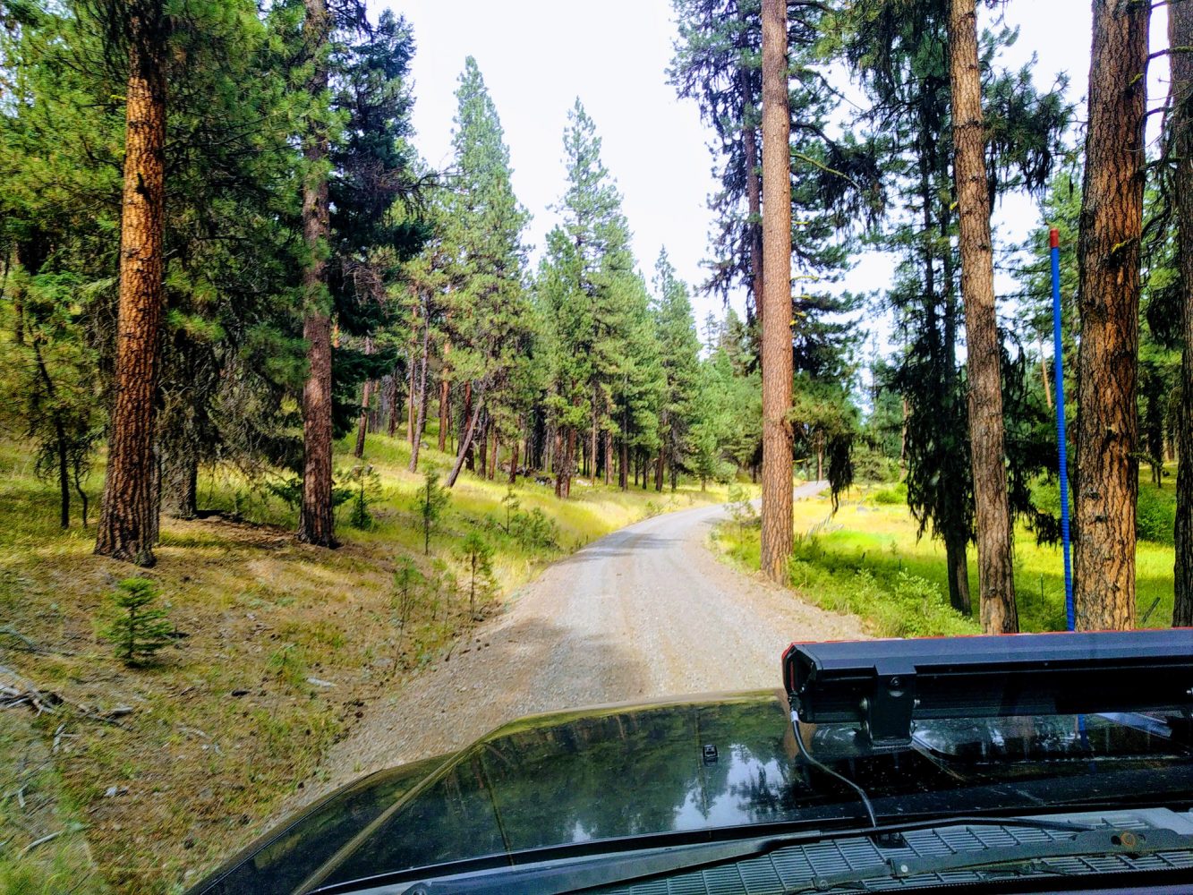
The Snake River is widely known for being the home to Hell’s Canyon, which is North America’s deepest river gorge at 7,993 feet. We didn’t leave this area unexplored before continuing eastward through Idaho. Again we stumbled upon a road that led through another gorgeous river valley. Unbeknownst to us, we found that instead of going back the way we came, there was another way over the Idaho mountain range that lay before us: The Nez Perce–Clearwater National Forests.
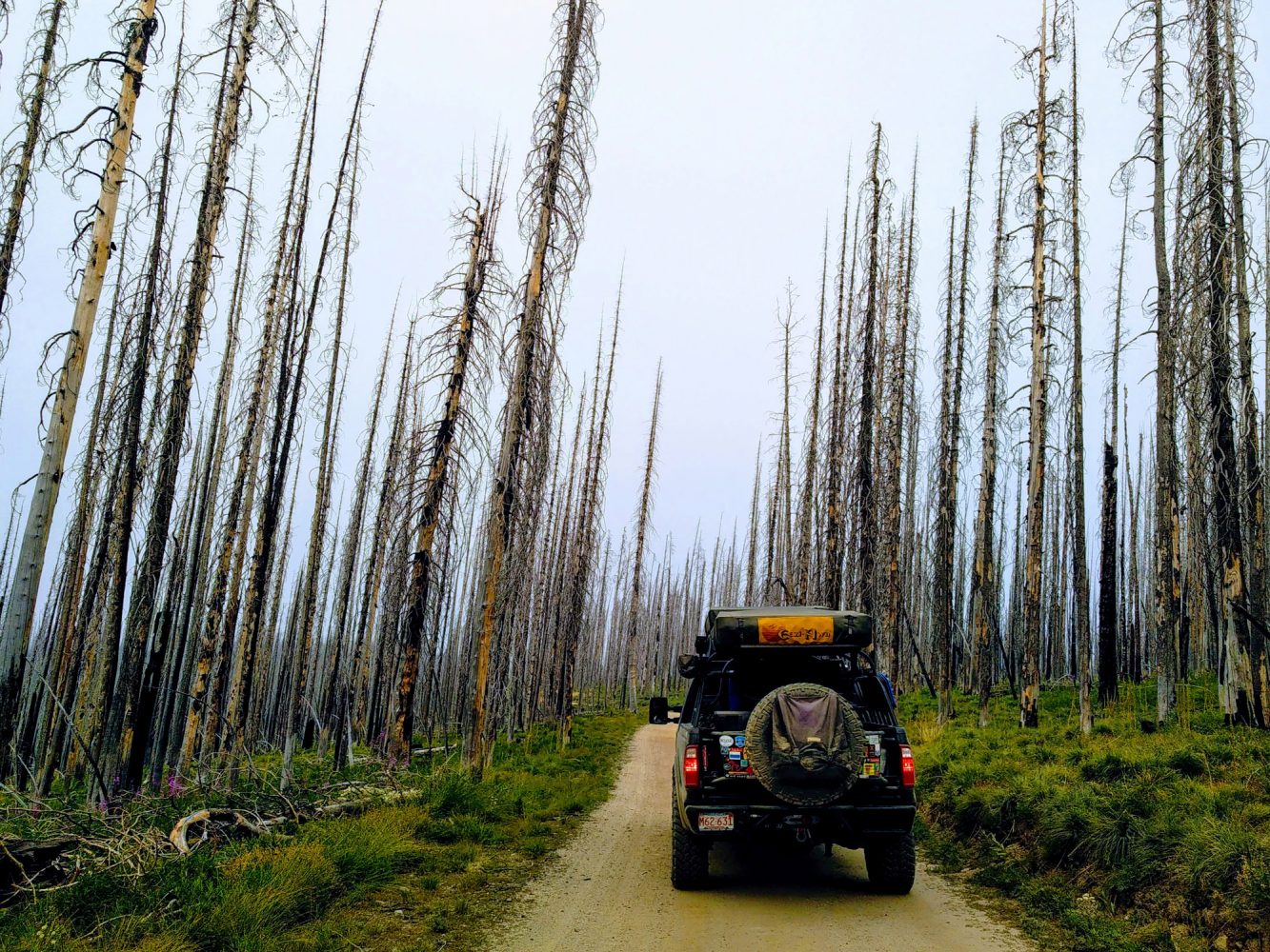
We were alerted to a fire in the area but were also told that the Magruder Corridor Road was still open. This 122-mile, single-lane, unimproved road should have provided beautiful mountain views; instead, we got thick wafts of smoke. However, the views of the nearby wildflowers as they countered the gray, stoic, leafless trees of the fire (seen once before) were breathtaking.
This road was built in the 1930s by the Civilian Conservation Corps, enabling the traveler to journey between the 1.2-million-acre Selway-Bitterroot Wilderness and the 2.3-million-acre Frank-Church River of No Return. Named for an Elk City merchant, Lloyd Magruder was murdered in 1863, along with four partners, almost at the halfway point of the road. A two-day drive, reaching elevations of 9,000 feet, this is worth every corner, edge, and minute as you descend into the beautiful state of Montana.
Montana brought us new regions and roads as we continued back east. Slowly but surely, we found ourselves back on our familiar road leading to the house we live in on Cape Cod. Surreal moments came and went during our six-week adventure, even if it wasn’t Alaska. Home isn’t really a place; it is where you are and who you are with. This feeling lies so deep within us after traveling this way for so many years. Our lives, while touched daily by unknown, rough, and new, remind us that it is this that makes it worthwhile. If everything were easy, it wouldn’t be an adventure. Thankfully, in addition, we also have come to recognize that the adventure will never be over because it is always right in front of us.
Rough roads don’t just lead to beautiful destinations; they are beautiful destinations. So often, the unknowns of life are what scares us the most. The reality is that these are what life is made of. When you travel down roads or trails that are on areas of the map that have the dotted lines marking dirt or gravel, those are the ones we should be pursuing. More often than not, those are the roads that lead you to places beyond your wildest imagination. They take you away from your thoughts and into your soul to remind you that beauty is everywhere we turn in this world. It takes a lot of slowing down to see it. These very bumpy, curvy, dirty roads provide a spectacular life.
It makes it much easier to set off in the general direction of your dreams when you don’t know exactly where you will get to or go through. Our family adventures, by way of overlanding, impart the opportunity to be very present. The mere knowledge that the windshield is bigger than the rearview mirror provides the sense that the present moment is all we have, always viewing an amazing road ahead. This way of travel is about enjoying where we are and who we are with, in our badass vehicle named Lumpy, of course.
Hart’s Pass
From Winthrop, Washington, drive west on Highway 20 for 15 miles, turn right onto Lost River Road 9140 for 7.5 miles. Paved road turns into gravel forest service Hart’s Pass Road 5400. Follow gravel road for 13 miles, then turn left into Hart’s Pass Campground (across from Guard Station). Hart’s Pass Road 5400 is a narrow, windy mountain road with steep side cliffs in places. Yield to trucks. Trailers are not allowed on Hart’s Pass 5400 Road or on Chancelor Road 5400-700 from June 1 to December 31; snowmobile trailers are allowed from November 1 to December 31 to the Cache Creek parking area.
Buckhorn Lookout
From Enterprise, Oregon, travel south on state Highway 82 for about 3.5 miles to Cow Creek Road. Turn left on Cow Creek Road and go about 5 miles to the OK Gulch/ Zumwalt-Imnaha Road. Turn right on the OK Gulch/Zumwalt-Imnaha Road and go 9.5 miles to the where it turns into the Zumwalt- Buckhorn Road. Continue on the Zumwalt-Buckhorn Road (turns into Forest Road 46) for about 23 miles to Forest Road 780. Turn right on Forest Road 780 and go 1.3 miles to Overlook.
Magruder Road Corridor
From Grangeville, Idaho, follow State Highway 14 toward Elk City. Turn right on Red River Road 222 toward the old Red River Ranger Station (65 miles east of Grangeville). The west end of the Magruder Corridor (Forest Road 468) intersects Forest Road 222, 0.3 miles south of the ranger station. The east end is 0.8 miles south of West Fork Ranger Station (18 miles southwest of Darby, Montana). From State Highway 14, turn south onto Red River-Dixie Road 222. The Magruder Road is also known as Nez Perce Trail Road, Montana Road, Elk City to Darby Road, and the Parker Trail. This primitive road is rough, steep, and winding, with a few turnouts for passing oncoming vehicles. It is suitable for high-clearance vehicles, pickup trucks, motorcycles, and mountain bikes.