This past summer, Garmin unveiled the first GPS navigation device designed specifically with the overlanding community in mind. It boasted exciting features ranging from offline maps and campground databases to satellite communications and inclinometers, but at a price many of us found hard to swallow. We wanted to know if the Overlander was worth the dough, so we borrowed one from Garmin and took it on the road for a five-month trip spanning from the West Coast’s sunny shores to the craggy cliffs of Newfoundland in the East. Below you’ll find out what we loved about this device, what we didn’t, and whether or not we think it’s worth $700 hard-earned dollars of your paycheck. 
What is the Overlander?
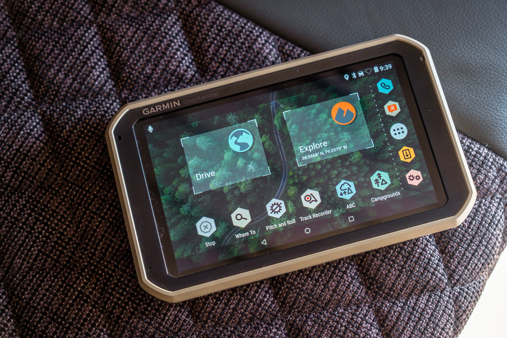
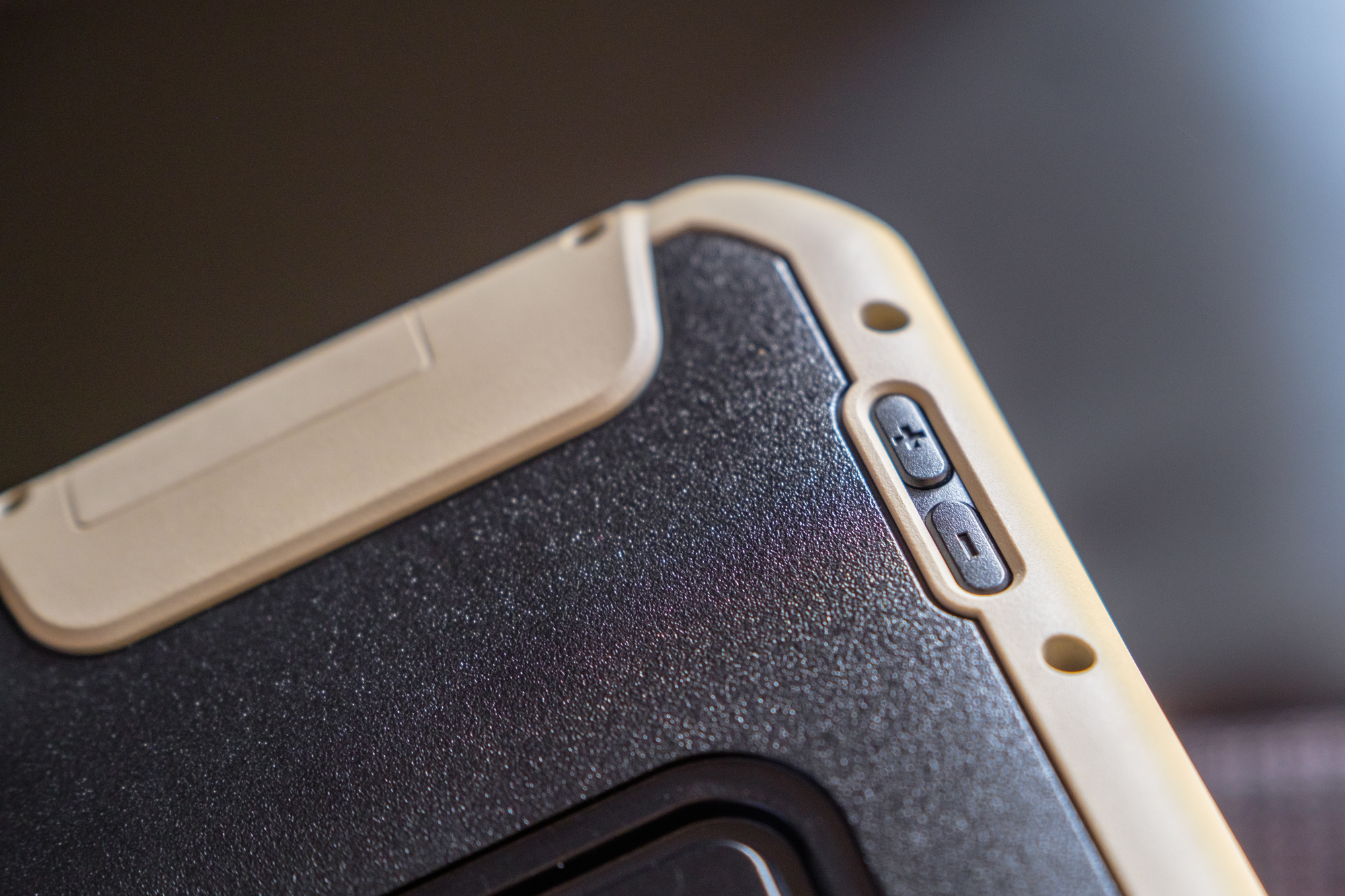
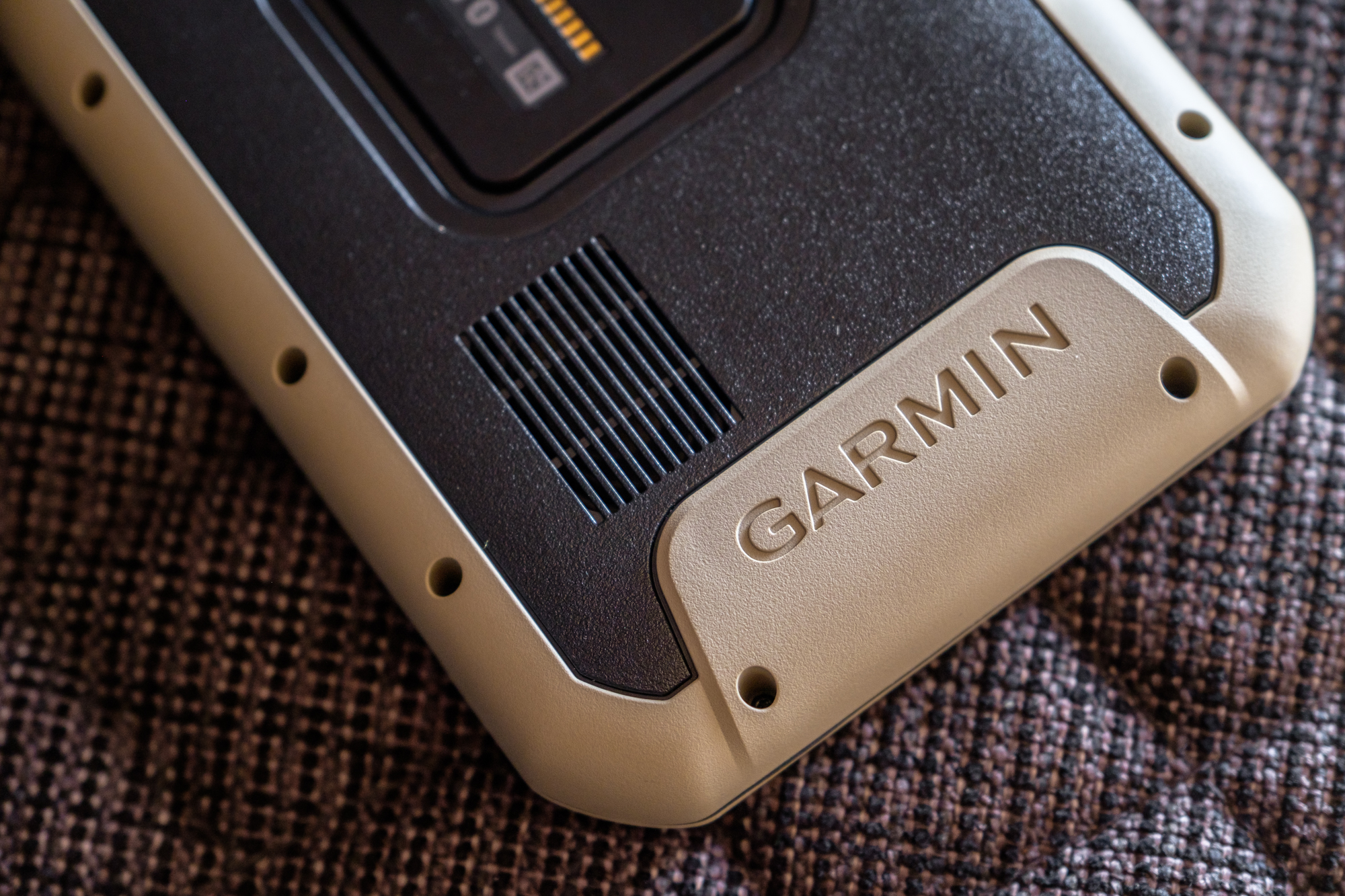
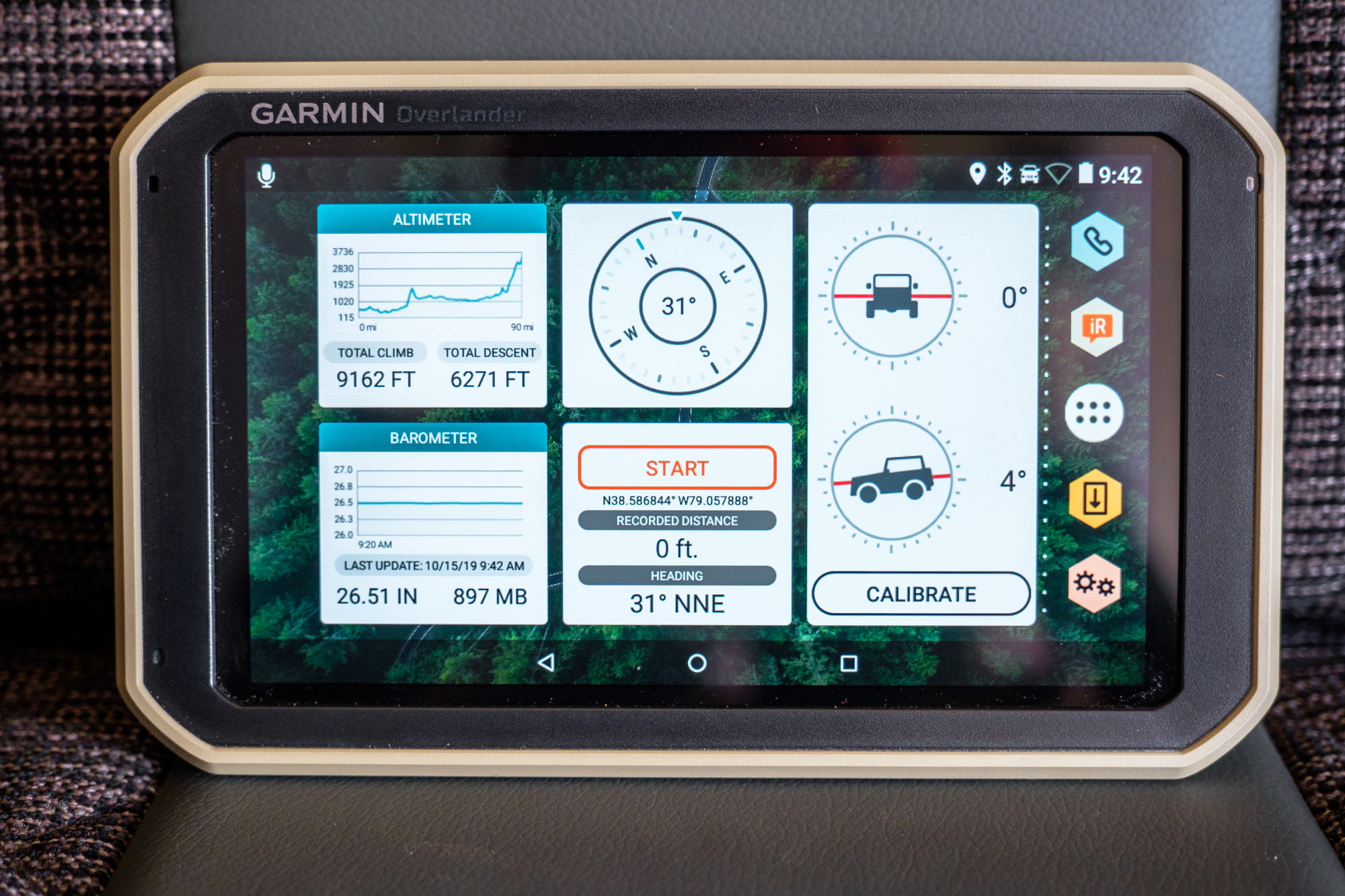
The Garmin Overlander is a ruggedized GPS unit for off-road and on-road navigation. It has preloaded topo and street maps of North and South America, trip planning capabilities, turn-by-turn navigation, and the entire offline databases of iOverlander and Ultimate Public Campgrounds. It carries an IPX5 dust-proof rating and MIL-STD-810 drop rating, which means it has been tested to a total of 26 drops from 4 feet onto 2 inches of plywood on top of concrete. Other features include things like a GPS-based speedometer which displays your current speed against the speed limit of the road you’re driving on, an inclinometer for pitch and roll on the trail, and so much more. If you want to read about every detail and feature, you can check out the Garmin link at the bottom of this article.

What we Loved
The ease of the computer-based trip planning and syncing
If you’ve seen just about any review or description of the Overlander thus far, you’ll be familiar with the fact that it has a heap of offline features integrated into the device. Although you may not have heard about the computer-based planning software which accompanies it that has become one of my favorite features.
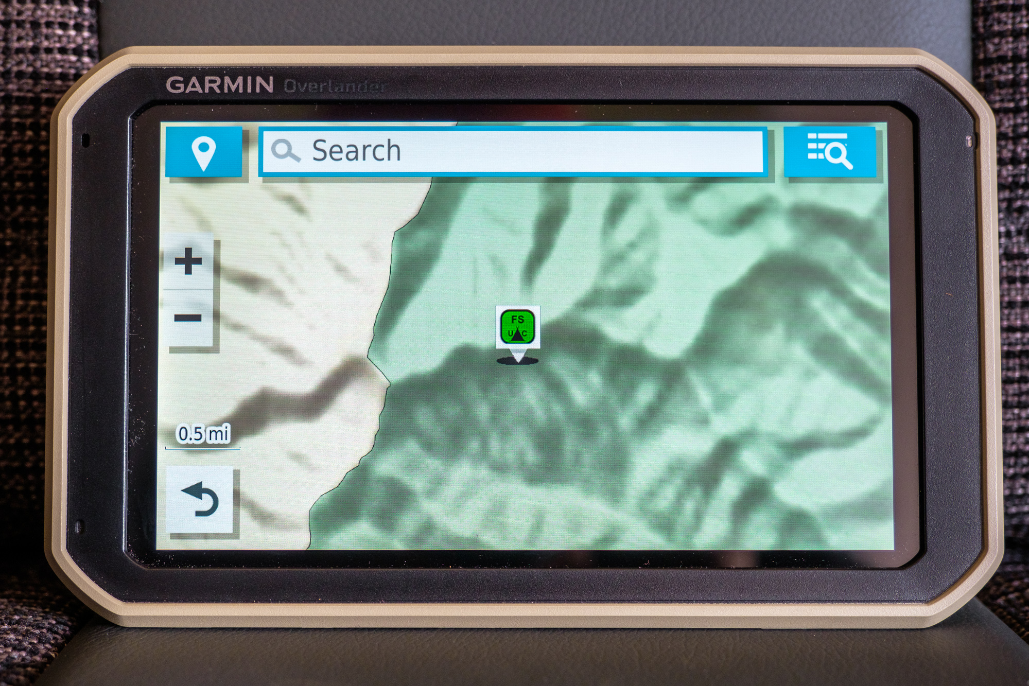
Now, I will give Garmin credit where credit is due. They have made trip planning on the Overlander more intuitive and straightforward than on any phone or tablet I’ve used. But at the end of the day, the screen size and touch interface is still limiting, and that’s where Garmin’s online maps come in. By logging onto the Garmin Explore website, users can pull up highly detailed topographic, street, and satellite maps of the region they want to explore and use them to build routes, mark waypoints, upload GPX files, and do research. What sets the Garmin system apart, though, is the clarity of their maps and the simplicity of the process.


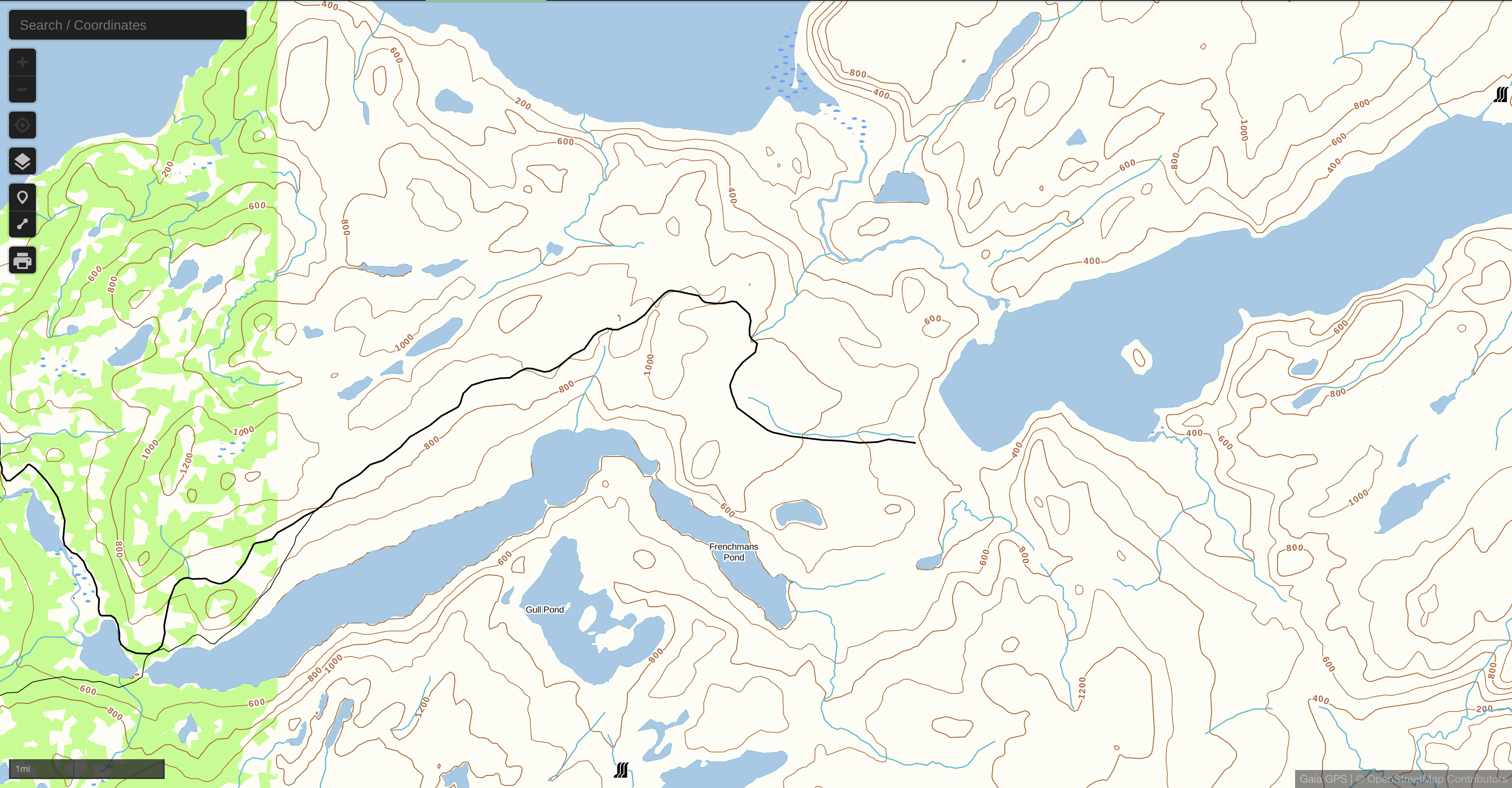
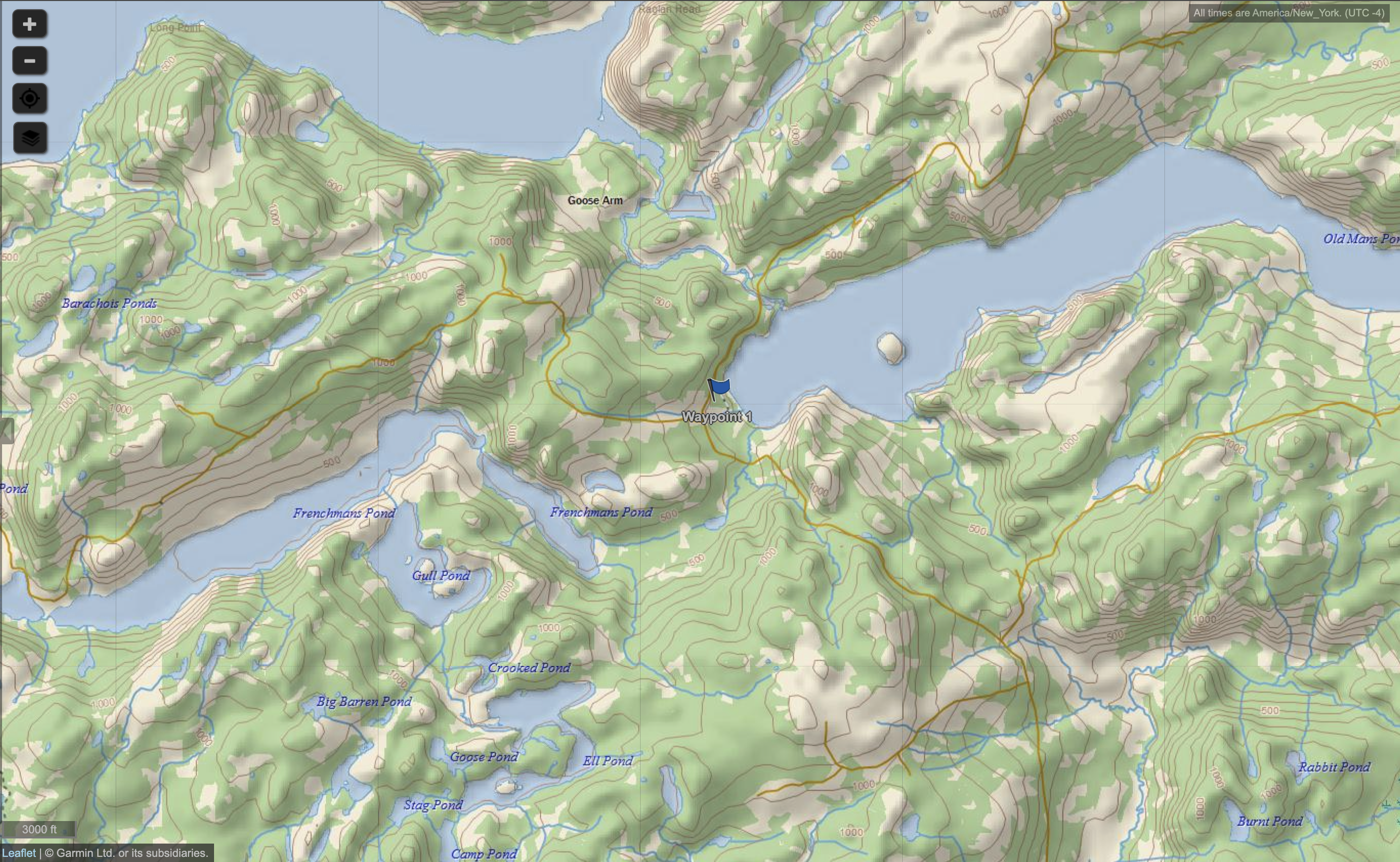
When compared to the base maps of competing online software like Gaia, the Garmin system is much easier to read and interpret. As you can see from the screenshots above, the Garmin software not only displayed tracks while zoomed further out, thus giving you a better perspective, but displayed trails that Gaia completely lacked. It also used more colors to differentiate topo lines from trails, highlight different road surfaces, and make terrain features stand out. However, Gaia’s ability to import a practically limitless number of additional maps will undoubtedly give it an advantage if you’re looking for the maximum amount of data possible.
The Garmin system also makes loading this data onto your device a piece of cake. Once your planning is done, you can either manually import it to the Overlander, or select the automatic sync function and let the device update every time it’s connected to WiFi or a hotspot. These sync sessions bring all of the tracks you created on your computer to the Overlander and also offload any recorded tracks from the Overlander back onto the cloud so you can view it online later.
Explore Mode with Preloaded Offline Maps
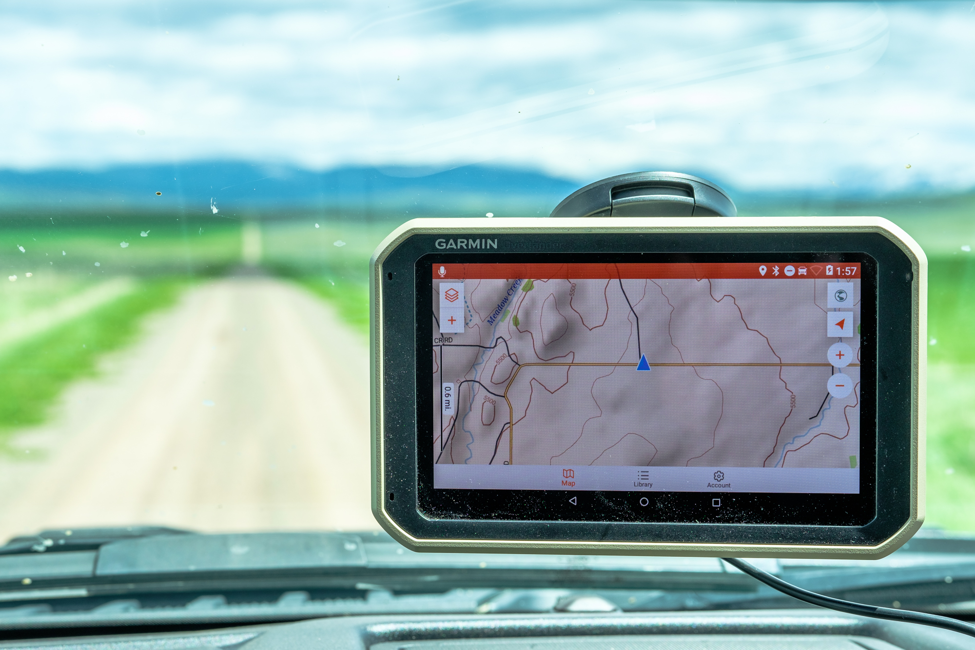
One of the biggest bonuses to buying an Overlander is the offline maps that come preloaded on the device. From the moment you take it out of the box, you have the complete street and topo maps for all of North and South America at your fingertips. No more guessing which regions you’re going to explore and trying to download them ahead of time. The mapping software is as fluid as your adventure, and as ready for unexpected developments and reroutes as you are.
As with the computer-based maps I mentioned above, I found the preloaded maps on the Overlander to be clear and easy to read with plenty of detail and coloration to differentiate features and types of trails. You can still plan routes, drop waypoints, and measure distances on the device, but it’s a bit more time consuming due to the touchscreen interface than on the computer.

Offline Database of iOverlander and Ultimate Public Campgrounds
One of my favorite features of the Overlander is hands down the offline integration of iOverlander and Ultimate Public Campgrounds. These apps have become the go-to resources for finding campsites while traveling for good reason, but they require internet or cell service to view camp locations on a map and that can be a big problem. I can’t count the number of times I’ve been forced to find a new campsite due to some unexpected delay or change in route, and the chances of having a signal in those remote locations are slim to none. Having the ability not only to look up where alternate campsites are but read detailed descriptions about them as well has made my life infinitely easier while traveling. When you add that to the peace of mind of always having the offline maps you need ready to go, it’s really a huge win.
High-Temperature Rating
Living in the desert, outside temperatures often creep into the 90’s and the 100’s, and any device positioned on your windshield will endure heat even greater than that. While iPads are rated to operate up to 95 degrees before shutting down, the Garmin will continue to function up until 131 degrees Fahrenheit, which for many people is going to be the difference between their GPS operating in the summer, or consistently shutting down.
The Charging Cradle, Sort Of
Garmin knocked the cradle out of the park with the Overlander. The base is magnetic, so all you have to do is pull it off the mount when you want to use it as a tablet, and then let it pop back into place with a highly satisfying click when you’re ready to drive. The finishing touch is the powered connection integrated right in so that the Overlander charges as soon as it is on the mount, eliminating the need to fumble with plugs and cables. I’m not exaggerating when I say that it is probably the most satisfying GPS mount I’ve encountered, and based on the reactions of friends who have tried it, I would say that I’m not alone in that sentiment. It does have some drawbacks related to the suction cup, which you can read about in the things I don’t love later on.
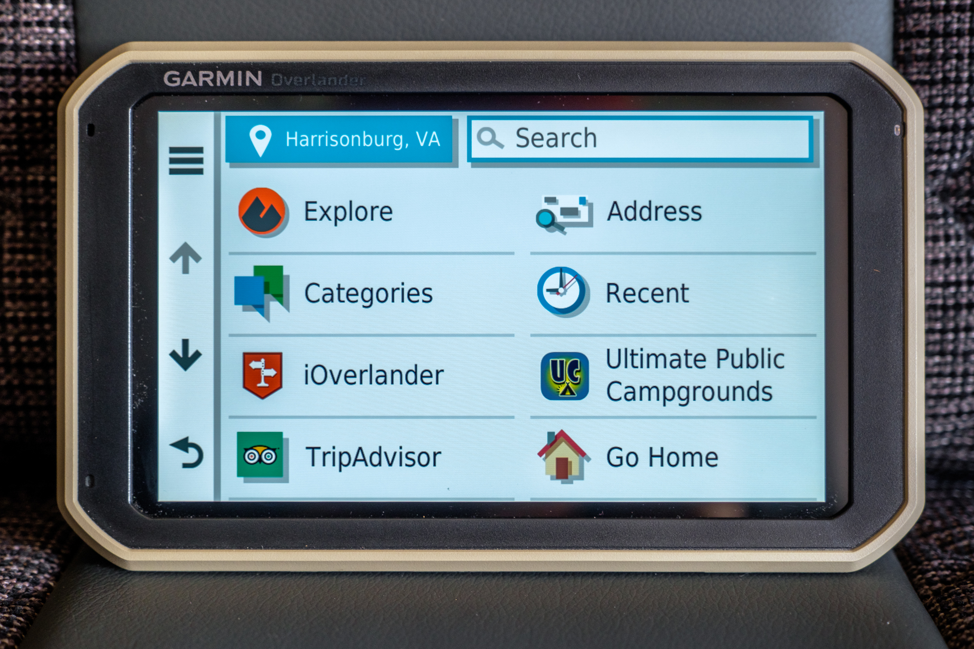
Drive Mode’s Turn-by-turn Navigation.
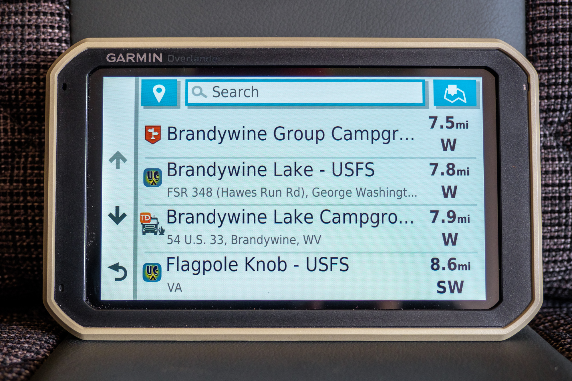
When I first picked up the Overlander, I doubted I would use the turn-by-turn navigation. I felt, and still feel that using your phone is better in most situations, thanks to the up-to-date traffic and construction information. But the offline turn by turn has its place. On numerous occasions, I have found myself parked at some fishing spot or mountain-bike trailhead without service and realized I forgot to plot my destination. Fortunately, with the turn-by-turn navigation, I can just search the next town I’m heading to or grab directions to the next campsite. Even if I don’t know exactly where I want to go, the Overlander’s “Where To” function can provide a wealth of potential options like national parks, historical points of interest, cities, and even recommendations from TripAdvisor in your area. This sort of thing is handy on a daily basis but could be potentially life-saving if you needed to look up the nearest hospital or emergency room.

Back-up or Forward-Facing Cameras
Although it does cost extra, I like that the Overlander has room to expand its capabilities with optional equipment like back-up and forward-facing trail cameras. For someone regularly operating solo, this could make trail spotting a much easier task. Cameras list for $169.
Redundant GPS Systems for Accuracy
Not all GPS systems are created equal. While many systems, like the iPad, operate on a chipset with a single GPS source, the Garmin uses GPS, Galileo and GLONASS satellite positioning systems for reliability and accuracy in all conditions.
What I Didn’t Love
No standalone satellite communication capability
The Overlander is not a cheap device, so I was more than a little disappointed to discover that to take advantage of its satellite communication capabilities, you must pair it with a Garmin InReach. Assuming you don’t already have one and decide to pick up the cheaper InReach Mini, that’s an additional $350, which brings your total for the combo to over $1,000. In my opinion, Garmin should consider integrating that functionality for a smaller incremental charge. Even setting the price aside, the thought of having to carry, mount, and charge two devices is a missed opportunity.

Suction cup mount and lack of an easily sourced alternative
As I mentioned above, I love the magnetic charging cradle, but what I loved less was the suction cup it’s attached to. It tends to fall off the windshield with temperature changes, and any extended driving on corrugations or large bumps will loosen it and allow the device to tilt downward slowly. That’s sort of expected from a suction cup, but the part that got me was that the RAM Mount replacement Garmin recommends cannot be purchased on their site. Even worse, its description is so vague that it lacks enough detail to find the parts you need on the RAM mount site directly. The “Ram Ball Adaptor” is described with the following statement. “Secure your compatible Garmin navigator with this 2-inch base mount (screws included). The ball shape allows for maximum range of rotation, so your electronics are easy to view from any angle.” There is no sizing, no product number, and no link, so when you arrive at the RAM site, you are faced with ball sizes A, B, C, D, or E, and there’s no way to tell which you need—not ideal.
Adding satellite maps can be tedious, and the function is limited to the USA
Although the Overlander is capable of downloading aerial imagery, the process can be time-consuming, to say the least. To download satellite imagery onto the device, you have to first go to the download map submenu. Then you’ll need to scroll to the region of the map where your trip will take place and see if you can download that segment. Most of the time, the region you select will be too large to download at once though, so you will need to zoom down until the application shows that downloading aerial imagery is even an option. Once you have that acceptable area selected, something like 30 miles x 20 miles, you can begin your download. Then you must repeat the process until the entire region you need for your trip is downloaded.
Even if you’re willing to go through this process, these maps are only available for the USA, so the rest of North and South America will be topo and street only. Fortunately, that’s okay because, as I mentioned, these maps are so good that I haven’t found myself using the satellite imagery even when I have it.
So, is the Overlander worth $700?
If I already owned a tablet like an iPad with an integrated cellular card and GPS, I think dropping $700 on the Overlander would be a more difficult sell. Don’t get me wrong, its mapping software is superior to any application I’ve tested on phones and tablets, the computer-based planning is stellar, and I love the convenience of the offline databases from iOverlander, TripAdvisor, and Ultimate Public Campgrounds. But for the cost, I suspect I would struggle to justify the purchase.
However, if I were deciding between picking up a new tablet or buying the Overlander for the purpose of four-wheel drive travel, I would choose the Garmin, hands down, because it’s not really any more expensive than an iPad system. In fact, it’s practically identical if not cheaper. The Overlander retails for $699 USD, while a 64 GB LTE (gps) iPad retails for $510 on Amazon, but add in a dustproof/shockproof case for $80, and a suction cup mount for $50, and you’re at $640. Then you still have to add a monthly data plan, and if you’re looking to use Gaia Premium, a $39.99/year payment for that as well. In the end, it all sort of evens out.
Sure, the Garmin may lack the added functionality of third-party apps, but the purpose-built interface is an absolute joy to use while traveling and makes your adventure easier from the moment you start planning to the second you roll back into the driveway. It is also important to note the increased tracking reliability of a dedicated GPS, as we have found every tablet-based app to randomly stop tracking, fail to track properly, or lose a completed track. We have never experienced a tracking failure with a Garmin device.
That’s probably why, despite owning an iPad with several great mapping apps, I intend to purchase this Overlander when our test cycle is finished. During the past few months of evaluation, it has helped me to find better campsites, plan more interesting routes, and in general, enjoy my trips more thoroughly with less stress. While I could go back to traveling without one, I definitely don’t want to, and I think that says more about how I feel than any accolades ever could.
For more information on the Overlander, check it out on Garmin’s website here.