
Across the globe, a number of historic overland routes owe their origins to military endeavors. Often forged in response to logistical, strategic, or imperial needs, these routes connected remote regions, facilitated troop movement, or supported colonial administration. Remarkably, many of these once-militarized paths have endured as practical and even popular routes for modern overland travelers, and we, as modern overlanders, are often following in the footsteps of giants as we travel the globe, sometimes without even realizing it. The original military purposes of these routes may have faded, but their significance endures, both as cultural landmarks and as adventurous routes for those exploring by vehicle. In honor of Armed Forces Day, here is a look at several important military-established overland routes that continue to serve travelers today.
The Silk Road

The ancient Silk Road, though not solely a military project, was partly shaped by the needs of imperial armies across Asia. The Silk Road comprised multiple routes. As it stretched westward from China’s ancient trading centers, it split into northern and southern branches to circumvent the Taklamakan Desert, and Lop Nur Merchants engaged in “relay trade,” where goods passed through numerous intermediaries before arriving at their final destinations. Marco Polo was among the earliest Europeans to journey along the Silk Road to China. His accounts, recorded in The Travels of Marco Polo, introduced many in the West to the customs of the Far East. Though not the first to share such stories, his writings became some of the most widely read, inspiring many explorers to this day.
The Silk Road’s modern successor, the Karakoram Highway, was engineered jointly by China and Pakistan in the 20th century and completed in 1979. Much of the route traces ancient trade and military paths through the Himalayas and the Karakoram Range, including those used by the Tang Dynasty’s military expeditions. The Karakoram Highway is now a vital link between China and Pakistan and is frequently traveled by overlanders, motorcyclists, and long-distance cyclists. Its combination of historical relevance and breathtaking scenery makes it one of the world’s most memorable driving routes. Entering and exploring China by overland vehicle is an expensive and bureaucratic affair; a local guide must accompany you at all times, and you may not leave an approved route. For this reason, most overlanders choose instead to explore the western route from Europe to Mongolia, and only a handful venture to and across China. Have a listen to Episode 116 of the Overland Journal Podcast; Hungarian overlanders Ferenc and Evelin spent four years driving their 2006 Land Cruiser Prado from Budapest to Singapore. In this field podcast, Senior Editor Ashley Giordano speaks with them about participating in multi-country rallies and shares insights on navigating travel through China with a local guide.
El Camino Real de Tierra Adentro
One of the most storied examples is El Camino Real de Tierra Adentro, or the Royal Road of the Interior Land. Spanish military and colonial forces established this route during the 16th and 17th centuries to connect Mexico City with what is now New Mexico. Its original purpose was to enable the transport of troops, settlers, and supplies through the Spanish Empire’s northern frontier.

Today, segments of the route remain drivable and continue to play a role in cultural tourism and overland exploration. Particularly in New Mexico and West Texas, stretches of the trail have been integrated into scenic drives and are often followed by 4WD vehicles, offering a blend of historic interpretation and backcountry access. El Camino Real de Tierra Adentro crosses diverse terrain, including Mexico’s high plateau, arid deserts, volcanic fields, and rugged mountains. The route spans dry plains, rocky uplands, and the harsh Jornada del Muerto in New Mexico, offering a challenging overland path through some of North America’s most remote and historic landscapes. Having explored much of this terrain in both Mexico and the US, we highly recommend traveling this route in any season except summer.


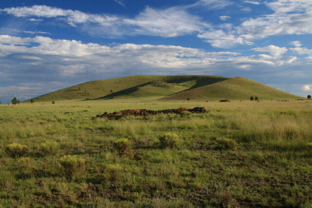
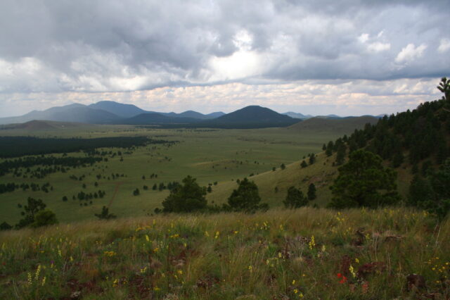
The Gunbarrel Highway

In Australia, the arid 840-mile Gunbarrel Highway, consisting of washaways, heavy corrugations, stone, sand, and flood plains, stands out as a uniquely modern military project. The first road to span Central Australia from east to west was carved through the heart of the continent in the 1950s by surveyor Len Beadell and the Gunbarrel Road Construction Party (GRCP), operating under the auspices of the Australian Army. With the help of a small fleet of Land Rovers, a grader, a bulldozer, and three Commer trucks, the treacherous road was surveyed and then built to access remote test ranges during the Cold War, and was one of the first transcontinental routes across the central deserts.

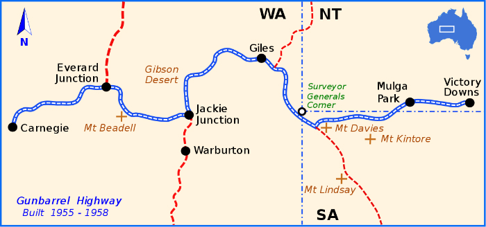
As the Gunbarrel Highway was never sealed, it remains one of the great overland adventures of the Australian Outback. Despite its rough conditions, it is traversed by experienced 4WD enthusiasts who rely on careful planning, extensive supplies, and mechanical preparation to complete the route. Len Beadell published a book titled Too Long in the Bush that documents how he and his team constructed the road, established the Giles Meteorological Station and its airstrip, and then continued to navigate the perimeter of the notorious Gibson Desert.
Via Claudia Augusta

Europe’s contribution to military overland infrastructure is exemplified by the Via Claudia Augusta from Italy to Germany. Commissioned by Emperor Claudius during the first century CE, this Roman road connected the Po River Valley in northern Italy to the Danube in southern Germany. Roman soldiers built the route to support campaigns north of the Alps and to ensure efficient control over newly conquered provinces. In the present day, much of the original alignment has been overtaken by modern roads, but portions of the route remain intact and accessible. In some alpine regions, adventurous 4WD driving along mountain passes that echo the route’s ancient purpose is still possible, but primarily, this route is a hiking and cycling route.


Having spent some time exploring the area, we can wholeheartedly recommend checking out the Via Claudia Augusta. The natural beauty is one thing, but the local culture is something else—and don’t even get us started on the food. Just make sure your overland rig is ready for Europe, meaning a fat wallet and a solid credit card.
The Ledo/Stilwell Road
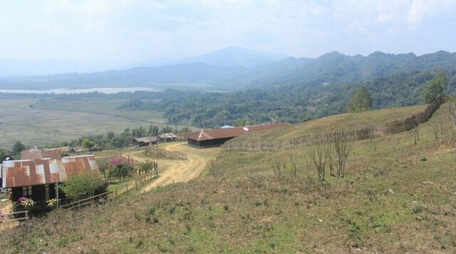
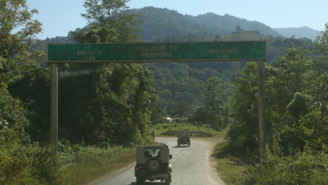
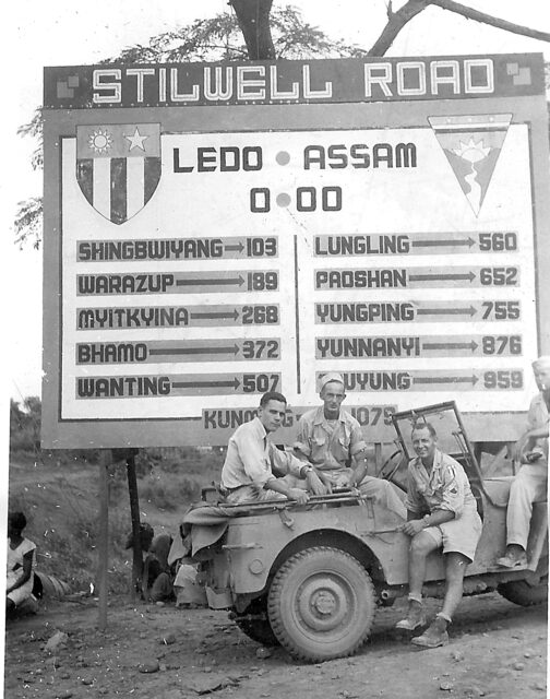
The 1072-mile Ledo Road, later renamed the Stilwell Road, was a critical logistical project during World War II. Constructed by Allied forces to maintain supply lines to Chinese forces resisting Japanese occupation, the road connected northeastern India with China via Burma (now Myanmar), which together shared the vast majority of the length of the road. Built under grueling conditions and through the most challenging jungle and mountainous terrain, the route saw intense military use between 1942 and 1945. The road earned the grim nickname “Mile a Man” due to the high number of soldiers who lost their lives during its construction, and it was the largest, most expensive, and most controversial engineering undertaking of the Second World War. Today, sections of the road are still navigable, particularly in India and parts of Myanmar. Overlanders with a taste for remote and seldom-traveled routes occasionally retrace parts of this path.
However, political and environmental obstacles can complicate access as China and India seldom see eye to eye in the region. Photographer Findlay Kember documented the Stilwell Road between 2010 and 2014, traveling in segments across India, Myanmar, and China due to border restrictions. His journey included a difficult six-hour scooter ride through a remote Myanmar section, illustrating the route’s poor condition and the resilience of local travelers. In 2019, the Last Overland team attempted to retrace a 1955 London-to-Singapore expedition but had to divert from the Stilwell Road in northern Myanmar due to conflict in Kachin State. They rerouted through the Tamu-Moreh border into India, highlighting the region’s ongoing instability and challenges for overlanders. World War II buffs will enjoy this historical documentary, The Stilwell Road (1945), narrated by none other than former US president Ronald Reagan.
The Beale Wagon Road

In the American Southwest, the Beale Wagon Road offers another example of a military-engineered path that persists in the modern era. This route was surveyed and developed under the direction of Lt. Edward Beale in the 1850s, with the goal of improving westward migration and military logistics across Arizona and California. Notably, Beale used camels in his expeditions to test their viability for desert transport. The camels did not endure the route. At the same time, they proved highly effective at carrying heavy loads across the arid, rocky terrain; they were not well received by the muleskinners, who considered them “foul-smelling, evil-tempered, and ugly.” Today, the trail’s alignment overlaps with portions of US Route 66 and is followed by off-road enthusiasts exploring Arizona’s backcountry.
In Arizona, particularly within the Kaibab National Forest near Williams, some portions of the Beale Wagon Road align with existing Forest Service roads that permit motorized travel. For instance, the Beale Wagon Road Main trail is a 5.2-mile stretch characterized by gravel surfaces and wide paths, making it suitable for 4WD vehicles. This segment traverses areas of the National Forest and remote neighborhoods, offering scenic views of prairies and forests. Another accessible portion is the 2.4-mile trail through the Kaibab National Forest, which is described as a smooth road without obstacles, ideal for a leisurely drive through towering Ponderosa Pines. It’s important to note that motorized travel is prohibited on sections of the Beale Wagon Road that are not designated as current USFS roads. These areas are preserved for hiking and horseback riding to maintain the historical integrity of the trail. The road’s legacy also contributes to the historical narrative of westward expansion in the United States.
The Roman Empire’s North African Roads

The Roman Empire’s engineering prowess extended far beyond Europe, including into North Africa. Military roads in modern-day Algeria, Tunisia, and Libya were constructed to secure Roman control over strategic cities and enable rapid Legion deployment. These roads often followed straight alignments, connected important urban centers with fortresses and outposts, and eventually connected the Atlantic to the Nile. Today, many of these routes serve as the foundation for paved highways, while others remain unpaved and are used by travelers exploring the desert regions. Overlanders in North Africa may find themselves unknowingly following Roman routes as they cross the Maghreb or head into the Sahara.
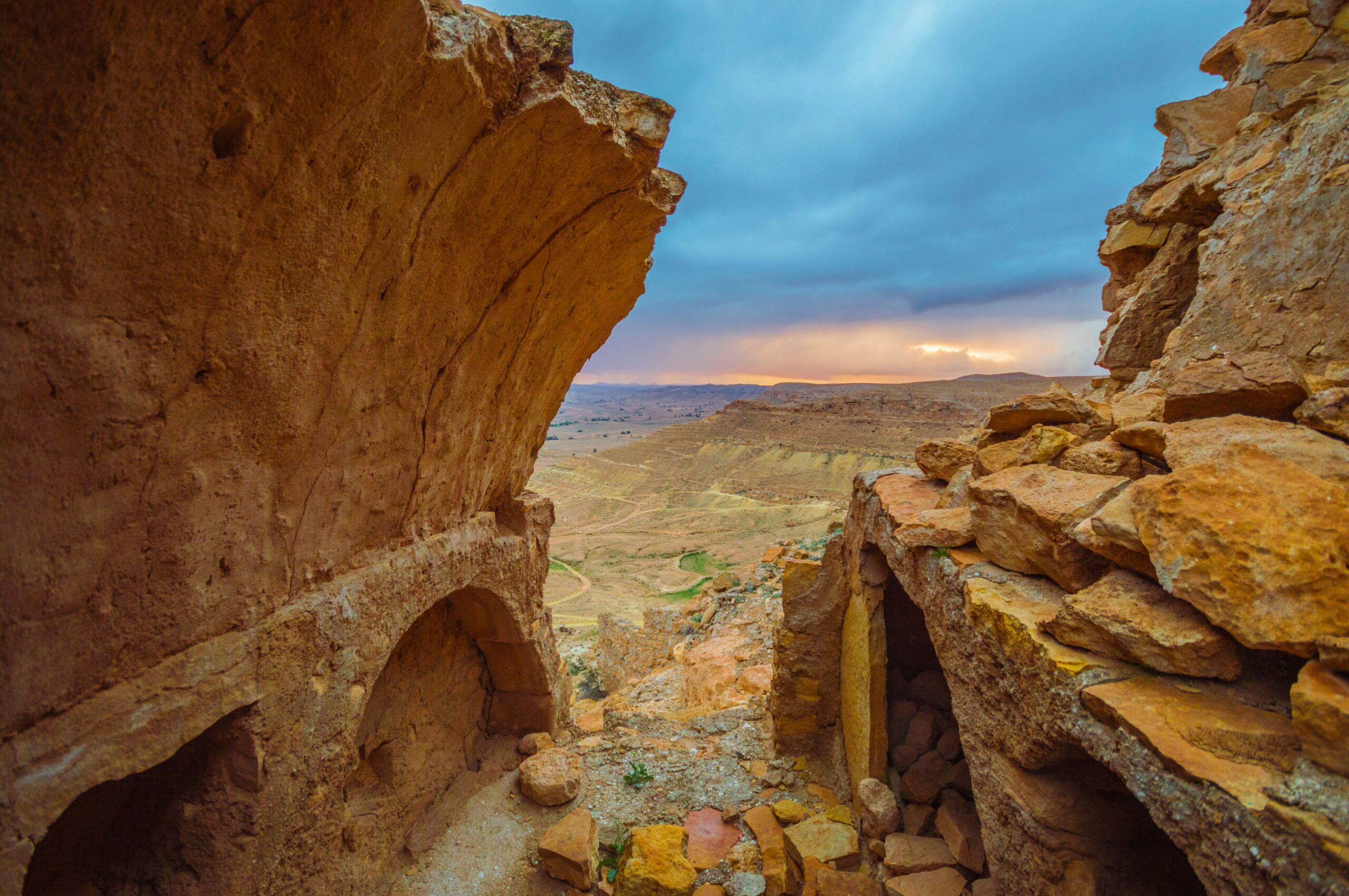
Travel in North Africa became increasingly difficult after the Arab Spring, but there have been some improvements in the last few years. Algeria began reopening to overland travel in stages following COVID-19-related closures. Notably, the land border with Tunisia, closed since March 2020, was reopened on July 15, 2022, allowing overland crossings between the two countries. In February 2024, Algeria and Mauritania opened a new trans-Saharan route between Tindouf and Zouerat to non-freight traffic, including foreign tourists. This route requires travelers to obtain a visa and may involve military escorts in certain areas. Despite these reopenings, overland travel in Algeria, especially in the southern regions and the Sahara Desert, remains subject to restrictions due to security concerns. If you want to escape the overland crowds and are brave enough to seek out a new and unique experience, North Africa is the destination for you. Morocco is an excellent overland destination and a great place to start an overland journey, as documented by The Outfit in their video Military Told Us It Is Not Safe To Camp Here – Expedition Morocco-Algeria Border.
The Darb al-Arba’in
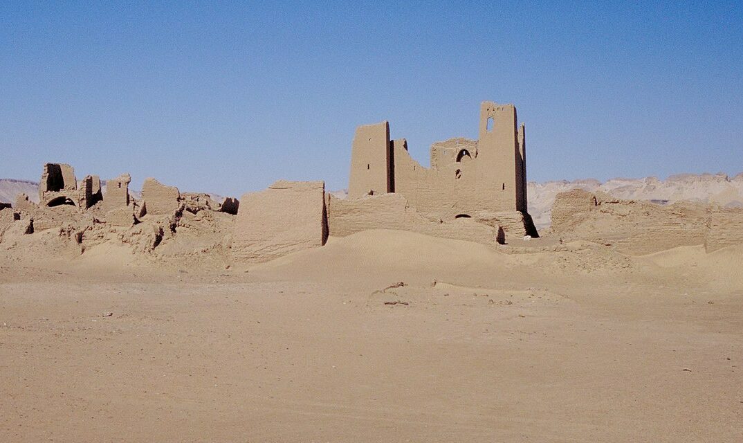
Staying in Africa, northeastern Africa specifically, the Darb al-Arba’in—also known as the Forty Days Road—was a crucial trade and military route linking Egypt with the Sudanese region of Darfur. Used since antiquity and formalized through military escort caravans during Pharaonic and later Islamic periods, the route allowed the movement of goods and personnel across the harsh desert. Though no longer a major commercial artery, experienced desert travelers can still follow segments of the route. Overlanders with an interest in ancient paths and a tolerance for extreme desert conditions occasionally trace portions of the Darb as they traverse the Eastern Sahara. Still, you might struggle to find any recent reports of anyone doing so.
Read More: Classic Land Rover Defender Upgrades: More Capability and Greater Reliability
Our No Compromise Clause: We do not accept advertorial content or allow advertising to influence our coverage, and our contributors are guaranteed editorial independence. Overland International may earn a small commission from affiliate links included in this article. We appreciate your support.