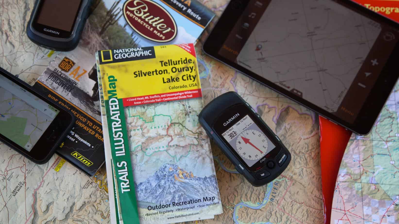
This is the tale of the sage old timer and the spunky new kid on the block. Another contest of the tried and true pitted against the latest and greatest, it’s difficult to pin a ribbon on a winner. On one hand, maps have been around for thousands of years. As soon as humans developed a spacial awareness of their surroundings, they began scratching representations of those earthly features onto cave walls. The GPS unit by comparison, has just arrived. For the overlander, which one is best?
Paper Maps
It’s hard to dispute the merits of a good map. I have one particular road atlas that has been a cherished travel companion for over 15 years. Tattered and torn, it chronicles travels past with highlighted roads, circled points of interest, and notes scribbled in the margins. Seeing notations of gas prices from pre Y2K is alarming. Oh, to have cheap gas again. Although it’s just a general overview of North America’s roads, my atlas has never failed to direct me to my end destination. Why do you care? Because you probably have a similar map in your inventory as well.
Maps are if anything, reliable. We may travel off their edges, or wish they offered greater detail, but a paper map, even a poor one, is often better than none at all. There are sometimes challenges getting the best maps possible for a given area, and some regions of the world are still significantly uncharted, but for the most part, getting base maps for most areas is not difficult. Although some governmental agencies like the USGS map division are quickly becoming a thing of the past, enterprising companies like Delorme, Rand McNally, HEMA and of course Michelin, are still producing and improving on the paper map. Many of these maps now have digital counterparts making them all the more useful.
If paper maps have a primary fault, it is that they do not tell you where you are. At least not without some calculations and some basic referencing of your position in the real world. This becomes an issue when traveling in an area with a warren of unmarked roads that don’t seem to match those on the map. Maps also cover a limited area, or a greater sized area with limited detail. There are other less significant drawbacks like obvious errors or exclusions. Maps can even become outdated in a short period of time as roads are built, closed, or rerouted. As negatives go, it’s hard to bemoan the paper map of anything noteworthy.
GPS Units
When GPS units hit the market, they were going to render the paper map useless. Then people actually used those first GPS units and decided they were worse than a toy compass plucked from a box of Cracker Jacks. Even when the newer units were released, they came with a multitude of challenges to be overcome. The displays were hard to read, the battery life insufficient, and the chances of them failing were a distant second to the likelihood of the user not understanding how to best employ the device in the first place.
Current GPS units, and this can also include GPS enabled tablets and smartphones, are not just easy to use, they’re sometimes fun to use. The GPS unit on my motorcycle even has a feature directing me to the closest curvy roads for maximum riding enjoyment. It also alerts me if my tires are low, and where to get gas, or even coffee. When bikepacking, I use a smaller GPS unit that signals upcoming intersections on small trails with an audible beep. It even tells me when the sun will set, the current temperature, and even my heart rate. Most importantly, it tells me where I am at any given time. It even records my moving speed, distance traveled, and can be preloaded with my exact planned route. Although the screen is rather tiny, I can nonetheless access a full scope of topographical maps for the entirety of North America. It’s really quite amazing, but there are some drawbacks.
Electronic devices just love to fail when you need them most. They also seem to derive a lot of user effort to get them to divulge the precious information you seek. I can poke and prod my GPS units for minutes on end, frequently with a lot of hair pulling before I get it to dance to my tune and do what I want it to do. I’ve also watched as a friend deleted his entire pre-loaded route with one accidental push of a button. With a paper map, my finger seems to plop right on the information needed in seconds. GPS units are also energy eaters and require constant feeding of batteries or charging to keep them cooperating. They’re also expensive and that new unit you just got for your birthday…it’s already outdated technology.
The Verdict
This is going to come across as a spineless evasion of declaring a victor in this matchup, but the reality is I almost never venture into the wilderness with a GPS unit as my only means of navigation. Just as we all travel with a spare tire and a set of jumper leads, even the most ardent technophiles carry a basic paper map as a backup. Since Murphy’s Laws apply to everything including trick electronics, that’s just the prudent thing to do. So, for this head to head, it’s too close to call. This one is a draw.


