

For adventure motorcyclists, easy-to-read, reliable navigation is a necessity. We cannot be fumbling with our phones and trying to scroll through touch screens that do not work with gloved hands. The screen needs to be bright and daylight readable, while also working with polarized glasses. This is why ADV motorcycling still has one of the highest dedicated GPS device usage rates in the overland market—it just needs to work.
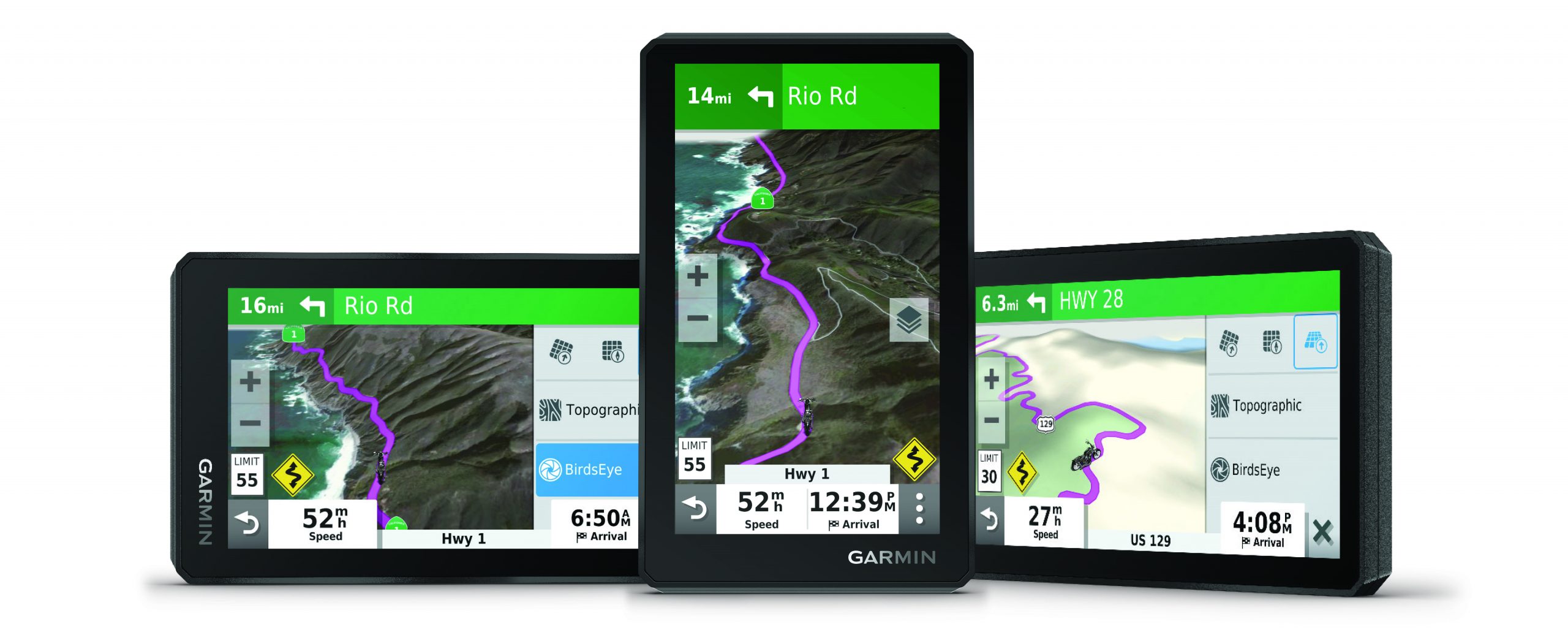
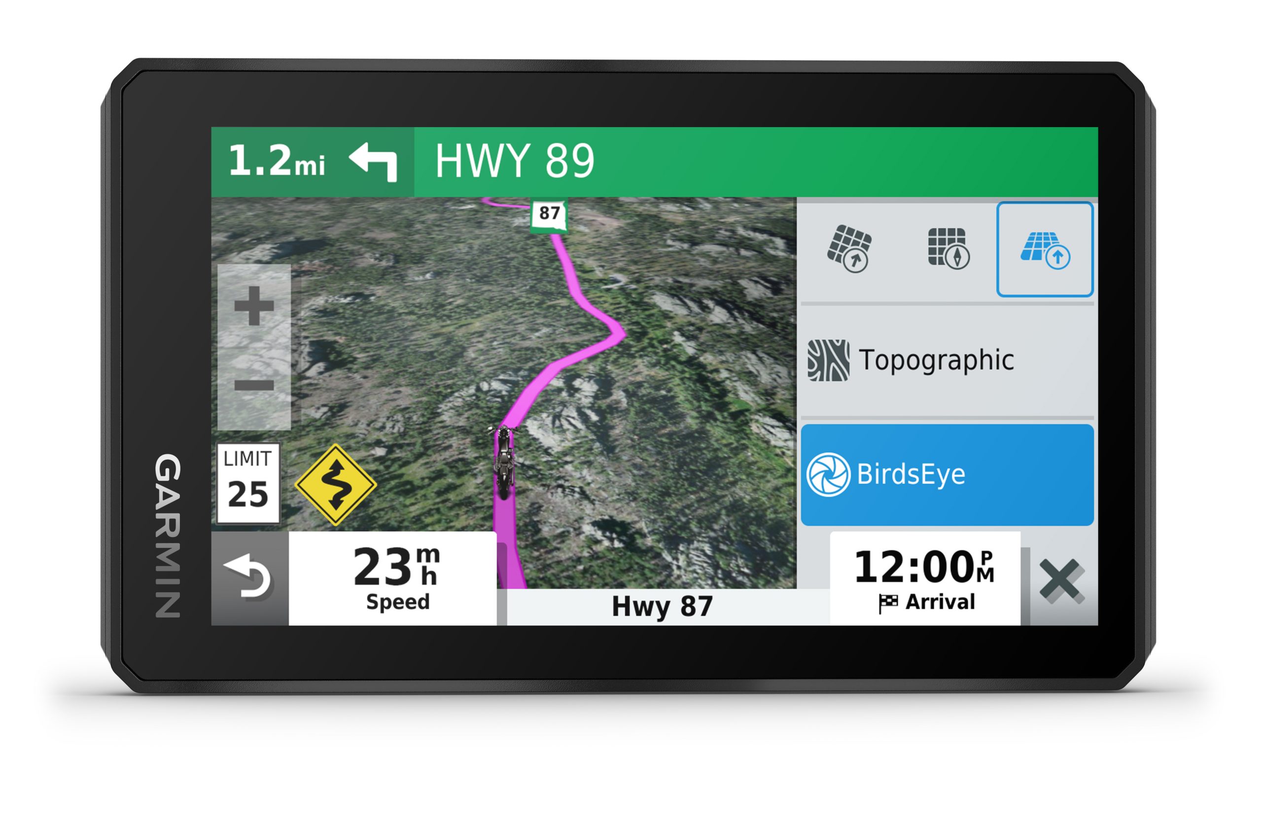
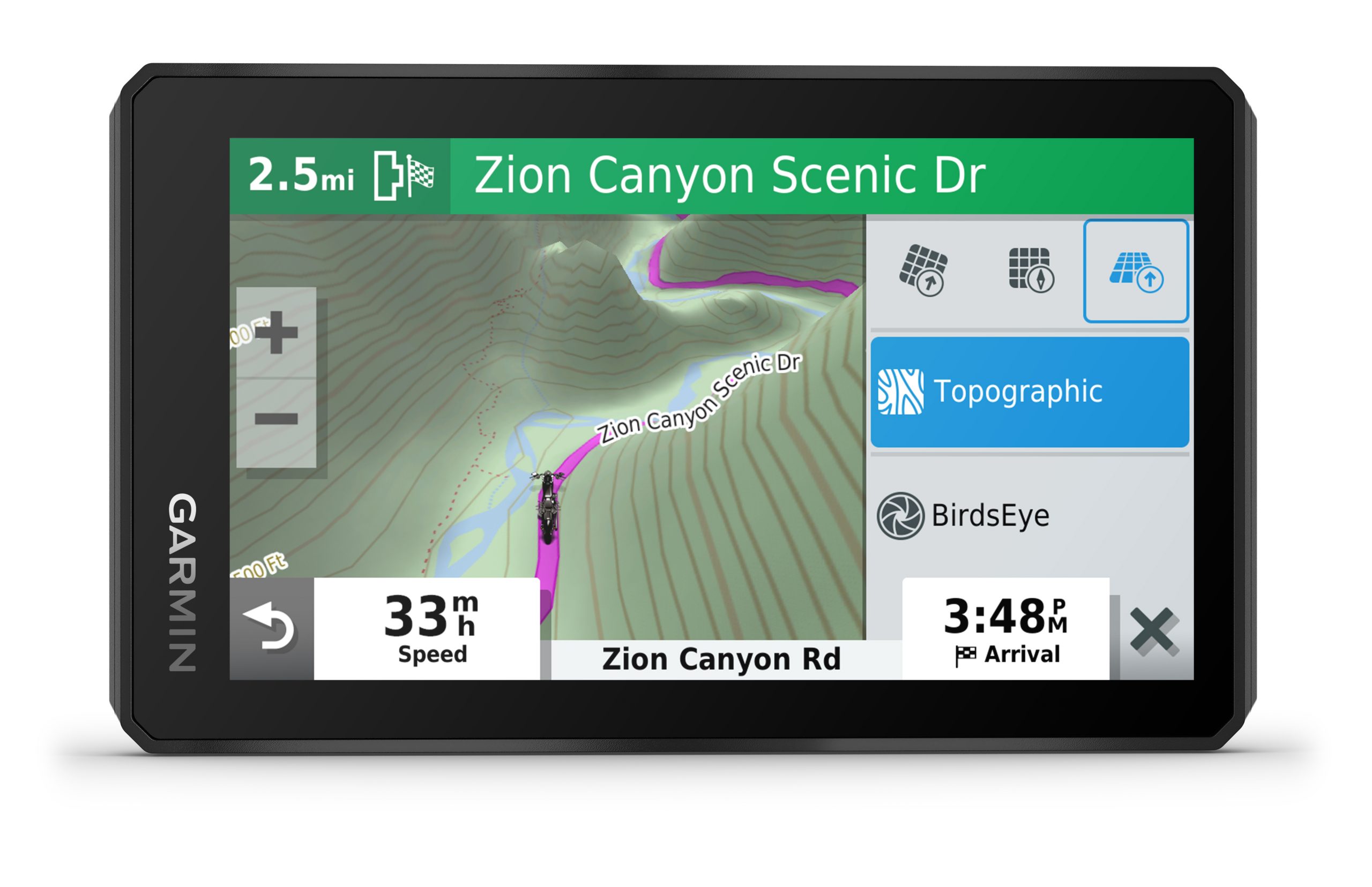
Garmins have always been popular with the motorcycle crowd and even come as a factory option from BMW and others. The 276c was a favorite, followed by the Montana. Now, Garmin has an IPX7 rated all-weather unit called the Zumo XT, and it has some interesting features. In particular, it is specifically designed to work off-road, sporting an ultra-bright 5.5-inch HD display that works with gloved hands. It is built to take vibration and drops with a military-spec 810G drop rating.
“The zūmo XT is able to take on any type of adventure, regardless of the weather or rugged
terrain, it’s ready to venture wherever the rider chooses,” said Dan Bartel, Garmin vice president
of global consumer sales. “With its new, larger display offering an impressive ultra-bright
touchscreen, riders will have the advantage of easily seeing their screen even on bright sunny
days. Visibility of the route ahead is further enhanced with a choice to mount zūmo XT in
traditional landscape or portrait mode.”
The features include Garmin’s new Adventurous Routing, which selects roads that are the most scenic (and curvy). There are also several datasets and map layers that are designed specifically for the overlander, including preloaded topo maps that also show public land boundaries, dirt tracks, and terrain contours. This can be combined with Garmin Explore to plan trips and share GPX tracks across users and devices. One feature I look forward to testing is the Birdseye satellite images, which can be so valuable when exploring unfamiliar terrain. We have not tested any of these features yet, so any opinions are reserved until we get our hands on an evaluation unit.
For the traveler, there are also iOverlander POIs, public campgrounds, notable sites, US National Parks directory, and even TripAdvisor data. The unit also supports GPX tracking and sharing (the universal XML format for GPS track and waypoint data).
On connectivity, the Zumo XT includes Bluetooth for pairing to headphones or helmets, hands-free calling, rider alerts, and incident notifications. The Zumo can also be paired to a Garmin inReach to display texts, etc. To eliminate the need for bringing a laptop, the unit has built-in WiFi for pairing to a hotspot on your phone or at the “Starbucks” to update maps and firmware. When removed from the cradle for a hike, the batteries will last for up to six hours. More details and a full review to follow once we are able to test the Zumo in the field. garmin.com