
The United States Forest Service has launched a brand new mobile app that the agency says provides the most complete and accurate collection of Forest Service recreation sites that has ever been made available to the public. The announcement came as a surprise to some given the recent wide-spread budget cuts and general reduction of services within the Department Agriculture, which oversees the Forest Service. Agency officials have suggested, however, that the development of the app had been planned for some time, and its back-end goal is to consolidate and sunset nearly 30 similar outdated apps within the 120 year-old agency.
-
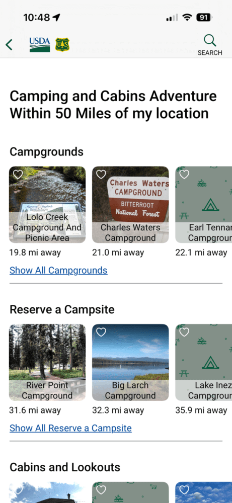
- For the first time comprehensive USFS campground data is available in one place.
-
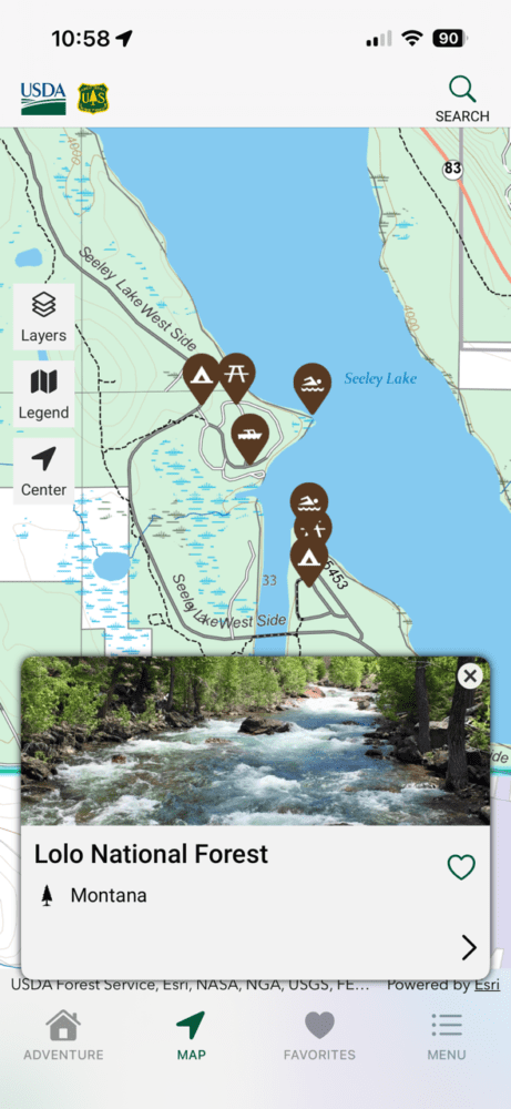
- In-map data often includes images of different attractions.
For the user-facing side of the technology, the app will integrate planning and notification tools like recent National Forest news, safety alerts, road, trail, and recreation site closures, and amenity information. Embedded links will bring users to recreation.gov or other concessionaires’ websites for booking campsites, cabins, fire lookouts, and other reservable facilities. The level of detail is impressive, as the app drills down into data across a wide range of activities, from hunting and fishing to water sports to hiking and mountain biking, and, importantly for overlanders, forest road access and ratings for OHV riding and camping. Campsites can be filtered for available amenities and price, and users can search for recreation opportunities within a defined radius and filter the app’s information by activity, which cuts out a lot of the noise in the interface.
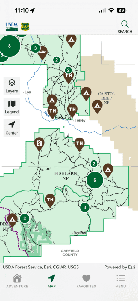
Front and center in the app is its native mapping tool, which leans on the Forest Service’s huge library of updated quadrangle and region maps and multiple other government agency sources. The maps are interactive and also fully downloadable, so the app can work offline with a phone’s GPS capabilities in remote areas with no data signal. For hikers and drivers, trail and road-level data are incredibly useful. “You can click on the different trail segments, and it will tell you what the average grade of that trail is, how long the segment is, and also some of the uses permitted on that trail,” said Montana-based Helena-Lewis and Clark National Forest spokesperson Chiara Cipriano.
-
- Maps are downloadable for off-line use.
-
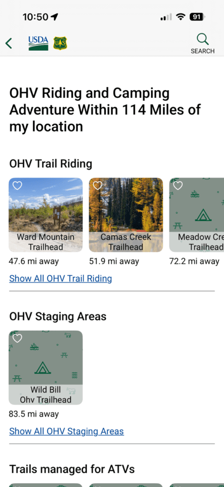
- The new app includes detailed information for OHV enthusiasts.
The UX/UI in the new app is uncluttered and intuitive. The maps themselves render quickly and cleanly with optional map layers that include wildfire information and National Weather Service alerts that can be toggled on and off. At smaller scales, the maps show contour lines and elevation, as well as geographic and geologic features. Tapping attractions like trailheads and campgrounds not only reveals information about the site, but also shows local photographs where available.
Of course, the app is limited only to National Forest and National Grassland landscapes managed by the USFS. The data won’t bleed over into other public lands, like Bureau of Land Management or National Park Service territory. The former doesn’t have a comprehensive resource app available, and the latter’s visitor app is more limited in scope than the new Forest Service application. One of the historic challenges of navigating National Forest roads and trails has been the fragmentation of information and data across seemingly endless agency websites (I often call local USFS offices for road information)—this app solves nearly all those issues.
Forest Service Chief Tom Schultz says, “Due to the sheer size and remote nature of our 165,000 miles of trails and more than 30,000 recreation sites, we know that mobile service can be limited once you reach your destination. We encourage everyone to download the National Forests and Grasslands app to check trail conditions, download offline maps, and view safety alerts before your trip.” The National Forests and Grasslands app is available for both Android and iOS and is completely free.
Read more: Overland Conservation :: Eastern Sierra Conservation Corps
Images: USFS, National Forests and Grasslands mobile app
Our No Compromise Clause: We do not accept advertorial content or allow advertising to influence our coverage, and our contributors are guaranteed editorial independence. Overland Collective may earn a small commission from affiliate links included in this article. We appreciate your support.