

In the never ending quest to get lost without actually––getting lost, the mobile device, GPS, and portable computer have supplanted the paper map as the adventurer’s go-to. This does not discount the value of a folded map, but our digital tools can now display more data than can fit on a thousand sheets of paper. There are many other advantages to electronic charts. Unlike printed maps which get dated quickly, digital map information can be made current with a click of a button. The challenge with digital systems has always been functionality and the quality of the information provided. Some have been glitchy, slow to load, inconsistent from one area to the next, or just––bad all the way around.
Montana based onXmaps was Founded in 2009 by Eric Siegfried with a specific mission. As a hunter he wanted a digital solution to precisely define the invisible lines that delineate public from private land. It was, and is still, a critical consideration for those prone to venture off trail. From those origins he created a new platform aimed at the general outdoor enthusiast and gave it the appropriate moniker––ROAM.
Earlier last month I started testing the ROAM app on both Android and IOS operating systems. My phone has been my primary navigational tool for a few years now with my GPS units collecting dust on a shelf. I haven’t been displeased with my previous mapping apps, so I wasn’t sure what ROAM had to offer over the competition. I was immediately impressed with the comprehensive features and the low $10 annual subscription fee.
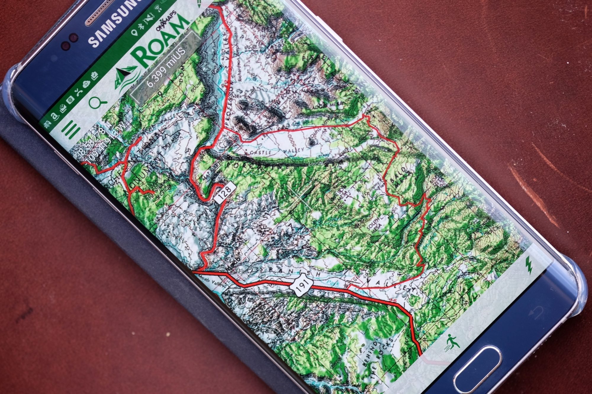
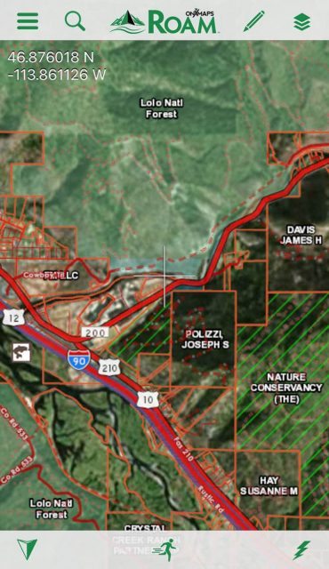
Like the original onXmaps designed for hunters, the ROAM system has the ability to clearly define federal, state, city, and private land holdings. The premium level yearly subscription, priced at only $20, uses current property tax records to label plots of land by owner name or business entity. For states like Idaho and Montana which are a confusing patchwork of private and public parcels, that could be a necessary feature for some travelers.
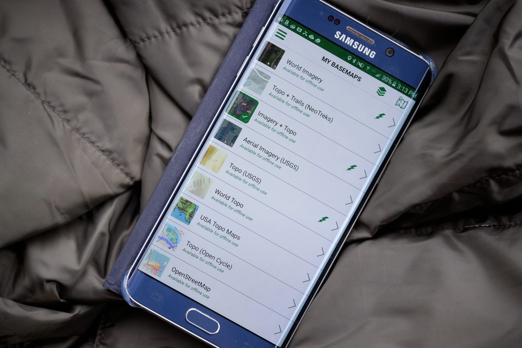
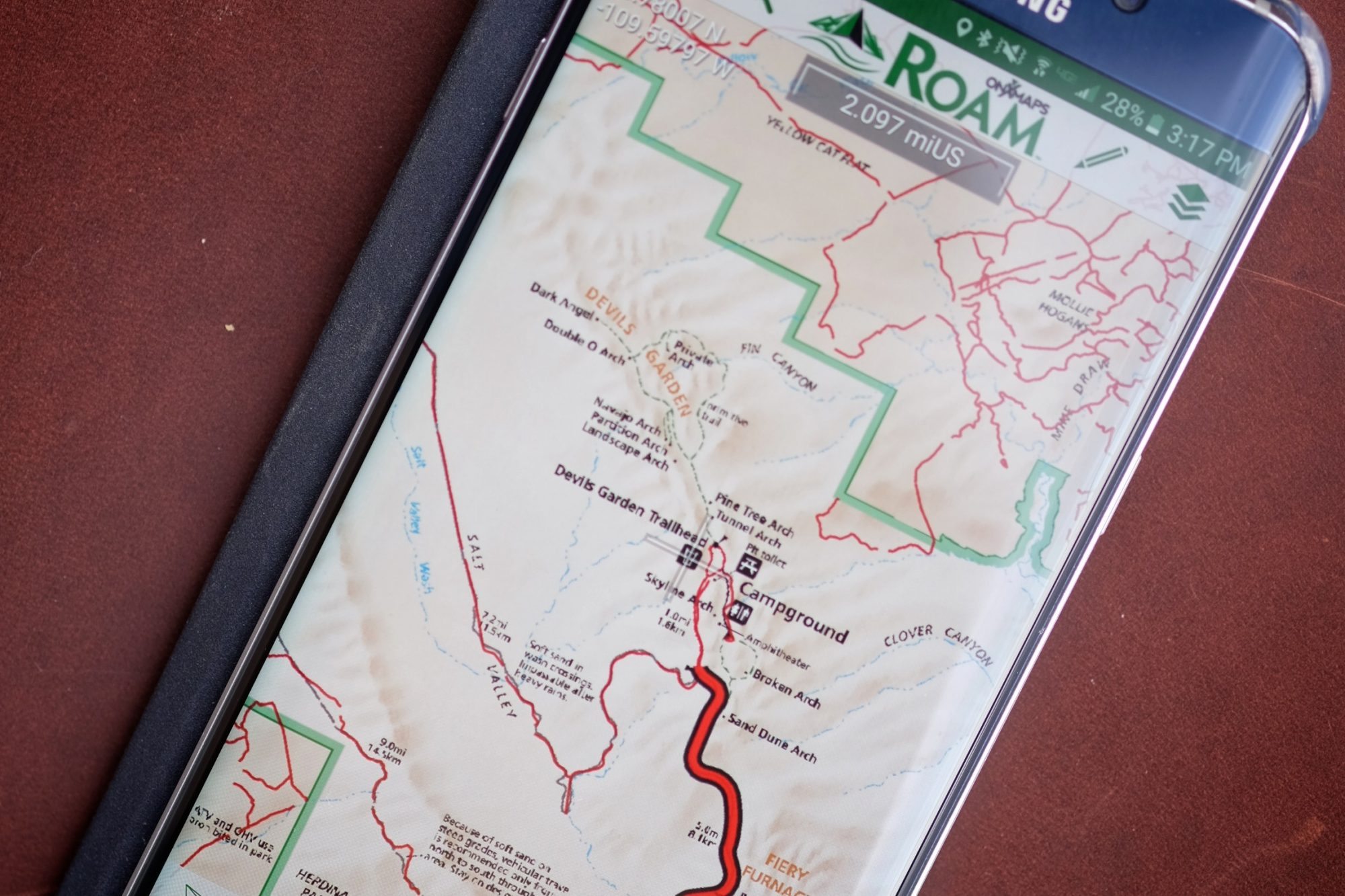
The base maps include: World Imagery, Topo+Trails (NeoTreks), Imagery+Topo, Aerial Imagery (USGS), Topo (USGS), World Topo, USA Topo Maps, Topo (Open Cycle), OpenStreetMap, World Streets, Slope (NeoTreks), Dark Gray Canvas, Light Gray Canvas, and Ocean Basemap. All of these maps can be used offline if downloaded in advance of leaving cell or WiFi connection. Additional layers can be applied to the base maps which include: Public Lands, Possible Access, USA Roads, USA Trails, USA Trail Mileages, National Scenic Trails, USA Recreation, USA Geographic, Forest Visitor Maps, National Park Visitor Maps and a few more.
That’s a significant amount of material to sort through which made we wonder how easy it would be to select the maps and layers I needed to best pilot my way through the woods. To my relief, it’s extremely easy. The app includes prompts to help users intuitively learn how to get the most out of the service. The real test was going to be the accuracy of the road and trail information listed for my area.
I hear it all the time––but it doesn’t work without cell or Wifi connection, right? Wrong. The modern smartphone is capable of receiving GPS signal even when out of cell range and even with the device switched into “airplane” mode. Watch this video for a better rundown on your phone’s GPS capabilities.
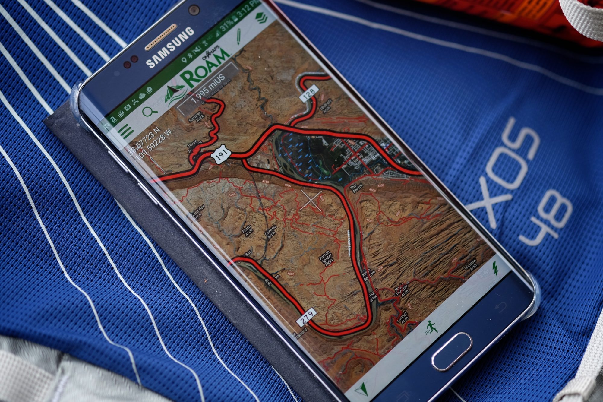
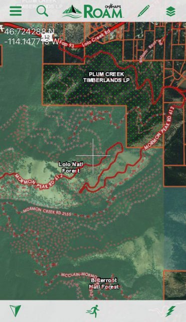
I live in the middle of several thousand square miles of national forest and unlike many districts in the country, our’s is in a constant state of flux with trails and roads opening and closing every month. Fortunately for us, the expansion of trails has been explosive. This presents a challenge for most mapping systems as they can never keep up. We’ve added hundreds of miles of trail in just the last 10 years. To test the ROAM database, I searched for a trail I know is less than a year old and––there it was. We can thank open-source data collection for these instantaneous updates. Try that, Mr. Paper Map.
Other functions include activity logging and waypoint marking as well as the ability to navigate along imported or previously recorded tracks. It’s a comprehensive mapping aid and I particularly like how onXmaps included useful instructions into their website. Even reluctant users intimidated by technology will find ROAM easy to use. Their regularly updated blog has useful tips for navigation and general outdoor skills.
A month after downloading the app and using it to explore some lesser known corners of my local forest district, I can say I’m so pleased with it I deleted the other mapping resources from my mobile devices. I’m an exclusive ROAMer now. Time will tell how it performs over the course of the year, but so far, so good. roam.onxmaps.com