
Editor’s Note: This article was originally published in Overland Journal’s Gear 2022 Issue.
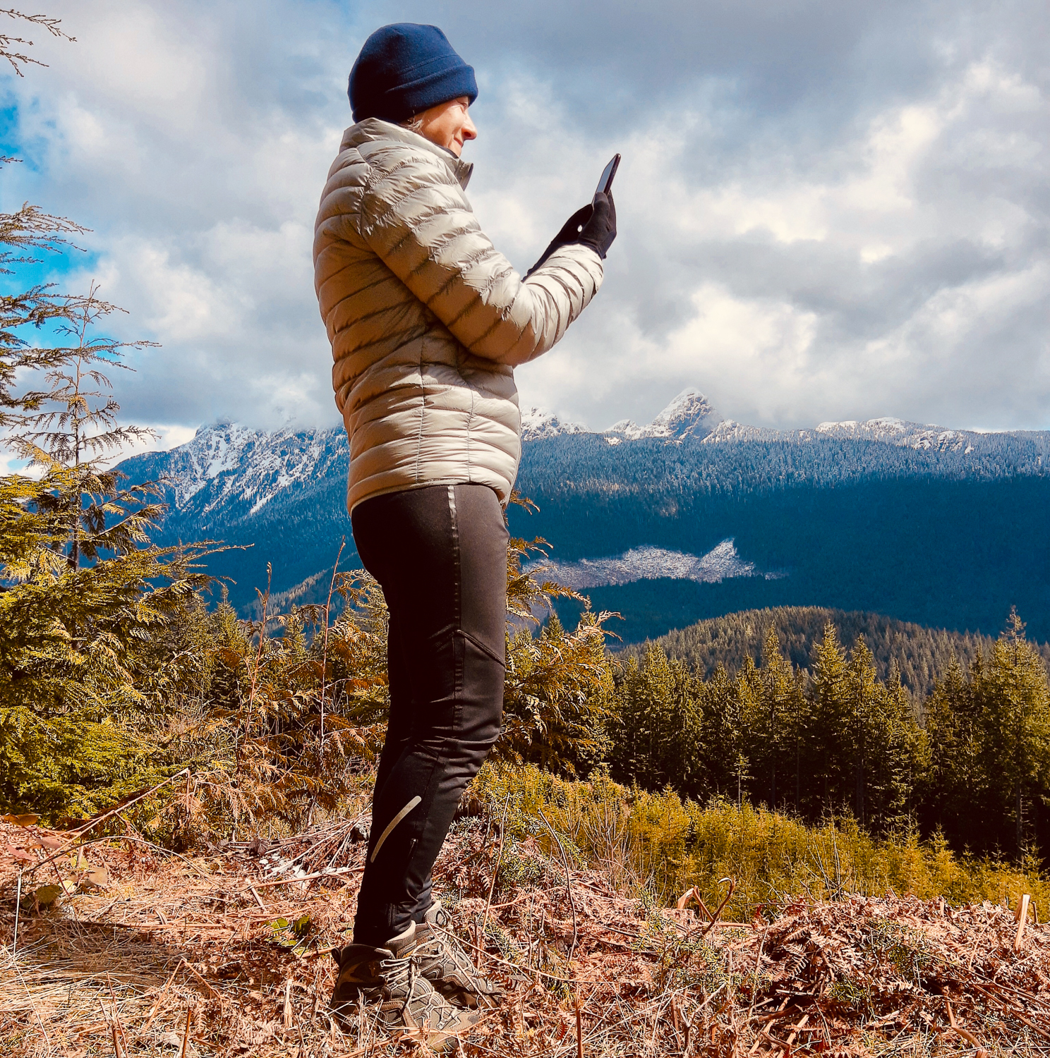
Many of us don’t leave details of our trips to the backcountry with trusted contacts: Where are we going? When do we plan to return home? Who are we with? What colour and type of outdoor gear will we be wearing? What safety gear have we got with us that is essential for the kind of adventure we’re on? Even if you have a satellite communicator device to act as a safety net, a trip plan is critical should search and rescue need to locate you as satellite communicators can fail and may not work where a direct line of sight to the satellites is not possible.
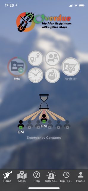
The Overdue trip planning and safety app is a new kid on the block, the creation of Canadian cartographer and search and rescue volunteer Steve Chapman, offering a safety net for adventurers, no matter where they are in the world. It’s as simple as creating a trip, pressing a button to register the plan with the app server, going on your trip, then checking in when the app messages you. It can be used by many types of adventurers, including overlanders, day and overnight hikers, paddlers, alpine skiers, cavers, hunters and anglers, mountaineers, trail runners, moto riders, ATV riders, windsurfers, and even those taking on-highway trips.
Chapman has over 40 years of mountain experience and 7 years of volunteer work for Coquitlam Search and Rescue in British Columbia, Canada, and is a strong advocate for outdoor safety. His climbing resume includes peaks in the Himalayas, Alps, Denali, Scandinavia, UK, and, more recently, British Columbia. A fall that resulted in a serious head injury while climbing in the Alps, volunteer work with Coquitlam Search and Rescue, and a passion for cartography inspired the creation of the safety app.
I tested Overdue over a couple of months and found it well-designed and easy to use. Flashing icons guide the user through the initial setup of their profile, emergency contacts, and the trip plan, and there are company YouTube videos to help further.
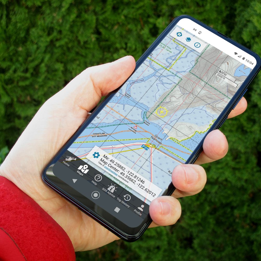
Overdue works on iPhone and Android and is available worldwide in the App Store and Google Play store. It’s subscription-based at $30 CAD a year, or $4 CAD for three months if you only want to use it for part of the year. It has in-app purchases for some Backroads Mapbooks, Ordnance Survey (UK), and other maps, and comes with a growing number of base layers. Maps can be used offline, and there are navigation tools.
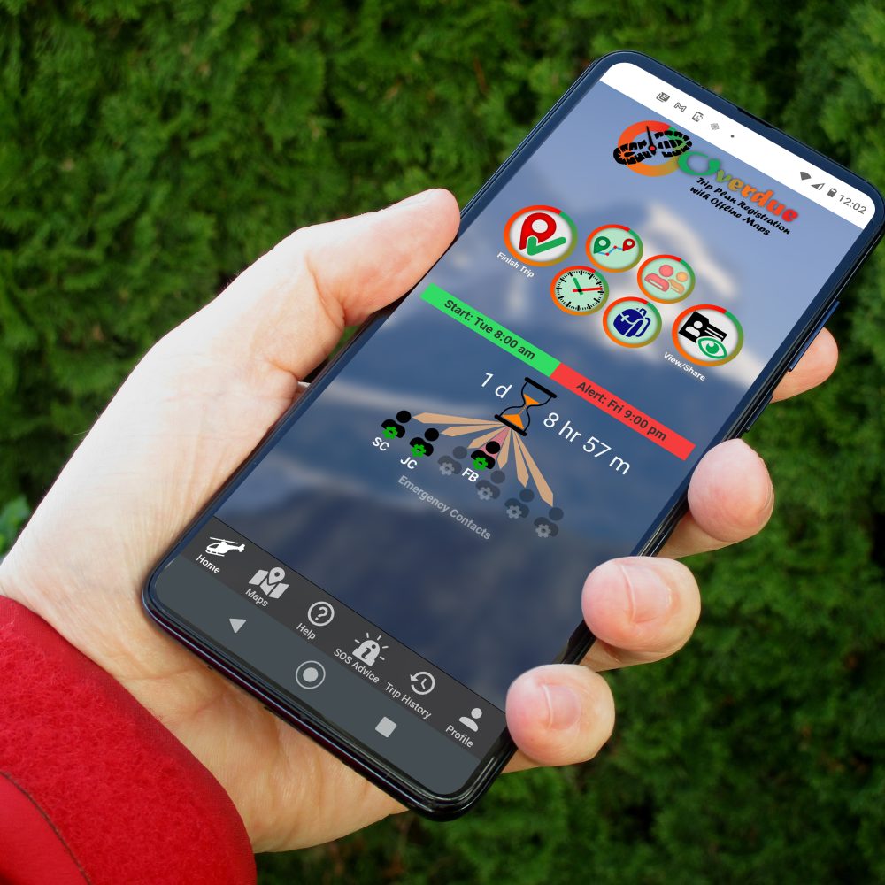
To use the app, set up your trip plan on your phone and tap a button to register it with the Overdue server. If you don’t check in 15 minutes before the time you listed as your finish time, the server will SMS message and ring your phone twice to ask you to do so. At that point, if you have cell service, you can check in, raise an alert, or request more time. If you don’t check in at the end of that 15-minute window, you become “overdue.”
When you are overdue, the server will send an SMS message and/or email to the first contact on the list (you can enter one primary and six others). The primary person, if available, can say whether they can handle the request. If they say yes, they are sent a trip plan link and an access code to unlock more details about you. Then they can decide if you are okay or if there’s a problem. If they are worried, they can call emergency services, and the trip plan link can be forwarded to search and rescue. If your primary doesn’t respond, the same process repeats with the secondary ones. Choose persons who have smartphones and are likely to be in cell range whilst you are adventuring. Let them know about your trip prior to leaving, and add as many secondary contacts to your list as possible.
If you are out of cell range during your trip, tracks will not be recorded and uploaded to the Overdue server. However, if you have a brief bit of cell coverage anywhere along the trip, the app will upload data to the server. This is helpful if you plan your route incorrectly or decide to explore a side trail; it allows for changing plans “on the fly.” Search and rescue can use your trip plan and tracks to determine an accurate “last known position” to begin their operation.
Here’s how the trip plan setup works:
With the app on your phone, follow the blinking icons to complete each step.
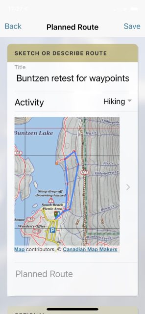
First, describe your route in words or sketch it on the map, placing crosshairs over the route and tapping to make waypoints. For short trips, it’s easy to sketch on a map within the app, setting waypoints. For long trips, save time by importing .gpx and .kml track files to the app after drawing them in Google Maps or Google Earth. You can also reuse tracks and trip plans, though you’ll need to update some other information about your new trip, for example, who is with you and the safety essentials you are taking. And if you want to share your tracks after you return from your trip, you can export them from the history tab and send them to friends by email.
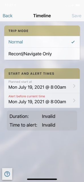
Next, enter a trip day selfie and start location photo. If you forget to do this, your profile photo will be used instead. Decide whether to make the trip plan registrable with the Overdue server or use the app to record tracks and navigate only. It is wisest to register the trip since it will record tracks anyway, and you then have a safety net; make sure to add start and finishing times.
Add the names and contact info of everyone travelling in your group, unless you are going solo.
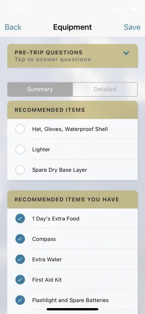
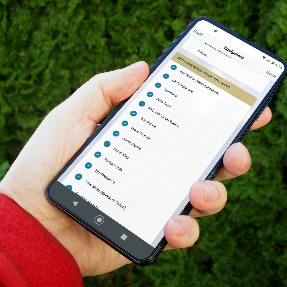
Go to the next blinking icon that guides you through what you should carry for the kind of trip you’ve chosen. You can check off boxes for optional items like insect netting, bear spray, handheld GPS, and more.
The next blinking item is to register the trip with the server, after which you will be sent a link to the Cloud-based trip plan. This will also be sent to the emergency contacts you have “opted-in” to receive your trip plans at the time of registration. Otherwise, contacts will only receive your trip plan if you become overdue.
Setup of the Overdue App is now complete. Onwards to a safer adventure.
$30 CAD/year, or $4 CAD/three months | overdue.info
Our No Compromise Clause: We carefully screen all contributors to ensure they are independent and impartial. We never have and never will accept advertorial, and we do not allow advertising to influence our product or destination reviews.
Read: A Touch of Camel Trophy: Towing a Land Rover Through Canada’s Whipsaw Trail by Glenna Barron
A Touch Of Camel Trophy: Towing a Land Rover Through Canada’s Whipsaw Trail