

To honor the 20-year anniversary of Overland Journal, we are revisiting special heritage content in the upcoming 100th issue of the magazine. Originally published in Overland Journal’s Gear 2011 issue, this article is part of that celebration.
“On that?”
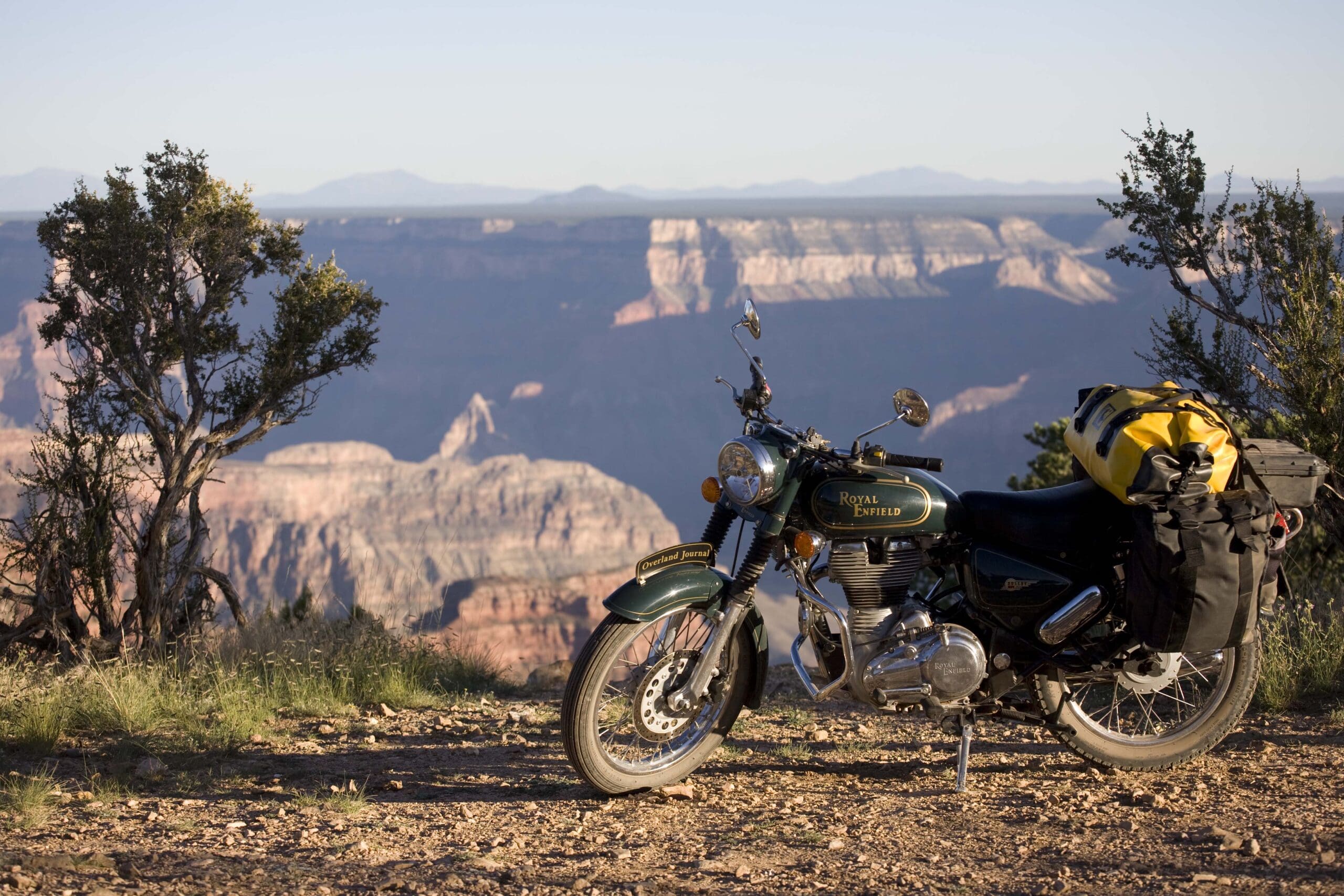
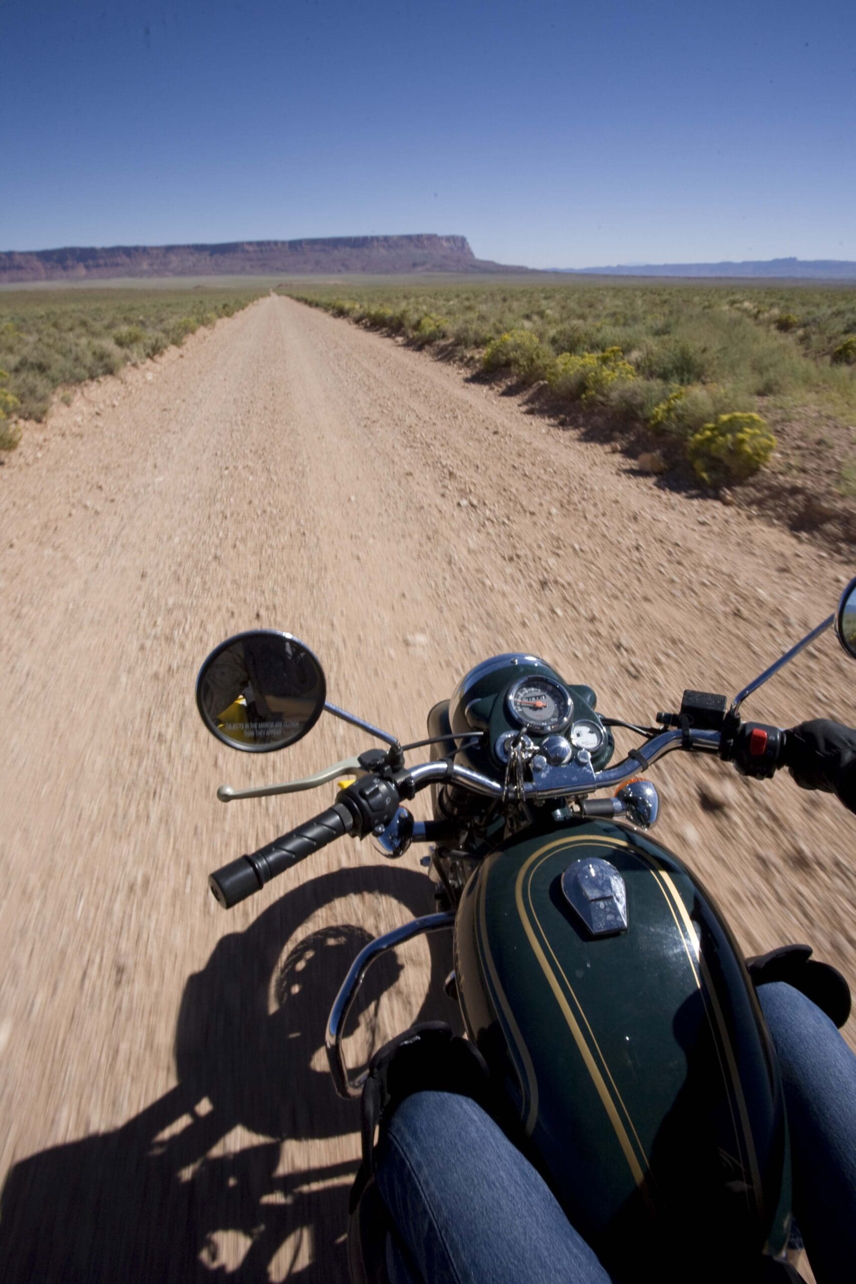
The ranger in the North Rim Ranger Station stopped filling in my backcountry camping permit and gestured out the window with his pen, where the green and gold Royal Enfield Bullet 500 sat, dusty, loaded down with panniers and duffel bags, waiting to tackle the 17-mile trail to Point Sublime.
“You do know it’s a four-wheel-drive route?”
I assured him I did, and explained where I’d already been and that I was headed to several remote roads along the Grand Canyon’s North Rim.
One eyebrow arched toward his hairline, and he said, “Well . . . you obviously know what you’re doing.” He was gaining points rapidly.
“But . . . isn’t that a Harley or something?” He was losing points rapidly.
I was here to continue my experiment to determine whether or not Royal Enfield’s slightly modernized, fuel-injected, developed-world-friendly Bullet motorcycle could handle the same kinds of conditions its much more basic cousins have for decades in India and various outlying Himalayan countries. Compared to, say, Gaurav Jani’s subcontinental excursions on a massively overloaded, carbureted 350 cc Bullet at elevations up to 18,000 feet, a vacation ride around the North Rim of the Grand Canyon at barely 9,000 feet was a walk in the park. Nevertheless, the EFI Bullet was an unknown quantity for this sort of thing.
Also an unknown quantity to the vast majority of visitors to the Grand Canyon is the fact that 99% of those visitors cluster in tightly defined and carefully Disneyfied areas of the park. The South Rim’s Grand Canyon Village might be overrun with tourists in minivans who stop, videotape, yell at the kids, buy a jackalope postcard and an officially licensed snow globe, and leave just as the next 10 minivans pull in, but there are other spots right on the rim where you’re alone with creation, where the silence from the depths rises up and surrounds you like a palpable thing, where the immensity of distance and time confirms that the Grand Canyon takes second place to no natural wonder on earth.
My first thought when contemplating the trip was to do a complete circumnavigation of Grand Canyon National Park. But after perusing map and memory and doing some research, I concluded there was little reason for someone seeking solitude to bother with the South Rim. Not so much because of the heavily developed complex extending left and right of Grand Canyon Village; rather because most of the land to the west belongs to the Hualapai and Havasupai Indians and is unamenable to casual exploration and backcountry camping. I did—briefly—consider riding to the (in)famous Skywalk, the transparent walkway built by the Hualapai tribe that arches out over the abyss, just so I could say, “Done that.” However, investigation revealed that the combination of the reservation entrance fee and Skywalk ticket would total over $75, after which I’d be prohibited from taking photos while on the bridge. Say what? The clincher was intelligence from a friend revealing that a good percentage of Skywalk clientele comprises Las Vegas tourists out on day flights between coffee-and-cigarette slot-machine breakfasts and Elvis-impersonator dinner shows.
No thanks.
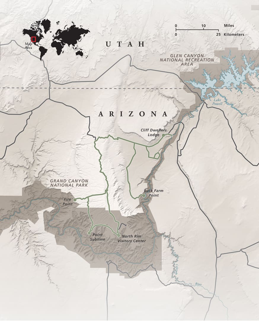
Instead, I decided to do a sweep of the North Rim, starting in the east along Marble Canyon, the gorge downstream from Glen Canyon Dam and upstream from the park. I’d explored here before in my Land Cruiser, and Roseann and I had hiked down an unnamed slot canyon in an attempt to reach the river, but I was unfamiliar with the area from the perspective of a motorcycle seat, which always makes a familiar road seem like a new one.
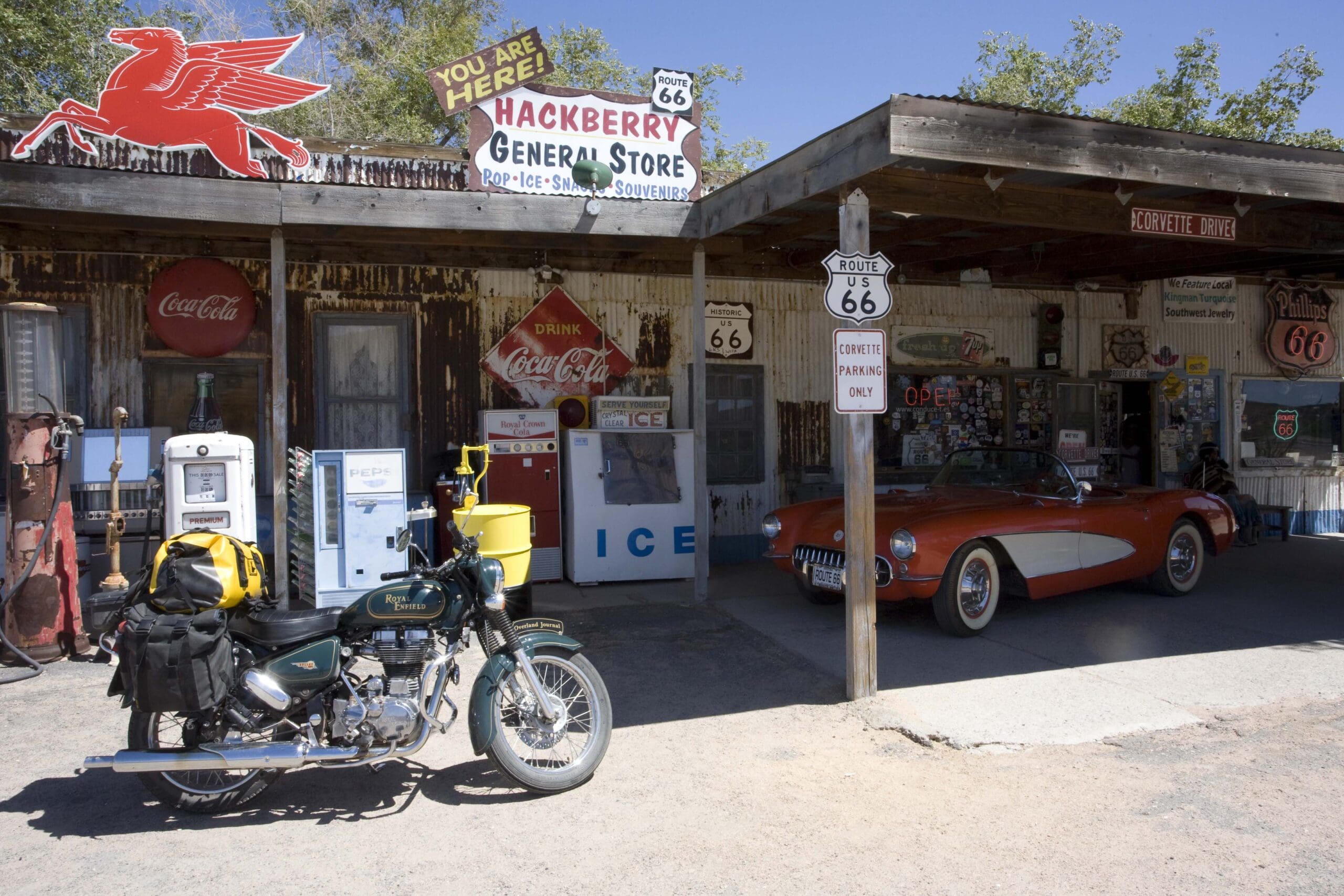
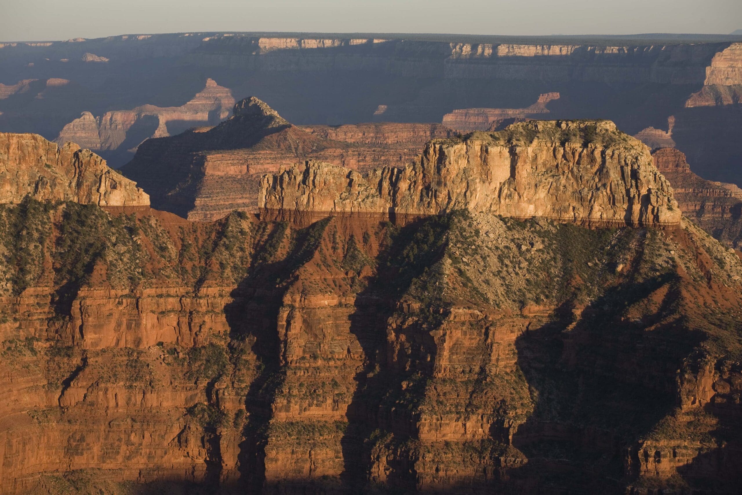
Those who’ve learned just a bit about the Grand Canyon’s geologic history usually have it upside down. We tend to think of the river as cutting down through those thousands of feet of rock layers, which of course it did. However, what really happened was that the rock—in fact, the entire Colorado Plateau, which sits on the North American Plate’s little section of the earth’s crust—rose around the river, pushed upward as the heavier Pacific Plate forced its way under its North American neighbor. As the land around it rose inch by inch, the river cut its way down inch by inch, through all the ages of the earth as laid bare by the banded formations at which we now gasp: the top layer of Kaibab Limestone, a mere 250 million years old and the former bed of a shallow sea littered with fossils of coral, crinoids, sharks, and sponges; down through the Toroweap Formation; Coconino Sandstone; Hermit Shale; the Supai Group (we’re back to 300 million years ago now); then Redwall Limestone; Mauv Limestone; Bright Angel Shale and Tapeats Sandstone (back to a half-billion years or so); and finally to the river-level Vishnu Schist, a 1.7-billion-year-old layer of pressure-cooked metamorphic rock formed when visiting alien biologists would have needed microscopes to see our most advanced ancestors.
But there’s another facet to the upside-down bit about the canyon’s history. Look closely at a map of the Grand Canyon, and you might notice something odd: many of the Colorado River’s tributaries (especially in the Marble Canyon region) seem to hit the main channel at the wrong angle, pointing upstream rather than down, so that their outflow has to take a sharp turn to merge with the Colorado’s path toward the Sea of Cortez. Only within the last few decades did geologists smack their foreheads and figure out the reason for this: Up to around five million years ago or thereabouts, the river running across what is now northern Arizona actually flowed in the opposite direction, into present-day Utah and out into the Pacific Ocean. At some point around then, another river cutting its way backward into the San Andreas Fault captured the ancestral Colorado, and reversed its course. (Imagine what a sped-up video of that would look like.) Geologists now speculate that the Colorado, and other rivers in the region, might in fact have reversed their courses numerous times over the eons as their underlying tectonic plates heaved and shifted, and mountain ranges rose and fell. (Another Grand Canyon theory involves an enormous inland lake called Bidahochi, which might have captured the river until the drainage was cut through. The astonishing thing is not that there’s still some speculation going on, but that geologists can figure out anything of what was happening here millions of years ago.)
After checking from the Navajo Bridge on Highway 89 to make sure the Colorado was running in the direction I’ve come to expect, I pulled in at Cliff Dwellers Lodge, built in the shadow of the second-most spectacular natural wonder in this area: the Vermilion Cliffs—the name of which describes them with such utter succinctness that attempts at literary embroidery would be superfluous.
Cliff Dwellers began as a tiny trading post in 1920, expanded to a lodge in the 1940s, and has been in business ever since. It’s now owned by Terry and Wendy Gunn, who also run the Lee’s Ferry Anglers guide service—and just happen to be Overland Journal subscribers. The lodge still retains the original block of guest rooms, in addition to a more modern addition. Take your pick—but after seeing photos from the 1950s of the old rooms looking exactly the way they still do, I suspect you’ll opt for the more rustic wing. In either case, you’ll want to set aside all your expectations of what kind of food to expect from a lodge dining room with an essentially captive clientele, and book a table for dinner. If there’s a restaurant farther away from anything else that serves better cuisine, I haven’t found it.
The next morning I loaded up the Andy Strapz panniers and Wolfman duffel on the Royal Enfield, and picked at random one of the dirt roads heading south from the highway that my map showed wandering across the plateau before ending abruptly at a dense cluster of elevation contour lines.
House Rock Valley, between the Vermilion Cliffs and the Marble Canyon gorge, is country of more sky than earth. The land is so flat that one’s view from a motorcycle, 5 feet off the ground, comprises just three elements: a long triangle of perspectively retreating road, two flanking triangles of gray green sage, and an enormous blue canopy of atmosphere, God’s fisheye lens inverted over one’s head. It’s a huge and lung-expanding tableau that could have been created for no other reason than to lure a motorcycle toward the horizon; with every mile you can feel your blood pressure dropping and endorphin level soaring.
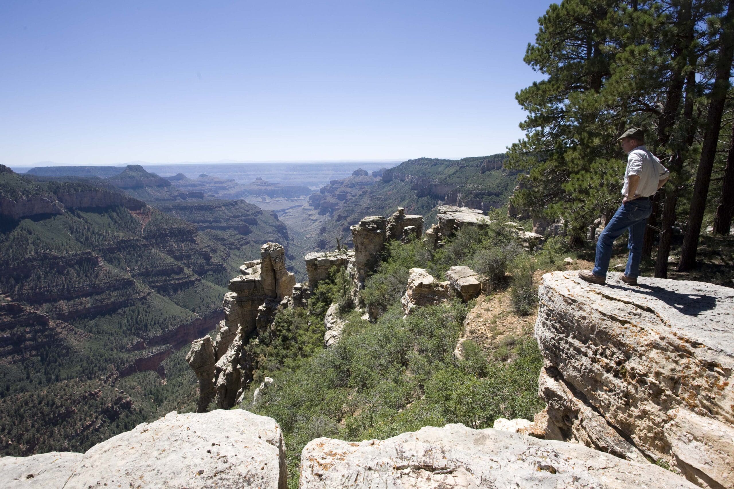
Soon the road I had chosen—lacking a name or even a land-agency number on my map—began to twist and turn for no discernible reason, as though the builder had simply decided it was time to liven things up with the bulldozer. The track narrowed; the sage now took up most of the earthly view. Then there was a faint horizontal break in the vegetation, a couple of boulders dropped haphazardly right in the middle of the trail—what’s up with that?—and in the space of a squeeze on the front brake and a foot-tap on the rear, the track disappeared at a stone lip, and I was looking at the Colorado River a fifth of a mile straight down.
If you’ve ever experienced the Grand Canyon via ‘normal’ channels—a paved drive to a big parking lot, a walk past or through gift shops and visitors’ centers, and a final stroll across a flagstone veranda to a walled and guard-railed overlook—you were no doubt awed and humbled. The canyon defies the banality of our puny capitalistic endeavors on its margins. But the trails around Marble Canyon catapult you into a new universe of thrill. There are no interpretive kiosks, no gift shops, no other humans to blunt the effect—and it’s as if the genetic predecessors of lawyers willing to sue public land agencies over the stupidity of public land visitors had died off with the trilobites in the Kaibab Limestone. It’s entirely up to you to keep in mind there’s a large piece of the landscape nearby that is simply missing. Lose your concentration and gaze around for too long on some of these trails, and you could find yourself riding straight over the edge, facing a very severe test of your bike’s suspension about 1,000 feet down. Pulling up short and walking to the lip doesn’t induce wonder: hyperventilation and stomach-twisting vertigo are more likely.
And it doesn’t dim with repetition. I spent the day skirting the edge of the canyon on a web of roads and trails, and each encounter with the rim was as thrilling as the last. At one I watched a pair of ravens for a half hour as they repeatedly strafed the edge from 6 or 7 feet above the sage and soared out over the abyss, only to circle back and do it again and again, just for fun (if you don’t think ravens understand the concept of “fun,” just go to YouTube and search for “ravens sliding in snow”). At another I spotted a brace of rafts in the river, each a millimeter long, and watched as they bounced down a mild rapid before floating out of sight.
Night caught me away from the rim, so I set up camp in the middle of the vast expanse of sage, with that fish-eye lens overhead now cascading stars, the giant desert-appropriate constellation of Scorpius high in the south. A breeze played through the shrubs, and quite naturally the old Dick Charles song popped into my head:
I love to lie and listen to the music
When the wind is strummin’ a sagebrush guitar
While over yonder hill the moon is risin’
It always finds me wishin’ on a star
The next morning I headed west on 89, then south on the dirt FS 8910—also known as Buffalo Ranch Road for the small herd of bison transplanted to the area decades ago. A few miles later I passed the place I would live in preference to any other spot on earth: Kane Ranch. I won’t describe it; you just have to go see if you agree with me. Now owned by the Grand Canyon Trust, I wait for the day the little stone cabin will be open to visitors, so I can stand on the porch and look out over the entire House Rock Valley toward the Vermilion Cliffs to the north and the Echo Cliffs far off to the east, and at least pretend I live there.
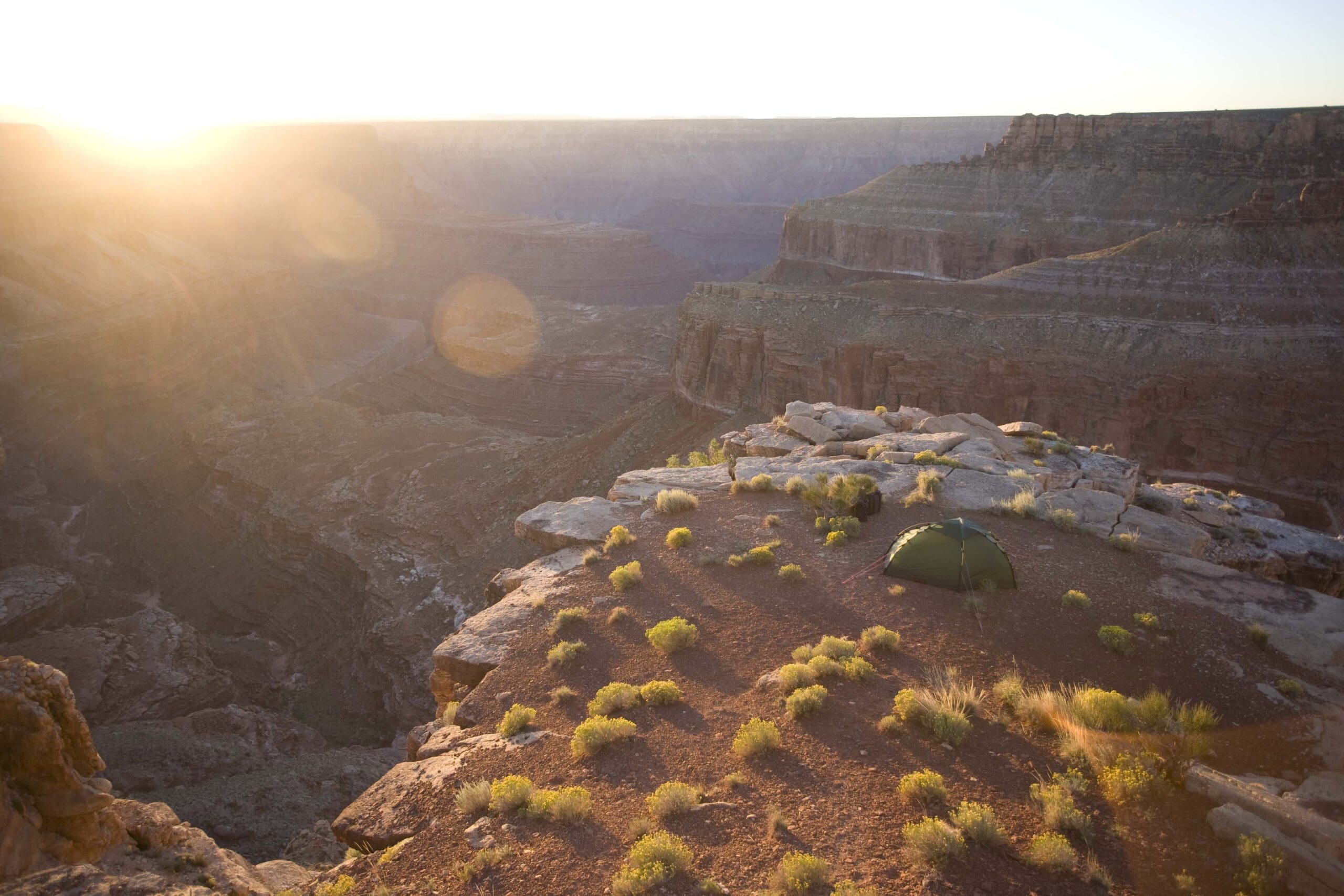
Twenty miles or so south, I turned left toward the gorge and parked the bike at a clearing south of Buck Farm Point. The river here carved out a series of giant loops, and numerous ravines and promontories overlap the view, with just glimpses here and there of coruscating green water still carving its patient way down through the rock. At one spot, I found I could semi-slide down a cleft to a little flat outcropping surrounded on three sides by nothing—an inspiring campsite for anyone not prone to sleepwalking. At sunset, some sort of differential-heating-canyon-channeling effect spawned an intermittent wind that would moan away downslope like a lost soul, then come roaring back and arch over my little promontory with a banshee wail and flatten the burro weed. In defense, I pitched the Hilleberg Soulo tent I’d brought along, and was grateful for its sturdy three-pole design and spiderweb of tie-out points. Dinner comprised a couple of quesadillas warmed on a stove inside the vestibule, and a dozen or so Pepperidge Farm cookies. Perfect. Despite the wailing banshees, I slept dreamlessly until …
Well whatta ya know, it’s mornin’ already
There’s a dawnin’, so silver and pale
It’s time to climb into my saddle
And ride the Navajo Trail
I was beginning to think Dick Charles might have toured the North Rim by motorcycle.
Turning the bike back westward aimed me at the 3,000-foot escarpment climbing to the immense Kaibab Plateau, which puts the North Rim visitor’s center a half-mile higher than the South Rim’s, just 10 airline miles away but separated by a chasm now a mile deep.
We can only surmise the reaction of the first human to see the Grand Canyon, sometime around 12,000 years ago, as he was fulfilling his generation’s role in mankind’s great southward diaspora from the Bering Land Bridge to Tierra del Fuego. Was he as astounded as modern travelers, or did he look over the edge with disgust, arms akimbo, and say to his companions, “We’ll never colonize South America at this rate!”
We do know that humans have lived in and around the Grand Canyon for at least 4,000 years, as shown by the carbon-dated twig figurines left in caves beneath the rim by the Desert Culture. The figurines are graceful and immediately recognizable representations of mule deer and bighorn sheep, formed from single split willow or sumac sticks folded origami-like into dolls a few inches long. First discovered (astonishingly well-preserved by the dry climate) by Civilian Conservation Corps workers building trails in the 1930s, over 300 have since been recorded—in 1967, river runners found four near-perfect examples in Stanton Cave, and a subsequent dig produced 74. Some figurines appear to have been ritualistic in nature (although archaeologists always seem to attach ritualistic import to these things); others were clearly no more than toys, as evidenced by their casual disposal in middens. Some have little spear-like twigs stuck through the chest area—a good-luck hunting charm, or just boys playing before they had magnifying glasses with which to fry ants?
The early, so-called ‘Basketmaker’ Ancient Pueblo apparently grew out of the Desert Culture, and began to erect mud-and-stone dwellings around 800 CE, by which time they were also farming maize. Within the borders of Grand Canyon National Park, there are over 2,000 known Ancestral Pueblo sites. However, around 1300, what we believe was a severe drought forced the Puebloans out permanently. In 1540, García López de Cárdenas, one of Francisco Coronado’s officers, became the first European to see the Grand Canyon, although he’d rather been hoping for the Seven Cities of Cibola and their rumored heaps of gold instead. The sighting certainly failed to ignite canyon fever in the Spanish, as it was another 200 years before two priests became the second European party to reach the rim.
Trappers probably skirted the canyon starting in the 1820s, and in 1858 Jacob Hamblin, on a mission from Brigham Young, discovered Lee’s Ferry, one of only two relatively convenient crossing points for Mormon pioneers on the way to or from Utah. In 1869 and 1871, John Wesley Powell made his famous boat trips through the Grand Canyon; the second one resulted in a huge collection of photographs, artifacts, and notes about the canyon’s flora, fauna, and geology.
It shouldn’t be considered flippant to be relieved that one of the next canyon explorers, Frank Brown, drowned in 1889 shortly after his party set out in Marble Canyon in six boats. Brown’s goal was to survey a route for a river-level railroad he envisioned for carrying coal from Colorado all the way to a port on the Sea of Cortez.
Tourism to the Grand Canyon exploded in 1901 when a Santa Fe Railroad line was built from near Flagstaff, Arizona, to the South Rim (you can take this rejuvenated ride today, and it’s a lovely trip if you’re willing to laugh along with the slightly corny fake holdup halfway through the journey). Just one year after the railroad, the first minivan, I mean automobile, reached Grand Canyon Village—and by some reckoning it’s been downhill ever since.
But not where I was this morning. My eye had caught a road on my map, labeled FS 220, that appeared to ascend more or less straight up the escarpment to the Kaibab Plateau along the intriguingly named Tater Ridge, at the top of which it joined the paved North Rim Parkway. Successfully climbing that would eliminate backtracking to Highway 89, and take me through country I hadn’t seen.
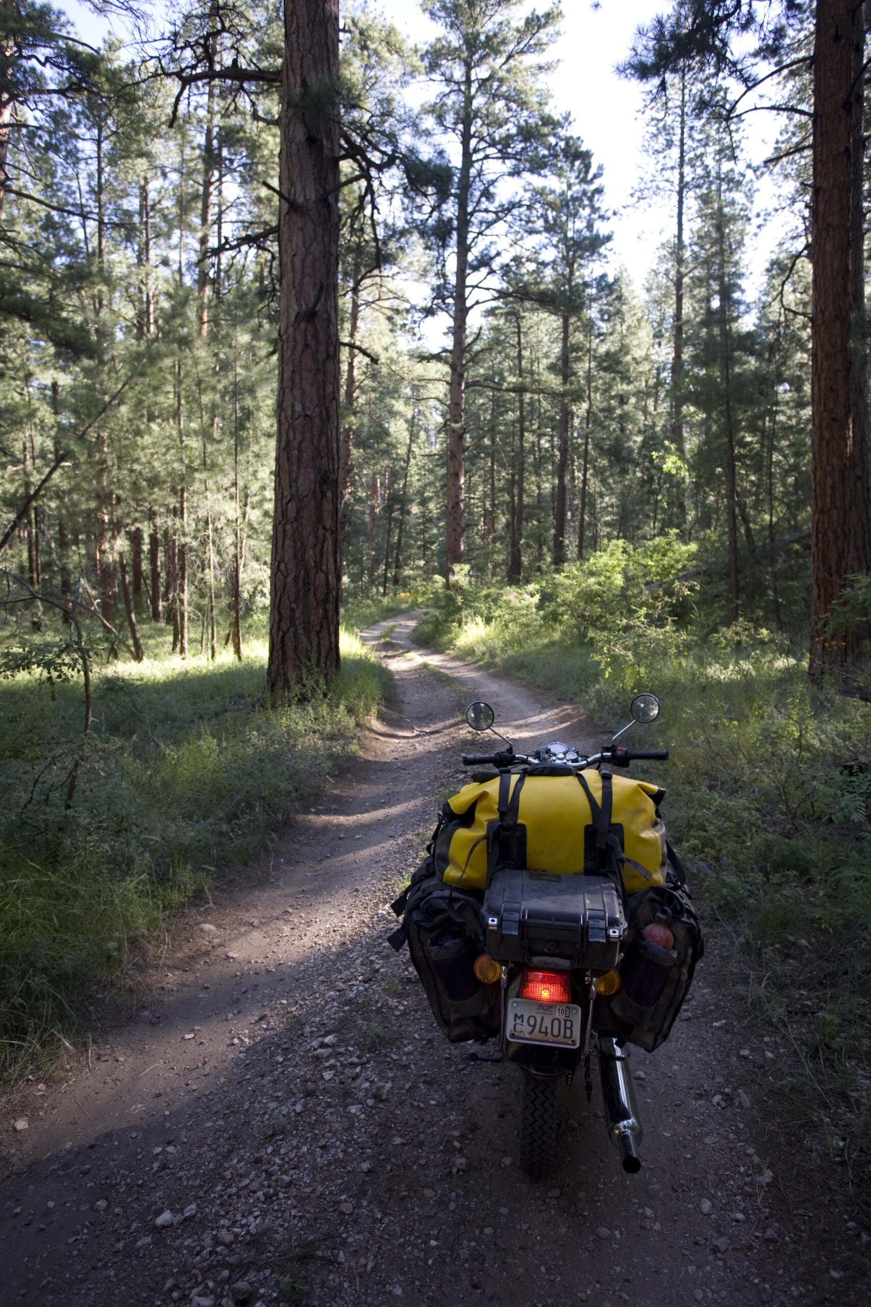
I turned off where the road followed the edge of the Saddle Mountain Wilderness Area, and for a time had an easy go. Then the trail narrowed and began a series of steep switchbacks—not a problem in itself, except the surface also began to deteriorate quickly. Dirt and gravel were increasingly replaced by ruts edged with jagged rocks impossible to avoid completely. Unfortunately, the Royal Enfield was still on its original equipment Avon street tires—a mountain-bike-width 3.5 x 19 in the rear. I had spare tubes and a patch kit, but as I maneuvered the bike through washouts and balanced it along ridges, whatever dirt had been in the road disappeared more or less completely, leaving only the jagged rocks. After five or six wince-inducing sidewall pinches against the substrate, it became apparent that spare tubes would do me little good—much more of this would simply shred the tires. So, reluctantly, I turned around.
Since I was backtracking anyway, I took a short detour to the House Rock Wildlife Area headquarters and had a chat with the biologist in residence there, who was entranced with the Royal Enfield and told me she was the past owner of a BMW R80 G/S, on which she had explored much of northern Arizona. Then she said, “By the way, whatever you do, don’t try to ride up FS 220 to the plateau. It’s all torn up. My boyfriend drove up there in his Jeep last month and blew out two tires.”
Good advice.
The ride up the winding paved road to the plateau provided its own joy. I hustled the Bullet along at a brisk pace which, admittedly, any 18-year-old on a CBR600 would have found laughable—but “brisk” is a relative, rather than absolute, term, so I couldn’t have cared less. Plus, I actually passed a group of a half-dozen Harleys, their riders attired in headscarves, jeans, Frye Engineer boots, and suspiciously glossy studded leather jackets, at least several of which, I strongly suspected, concealed glossy iPhone 4s. Sonny Barger would have traded his Sportster for a Honda Cub had he foreseen the future of motorcycle “gangs.”
At Jacob Lake I spontaneously decided a night in a cabin would be fun, and checked into the Jacob Lake Inn, a family-owned institution on the North Rim since 1923. Although a two-story hotel addition blunts the romance of the compound, the separate cabins retain the proper woodsy feel. The last time I’d stayed here was with Roseann, just before a cross-country skiing trip to the rim during which our guide got us hopelessly lost in a blizzard on the way to Cape Royal, and we found our way back to camp only by skirting the edge of the gorge in 20-foot visibility.
Next morning in the restaurant, I passed the Harley gang having breakfast. One of them was talking on an iPhone—but, to be honest, I couldn’t tell if it was a 4. Later I found them clustered around the Royal Enfield, scratching their headscarves. “What year is that?” one of them asked (a common question). They were amazed to hear it was current production.
A couple of hours later, backcountry camping permit in hand, I was on that ‘four-wheel-drive’ trail to Point Sublime. To be honest, it wasn’t a very difficult ride—again, my chief worry was the street tires with their shallow 1970s-replica tread. But the advantages of the Royal Enfield’s low seat height were clear in this situation, since as I picked my way slowly around rocks and across washouts it was easy to dab a boot if needed to maintain balance, rather than having to either ride through it or fall over, as would have been the case had I been on a conventional adventure motorcycle with a nose-bleed seat height. Yes, there were a couple of spots where the Bullet’s low and ridiculously long catalyst-equipped exhaust pipe whanged painfully on rocks, but no damage came of it. Otherwise, the single-cylinder 500 cc engine with its modest horsepower but effortless torque was happy to chug up loose grades at what felt like about 200 rpm. I found myself wondering, not for the last time, what a simple high pipe and a set of knobbies would do to the Bullet’s backroad performance. After all, 40 years ago, a British street bike with a high pipe and a set of knobbies was an adventure motorcycle.
Point Sublime (another self-encapsulating name) is not as unpeopled as other North Rim overlooks—there’s actually an easier route to access it from north of the national park boundary, and the campsite boasts tables and a clean and odorless solar-powered composting bathroom—but it’s right out in the full-on, 10-mile-wide, one-mile-deep Grand Canyon, its splendor only slightly blunted by the faint clatter of helicopters shuttling between the North and South Rim tourist centers 10 miles to the east. Only two other vehicles showed up the day I got there—a nicely augmented Jeep Wrangler and a Toyota Tacoma—and they left before sunset, so I had the place to myself all night.
By now, I had convinced myself the Royal Enfield was up to the task of serving as a unique, mild-mannered adventure motorcycle, capable of negotiating moderate trails while attaining 75 mpg on two-lane highways. I still had several places I wanted to reach on my way across the North Rim—Swamp Point, Fire Point, and Jumpup Point—but I’d already met my goals, and was feeling delighted the next morning as I loaded up the bike once more. The rest of my exploration of the North Rim’s backcountry would be pure fun.
I heard the sound of an engine, and watched as a Toyota RAV4 pulled into the cul-de-sac at the end of the trail. I walked over to say hi to the couple inside, who looked a bit spooked. “We came out the Point Sublime Trail,” the fellow said, “and weren’t sure we’d make it. We’re not really used to this sort of thing.” I mentioned the easier road out, to the north, and showed them the route on their map, at which they visibly relaxed. Then the fellow noticed the motorcycle parked some way off.
He said, “Did you come out here on that?”
I allowed as to how I had.
“But . . . isn’t that a Harley or something?”
royalenfield.com, 800-201-7472
cliffdwellerslodge.com, 800-962-9755
nps.gov/grca, 928-638-7888
jacoblake.com, 928-643-7232
Cartography by David Medeiros (mapbliss.com)
Our No Compromise Clause: We do not accept advertorial content or allow advertising to influence our coverage, and our contributors are guaranteed editorial independence. Overland Collective may earn a small commission from affiliate links included in this article. We appreciate your support.
