
The Expedition Journal is a new series for 2016 featuring some of the stories that inspire us most, those found right here on the forum. Like any true journal entry, these will be the raw text pulled straight from the writer with no changes or editing by our team. Some may be short, some long, but all will be honest and unfiltered tales from the trail. We hope you enjoy reading about these trips as much as we have, and continue to submit and share your own adventures with others.
– Chris Cordes
The Owyhee Desert
I recently spent ten days with a few friends in the Owyhee Desert of Nevada, Idaho, and Oregon, scouting the first six sections of a larger route that I’ve been working on for several years now.
The plan called for the larger Utah Rovers crew to meet up in Salt Lake and drive northwest but as the date approached, the crowd dwindled. It’s hard to take ten days away from family and work and so–in the end–we only had a quorum of amigos for a night of camping and an afternoon of driving. The other nine days were a minimalist affair–just Peter and I driving as a duo through what one of the least populated and most isolated areas of the Lower 48.
[EDITOR’S NOTE: We’re sorry, this image has been removed.]
The major streams and rivers of the Owyhee desert. Our route took us across most of these.
The Approach
After eleven years of doing these trips, I finally feel like my preparation is becoming systematic. There were no late nights of furious last-minute packing this year. I had my Pelicans planned and packed weeks ahead of time. The week before departure was relaxed and spent making a few tweaks to the 110.
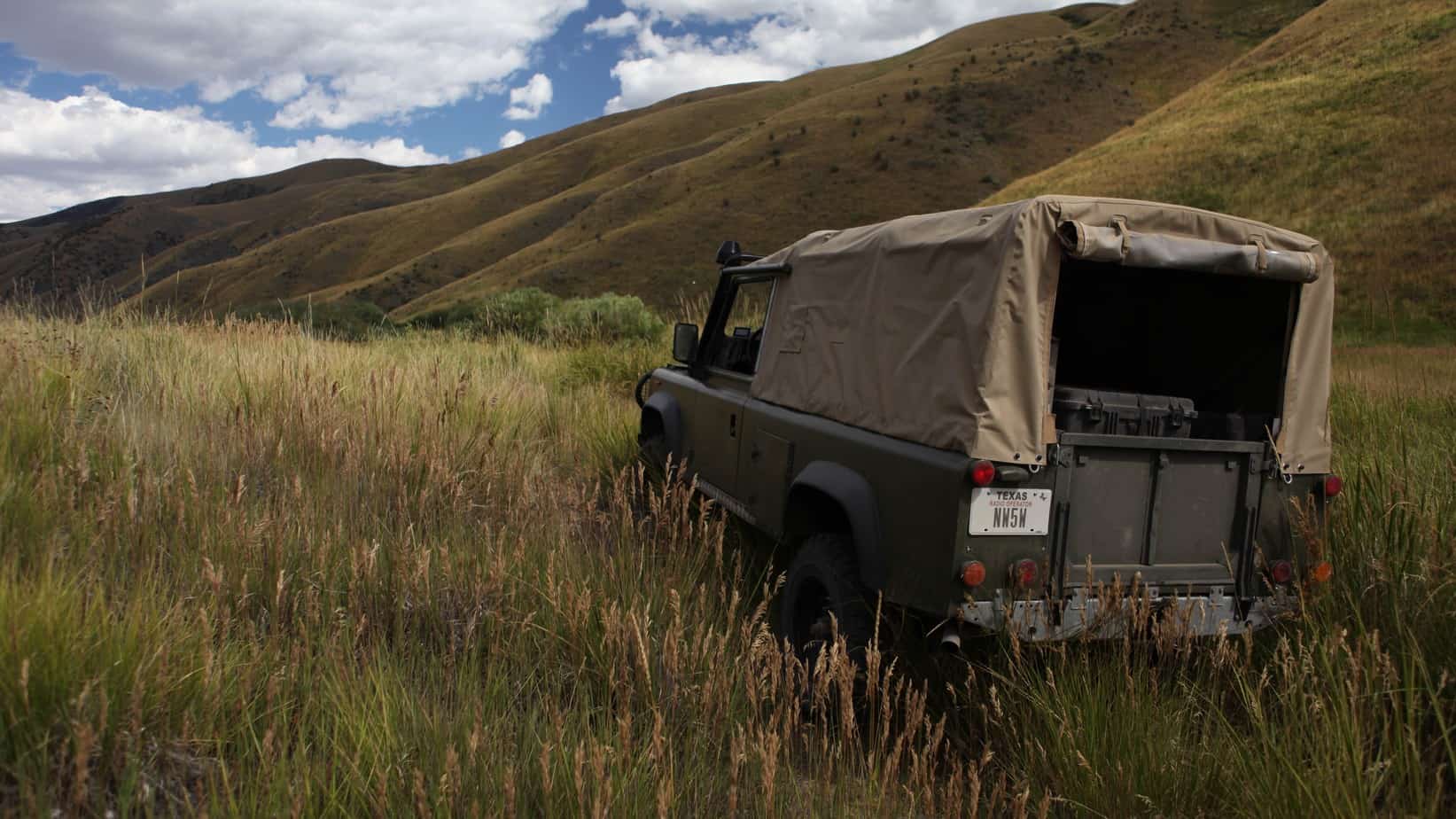
I had sworn never to **** with the factory suspension of this truck but adding the 300Tdi, Husky 10 and Brownchurch onto my old, saggy front springs left my front tires with only a few inches of clearance beneath the fender wells. My shocks were also blown so I decided to replace them with some new OME Nitrochargers and decided to swap springs while I was in there. Following Jack’s lead, I went with OME 755s in the rear and 766s in the front. My initial impression of this choice was not good. These springs ride like total crap when unladen on the road–the truck is nearly undriveable as such. Load the truck down with six heavy Pelicans, a fridge, and four full fuel cans, however, and it’s a completely different experience. The ride is still mildly harsh in the really rough stuff but the truck sits level when loaded and remains stable on uneven double-track at speed. I like it.
I also ditched the goofy, insufferably hot fiberglass top and installed a MOD-spec PVC Wolf top from Exmoor. It took me quite some time to chase down the new top because mine is a Tithonus 110 and Exmoor believed that the Wolf top was not compatible with my roll cage, which differs slightly from that of the Wolf’s. Brian Hall and I suspected that the differences could be overcome and I decided to take a $1,000 bet and airfreight the Exmoor top from the UK. The modifications turned out to be trivial and in short order, my 110 had a new summer get-up:
[EDITOR’S NOTE: We’re sorry, this image has been removed.]
[EDITOR’S NOTE: We’re sorry, this image has been removed.]
With the truck sorted, I finally got around to finishing the IWD furniture for my SAM7R and got them installed in time to bring the rifle along. It’s a tung oil finish on American walnut. Hardly traditional but neither is the milled SAM7R.
The drive down to the desert was improvisational–Peter and I weren’t sure how quickly we’d be going so we decided that he would head north and I would head south and we’d meet someplace in the middle. I avoid interstates so I left pavement as quickly as possible, taking a dirt road that connects the Puget Sound with the Columbia River by way of Mount Saint Helens and Mount Adams:
I camped high in the Cascades that night and continued south into Oregon the next morning, stopping to pick cherries in the Hood River Valley before continuing on to Bend for dinner and a fuel-up. South of Bend, I turned east onto a small state highway and made my way towards US-395, where I would meet Peter.
South-central Oregon is under-appreciated and truly stunning. It is reminiscent of the northern flanks of Utah’s Aquarius Plateau with its high-altitude hay farms and lakes and empty roads. I vowed to come back to spend more time in the area but I had miles to cover and it was getting dark and cold. The music for the night was Jerry Jeff Walker’s seminal, self-titled 1972 album; I stopped on the side of the road to change into warmer clothes and pressed on into the night.
Late that evening, Peter and I finally crossed paths in tiny Valley Falls, OR. Exhausted from our long days, we decided to forgo campsite hunting and spend the night in a quiet and entirely empty RV park in the center of this one-intersection town. After a quick meal of sausages and a San Diego beer, I set my tent up on the grass and was asleep within minutes.
The first morning after link-up is always my favorite part of a trip. I made my standard trail breakfast–oatmeal–and we studied the map. We had two days to make it the roughly 400 miles to Jarbidge, NV, where we would meet the rest of the gang. We decided on our destination for the day: a promising-looking flat spot on top of a high range overlooking Nevada’s Black Rock Desert below.
Heading east out of Lakeview, we crossed the Sheldon National Antelope Refuge and passed herds of skittish pronghorn out in the sagebrush. I thought of Cormac McCarthy and Llewelyn Moss’s “heavybarreled .270 on a ’98 Mauser action”.
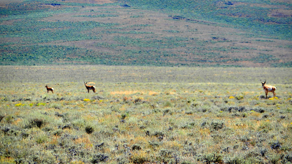
Photo by Peter Matusov
Turning south across the desert, we made our way down to Black Rock country and approached the desert range that was our destination.
I did some USGS topo scouting and found an old 4×4 road to the summit. We followed this for a while, passing a dried-up cattle trough and the desiccated remains of a heifer lying next to it. This is tough, unforgiving country.
Shortly past this, we came upon a No Trespassing sign. Looking down the road, we could see a ranch house in the distance and a tractor working a hay field. This is Cliven Bundy country and we thought long and hard about the risks of rolling up on somebody’s private homestead and asking for permission to pass through. Unable to decide, we flipped a coin: we would either head in or turn tail and find another route. Heads it was and so we proceeded slowly up the drive, maintaining one hand on the wheel and one on the outside of the door, trying to appear as non-threatening as possible. I spotted the rancher and rolled up to him slowly. “Hi sir, sorry for the tresspass. We’re heading up to the summit and I was hoping to follow the road up from your property if you would allow us to pass through.”, I sheepishly said. His response was to the point: “No.” I apologized and said we would leave the way we came. As we were leaving, he must have decided we were okay because he stopped me to direct us toward a turn-off a few miles off his property where we could find a trail that would eventually make the summit.
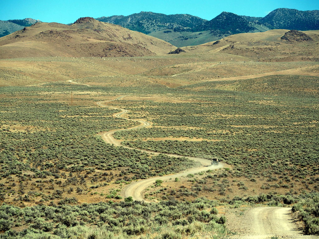
Photo by Peter Matusov
The gravel gave way to doubletrack and give us our first taste of Owyhee volcanic travel. It was, at times, quite washed out and rutted. My truck is still running open differentials; unlike my previous D90 where I immediately built it up, I’ve been proceeding slowly with the 110, focusing on using technique in lieu of equipment when possible. It was slow-going on a few of the steeper stretches of this route. There were a few times when I would have to reverse and make a second run at an obstacle.
We finally gained the summit about an hour before sunset and set about scouting a place to park and camp. There was a more heavily-used area with a pit toilet that the BLM had installed. This area was occupied by some Jeepers with a large herd of kids and women so we continued driving, looking for something a little more quiet. That’s when we stumbled upon what might be one of the finer campsites in Northern Nevada:
We set up camp and prepared dinner in the fading light. I fired up my 1964 Coleman stove on the newly-installed tailgate of the 110. This tailgate is my most favorite part of the new soft top setup–in ten years of Defenders, this is my first one with a built-in table.
We ate New York strips and watched an incredible sunset over the desert floor 3,500′ below.
Photo by Peter Matusov
After dinner, I tried my best to hang with Peter and drink a little whiskey but I was tired and decided call it an early night. We racked out, Peter on a platform in his Disco and me opting for my Thermarest thrown down on the tub floor of my 110.
The next morning, I wake up and begin my morning routine–heat water and grind coffee in the Zassenhaus, only to realize that I somehow forgot my Frieling french press at home. This was a huge bummer. Trail coffee is one of my most favorite things about doing these trips and I was a long way from a Bed Bath and Beyond. Instead, my Stumptown Hairbender beans were not-so-secretly replaced with Peter’s Folgers crystals.
Before breaking camp, we took a hike up to a mountain lake near the summit.
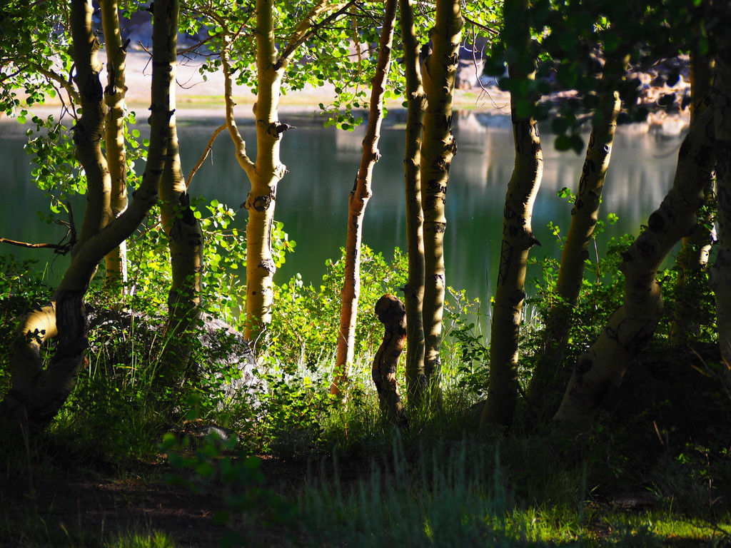
Photo by Peter Matusov
Like a labrador retriever, if there’s water, I’m going to swim in it. The lake was snow-fed and quite cold but refreshing on this quickly warming July day. On the way out of the water, I cut my foot deeply on a piece of broken glass. I didn’t notice it until I got back to the campsite. I should have taken care of it and patched it up but I didn’t and just put my flip-flop back on. This would come back to haunt me in a few days.
260 Miles to Jarbidge
After the hike, breakfast, and loading trucks, we didn’t hit the road until 1100. We had a lot of miles to cover before our 1900 rendezvous with the guys in Jarbidge, NV, so we made a swift descent down the trail that runs off the east side of this range.
45 minutes of rough dirt later and we’re back on the blacktop for a short time. Our immediate destination is the tiny farming town of Paradise Valley, where we’ll hop off the pavement for the run to Jarbidge. Before we can do that, however, Peter needs to fill up.
We make a five mile detour towards Winnemuca where we fill the tanks and buy some Gatorades and snacks. As we’re pumping, a local guy in a Jeep Wrangler chats me up with the usual questions about the truck. He asks where we’re headed and I tell him and his eyes widen. “Jarbidge? Ha! That’s a hell of a long way. You should have left hours ago!”.
This comment encouraged us to put the pedal down and make some time. We knew that there was a lot of dirt to drive and we would have to cut photography and eating breaks to a minimum if we wanted to make it by sundown.
The turn-off out of Paradise Valley started off as an improved gravel road through alfalfa farms.
It quickly gave way to a dirt trail strewn with volcanic debris the size of softballs.
About ten miles into this, it became a seldom-used and very rough doubletrack. We reminisced about our 2013 Utah trip how we drove a scarcely-traveled trail to get to a canyon overlook I’d scouted. It felt so hardcore to drive those five miles of track back then but now we were discovering that what was a rarity in Southern Utah is just the normal reality out here. The track we were on had not been travelled in some time, yet it continued on for over almost thirty miles like this.
This land is empty–really empty. There are no people and no ranches that we can see; even cattle are scarce out here in the heart of this desert. We eventually come along the remains of a 160 year-old old ranch house and stop just long enough to take a few photos and eat a quick handheld snack of cold cuts from the fridges.
The trail out here is covered in moon dust. I imagine the morass that it must become after a downpour but not today–there’s barely a cloud in sight. To keep cool, I run with the back window rolled up. This creates a vacuum in the truck that sucks huge clouds of dust and exhaust into the truck constantly. My eyes are red and swollen and my arms turn into mud when the sweat mixes with the powder. If I want to check the GPS or check the time on my watch, I must wipe their faces with my finger first. The steering wheel even becomes difficult to grip because of the fine particles that coat it. Not wanting to scour my sweet new VDO gauges, I leave their lenses untouched and blow air on them if I need to check a reading.
[EDITOR’S NOTE: We’re sorry, this image has been removed.]
[EDITOR’S NOTE: We’re sorry, this image has been removed.]
We eventually come to a section of pavement south of Mountain City, NV and turn south. It’s short-lived, however–a half mile later and we’re back on dirt. It’s been nearly two hundred miles since we last touched pavement and it will be nearly two hundred more before we touch it again.
The flatness of the Great Basin soon gives way to a slow and steady climb up the Jarbidge mountains. The cut on my foot is beginning to hurt so I stop taking photos and mostly stay in the truck when Peter takes his.
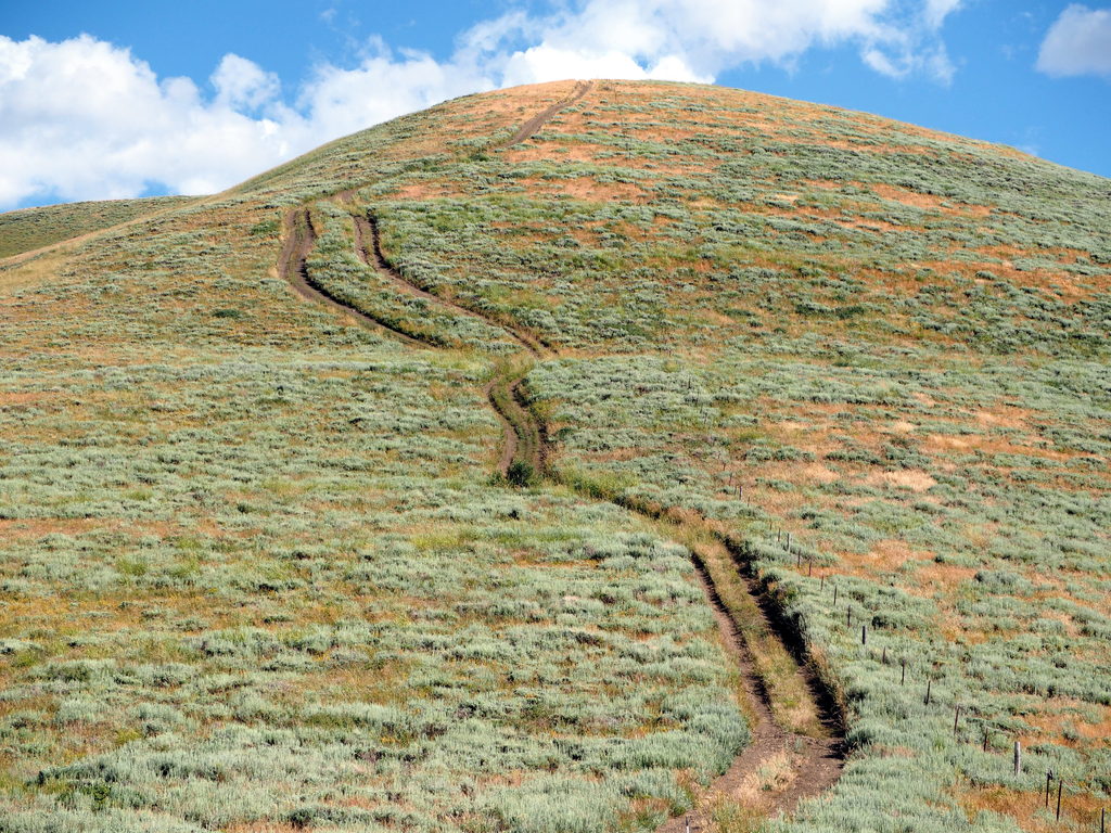
Photo by Peter Matusov
Finally, at around 1900 and over 220 miles of dirt travel, we reach Jarbidge. I am beyond filthy and thoroughly road-weary.
For those that have never been here, the best way I can describe the place is this: if you pulled a bunch of salty retirees out of a Florida trailer park and brought them to an old mountain mining town 40 miles off the pavement, you would have something approximating the place. People start drinking early here and they drink all day. Pulling into town, we headed for the Outdoor Inn, Jarbidge’s summertime bar. Jason’s and Kevin’s trucks are parked out front and we go inside, getting a chorus of whoops from the quite-drunk locals when they see us dirtbags stroll in.
As you can see, the Outdoor Inn is one of those places that’s way off the beaten track but still somewhat civilized and frequently visited. Its existence elicits an amazement from its visitors that compels them to write their names on the walls.
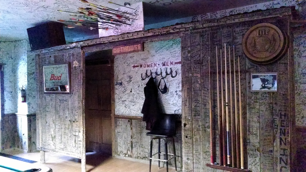
Photo by Peter Matusov
After a reunion with the gang, we decide on camping arrangements. We decide to take the easy route and head to a National Forest campground just south of town, where we build a fire and prepare dinner. I make my new trail standard: red curry and tofu on the Snow Peak cast iron, which does a passible job as a wok. The traditional shots of The Glenlivet are poured and we stay up late into the night, re-telling campfire favorites and a few new stories from the two years that have passed since our last trip together. We’ll begin an incredible day of off-road driving in the morning but for now, it’s time to stare at the burning embers and enjoy the camaraderie of long-distance friends.
Culebra Canyon
After the whiskeyed revelry the night before, it was a slow and painful wake-up for the crew, especially when we discovered that neither Jason nor Kevin had brought a French press either. Desperate for caffeine, we mixed Folgers and hot cocoa and sat around camp until our throbbing heads cleared enough to start breaking camp.
We heard that there were showers available to campers at the Outdoor Inn so Peter and I headed that way while the rest of the crew gassed up and poked around town. To shower there, you pay $2 and get a towel and soap from the restaurant. The shower is at the back of the restroom. It’s basic but, when you’re as filthy as we were, it’s amazing. When I finished mine, I came out onto the front porch where the crew was drinking a morning beer with the locals.
By this time, the cut on my foot was really hurting and I was limping around. My plan was to rummage through my kit for the Superglue and glue it back together. The locals saw what I was up to and were emphatic that I called the town medic to come take a look at it. Being an Army guy, there’s nothing more lame than sick call so I resisted but they were insistent. Life in a sleepy retiree community is so quiet that a sliced foot might have been the most exciting thing to happen all week. They called the medic and only a minute or two later, she came riding up on her ATV wearing blue jeans and scrubs with her medical kit. Unfortunately, she didn’t have any alcohol wipes or anti-bacterial ointment so all she could do was put a Steri-Strip over the gash to close it.
We left the Outdoor Inn and Peter and I headed to the two-pump gas station to fill up before the group departed. One of the really neat things about Jarbidge is the 24-hour pay-at-the-pump gas station. It’s not often that you find gas in such an out-of-the-way place that’s available at 11PM on a Sunday night if you needed it.
For our 220-mile off-road run the day before, Peter’s gasoline-powered D1 took about 16 gallons. My 300Tdi, by comparison, was miserly and only burned about 8 gallons of diesel for the same distance. This is the real advantage of 300Tdi power for the Land Rover owner on a trip like this. Gone are the days of fretting over the tiny D90 fuel tank and bumming jerry cans from friends with roof racks. Now I just top off whenever it’s convenient.
For the overland traveller in Jarbidge, I should also note that there is an unmanned telephone switching office near the north end of town that has open, free wireless Internet access for passersby. Incredibly, Jarbidge is moving ahead of most of the United States and bringing high speed fiber optic internet to town. The internet here is ridiculously fast and we greedily downloaded large batches of topo maps for areas we thought we might visit.
Finally–after what seems like forever–the herd of four departed Jarbidge. As I mentioned in my first post, I’ve been piecing together this route for two years now and I had mapped out a path out of Jarbidge that minimized improved roads. Just past town, we turned west on a nearly hidden track that drops down a steep cutbank to the Jarbidge River. The water approached the floorboards but the river was narrow and we were quickly climbing up the steep and slippery bank on the other side. No sooner did we get all four trucks across than we came to a Road Closed sign in the middle of the trail. We later found out that the switchbacks above town had washed out.
We cross the river for a second time and get the crew back onto the main road, where I stop for a quick map recon:
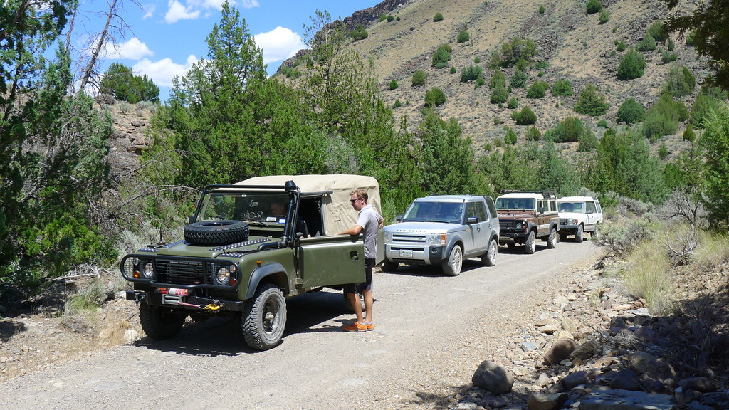
Photo by Peter Matusov
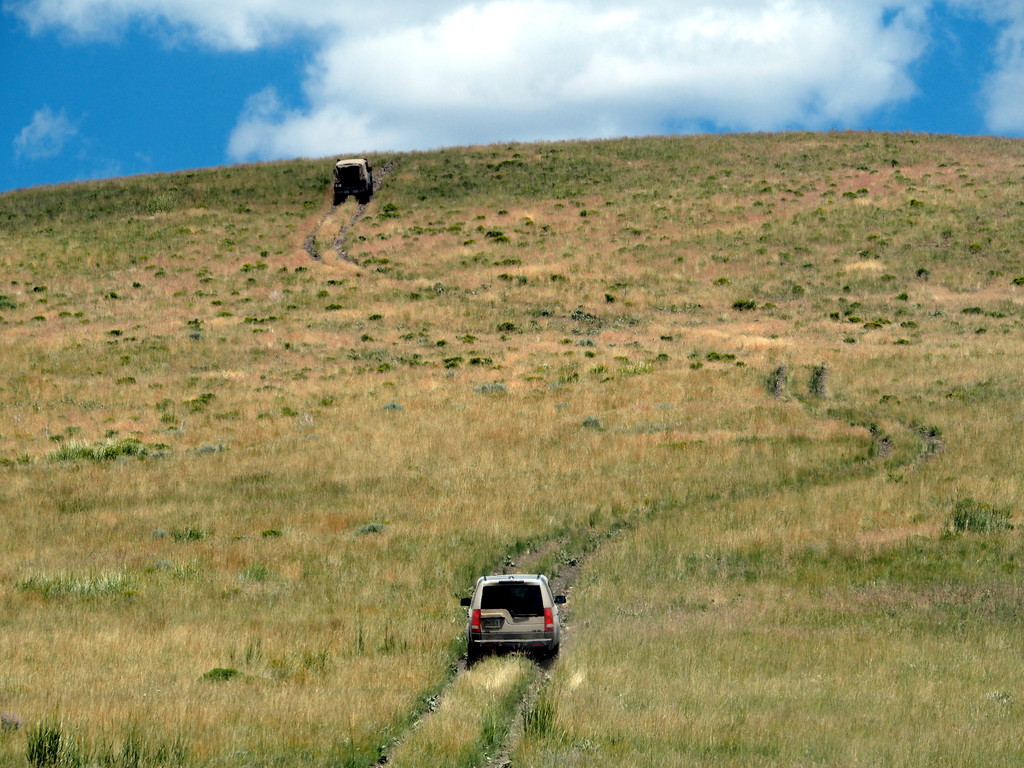
We end up re-routing north of town around large cattle operation up on the ridgeline above Jarbidge Canyon. We skirt the woodline before dropping back down to the rolling Owyhee desert where the doubletrack begins to vanish and the track becomes rough.
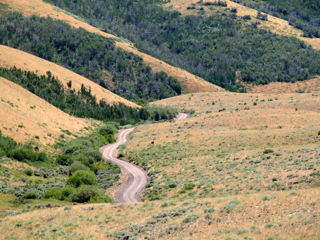
Photo by Peter Matusov
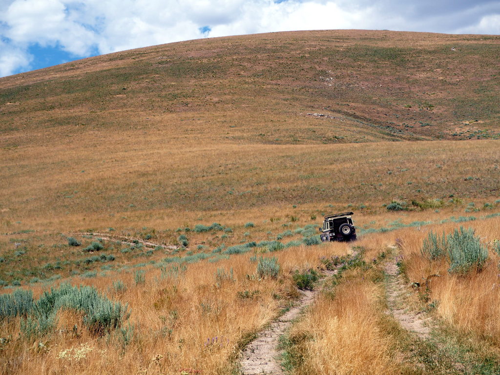
Photo by Peter Matusov
The group is hungry for lunch and I scout the map for a good stopping point. I spot a 4WD road leading to the top of a small mountain with about 400′ of prominence. “Are you guys game for driving up this one?”, I ask.
Jason is always game.
Photo by Peter Matusov
We start the slow, low-range climb up the mountain and ten minutes later, we’re on top and it’s time for lunch.
When I was packing for the trip, I made the mistake of using my Pelican 1650 as my kitchen case. It made sense because the Coleman two-burner stove fits neatly inside, along with the slat table and everything else. Unfortunately, due to the layout of my tub, the only place this case can ride is up front by the bulkhead. To get at the kitchen, you have to unload the entire truck. It’s bull****. So, I eat my deli counter lunch out of the Ziploc baggies, drink one of Kevin’s Kokanee beers, and wax philosophical about a better storage system for my truck.
Kokanee–only available in Canada–must be the best lager-style mass market beer in North America. I have no idea how Kevin got ahold of these but I was grateful. The name is pretty funny, though. I can’t drink it without thinking of this:

After lunch, things get interesting. I had previously scouted a potential campsite along the banks of the Owyhee River that would hopefully afford us a small, level spot and maybe even a swimming hole. To get there, we would have to follow some old 4WD roads down a series of feeder canyons. Those who have wheeled with me know that I love the rarely-followed path–the more marginal, the better. Sometimes it pans out and sometimes it doesn’t; trails like these are why I won’t wheel with anyone pulling a trailer.
Today’s route was completely impromptu and took us on some doubletrack that was, at best, overgrown, but mostly entirely invisible. Shortly after turning into the first canyon, the trail became very steep, muddy, and washed-out. To make matters worse, the moisture of the canyons supported a thick overgrowth of willows, tamarisk, blackberries, and poison oak that had to be broken through by force of truck–and a complete disregard for my ****ty MOD paint job. The ground was a slick, soupy, foul-smelling mix of clay and cow ****. The winches were unspooled and I found myself slogging through poison oak and this mud to get hooked up. Like a fool, I was wearing my sandals to beat the heat and my foot slipped out and my Steri-Strip came off, exposing the cut on my foot to the disgusting mire that was all around.
It was completely gonzo.
It was almost a full hour of slogging just to get down the mile-long canyon. Peter may have a GoPro video of this section but none of us–as far as I know–have any photos. It was too intense.
Finally, we exited the canyon into a larger feeder canyon. The trail was still invisible but was at least passable. Eventually this feeder made it down to a National Forest road that traced the floor of the Bruneau Canyon. It wasn’t much better, though. We had four miles of this to drive and it, too, was overgrown with tamarisk and willow.
I made it only a hundred yards before ripping the mag-mount antenna off the truck and destroying the cable. Amazingly, the Diamond NR770HB antenna itself was completely undamaged. This is one bad-*** amateur radio antenna.
At this point, we decided that whatever campsite might exist four miles down the trail simply wasn’t worth the effort. It was late in the day and we would head north again to the edge of the mountains. Kevin had to be at work the next evening and he was worried that any potential campsite might be too far from the roads that would get him home in time. So, he decided to bail. Jason had to leave the next day but decided to caravan with Kevin just to be safe. They split off to the north that afternoon and it was just Peter and me again.
Amazingly, we drove only four or five miles before happening on yet another incredible campsite, a high ridge with a 270° view of the Snake River Valley to the north and the Owyhee Mountains to the west. I was totally bummed that our friends had bailed and wished they could have joined us at this spot.
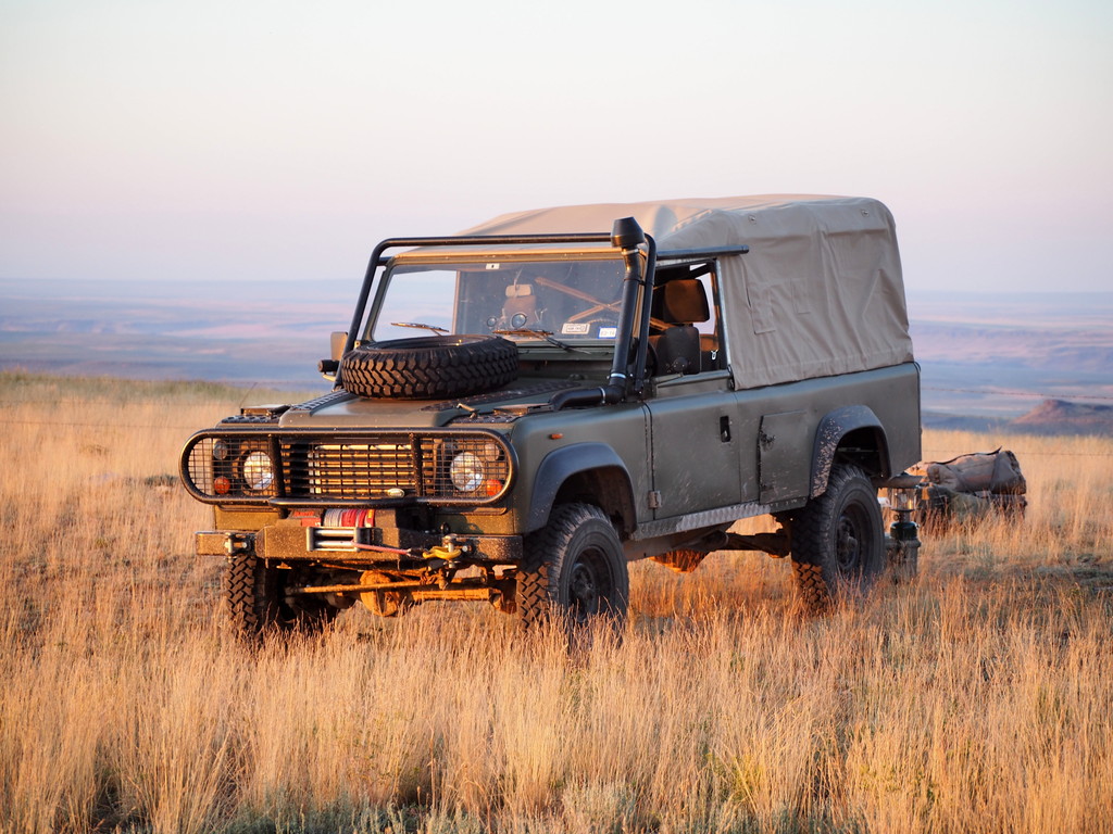
Photo by Peter Matusov
My first order of business was to attend to my foot, which was now looking quite nasty. I cleaned it off with dish soap and water and then used Purell to sterilize the area. Peter dug out his first aid kit and found some anti-bacterial ointment and I applied this and then sealed the entire thing up with a strip of duct tape. After the repair was complete, I put on my Blundstones and kept them on until the end of the trip–I had no more problems. Amazingly, with the duct tape to stabilize the cut and the ointment to kill off the cow **** beasties, the cut healed quickly. I was soon back in business with my photo-taking and feeling much better.
With an hour of daylight left, we set up camp and Peter began preparations to grill lamb chops. The amigos traditionally cook up this meal on the first night of our trips on which we’re all together. We celebrate with the lamb and shots of The Glenlivet in little plastic cups.
Peter prepared the chops with salt and pepper and began a slow roast on his charcoal grill:
I set about trying out a new trail recipe for me: french fries. Just to spite Jason, who grew up on an Idaho farm, I like to bring Washington potatoes to Idaho.
After chopping them, I gave them a good water soak, dried them, then fried them in the cast iron. It takes a really long time to bring oil up to temperature at altitude and on cast iron so it was dark before they were ready. Sadly, I didn’t take any photos of them but they were amazing and worth the wait.
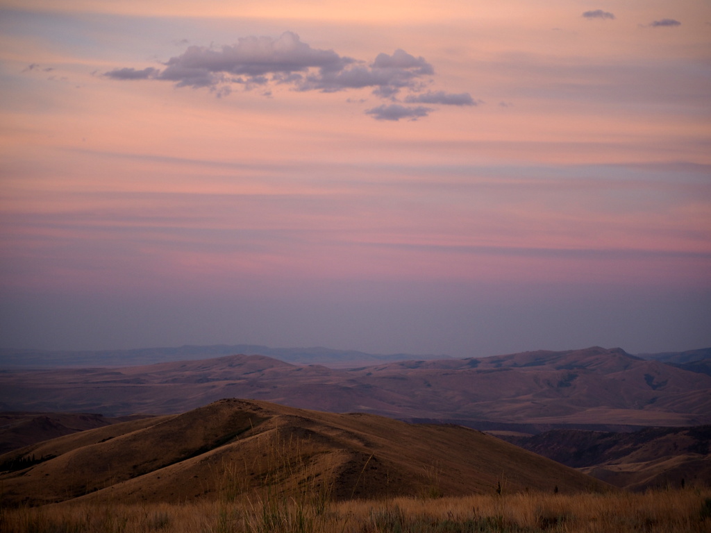
Photo by Peter Matusov
We watched the sun set while we stuffed ourselves on lamb and fries and washed it down with Macallan. I slept in the back of the truck, better than I’ve slept in months.
We would head for the real canyons in the morning.
The Owyhee River
Camped up on that ridgeline, we gorged ourselves on lamb and fries but drank our Macallan somewhat somberly because Jason and Kevin had split for Boise that afternoon and the trip just isn’t the same without all of the usual compadres. We talked of the canyons and desert to come and made a rough plan to head west towards Oregon in the morning.
I slept somewhat fitfully, worried about our exposure to thunderstorms even though the weather was fair. That’s the drawback to a campsite like this. The view that it commands is almost infinite but you can never really let your guard down because danger could be silently boiling up over the next mountain.
We slept late the next morning and considered the topo maps over coffee and oatmeal. When we eventually broke camp, we headed down the hill and out across ranchland towards Nevada 225.
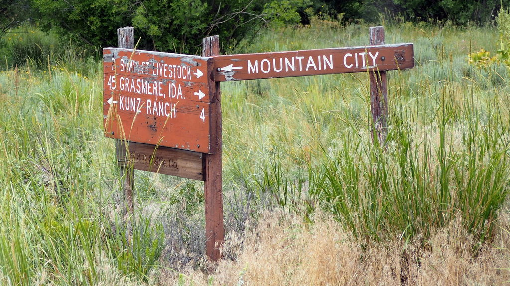
Photo by Peter Matusov
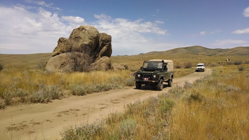
Photo by Peter Matusov
Photo by Peter Matusov
It was a strange feeling, pulling out onto the smooth asphalt of Nevada 225. We wouldn’t be on it for long–only a few miles–but it cuts a north-south swath through the Owyhee and it’s unavoidable. Our short stretch took us through the scrub-brush town of Mountain City, the last non-Indian town before northbound drivers enter the Duck Valley reservation.
We cross back into Idaho and turn off to the west on dirt doubletrack. We’re in the high desert and the terrain flattens out considerably. Coming around a bend, we roll up on a sight that neither Peter nor I have ever seen: wild mustangs.
The free mating and decades of harsh desert conditions have built a magnificent breed that is tough, beautiful, and intelligent. They watched us approach and were curious and didn’t flee but kept a safe distance, their young in the center of the herd.
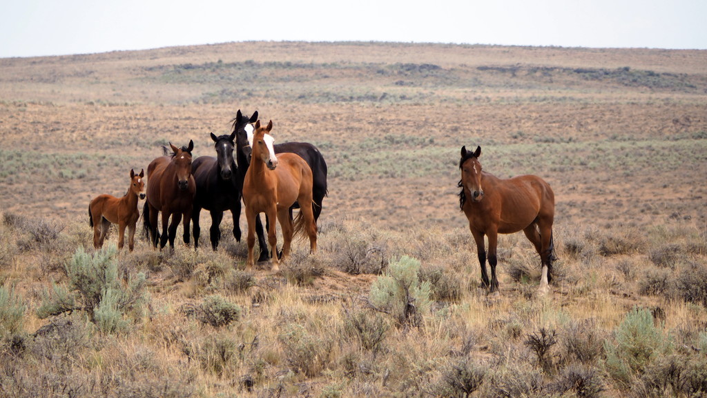
Photo by Peter Matusov
We press on.
The doubletrack was well-travelled and easy so I began to look for alternate routes and shortcuts to our first destination, the South Fork of the Owyhee River. In short order, our graveled path changed to this:
..and before long, disappeared out entirely:
Photo by Peter Matusov
We poked through the sagebrush carefully and eventually intersect with the BLM trail that took us to a fork in the road several miles shy of the Owyhee River Canyon rim:
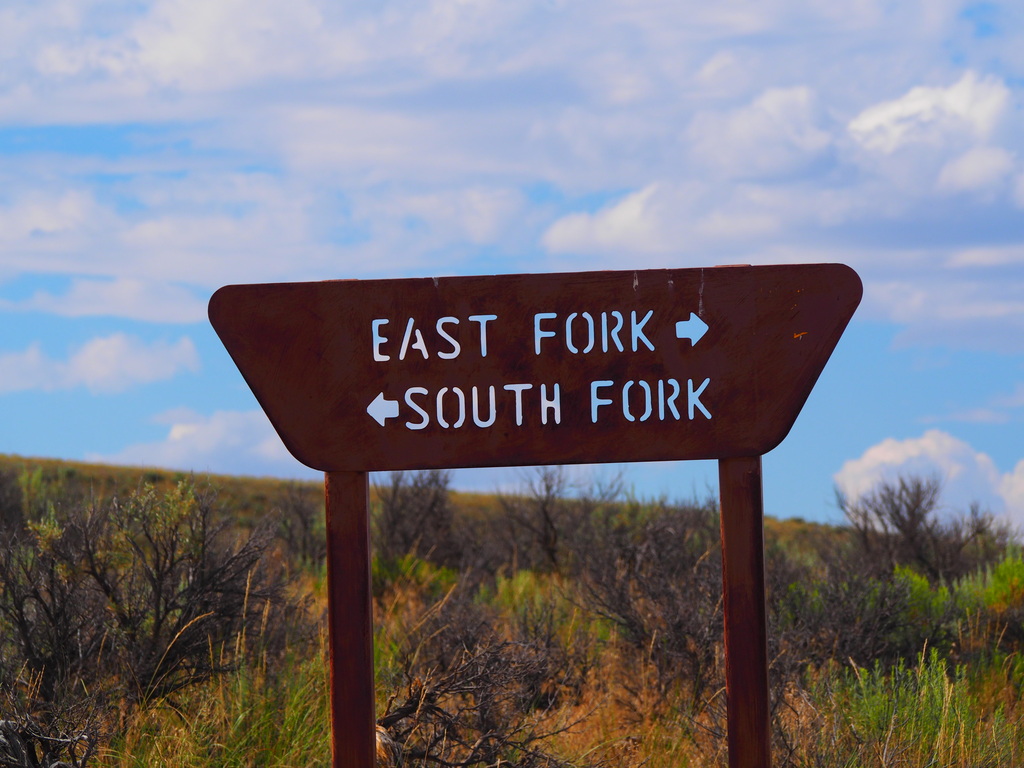
Photo by Peter Matusov
We ponder our options and turn left. In short order, the land parts and the sheer, volcanic walls of the canyon begin to show:
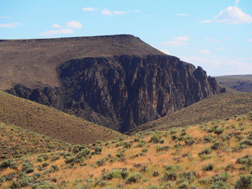
Photo by Peter Matusov
By this point in the afternoon, the sun is beating down and the desert temperatures are scorching. We knew that a swim in cool, clear water was close and imagine our excitement when we came upon this:
It was private property–the 45 Ranch–but we longingly gazed at the freshly-mown grass and imagined setting up our tents down there, enjoying steaks and a sunset swim in the river. We rolled up on the ranch and spotted a man working on a tractor. I hailed him and we met him at the fenceline. Would it be possible for two dusty and sunburn travelers to set up camp on his field? Unfortunately, the answer was “no”. It’s a private ranch and they don’t allow visitors. It operates, ostensibly, as a private Nature Conservancy property but the real owners are grandfathered into the deal and can use it at their leisure. The yurts set up on the grass? That was a party of BLM surveyors. The land was so choice–a rarity in this desert–that it must have been expensive. I wondered who owned it. When I got back to civilization, I looked it up. Amazingly, it was Charles Conn, the CEO of Ticketmaster when I worked there back in L.A. in the 90’s. He has an airstrip right next to the river and he and his buddies fly their planes in for fly fishing trips.
Bummed, we got back in the trucks and continued down the road a bit to the public river put-in. The road turns to private property just across the river but we were able to have a leisurely swim break to cool down and wash days of dust from our hair and clothes. I feel like a new man.
[EDITOR’S NOTE: We’re sorry, this image has been removed.]
Photo by Peter Matusov
Afterwards, we grind our way back up 1,000′ of vertical to the canyon rim and head for the East Fork crossing.
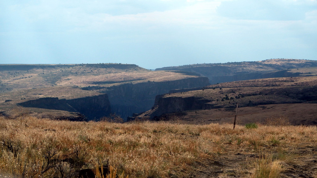
Photo by Peter Matusov
Photo by Peter Matusov
Photo by Peter Matusov
[EDITOR’S NOTE: We’re sorry, this image has been removed.]
The East Fork ford, known as Crutcher’s Crossing, is similar to the South Fork but much more remote. There’s no fly fishing ranch, only a lonely river gauge and put-in spot.
My labrador-like tendencies have me really wanting to take another swim but the sky has darkened and rain drops are falling on the river as we make the ford. A very big thunderstorm is moving in and we must move quickly if we want to make it to a safe place to camp. The risk of flash flood aside, the crossing isn’t a terrible place to camp but it’s frequently travelled and very dusty, with no natural shelter to be found. Not wanting to wash away or wake up in a mud pit, we decide to make for the rim and seek camp in the juniper forest to the west.
At this point, we have to move quickly. We stop taking photos, except for Peter’s front-mounted GoPro camera.
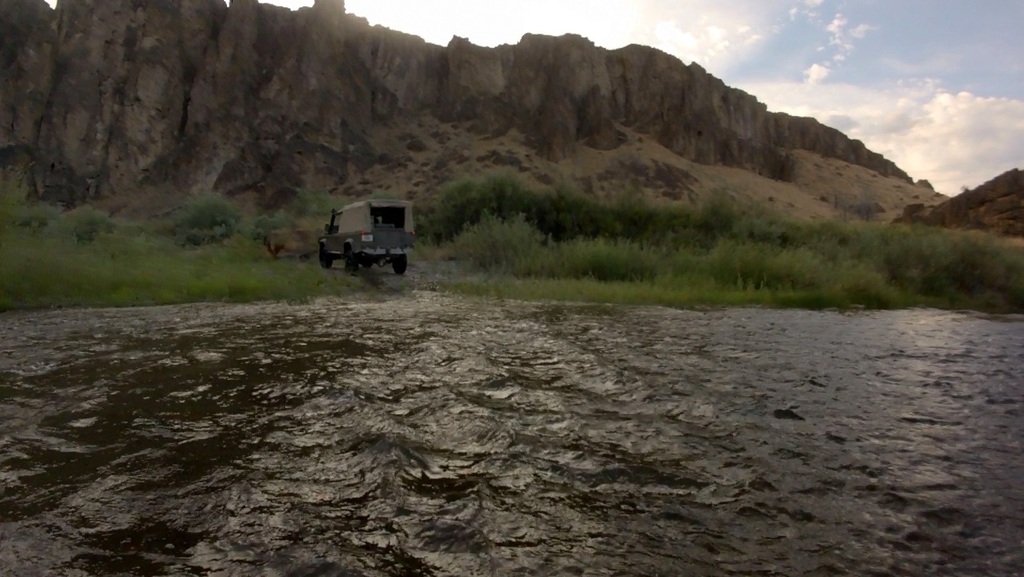
Photo by Peter Matusov
The drive up out of Crutcher’s was one of the most challenging of the entire trip. It’s steep, ledgy, and loose and it was a struggle for my truck, which still has no lockers. Further complicating the matter, my transmission brake slave got sticky after the river crossings and stopped working so I had no choice but to drive on.
I was being cautious, not wanting to snap an axle. There was no backing down, though, so I used the Force and made it up without winching. It’s amazing how much challenge and fun you can have in a stock Land Rover. This would have been a quickly-forgotten cakewalk in my NAS truck but in my stocker 110, it was a run I’ll never forget.
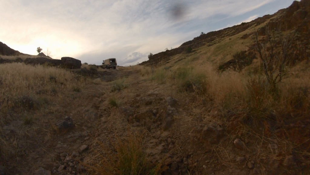
Photo by Peter Matusov
At last, we reached the rim. The storm was bearing down on us and the wind and dust was whipping through my window-less door tops. We had no destination in mind but we needed shelter quickly so we decided to camp in the first sheltered spot we could find.
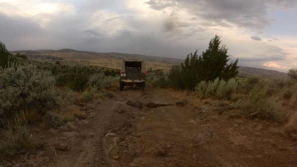
Photo by Peter Matusov
Racing along this trail, we came upon a creek crossing. There was no usable bypass and the mud was quite deep. There were cattle everywhere and the mud was vile, cow ****-smelling filth. I really didn’t want to get stuck here. The plan was to send me across first. If I got stuck, Peter would winch me back, using my rear DB jaw. I put it into low range and 4th gear and booted it.
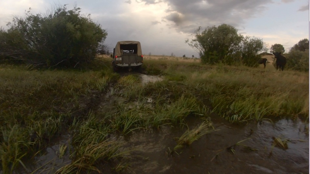
Photo by Peter Matusov
The three hundy roared and I flew through the mud before hitting the unseen foot-high far bank of the creek, which stopped me in my tracks. Several more attempts and some turning, I popped up on the other side and a cow ****-covered winching session was avoided.
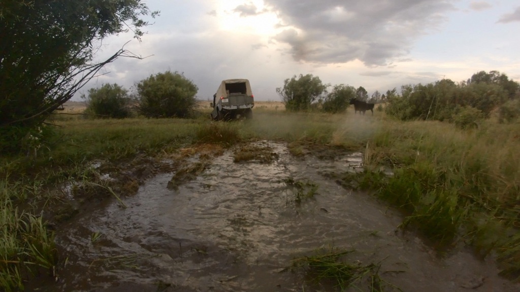
Photo by Peter Matusov
We stumble upon an acre-sized fenced plot with a small cabin in the middle of it. With the storm bearing down, it looked incredibly inviting. It was posted private property so trespassing was out of the question but Peter swore he saw a man walking around the cabin as we arrived. We stood there for a few minutes trying to hail the occupant but nobody ever came out and we decided that the man Peter saw was really just one of the cows ambling around.
We decided to set up camp just across the road so we raced to batten down the hatches before the rain arrived.
We improvised protection for the open cab of the 110 and added a tarp between the trucks for a camp kitchen:
We fired up the stove and cooked New York strips on the cast iron as the skies began to grow very ominous and the rain began to fall.
[EDITOR’S NOTE: We’re sorry, this image has been removed.]
[EDITOR’S NOTE: We’re sorry, this image has been removed.]
To read the rest of this great story, check it out on the forums here.