
Background:
My name is Neil, 24 years old and I’m living in Switzerland. I always had the dream to travel through the western US and north to Alaska Canada. But not with a rental Mustang on Highway 1 with all the mass tourism. No, I wanted to explore more remote places, going deeper into the land and nature.
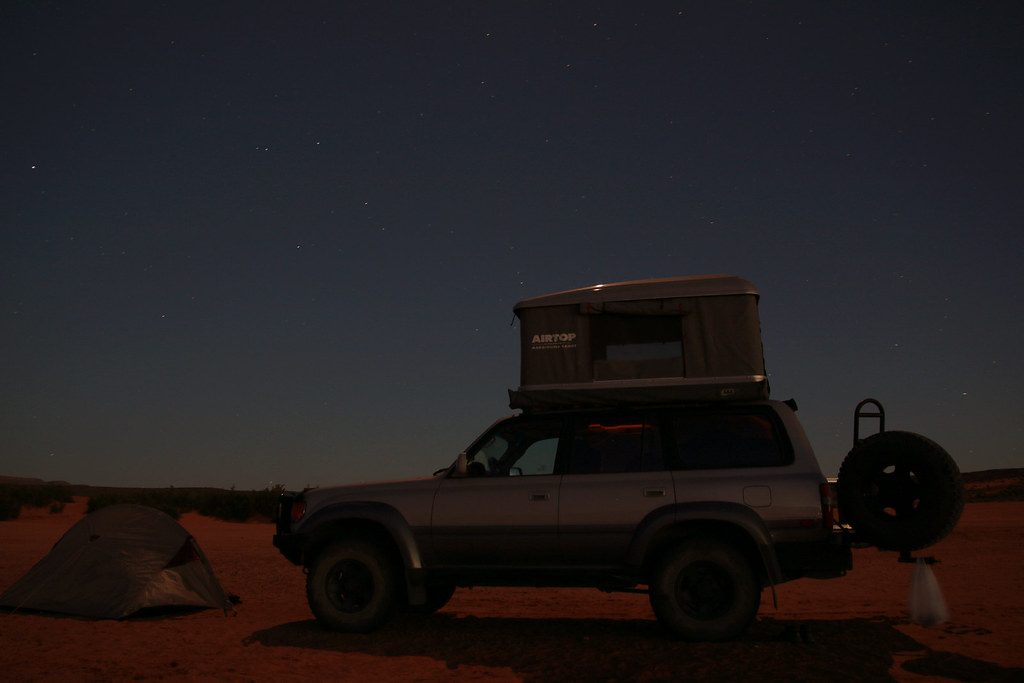
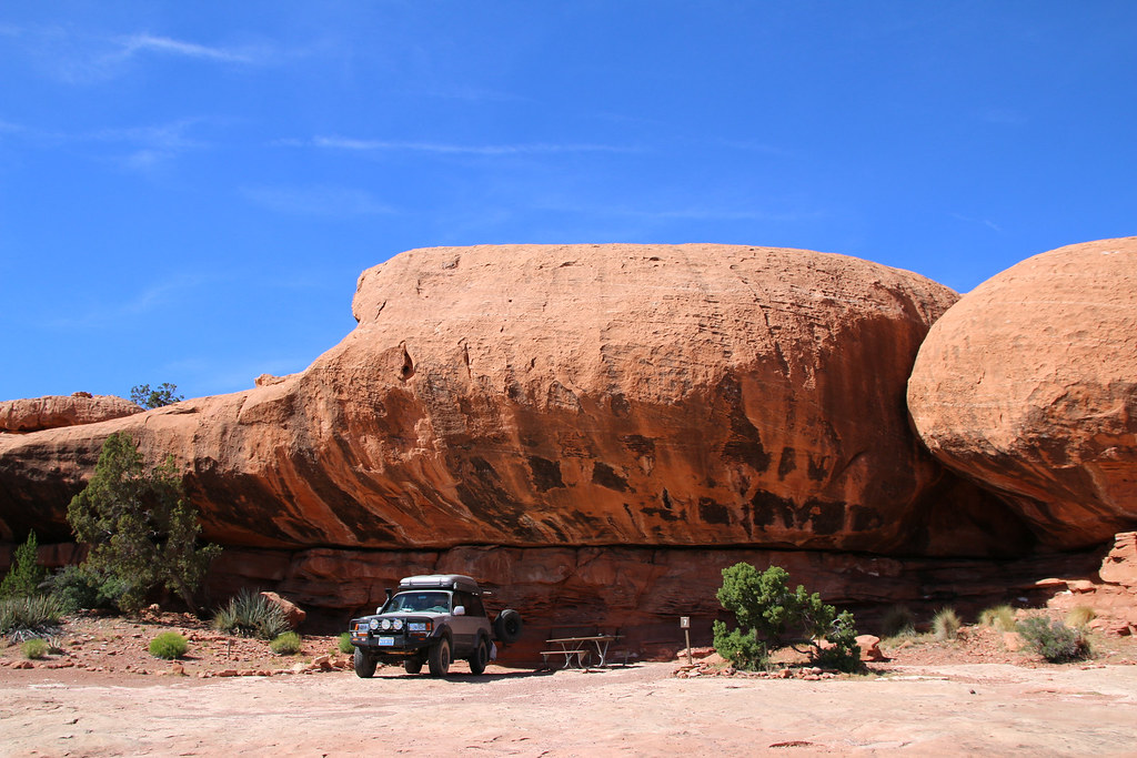
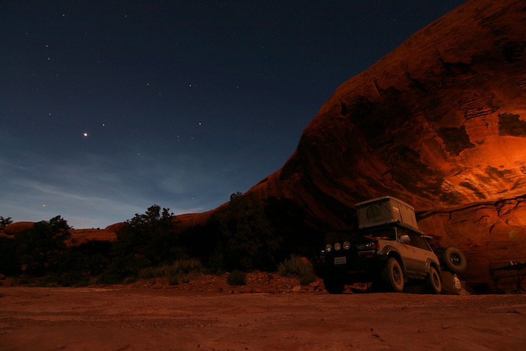
I saved all my money for many years while shift working as a machine engineer/assembler and spent many hours in front of the computer, dreaming about my trip, doing research of roads, trails and places to visit. I was lurking around on ExPo most the time and checked the vehicles for sale section daily. I then found a very nice 96 Toyota Land Cruiser FZJ80 completely outfitted for overland traveling. It came with a nice Maggiolina Airtop roof top tent, second fuel tank, dual battery system, spare wheel carrier and many more nice things. So I contacted the owner and luckily, he was willing to sell me the car and even to store it at his warehouse until I arrive in the US, which was almost six months. At this point, thank you very much again, Mike!
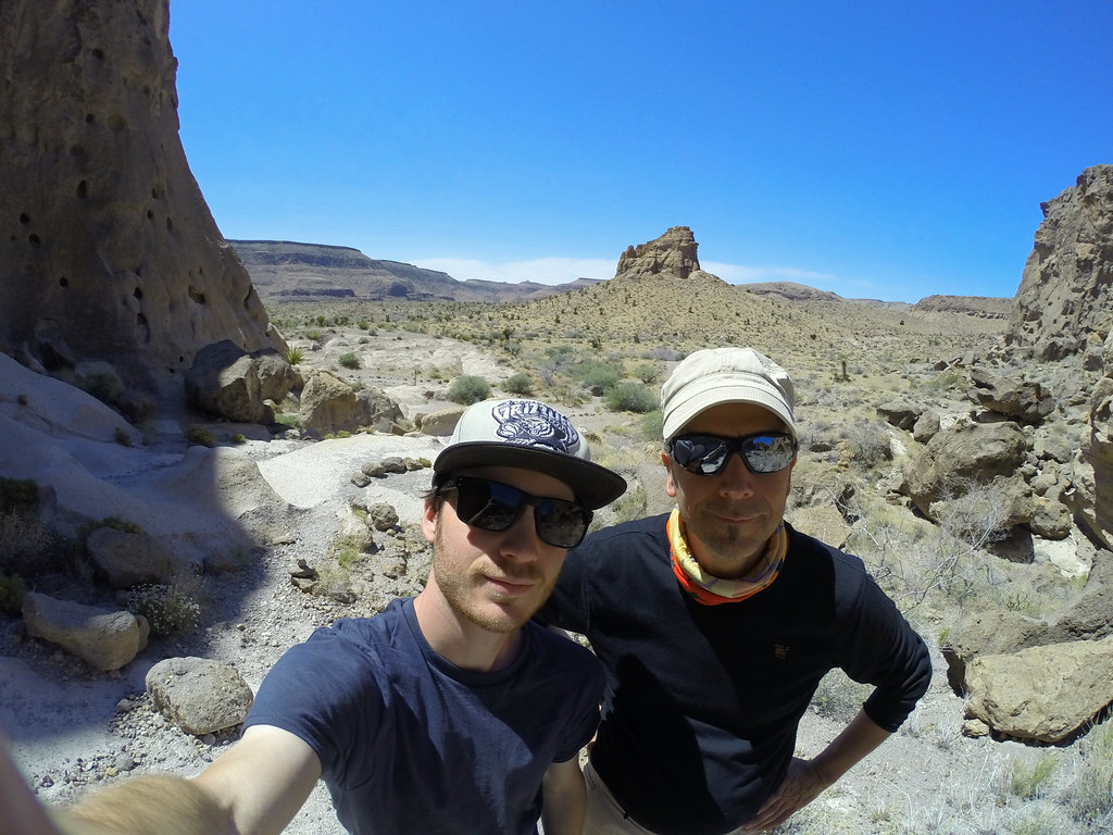
For the most time of the trip I’ve been traveling by myself. My dad flew in a couple weeks after I arrived and joined me for about 5 weeks. That was probably the best time of the trip. I took over 5000 pictures on my journey and I’m still trying sorting out and editing that mess. I’ll upload them during the next weeks and do the write up, it will take some time..
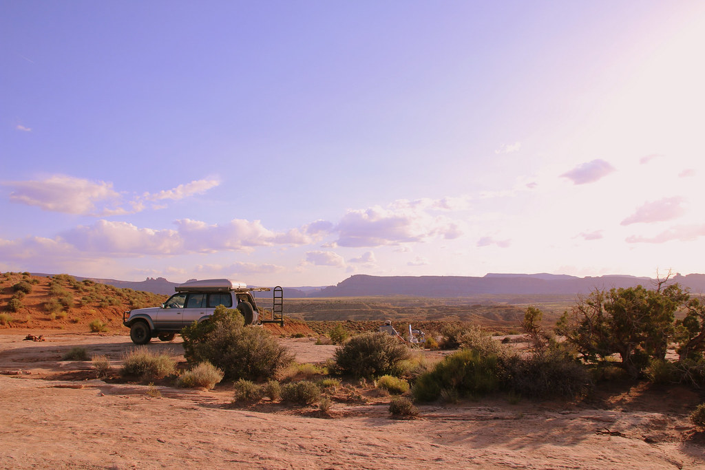
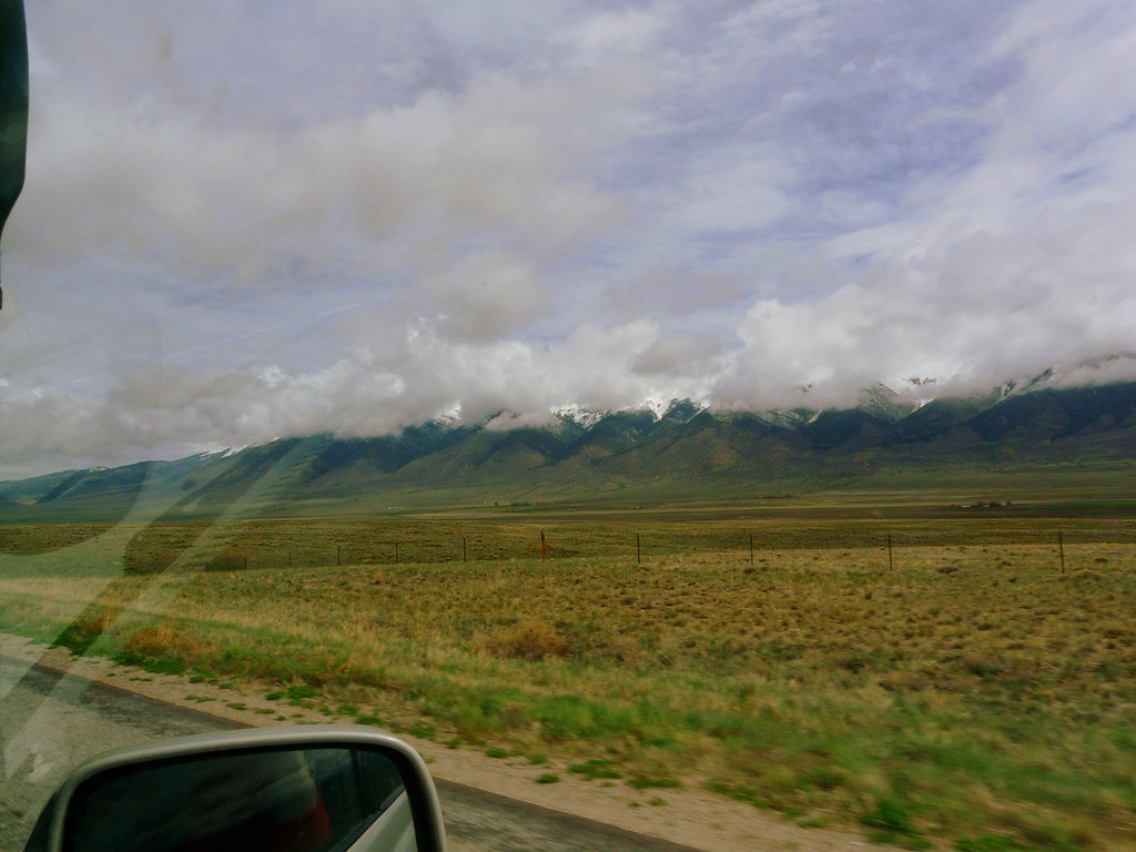
On March 24th I finally flew from Zurich via London to San Francisco. On the next day Mike picked me up at my Motel and we drove to his warehouse where I received the Land Cruiser. First thing for me was driving it no Nevada to register it due no sale tax and cheaper license tags. The first drive was already an adventure. The truck is big, wide and heavy, at least for me. And it’s definitely not a rocket. But the more miles we made the more I liked it and the more comfortable I got. I drove to Lake Tahoe, slept at a Motel and drove down to Carson City the next day to the DMV. I did some research in advance to register the car but it was waay easier as I thought.
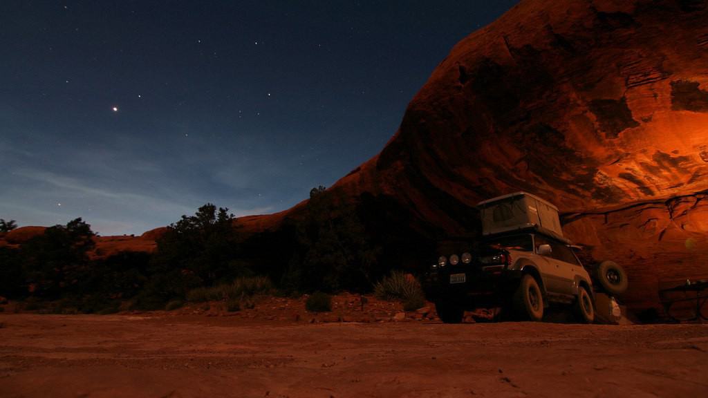
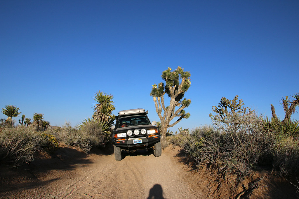
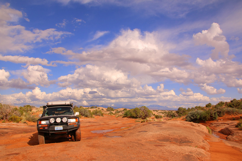
My Land Cruiser with the new Nevada License Plate.
[EDITOR’S NOTE: We’re sorry, this image has been removed.]
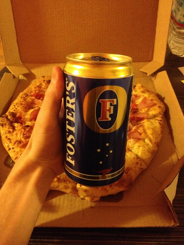
I spent a couple days in Carson City and celebrated my 24th birthday with a delicious pizza and a big can of beer. Everything is bigger in America, right?
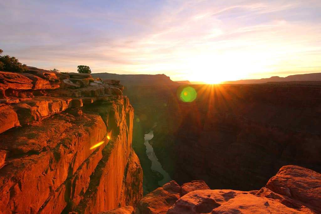
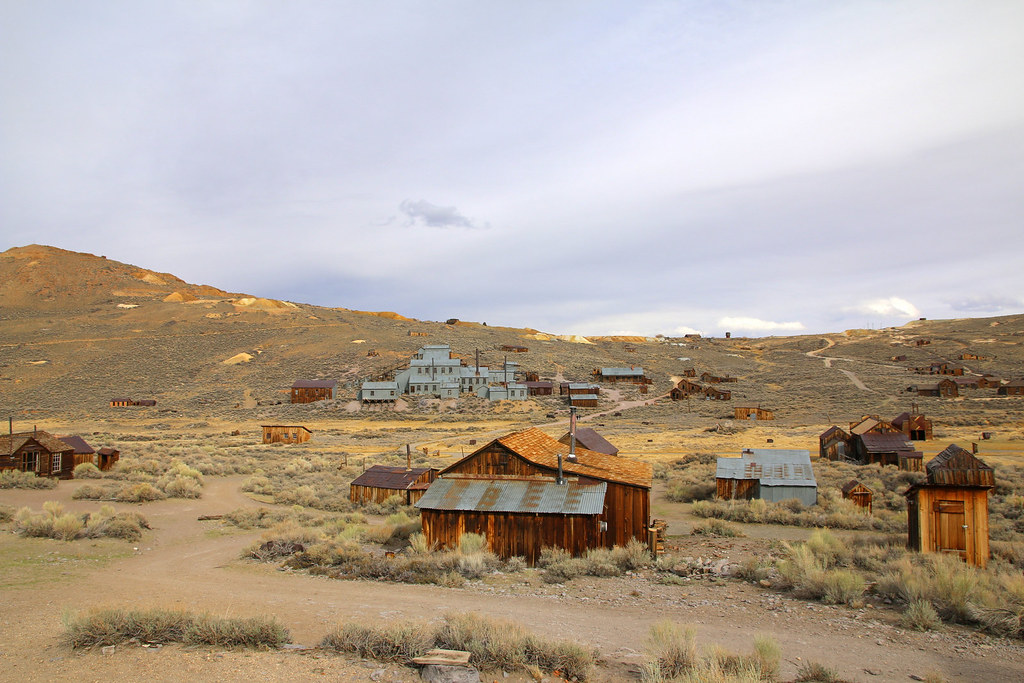
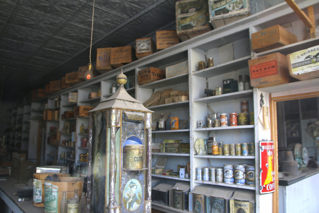
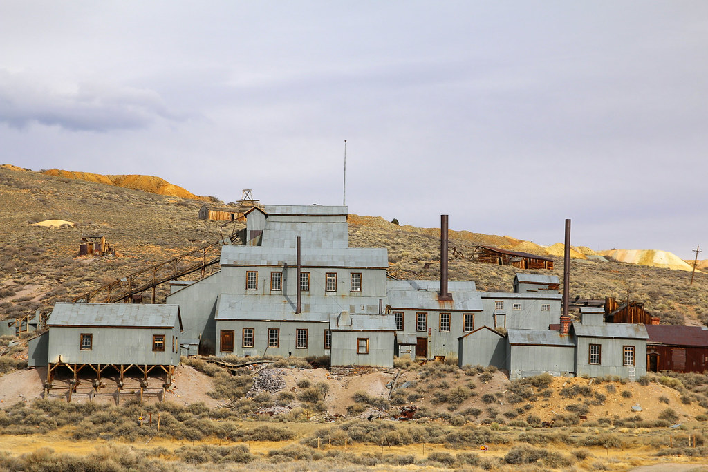
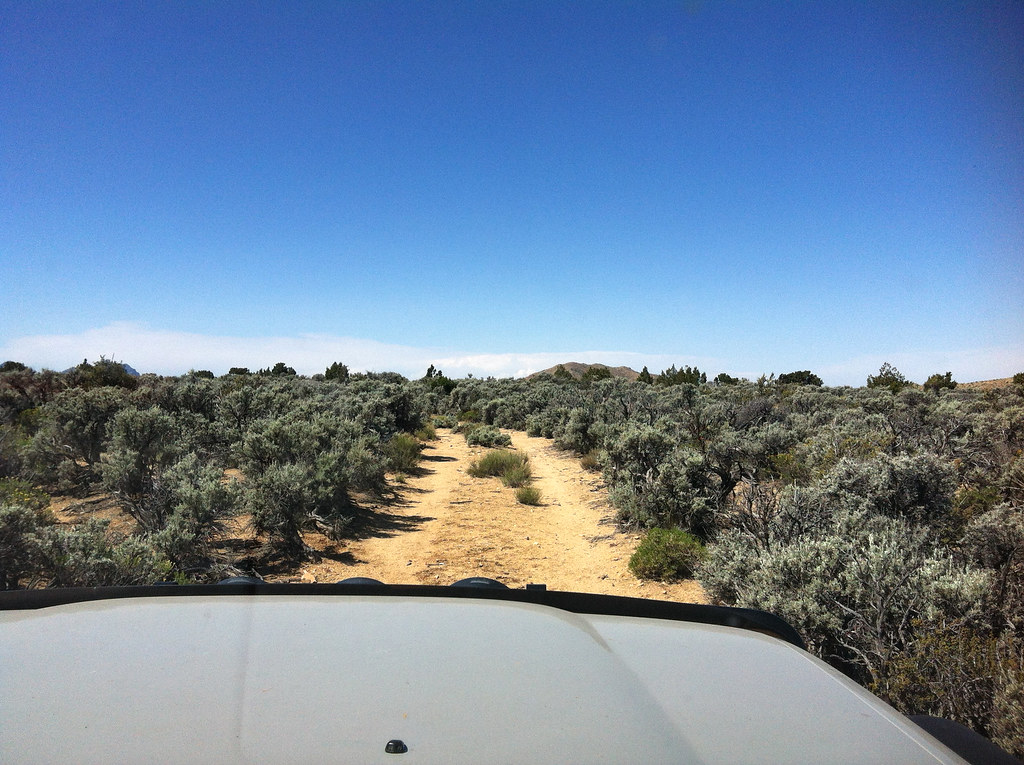
The next thing on my list was driving to Camarillo on the coast for picking up some camping gear and for shopping in the outlet village. I decided to drive down 395S for taking a look at Mammoth Lakes (I’m a passionate skier) and to check out Bodie, one of the nicest ghost towns in the west. I went on a gravel road somewhere near Bridgeport and entered the ghost town by coming from North.
[EDITOR’S NOTE: We’re sorry, this image has been removed.]
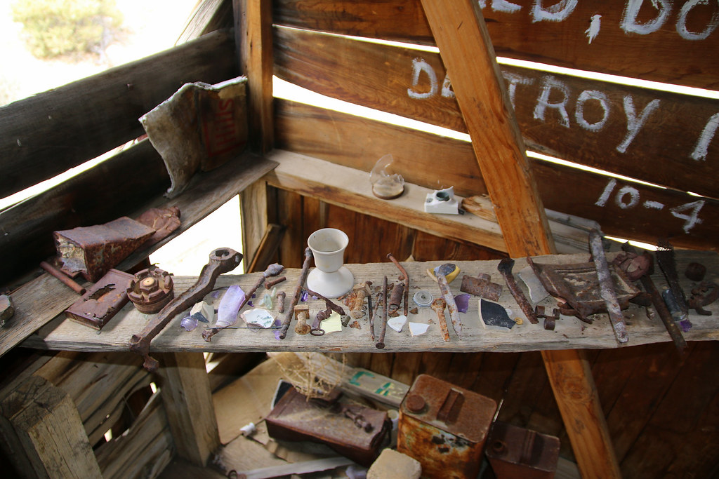
I’m a big fan of those western ghost towns or old and abandoned mines. I spent about three hours in the town, walking around, taking and pictures
[EDITOR’S NOTE: We’re sorry, this image has been removed.]
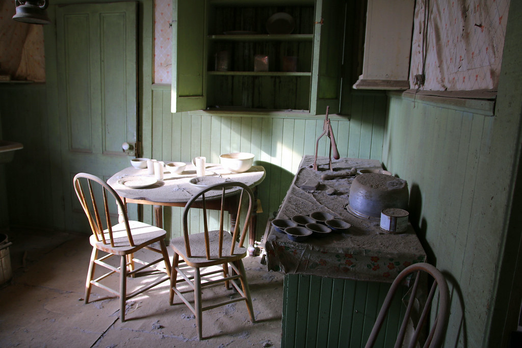
I personally find it amazing just looking at the old buildings, seeing all the old machinery, tools and so. It makes it way easier to imagine how people lived back then, It’s history to touch. In Europe everything is so old you only can see a couple stones or poles of old buildings or pieces of tools they used to work with.
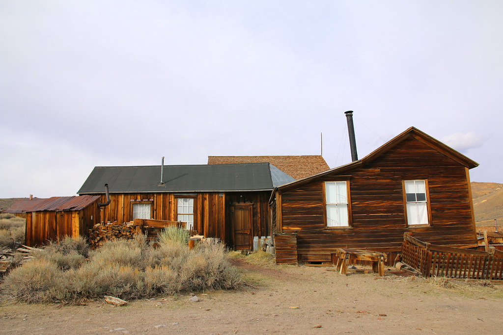
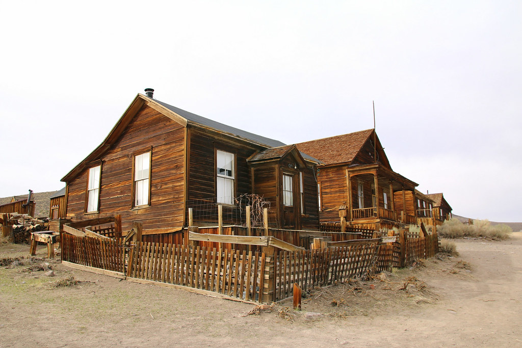
Some of the living houses.
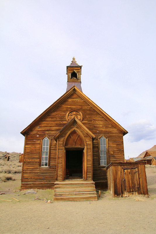
I’m not sure if the church has been rebuilt once, it’s in pretty good shape though.
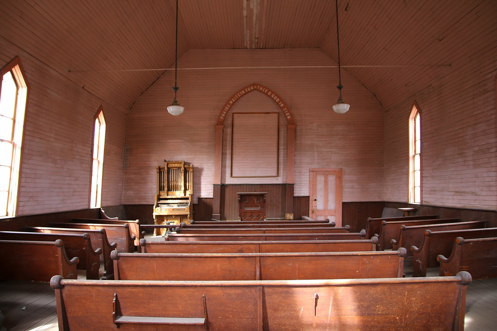
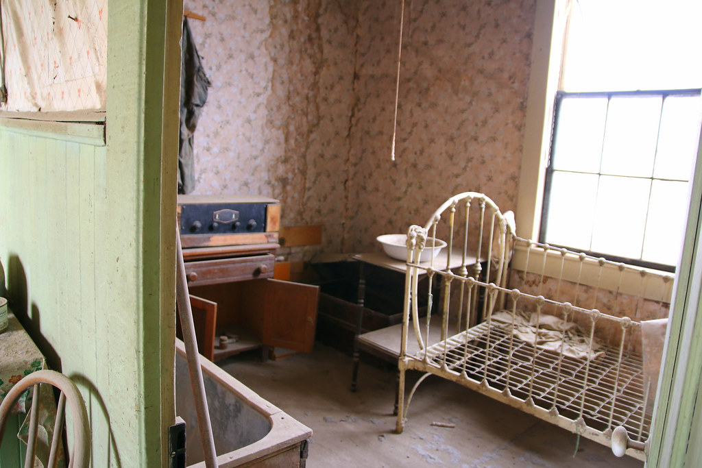
Inside of a living house.
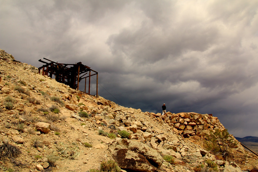
Unfortunately they didn’t offer a guided tour to the mine itself when I was there. Entry only with a guided tour..
I then spent two days in Camarillo and checked out all the outlet stores. I found a lot of cheap clothes and shoes for my journey (you won’t believe me what I would pay for that stuff in Switzerland).
After Camarillo I drove up the coast to Santa Barbara, one of my favourite cities in the US. It’s already two years ago when I spent 3 months in Santa Barbara at EF, a language school for English. I had the time of my life back then. Super nice city, not too small not too big, nice and friendly people, perfect weather, nice girls and mind blowing parties in Isla Vista (some of you may have heard of it, or experienced).
I stayed for three days, met a friend from back then, chilled a day on the beach and walked up and down on State Street.
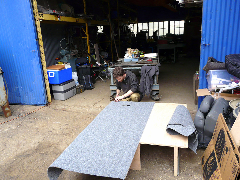
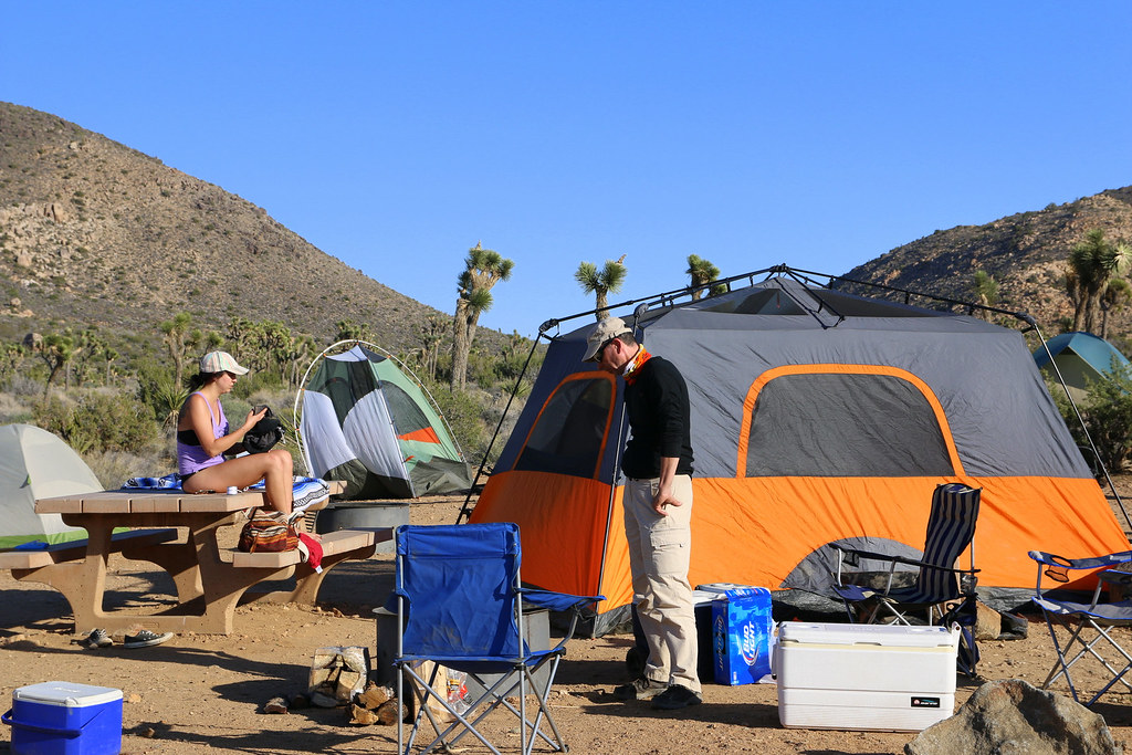
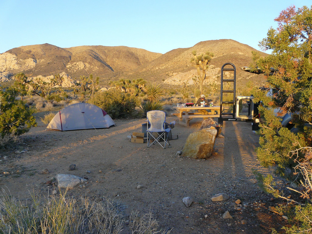
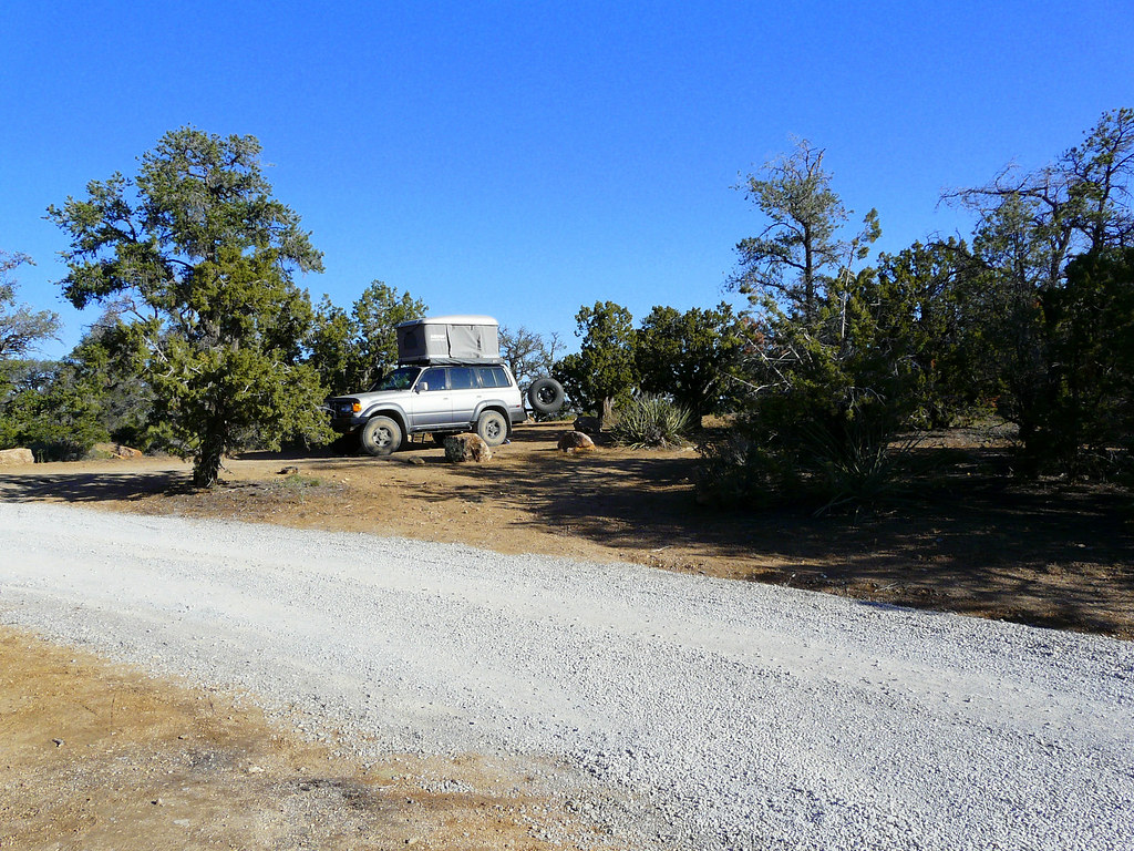
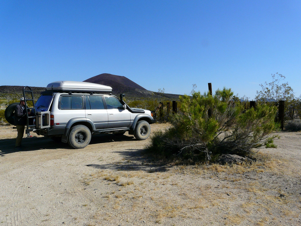
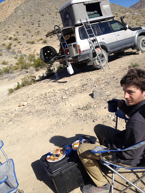
I wished I had more time to spend in Santa Barbara, but I made my way a little bit up the coast to the San Luis Obispo area where I met my friend Jack. He let me stay at his awesome property for doing some work on the Land Cruiser. My plan was to build a storage/sleeping platform to store all my stuff and equipment secured and having a place to sleep in bad weather or for some stealth camping. Jack offered me all his tools and machinery to work with and I even had nice spot outside the sop to do my work. I started with removing the second seat row, cleaning out the whole truck, made a couple trips to Walmart and Home Depot and started to build the platform.
I first laid a new carpet over the old one, mostly to save the factory carpet from scratches due the storage boxes.
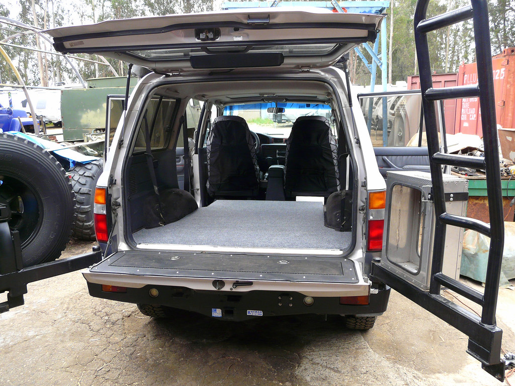
I then made a simple sleeping platform with square poles, a wall in the middle so the boxes don’t fly forward when braking, a cut out on the driver side where the door is for the fridge and some tie down hooks in case I’m having some stuff on the platform. It won’t win a design prize, but it only has to be good for about six months.
It turned out pretty well and sturdy enough for me. I bough the storage boxes at Home Depot, three big container and two flat ones, but the same size as a big one when stacked together. They fit absolutely flush under the platform and they don’t even move between the wall and the tailgate. The platform is simply tied down with a ratchet strap using the mounting brackets from the third row seats. No moving or bouncing at all. I was kinda surprised how well everything turned out for a first try.
[EDITOR’S NOTE: We’re sorry, this image has been removed.]
I was busy for a couple days with building my storage platform, drinking beer, sitting around the fire pit and enjoying the time with Jack and his girlfriend. Days just flew by and on April 11th it was time for picking up my dad at the airport in Los Angeles.
I grew up with my dad and we stay very close to each other, he loves to travel and camping, I was looking forward for a good time together! I assume I’m very blessed having the opportunity to travel in a country oversea for five weeks with my dad. Such a perfect father son-trip.
I barely made it to LAX due the terrible traffic, how can you live down there?? I arrived just in time and together we were back on the road. We decided to drive to Santa Monica and then along the coast up to Camarillo again. Bad decision. It took us almost two hours from just from Santa Monica to Malibu. But it was warm, sunny and we were both in a good mood and had a lot of time to talk.
We spent the night in Camarillo, went shopping for my dad in the outlet stores the next day and continued north back to Jack’s place. I had to finish the sleeping platform and we had enough time for drinking cold ones, playing boccia and having good dinner and nights around the fire pit with Jack and his girlfriend. A big thank you again two this two amazing people, my dad and I had a blast!
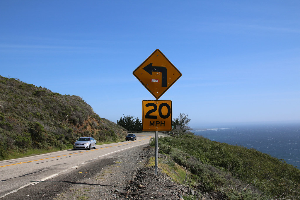
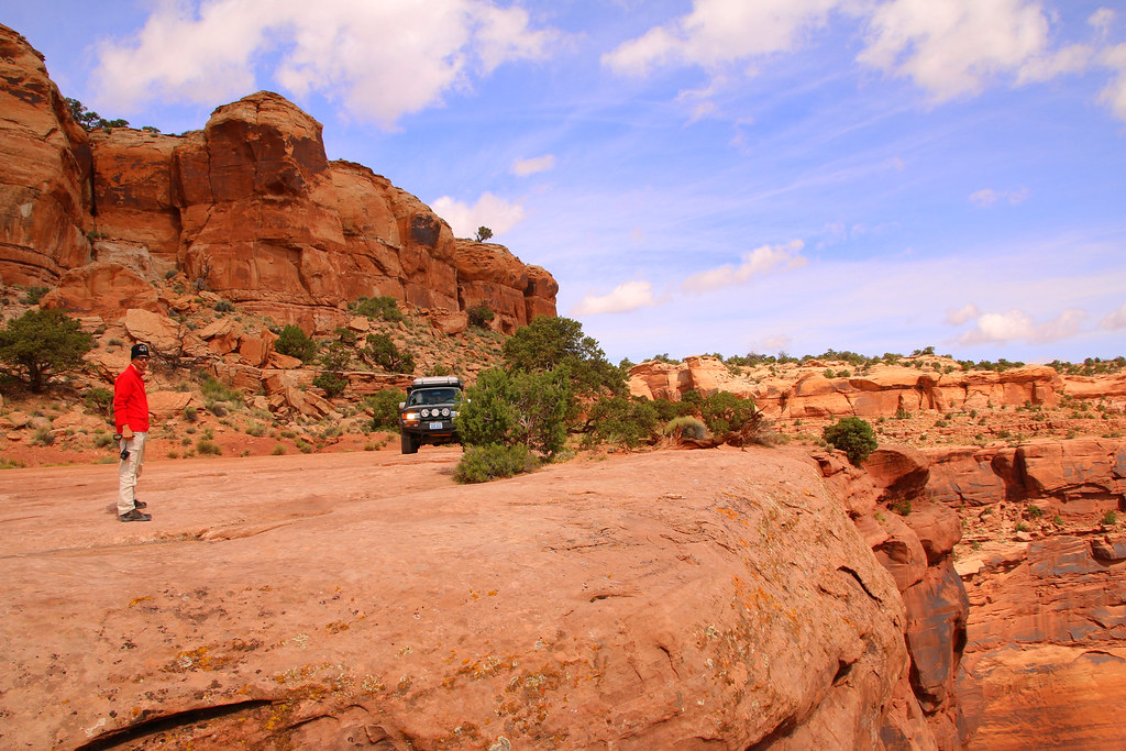
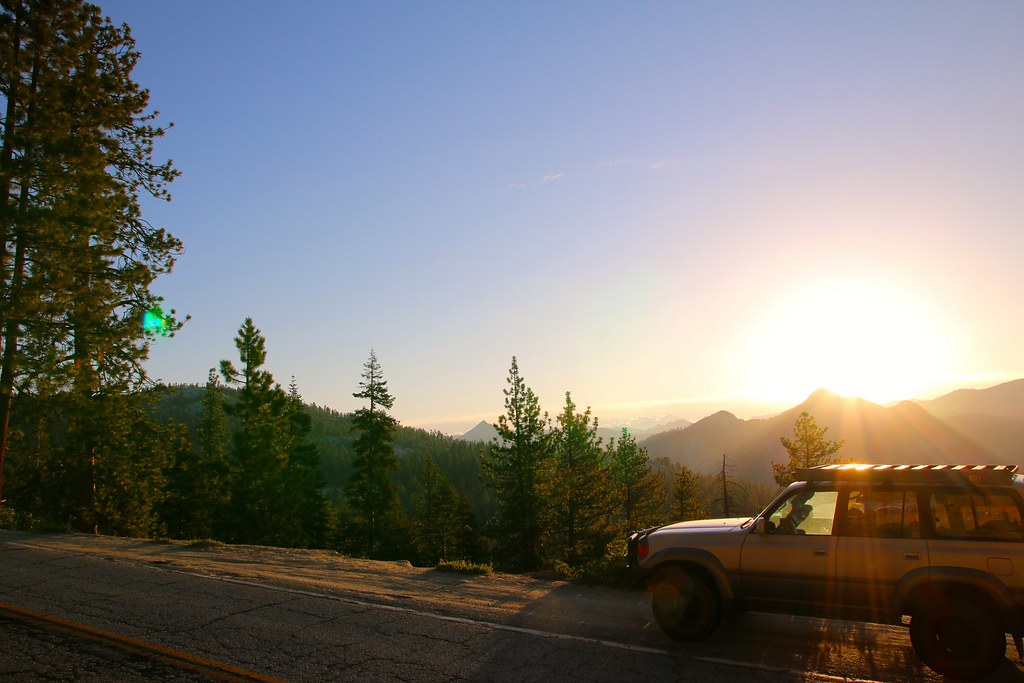
It was time saying goodbye and hitting the road direction north to Big Sur. Jack highly recommended that curvy stretch of Highway 1 along the steep cliffs.
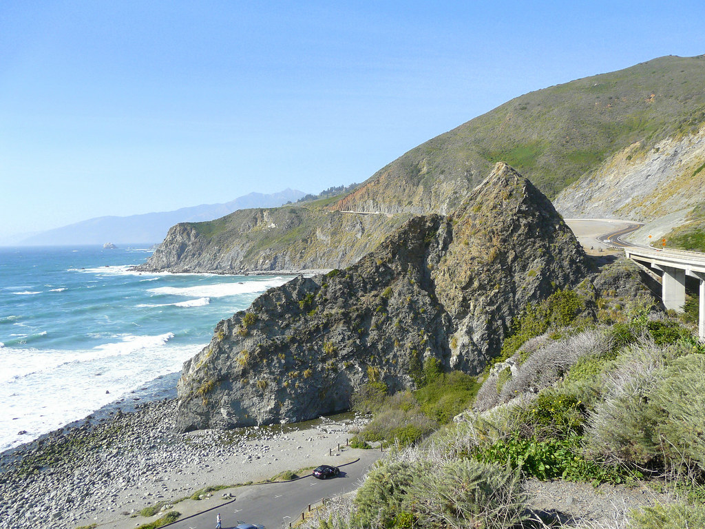
The view next to the road really was amazing and the road was nice to drive. It was amusing seeing the big rental RV’s struggling with curves.
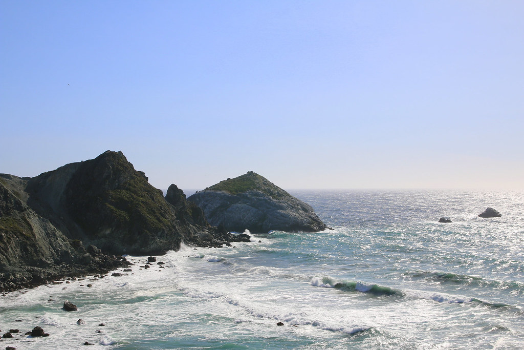
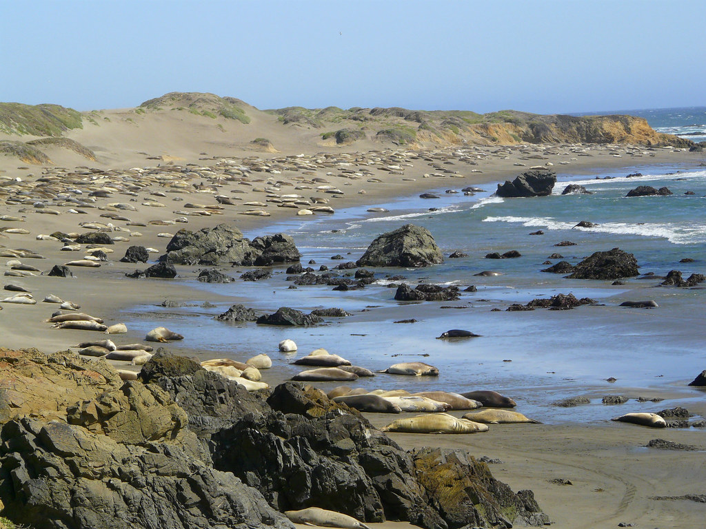
Sea Lions and Elephants all along the coast.
We tried finding a camp spot at one of National Forest campgrounds, but they all were already full. We ended up on a nice private one and spent a first and cold night camping. lets get up early in the morning to avoid the tourism traffic my dad said, just for being stuck behind this guys the next morning..
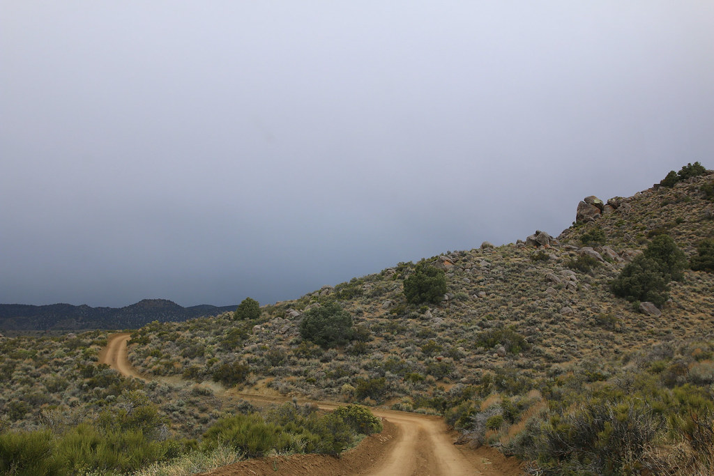
We were driving back south for a while and then turned onto Nacimiento Ferguson Road which brings you up the hills and more inland. It was a very nice and relaxed drive.
[EDITOR’S NOTE: We’re sorry, this image has been removed.]
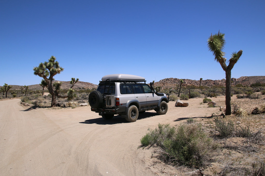
We drove all the way east to Bakersfield, spent the night there and moved on to Joshua Tree National Park.
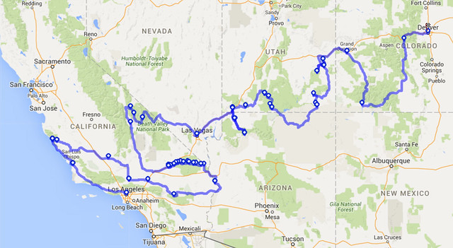
This is the route we took from LA to Denver, more or less.
The first thing we did at the park entrance was buying the Annual Pass for all National Parks. It’s definitely worth the price.
I hoped getting a camp spot at the Jumbo Rocks Campgrounds but it was already full when we arrived. We then found a nice place on the Belle Campground, almost the last one. Belle was smaller as Jumbo Rocks and maybe more quiet, which was nice.
[EDITOR’S NOTE: We’re sorry, this image has been removed.]
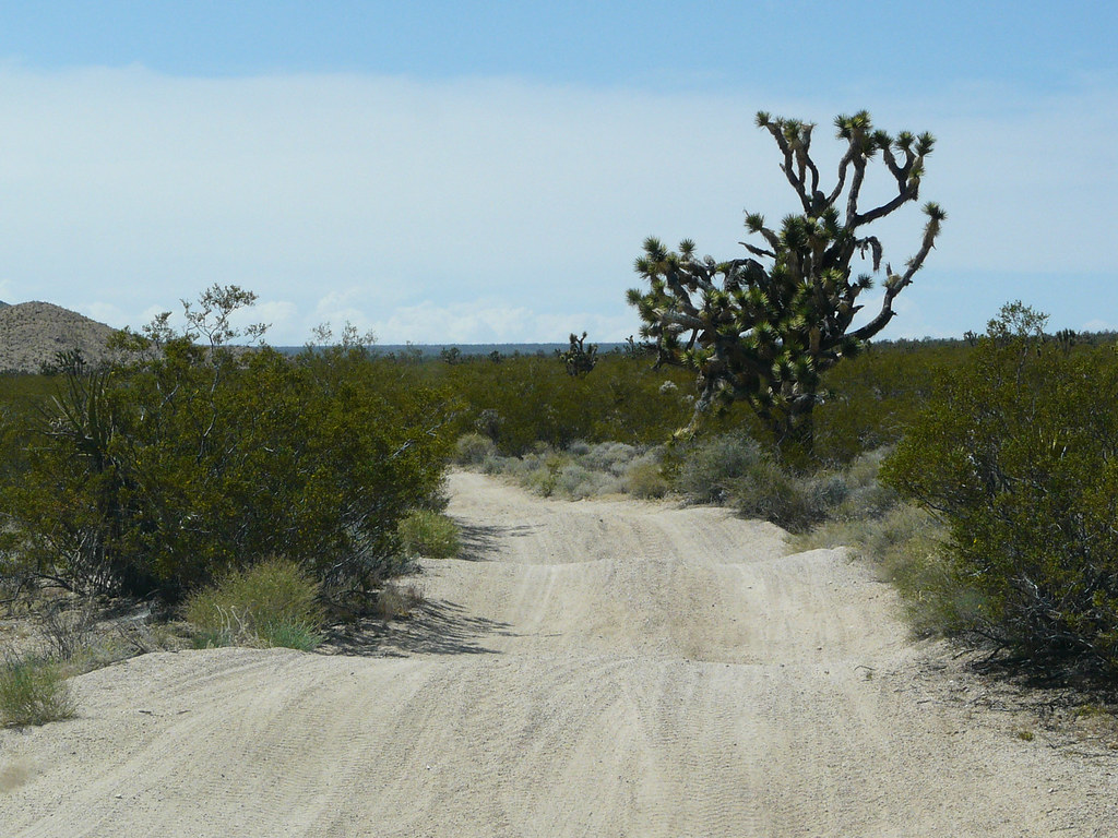
We had a quick lunch and started exploring some of the dirt roads.
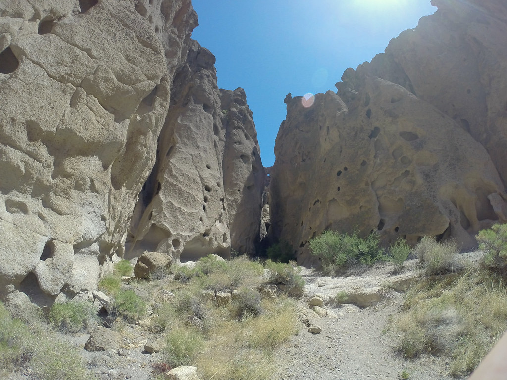
We also did a short hike to an old mine. There wasn’t much left from the mine but scenery was beautiful.
[EDITOR’S NOTE: We’re sorry, this image has been removed.]
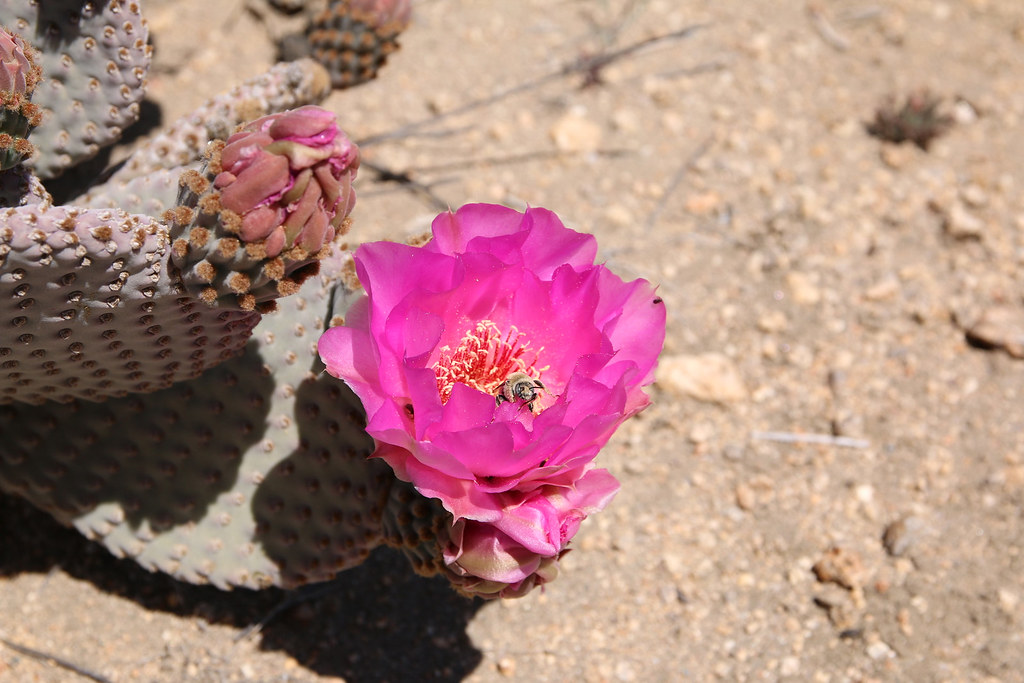
Everything was blooming around us.
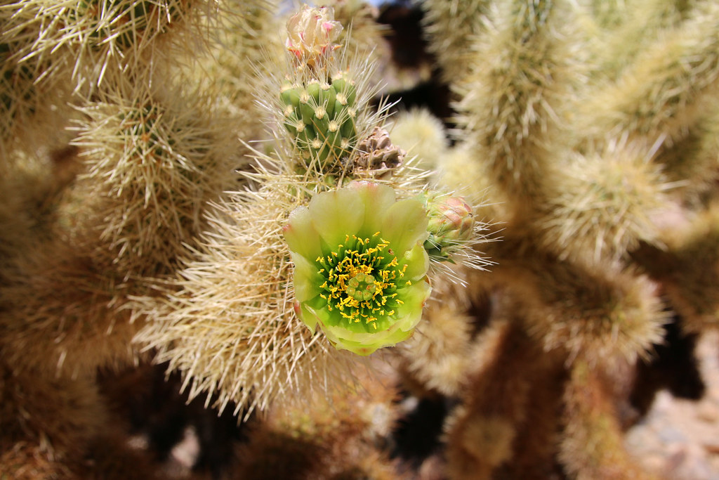
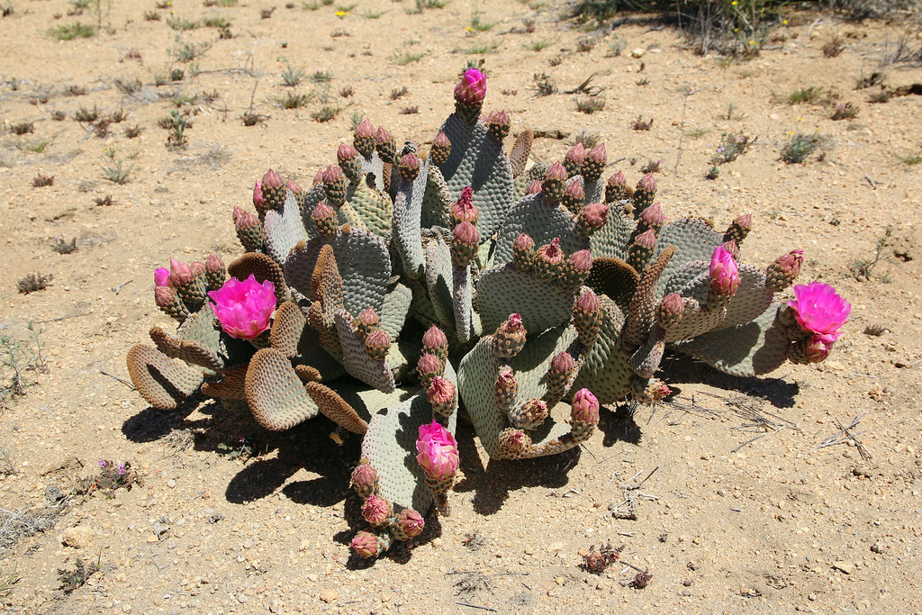
And the bees were busy.
The first thing we heard when we got back to our camp spot was a girl from the neighbor site yelling “your chairs, bring them over!”. Alright then, we moved our chairs and were chatting ad drinking beer with our neighbors.
My dad, focused on lighting up the fire.
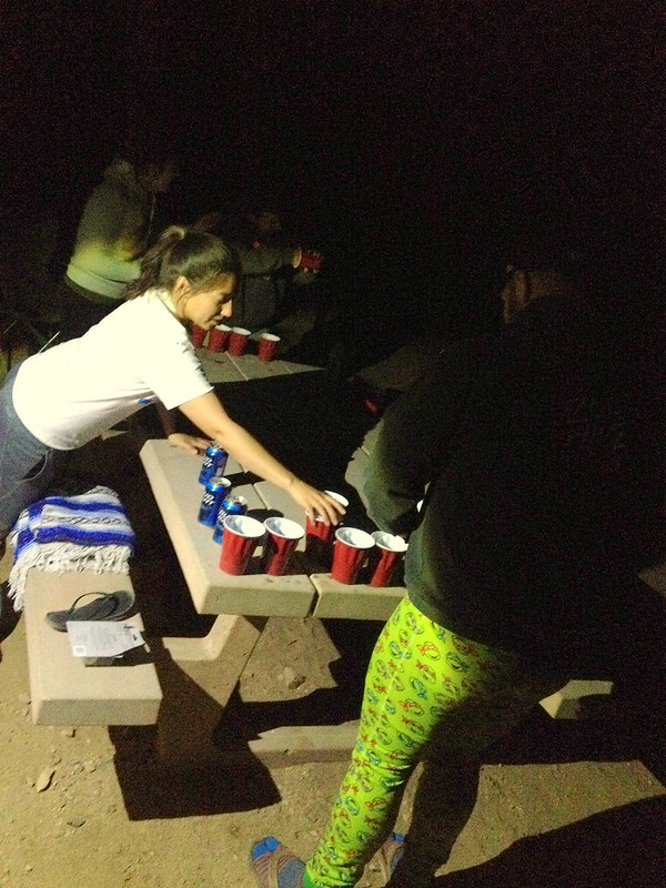
We had a very fun evening with them and we started a small beer pong competition. Even my dad never played beer pong before and didn’t really get the rules, we won the first round and made second place. I think you can assume that the evening got even more fun.
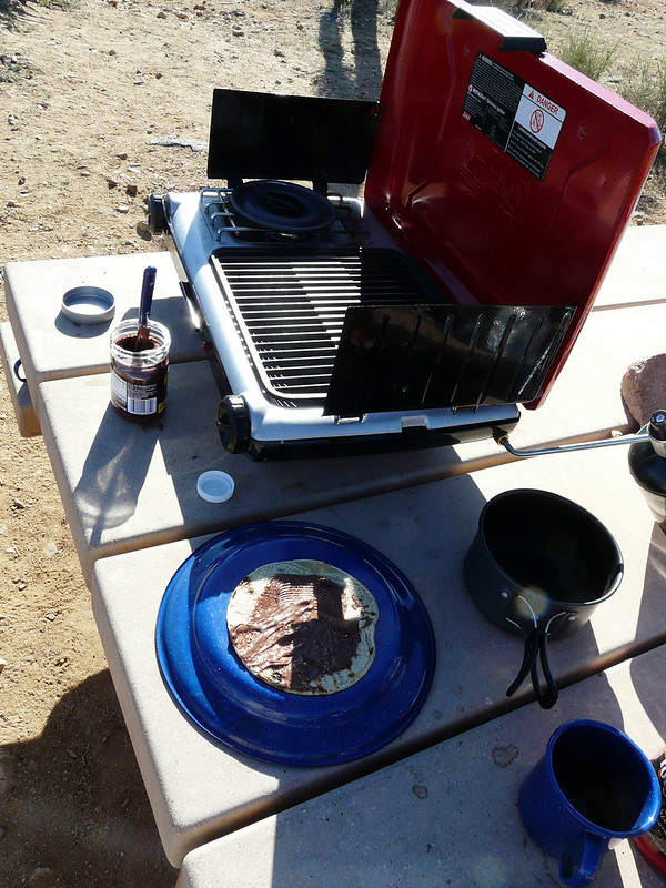
Chocolate-tortias-whatever for breakfast.
We again spent the days with driving and walking around in the park, checking out all the highlights of the park.
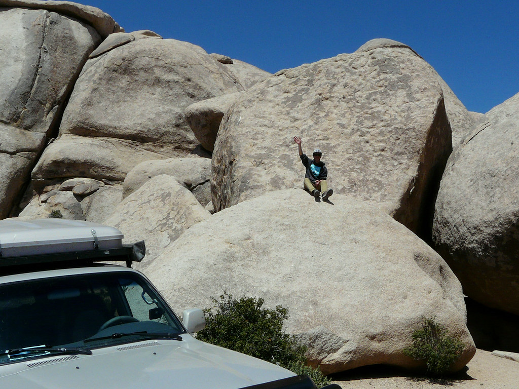
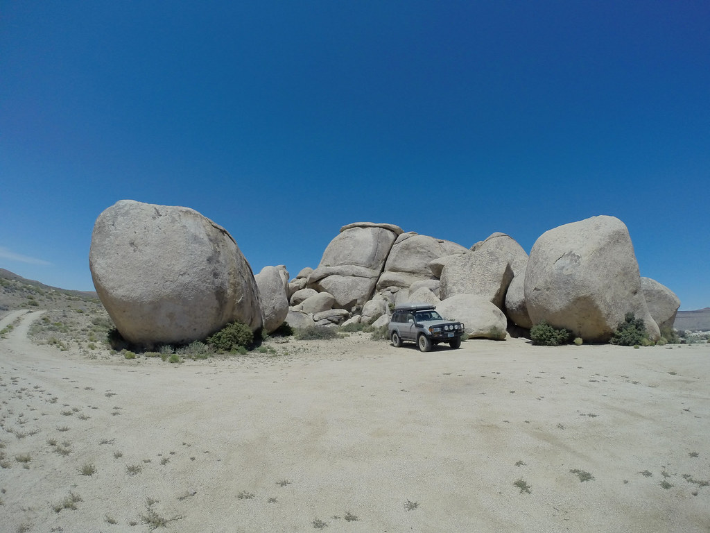
The Campground is absolutely beautiful with all the joshua trees and the boulders laying around. This park definitely ins one of my favourites. Enjoying the camp site at the evening.
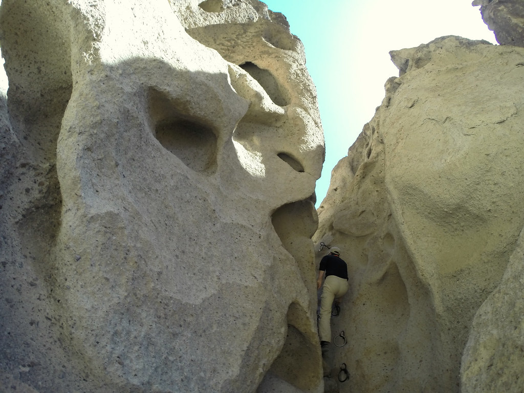
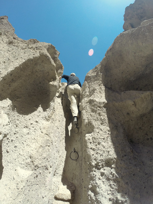
Obviously rock climbing is a common thing in and around the park.
[EDITOR’S NOTE: We’re sorry, this image has been removed.]
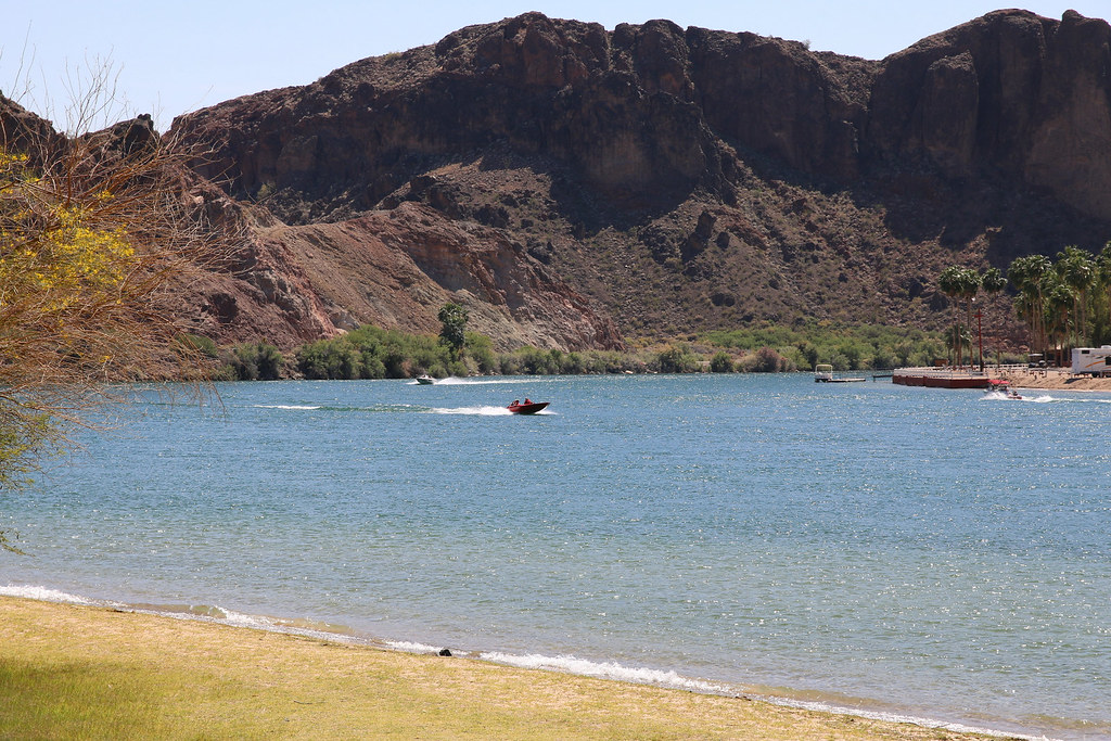
On the next day without headache we wanted to see the Colorado River and drove to Lake Havasu City. We watched the boats racing up and down the river at Buckskin Mountain State Park while having lunch.
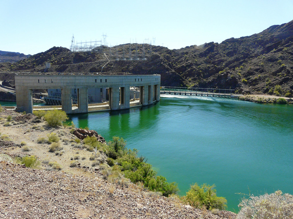
Parker Dam along the Colorado River.
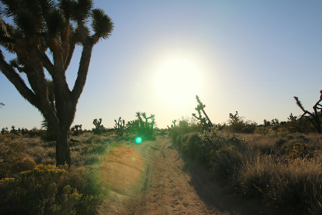
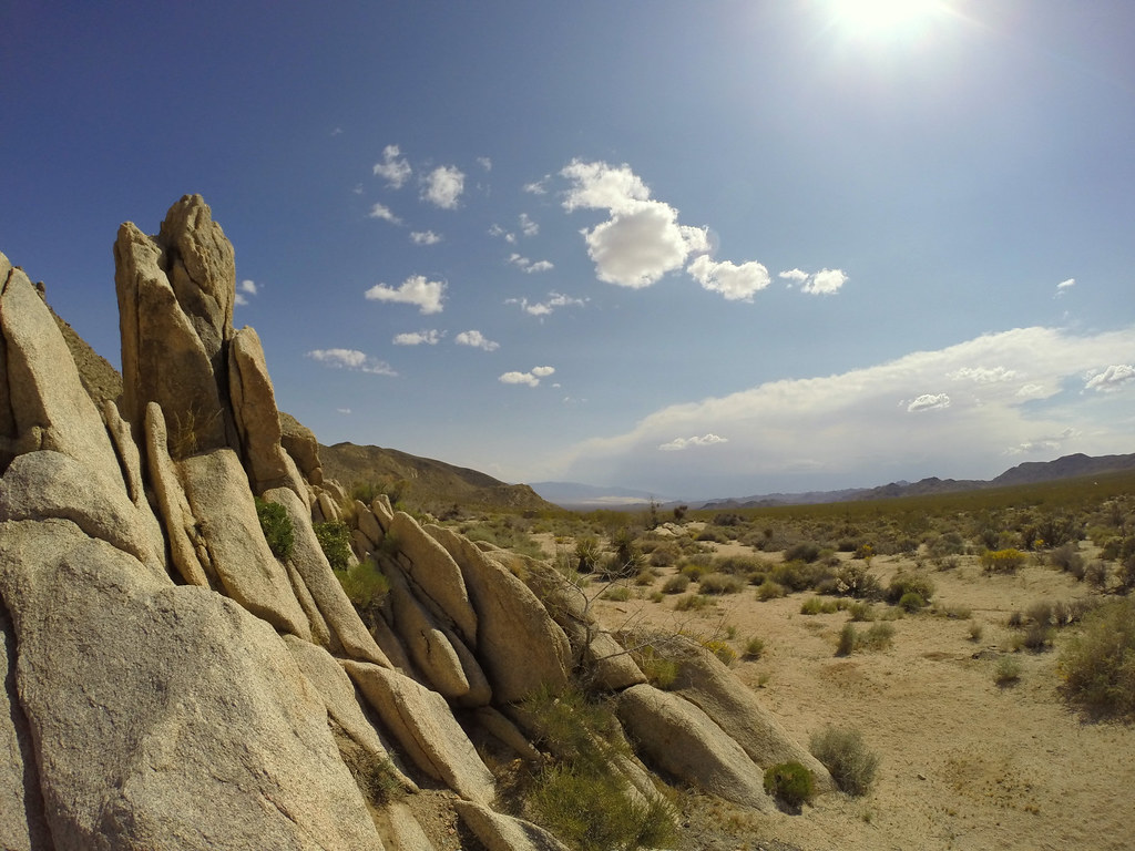
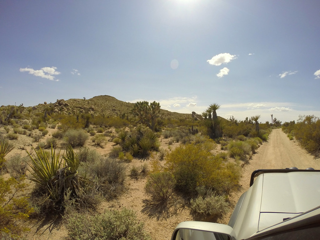
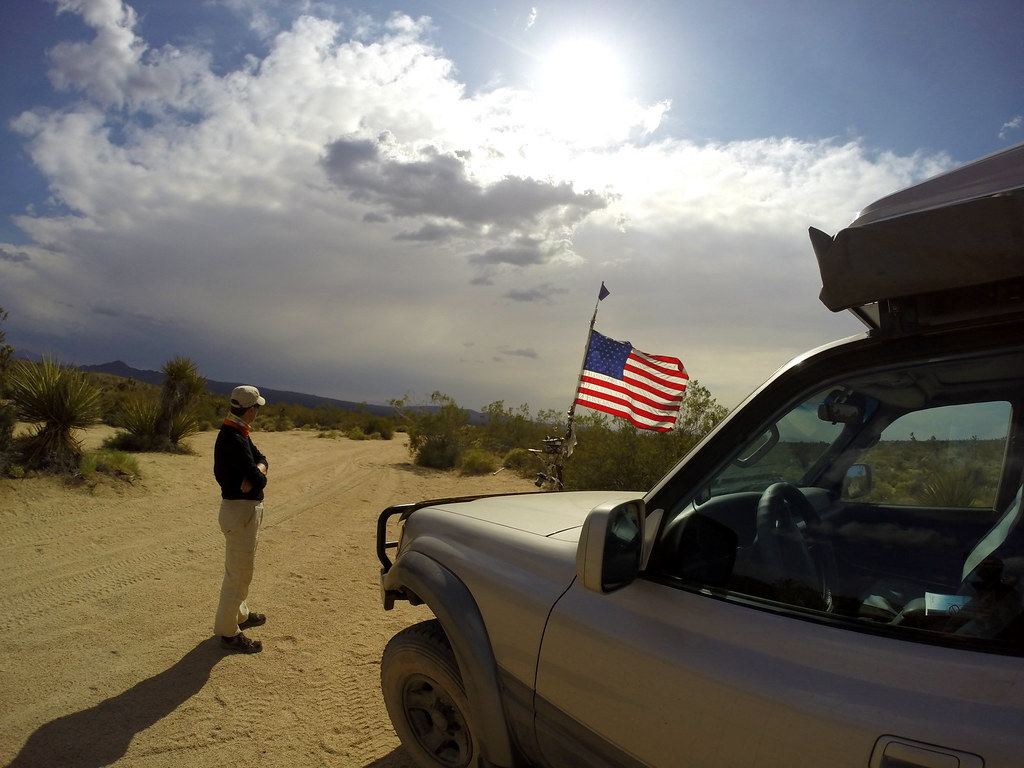
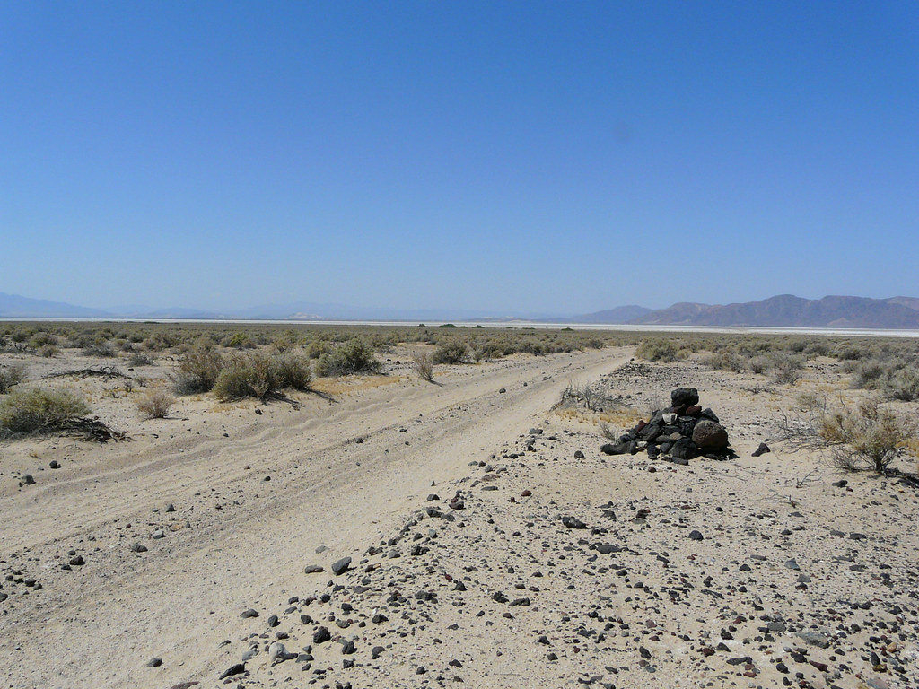
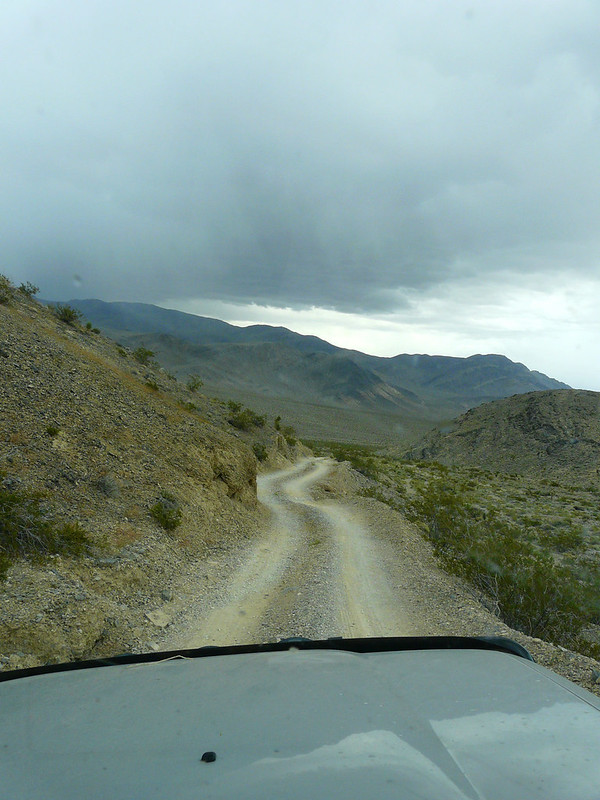
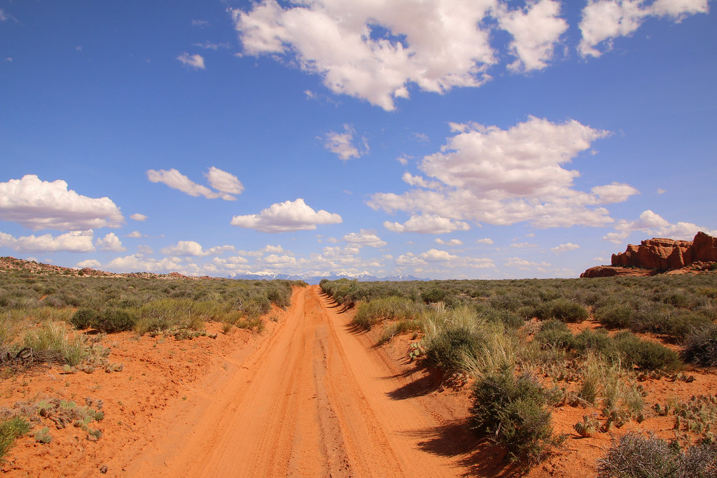
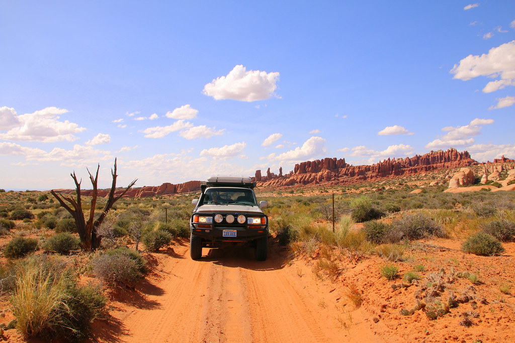
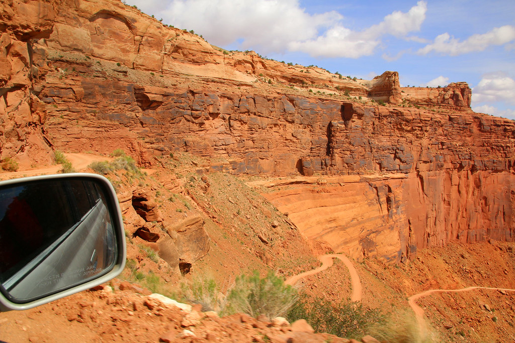
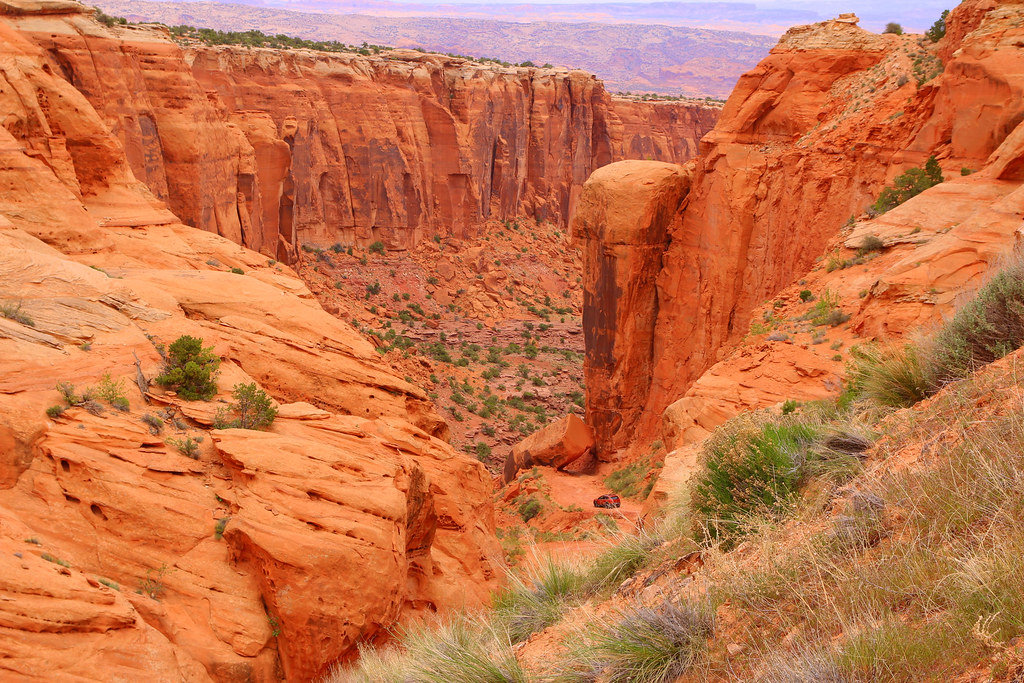
Next thing to accomplish was crossing the Mojave Desert on the old Mojave Road.
After getting groceries we tried finding the starting point of the Mojave Road on the eastern side. We bought the book Mojave Road Guide at a visitor centre and we had a GPS track on my dads handheld GPS. Even though, finding the beginning of the road was a bit tricky. It was already noon when we started on the road near the casino, which was too late as we realized later.
[EDITOR’S NOTE: We’re sorry, this image has been removed.]
Coming from Switzerland where civilization is everywhere around you, driving on a dirt track through a remote desert with just one car was very special for us. We didn’t really have an idea what to expect, we’re just not familiar with situations like this. So we decided to at least inform our friend Jack with a text message that we’re driving the Mojave Road for the next three days and we will get back to him after crossing the desert. We had a much better feeling then.
A long stretch of the road.
[EDITOR’S NOTE: We’re sorry, this image has been removed.]
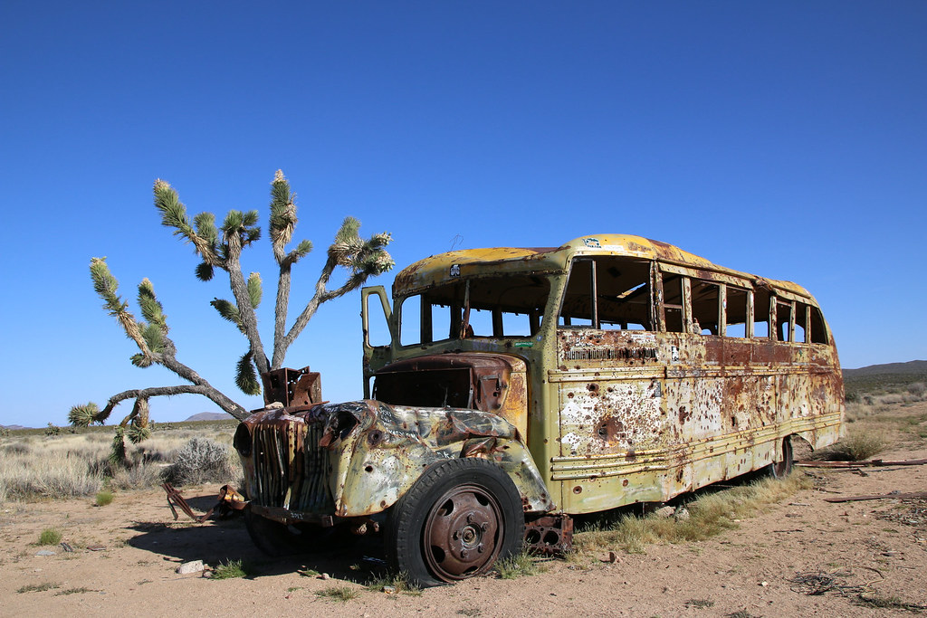
We soon made it to the “magic bus”. I’ve seen that place before in other trip reports and was pretty excited to finally see it by myself.
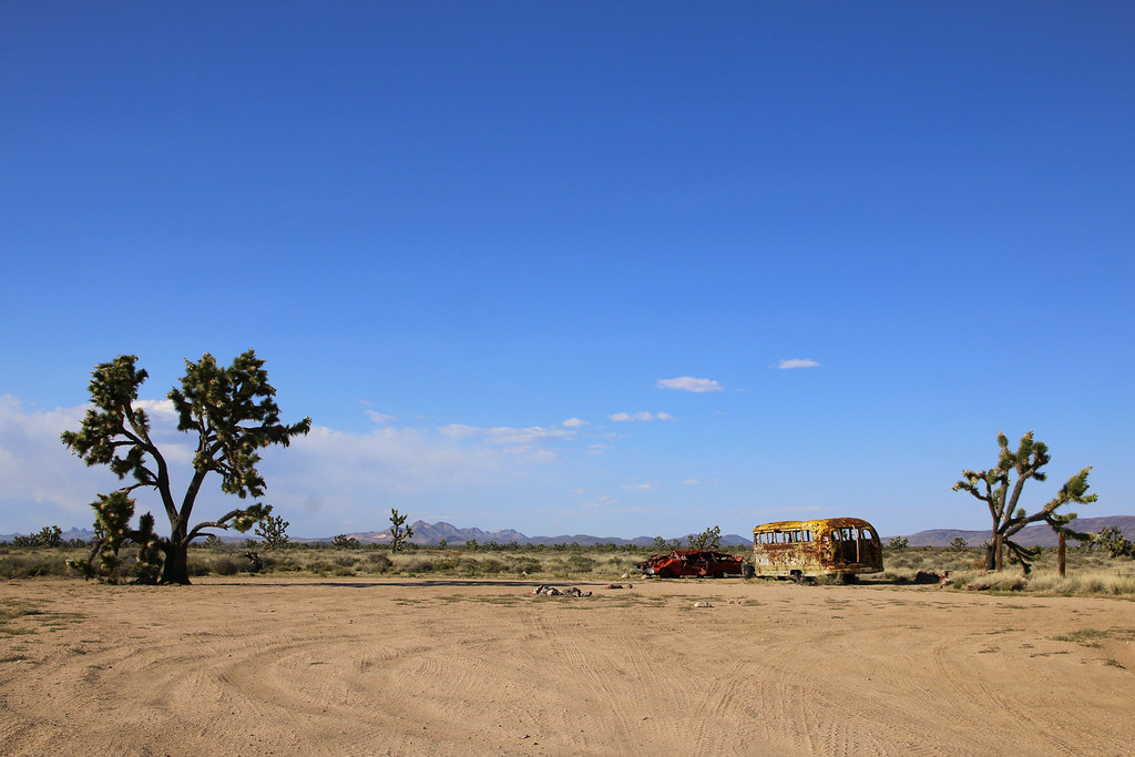
Taking pictures and exploring the are was the next thin of course.
[EDITOR’S NOTE: We’re sorry, this image has been removed.]
By the way. Does anyone know the story behind that bus? How did they make it that far into the desert with it?
[EDITOR’S NOTE: We’re sorry, this image has been removed.]
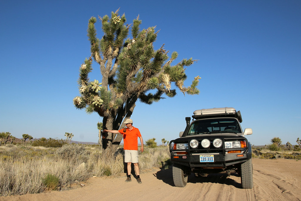
Probably the biggest joshua tree we have seen so far.
[EDITOR’S NOTE: We’re sorry, this image has been removed.]
Seems like some people are living there, must be nicely warm in the summer months.
[EDITOR’S NOTE: We’re sorry, this image has been removed.]
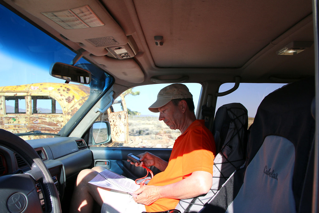
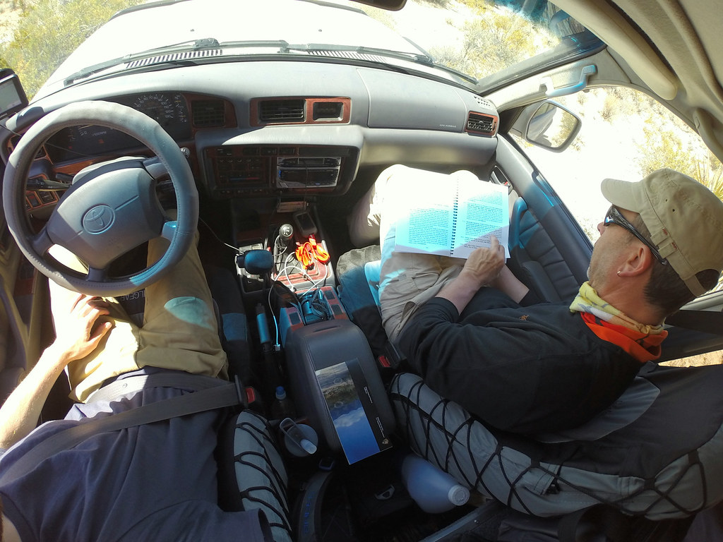
My navigator on duty.
The sun already started setting down when we passed the Penny Can Tree.
[EDITOR’S NOTE: We’re sorry, this image has been removed.]
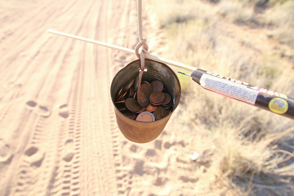
We didn’t leave without spending two pennies. It brings luck they say, and luck is always nice to have.
It was getting tight sometimes.
While the sun didn’t stop setting even more down, we started getting worried a bit of finding a good place to camp. The sun was already down when turned into the wide Cedar Canyon Road. We decided to skip the steep hill into Rock Spring Canyon and went straight on to the Mid Hills Campground. It was already dark when we arrived, had some dinner and I had time to play around with the camera.
The campground was pretty nice as we realized the next morning.
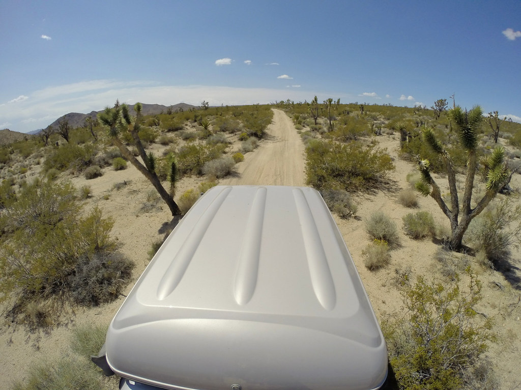
We packed our stuff and went off to explore some trails in the area.
Some in open terrain and some more fun to drive.
We wanted to do a short hike and went to rancher station where the Hole in the Wall trail starts.
Getting the wrong trail is almost impossible, just walk further into the canyon.
And up it goes.
Nothing an old Swiss mountaineer couldn’t handle.
The trail was fun and while driving back north to the Mojave Road, we took a brake next to big boulders. That would have been a nice camp spot for the night.
After being back on the Mojave Road we reached a long whoop de doo section. My dad is famous for getting seasick real quick but we had fun, or at least I had.
Navigating on the road isn’t very difficult. With the book and the GPS track we almost had zero problems. When we turned into a wrong track we saw ourself getting away from the GPS track and had to turn around. But with all the stone foundations along the road, getting lost is almost impossible. And my navigator did such a great job.
The scenery along the road is just stunning.
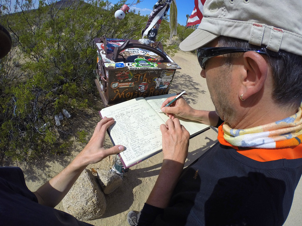
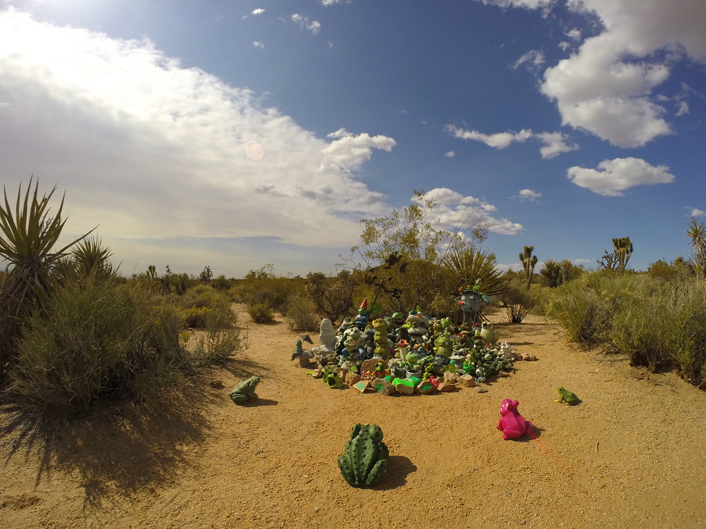
And we made it to the mailbox.
Signed the guest book.
And watched the frogs jumping around.
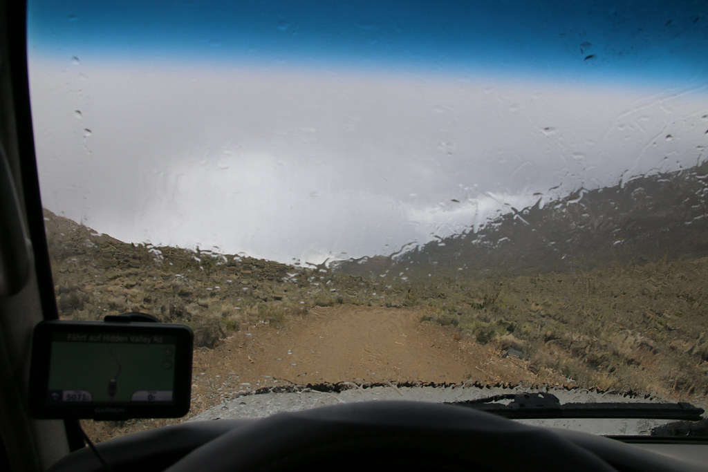
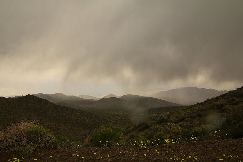
The weather was acting strange at this time and it looked like rain for the most time. We or particularly my dad were a bit concerned about the weather situation. We had no idea how fast the weather could change in this area or what happens when it starts raining.
While checking out the Lava tube the sky was covered by dark clouds.

We made the decision to not camp in the desert due the weather situation and drove over the paved Kelbaker Road to Baker. There wasn’t anything going on in Baker but we found a motel (probably the only one) and had dinner at Denny’s.
The next morning we drove back to the point we left the day before and had breakfast at an old cattle ranch.
We followed the Mojave Road and landscape got wider and flat while approaching the salt lake.
Driving on a salt lake was an absolutely unique experience for us. The track was dry and no problem to drive on it at all.
[EDITOR’S NOTE: We’re sorry, this image has been removed.]
Since we’re from a small country, we only brought two small stones with us for the travelers monument. What an amazing and unique place out there!
[EDITOR’S NOTE: We’re sorry, this image has been removed.]
Driving in the wash was a lot of fun but also tricky on finding the right track. I wished I had a Baja Bug!
We made a couple stops along the railroad tracks in the hope seeing a train passing by.
[EDITOR’S NOTE: We’re sorry, this image has been removed.]
No luck for us but we got recompensed with some wildlife next to the tracks.
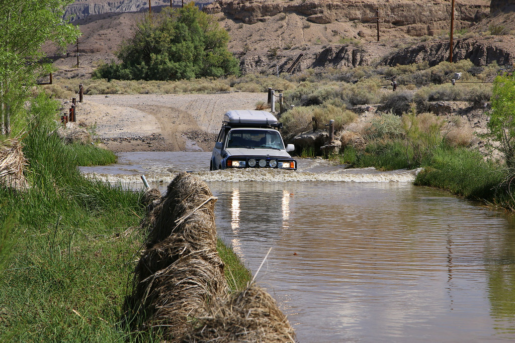
The water crossing was one of the best parts of the road. No problem for the Land Cruiser.
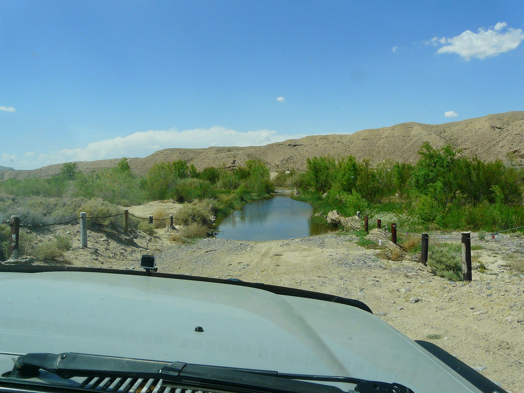
I wanted some pictures of the Land Cruiser in the water, so I kicked out my dad with the camera and drove back through the river.
[EDITOR’S NOTE: We’re sorry, this image has been removed.]
We tried following the wash after Afton Canyon when it started raining. We turned around, drove back to Afton Canyon and went to the Interstate.
[EDITOR’S NOTE: We’re sorry, this image has been removed.]
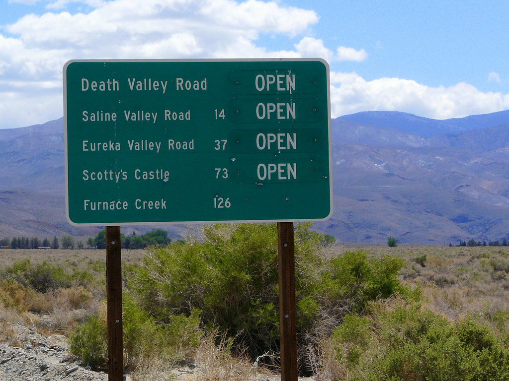
Crossing the Mojave Desert was a full success and we left a great chapter of our trip behind us and drove north, to Death Valley.
We started our Death Valley trip from the north near Big Pine. We found the start of Saline Valley Road and followed the gravel road.
The first stretch of the road was pretty nice with lot of little valleys and some mines near the road.
The Bat Pole which marks the turnoff to the Hot Springs.
[EDITOR’S NOTE: We’re sorry, this image has been removed.]
[EDITOR’S NOTE: We’re sorry, this image has been removed.]
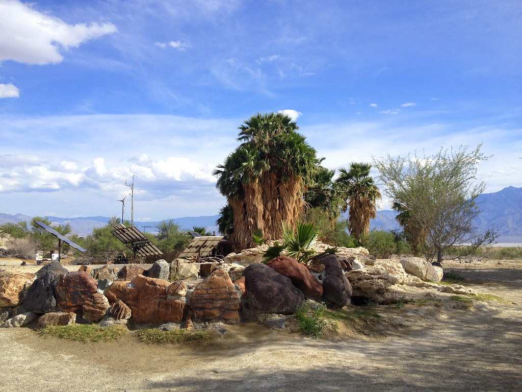
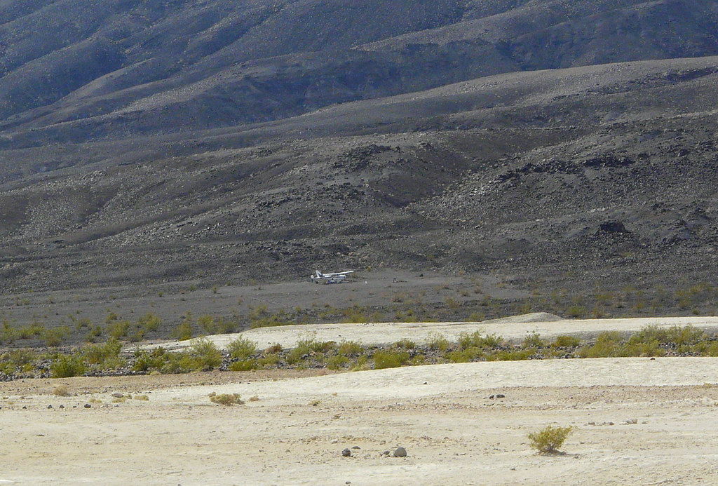
The Hot Springs is just a surreal place. Palm trees, plants, green grass and a couple hippies with very cool homebuilt campers.
[EDITOR’S NOTE: We’re sorry, this image has been removed.]
We had absolutely no clue what the aircraft was doing out there. Maybe delivering pot supplies for the hippies, who knows.
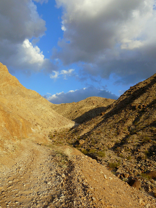
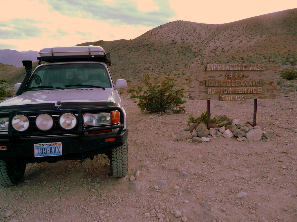
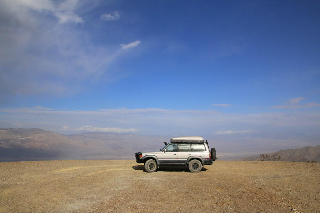
Back on the Saline Valley Road we had a very shaky ride due all the washboard on the road. It was already late noon when we took the turnoff to the Lippincott Road. Maybe it was a good thing driving up Lippincott Road late in the day, the chance of oncoming traffic might be small.
[EDITOR’S NOTE: We’re sorry, this image has been removed.]
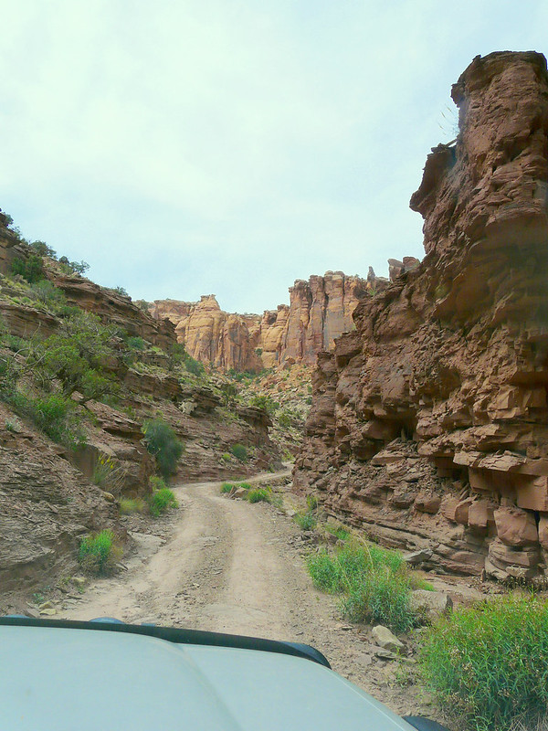
The road was quite challenging but fun to drive.
[EDITOR’S NOTE: We’re sorry, this image has been removed.]
Luckily we were the only one on the road.
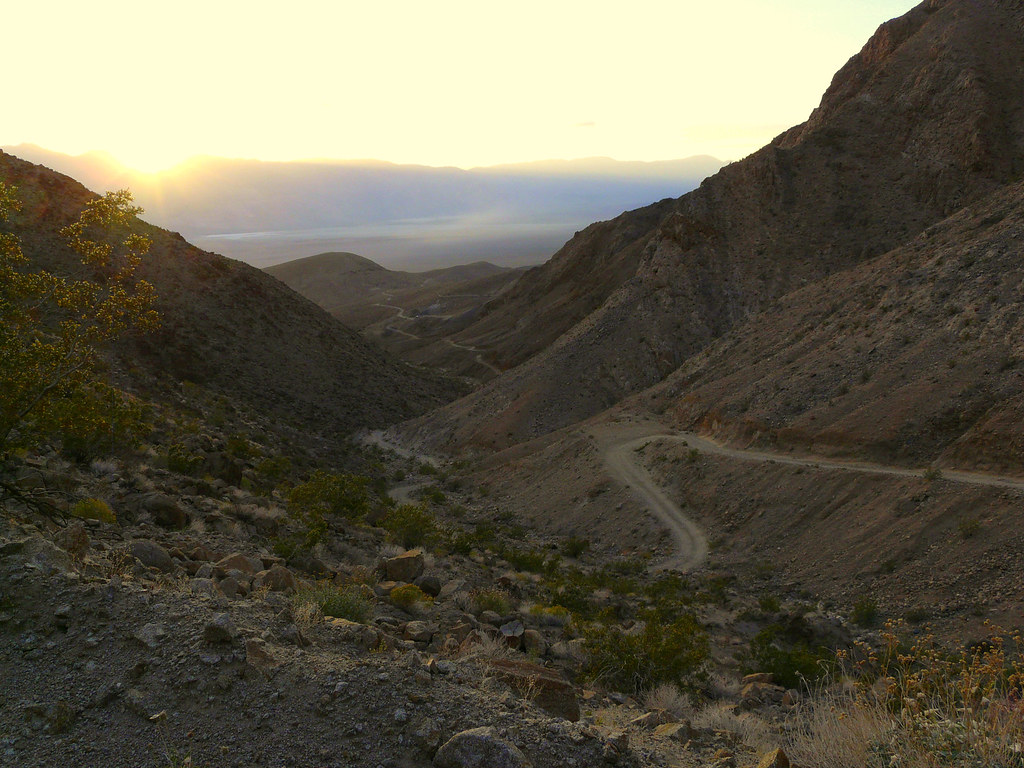
And we made it.
It was already dark when we set up camp on the Homestake Dry Camp. The next morning we had one of our delicious egg-bacon-ketchup-toast breakfast.
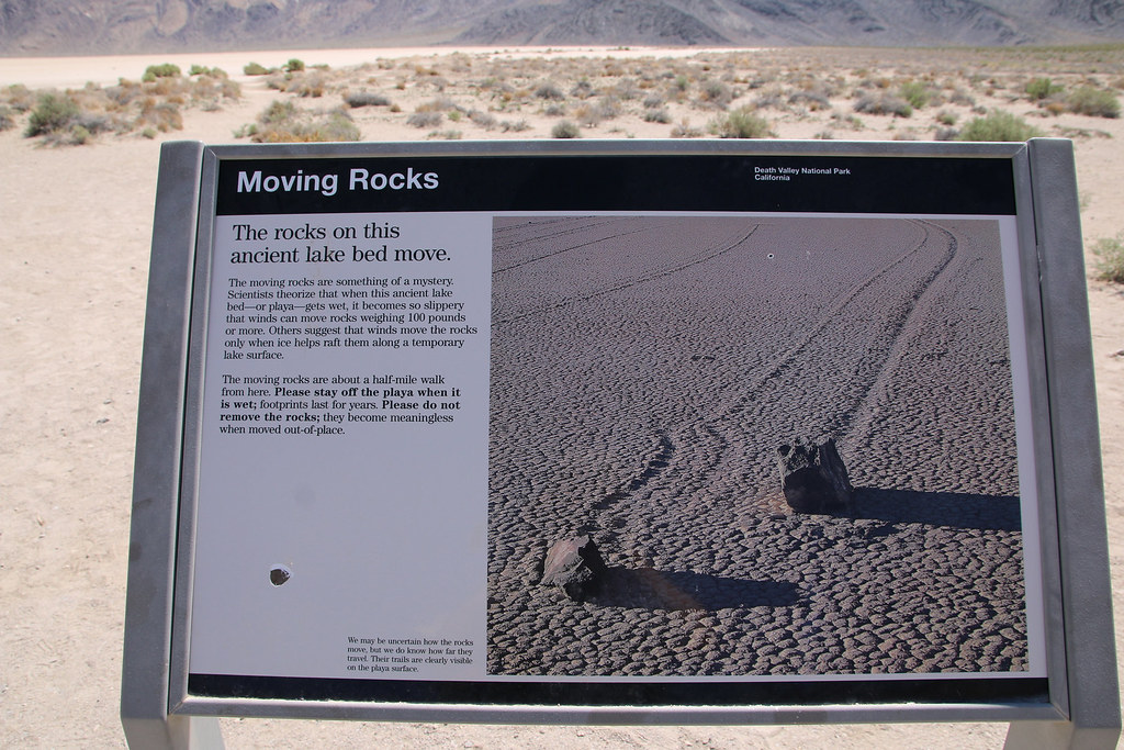
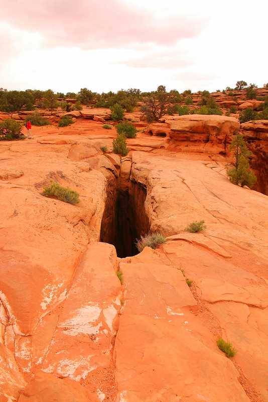
Now it was time checking out the moving rocks on racetrack playa! I’ve seen that place before in other trip reports and it was right as I imagined it. Absolutely stunning seeing the rocks and the spur. It’s still unknown how or why they actually move on the playa.
[EDITOR’S NOTE: We’re sorry, this image has been removed.]
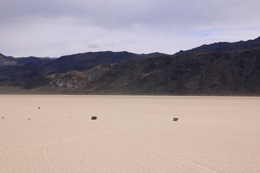
Some of them are really big and heavy.
[EDITOR’S NOTE: We’re sorry, this image has been removed.]
My dad doing what he can do best, goofing around.
[EDITOR’S NOTE: We’re sorry, this image has been removed.]
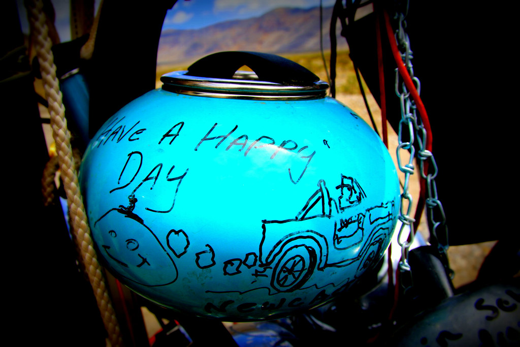
What else would you expect at the Teakettle Junction?
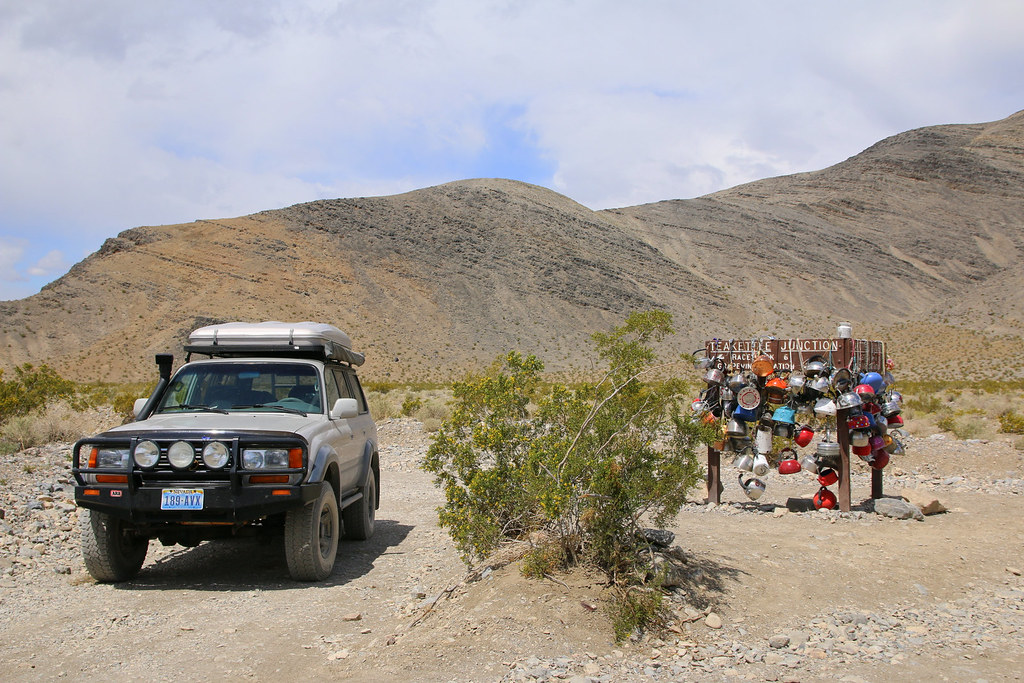
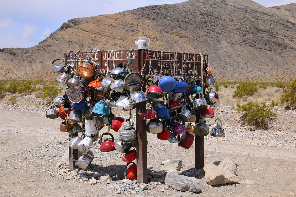
Unfortunately, we didn’t bring a teakettle with us.
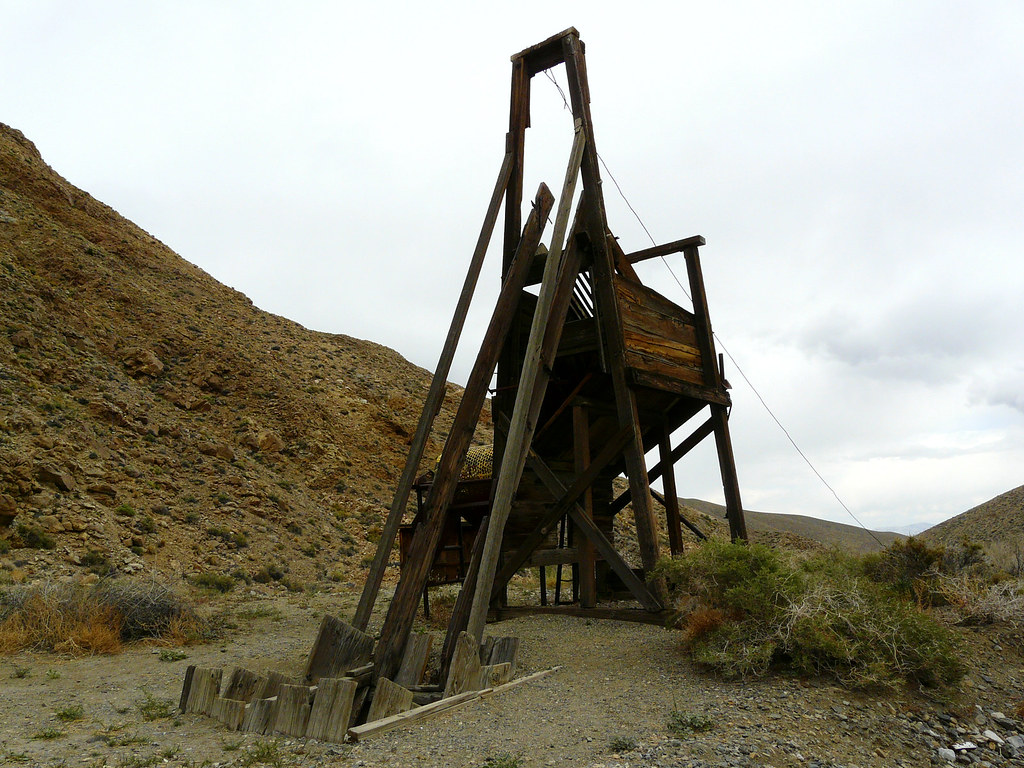
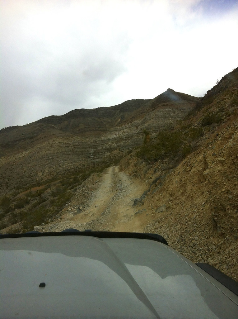
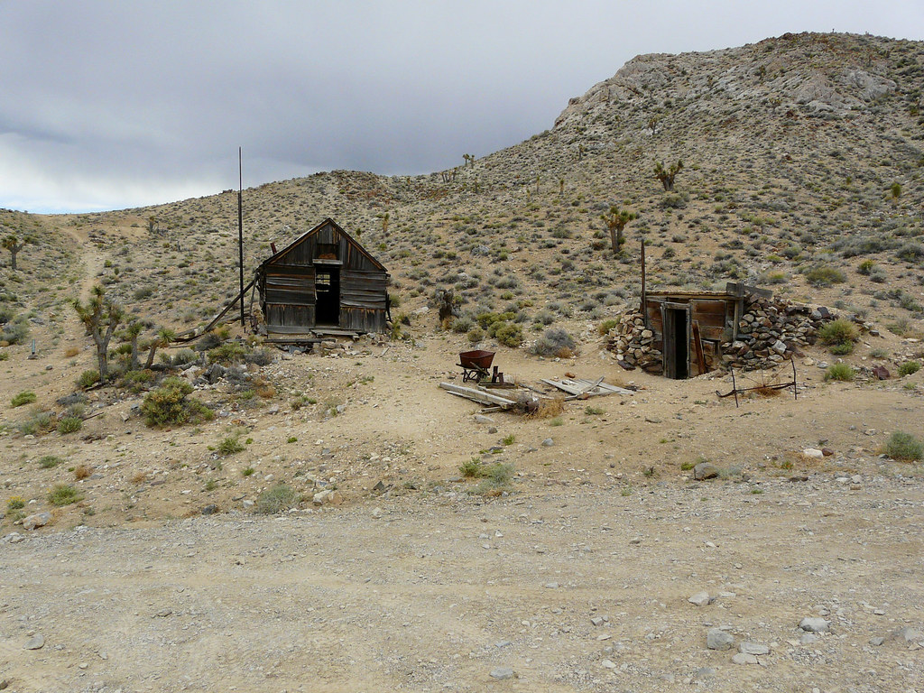
We didn’t want to drive the Racetrack Road to the Ubehebe Crater, so we took the other road at the junction which I forgot the name of. We made a little sightseeing tour to the Lost Burro Mine. Another small and narrow road.
Walking around and checking out the old mine and cabins was the next thing we did.
[EDITOR’S NOTE: We’re sorry, this image has been removed.]
History to touch – I love it!
And once again it seemed like we’re getting some rain.
[EDITOR’S NOTE: We’re sorry, this image has been removed.]
[EDITOR’S NOTE: We’re sorry, this image has been removed.]
Driving back the narrow road.
[EDITOR’S NOTE: We’re sorry, this image has been removed.]
We continued the road south and it was a perfect drive. Nice road with beautiful scenery. And then it started to rain, at Death Valley! And it wasn’t just a sprinkle.
[EDITOR’S NOTE: We’re sorry, this image has been removed.]
After hours on that nice road we slowly reached the main road which brings you into Death Valley via Panamint Springs.
[EDITOR’S NOTE: We’re sorry, this image has been removed.]
Lookout before the main road drops deeper down into the valley.
Camp spot for the night was at the Panamint Springs Campground and we had a nice dinner at the restaurant. Luckily we didn’t have to gas up at Panamint Springs were fuel prices are ridiculously high, props to the second fuel tank.
Making friends with the locals.
[EDITOR’S NOTE: We’re sorry, this image has been removed.]
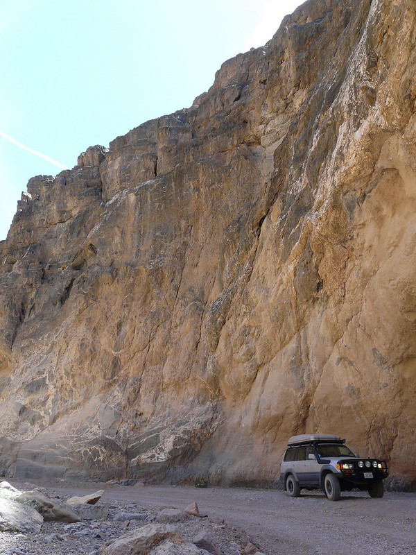
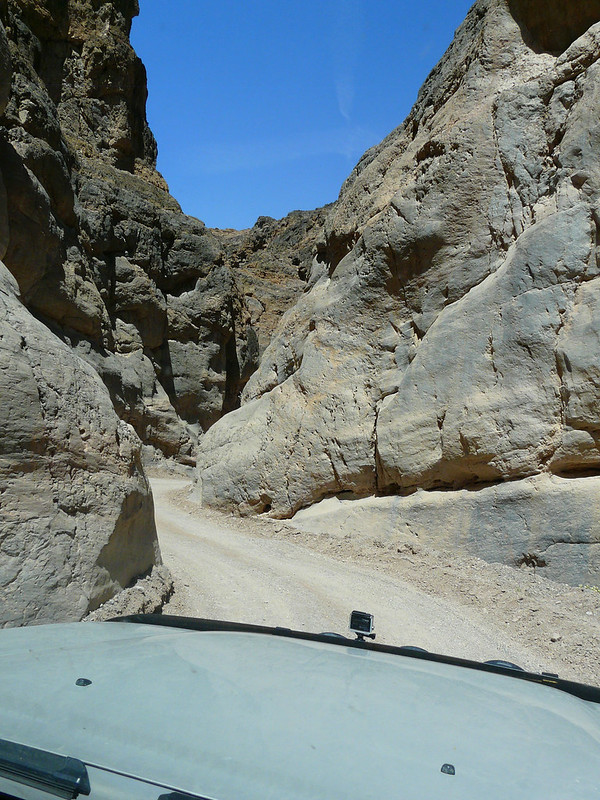
The next day we squeezed the big boy through Ti(gh)tus Canyon.
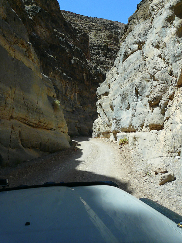
Titus Canyon Road is super easy to drive, we even saw a sedan on the road.
Las Vegas is close to Death Valley, my dad has never been to Vegas and we wanted to stay at a hotel/motel for a couple days, so off we went.
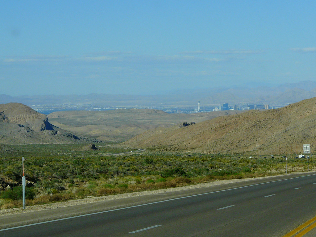
While resting at MC Donalds with free wifi, we checked out the hotels in Vegas. Luckily it was during the week and the prices were cheap for a nice room. I made an online reservation at a hotel for three nights in walking distance to the strip.
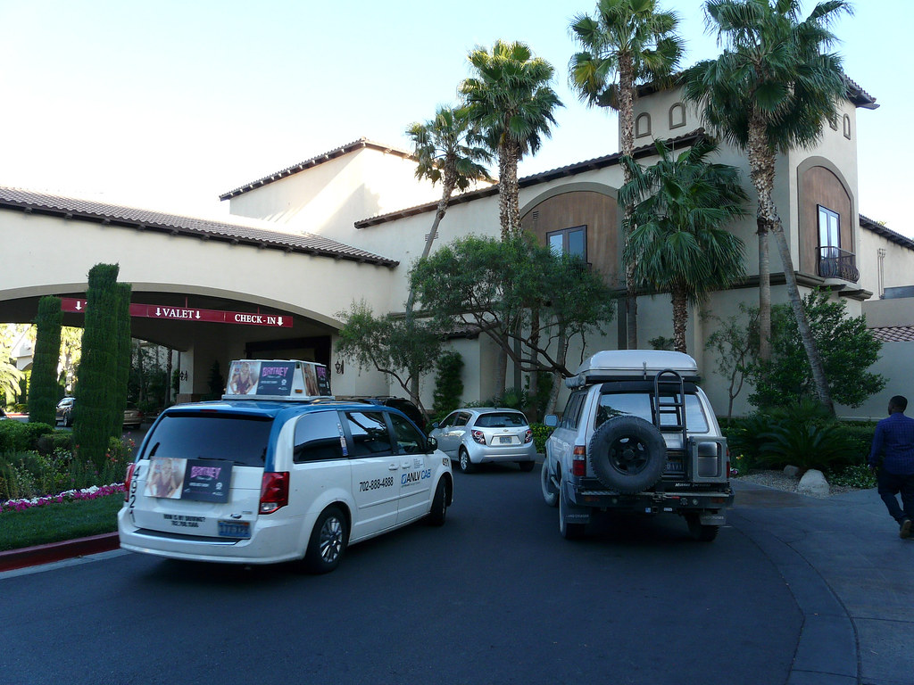
It was nice having a room, two big beds and a bathroom with hot shower. Two years ago I spent 4th July in Vegas with some friends of the English school I went to. I won’t say I’m traumatized, but it definitely was crazy! Vegas is fun, but I already had my fun and my dad isn’t a fan of big cities or a gambler neither. We were walking up and down on the strip, went to a casino or spent time in the hotel room and just relaxed.
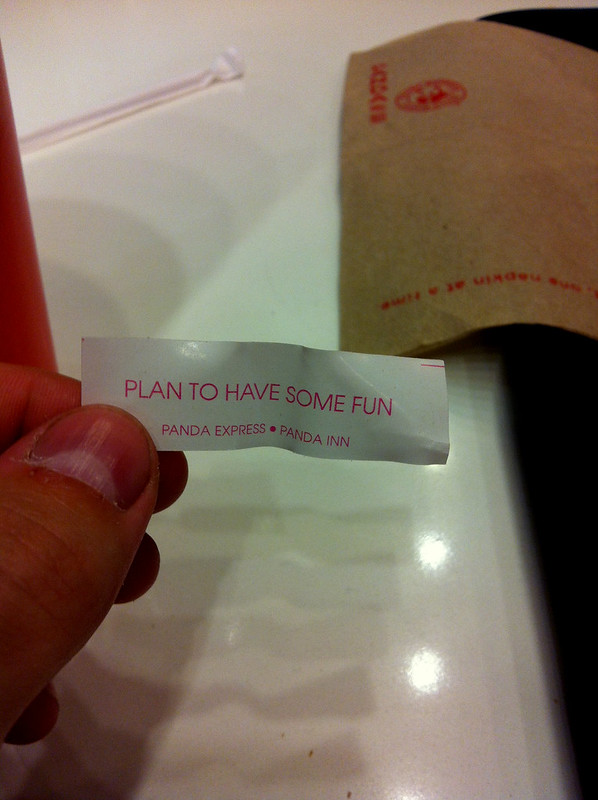
I don’t know how many of these fortune cookies are given away in Vegas, perhaps more as in other cities.
During our stay we had enough time to plan our next adventure, camping at the north rim of the Grand Canyon. Next stop, St George Utah. We ended up on a parking lot in St George while looking for a snack and ate the worlds best corndogs. Well, they were our very first corndogs. We were chatting with the owner of the food truck and he recommended us Sand Hollow State Park for camping. pretty good advise.
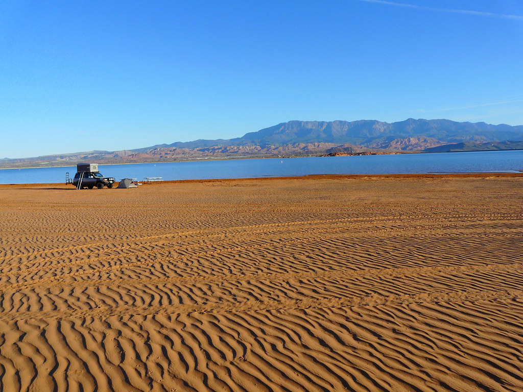
While others had some fun in the sand –
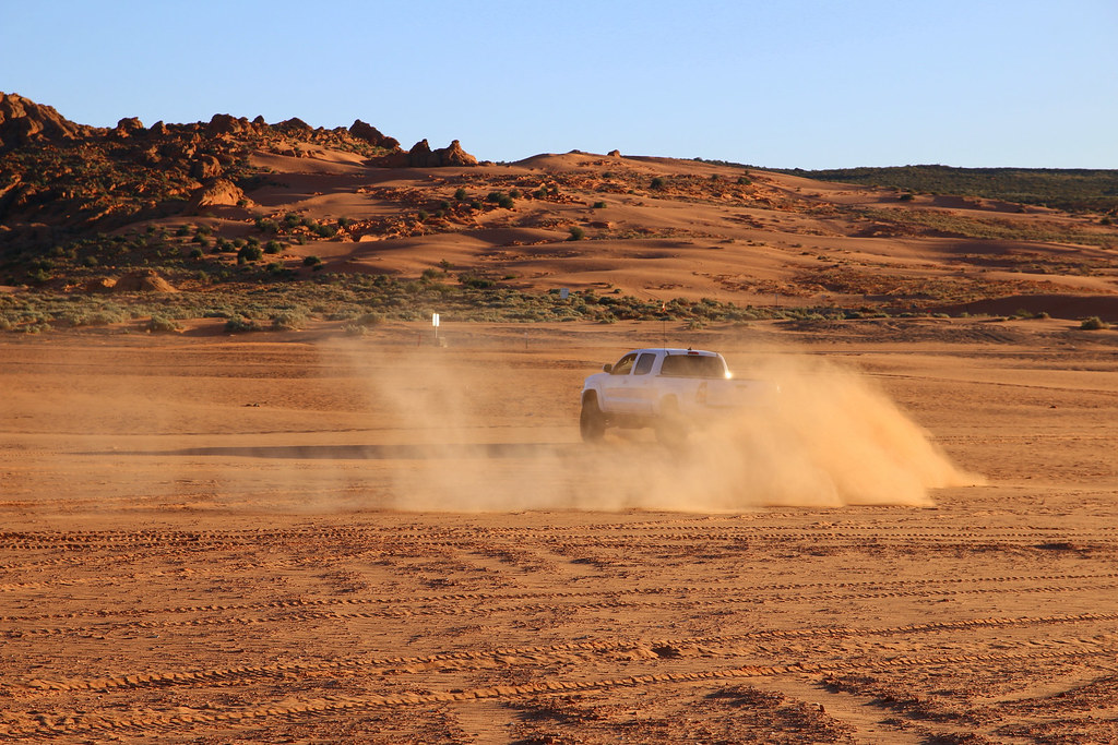
Did we what we can do best. Yep, nothing.
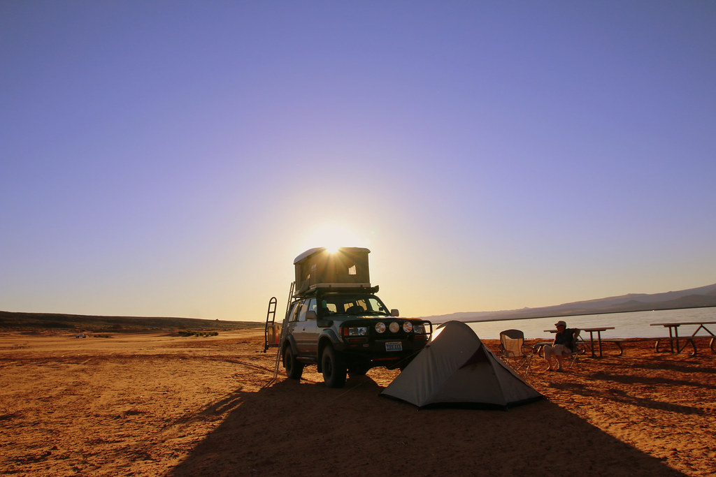
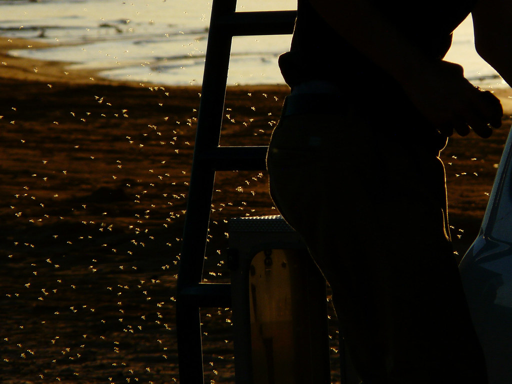
We were the only campers on the beach and the only thing that bothered us were thousands of flies and mosquitoes.
Otherwise it was such a peaceful place.
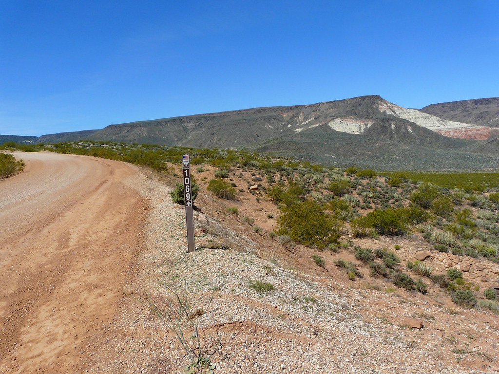
We left early the next day and went south direction Grand Canyon via wide gravel roads which were fast and nice to drive.
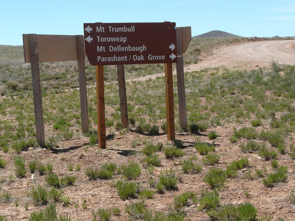
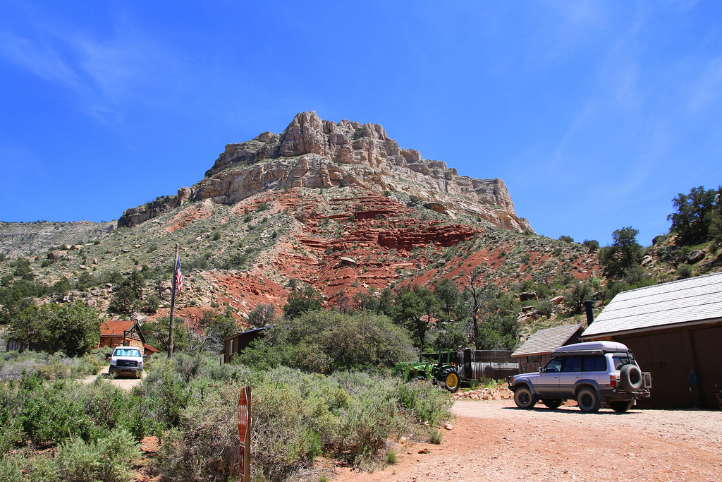
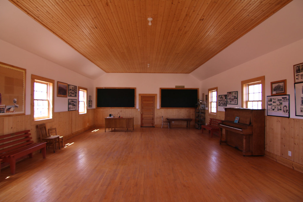
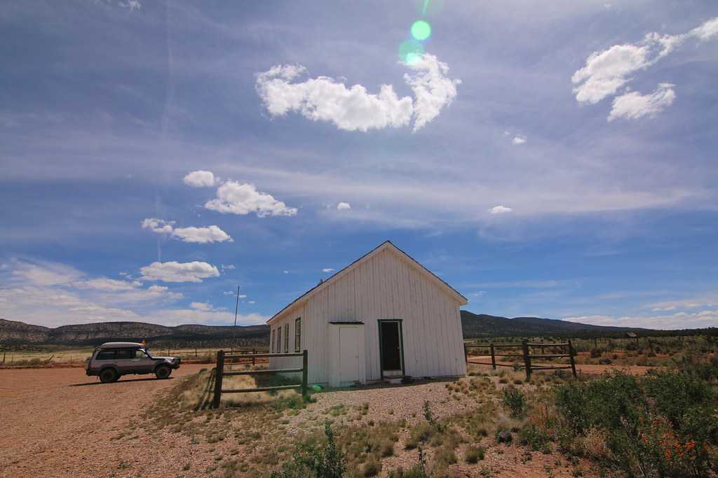
A lot of cars were staying around the Mount Trumbull school house as we arrived. The school house was full of people and cameras and an older lady was talking. We didn’t want to interrupt and moved on to Mount Trumbull. We later heard that this lady was the last teacher of the school house, telling stories from back then and answering questions.
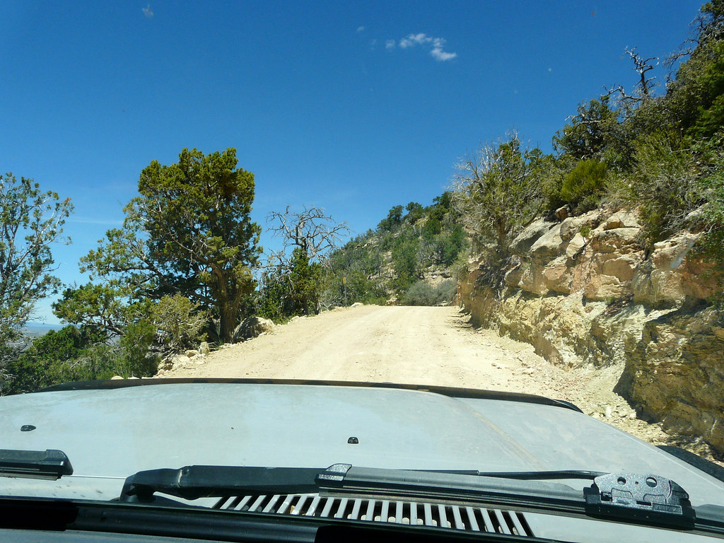
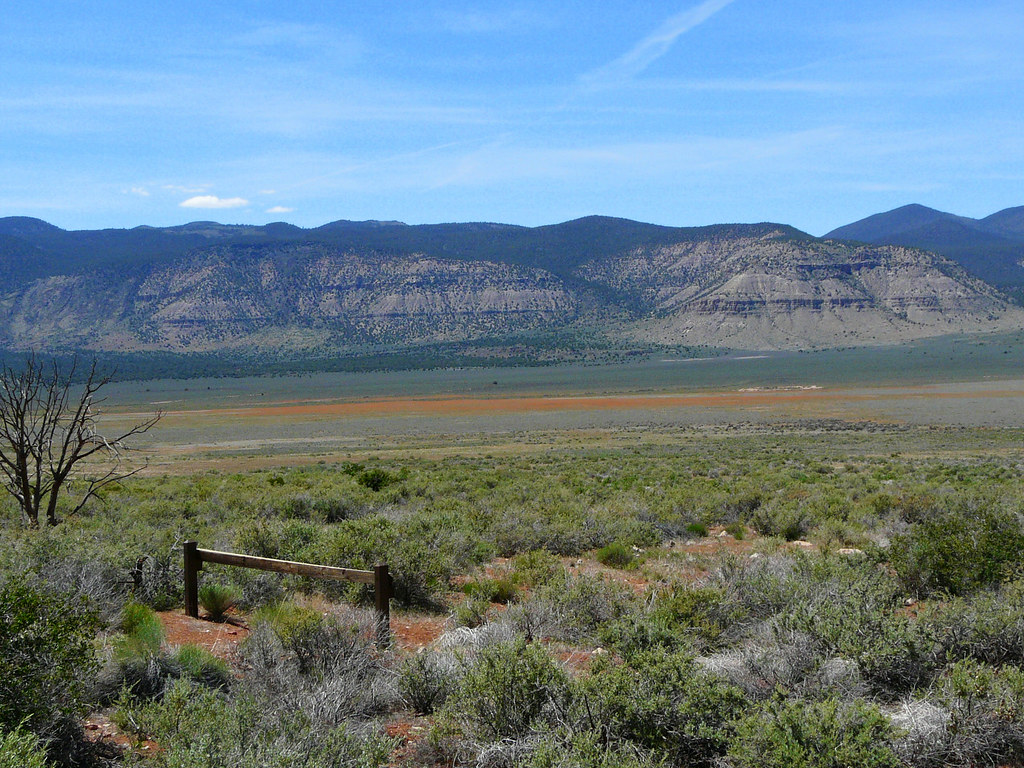
The view from the road as amazing.
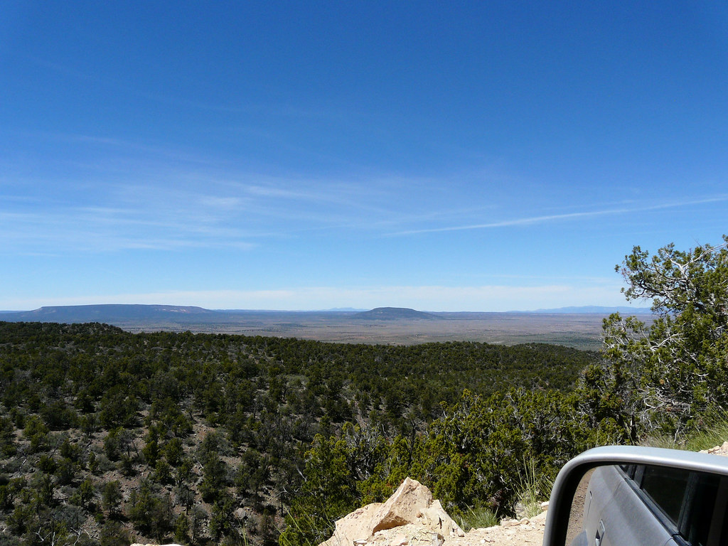
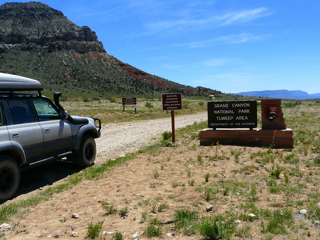
Entering the Tuweep area.
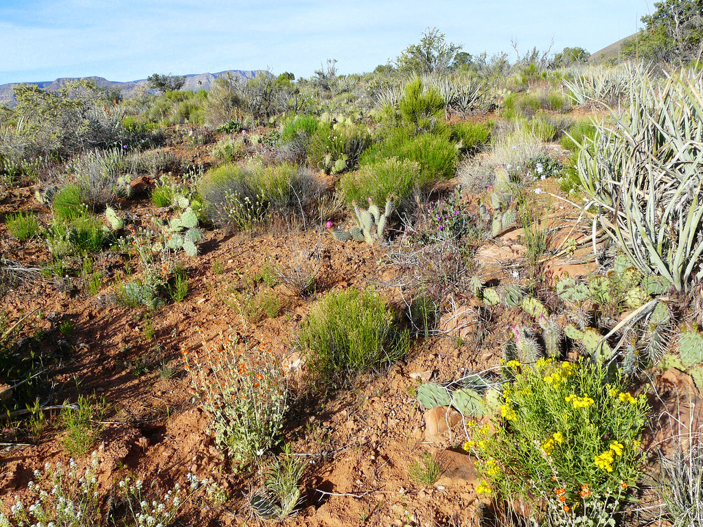
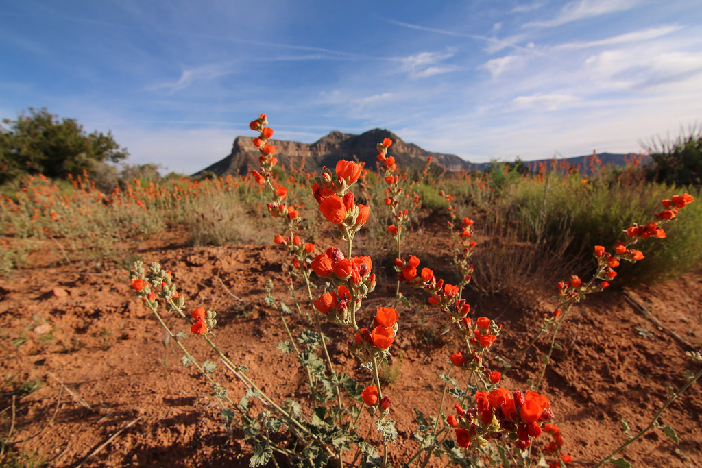
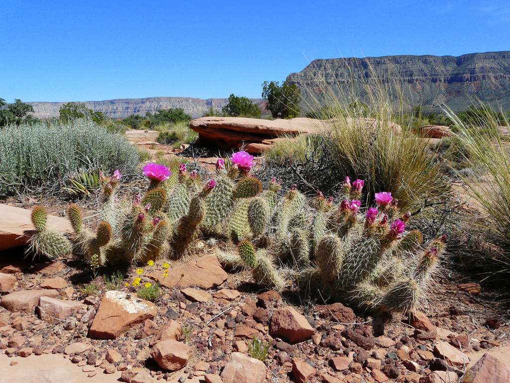
Everything around us was green and blooming.
[EDITOR’S NOTE: We’re sorry, this image has been removed.]
you now need a permit to camp overnight at the Toroweap Campground. We got our permit the day before in St George at the BLM office within 20 minutes. The employees there were super friendly and helpful and gave us a lot of information about the area.
The Ranger Station at the entrance, they close the gate from sunset until sunrise. Not a bad place to work though.
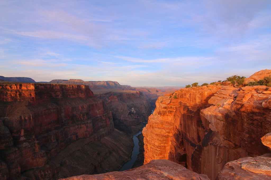
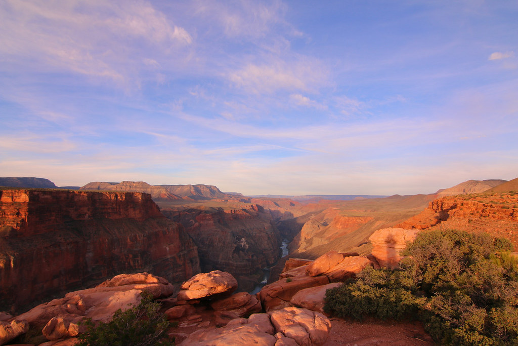
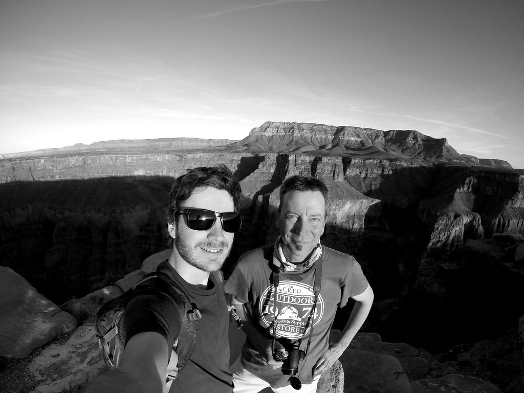
We first drove straight to the Lookout point for getting a first impression. What should I say, you need to see it. Pictures just can’t justified how awesome and spectacular this place is. No barrier between you and the edge, no tourists bumping into you, just you, the canyon and the silence. the only thing you hear are the birds flying by and swooping down into the canyon. We both have been to the south rim two years ago, but the north rim, especially Toroweap beats everything.

We decided to set up camp and coming back in the evening to watch the sunset and seein the canyon in the evening light. Even here was everything green and blooming along the road.
The next highlight was the campground itself. It’s perfectly built into the landscape, nice sites, not too big and clean.
[EDITOR’S NOTE: We’re sorry, this image has been removed.]
there were about 5 other campsites occupied by other campers and we had a very nice spot right under the rocks.
The view from our campsite.

it didn’t take long and we already knew most people of the campground. Everyone that passed by on the way to the restroom stopped to say hi and to chat a bit. The atmosphere on the campground was super nice and familiar, we felt welcome from the first minute on.
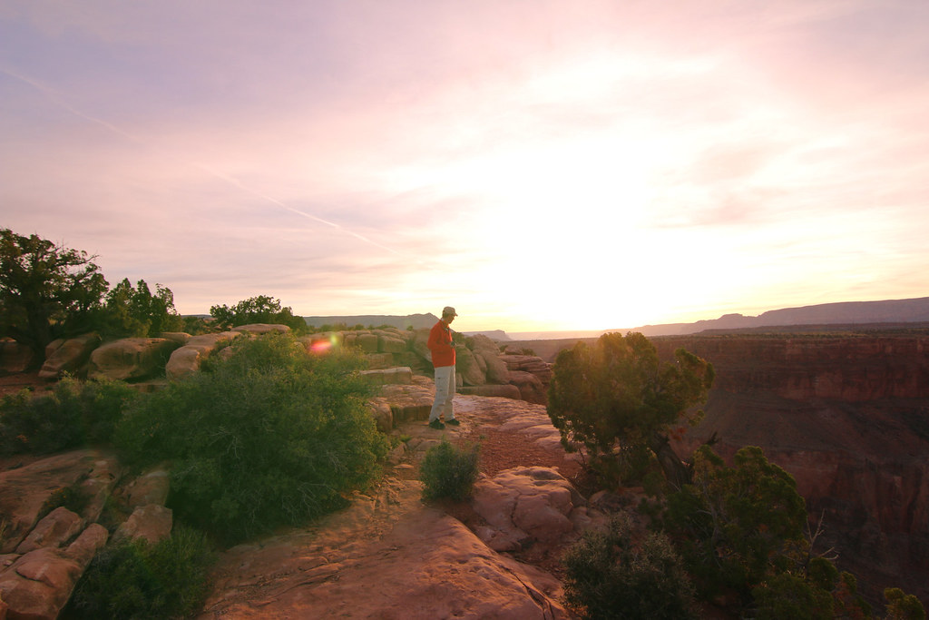
As the sun started setting down we walked to the overlook to capture that moment.
[EDITOR’S NOTE: We’re sorry, this image has been removed.]
The view is just stunning.
[EDITOR’S NOTE: We’re sorry, this image has been removed.]
[EDITOR’S NOTE: We’re sorry, this image has been removed.]
We then had a beautiful and quiet night at the campground.
Both of us were super amazed by the beauty of this place. So we set up our alarm clock to 4:30 in the morning for watching the sunset from the edge. And guess what, it was absolutely worth it!
[EDITOR’S NOTE: We’re sorry, this image has been removed.]
[EDITOR’S NOTE: We’re sorry, this image has been removed.]
Doesn’t matter if you look left or right, it’s amazing anyway.
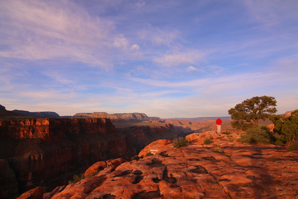
An experience I’ll never forget.
Since we only had the permit for one night, we left the Toroweap campground and made our way back over Mt. Trumbull. At these time we were the only ones at the schoolhouse and had plenty of time to look around.
[EDITOR’S NOTE: We’re sorry, this image has been removed.]
The schoolhouse has been rebuilt in 1994, someone set it on fire in 2000 and a restoration committee built a replica in 2001.
Unfortunately I wasn’t able to figure out if the swing was the original one from back in the days. But it’s fun anyway.
[EDITOR’S NOTE: We’re sorry, this image has been removed.]
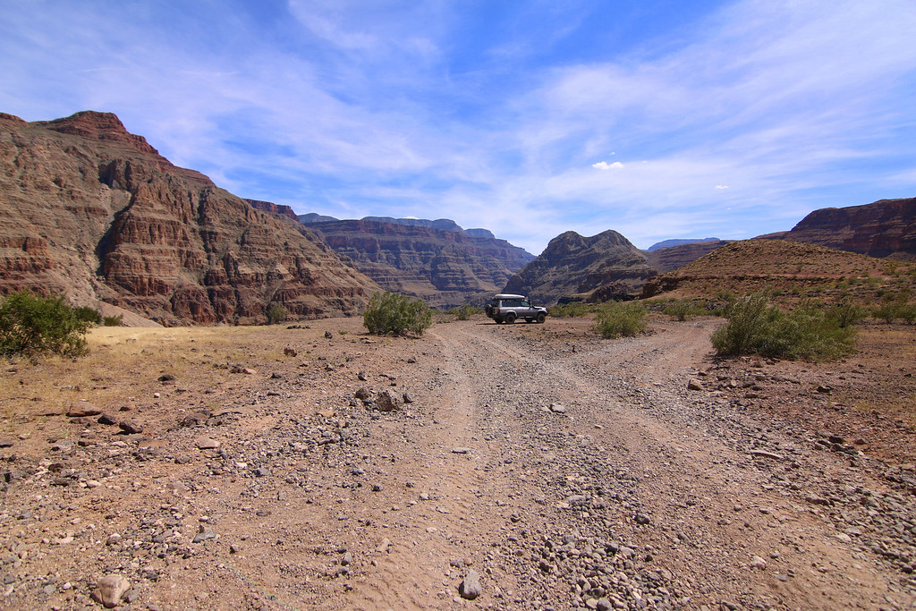
From the intersection at the schoolhouse leads a way to the Bar 10 Ranch and further down into the canyon. It was nice to drive until we passed Bar 10 Ranch and the road started winding down. You’re literally driving on a loose rock and lava rock field and the shaking of the car was getting kinda annoying.
[EDITOR’S NOTE: We’re sorry, this image has been removed.]
But it’s absolutely worth the little torture! We reached the dead end of the road which is a small platform, and it offers a stunning view into the Grand Canyon and onto the Colorado River.
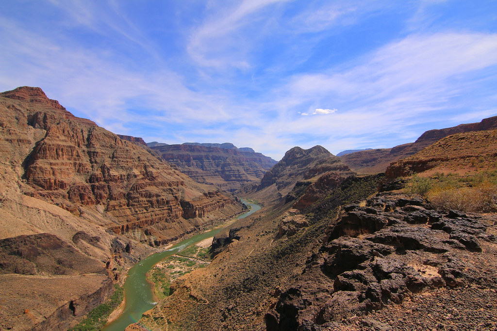
You even can see the rafts floating slowly down the river. You also can see a small hiking trail that brings you to the river at the bottom of the canyon.
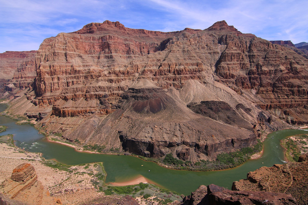
And that explains all the lava rocks. We both never heard or read that the Colorado River once has been dammed by a massive molten lava flow.
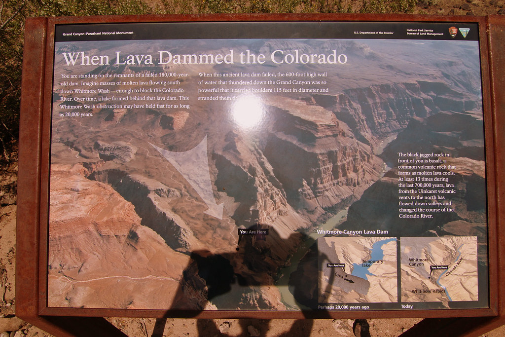
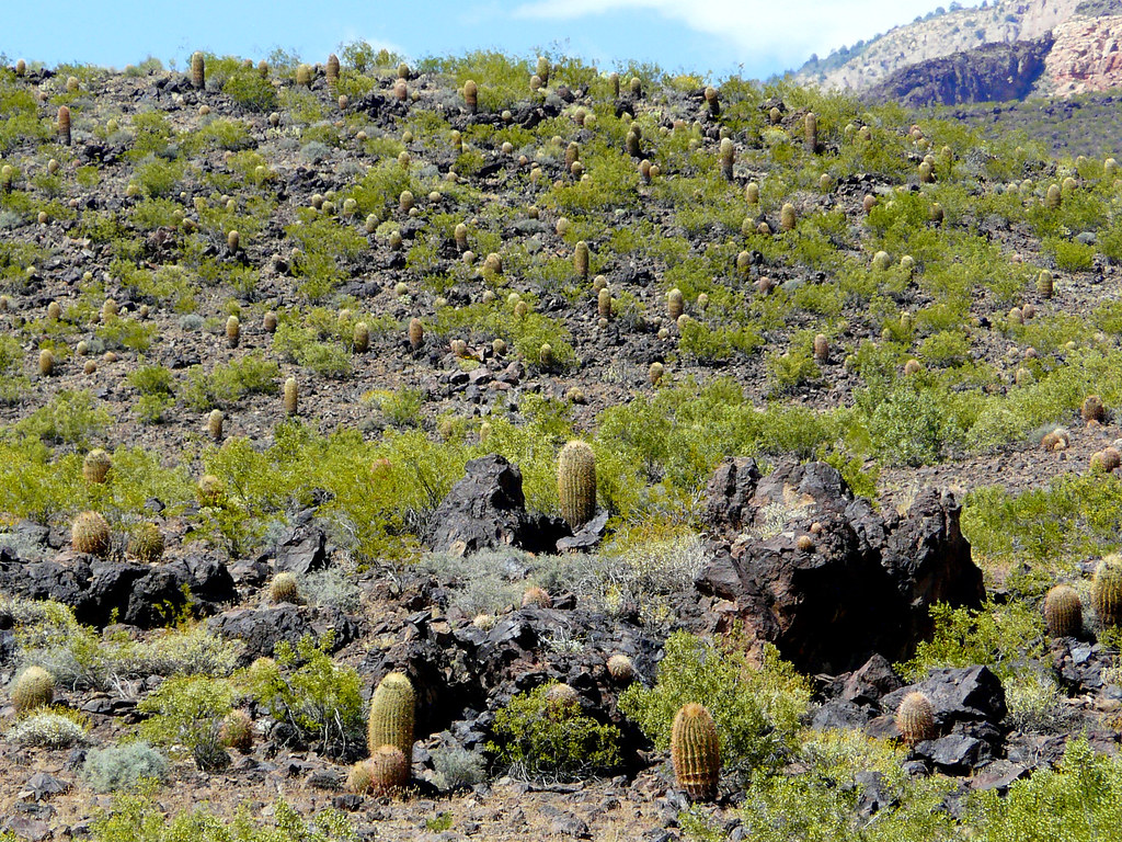
Lave rocks everywhere
It was sticky and hot at the lookout and we started making our way back to the schoolhouse and St. George.
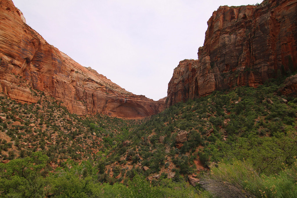
Bryce Canyon National Park was supposed to be our next highlight and since Zion National Park was on the same way, we took the longer way through Zion NP. We both spent a couple days in Zion NP two years ago and it definitely is one of the most spectacular Parks in the US. Although we both really like the park, we just drove through it and went straight to Bryce Canyon NP.
The road through Zion NP always amazes me.
[EDITOR’S NOTE: We’re sorry, this image has been removed.]
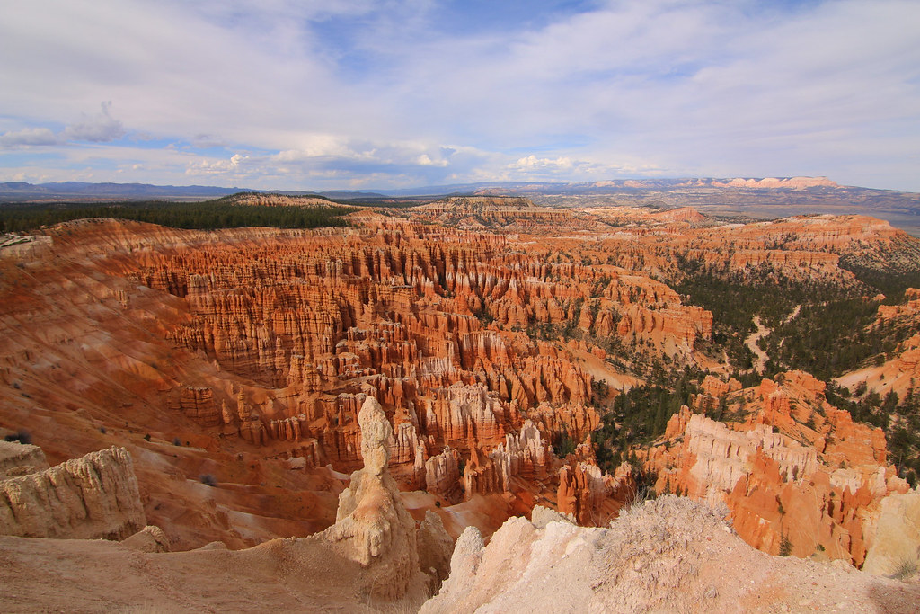
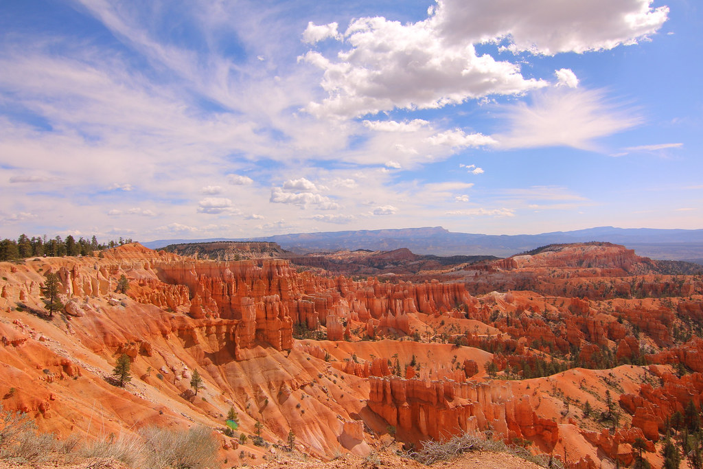
We then arrived at Bryce Canyon NP at noon and snapped one of the last available camp spots inside the park. The park was very crowded and we always hardly found a parking spot at the lookout points.
[EDITOR’S NOTE: We’re sorry, this image has been removed.]
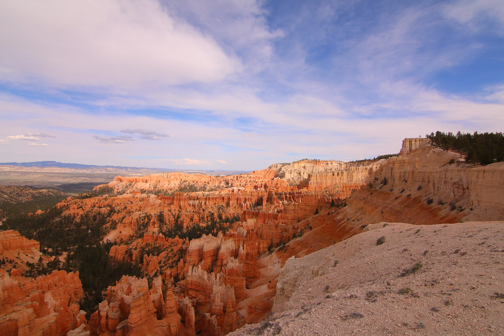
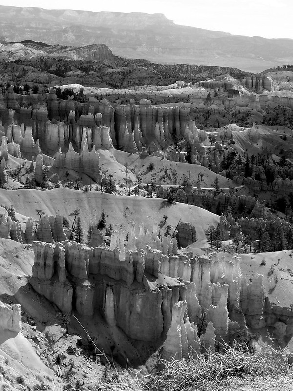
We enjoyed the amazing view over the amphitheater, were walking along the edge and spent a very chilly night on the campground. The next morning we went to the lookout points again. Everything was still there and we enjoyed the view for a second time with all the unique and queerly rocks called hoodoos. Now I know why Ebenezer Bryce, who settled in the valley just below the canyon in 1870, said “It’s a hell of a place to lose a cow”.
[EDITOR’S NOTE: We’re sorry, this image has been removed.]
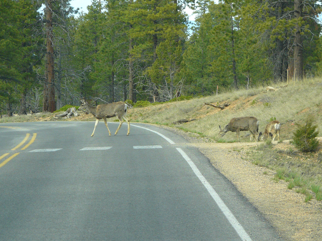
The park even offers wildlife
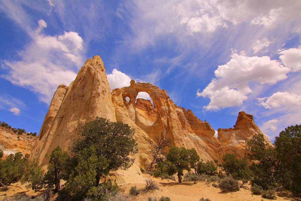
We left the Bryce Canyon NP and drove south a bit to the small village Cannonville. There starts a nice dirt road called the Cottonwood Canyon Road which brings you south to Lake Powell. Way better as taking Highway 89.
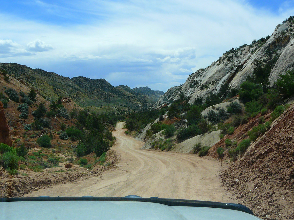
The road is easy to drive but very nice and scenery.
Wild west roadblock??
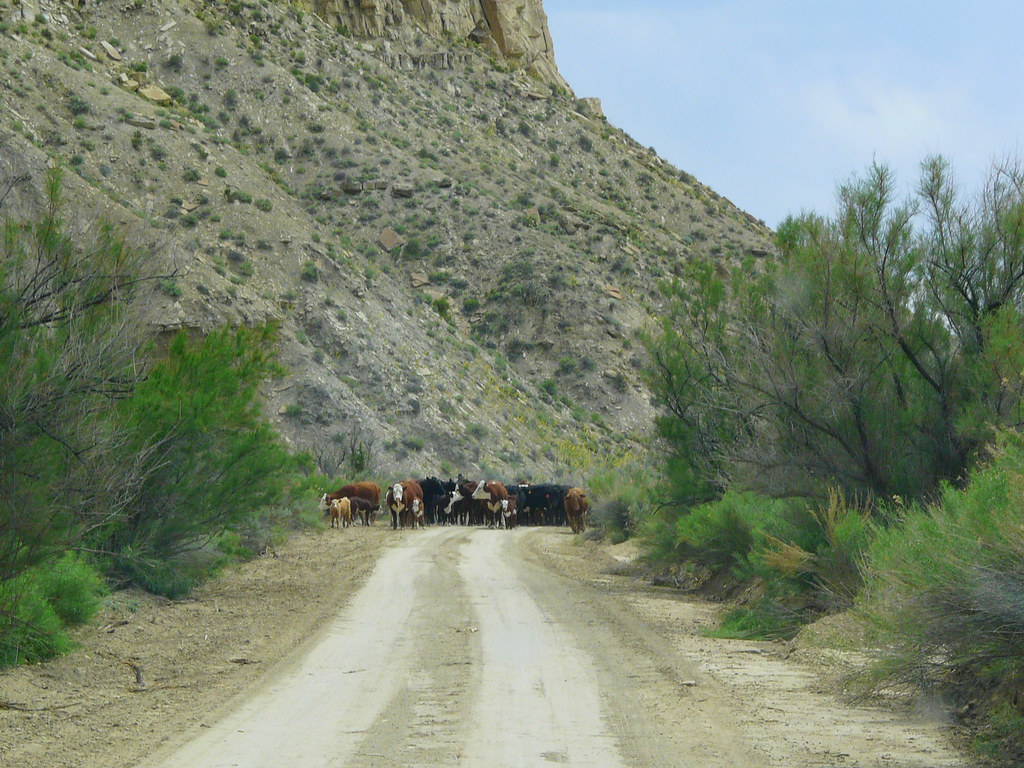
No riot, just a couple cowboys doing their job. It was absolutely cool seeing the guys (and one girl) driving cattle right in front of us, a real wild west experience.
[EDITOR’S NOTE: We’re sorry, this image has been removed.]
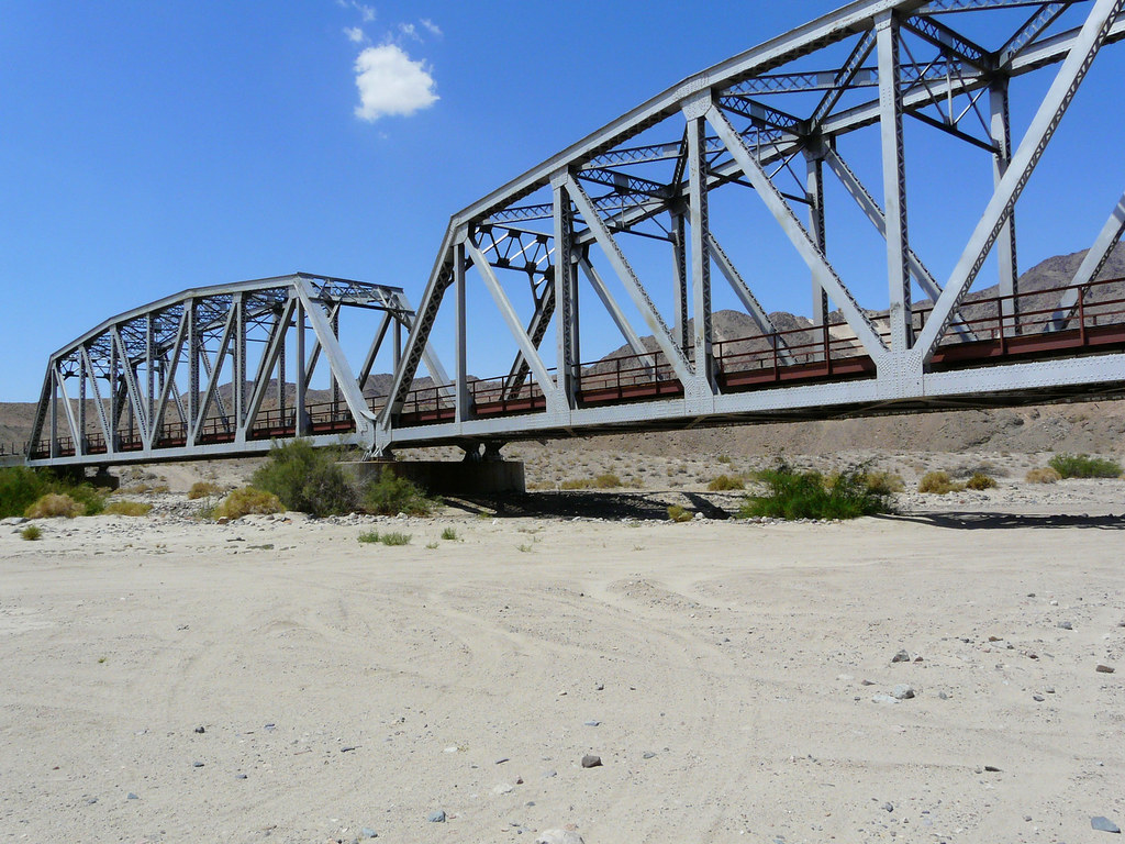
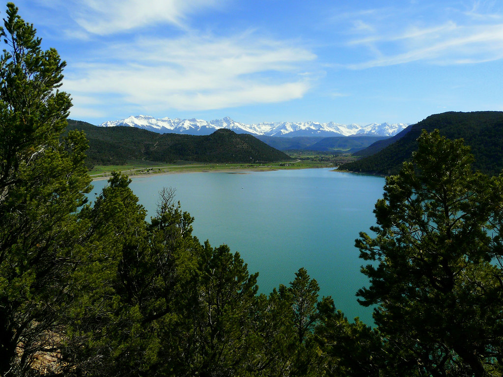
After getting back onto Highway 89 we went to Paige and stopped at Glen Canyon. We do have a lot of dammed lakes at home in Switzerland, but this one was really impressive!
[EDITOR’S NOTE: We’re sorry, this image has been removed.]
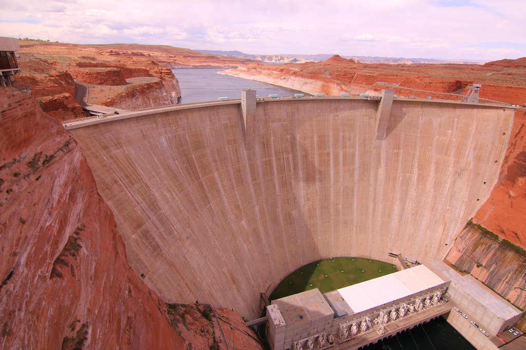
The bridge right next to the dam makes it even more spectacular.
[EDITOR’S NOTE: We’re sorry, this image has been removed.]
We found a nice campground at Lake Powell,
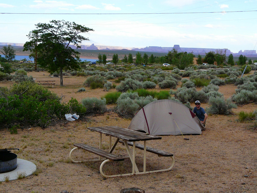
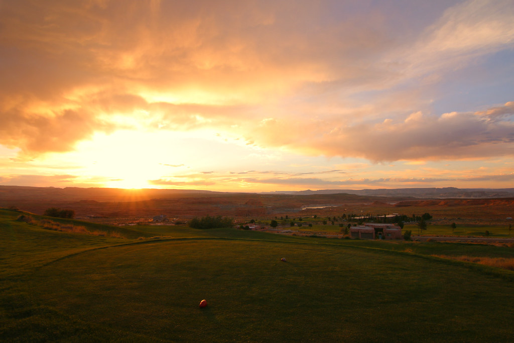
had lunch in Paige and ended the day with watching a nice sunset from the golf course while playing like pros do on the PGA Tour.
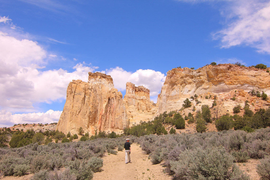
The Lake Powell area offers a lot nice backcountry roads and dirt tracks with remote camp spots, we definitely have to come back once to explore this area. We were already on the road the next day to the probably most famous western landscape, at least for us Europeans.
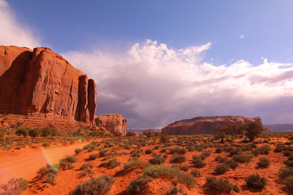
Monument Valley
[EDITOR’S NOTE: We’re sorry, this image has been removed.]
I really like that you can drive through the park on the dirt road with your own vehicle.
[EDITOR’S NOTE: We’re sorry, this image has been removed.]
Not John Wayne on John Wayne’s Point.
[EDITOR’S NOTE: We’re sorry, this image has been removed.]
The weather condition was changing this day and it generated a very special atmosphere over the valley.

I’m curious about what the thoughts of the first white people were who passed through this land on their way to the west coast. We also very appreciate that the Navajo Indians allow us to visit their reservation. Although, we’re not sure if they do that on purpose, we don’t know much about the history of Monument Valley and I haven’t found anything online about that.
It finally started to rain a bit, but do we worry? Not really, we keep enjoying the unique landscape with its beautiful red stones and sand.
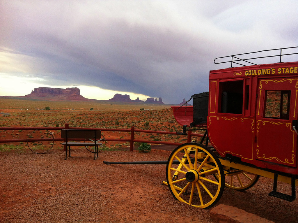
For the night we camped at Goulding’s Lodge Campground and enjoyed a hot shower. They also offer a lot of entertainment and we ended up watching an old John Wayne movie in a small theater down at Goulding’s Lodge for free.
We left Monument Valley the next day direction north and made a quick stop at the Mexican Hat.
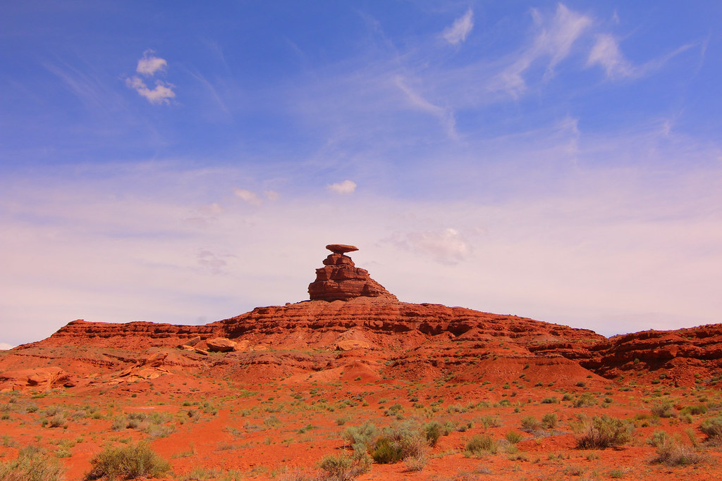
I’m curious how long the hat will still be on top, maybe another 100 years?
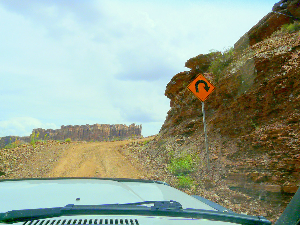
We left Highway 163 and shortly after, arrived at this sign. The beginning of Moki Dugway.
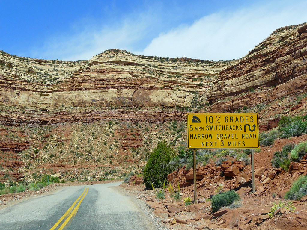
But it sounds harder as it is. The road is super wide and nicely graded, a piece of cake to drive it.

We even spotted some big RV’s coming up the switchbacks.
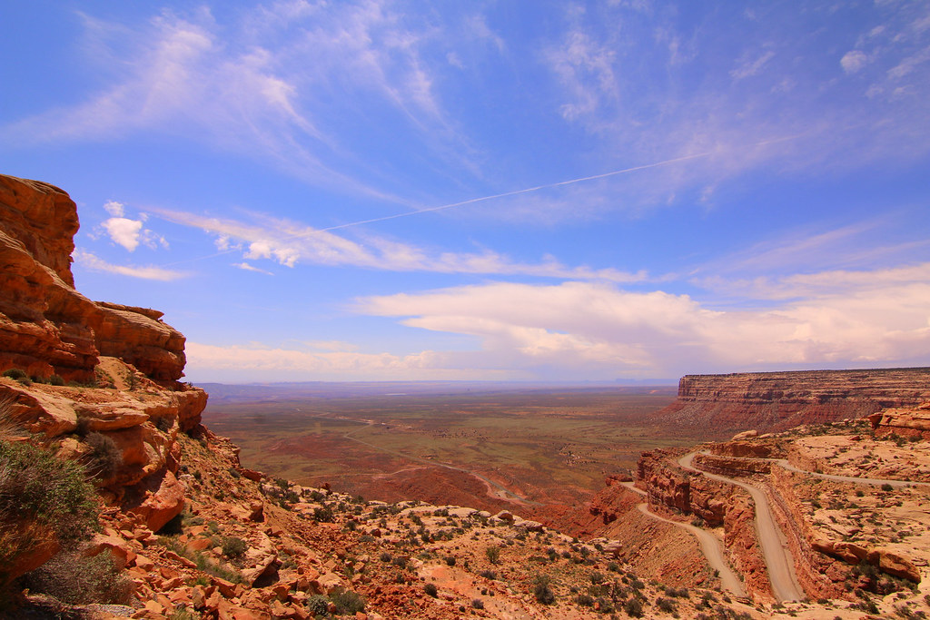
We made a little detour after Moki Dugway to Muley Point for another breathtaking view.
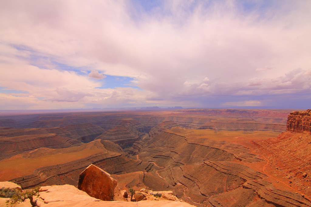
Also close are the Natural Bridges, but honestly, it wasn’t very exciting.
[EDITOR’S NOTE: We’re sorry, this image has been removed.]
And it started to rain while we were driving on the park loop.
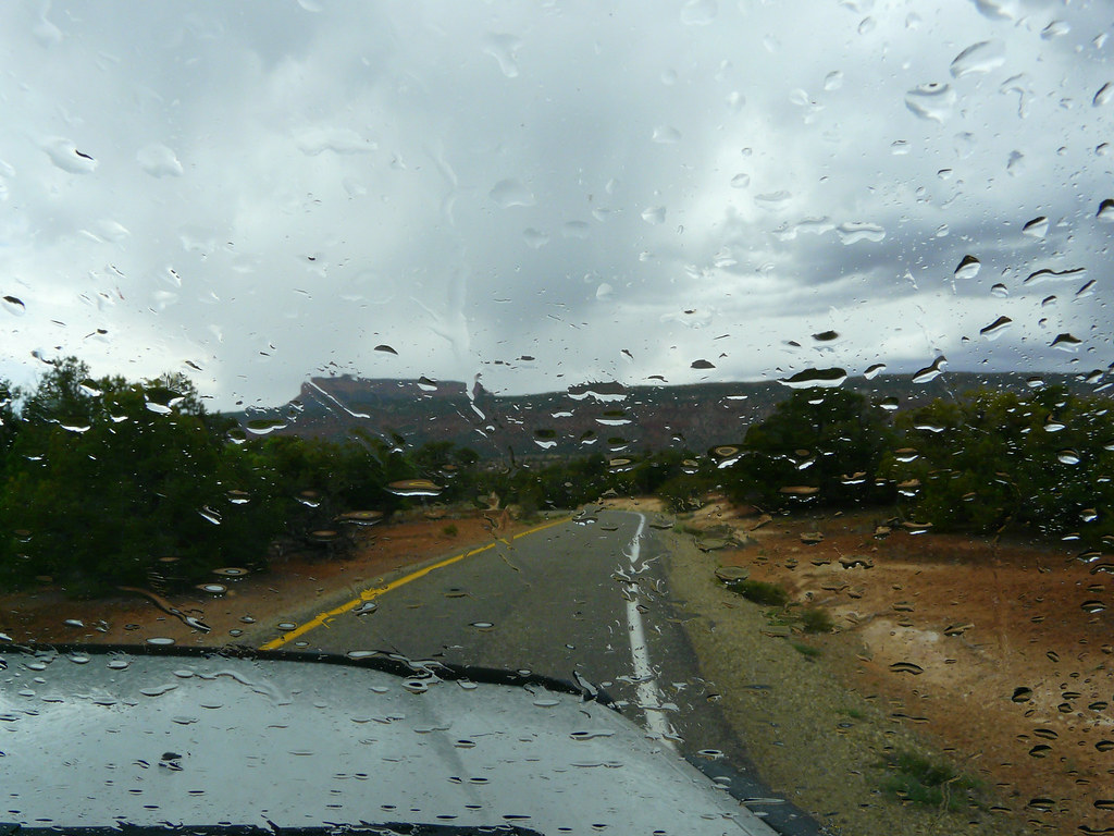
We continued to Moab where it started to rain again, heavy rain..
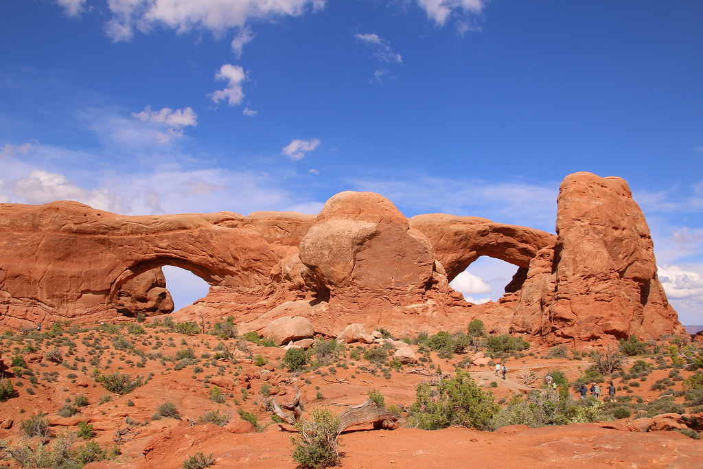
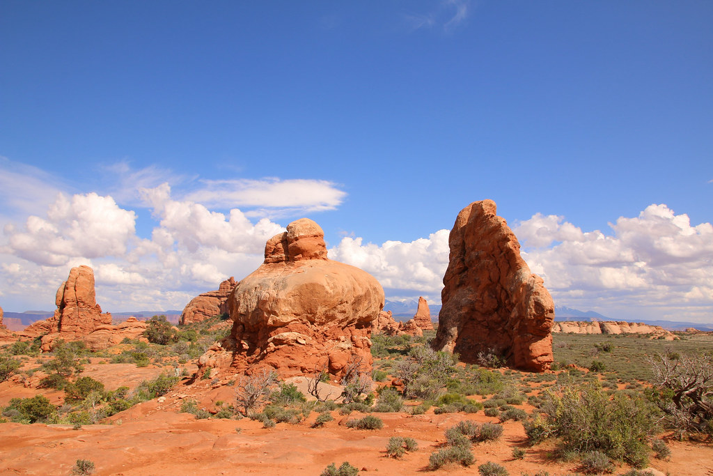
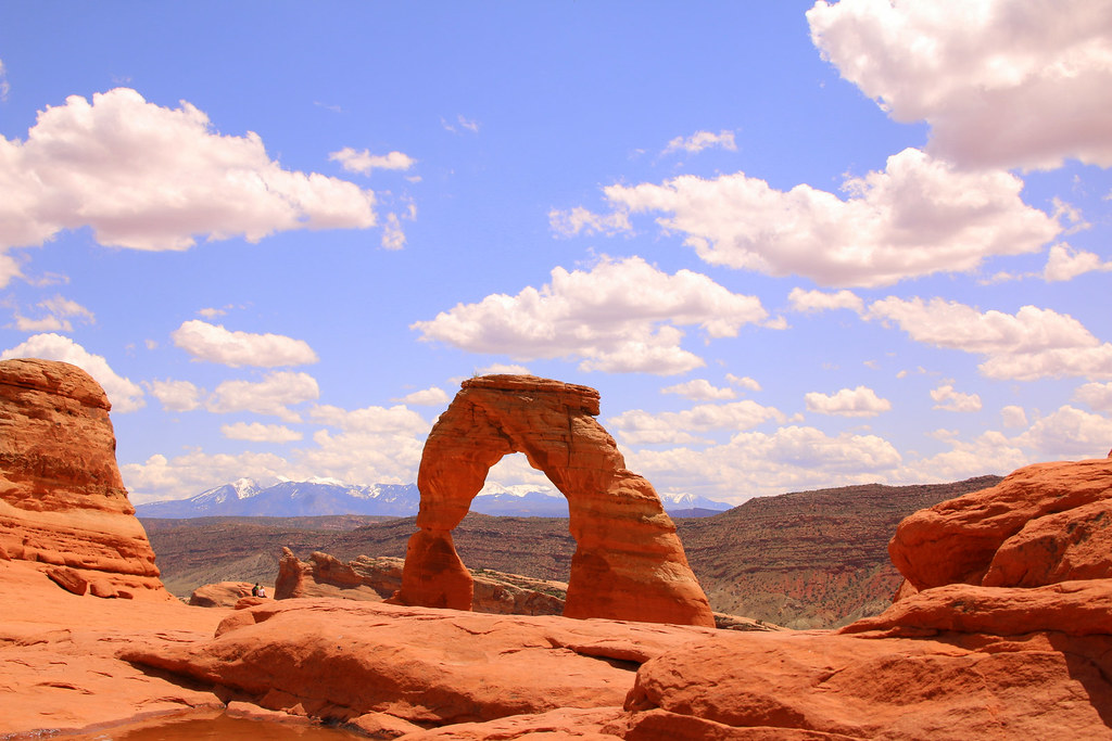
The next day we visited another national park on our list, Arches NP. Once again another absolutely beautiful and unique national park, absolutely worth visiting it.
Can you guess the name of this rock formation?
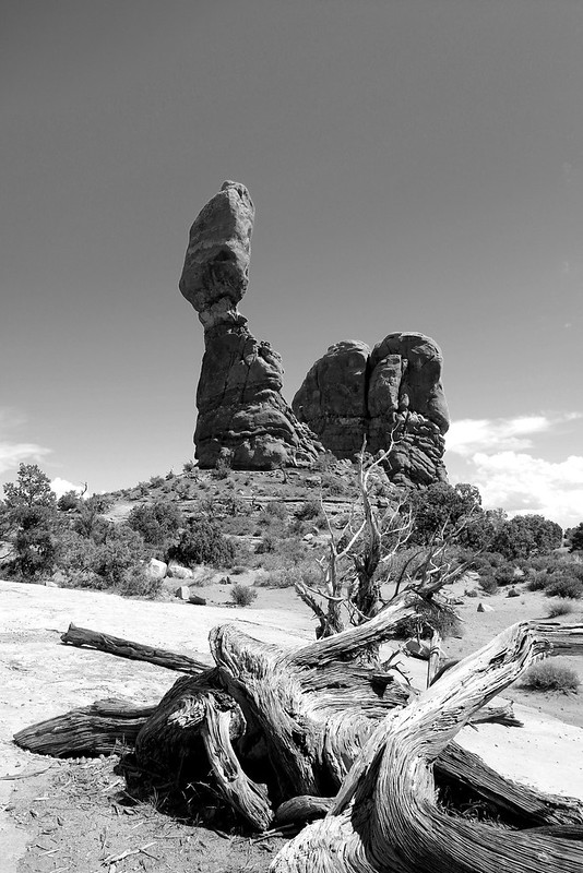
Right, the Balanced Rock.
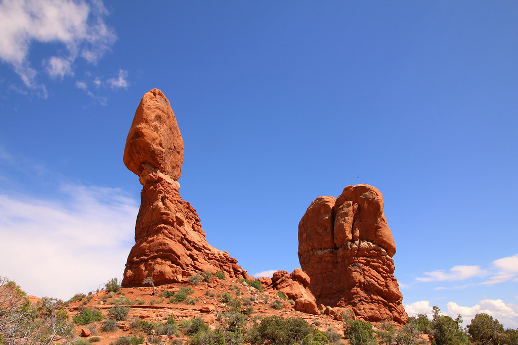
They’re huge!
[EDITOR’S NOTE: We’re sorry, this image has been removed.]
Arches everywhere
[EDITOR’S NOTE: We’re sorry, this image has been removed.]
[EDITOR’S NOTE: We’re sorry, this image has been removed.]
Absolutely fantastic scenery and rock formations all around.
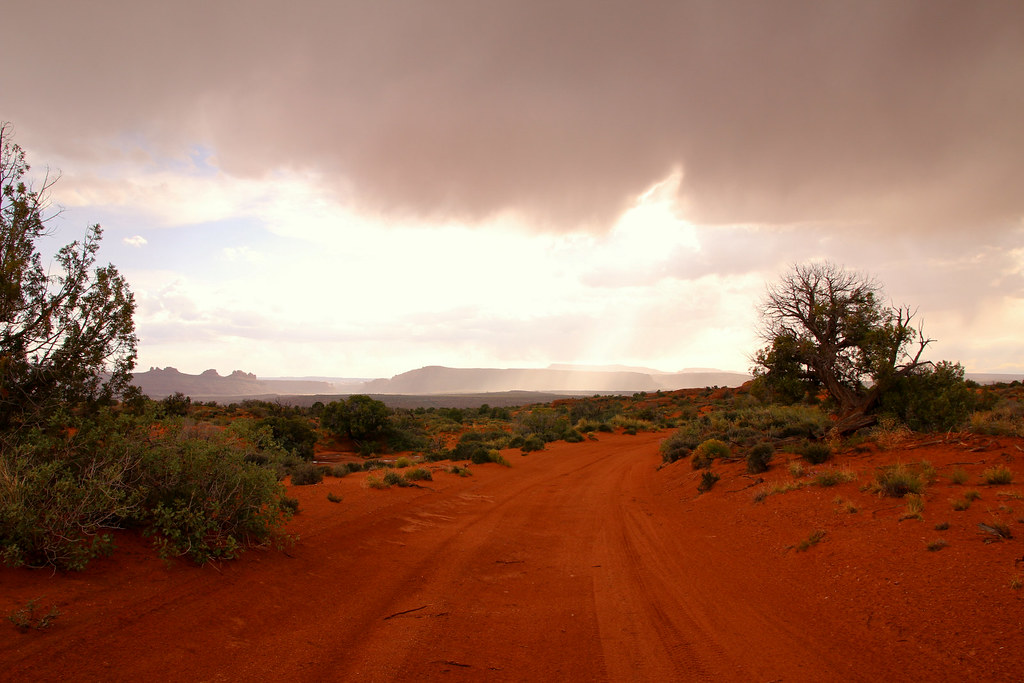
We once again experienced very special weather condition with dark clouds and rain in the distance.
[EDITOR’S NOTE: We’re sorry, this image has been removed.]
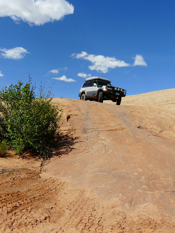
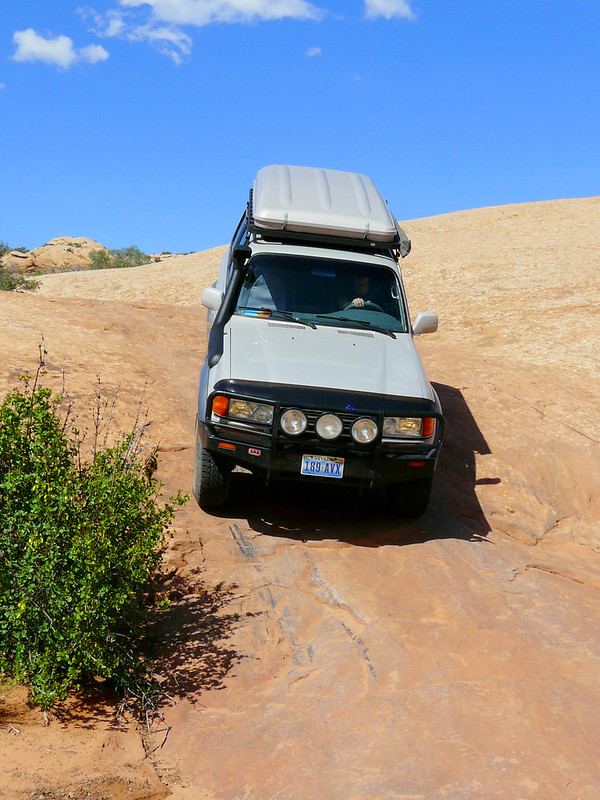
Arches NP also offers some very nice offroad trails, we drove via Willow flats out of the park.
Best decision! The road leads over slickrocks and through a beautiful landscape.
[EDITOR’S NOTE: We’re sorry, this image has been removed.]
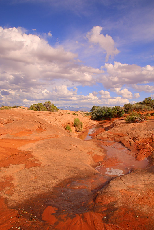
The rain formed some little creaks over and beside the road and the potholes were filled with water. The trail got a bit slippery, but it wasn’t a problem at all.
[EDITOR’S NOTE: We’re sorry, this image has been removed.]
The trail brought us back to Highway 191 and we headed to Moab for another night on the campground.
We haven’t seen all the highlights of Arches NP so far. So we went back to the park the next day for walking up to the Delicate Arch, probably one of the the best known natural arches. The trail up is steep but very beautiful, you basically just walk on a giant boulder.
Obviously we weren’t the only ones at the arch. People were sitting and photographing all around on the amphitheatre shaped viewpoint.
[EDITOR’S NOTE: We’re sorry, this image has been removed.]
The arch itself is just stunning. It’s always amazing what erosion, wind and weather can do to stone within hundreds, thousands or million of years.
On the trail back to the parking lot.
[EDITOR’S NOTE: We’re sorry, this image has been removed.]
We went for another offroad trail in the park today and drove through Salt Valley towards the intersection of the Tower Arch Trail.
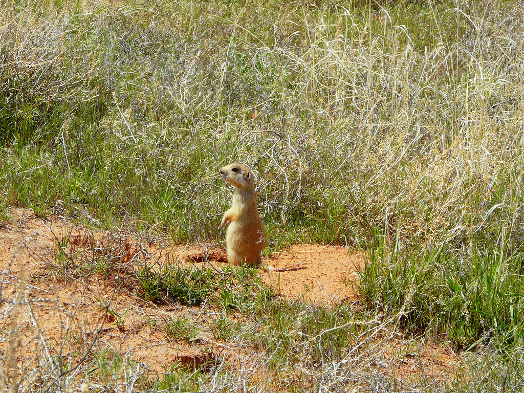
Right at the intersection we run into these guys, Gunnison Prairie Dogs?
We didn’t take the trail to the Tower Arch hiking trail, we went for the shorter one which allows you to drive almost a loop back to the main park road. While the road to the start of that trail was a nicely gravel road, it started getting rough now, like really rough for us greenhorns.
[EDITOR’S NOTE: We’re sorry, this image has been removed.]
Better airing down the tires at this point.
[EDITOR’S NOTE: We’re sorry, this image has been removed.]
It honestly was quite a challenging trail for me. Steep uphill with a lot of rocks, steps and bumps. My dad was the spotter and photographer at the same time and as you maybe know, multitasking just isn’t a man’s thing.
And it always looks easy in the pictures of course!
[EDITOR’S NOTE: We’re sorry, this image has been removed.]
We made it to the top of the hill surprisingly flawless. Once again we both were absolutely amazed by the ability of the Land Cruiser. What an amazing truck! Going down the hill was an adventure for it self. Even with being in low-gear you feel the heavy weight pushing and you realize that its brakes really are kinda worse. But after knocking on rocks with the rear bumper for a couple times, we made it to the bottom.
After that rocky section of the trail, you find yourself driving in a small and sandy wash. It’s a lot fun until you reach a big boulder to climb over. There was a group of Jeeps right in front of us driving down on the steepest side of the boulder, not straight, in an angle and almost rolling over. We took the chicken track.
And down it goes
After driving in the wash for some time the terrain opens and we were on a beautiful sandy track with an amazing scenery around us, completely alone but still inside the national park.
About a mile before entering the main park road, we turned back on the trail we did yesterday which brings you out of the park to Highway 191. After leaving the park boundary, which is about after half of the trail, you find yourself on BLM land where wild camping is permitted and for free. We passed by several potential camp spots the day before but already had paid for the night in Moab.
We found a very nice spot on the slickrock which offered a beautiful view over the flat.
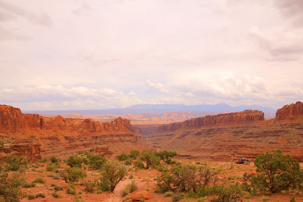
Another Highlight has been scheduled for the next day, Canyonlands National Park.
As you probably know, the Moab area is such a huge playground for 4×4 activities. Canyonlands, Arches, Needles District, and so on. You could spend several weeks being busy with exploring new trails. We already were short on time due my dads departure from Denver in a couple days.
My plan was driving the white rim trail within two days with camping on the trail. Unfortunately that’s just impossible when you’re traveling with an open time schedule. We didn’t know when we’ll be in Moab exactly and getting a permit for camping in advance was not possible. I checked the reservation homepage a couple days in advance and there was already everything full. Our last chance was going to the visitor centre, maybe someone cancelled their reservation or didn’t make it by time. No luck for us. The lady on the desk was very nice and completely understood that we were a bit disappointed. It’s nearly impossible getting a permit as a foreign traveler or someone who doesn’t exactly know when he will be in the area. It’s not like you set a weekend, get your permit three months in advance and just drive out to Moab on that date.
We totally understand and respect that they want to regulate traffic and overnight stays on the trail, but it would be nice if they would save one spot/permit at each campground for first come first serve at the visitor centre. Maybe something like that.
I also asked her what happens when we just stay on a campground without a permit. She just smiled and said we would have a nice conversation with officer Bryan followed by a high fee. Not really worth it.
She showed us plenty other trails on the map which can be done as one day trips. We left the visitor centre thankful but still disappointed. My dad and I discussed what to do next. We knew it might be possible doing the white rim trail in one day, but we didn’t want to rush through that beautiful area. One more reason to come back another time!
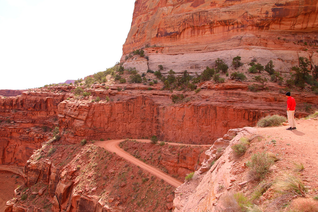
We started our offroad day with the Shafer Trail. It starts right at the visitor centre and brings you from the high plateau down into the valley.
Nice switchbacks and wide enough to pass other vehicles.
The road itself is just amazing, it looks like it’s carved into the wall.
Once you’re at the bottom the road disappears into nowhere.
[EDITOR’S NOTE: We’re sorry, this image has been removed.]
On the road downwards.
[EDITOR’S NOTE: We’re sorry, this image has been removed.]
If you look back to where you come from, you couldn’t even imagine that there a road exists.
Soon after the switchbacks we turned left onto Potash Road instead of going straight for the White Rim Trail.
Green River overlook.
[EDITOR’S NOTE: We’re sorry, this image has been removed.]
Absolutely beautiful rock formations all along the trail.
[EDITOR’S NOTE: We’re sorry, this image has been removed.]
And we kissed the Colorado River!
[EDITOR’S NOTE: We’re sorry, this image has been removed.]
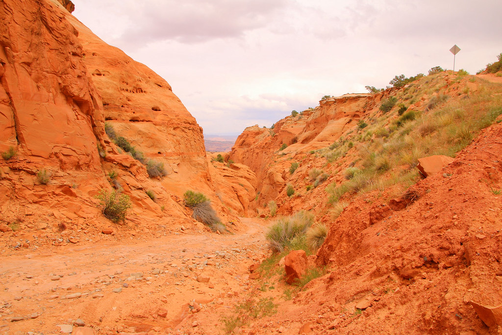
Potash road is a very short trail and there was plenty of time to explore more trails. Close to the end of Potash Road, a little bit north, starts Long Canyon Road.
The road quickly brings you back to higher elevation.
And offers beautiful views.
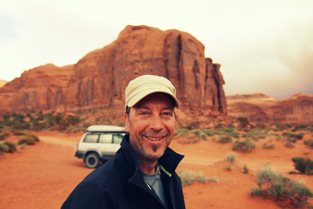
All the good things of the trip in one picture, my dad, the Land Cruiser and little me.
Climbing up Pucker Pass
[EDITOR’S NOTE: We’re sorry, this image has been removed.]
When suddenly this massive boulder appeared.
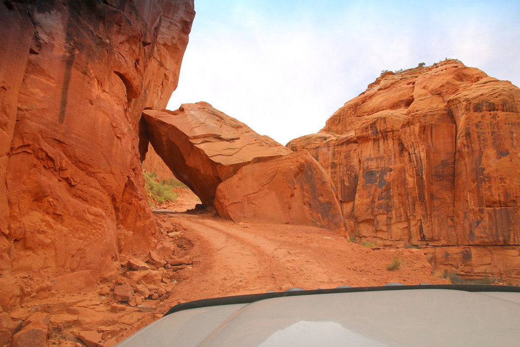
That’s one of the coolest things I’ve seen on a trail so far! Just take a look at the size of that boulder and imagine the noise and shock when it landed on the ground.
[EDITOR’S NOTE: We’re sorry, this image has been removed.]
Along the trail
Another view of the big boulder.
We turned back onto the main park road and went on another dirt road for taking a loot at the Gemini Bridges.
The bridges itself are huge!
[EDITOR’S NOTE: We’re sorry, this image has been removed.]
An yes, they really are two bridges.
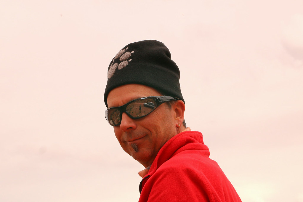
Deep drop offs all around. You barely can spot my dad on the other side in its red jacket.
[EDITOR’S NOTE: We’re sorry, this image has been removed.]
Dark clouds were coming up once again.
High above Highway 191, almost at the end of the trail.
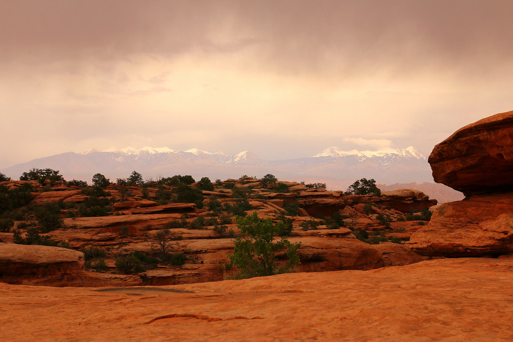
We really wished having more time to explore the area, but it was time to move on. We left Utah over Highway 128 direction Grand Junction Colorado.
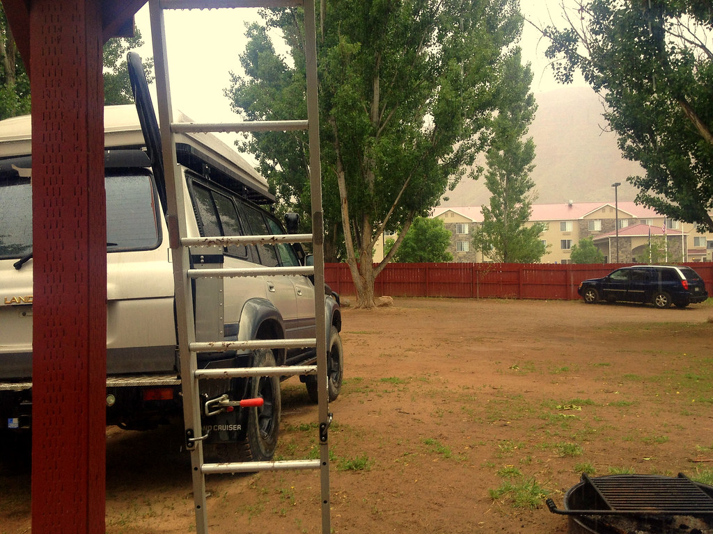
We spent a night in Grand Junction and continued south the other day towards Ouray. it was rainy all day long long and pretty chilly. We checked the weather in advance for Ouray and Red Mountain Pass and we knew that it was getting cold, too cold for camping. My dad did some research online and we ended up renting a small, cozy and heated cabin in Ouray.
I’m very glad we did, it was almost snowing when we arrived at the cabins.

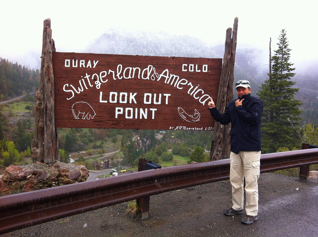
We still had half of the day left, so why not driving up the mountain road and checking out the Million Dollar Highway?
Welcome to Switzerland of America!
[EDITOR’S NOTE: We’re sorry, this image has been removed.]
And we really felt like home. Cold, rain, fog, mountains.. Does it say COLD or COLO on the sign??
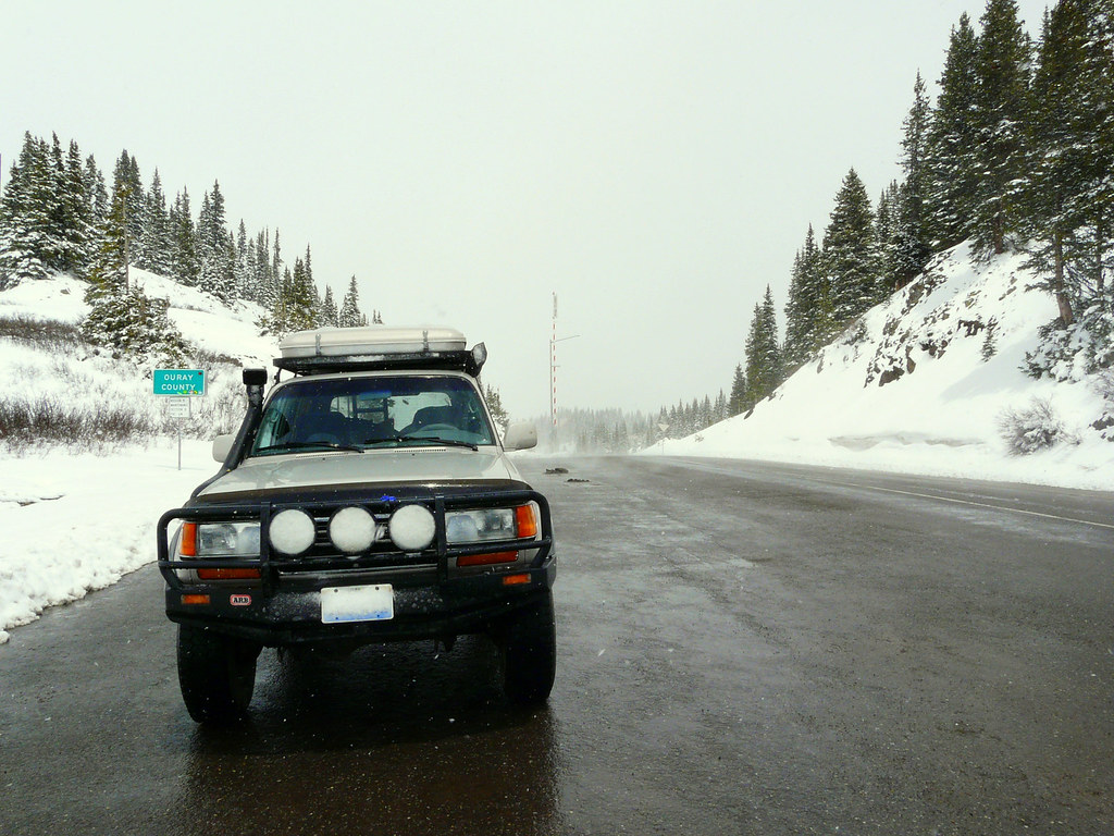
The rain quickly turned into snow while we drove higher and higher into the clouds.
[EDITOR’S NOTE: We’re sorry, this image has been removed.]
Can you see the car in the oncoming lane? I almost didn’t either. I don’t know what kind of idiot you have to be for driving without your headlights on on a narrow mountain road, in the fog, while its’ snowing!
[EDITOR’S NOTE: We’re sorry, this image has been removed.]
We made it to the top and had a little snowball fight going on.
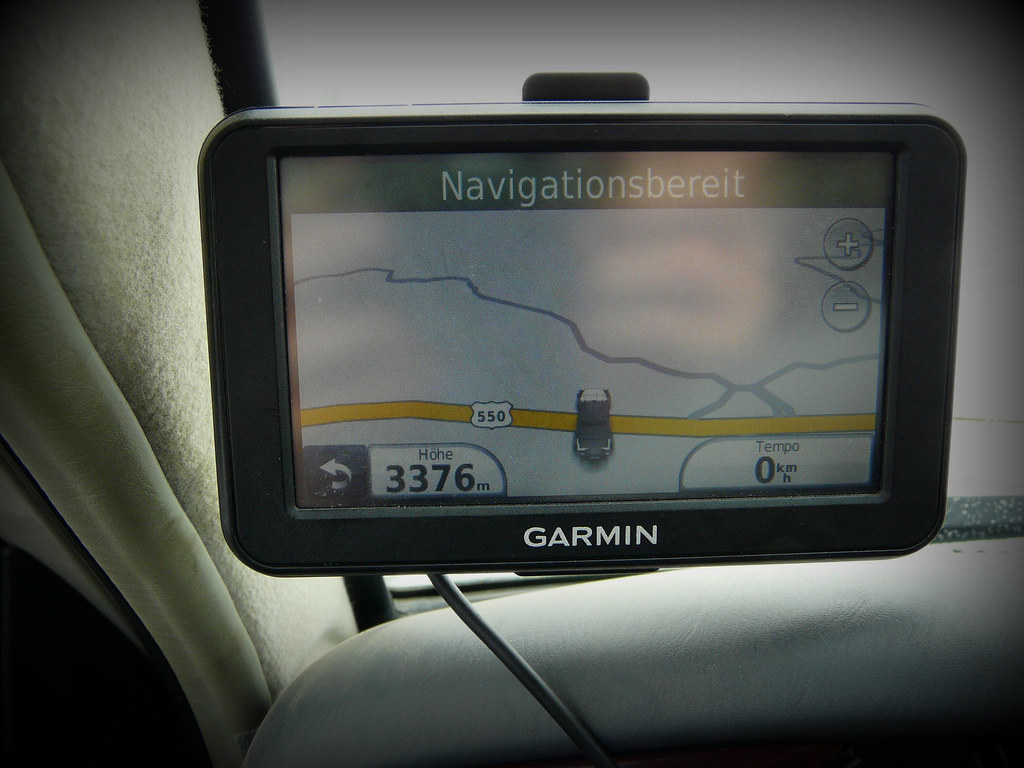
3’376m (11’076ft) over sea level, that’s a pretty serious height for a mountain pass road. The highest mountain pass road in Switzerland is about 2’478m (8’130ft) high.
We drove the same way back down to Ouray and had dinner in town. Next to us was a motel named Matterhorn Inn and the name of our waitress was Heidi, we couldn’t felt more like home.
[EDITOR’S NOTE: We’re sorry, this image has been removed.]
The weather was way better the next and we woke up to a sunny and bright morning.
[EDITOR’S NOTE: We’re sorry, this image has been removed.]
Could have been worse I guess.
Today we drove to Montrose for shoping and doing some service on the Land Cruiser. On the way back we stopped at the hot springs for a bath. It was a absolutely beautiful landscape with the white mountains around us.
[EDITOR’S NOTE: We’re sorry, this image has been removed.]
[EDITOR’S NOTE: We’re sorry, this image has been removed.]
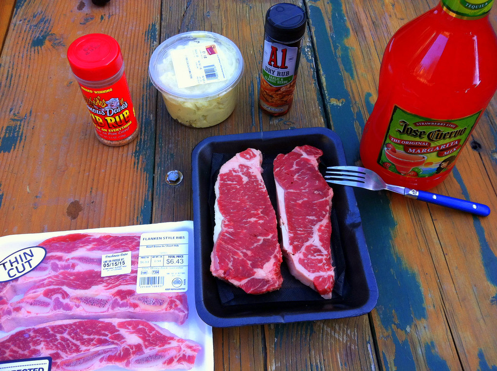
It was still very cold in Ouray, but not too cold for grilling some good meat.
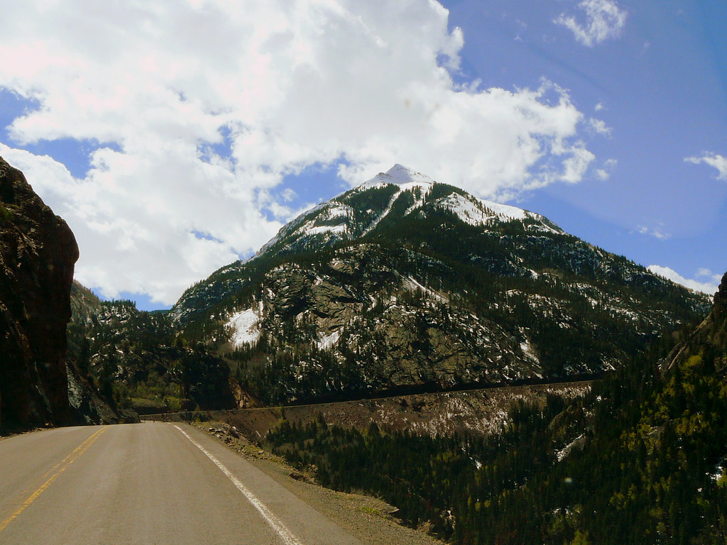
There was absolutely no chance for driving any offroad trails due the snow and we drove from Ouray over Red Mountain Pass to Durango.
The Million Dollar Highway is way more spectacular when not covered in fog.
[EDITOR’S NOTE: We’re sorry, this image has been removed.]
[EDITOR’S NOTE: We’re sorry, this image has been removed.]
From Durango we first drove east and then back north. The landscape was absolutely beautiful but unfortunately, the mountains were covered with clouds for the most time.
[EDITOR’S NOTE: We’re sorry, this image has been removed.]
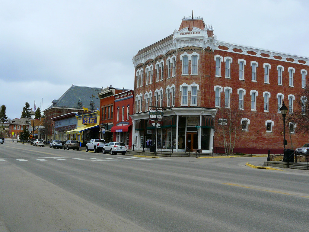
We made a short break in Leadville and checked out all the old buildings.
[EDITOR’S NOTE: We’re sorry, this image has been removed.]
[EDITOR’S NOTE: We’re sorry, this image has been removed.]
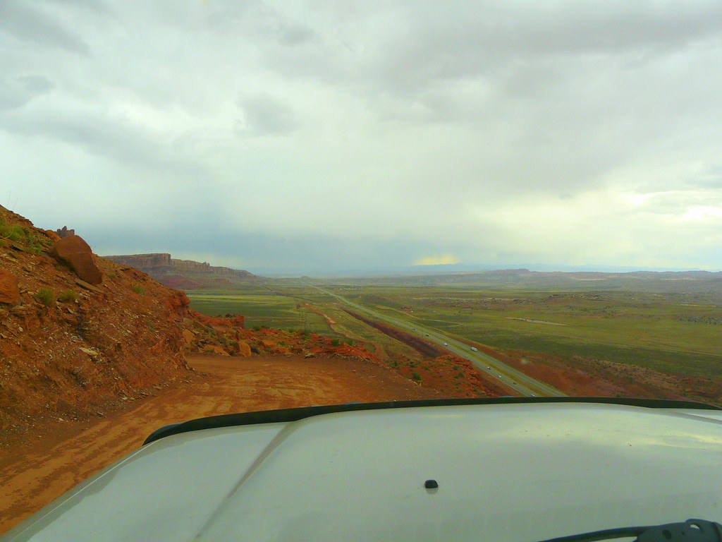
The last stretch of our journey was from Leadville to Denver. We had some heavy rain and the drive wasn’t very enjoyable.
[EDITOR’S NOTE: We’re sorry, this image has been removed.]
We took a motel for two nights and then it was time to say good bye to my dad, he had to fly back to Switzerland.
It was an awesome trip and time we shared together and we both hope doing something similar again in the next future.
It was a strange feeling after dropping off my dad at the airport, suddenly being alone again in the big world. The last couple days were very nice, but also a bit tough. The rain, cold weather and even snow made me thinking a lot about my concept of traveling to the north with just a car.
I made it to Cheyenne Wyoming the same day to spend 3 nights at a private accommodation wich I found on Airbnb. I had a comfy room in a big house with a very nice and friendly family. I spent those days with rethinking my travel concept, while it was snowing outside.
I came to the recognition that a car with only a roof top tent isn’t the best solution for a multiply month journey to the north, at least for me. A small truck camper or a van would have been a better option for me. I also shared my thoughts with Mike, the pre owner of my truck, and he offered me to buy the roof top tent back for a really good price. I then made my decision to sell the tent and continuing my trip to the north, using the money from the sale to spend some nights at a motel when the weather is bad.
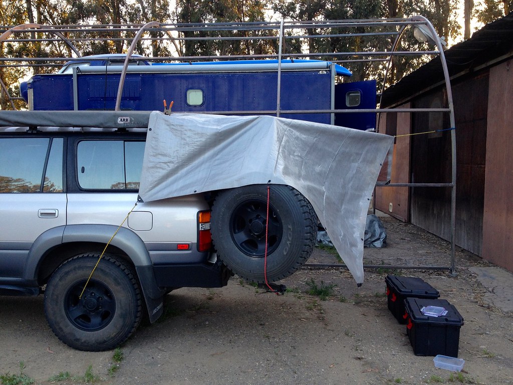
So I drove all the way from Cheyenne back to the west coast, dropped off the tent and Mike’s warehouse near Santa Cruz and continued to my friend Jack were I spend about a week at his place. I reorganized all my stuff, bought a comfortable camping mattress at Cabela’s for my sleeping platform and built myself a rear shelter out of a tarp and some old tent poles. The rear shelter was perfect for cooking on the tailgate or just for having a dry place before entering the sleeping area.
[EDITOR’S NOTE: We’re sorry, this image has been removed.]
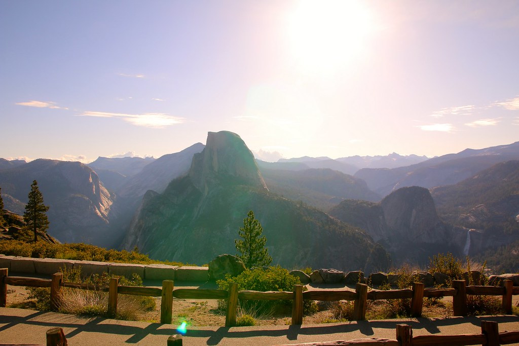
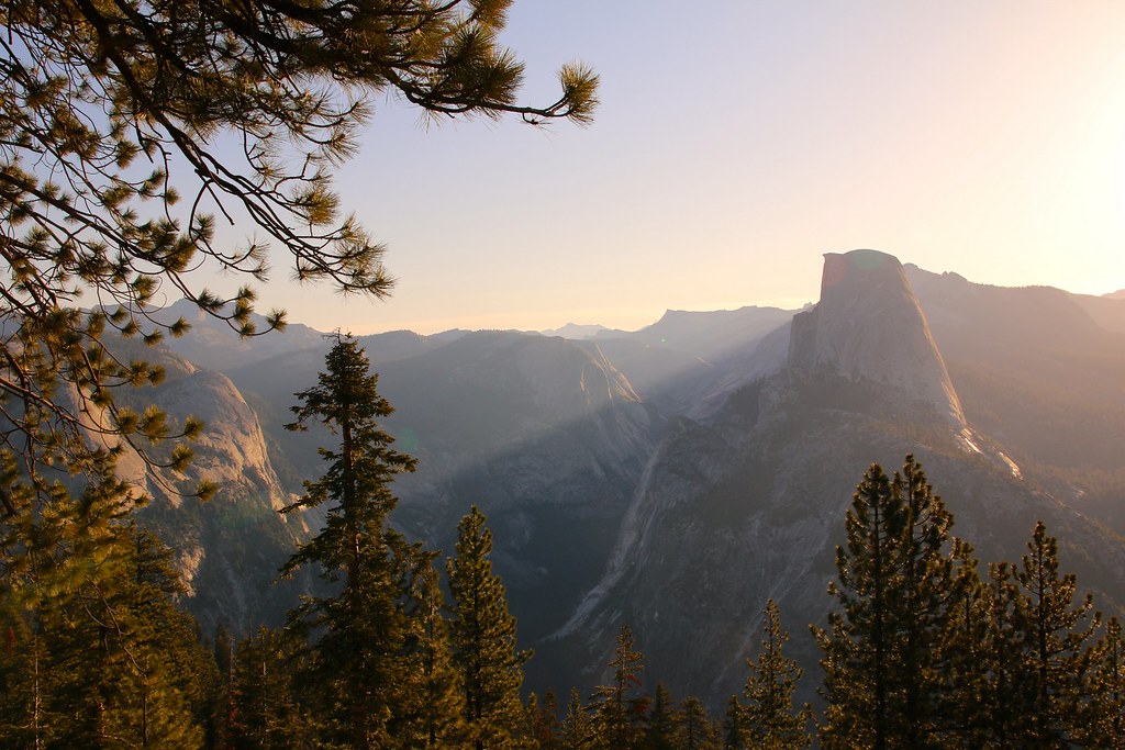
I once again had an awesome time at Jack’s place, but it was time to leave again. Next destination Yellowstone NP, but not without driving through Yosemite NP. I spent the night on a campground right in front of the south park entrance. I got up before sunrise the next morning and drove up to Glacier Point. Unfortunately, I din’t make it to the top to watch the sun rising, so I stopped somewhere beside the road.
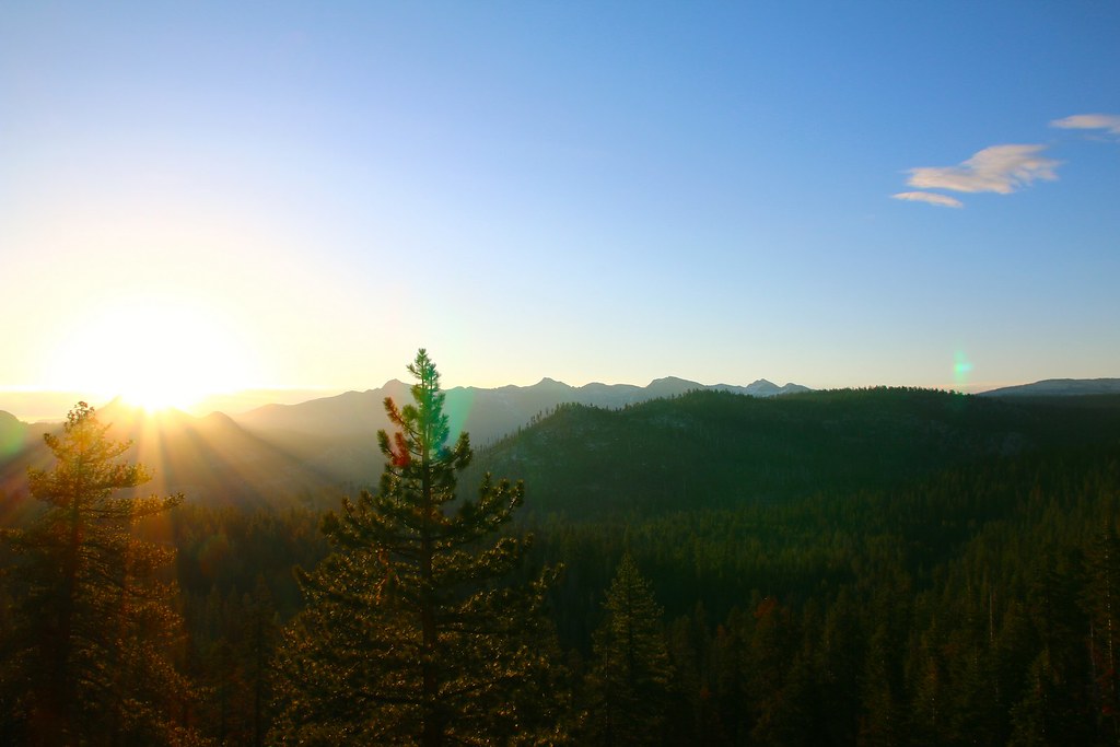
I then continued to the lookout point to find myself absolutely alone. There was only one younger couple and a man photographing right at the lookout point. Everybody told me in advance it will be super crowded up there. It definitely wasn’t.
[EDITOR’S NOTE: We’re sorry, this image has been removed.]
[EDITOR’S NOTE: We’re sorry, this image has been removed.]
It’s an absolutely amazing and magical place. If you haven’t been there, do it! It’s absolutely worth it.
I sat down and enjoyed a not so fresh Subway sandwich from yesterday.
[EDITOR’S NOTE: We’re sorry, this image has been removed.]
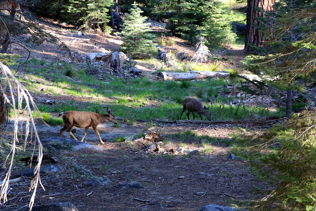
Deers right next to the parking lot.
Another view of Half Dome from Tioga Pass Road.
[EDITOR’S NOTE: We’re sorry, this image has been removed.]
[EDITOR’S NOTE: We’re sorry, this image has been removed.]
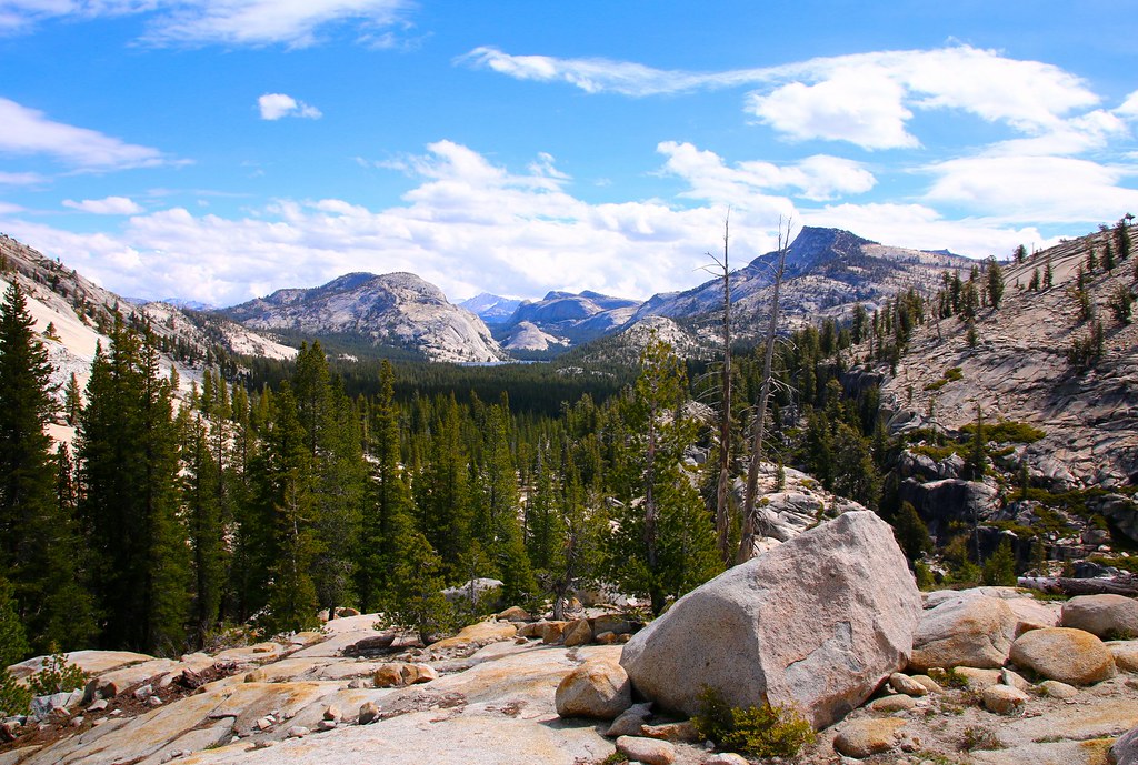
The beautiful Sierra Nevada landscape.
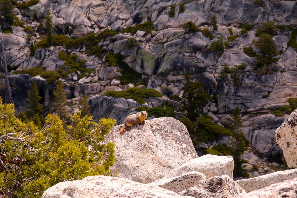
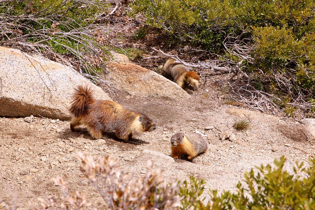
Those little guys were all over the place.
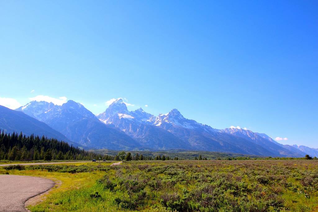
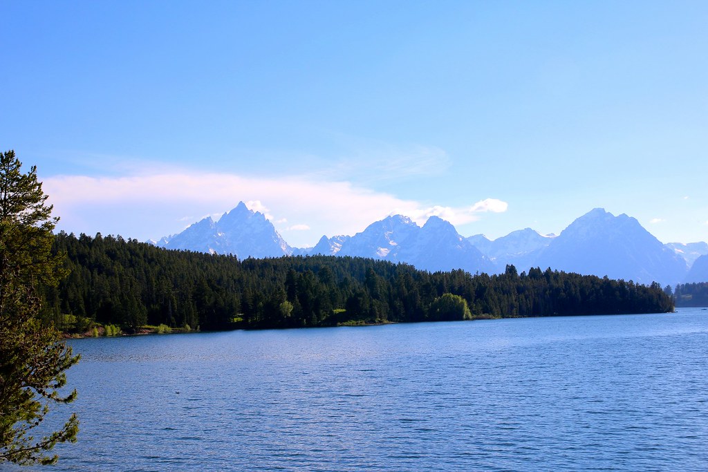
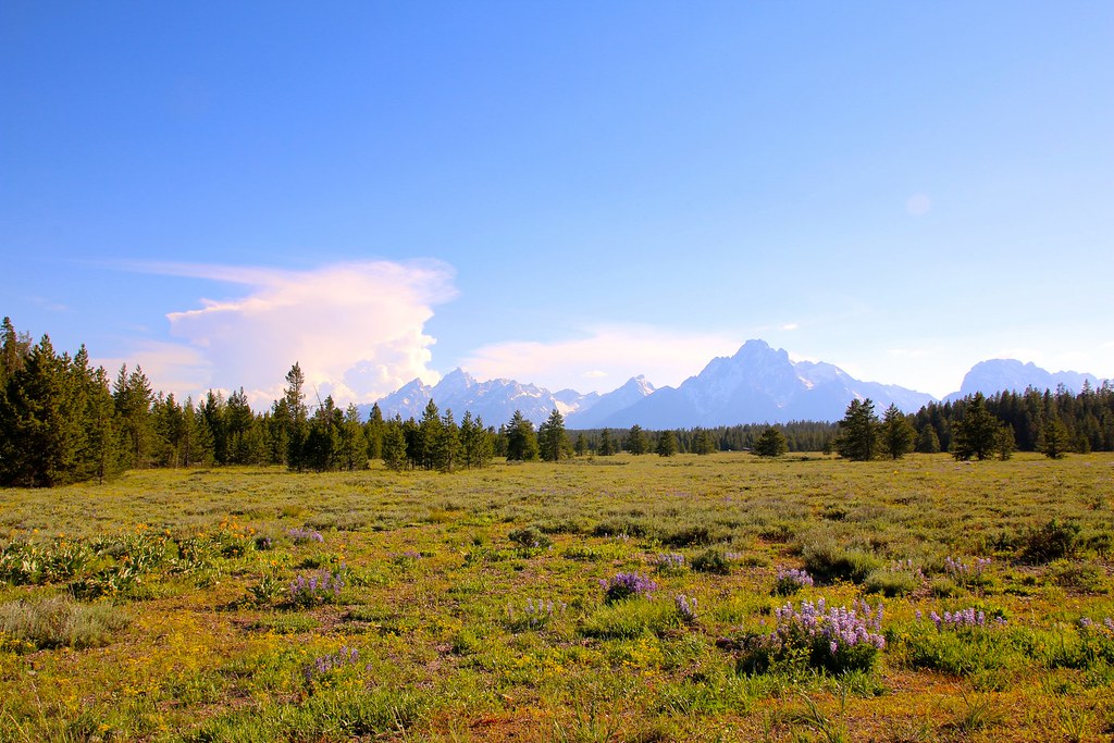
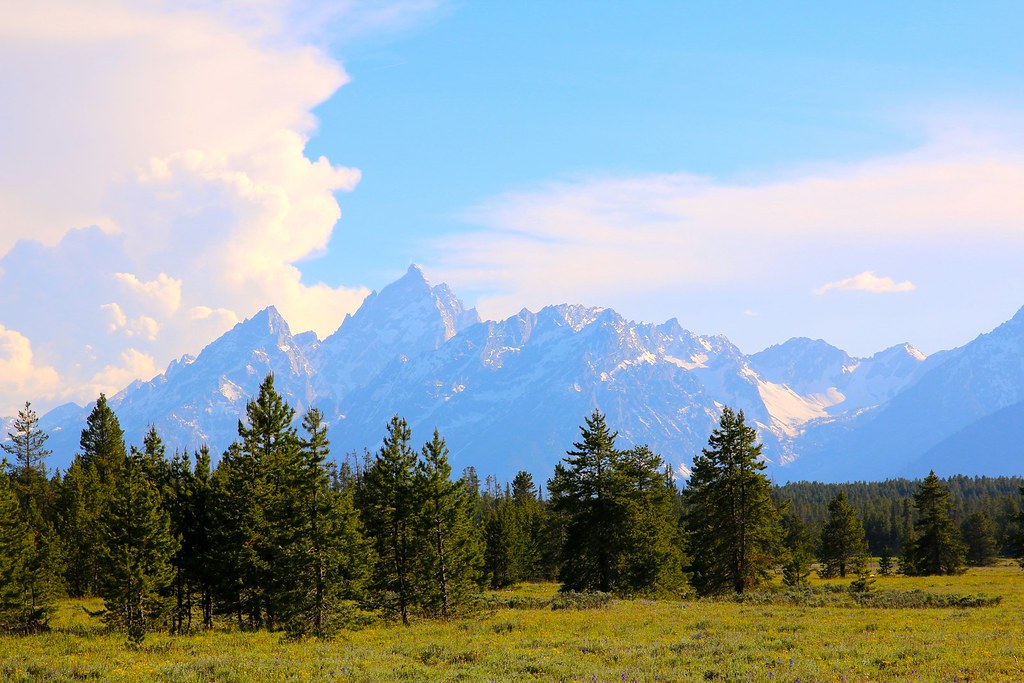
Grand Teton offers an impressive mountain range.
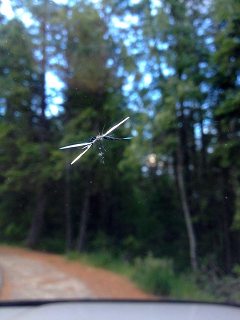
I assume that I hit a bird and not a stone. There was no one driving in front of me or in the oncoming lane. I had a shock anyway from the bang.
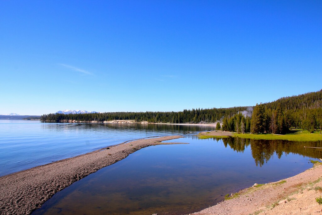
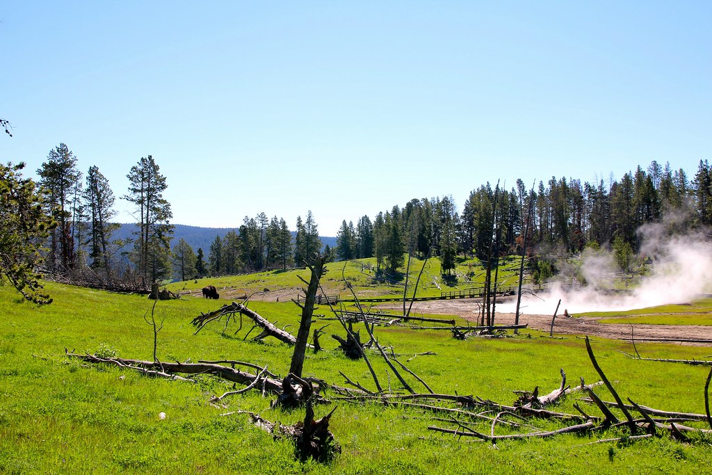
Bad luck for me at Yellowstone NP. The completely road through the west side of the park has been closed and made driving a loop impossible. I was only abel to visit the right half of the park.Wildlife everywhere along the road.
[EDITOR’S NOTE: We’re sorry, this image has been removed.]
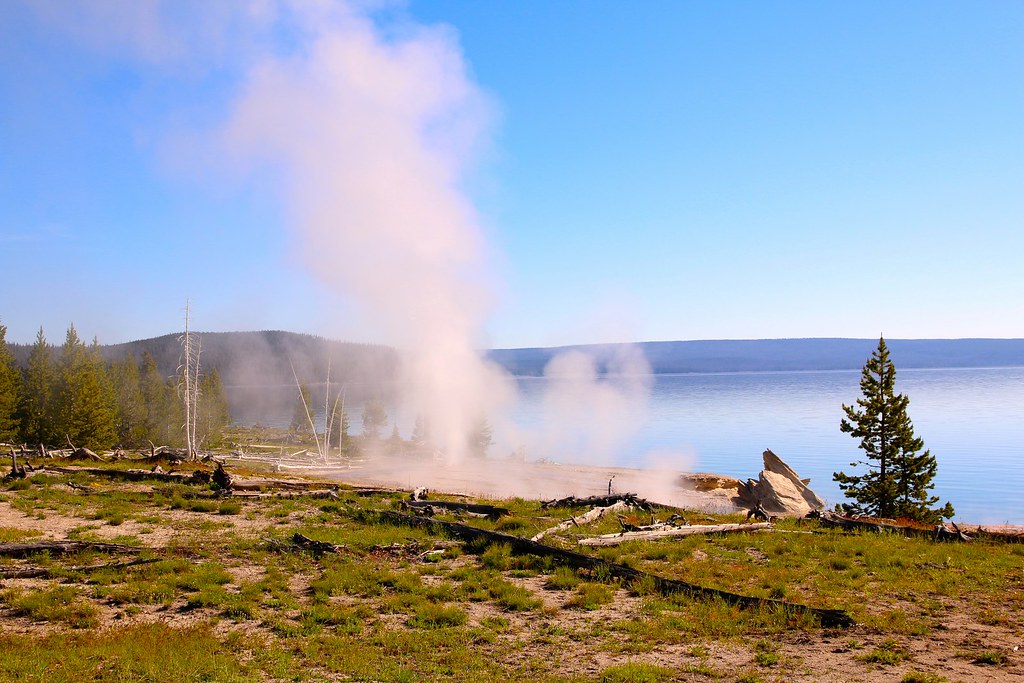
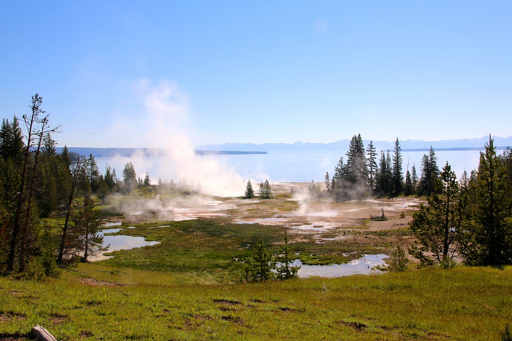
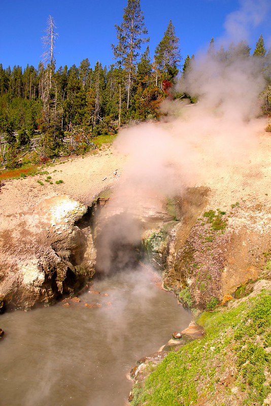
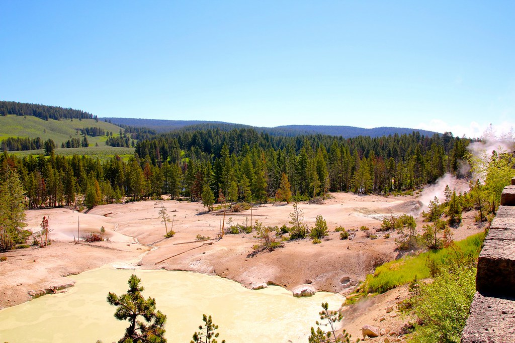
One of the many geysers.
Finally some bisons!
[EDITOR’S NOTE: We’re sorry, this image has been removed.]
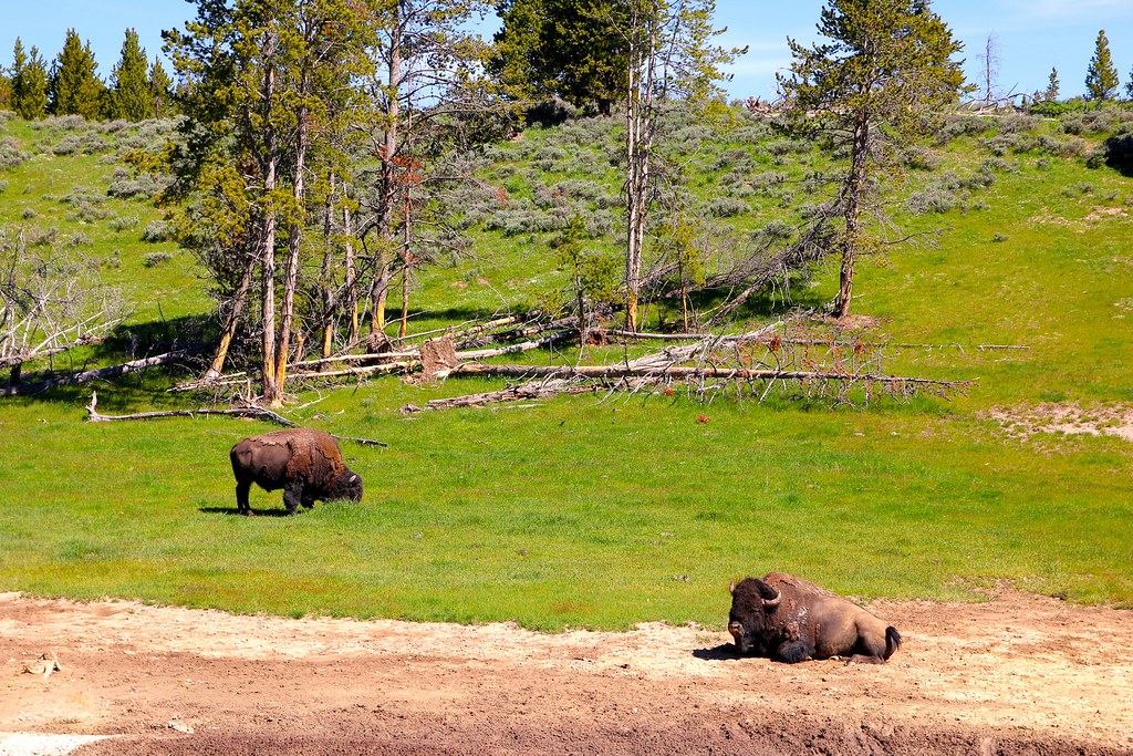
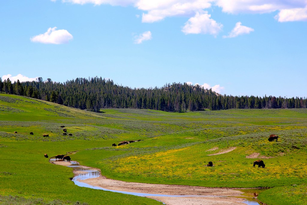
A free living bison herd.
Drive by shot.
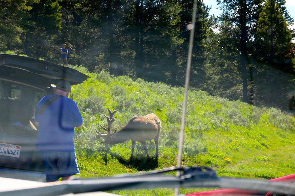
The most dangerous thing inside the park aren’t all the animals crossing the road, it’s the idiot people doing emergency brakes when spotting a squirrel high up in the trees 100 feet off the road or parking in the middle of the road..
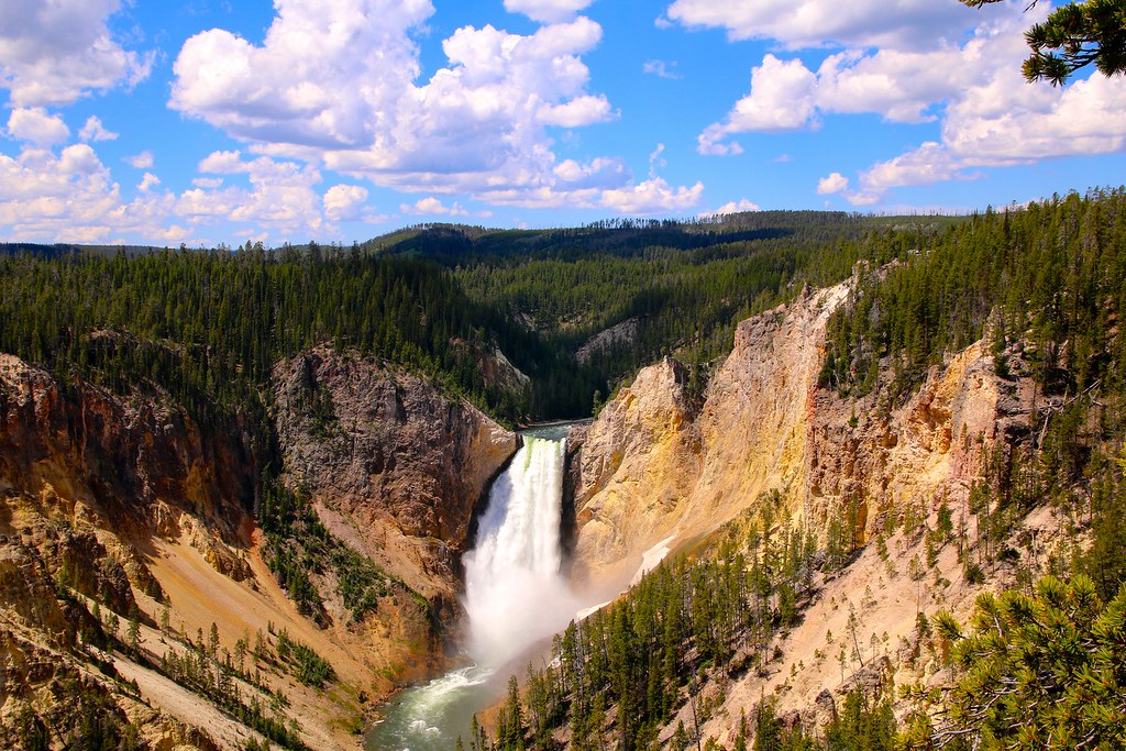
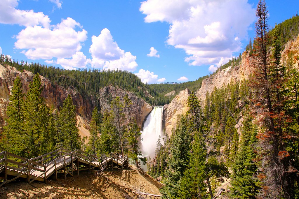
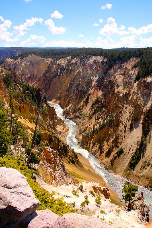
The waterfall is huge! You can spot the people on the lookout point right next before the water drops.
[EDITOR’S NOTE: We’re sorry, this image has been removed.]
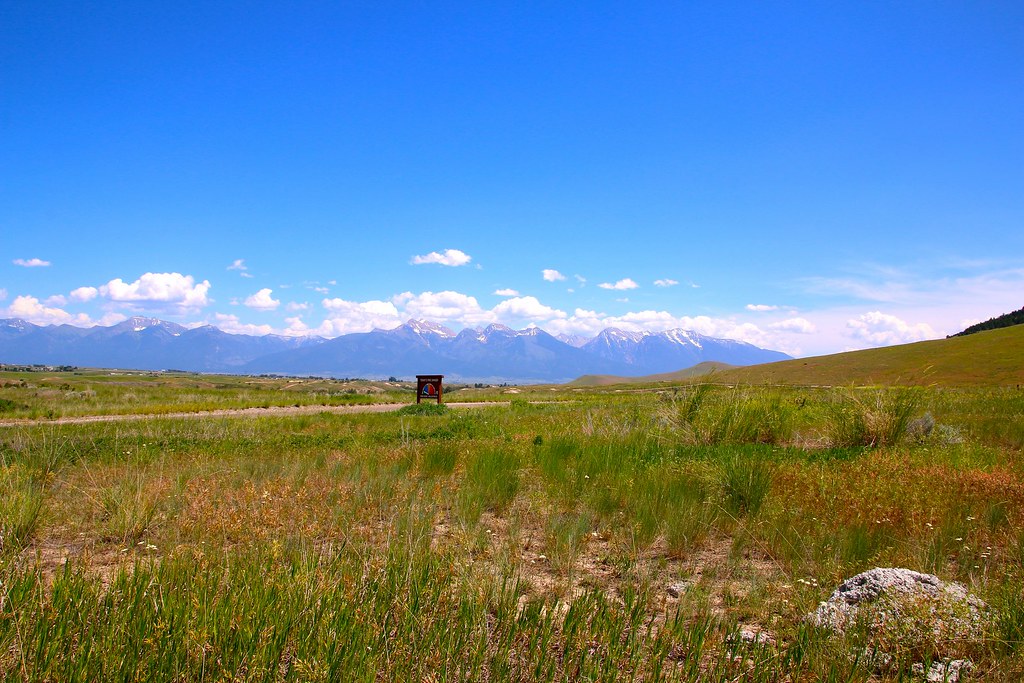
At the beginning of the loop with the Mission Mountains in the background.
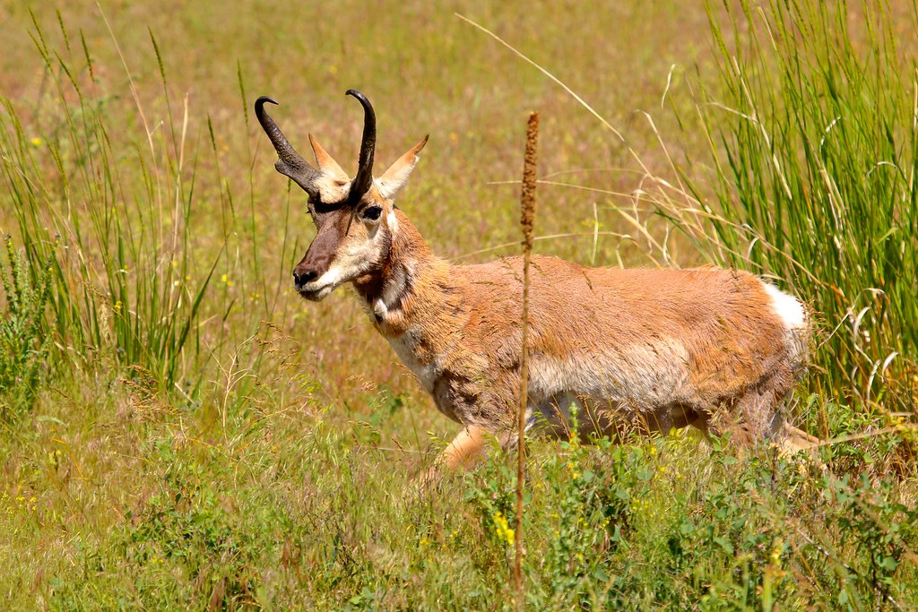
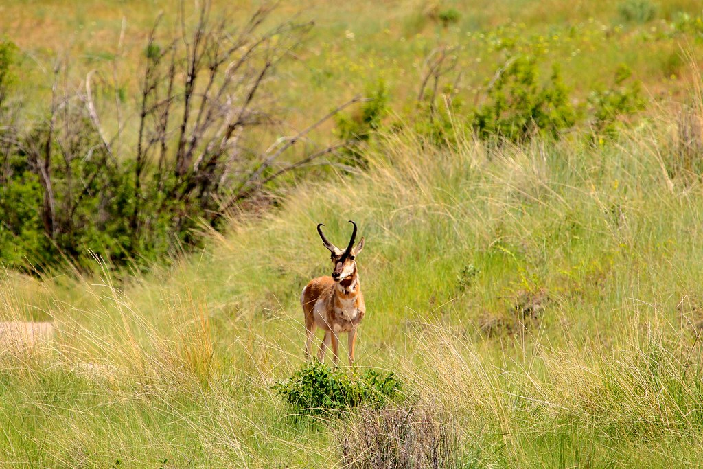
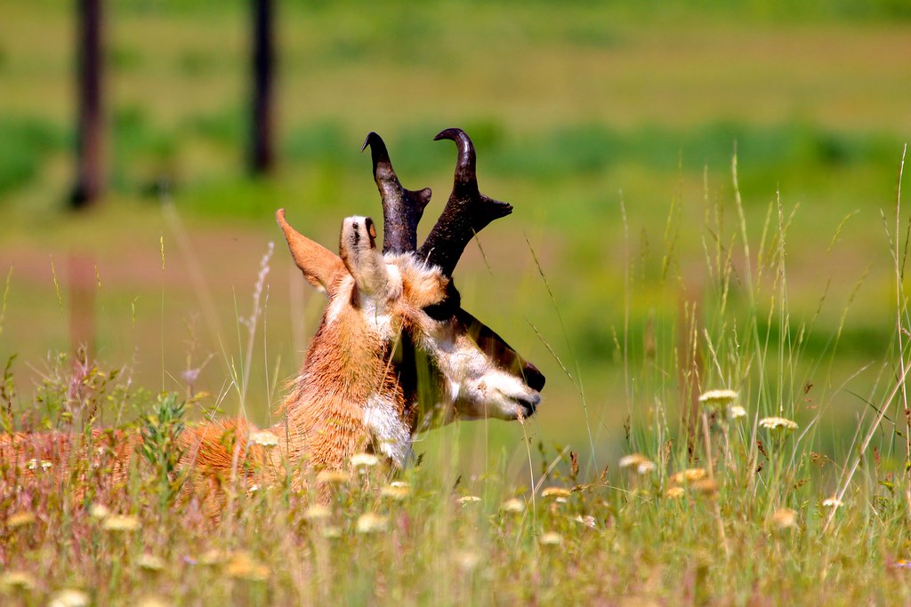
A Pronghorn along tho road.
And then finally! A real Bison almost next to the road. They’re just massive!
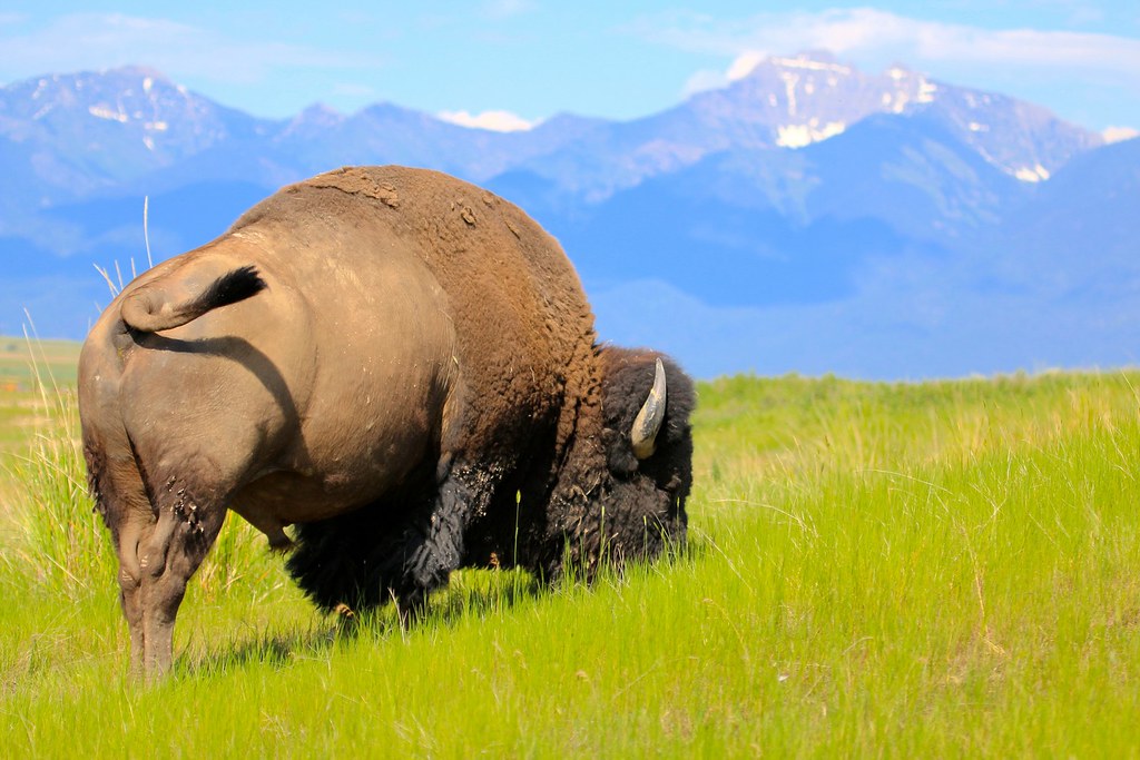
[EDITOR’S NOTE: We’re sorry, this image has been removed.]
I then spent a couple days in Kalispell, a nice town just north of the Flathead Lake. The Land Cruiser received some fresh oil and it was also time to replace the belts wich I carried with me as spare parts.
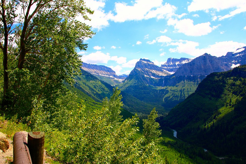
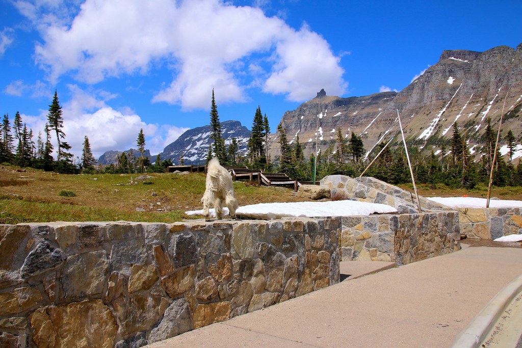
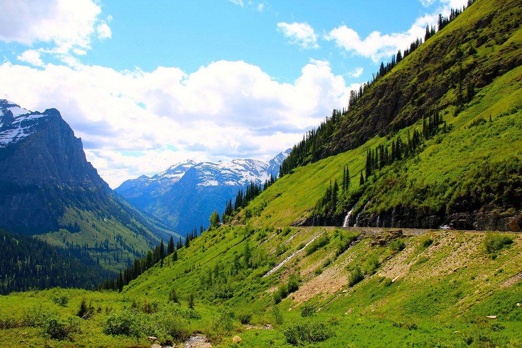
The weather was perfect and I hit the road towards Glacier NP. There’s one narrow park road, called Going to the Sun Road which was only open until Logan Pass, about halfway of the road.

[EDITOR’S NOTE: We’re sorry, this image has been removed.]
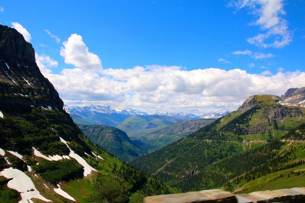
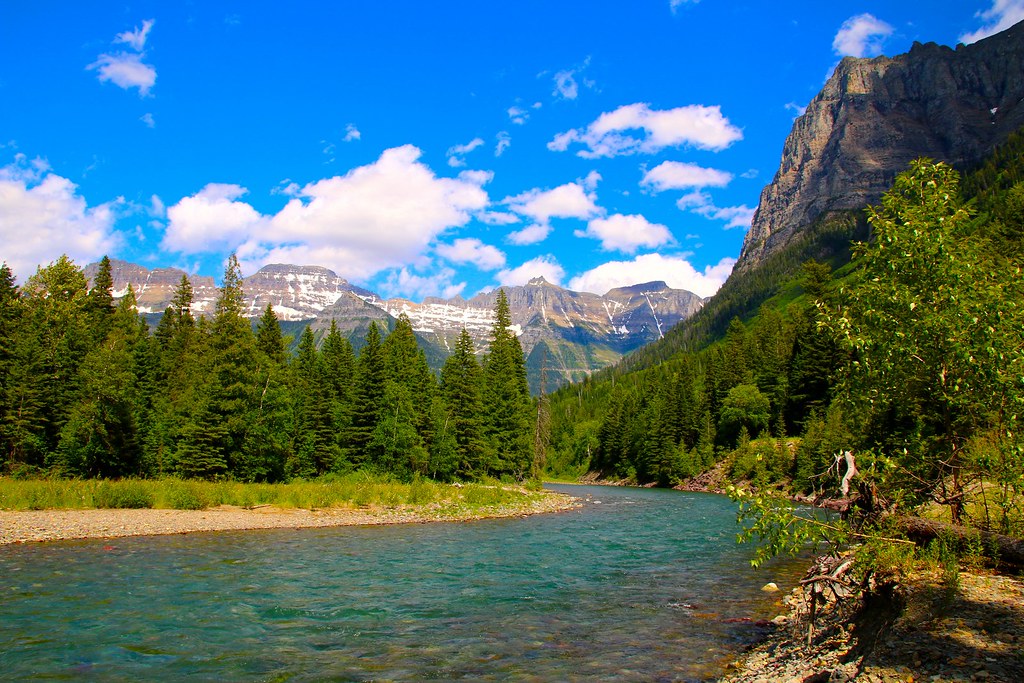
The scenery was absolutely beautiful
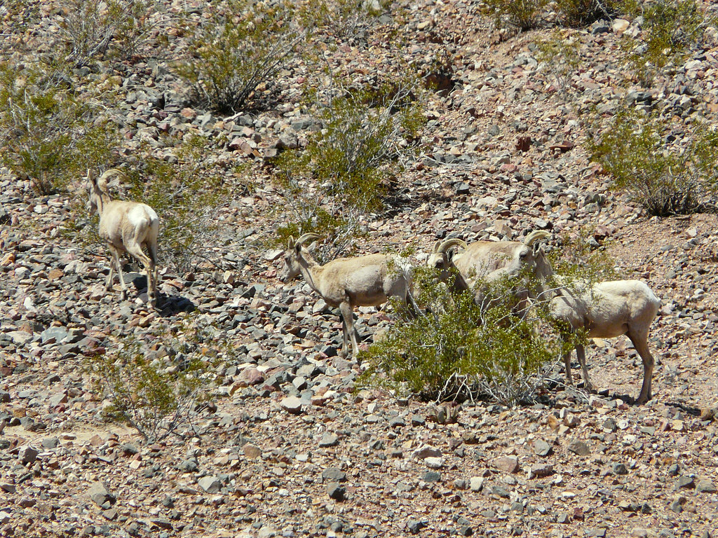
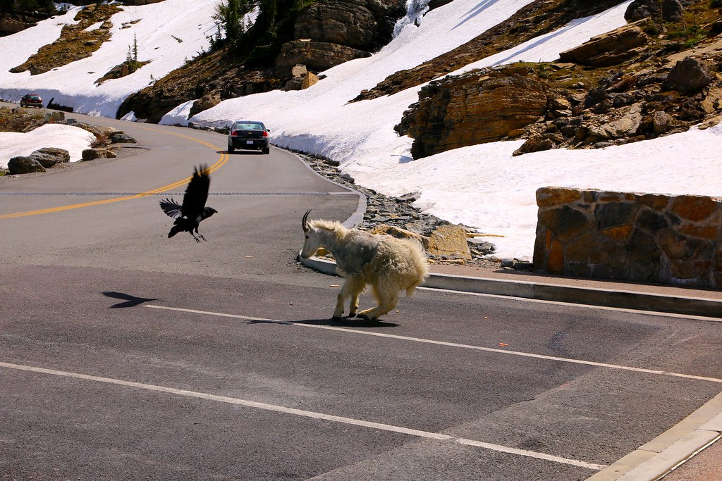
A Mountain Goat on the parking lot.
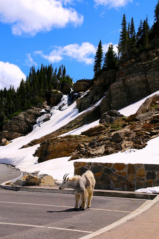
They were fighting about the food.
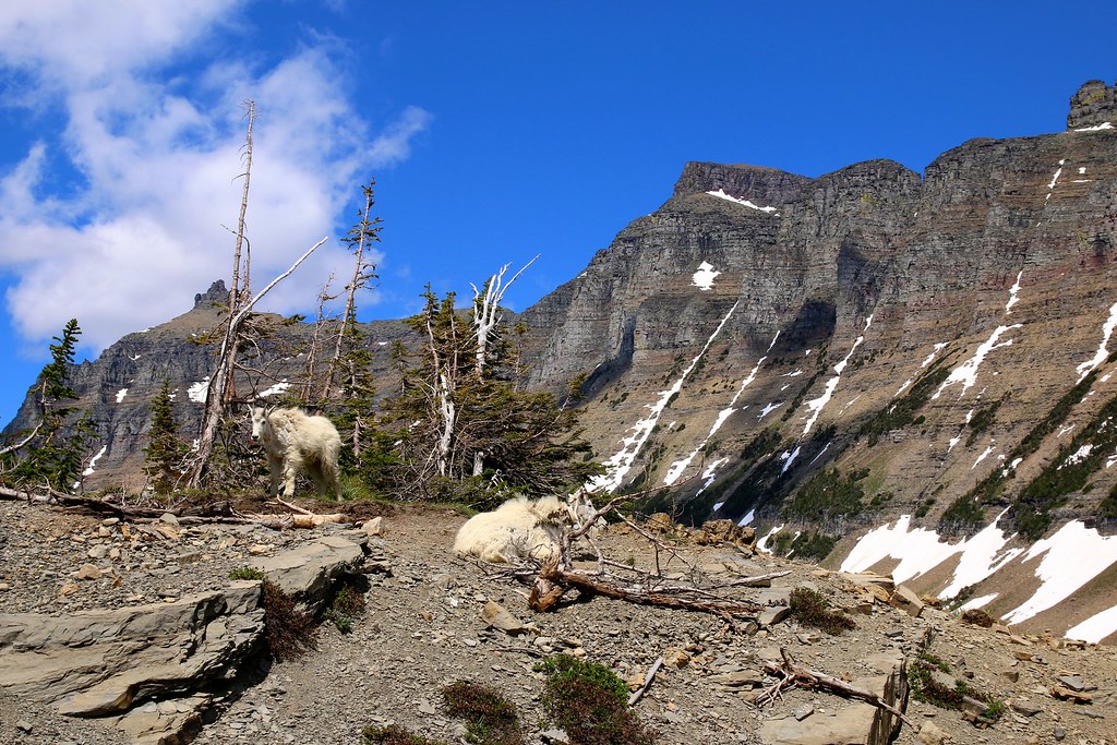
Fluffy Mountain Goats everywhere.
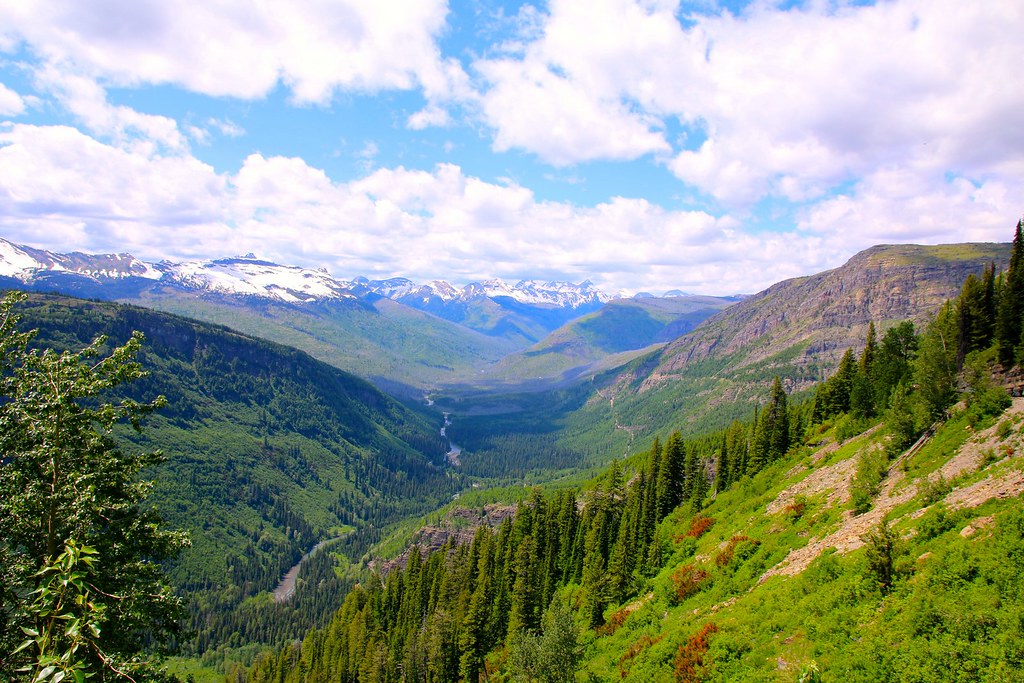
Breathtaking scenery along the road on the way back down.
Down in the valley.
It must be a nice experience driving along the road with a nostalgic bus and a roll-back top.
[EDITOR’S NOTE: We’re sorry, this image has been removed.]
I spent the night on a campground near the Canadian boarder, which I crossed the next day.