
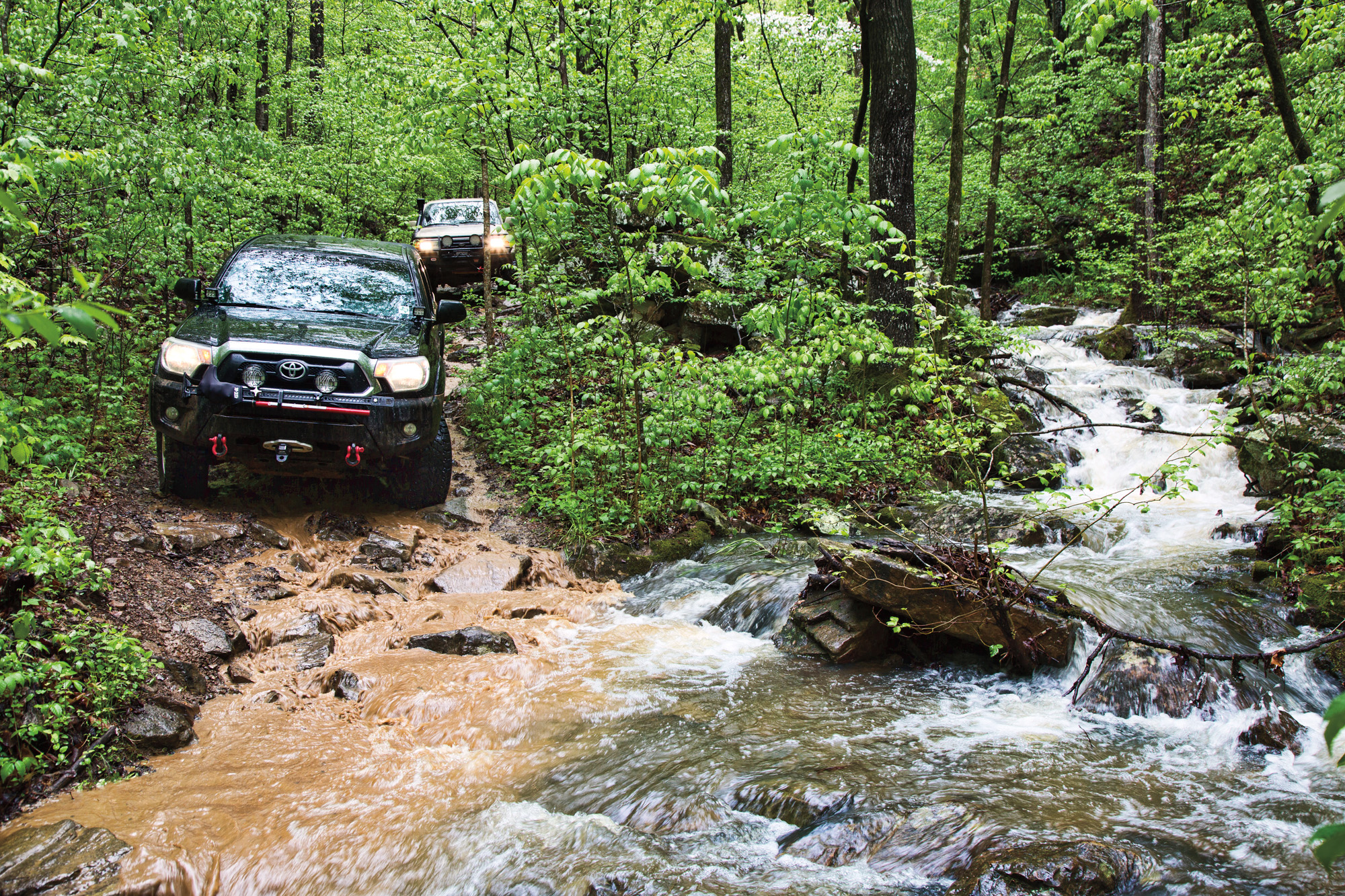
White caps, like the peaks on my great-grandmother’s meringue, fill the road ahead. The waters are high and raging at a usually benign stream crossing deep in the Ozarks. It is late April and a wet and stormy spring in Arkansas. We had another downpour last night, the rain is still falling, and we’re in a bit of a pickle.
Clearly, we did not choose an easy time to traverse the Ozarks. We’ve already deviated three times from our original route because of high water, beginning at the Woolum Ford on the Buffalo National River, a common crossing point for vehicles, yet far too deep to attempt this morning. Any course of travel through this green expanse of knobs, hollows, and usually clear flowing streams is okay with me, as long as it’s mostly off-pavement. But for Tod Dudley, who designed our route, each turnaround increases his frustration.
Our caravan of five vehicles is stopped 500 feet back from the crossing, where Cedar Creek flows into the North Fork of the Illinois Bayou. The forest road from here to there is flooded to the same level as the bayou, which is roiling out of its banks only 200 feet to our right. Tod walks ahead to take a closer look. He steps gingerly along the roadside turned creek bank and takes a gander, returning with the obvious conclusion. “I hate to have to turn us around again, but there’s no way we’re going through that.”
Such challenges are not unexpected as we travel east to west across the Boston Mountains, the highest and some of the most rugged of the Ozarks. Some say the mountains’ moniker comes from a French phrase for rough road, although in the American West, the term “a Boston” referred to any difficult task. In either case, it fits. The name Ozark also has French origins, coming from “Aux Arc,” possibly a reference to the top-most bend in the Arkansas River, or an abbreviation of “Aux Arkansas,” referring to Arkansas Post, an early settlement. French explorers, hunters, and traders of the late 1600s and 1700s left an indelible mark on the place names of the region.
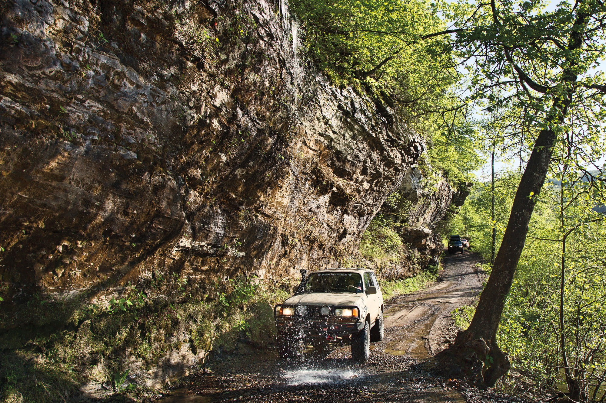
For my husband, Bill, and me, both native Oklahomans, the Ozarks are a familiar next-door neighbor. Though mountains for all practical purposes, the region is geologically a deeply dissected plateau covering northwest Arkansas and much of southern Missouri; its “foothills” even stretch into eastern Oklahoma and Kansas. It’s the largest highlands region between the Appalachians and the Rockies, yet elevations stay below 2,600 feet. Even at that, the steep and rocky ups and downs created by the dissections, or hollows (“hollers” in local dialect), make for often-difficult travel which is, of course, the attraction for overlanders. Countless streams flow through those hollows, feeding several sizeable rivers. Traversing the core of the Ozarks requires negotiating this rugged terrain on a network of unpaved county roads, forest roads, and unnamed and unmaintained trails canopied by the oak, hickory, and shortleaf pine of the Ozark National Forest.
We’ve motorcycled here extensively, and I’ve backpacked the 165-mile corridor of the Ozark Highlands Trail. Walking in those deep woods, along the rocky ridges and through the verdant hollows, I wove through a web of remote forest roads and abandoned pioneer pathways. They looked traversable on four wheels, and I wondered about connecting them as a through trail for overlanding. To satisfy my curiosity, we contacted Randy Putt, founder of Natural State Overland (NSO), a group that showcases Arkansas as an overland destination “for those looking for raw beauty” (echoing Arkansas’ “Natural State” nickname). They also promote Tread Lightly principles and work with the US Forest Service to help keep trails open. Since its inception in 2017, NSO has grown to more than 3,000 members.
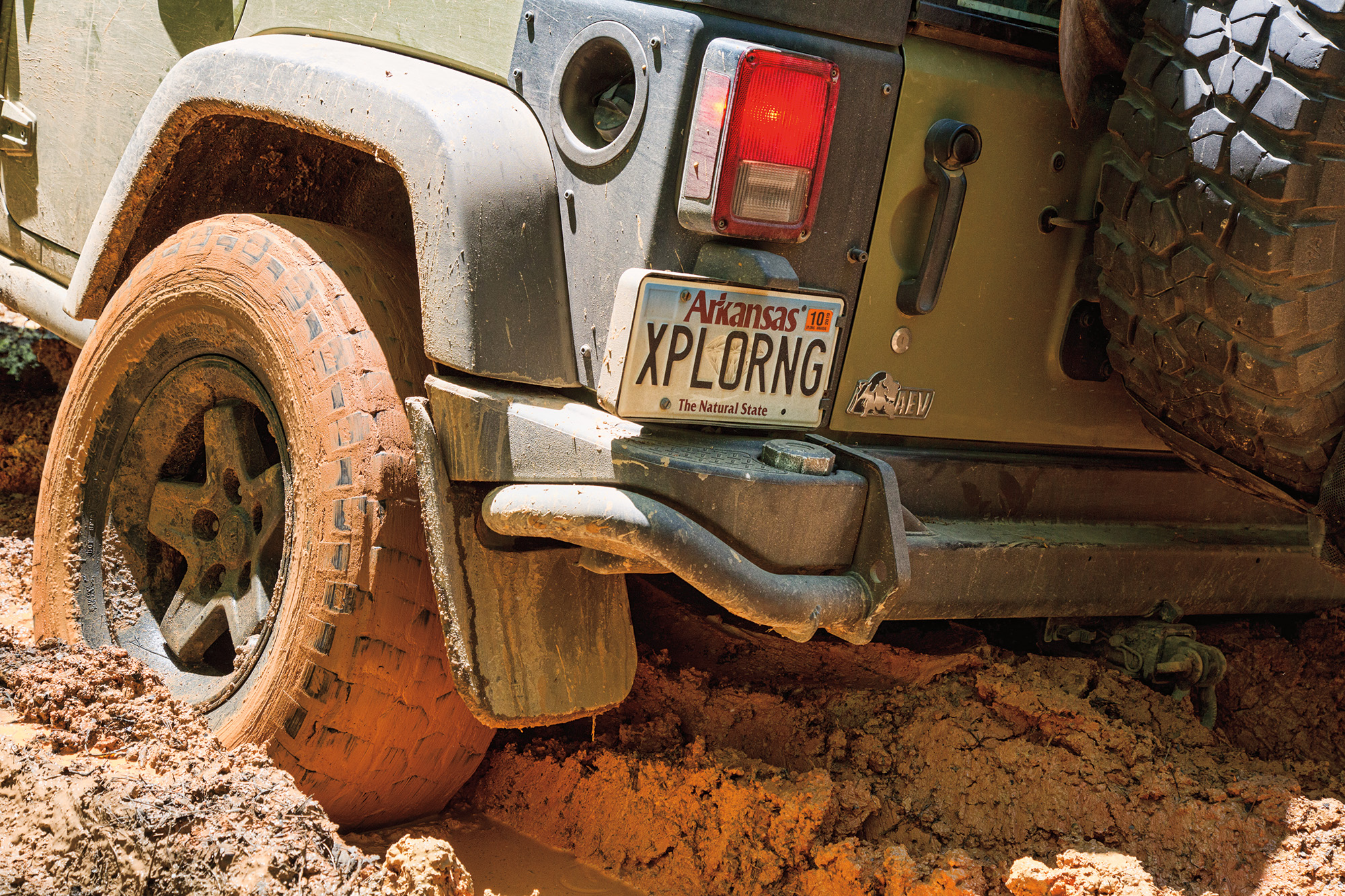
Randy is happy to help us with a route and offers to join us when we run it. He lives on the western edge of the Ozarks in Cave Springs and has been exploring this region since 2007. We plan to meet at Woolum Campground on the Buffalo National River a few days before NSO’s Bonfire Rendezvous, a spring gathering meant to keep enthusiasm high between occasions of the group’s annual fall Rendezvous in the Ozarks. Joining Randy are our trail guide, Tod Dudley of Little Rock, and Brad Brazell, from Oxford, Mississippi. Bill and I are accompanied by our friend and fellow Oklahoman, Mark Driscoll.
On Wednesday evening before the Saturday bonfire, we meet Randy at the Woolum Ford, our intended starting point for the planned 187-mile, three-day traverse. After several weeks of rainy weather, it is too deep and swift to cross, even for the NSO guys, all of whom have snorkels. Our Oklahoma contingent does not. With more rain in the forecast, we resign ourselves to a reroute.
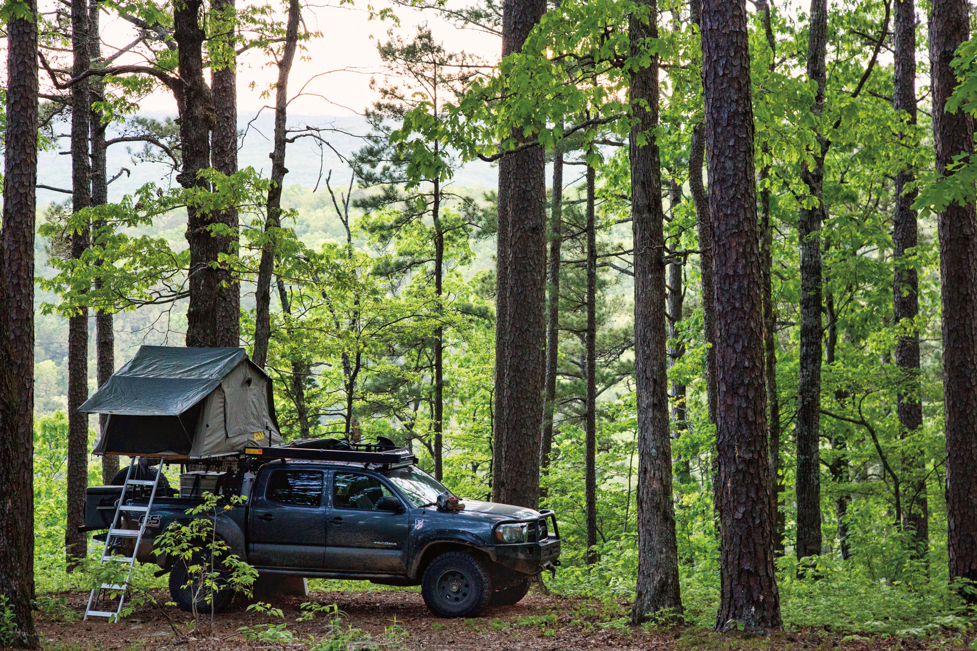
A campsite on the river bank is big enough for all five vehicles, and we fill it up with three Toyota Tacomas (ours, Mark’s, and Brad’s), Tod’s 80 Series Land Cruiser, and Randy’s Jeep JK Unlimited. While I cook dinner under an awning, Bill builds a fire and keeps it roaring in spite of the showers. The downpour finally lightens to a drizzle, and we emerge from undercover and gather around the flames. We talk about the reroute, and the deep water crossings these guys have done. They’ve been traveling off-pavement together for a decade. “We’ve never drowned out anyone, yet,” says Tod, with a grin.
In the dark of night, we notice a light high on the bluff on the opposite bank of the river. Its source is mysterious; there’s no house up there. Curious (there’s always the possibility of Bigfoot) but not overly concerned, we sleep well to the sound of rain on canvas and flowing water a few feet away.
DAY ONE—TURN, TURN, TURN
At dawn, heavy clouds hang low over green mountain tops. Rafts of debris rush downstream, testifying to the massive hydraulic power moving through the tributaries of the Buffalo. Tod conjectures over breakfast that the light on the cliff was a hiker, and I realize that the Buffalo River Trail runs exactly there. What an obvious answer to a silly mystery. Besides, would Bigfoot build a fire?
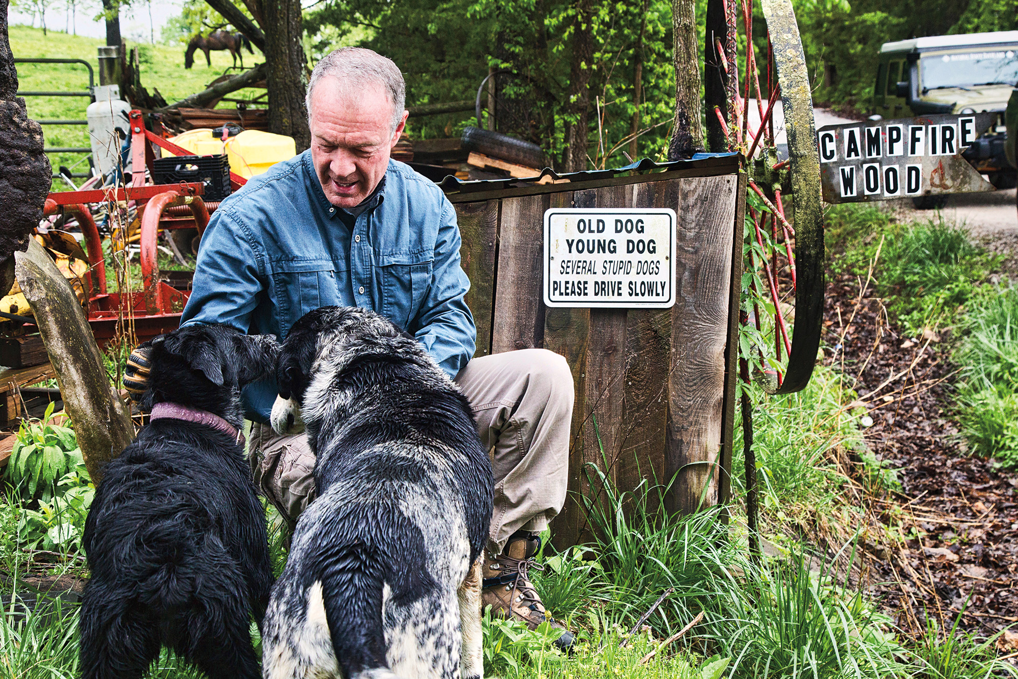
On our way to Highway 65, we stop to buy firewood at a house where it is sold on the honor system. No price is posted, and a coffee can, labeled “Money Hear [sic],” sits atop the woodpile to collect payments. A pack of friendly dogs greets us, and Bill takes the time to reward them with a good scratching behind the ears.
We attempt a detour to reach the opposite bank of the Woolum Ford to officially start the trail, which will take us southwest to White Rock Mountain. After a short jaunt on the highway, we are back on dirt, driving through Snowball, a once-thriving community founded in the 19th century. It’s now only a Masonic hall, a Baptist church, and a few homes. Snowball’s tiny population experienced a brief resurgence in the 1970s during the “back to the land” movement, when college-educated young people moved to the Ozarks to farm, seeking to return to the basics of life. That era is long gone but had a lasting impact on Arkansas’ perspective on caring for its natural resources. I think about the cultural stereotype of the Ozarks, the “hillbilly” image, typified in my lifetime by The Beverly Hillbillies, of which I am quite fond. As an “Okie,” a native of a state with some negative cultural stereotypes of its own, and with my ancestral roots in Arkansas, I can appreciate the efforts of people like Randy to illuminate the best of the Ozarks.
West of Snowball, we are enveloped in a blanket of fog as we ascend Point Peter Mountain, then drop into the Richland Creek Basin and turn north to try for the Woolum Ford. But what looks like endless water on the road forces us to reverse. In only a mile and a half, we are stymied again by Richland Creek, its flow deep and swift. Living in these woods would require a solid grasp of topography and route options—and a lot of gas in the tank.
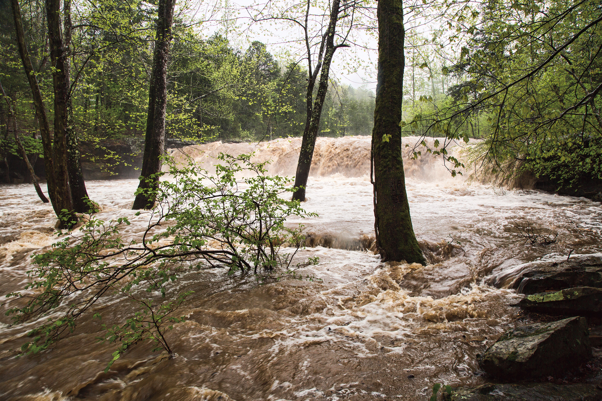
Thankfully, Tod has plenty of reroutes in his back pocket, so we climb back over the mountain to Snowball and take a paved road to the turnoff for Falling Water Road. The rain continues. In the downpour, we stop at Falling Water Falls, which has become a muddy deluge, then are back on course through a canopied forest road.
We expected to reach Boyd Cemetery by midday, but the white water at Cedar Creek intercedes. After Tod pronounces another crossing impassable, we take a nearby cutoff, a narrow two-track through thick vegetation. I’m surprised to see it has a Forest Road designation, 93081C. We make it through and stop for lunch at Fireball Campground, so named because a meteor once set the night sky afire here.
Carrying on, we enter an area scarred by logging, then pick up another narrow two-track. Again our progress is foiled, this time by a fallen pine, which has obliterated the path. Bill wants to move the obstruction with winches and a chainsaw. But the group, concerned about the time it will require, wins the day, and we turn around again.
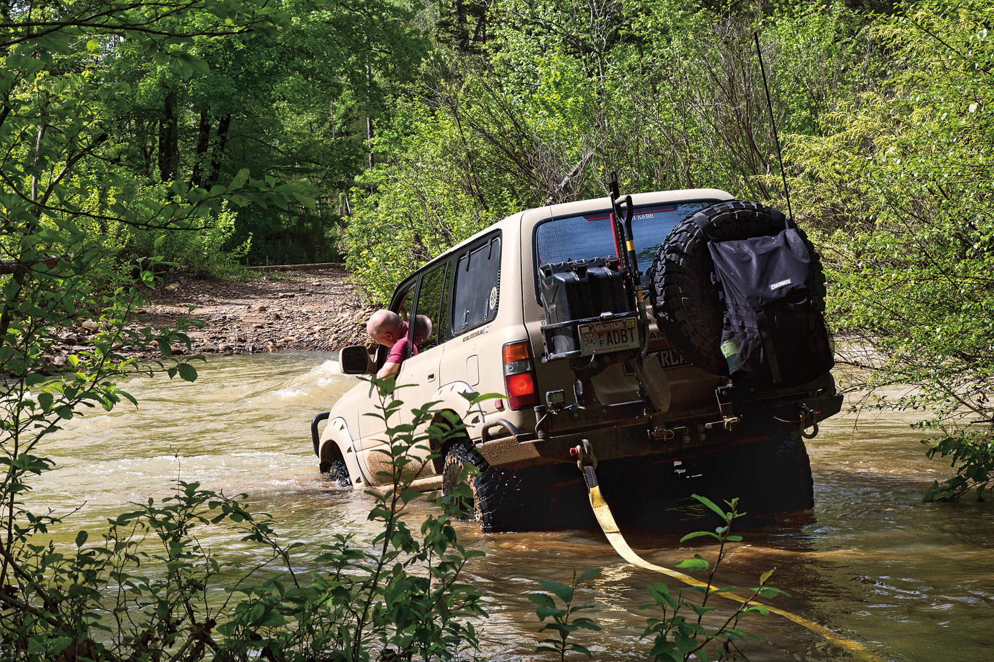
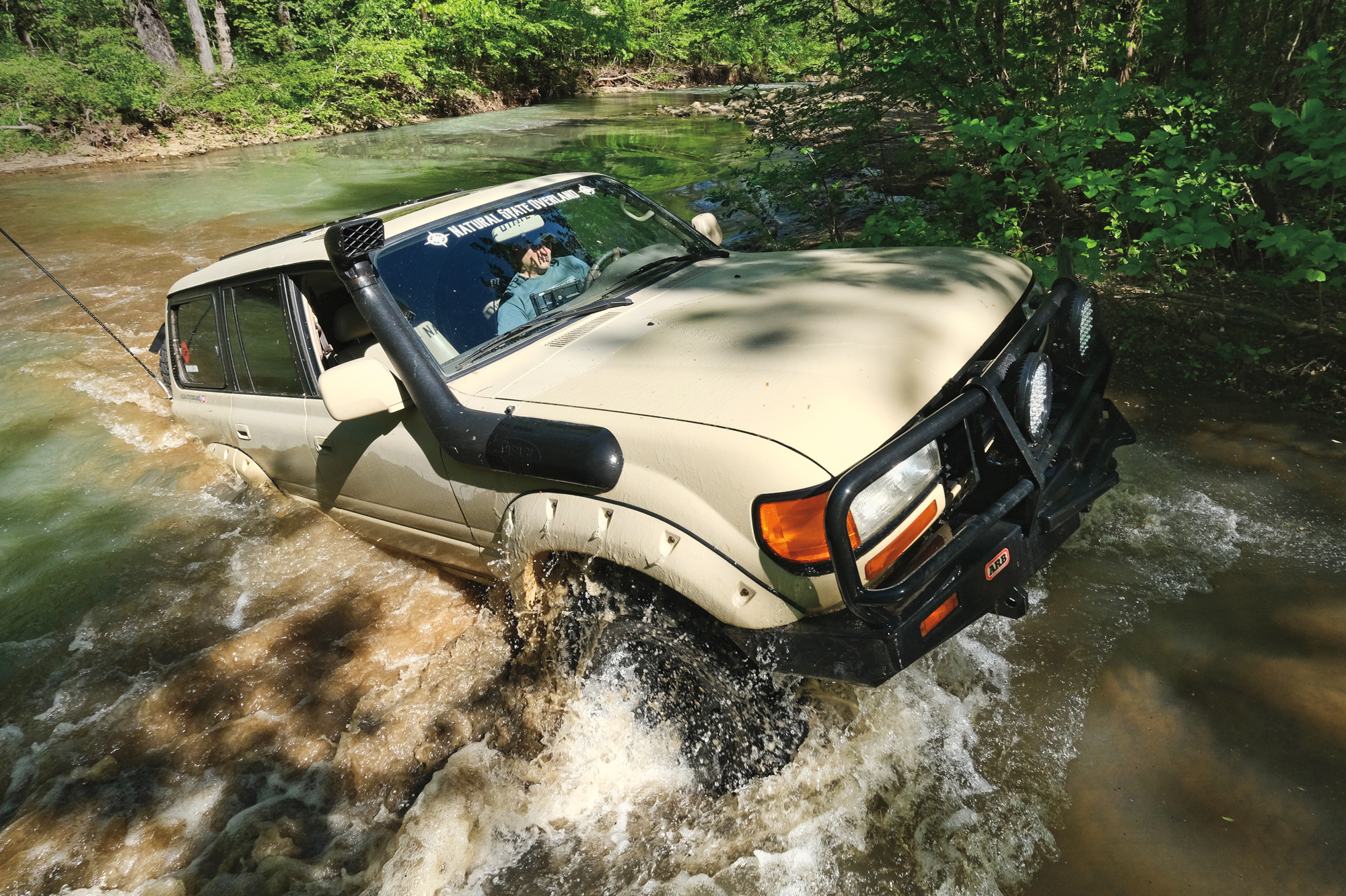
Another stream crossing, this time narrow and deep, rears its head. Tod dips his proverbial toe in the water, his Land Cruiser connected by a strap to Brad’s Tacoma in case retrieval is necessary. Within a few feet, he drops steeply off to the depth of his front tire. “That’s not the bottom,” he says, and reverses to dry land.
The guys with snorkels might make it through, but we probably wouldn’t. It’s time to call it a day on this segment, and we detour to Victor Road, head west, then jump on the pavement for a few miles, bypassing the inundated trails we would otherwise have attempted. A one-lane 1931 steel truss bridge takes us across Big Piney Creek. Then we are on dirt again and headed to Car Wash Falls, where the cascade from a roadside bluff splatters down on passing vehicles. Everyone takes a playful turn in the shower, and Tod discovers that his sunroof still leaks. We continue into the highlands and spend a peaceful night camped on Big Piney. The rain has finally stopped, and the now-familiar sound of rushing water eases us into sleep with high hopes for tomorrow.
DAY TWO—RUTS AND LEDGES
Pre-dawn sunlight filters through the spring-green leaves, lighting up the blooming dogwoods. The break in the weather renews our optimism about finishing the trail, although completing it in three days now seems unlikely. We return to the original route, stopping at Haw Creek Falls and the historic Union School, built-in 1929. Unoccupied, it is maintained in perfect condition and kept open for visitors to enjoy. I inspect and appreciate its clean outhouse.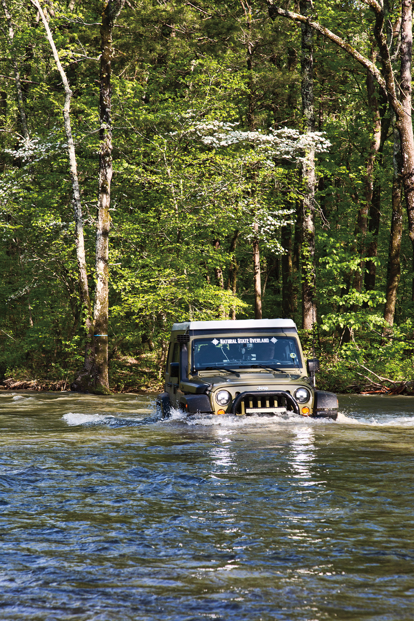
Soon we encounter The Ledges, a feature on the edge of Ozone Mountain that is just what it sounds like, a series of rock ledges up a steep hill. With good spotting by Tod and Bill, everyone makes it through, and soon we’re negotiating some tight, deep ruts. I hear a crunch as Bill reverses to reset on a large rock. Water runs out from the Tacoma’s rear bumper, which is plumbed from the water tank in the truck bed to a spigot on the right rear. We stop so that Bill can execute a repair with Brad’s help.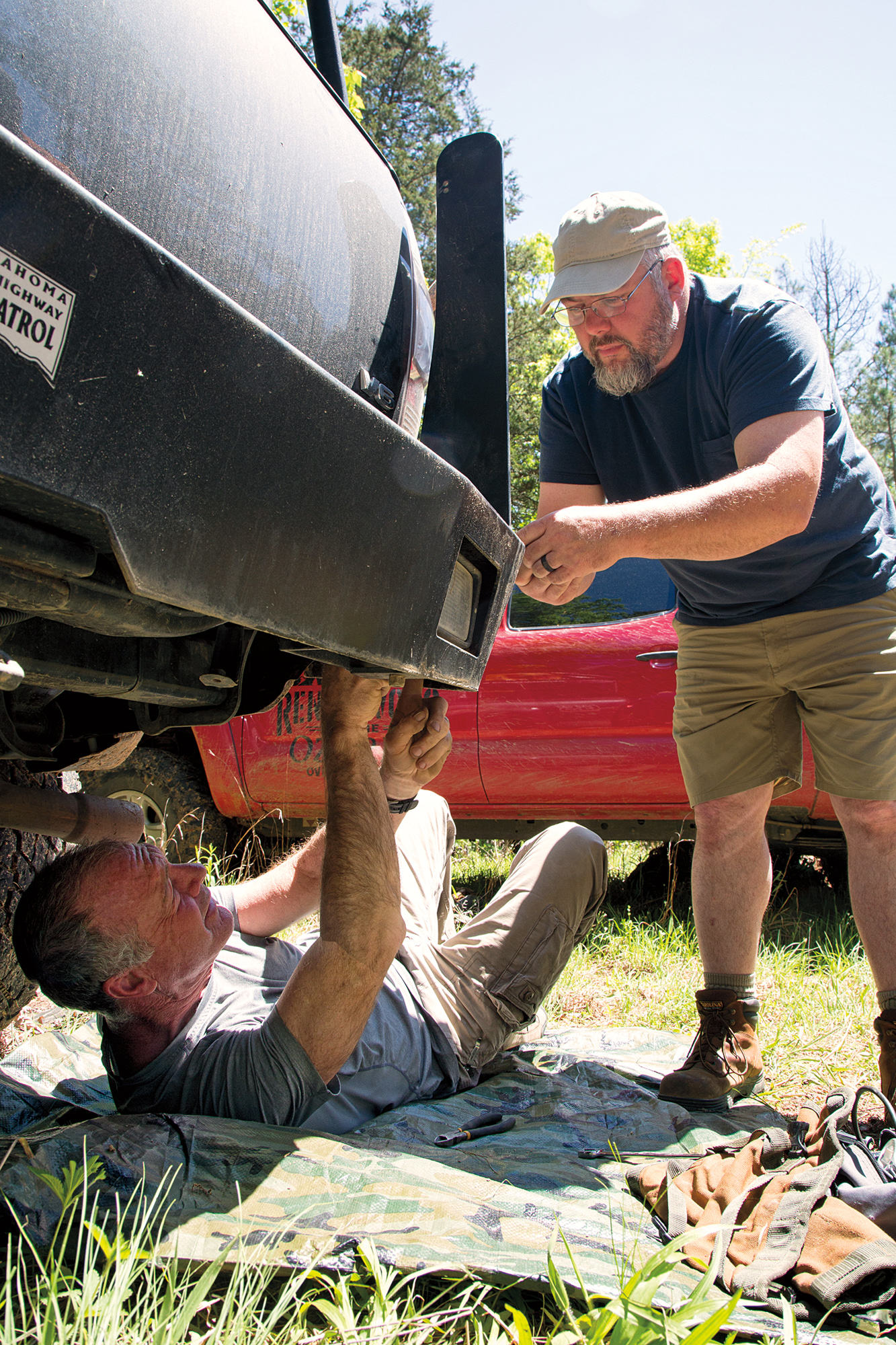
“The Ozarks are not kind to trucks,” says Tod. Indeed, this route is much more challenging for the Tacomas than for Randy’s Jeep, with its steeper approach and departure angles.
As we get back in the truck, Bill and I find ticks crawling on our skin. It’s nearly May and almost too late in the year for cavorting in these woods without consequence. Poison ivy is popping up everywhere, and gnats probe the eyes. But the evenings are cool and daytime temperatures mild, so except for a few pests, it’s tolerable a bit longer. Primetime for overlanding the Ozarks is late October to early April, with fall foliage being a big attraction. Even winter, usually mild, is a decent time to travel here; summer is best avoided in these humid depths.
We make one more stop at the mid- 1800s Spurgeon Warren Homestead with its log cabin and barn, open for respectful exploring. Like the Union School, it is maintained in perfect condition for the public’s pleasure by the property owner. In a less remote area, these relics would likely be vandalized. Apparently, those who live and travel here take pride in preserving history. It’s an encouraging attitude.
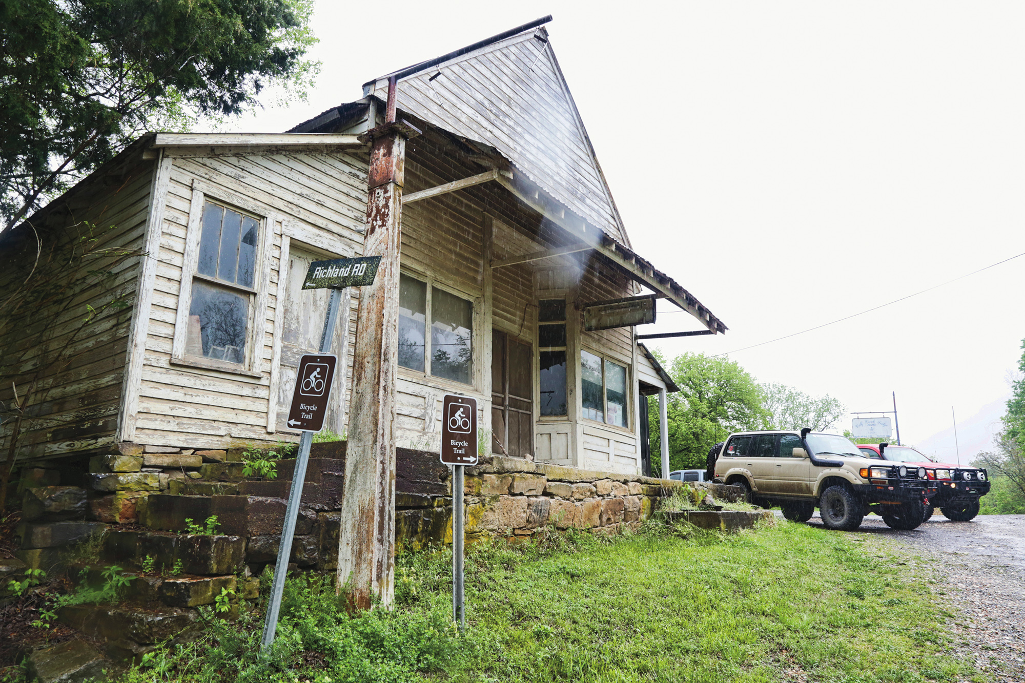
With all the detours, we’ve already driven 180 miles but completed only about two-thirds of our route. And, with gas mileage in low range nearing the single digits, it’s time for a gas stop for those without auxiliary fuel. We carry double the Tacoma’s normal capacity and plan to top off anyway as a precaution. Soon we’re on an improved dirt road, then Highway 215, which runs along the Mulberry River. The timing is right for an early dinner at the Oark General Store, a way station continually operating since 1890 and an iconic stop for travelers in the Ozarks. There’s one gas pump, 87-octane, and you pay inside. Bill adds a Dragoo Adventure Rider Training sticker to the dozens left by travelers on the front door. We order hamburgers and onion rings, which live up to their reputation as some of the best around. The homemade pies, peanut butter for me and cherry à la mode for Bill, take the cake.


With full tanks, we head to a campsite on Morgan Mountain Road, which has plenty of room and a great view but also cell service, allowing everyone to catch up with the outside world after two days off the grid. After dinner, while the others sit around the campfire talking about Motor Vehicle Use Maps late into the night, Bill and I retire to our rooftop tent for Netflix on the iPad. Ah, technology in the “wilderness.”
DAY THREE—TIGHT AND MUDDY
In the morning, we backtrack and pick up the narrow passage again at Oark, making lazy, westward arcs through the forest. The road climbs, smooth and canopied, to the top of a ridge, and soon Brad urges us to stop near a rocky outcrop. We walk to its edge and are blessed by the sight of a beautiful ravine with cascades of clear water, quite a departure from the first days’ muddy flows. The trail constricts into an entanglement of stony undulations, then a deep abyss of sticky red muck. Most extrude themselves from the mud, but then we hear Randy on the radio, “Hold on, this thing ate me up.”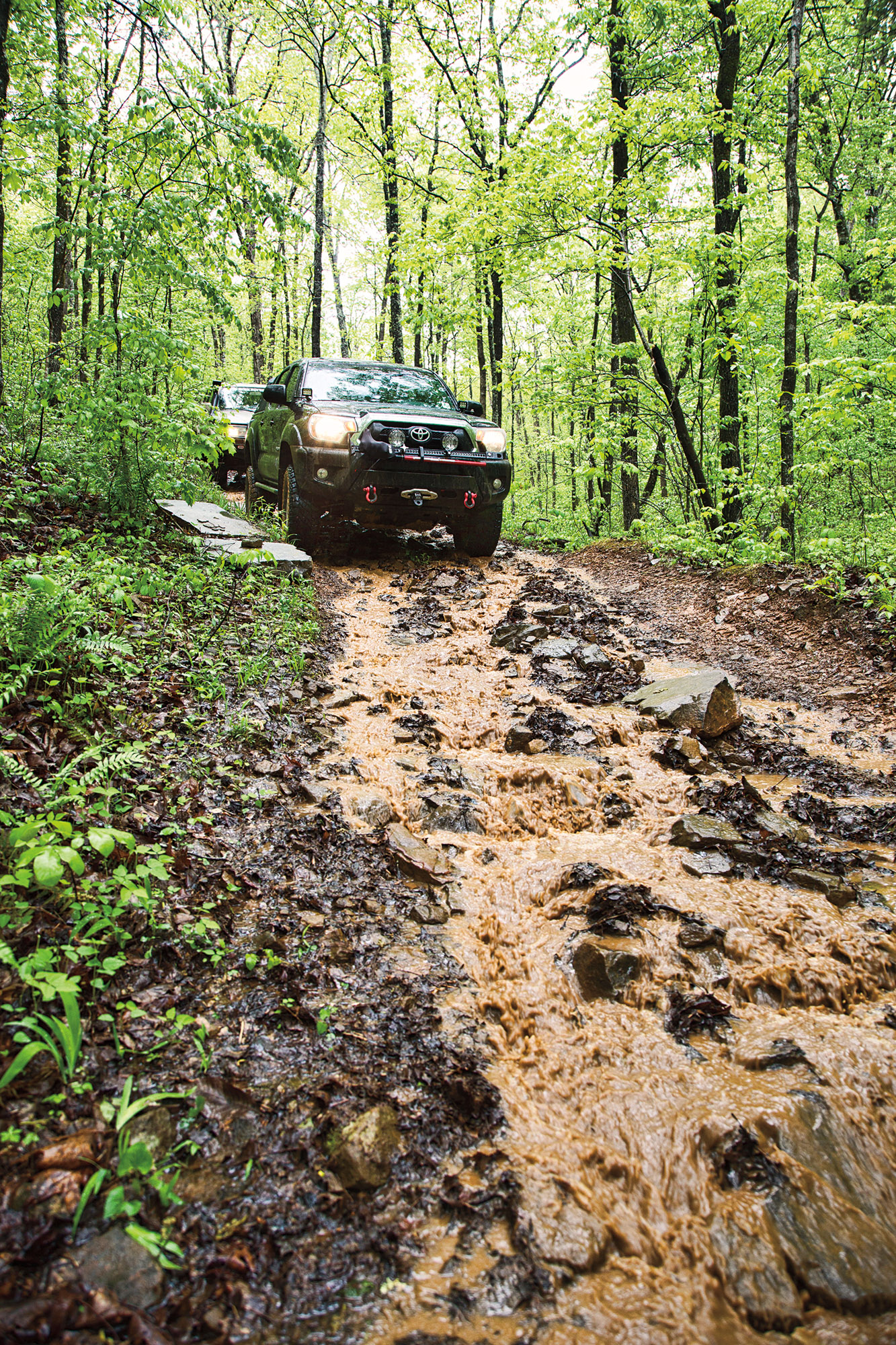
“I’m coming, Randy,” responds Brad. The guys are excited about the prospect of winching the Jeep. Tod is ecstatic because it’s the first time in 10 years that Randy has gotten stuck, whereas he hasn’t been quite so lucky. “It’s like we just saw Bigfoot,” says Tod, practically aglow.
After extracting Randy’s Jeep, we take on some exceptionally tight trails. Branches play a tune on our antenna, and vines grab at the rearview mirrors. Eventually, we arrive at a deep chute with ledges that require intense spotting and strategic road building to avoid tearing off bumpers. With a bit of engineering, everyone gets through without significant damage. For Randy, in his Jeep, it’s no big thing, but I dub it the Darién Gap of the Ozarks for the length of time it takes to get all the trucks through.

We traverse an area where logging appears imminent: the road widened, and trees marked with orange and blue paint. It is not a happy thing for our NSO friends, who mourn the loss of their tight trails and tall hardwoods. Mid-afternoon, Randy, Brad, and Mark split off, heading to Byrd’s Adventure Center on the Mulberry River to prepare for the evening’s Bonfire Rendezvous. Bill and I continue with Tod, stopping at the remains of another old homestead, this one only a chimney, foundation, and the ghosts of a bygone era.

Then, late in the afternoon, we head to the Bonfire ourselves. Driving into the camping area, we enter a land of rooftop tents and adventure trailers, where about 200 overlanders are gathered for the event. We take advantage of the facilities at Byrd’s for a welcome refresher, our first showers in three days. Bill and I retire early that evening, but in typical social form, the campfire carousing goes on into the wee hours. Always the Boy Scout, Bill is prepared with noise-canceling headphones.
DAY FOUR—ROCKS AND BIGFOOT
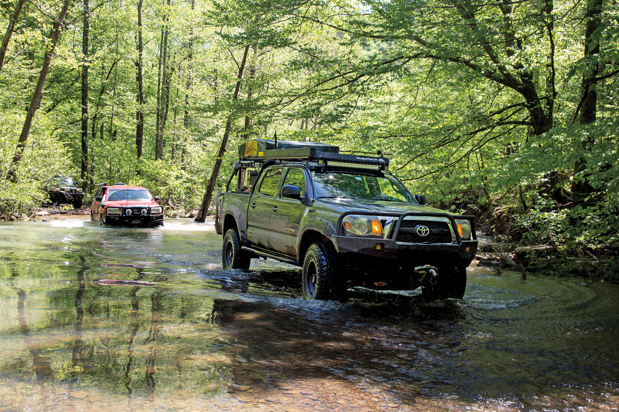
We awake to a gorgeous morning just before the sun crests the mountains into a cloudless sky. Bill and I depart early to finish the last 40 miles. Tod says the route is technical, and we should take someone else along, but we light out on our own, beginning outside of Byrd’s, crossing Morgan Mountain before descending into Spy Rock Hollow. The streams today are a milky turquoise, almost opalescent. Bill sluices the truck back and forth in a shallow crossing, redepositing some of the soil from whence it came.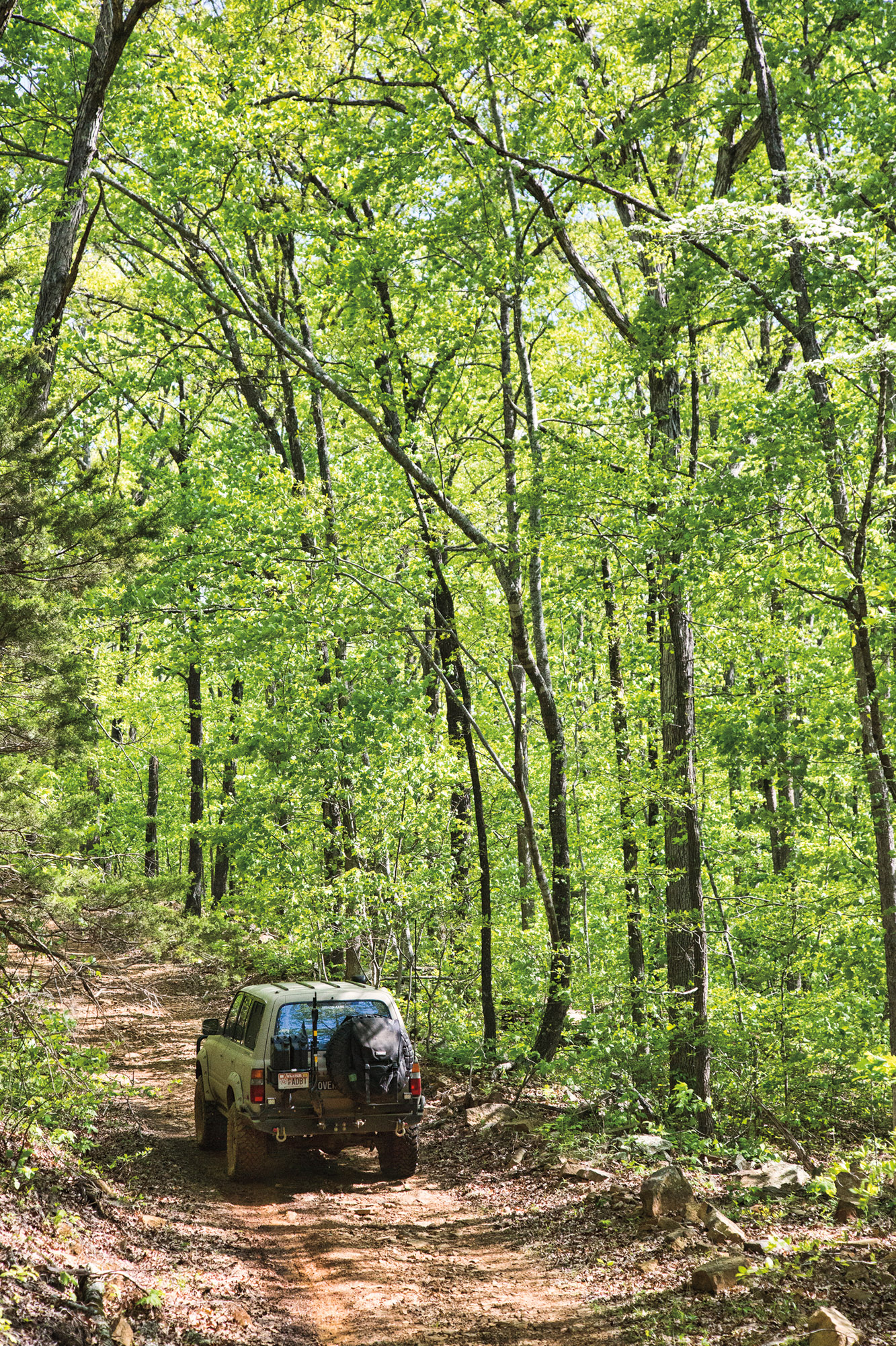
Today’s trail is tight, with steep switchbacks in rocky red soil. It is perhaps the most technical of the route, and Bill’s favorite segment so far. As we enter a bog on a spur to two waterfalls, I scout ahead on foot. Returning to the truck, I notice a gigantic footprint in the mud. Right there in the middle of nowhere, is a single, huge, size 17 footprint with deep claw marks before the toes. It’s definitely the Sasquatch, what else could it be? Bill says it’s a bear; I disagree. There is, however, a bear print right next to it, so who knows?

Back on the main route, we continue to ascend on an even narrower, deeply rutted trail. At one point, I get out to take a photo and notice the right rear tire looks low. Very low. Flat, actually. We pull off in a bare spot 20 feet ahead. The valve stem is broken off, and the rim badly scored. Unfortunately, the biometric lock securing the Hi-Lift jack has run down. A lock that you have to recharge? What were we thinking? We use the factory jack, a precarious arrangement on the lifted Tacoma, but it works.
Though a bit more rocky terrain remains, we are quickly on improved road that takes us up to Fly Gap. At this point, the depths of the Ozarks are behind us. Our route to White Rock Mountain would take us on more interesting trails, but we find one of them gated and must reroute on graded dirt.


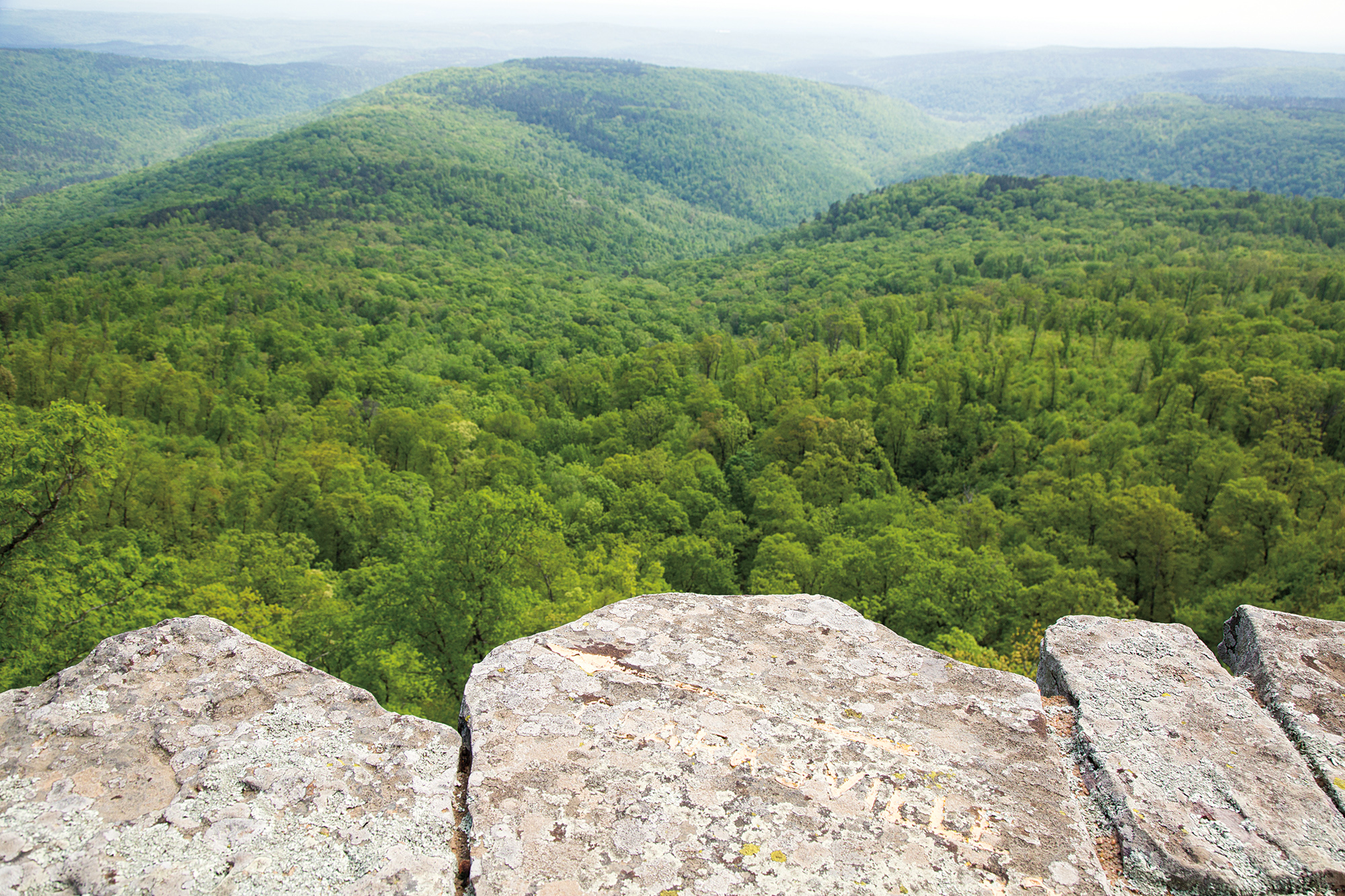
I prize White Rock Mountain for its overlook, a panoramic pinnacle at 2,000 feet, beautiful and breathtaking on its own accord. But since the 1930s, a stone pavilion built by the Civilian Conservation Corps has graced the southwesterly lookout, a perfect frame for the sunset. Some might prefer their nature raw; for me, man’s handiwork adds to this spot’s appeal.
We’re too early for sunset today, and while Bill characteristically naps in the truck, I walk to the overlook. The names of nearby towns—Fort Smith, Clarksville—are inscribed into the stone, along with directional arrows pointing their way. I buy an ice cream at the caretaker’s cottage and enjoy it at a picnic table. It all seems so civilized compared with where we’ve been the past few days. I savor these moments at the end of the trail.
Then, as if emerging from a time warp, we are south of White Rock and driving west at 70 mph on Interstate 40. A mile marker tells me we’re just 20 miles from the Oklahoma border, emphasizing the suddenness of the transition.
Bill wants to go back and run the route in the fall when the weather is not so wet, and we can pick up the segments we missed. We probably will, though I consider this trip a success. In some respects, April wasn’t the best time to go, but it was certainly an adventure and fascinating to see the Ozarks dressed in deep green and the streams at flood stage. And as we traversed those hollows and ridges, I saw the familiar white blazes of the Ozark Highlands Trail, looking with satisfaction on the places I’d hiked, and knowing my question had been answered.