
Just like everyone, we get busy and sometimes a great trip gets pushed to the back burner or lost with the passing of time. The images are older and lower quality, but the adventure is still worth sharing. They will emphasize images with captions over text. This is mostly because our memory gets a little fuzzy on the details and places. . .
In 2004, a few friends and I decided to explore Copper Canyon, crossing the region from east to west. Our goal was to take the most obscure route possible, including the goat tracks from the Lost Cathedral to the Rio Fuerte and ultimately to Cerocahui. The region is stunning in its beauty, but overshadowed by the sense of danger related to the drug cultivation and transportation there. Traveling to this region should be done with some caution and attempted after the fall ‘harvest’. When we traveled there in 2004, tourist traffic was almost non-existent and there were no GPS tracks or reliable maps. I found GPS waypoints for the little towns and a few of the rivers and then with a hand-sketched map from a guy in Creel, we set-off into the canyons.
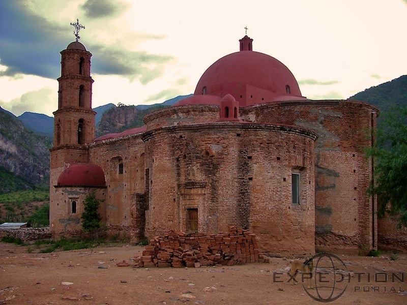
The Lost Cathedral at Satevo
The village of Cerocahui is one of the most beautiful in all of Copper Canyon, nestled in a wide valley with a meandering river running through it.
[EDITOR’S NOTE: We’re sorry, this image has been removed.]
The cathedral in Cerocahui is just in the village square. The place feels safe and welcoming
[EDITOR’S NOTE: We’re sorry, this image has been removed.]
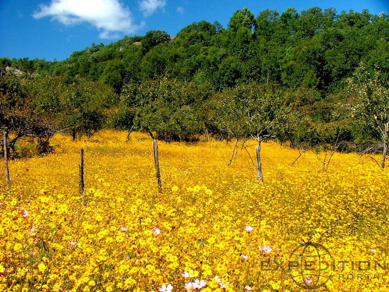
This final segment of our journey was to travel an old mining road from Cerocahui to Huitis Lake, just in the western foothills of Brancas del Cobre. The route winds through the canyons and small valleys, most inhabited by the Tarahumara indigenous groups.
[EDITOR’S NOTE: We’re sorry, this image has been removed.]
This was the first major trip with my 2004 Tacoma. In later years, it took us to the Arctic Ocean and all the way south to Panama and the Darien Gap. You can read more about the truck here: Expeditions West Tacoma
[EDITOR’S NOTE: We’re sorry, this image has been removed.]
[EDITOR’S NOTE: We’re sorry, this image has been removed.]
Our friends Duron and Cindy were along for the trip. They brought their cat (look on the hood).
[EDITOR’S NOTE: We’re sorry, this image has been removed.]
We had another fellow traveler along, Justin, who was fixing a flat on the remote track
[EDITOR’S NOTE: We’re sorry, this image has been removed.]
The canyons are beautiful and quiet. We did not encounter another vehicle except for a few military trucks.
[EDITOR’S NOTE: We’re sorry, this image has been removed.]
Towards the end of the trip, we explored the abandoned mining operation at La Reforma
[EDITOR’S NOTE: We’re sorry, this image has been removed.]
The track was all easy for a standard 4wd, although there were a few water crossings and rocky climbs that benefited from a little more clearance. The reserve capability of the Land Cruiser and Tacoma was appreciated, just in case we encountered a washout or road damage.
[EDITOR’S NOTE: We’re sorry, this image has been removed.]
[EDITOR’S NOTE: We’re sorry, this image has been removed.]
[EDITOR’S NOTE: We’re sorry, this image has been removed.]
[EDITOR’S NOTE: We’re sorry, this image has been removed.]
After La Reforma, we needed to cross the Huites lake on the sometimes operational ferry.
[EDITOR’S NOTE: We’re sorry, this image has been removed.]
[EDITOR’S NOTE: We’re sorry, this image has been removed.]
The route ended at Choix and then El Fuerte. El Fuerte is a beautiful little town with several nice restaurants and hotels. Good food and a hot shower is never a bad way to end a trip.
Let us know if you enjoy some of these older images and trip reports. If so, we will try to keep them coming.