Trail Time: 5-7 hours
Location: Florence Junction
Trail Rating (1-5 scale): 2.5
Major Obstacle: There are several tight rock sections and a 2.5′ rock ledge to climb while making a right turn. All within the capability of a high clearance stock SUV or truck
Brush (minor, moderate, severe): Minor
Scenic Value (1-5 scale): 4 -The desert was healthy, wildflowers had begun to bloom. It was impressive!
Attendees:
Scott Brady- 2004 Toyota Tacoma
John Shotts- 2001 UZJ100 Land Cruiser
BajaTaco- 1998 Toyota Tacoma
Bret- Tacoma Double Cab (Red)
Manny- Tacoma Xtra Cab (Tan)
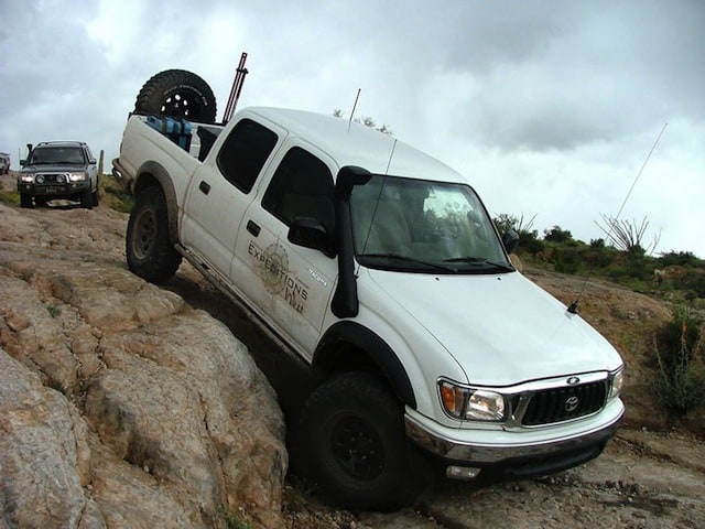
James- Tacoma Double Cab (white and stock)
Brittan- 2001 Tacoma Double Cab (silver)
The rain started to fall heavily at 8:30 am, sending the participants of AZ Rocks running for the cover of tarps and their vehicles. The wet conditions changed many of the run plans, and I suggested a group run to the Coke Ovens and out through Box Canyon. It is a relatively easy trail, made somewhat more difficult by the water. Several other drivers were up for the route and lined up. We left camp under a downpour with seven vehicles.


A view west towards Florence Junction
Cottonwood Road was firm past the camp and we made our way towards Mineral Mountain. The rain slowed and we dropped into Cottonwood Wash, which had become a small creek, winding through the narrow pass. After passing the ranch and the Woodpecker Mine trails, we climbed down the small ledge that marks your entrance into the Box Canyon. This canyon runs several miles before the famous narrows we would ford later in the day. The trail heads east, leaving Box Canyon and continuing on to Martinez and eventually the ovens along the Gila River.


After passing Martinez Canyon, and the northern route into the cabins and Martinez and Columbia mines, we started to climb towards the crux obstacle of the Ovens trail, a 2.5′ tall ledge with a tight right-hand turn. For a modified vehicle, this is an easy challenge, but the two stock vehicles required some guidance.


Nice tires!

After the shelf there were a few more optional areas, but most of the main trail is tame. However, it still requires good line selection for the stock vehicles. Bret did a great job spotting several vehicles along the more difficult shelf road entrance to the ovens.


After reaching the ovens, we made a short trip to the Cochran Ford to check the depth. Determining it was not safe to cross (we expected this), we continued along the Battle Axe Trail, looping back west to the Ovens route. The drive out was fast, with only a few stops to play on the more difficult lines.
Soon we were in the Box Canyon, heading south and downstream with its flow. The waters were rising, and we knew it would be a rare tread to drive this slot under these conditions.


As we drove through the canyon, waterfalls cascaded down the steep walls, splashing into the muddied waters below. Though we were moving quickly, we still stopped for several pictures and to spot to stock vehicles down the rock ledge and through several tight sections of rock. The water makes judging the trail more difficult, as much of the surface and size of the rocks were obscured.
We exited the canyon after about 30 minutes and made haste down Price Road, and back to camp for dinner!


