

It’s All in the Planning
We had planned the trip for a couple of months, poring over the details, making inventories of what we had and would need for a long-distance moto journey across the Ozarks of Arkansas and Missouri. I would need to bring a new set of tires for my BMW F 750 GS. My riding compadre, Steven Polk of Garland, Texas, would handle the ice chest since his larger bike, a 2014 BMW R1200 GSA, is more accommodating.
I had been in charge of getting my bike across Texas to our rendezvous point. With temperatures soaring into the 100s and the winds out of control, I opted to put my bike in the back of my truck and cart her 12 hours to my destination. Steven would use his tow truck to help me get the bike back out. Steven had also been in charge of creating the Arkansas-to-Missouri route. We were headed to the BMW MOA rally in Springfield, taking our time to adventure through the Ozarks on the way back.
“Just make sure we hit a lot of twisties,” I texted him a few nights before the trip. He laughed at my words and sent me a photo of the Butler maps he had been using to plan the trip. “See these roads in yellow? We can’t help but hit the twisties,” he texted back.

The map was, in fact, covered in yellow routes, Butler’s indication that these were ripe for motorcycle riding.
I had heard about riding the Ozarks from others, how mountain passes give way to stunning views of tree-filled valleys, and how treats like waterfalls and massive river bends with skyscraping cliffs punctuate the roadsides.
As it turned out, few American rides can rival the beautiful scenery and endless twisty roads found in the Ozark Mountains of Arkansas and Missouri. Mountain View, the Pig Trail, the Buffalo National River, Eureka Springs, Branson, and Lake of the Ozarks have been the backdrop for satisfied riders for decades, offering ample scenery, fascinating history, and great pullover stops for road-weary travelers.
Camping and hiking offerings also abound along these roads, where American eateries, music festivals, art galleries, and the Arkansas wine country—the largest and oldest in the American South—dot the landscape. Riders to this part of the country can visit bike rallies or listen to music in Branson, Missouri, or take in barbecue and blues in Arkansas’ famed Fayetteville.
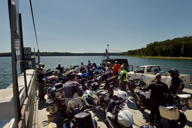
After spending a few days camping among some 5,000 adventure riders at the rally, we turned our bikes back south for a little road fun. Taking Missouri State Highway 125 to Peel’s Ferry, we loaded our bikes on the boat to traverse Bull Shoals Lake. The ferry is the last of its kind in Arkansas, and it was a pleasant surprise that 42 other motorcycles joined us on the water crossing, mostly the adventure kind, but everything from Harleys to Hondas. From the ferry, we jumped onto Arkansas State Highway 7 and headed for Jasper.
Peel’s Ferry Crossing
Before reaching this quaint little town, we turned our bikes onto a dirt road and headed for The Buffalo National River at Ozark Campground. Camping in this part of the country is relatively easy to find and varied. The western end of the Upper Buffalo Wilderness offers five campgrounds, with four being developed and one being primitive and free of charge, although camping fees are only charged at the developed sites from mid-March to mid-November.
Sites at the Ozark Campground are shaded by oak, beech, and hickory trees and offer trails to the Buffalo River flowing around it. We still had a good bit of daylight, so we decided to take in the view of the Arkansas Grand Canyon via the Cliff House Inn south along Arkansas State Highway 7. Here, you can grab a sandwich while overlooking an 800-foot drop into the canyon and the expansive view beyond. The trees are so numerous that the valley floor is completely covered in treetops, resembling a velvet moss carpet covering the countryside.
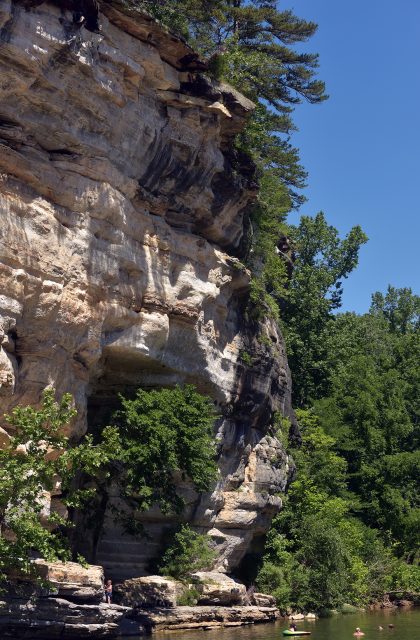
The Buffalo River
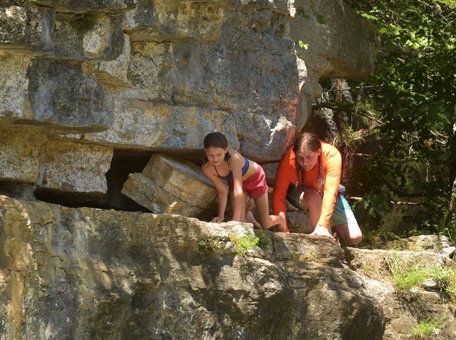
Back at camp, we pitched our tents and headed for the cool, clear waters of the Buffalo River. This slow-moving river offers beds of grasses and rocky beaches. Walk a half mile or so to the bend and cool off in the deeper waters at Briar Bluff. This towering rock formation offers coves and caves and even access to a jump-off point along the deepest part of the river there. One by one, the jumpers took turns splashing into the water below.


Steve Boyd had stopped on his Beemer while on his journey from Friday Harbor, Washington, to Florida to see his children. He pitched his tent with a sign, “The Lone Rider,” and headed for the water. Not far from him, Isaac and Caroline Cummings were eyeing the jump from the top of the cliffside. Issac went first, then his little sister.
“The path getting up to the jumping point isn’t as wide as it used to be,” Isaac said. I wondered if erosion had taken a toll on the cliff. “No, I’ve just gotten bigger,” he laughed. Isaac has been coming to this swimming hole since he was a little boy. His grandparents own the Ozark Cafe, the popular town eatery down the road.


We enjoyed breakfast there the following day and spent some time talking with the locals. The owner, Russ Todd, runs the place with his wife, Jerri. He is a direct descendant of Mary Todd, Abraham Lincoln’s wife. He wondered if I were, too, and we decided we might be distant kin. The Ozark Cafe offered a hearty breakfast at a good price and plenty of uplifting signage to read along with an autographed picture of Elvis Presley, who had eaten there at some point in his career.

The Pig Trail
After breakfast, we headed west to State Highway 23, the Pig Trail Scenic Byway. This is a 24-mile ride and is listed in many sources as one of the best rides in America. During the summer, this road is as canopied as it gets, with twists, turns, and hairpins so numerous that there is hardly a stretch of straight road along the entire route. It crosses the Mulberry River region, the waterway for which it was named. Apparently, the thick forests are so abundant there that they fattened up the farmer’s pigs, so it was fondly called the Pig Trail.
We didn’t see any roaming hogs, but we did manage to get behind an 18-wheeler with large pictures of donuts on its trailer. This isn’t a road for passing, and this isn’t a good road from which to pull off. There are a couple of scant sections of deep gravel pull-offs on the northern route, but they’re crammed between curves with low visibility, so we waited the donut truck out and passed on the first straight section.
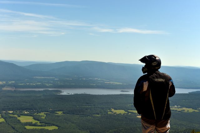
At the trail’s end near the town of Ozark, we took a break from the high temperatures and ate chilled watermelon on the banks of the Arkansas River before heading to the state’s highest peak. State Highway 309 to Magazine Mountain is 51 miles of easy curves and scenery, small towns, farming communities, and agricultural landscapes. At Cove Lake, the mountain’s base, the roads get twisty again as they ascend the mountain to 2,752 feet. This is a flat-topped mountain with steep cliffsides overlooking sweeping valleys. A destination for the adventurous, its cliffsides offer two hang-gliding launches and technical rock climbing opportunities.

Trails weave their way through Magazine State Park, rich with hiking, ATV trails, and horseback riding. Closer to the top, Cameron Bluff Campground features 18 campsites with water and a bathhouse, and more camping can be had at nearby Cove Lake with a waterfall and swimming hole. Another camping option, Blue Mountain Lake, offers 87 tree-shaded campsites.
Since it was only midday, we decided to push on to our destination for the night, Queen Wilhelmina State Park on the Talimena National Scenic Byway in the Ouachitas Mountains. Getting there wasn’t easy. It wasn’t the roads but rather the heat. Since the ice was rapidly melting in Steven’s ice chest, we made frequent stops to soak buffs in the ice-cold water before putting them around our necks, dripping wet. At one point, the heat became so exhaustive we had to stop at a gas station for an extended break in cooler air.

Heat waves and heat warnings are nothing to be toyed with in the South, and the National Weather Service had issued several that day with heat indexes as high as 105°. Couple that with 95 percent humidity, and overheating along with dehydration can quickly become an issue. We decided we’d make frequent stops for water and cooling about every 30 to 40 minutes. The plan proved to be a good one.
The Talimena Parkway
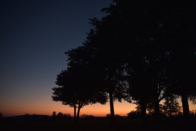
As we entered the Talimena byway on Arkansas State Highway 88 just north of Mena and passed the visitor’s center, the tree canopies returned, and the road began its ascent to the top of the mountain. The temperatures dropped as the twisties increased. This road has a lot to offer: history, scenery, vistas, vegetation, winding curves, cliffsides, and sunsets, all of which can be viewed from numerous pull-offs along the side of the parkway. We reached the top of Rich Mountain at 2,681 feet, with sweeping views to our north and south. The Ouachita Mountain Range is a bit different in that its peaks are east to west trending, unlike other North American mountain ranges that typically run south to north.

The Talimena National Scenic Byway comprises 18 miles of road through the Ouachitas Mountains on the Arkansas side and continues for another 33 miles to the Winding Stair Mountains of Talihina, Oklahoma. The ride is a total of 54 miles, but it takes about two hours to traverse, riding from start to finish. It could take days to properly explore this road for its worth. Its creators wanted it that way, having built it in the 1960s solely for its scenic views and historical value. Along the way, hikers can peruse remnants of the area’s first communities of settlers, watering holes where horse thieves stopped to water their stolen steeds, and the 1877 site where the Arkansas border with the Choctaw Nation was erroneously set, effectively removing 130,000 acres of land from the Native American nation.
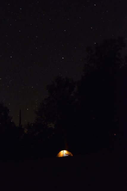
Talimena offers an abundance of visual beauty year round, even during the heat of summer. But rangers there say the last week of October and the first week of November are prime for fall colors and cooler temperatures. On this particular trip, we got lucky. We pitched our tents as the sun went down, and a gentle north wind began to blow. It wasn’t a cold wind, but a cool wind with which to enjoy a night sky filled with stars.
Run by the Arkansas Department of Parks, Heritage, and Tourism, this campground offers an interesting backstory. The original lodge was constructed and opened in 1898 to house railroad passengers on the Kansas City, Pittsburgh and Gulf Railroad, and since their investors were largely Dutch, they named the park in honor of the Dutch monarch.
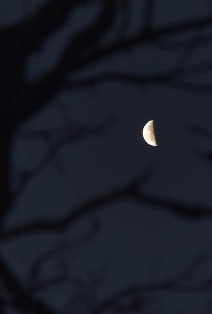
When I opened my tent flap early the next morning, it was in time to see the silhouettes of about a dozen deer running past the early morning sun. I got out of my tent, and a rabbit scurried by. I walked to the edge of the southern cliff. Another deer regarded me for a moment, then walked slowly into the woods. The early morning light here is a sight to behold. On one side of the ridge, the sun rises gently, and on the other, the blue and purple folds of mountains slowly receive the sun’s rays. It is a gentle area, free from traffic and busyness. Even the campers were quiet and kept to themselves, save a few Beemer riders who stopped to swap motorcycle stories the night before.
The next day found us winding our way into Oklahoma with no shortage of vistas and parks along the way. In Talhimena, we stopped downtown at an antiquated fountain restaurant for a burger and a shake. It was hot, and we were still far from home, but we didn’t care.
“I got to see the stars at night. I never get to do that because I’m a city boy,” Steven said.
We shared the chocolate shake, then returned to the heat. Summer isn’t even over, and we’re already talking about the next trip there.
Our No Compromise Clause: We carefully screen all contributors to ensure they are independent and impartial. We never have and never will accept advertorial, and we do not allow advertising to influence our product or destination reviews.