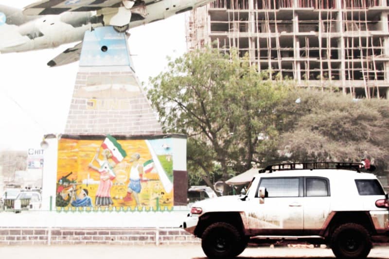
I’ve lived in East Africa long enough to know that there are different post-colonial narratives. Like the Kennedy assassination and other things that happened fifty years ago, everyone has a different version of the story. These different versions eventually cease being explanations and start being beliefs.
After the colonial Italians left Somalia, the country began to rot. Mogadishu now looks like a strange Italianate alternate universe; it’s what Florence would look like as a ghost town. In the north, across the Gulf of Aden from Yemen, lies Somaliland. Somaliland is not a recognized country in the conventional sense, and does not maintain embassies recognized by the United Nations. It is to Somalia what French Canada is to Canada – socio-politically distinct, but inextricably connected.
I became interested in Somaliland as a traveler and as an economist. At the time, I was writing a chapter of an economics textbook and wanted to use the pirates of the Gulf of Aden as the topic of the chapter.
I’d been to the Gulf of Aden from the Omani side, and thought it would be interesting to explore what is happening in Somali, where the majority of pirates are recruited (it should be noted that most pirate recruits, however, come from the south and not from the region of Somaliland).
Papers
Visiting Somaliland is not difficult, but it is crucial to note that entry clearance or visas for Somalia will not be accepted at any Somaliland border. I kept a home in East London at the time, which was walking distance from Somaliland’s “embassy” – a one-room office suite on the third floor of a building. Both times I visited, I had to wait for a person to arrive. There seem to be substantial differences in attitudes according to nationality: I was only able to get a single-entry 3-month visa in an American passport, but was able to get a 1-year unlimited-entry visa in a Caribbean passport.
So… how many people visit Somaliland? It’s hard to know, but I’ll work from some basic assumptions. I think most overland travelers to Somaliland come from Europe (like me) and would want to have their papers in order before leaving (and hence would obtain the visa in London). If true, I was issued visa #SLM13_ (final digit omitted) on June 12, 2010. I was then issued visa #SLM16_ (final digit omitted) on October 5, 2011. The visas are logged, by hand, sequentially, in a blue logbook at the London office. So, in about eighteen months, fewer than thirty people obtained visas to visit Somaliland. Because aid workers and tourists are issued the same visa (there is no specific “tourism” visa), I’m guessing the number of tourists is extremely low.
Note that visas are also available in Addis, for a similar fee (paid in USD), or periodically at Djibouti, conveniently only about a half hour drive from Camp Lemonnier, according to a fellow “tourist” (who I suspect was more likely U.S. Naval Intelligence). I have seen people traveling in Somaliland with visas
issued in all three places.
It is important to understand that there are two kinds of security needed in Somaliland. There is physical security: making sure you are physically secure in your things, that you have a plan if something goes wrong, and so forth. There is then “administrative” security: making sure that you have pleased the local commanders with your arrangements.
The latter half, as it turns out, is much more complex. Most tourists are forced to have a driver.
However, you can negotiate with local commanders, and this is best done through a local intermediary.
We knew a German who had been resident in Somaliland for some time and had a relationship with a local commander. He explained our backgrounds, our intentions, and that we would be “grateful” for an armed escort for parts of our visit, if he felt this was necessary. Otherwise, we would be happy to help him patrol other parts of the country (in other words, we would pay for someone NOT to accompany us). In the end, we had armed “escort” (in this case, “escort” meant passenger) from two different people affiliated with this commander between Waypoint Baker (see below for Waypoint names) and Boorama, about half of our total distance traveled in Somaliland.
We carried two separate letters from commanders, plus a letter from an official affiliated with the government (whom we had met for tea in London). All three documents looked very official, and we kept the originals in a travel safe in the vehicle (high-quality color copies on A4 paper were kept in the console along with passport and visa copies). At no time did we feel threatened or in danger, and compared to Sudan (where we had been traveling months earlier) Somaliland seemed very safe. We had multiple-entry visas for both Somaliland and Ethiopia, which I would recommend. The Ethiopian Embassy in Washington, D.C. offers prompt service by FedEx (enclose a return envelope and air bill).
If in doubt, get another official-looking document and add it to the file. Have a good, one-sentence explanation for why you are in Somaliland and one good thing you can say about your visit to the country in a genuine voice – even if it’s only your first day. People are trying hard to make it work in this poor, remote place. Acknowledge that by finding something positive to say to the people you meet.
Money
As an economist, I’d like to pause for a minute and talk about money.
Like many places in East Africa, Somaliland looks to China for capital. In fact, coins issued last year described the value of the coin in Arabic on the recto, but proclaimed (in Chinese) that it was the Year of the Rabbit on the backside of the coin. As in most countries, the Chinese government’s money never reaches the people at street level: the main source of money for “regular people” is relatives abroad.
Money flows in from Cardiff, London, Melbourne, Brooklyn, Milan, Detroit, and other population centers of Somali expatriates, but even this money often passes through Chinese hands along the way.
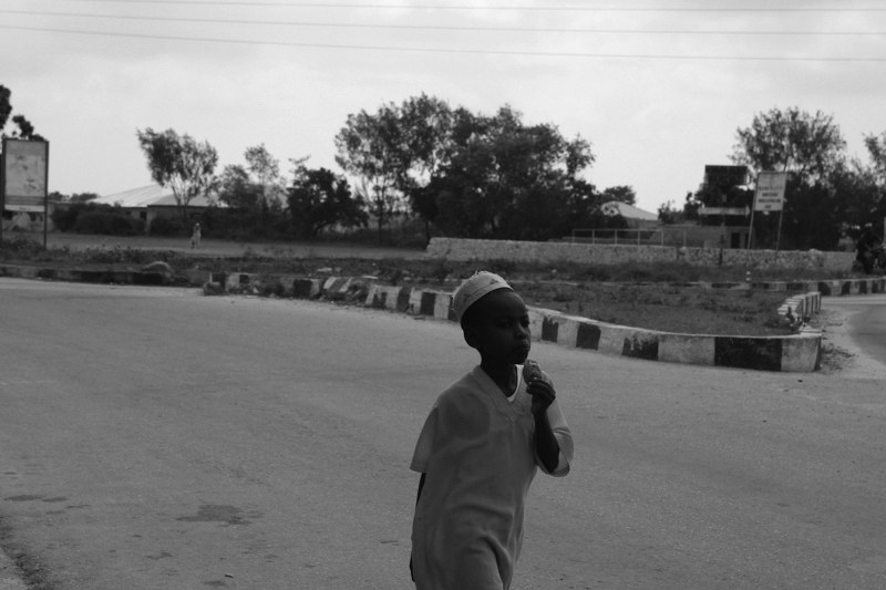
The influx of Chinese influence can be seen at the moneychanger’s table: come with $100 bills newer than 2006 – anything else is assumed to have been printed in Taiwan. Here, it helps to know a little Arabic, but it isn’t vital. Every moneychanger has a blue receipt book – write on the first line your offer, he (and it is always a “he”) will write a counteroffer. When you agree, money changes hands.
Remember: The amount you are writing is how many shillings you will receive for the bill you presented (usually a $100 USD note).
Negotiate hard, it’s seen as a sign of respect – the moneychanger should not feel like he is receiving charity: he’s one of the few people trying to run a business in a country with estimated 80% to 90% unemployment. Go back and forth three times on the rate, even if you think the amounts of money involved are negligible (in your greater expedition budget, they are).
Driving
This section is written with future expedition overland travelers in mind. Those interested only in reading about travel can either skip this section or bring up a copy of Google Maps and follow along.
As everyone has different standards of accommodation, comfort, and so on, I’ll focus on the actual traveling rather than more general tourist advice. This is an expedition write-up, not Trip Advisor.
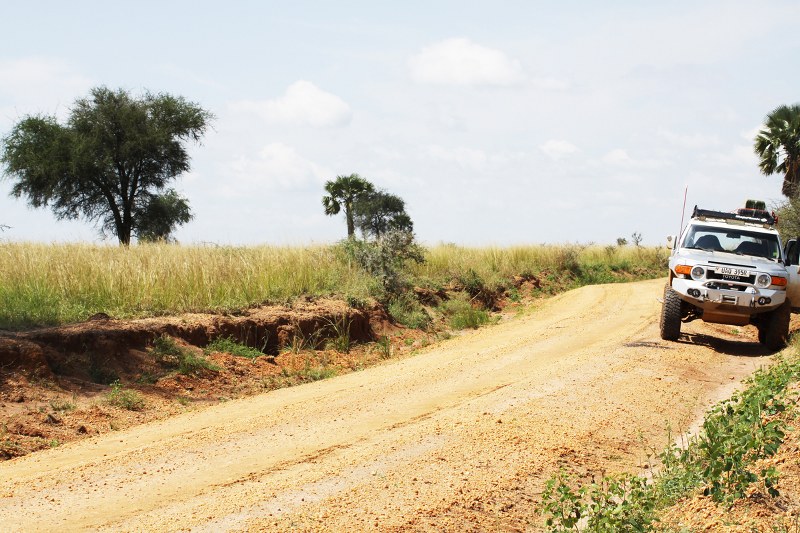
Most vehicles arrive in Somaliland from Djibouti. Some of the road signs still say “Somalia” rather than “Somaliland” and the road to Saylac is relatively good (quite good, actually, by African standards).
In the dry, it would be passable in a 2WD pickup, but ground clearance is still valuable in parts. There is a U.S. Navy and U.S.M.C. presence north of Loyada, with HMMWVs visible on the horizon. Blue and white tarps with a variety of UN agency logos near the border cover what looks like a strip mall constructed from the wreckage of the set of Waterworld. This is your last chance to resupply.
The only visible indication that you’ve entered Somaliland is the change in architecture of the buildings on your right. They are suddenly desert huts rather than improved buildings with corrugated steel roofs. There is a shortcut to bypass Saylac, if you have 4WD and it is dry, but in our planning we found this too dangerous – it could be days or weeks before anything passed on that road able to winch out or offer assistance. The shortcut is about five miles of track, while the Saylac route is about twelve miles of pavement. Cases of Evian and fuel (diesel, petrol, and kerosene) from jerry cans are available in Eeringe, a few miles past Saylac.
From here, you must make the most important decision of your drive. There will be a VERY nice looking road to your left that appears to go along the coast, or an iffy road of broken pavement (gaps in the pavement are a quarter mile to half a mile long and sand ladders are mandatory) to your right. On the British map (E5002, Quadrant F2) it appears both lead to Berbera. This is technically true, but unhelpful.
The best instructions are these: Continue twenty miles due south from Saylac. You will see the road branch right and left. Go left. There will be a radio tower dead ahead on the horizon if you are on the right road (binoculars). In seven miles (almost exactly) you will have another opportunity to branch left. Do not. If you take this road, you will eventually meet the Berbera road, but the last twenty miles before you reach the road will be coastal desert sand – the road simply ends twenty miles before any junction (the junction seems to exist on the British map, and perhaps once did, but it has long since disappeared, see Quadrant G4-5). Instead, follow the road you’re on until you pass the radio tower and the road gently curves left. We will call the radio tower Waypoint Alpha (if you keep a logbook, mark your Somaliland waypoints starting here).
You will see an abandoned World Food Programme container on your right. Continue straight. The market town on your left sells basic provisions, flatbreads, and in-ground Sahara-style stoves. Continue straight (do not turn left at the market town road), your compass heading should read 110 (+/- 5 deg).
You can use the coastal markers on either map (British or UN) to draw arcs to north, if you are double- checking your GPS. The old, blue Italian road signs are now meaningless, but are a fun thing on the roadside – most of your drive will be empty desert horizon.

When the road begins heading eastward (your compass will read less than 90 heading), you are slightly more than halfway to Berbera from Waypoint Alpha. We’ll call this Waypoint Baker. There is a small trading center here, with heavy Italian-made fishing nets on offer (need to tie down anything?) and heavily-used (ex-military?) metric tools stamped with Chinese and Russian markings. Lots of salvage steel is available, but most of it is in tough condition.
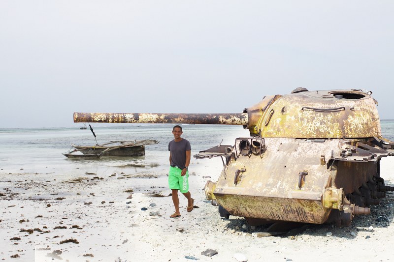
As you approach Berbera, the road is along the beach – a low-rent corniche of sorts (even this is a generous description), with a poorly-reinforced sea wall protecting the eroding road from the Gulf. Two Russian tanks, both destroyed in combat, are mostly buried in the sand to your right. You are now two miles from Berbera and will almost certainly encounter a checkpoint if you haven’t already.
Berbera
Berbera is a crucial port city and heavily protected, though its protection is not through fortification.
It is protected by police (uniformed and not) who are suspicious of outsiders and underequipped.
Many have not been paid for weeks or months. Berbera has a prehistoric history as a fishing site and is fascinating economically. There are clearly wealthy people in Berbera, with two white, left-hand-drive Mercedes-Benz G55 AMGs being the most obvious indicator.
The architecture is a strange mix of Italian colonialism and peninsular Arabian influences. Both coastal roads slowly become more populated as you enter town, with single-story brick or white stucco buildings being the norm. The beach complex itself is in surprisingly good repair and clean, with at least two retaining walls that appeared to have been constructed or repaired recently.
Shacks made from scrap metal are common only three or four hundred meters from the beach, and a circle of these forms a tiny “village” – similar to huts in villages in Uganda or Ethiopia. Mud hut construction is rare, with scrap industrial material seeming the building material of choice.
Contrary to what you may have heard, the begging situation is no worse in Berbera than in other places in Africa. In fact, the beggars are not as aggressive as the aggressive beggars in Dar es Salaam. As always, keep your composure, do not act surprised, and politely deal with each situation independently. Beggars are not an organized militia; they are individual poor people looking for assistance. Treat them this way and you will be able to keep perspective on the situation.
It is advisable to leave Berbera ten or fifteen minutes after the bus to Hargeisa. You will invariably catch up to the bus (any 4WD in decent condition will be able to sustain speeds faster than the bus, even though the bus is driven at a higher speed than is likely safe). Stay behind the bus (I’d recommend a 200m following distance). This allows you to know you’re on the right road until the first checkpoint. It also gets you one “free pass” as the checkpoint police will likely wave you onward while they deal with the bus occupants. As there is only one major checkpoint area between the two cities, this might be enough to get you through your day without a bureaucratic hour of negotiation at the checkpoint.
This is also a good time to think about your guard’s comfort. Most Somalis are chronically dehydrated, so if you’ve given your guard a bottle of water (you should have), he’ll probably need to stop soon (people who don’t drink water often enough have smaller bladders). Your expedition bragging about how you can drive on and on without stopping for the toilet is not appropriate here. Stop about thirty miles past the airport (here, the road turns from pavement to hard red material to sand to pavement).
The roadside sign will read S900 (or S9oo?). This is a good place to stop, re-orient, visit the toilet, and pick up Ethiopian-style snacks from local merchants (the green spinach-like vegetable they cook into a dish here is bland, like most Somali food, but safe to eat). Some packaged things are available here including, inexplicably, Weetabix.
Hargeisa
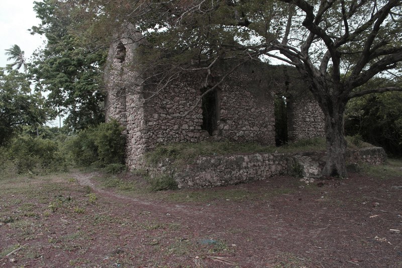
You will approach Hargeisa from the northeast on the creek road. Hargeisa is much more of a “real city” than Berbera. You will see the first major cross street on your right (with a checkpoint that may or may not be manned) and what looks to be a hospital perpetually under construction (it has the haphazard concrete architecture of a building that exists only for aid money embezzlement). Continue through town due west and you will arrive at the bus station. This is the center of town.
Within the boundaries of the city, you cannot camp (and we suspected our North Face yellow tent would draw more attention than was necessary – a silver Toyota with Ugandan license plates was already somewhat conspicuous). However many inexpensive, safe hotel options exist. I recommend staying not far from Hargeisa Hospital, which is one of the most secure and best serviced (electricity and water) areas of the city. Several storefront moneychangers, pharmacies, and hardware stores exist in town offering a surprisingly-good selection of wares. There are two fuel stations to the southeast of the city (Mubarak Road, near the airport) and two in the northwest; diesel and petrol are both available, but kerosene cannot be had here.
If you visit a mosque in Hargeisa, do so respectfully and in the morning. Remember that your armed guard will not be permitted within the curtilage of the mosque and that he is not allowed to abandon his weapon or leave it in your vehicle. The best use for your guard in this situation is to put your vehicle on a street corner in a relatively open area and to have him posted on garrison duty while you are a tourist.
He should be outside the vehicle and it should be locked. Hargeisa is relatively safe, but the shortage of Toyota parts makes any late-model Landcruiser, Hilux, or other vehicle an easy target for opportunistic thieves.
Southbound
If you’ve never been to a city like Muscat, then Hargeisa may seem worthy of a weekend. If you have been to towns like this in wealthier and more culturally-rich areas of the region, then you’ll likely be done with Hargeisa after one full day (two nights).
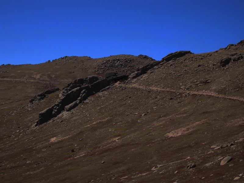
Traversing to Ethiopia is actually much easier than it looks on any of the paper maps we had and the Google Maps data (as of February 27, 2012) is very poor west of Hargeisa. The best map, surprisingly, is the East Africa maps kit that Garmin offers. We use this map kit on a micro SD card in a latest-generation Nuvi. It is not perfect, but surprisingly useful.
The first leg of not more than 25 miles is straightforward, and takes you past the two northwest fuel stations and toward Gebilay, via Arabsiio (Arabsiyo on some maps). Gebilay is a typical oasis town, but offers diesel.
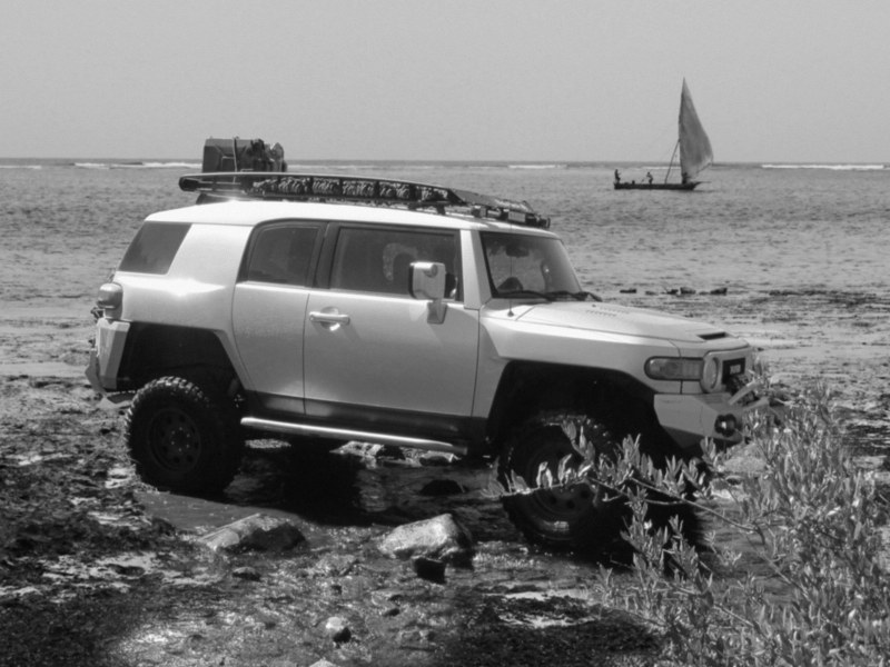
Continue not more than 12 miles to the west of Gebilay and look for a faded sign on your left with four-digit markings (likely military). Less than 100 meters after this sign, there will be a path leading to the left. This is the road to Ethiopia. Bear in mind the transition from the main road to this road is substantial, and required sand ladders as rear axle bridging even for a FJ Cruiser running 33” tires and an OME Heavy suspension (3” lift). If the transition looks like a 30cm to 35cm kerb, then you are at the right place.
Once you are on this path, in less than 500 meters you are faced with a fork. There is a clump of cacti to your right and nothing to your left. Go right.
Combined with the British map, you will find the correct road, which has a heading of 245 (+/- 5 degrees) as you pass the two-story cinderblock building (abandoned). You will not see another two story building until you are substantially into Ethiopia. This map will fade away on Garmin and Google Maps (again, as of February 27, 2012), but still exists and continues on with heavy sand and dune migration in places. The next intersection is where many desert roads meet, with evidence of heavy artillery fire on two of the five roads. You will see a white sign to Gobiyere. Set a waypoint here. As the sign’s arrow ambiguously suggests, continue south, then west, then southwest (all within seven kilometers). If you now see a second sign to Gobiyere, and are more than nine kilometers from the waypoint you set, you are now back in Ethiopia.
You will see a truck stop on the horizon, which may or may not contain border control personnel. They will ask for your visa, your passport, and how long you were in Somalia. They will also do a cursory search of your vehicle for animals. At the end of this inspection, you will be waved into Ethiopia, and not charged a fee, but they will not stamp your passport.
Obviously, Somaliland should be considered a destination for the very experienced overlander only – but if you like to go off the beaten track, then I hope this quick guide will help you!


