
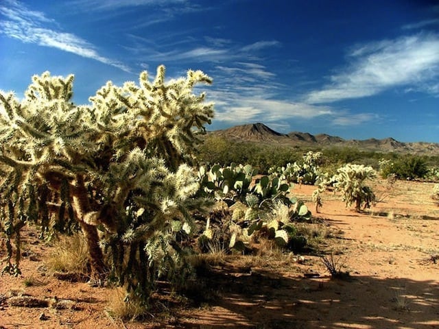
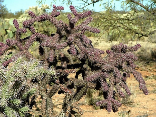
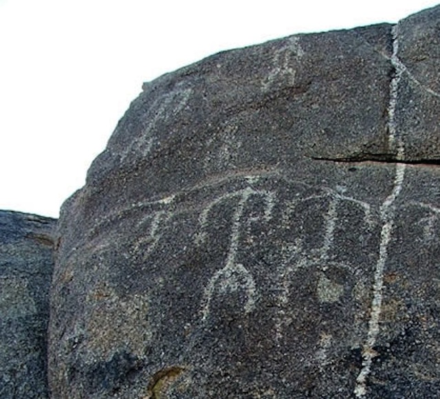
The Tortolita Mountains North of Tucson contain a wealth of desert treasures, including expansive stands of beavertail cactus and cholla. Zoomorphic petroglyph’s adorn the eastern face of a large granite outcropping, the figures chipped into its surface carrying the Hohokam’s story through the ages…
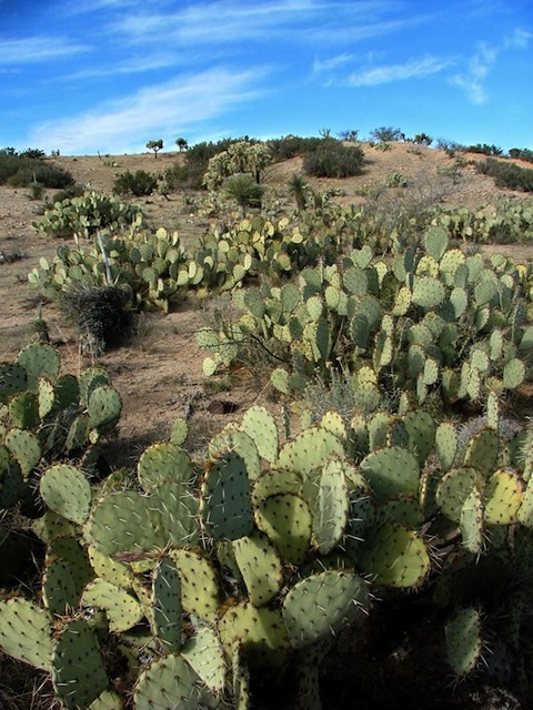
The Tortolita’s border the northern range of Tucson basin, with the larger and more frequented Catalina’s to the east. As with most of the mountains in the Sonoran Desert, the Tortolita’s are young, geographically speaking, with sharp features, rugged peaks and deep erosion scarring the surface creating gully’s, canyons and alluvial fans. The rocky soil supports vast concentration of cactus, though little else.
The trail starts at (N32 30.658 W110 55.503 NAD27), leaving AZ77 and heading west across Big Wash and into the Pass X Ranch. This area is frequently occupied by cattle, so drive slow and show respect to the land lease owner. Just after Big Wash (N32 30.684 W110 55.917), the trail leaves the main track and heads north for nearly a mile before starting a slow curve to the northwest. The trail along this area is easy, and yields beautiful views and cactus groves.

At just over 3.5 miles from Big Wash, the trail bears west. There are several other minor tracks that head off from the main trail, so make sure to keep a westerly direction towards the mountains. We crossed a cattle guard at (N32 33.025 W111 00.532), and the trail became more challenging as it entered Batamote Wash on its climb to Cottonwood Springs. There are several crossed axle gullies and cambered sections, restricting further passage to 4wd vehicles.
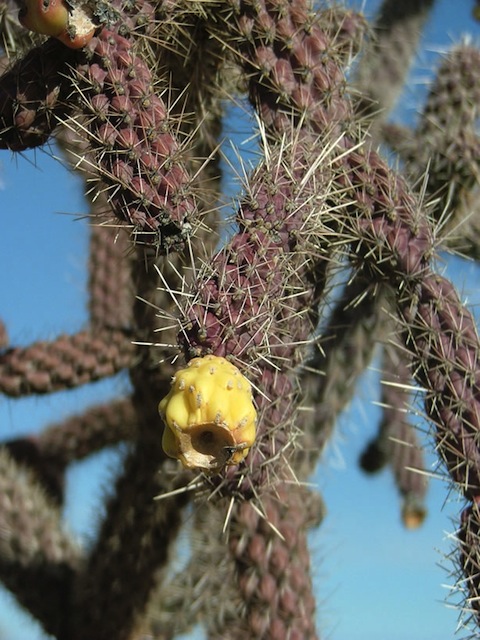
The petroglyph site is at (N32 32.997 W111 01.156), and makes a great place to stop. There is a good parking area with turn-around, and even a few level spots for camping. The petroglyphs are on the east side of the granite rock outcropping.

From the petroglyph site the trail continues west, and begins to climb in elevation. The obstacles after the petroglyphs are what earns this trail a 2.5 rating, as there are several granite shelves and rock outcroppings to negotiate, including a challenging crossed axle ledge that will likely lift a tire on most vehicles. For stock height vehicles, skid plates are important and running boards may be damaged.
The first challenge is a rounded granite ledge that climbs steeply to a shelf at the top.

The second obstacle is a sharp crossed axle granite ledge.
The trail climbs to a draw, with an open area for two to three vehicles that makes a great lunch spot (N32 32.842 W111 01.916). This is the high point of the trail and provides for beautiful views to the north to Fresnal Canyon and the Falcon Divide. To the west, the Samaniego Ridge of the Catalina’s rise from behind Canada del Oro. From this high point, the trail does continue west from the draw and into the deep canyons of the tortolita’s.

Trip Details
- Date: 12/22/2004
- Trail Time: 3-4 hours
- Location: The trail starts just north of Catalina at (N32 30.658 W110 55.503), turning west and crossing Big Wash. There will be signs for the Pass X Ranch.
- Mapping / GPS / Waypoint / Track Files:
- Map: MPS Map
- Note: To download, right click and “save as”. Mapsource Version 6.5.0 Beta
- Trail Rating (1-5 scale): 2.5
- Major Obstacle: There are several minor challenges, including a short, crossed axle climb and a series of smaller granite shelves to scale.
- Brush (minor, moderate, severe): Moderate
- Scenic Value (1-5 scale): 4
- Attendees:
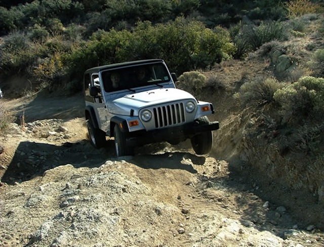
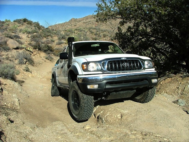
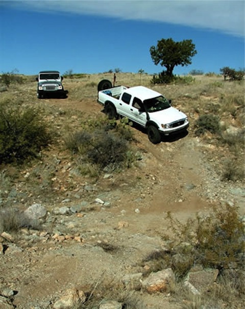
- Scott Brady- 2004 Toyota Tacoma
- Randy and Linda- 2004 Jeep Wrangler Sport
Trip Planning
- State Trust Land Permit Required
- Contact:
- AZ PLIC
- 222 N. Central Avenue, Suite 101
- Phoenix, AZ 85004-2203
- Phone (602) 417-9300
- Fax (602) 417-9556
- e-mail: [email protected]