
It was early June, and I was exploring the backcountry of North Carolina. The COVID-19 pandemic was still in full force, with numbers on the rise daily. My phone rang, and it was one of my supervisors in Breckenridge, Colorado. The ski resort I worked at was getting ready to resume operations for the summer season. As I drove back across the country, I knew I would have a great time exploring the Rockies. I had a long list of places to check out. Off-roading in the summer and skiing this coming winter sounded like the plan to me.
Boreas Pass
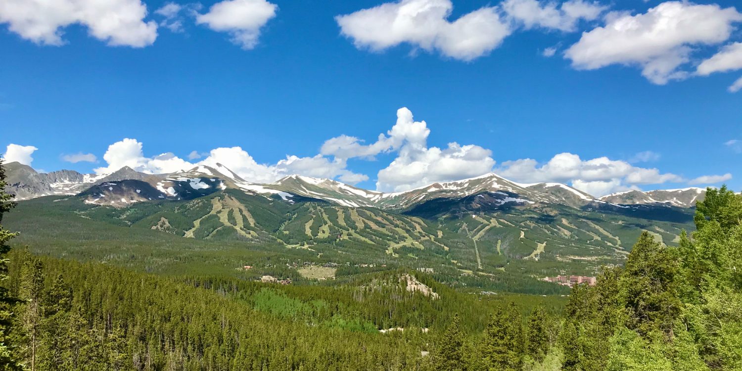
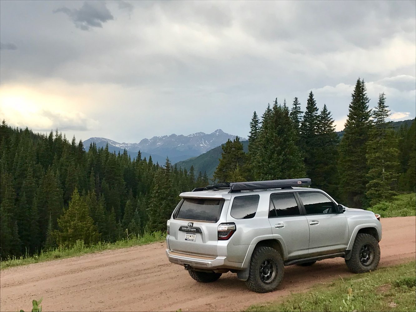
Upon arriving in Breckenridge in early July, I immediately set out for a close local trail. First up, The Boreas Pass in the White River and Pike National Forests. Stagecoach travel dominated back in the mid-1800s, then railroad travel took over by the end of the century. By the 1950s, the Boreas Pass was converted over for automobiles. I was excited for the adventure, the views, the wildflowers, old mining artifacts, and the trail. Finally, I was exploring Colorado again. I gassed up the 4Runner, located the trailhead, and aired down my tires. It was July 4, and I was happy to be out on a sunny day. I passed a number of mountain bikers, hikers, and 4x4s as I ascended. I took in the fantastic views of Breckenridge from up the hill. The vantage point was ideal for taking in the resort and those green ski slopes eagerly awaiting the return of snow. Several restored historical structures were from the mining era and in great shape. The flowers were loving the sunshine, and I could feel the air changing rapidly as the wind picked up. As the pressure dropped quickly, I knew a storm was approaching fast. I continued on the trail ascending the mountain. I approached the top of the trail, noted my elevation of 11,480 feet, and it began to rain. The rain poured down, but due to the elevation, by the time it hit my vehicle, the rain started to freeze. I was astonished as another vehicle passed by covered in white icy slush. My 4Runner started accumulating ice, too. The storm passed just as quickly as it rolled in, and the day began to brighten back up. One thing is for certain: Colorado’s weather can change dramatically in just a few seconds.
Weston Pass
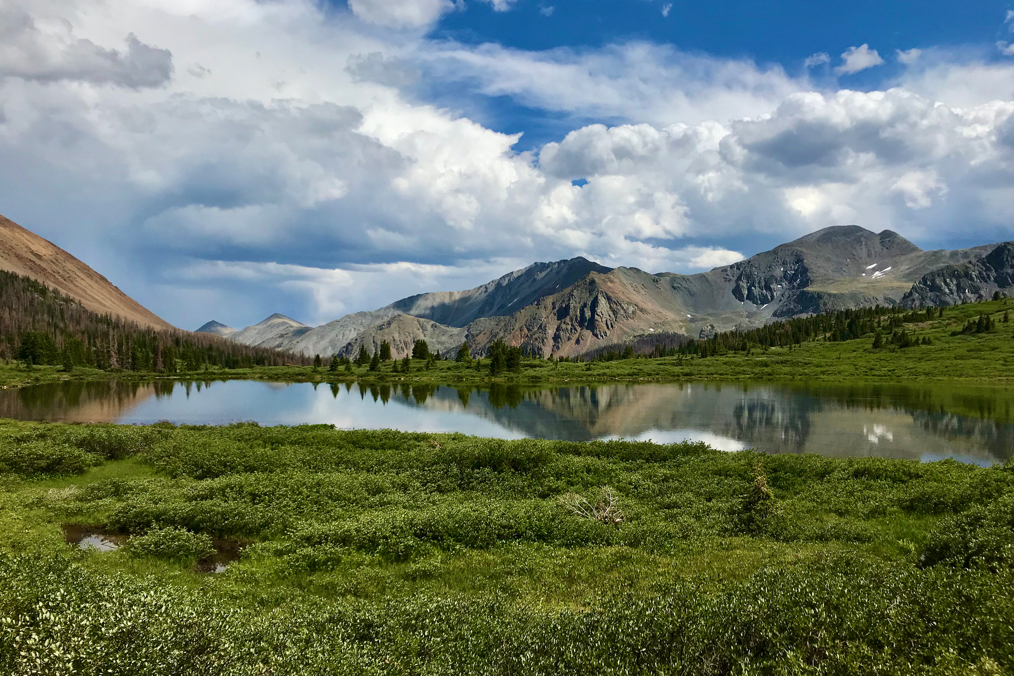
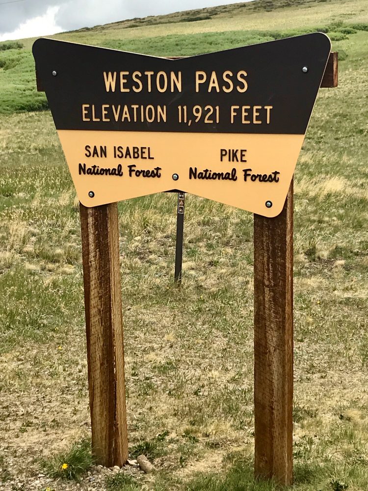
The weather was going to be spotty in Breckenridge for the next few nights, so getting south and away from the path of the storm was the play. It was my first three-day weekend, and I was gone, exploring the western side of Weston pass. My friend was going to join, and I received a text from him stating that he was arriving on the eastern side. Our plan was simple. Meet in the middle at Weston Pass Campground and then set out together. Once the trail got going, I just laughed with excitement, cruising through a steep rocky area with big boulders and rocks on both sides reaching up to the sky. I passed Mt. Massive Lakes and Buffalo Peaks Wilderness Area and spotted some wonderful dispersed camping spots along the route. The trail was fairly rocky in sections but mostly an easy dirt road with wonderful views and scenery. Arriving at the same time to Weston Pass Campground, my buddy and I were both stoked. We both wanted to keep exploring, and since he came from the other direction, I offered for us to go west since I spotted a few spur trails on the way in. We took the spur trail; it led up a hill that passed a wonderful ridge camp spot that I knew I would be coming back to later. We eventually reached the historic Weston Pass trail sign and took in the view. Elevation: 11,921 feet. Back in the mid-1860s, Weston Pass was a major thoroughfare. In a time before the railroads had made it all the way out to Leadville, this pass saw a lot of action with daily visitors making the journey. We ventured up some of the more technically demanding sections of the trail, and it grew increasingly rocky. I looked up the hill after a tight switchback and saw a large herd of something grazing up on the hill. It was getting late in the day. My buddy took off for Breckenridge, and I went back to that ridgeline camping spot, deployed my new awning, and got to work on dinner.

Shrine Pass
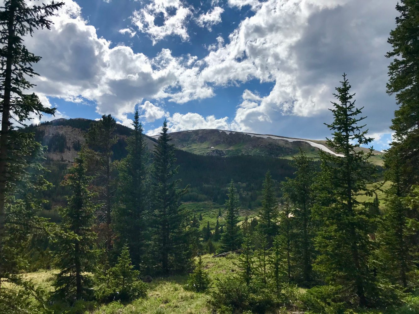
Morning came early on Weston Pass with birds chirping. Last night was windy, and a storm had rolled through with some light rain. Once I was up and out of my tent, I surveyed my new awning as sunshine beamed down through the evergreens. It had held up great with no visible signs of wearing or tearing against the storm. This early in the morning, it was majestic up on this hill. From my current location, I still had the eastern portion of Weston Pass to complete, before I could make it up to Shrine Pass. Before I-70 was constructed, Shrine Pass was one of the best routes over the Gore Range. After breakfast, I packed up and headed that way. I stopped off at the Mount of the Holy Cross overlook and took in the view. This section of the White River National Forest was impressive. I continued west along Shrine Pass and ventured up Lime Creek. I wanted to explore as much as I could and take in the sights from another vantage point. I came across a buck, and from the size of his fuzzy antlers, he was going to be a big boy. I spotted an empty campground up on the hill with a great view. This place had a vibe. I would come back, so I continued exploring the trail heading west and came upon the trailhead for McAllister Gulch. As I peered up past the closed signs, I got a good look at the trail and realized what I’d heard was true. The McAllister Gulch ahead was an extreme trail that came with extra difficulty and inherent dangers—definitely a black diamond. I continued west toward Red Cliff. Just as the name states, the red rocks became ever-present. It is almost as if the earth was carved directly from the same stone as the world-renowned Red Rocks Amphitheater near Denver. This trail was a gem. I made it to Red Cliff, turned around, drove to my ridge camping spot, and made it in time for sunset.
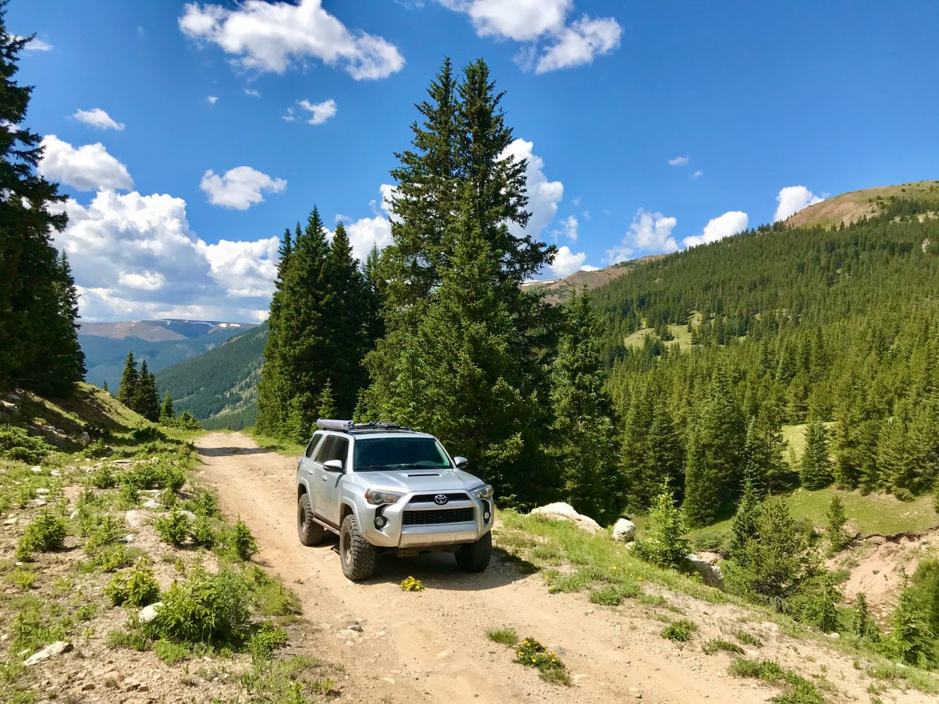
Chalk Mountain
Another storm had rolled in last night. I arose from my tent that I had situated underneath my awning for extra coverage; it was fairly dry with the surrounding area wet from last night’s rain. I was standing on an amazing ridgeline. With Vail Ski Resort just to the north of my current position, I was deep in the heart of the back way from Copper Mountain Ski Resort to the Holy Cross Wilderness Area. Next Up, Chalk Mountain. Just off Highway 91, nestled in the San Isabel National Forest, this round trip, from my best estimation, is just under seven miles. Chalk Mountain was going to be the toughest track of the weekend. I pulled up to the trailhead, aired down, and scanned the area. This ascent was going to be fun. Heading up the hill, a series of switchbacks quickly greeted me, and the rocks started to multiply and get larger. I came to a tricky rock ledge that had some steepness to it. The location of the large obstacle was also turning from right to left and then back right again. From a look at my map, I was about halfway on the trail. I picked my line over to the left, put it in 4Low, and engaged the locker. I crawled up the rock ledge, adjusting and keeping my momentum slow and steady as I climbed. I was over the hill. The climb continued, twisting up the hill, navigating the ruts and rocks. Looking over at my altimeter, I was just approaching 12,000 feet—nice. I pulled up to the top of Chalk Mountain, and the views were fantastic from this high vantage point. After soaking it in for several minutes, I noticed the trail continued and descended a bit. I continued down following the trail, and it led up to a dramatic vantage point. The overlook had excellent views down onto Highway 91 and Climax Mine. I headed out the way I came in, this time enjoying the views along the descent.
Browns Canyon National Monument
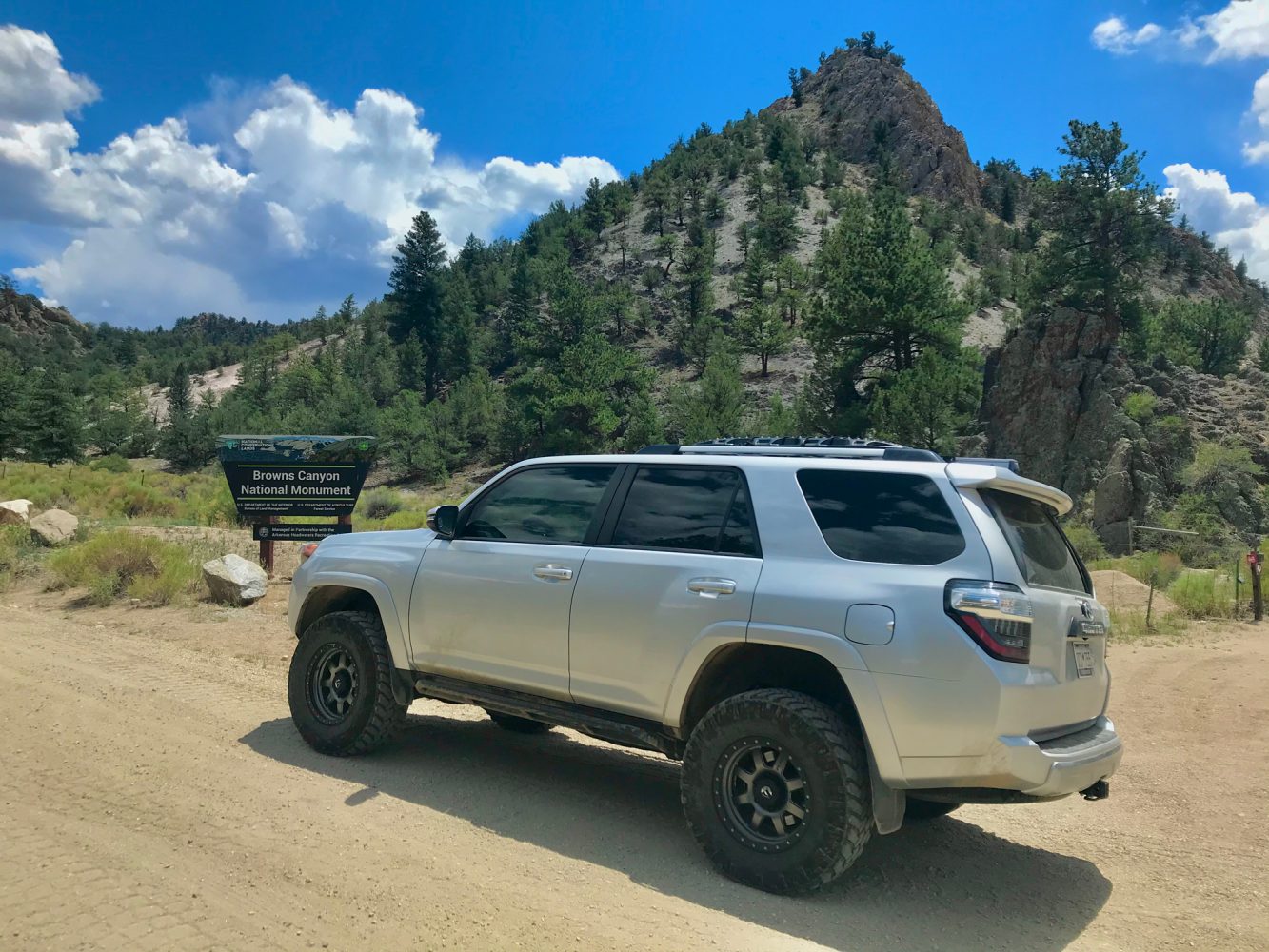
Back in February 2015, Browns Canyon was designated as a national monument by President Obama. I was very intrigued. What separated this from the rest of Colorado and made the area so special? I set out south. The area that surrounds Browns Canyon is known as the Fourmile Travel Management Area (FTMA). It is incredible out here with a tremendous trail network. FTMA is full of twisting and winding roads, gorgeous ascents, aspen trees, wildlife, wonderful campsites, and scenic views. I passed Ruby Mountain and found the trailhead for the Browns Canyon National Monument 4×4 Trail Network. Airing down my tires, I scanned the hills and ridges ahead of me. I had the distinct impression this was about to get epic. I set off, and within minutes the trail instantly had rocks, boulders, obstacles, and ridges that shot skyward. I came across a gulch area with huge boulders that barely had space wide to accommodate the 4Runner. Without a spotter, I got out for a closer inspection. This was a tight, tricky, off-camber section rolling from the right with a noteworthy rock ledge drop-off. I found my line. This one was going to require rolling down my window. Keeping my front left tire exactly where it needed to be, I crawled over the obstacle and cleared it. Heart beating at full blast, I continued on the trail. Bald Mountain Gulch was a beauty; when I came upon a T-junction, I opted to head left onto Arnold Gulch. It was a scenic ridge that required a turnaround. I made it to Bald Mountain and headed next over toward Castle Park, traversing through Columbine Gulch, rolling through hills full of aspen trees. The area had such a natural, easy flow. Castle Rock Gulch was tremendous, and I noticed dark clouds to the west. The time was approaching to find a camp spot. I crossed over Bassam Ridge and found a great spot in Fork Gulch, deep in the San Isabel National Forest. Today had some challenging obstacles and some winding tree runs. At camp with dinner and coffee in hand, dark clouds approached, and I opted to sleep in the back of the 4Runner. With a couple of windows rolled down an inch, the rear hatch window and the rear passenger window served as an ideal setup for sleeping in the back with a nice summer breeze. Cozy as I lay in the back reading, I reflected on just how much I enjoyed this area. I could not wait to continue exploring FTMA tomorrow. Cheers to the state of Colorado for seeking protection. Wild places are important to me, and I was glad to know this area provides natural habitats to mountain lions, bighorn sheep, mule deer, elk, and a number of birds.
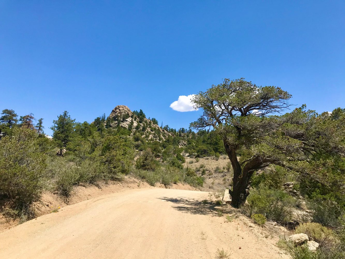
Turret
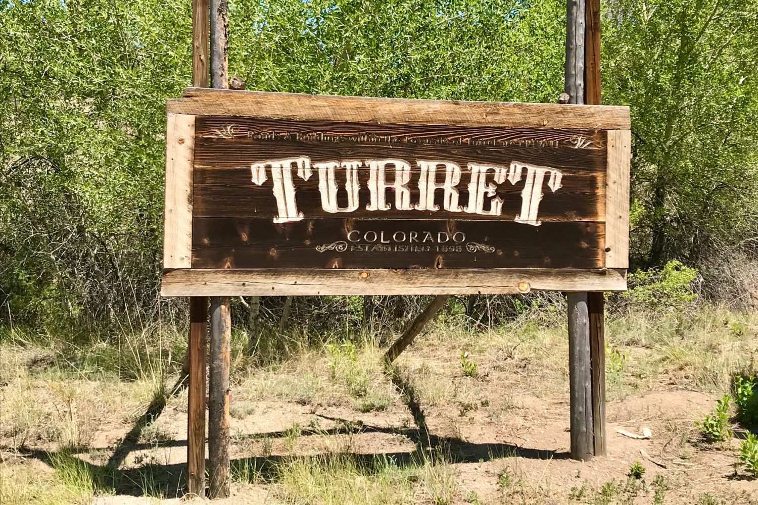
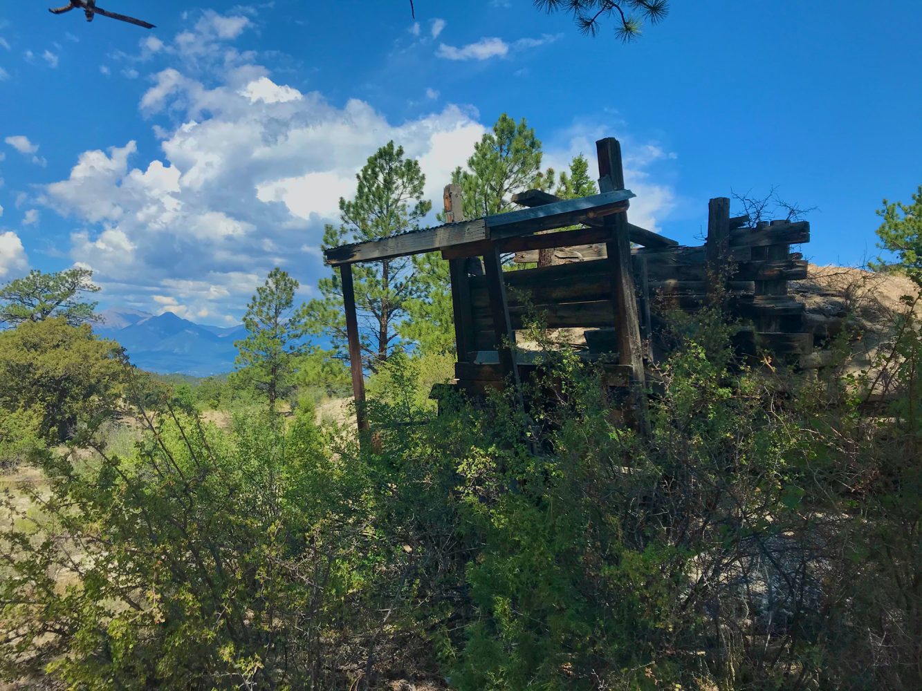
As morning arrived, the 4Runner filled with streams of sunlight. I listened and heard the birds talking to each other. I could not help but smile and laugh at just how much they had to say to each other. As I sat and enjoyed breakfast, it was apparent that I was surrounded by woodpeckers in search of their own breakfast. I was scanning my maps when a hummingbird flew into camp and hovered around for a bit, flying around and in front of me. He was gone just as soon as he had arrived. That was a sign. Today was going to be a great day. There was a ghost town to the south called Turret. I could explore and then continue south into Salida. It looked like route 184 and 185 would be ideal as they had a route through the Browns Canyon that I had yet to explore. As I cruised through the canyons marveling at the immense beauty, I found an old mine. I had to see it up close, so I hopped out in the noonday sun and explored. I purposefully made each step, on the lookout for snakes. I stayed on the well-worn paths and stood in front of Last Chance Mine, known for its silver production over the years. I imagined what life must have been like for these miners and the entire operation back in its heyday. I continued down the trail and arrived after a series of twisty canyons turns and switchbacks in Turret. I was deep. There were maybe eight houses way out here. I could not find the trail that led to the Browns Canyon Wilderness Study Area [185]. Only spotting private drive signs, I obliged and turned around. I marveled again at this area from a different viewpoint.
Billings Lake

I headed south toward Salida. Back in 1881, when Colorado was in the process of deciding the permanent location of the state capitol, Salida was in the running. Denver had a leg up and eventually won. I find this moment in history fascinating. Salida was a gorgeous town. I double-checked my map and noted that Billings Lake was to my west. Heading west out of Salida, I pulled off the main road and onto CR 240. Arriving at the trailhead, I knew I was in for a high alpine ascent that led to a stunning lake. I aired down even more than usual in this case, dropping down to 12 psi, and made my way up the rocky terrain. The afternoon storms rolled in, and the terrain quickly turned slick. I continued up and saw blue skies peeking through. Continuing even higher, I noted the storm had passed me and flipped off the wipers. The last portion of the trail to Billings Lake was jaw-dropping. Steep mountains surrounded me, and Billings Lake was magnificent. I walked around and felt peace and serenity. Sunset at that high alpine lake was something else.

Marshall Pass
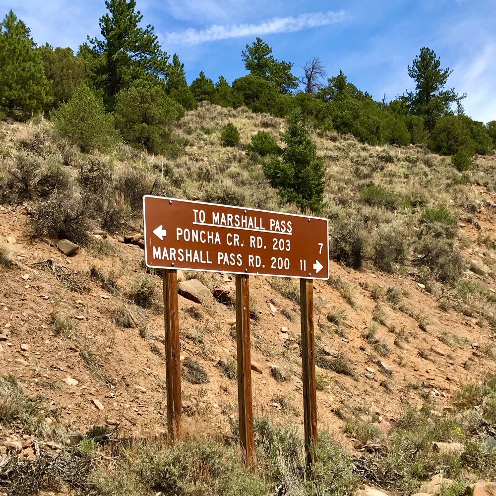
Waking up at Billings Lake, just shy of 12,000 feet, was incredible. It was understandably a bit colder in the morning, so I quickly began making some coffee and watched as the sun came up. I spotted some old mines in the area and began my descent back to Highway 50. Once I reached the bottom, I aired up and figured out my next move: Marshall Pass. I cruised over to Sargents and found the Tomichi Creek Trading Post. I filled up the gas tank, grabbed a few supplies, and headed up the trail. It started with an easy ascent and then progressively got more interesting, more beautiful, and rockier. Cruising through the mountains and passing through aspen forests, I reached the Continental Divide. Marshall Pass has an elevation of 10,842 feet. I took the Poncha Springs 4×4 Trail off to the right. The trail got rocky and aggressive quickly. Descending the tight and twisty trail, I was riveted. With the excitement pegged, I knew I was on another interesting and challenging track. I finally made it to the bottom of the trail and let out an audible yell as I made it down another thrilling 4×4 trail.
Sand Mountain
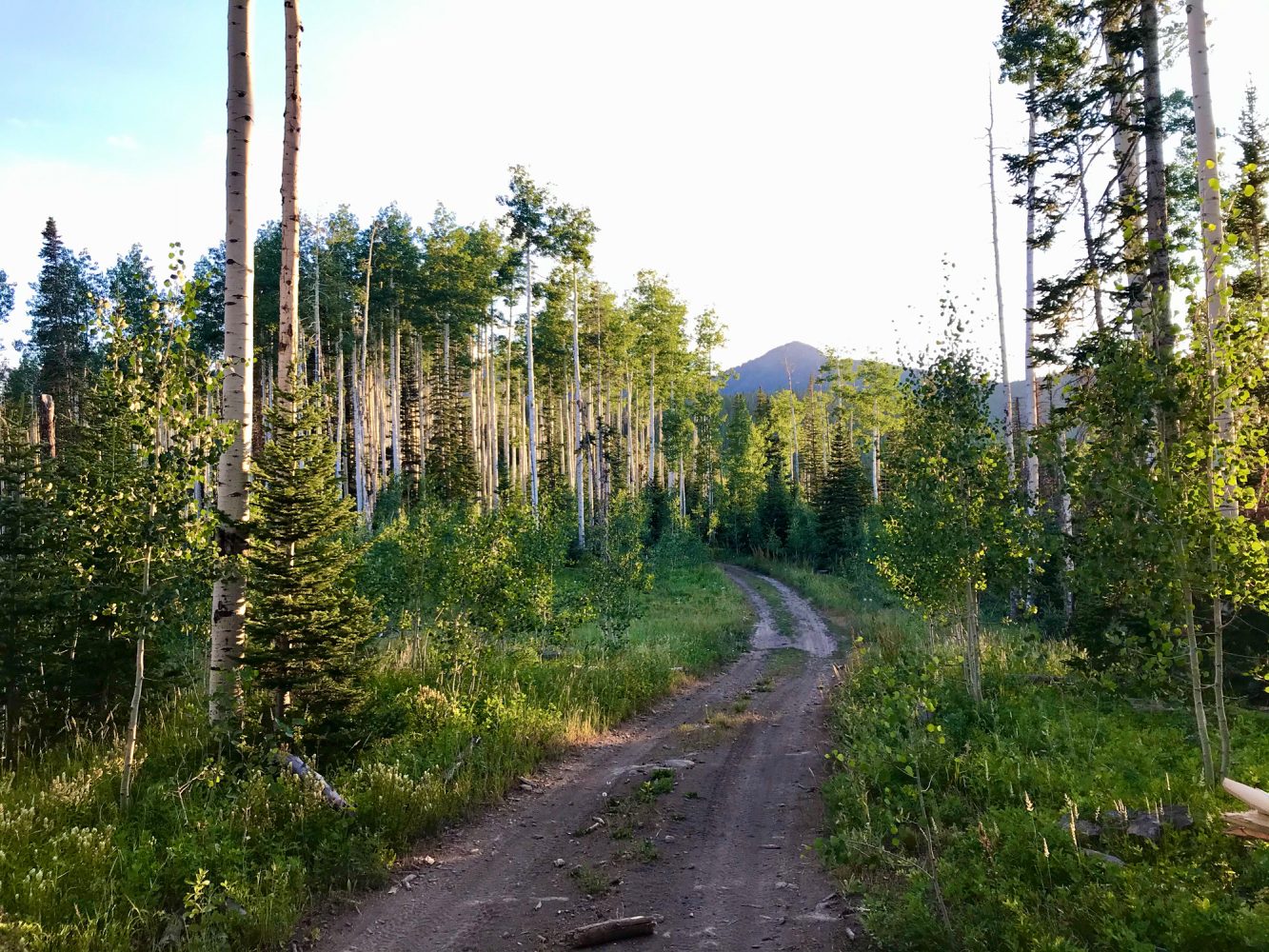
Steamboat was very high on my list. I drove from Breckenridge, and as I approached Sand Mountain, a wide smile found its way onto my face. From my estimation, this was just under 13 miles. I found the Mill Creek Trailhead and aired down. The trail began modestly and progressively got rockier and bumpier, but nothing was too intense—it was gorgeous. Sand Mountain is a loop with some medium level rocks, boulders, and ledges, with wildflowers blowing in the wind with views down on Steamboat Springs Lake. I started to put my attention on finding camp. I skipped the hike to the top of Sand Mountain and passed through an aspen forest, finding my camp spot for the night. Once the sunset had come and gone, I deployed the new Luci multicolor lights and was thrilled, realizing my camp setup was becoming more dialed in.
Ellis Jeep Trail

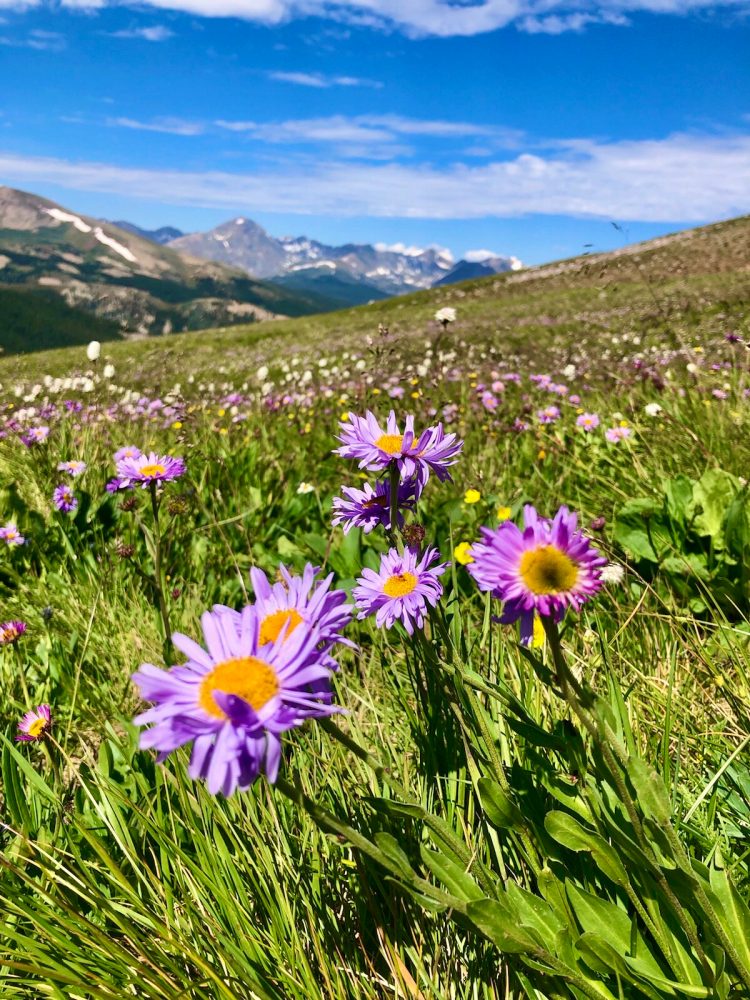
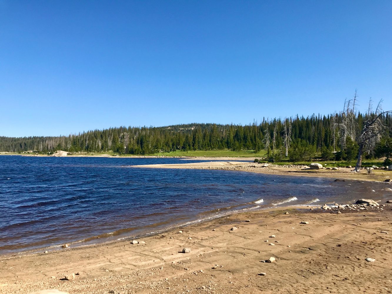
Sipping on some hot coffee, I watched the sunrise and began my day. Today’s track was the Ellis Jeep Trail, and if the trail and weather permitted, I was going to cross over into Wyoming. As I cruised up Whiskey Park Road, FS 500, it began to rain a bit. I hooked a right on Big Red Park and began my trek up the trail. I knew from my research that this track was going to get difficult. Scanning the mountains around me and my maps, I could tell that this was steep. With Mount Zirkel Wilderness to my east, I approached the ridgeline that became ever increasingly super tight and twisty. Fallen trees were everywhere. The rain poured now, as if right on queue for the most technically demanding sections. With more down trees than I could count, I gripped the steering wheel harder. Getting slicker by the second, the rocks got bigger and multiplied. Boulders joined the party. I crawled my way through, and I could not help but think this unforgiving, menacing trail could be where I incurred some serious vehicle damage. Taking my time out here alone in heavy rain, I safely made it through in 4Low. As the trail crested and began to descend steeply, I flipped on the locker to assist with downhill control. Utilizing the most out of my low-range gearing and rear locker, I pulled out of this one like a mountain goat. Once I fully cleared the hardest part, I continued approaching the Wyoming state line. The trail went from very rocky to placid and completely rocky to red dirt and pebbly. I crossed over into Wyoming, continued up FR 496, and stopped at Hog Park Reservoir for a bit, taking in the crisp air and beautiful water on this overcast day. With a cold, wet wind sweeping through, I continued on my journey, traveling around the reservoir on FR 550, and soon I was heading south. Once back in Colorado, I dropped in on the Hahns Peak Trail and entered an expansive trail network that presented multiple off-road trail options. I made my way around Twin Mountain and continued onto Farewell Mountain. The rain eased up, and the sun quickly began to shine through. Beauty was pegged at the abundance setting. There were some rocky, off-camber sections with some pretty serious angles as I slowly descended into a valley. I took everything nice and slow and found what remained of Old Farewell Mine. I descended into a relatively flat area full of wildflowers that had 360° views surrounded by mountain peaks. I reviewed my options. Next up was Buffalo Pass. I topped off in Hahns Peak and grabbed a few supplies. Upon reaching the trailhead, a storm looked to be rolling in. As I headed onto the trail and ascended the initial round of ridges, the leaves were blowing with intensity. The rain picked up a bit, and I came over a hill with the wind and rain blowing with ferocity. I noticed someone’s shade tent tumbling in the wind. I hopped out, caught it, and stopped it from moving. With the owners nowhere in sight, I secured the runaway tent utilizing some nearby rocks, figuring the owners would be by as soon as the weather cleared. After a few more minutes on Buffalo Pass, the weather did clear. I continued around some gentle bends in the road and came upon a ridge camping spot with an incredible view. From this perch, I could see the owners in the midst of retrieving their lost tent. Happy to know I helped, I took to setting up my camp for the night. Once settled in, I was lucky to be right on time for a wonderful Steamboat Springs sunset.
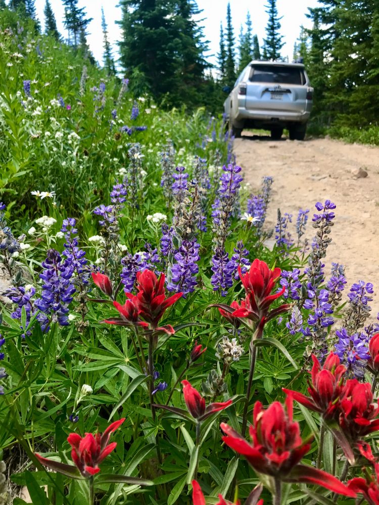
Buffalo Pass
Buffalo Pass originally served as an important route connecting the towns of Walden and Steamboat Springs. Residing in the Routt National Forest, this gentle trail rolls through scenic land. Wildflowers were everywhere. The trail was on the easier side compared to the previous day’s adventure on the Ellis Jeep Trail, and waking up on the trail this morning, I knew I was in for an easygoing scenic trail ride. I found a spur trail that looked from my vantage point to follow along some power lines. I ventured up that way and was pleased to see the difficulty rockiness increase a bit. This was a slightly less-traveled portion of the track. I ascended until the trail ended near a rocky outcrop, hopping out to take in the great view of the Routt National Forest. I descended back to the spot where the spur trail reconnected with Buffalo Pass, and I continued on the trail. With the sun out and the wildflowers blowing in the breeze, this was an ideal way to enjoy the day and the Steamboat Springs backcountry. Along the pass, I came upon a number of good campgrounds with Dry Lake Campground, Summit Lake Campground, and Granite Campground, to name a few standouts. Summit Lake is right next to the Continental Divide and a wonderful spot. Granite Campground was off a spur trail off to my right that headed south, and it is another beautiful option for those wanting to see as much of this area as possible. This trail leads to the Fish Creek Reservoir. After reaching a closed gate, I turned back around to make my way back to Buffalo Pass. I continued on, finding one more spur trail that led to the south and the hidden lakes area. Once I had taken that spur trail as far as it would go, I headed back north, resumed Buffalo Pass, and completed the journey.