

Photography by Sophie Ibbotson and Max Lovell-Hoare
To honor the 20-year anniversary of Overland Journal, we are revisiting special heritage content in the upcoming 100th issue of the magazine. Originally published in Overland Journal’s Fall 2009 issue, this article is part of that celebration.
“Madam, there appears to be a dead bird in your luggage.”
Of all the greetings I could have received at the Pakistan border, I can say for sure this was not one I had anticipated. The security officer on duty pointed to the apparent source of the smell, a wicker picnic basket, gestured for me to open it, then looked profoundly disappointed when it contained neither a deceased parrot nor confiscatable contraband. The offending article, a past-sell-by and leaking can of sardines, was eventually unearthed, whence it disappeared into the bemused crowd that had amassed to watch the spectacle of four foreigners rooting through three vehicles’ worth of luggage in the midday sun. It was a surreal start to our journey through Pakistan on the Karakoram Highway—but the good-natured curiosity of officials, omnipresent crowds, and unexpected experiences were to become defining features of the trip.
The Karakoram Highway (KKH) is the highest paved road in the world, and includes the world’s highest international border crossing as well: the Khunjerab Pass, at 15,397 feet. Since its official opening in 1986 (after a brutal 20-year construction project during which 892 workers lost their lives in landslides and falls), the KKH has transported thousands of trucks, buses, motorcycles, and ambitious bicyclists from Islamabad, through northern Pakistan, and across the border to China. So it was a must to include it on our overland route from India to the UK for our video documentary project, Tracing Tea.
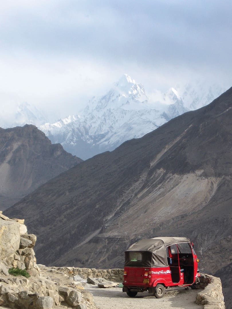
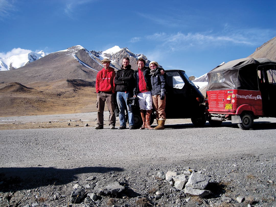
There was just one problem. For reasons vague even to the four members of our team, we had decided to cover the entire 15,000-mile route in two tuk-tuks, the tiny, three-wheeled, one-cylinder taxis ubiquitous across the Indian subcontinent and elsewhere.
And no one had ever driven the Karakoram Highway by tuk-tuk. Perhaps, we mused, because the locals knew better than to assault a 15,000-foot pass in a glorified ice cream cart powered by a scooter motor and rolling on 10-inch wheels?
It was an irresistible challenge. Our group of four traveling companions—myself, Andrew Daynes, Max Lovell-Hoare, and Sam Datta-Paulin—bought two tuk-tuks—a red, Indian-made Bajaj (its stock 50 cc motor upgraded to a full 100 cc), and a black Piaggio Ape from Italy (with a comparatively Le Mans-ready 175 cc four-stroke). We convinced the Pakistani and Chinese governments to part with visas, and set off in October 2008.
The tuk-tuk is a peculiar beast, neither motorbike nor car, and certainly with a character all of its own. The wheelbarrow-sized tires, absence of suspension, and worryingly low ground clearance hardly recommend it as the ideal overlanding vehicle—and yet, somehow, it survives. Sitting in the front seat, gripping the handlebars for security as much as acceleration, your hips swiftly adjust to the ruts and rocks in the road, and you learn to lean into each corner, guiding the tuk-tuk round with a combination of willpower and body English. On the rare occasions that the road leads downhill and has an unbroken surface, tuk-tuks can reach speeds as high as 45 mph—during such giddy intervals the tuk-tuk-tuk-tuk of the engine fades away along with the grrrrrrrrr of the wheels skimming across gravel and scree, and instead the sound of the wind roars through the cab, and your heartbeat echoes around your head. The combination of speed, fresh air, adrenaline, and more than a little bit of fear courses through every vein and, quite unexpectedly, you find yourself squealing and squeaking out loud, the stomach-leaping joy of a roller coaster ride blending seamlessly with the confrontation of your own mortality.
Islamabad is the single least inspiring city on the Indian subcontinent. It was built as Pakistan’s new capital after independence in 1947, and although it ticks all the boxes for efficient town planning, the planners forgot to instill a smidgen of character. Government and embassy staff hide in their compounds, and the country’s intellectuals and industrialists favour Lahore and Karachi. Still, the international airport, brand-new highways, and car rental companies make it a sensible starting point for a road trip, and the city is well positioned as Pakistan’s gateway to the Khyber Pass, Kashmir, and the Northern Areas. As we rattled out of the city, a road sign stating “Straight on for Afghanistan; Turn Right for China” filled my stomach with excitement and reminded us all that the territory now known as Pakistan has always been a meeting point for traders and pilgrims, explorers and invading armies.
The first town on the KKH is Mansehra, which straddles barren hillsides a few hours outside of Islamabad. Despite the apparently unproductive agricultural land, Mansehra is in fact home to Pakistan’s nascent tea industry. The government and Lipton are both engaged in research that could, theoretically at least, end Pakistan’s dependence on tea imports from bitter rival India.
It’s unlikely Mansehra would have registered on our radar if it weren’t for a near-collision with a donkey. Free-range and free-thinking animals are a constant threat across Pakistan, but this particular creature had even less common sense than most. An obvious escapee (remnants of a branch were still tied to the end of his rope), he trotted blithely upstream through traffic. We leaped out of the tuk-tuks and pursued on foot before he could cause an accident or be hurt—he was likely someone’s only source of livelihood. As at the border, the locals watched the strange behaviour of the foreigners until we ultimately cornered the donkey and tied it to a more substantial tree. Our looks must have been sufficiently triumphant, as we earned a round of applause from one small boy and his grandfather.
From Mansehra we puttered on to Besham, our first night’s stop on the road. After the devastating earthquake in 2005, Besham became the centre for reconstruction work, and many NGOs still have personnel working there. In an immaculately kept flowerbed of marigolds, there was a sign stating “No Weapons.” Incongruous, to say the least. Later that evening, the need for the sign became clear: Groups of aid workers, border security personnel, and local headmen were dining in the restaurant of the government guesthouse. Winter coats and hats were piled behind the table, and lined neatly against the wall were rows of knock-off Kalashnikovs. Perhaps surprisingly, the presence of so many guns in such a public place was not at all threatening. Looking at the owners, it was clear weaponry was part of their everyday lives; these guns were not toys, and the men in question knew full well how to use them. Should a problem have arisen in the region, these were exactly the people you’d want to have around.
I have to digress here and explain a little about the security and geography in northern Pakistan, as the country’s tourism industry is being destroyed by media focus on trouble areas. There are two main provinces: the North West Frontier Province (NWFP), which borders Afghanistan, and the Northern Areas, farther to the east. In the former there is, unfortunately, a very real security situation involving a resurgence of Taliban supporters and other terrorist groups. This is not the case in the Northern Areas, through which the KKH passes. No reports of attacks on foreigners have been registered in recent years, and crime in the province is generally very low. Politicians in the Northern Areas are so concerned about the damage caused to their tourism industry and reputation that they are considering aligning with the Central Asian republics as a means of distancing themselves from NWFP and its problems. NWFP and the Northern Areas are distinct regions with distinct characters, and we need to clearly differentiate between the two.
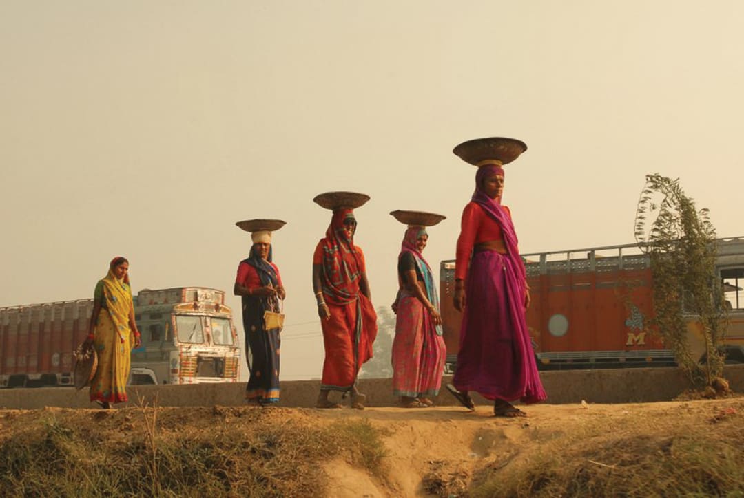
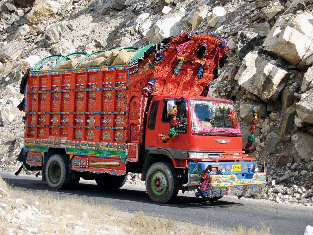
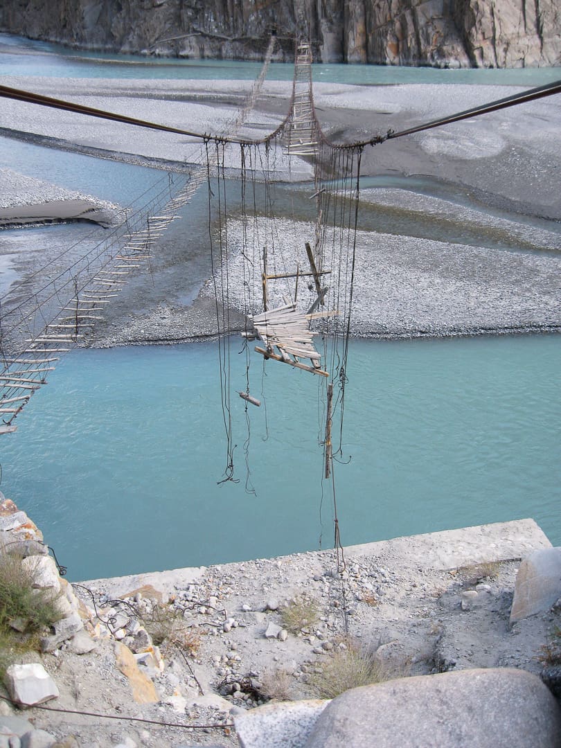
Nanga Parbat, the world’s ninth highest mountain, was the highlight of our next stretch of driving. You’d think a 26,660-foot peak would be hard to miss, but unless you’re inclined to look regularly over your shoulder whilst driving north (strongly disadvised), you drive on in ignorance until, round yet another bend, it rears up before you, and realise it’s been behind you all along. The distances between sites along the KKH, and this stretch in particular, are not excessive, but the time taken to drive even a few miles never ceased to surprise. While the tuk-tuks managed to navigate the potholes and remains of previous avalanches with relative ease, their inherent lack of acceleration on the uphill stretches meant we were regularly caught behind overladen trucks limping their way along the road and belching black smoke as they went. The tight hairpin bends, falling away hundreds of feet to the white water river below, also encouraged a conservative approach to driving, but the sunset over the valleys was absolutely spectacular if you didn’t mind a twilight finish to the day’s ride.
En route to Gilgit, home of the provincial government in the Northern Areas, we stopped repeatedly to scramble up the slopes alongside the road to take in a bit of the region’s history. Incised into the rocks bordering the KKH are around 20,000 petroglyphs dating back as far as 3,000 BC. A local guide can introduce you to the images of animals, human figures, inscriptions and religious symbols which testify to the presence of invaders, traders, and pilgrims (especially Buddhists) who left their mark whilst passing through the Karakoram range. We took the tuk-tuks along to see the Kargah Buddha, a seventh-century figure carved deeply into a cliff face, but were forced to a halt where a recent rockfall had wiped out the road. We left both vehicles with a crowd of spectators and continued on foot, taking a goat path up the cliff and then climbing further to see the Buddha eye-to-eye. This carving and its contemporaries stand as a testament to the skill of passing craftsmen, and their desire to leave a permanent message for others, even if their own presence was only temporary.
Gilgit is famous for its polo, but the sight that met us as we entered the town was not quite what we’d been led to believe. The winter polo season was yet to begin, but practice sessions on the streets were in full swing—except the horses were noticeably absent. Instead, teams of young boys and men ran in circles around squares, crossroads, and playing fields, wielding mallets around their heads and shrieking as they charged each other. It resembled a game of high school hockey, but with larger sticks, more aggression, and an added element of excitement: the need to dodge oncoming traffic moving at homicidal speed through the city streets. The players wove expertly among shoppers, stray dogs, open drains, and piles of rubble, erupting into hysterical cheering every time a goal was scored. There was really no need for horses after all.
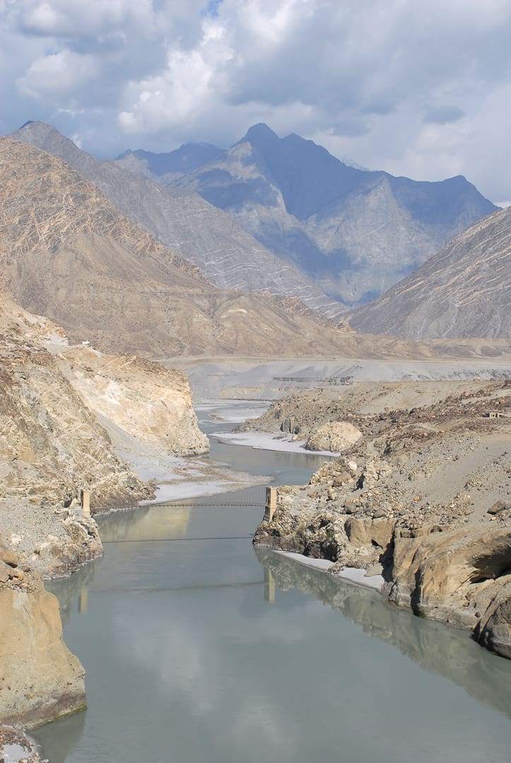
Three hours up the road is Hunza, a small mountain kingdom that is the supposed inspiration for Shangri-La and James Hilton’s Lost Horizon. Even as late as the 1970s, residents had self-reported [but unverified] life expectancies of 120 years, and the population claims descent from Alexander the Great. We had to check this out.
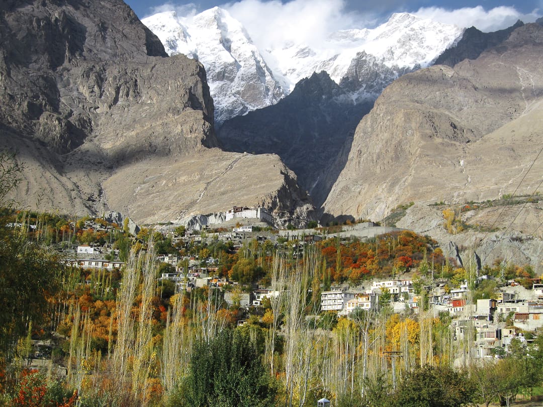
Getting any vehicle, let alone a tuk-tuk, up the cobbled slope to Hunza’s Baltit Fort is not a task for the faint-hearted. You have to keep your foot hard to the floor, wrench the steering on multiple, sharp bends, and pray all the way up that a pedestrian or goat doesn’t bolt out in front of you. The view from the top is spectacular: the silver river winds through a wide, rocky valley, the trees drape in a spectrum of reds and golds, and the rugged mountains are dusted with ever-increasing layers of snow and ice. We pulled up at the foot of the fort with the entire kingdom stretched out before us, and watched the children below run barefoot from rooftop to rooftop. Three small boys, intrigued by the tuk-tuks, had followed us up the slope and proceeded to barter half a kilo of dried apricots, a local specialty, for a ride. Who were we to refuse?
The next day’s drive took us north to Sost, the last town in Pakistan before you hit the Chinese border. The temperatures had dropped sharply, and the clouds looked foreboding. The only hotel in town announced it had turned the heating off due to the season’s end, and their helpful tip to avoid hypothermia was to share beds and sleep in our boots. Cosy.
Despite being half a day’s drive away from China, Sost is home to Pakistan’s customs and immigration posts. The officials working here have their jobs cut out for them—heroin and opium are trafficked through these mountains from Afghanistan, en route to Central Asia, Russia and beyond. The day we met them, however, they were in good humour and, having spotted both tuk-tuks and a large video camera inside their compound, were desperate to get in on the act.
The standard procedure for customs and narcotics is to check your engine and chassis numbers against the vehicle paperwork, then search a random selection of bags, tipping out underwear, books, and everything else in the middle of the car park. But the officials we met were a little star-struck on account of the camera rolling, so their approach was somewhat unorthodox. The head of customs normally delegates the vehicle inspections to a subordinate and remains seated in the office, surveying his realm. On this occasion, he was anxious to be seen in action, and he came out and bent down to examine the digits engraved on the bodywork. Some might say blindness is inhibitive in his profession, but he coped admirably, suggesting instead that we read off our own digits and then tell him what was written on the papers. A similarly farcical kit examination followed: the officers lined up in front of the camera, showed off their various weapons, and requested we bring two bags of our choice to the examination table. No one wanted to lose his place in the scene.
Leaving our new friends and relative civilisation behind, we set off the following morning to make our way through the wilds of Khunjerab National Park to the 15,700-foot pass that marks the start of China. The park’s location is interesting, as it contrasts Pakistan’s natural beauty and prolific wildlife (snow leopards, Marco Polo sheep, and red pandas, to name just a few) with China’s construction ambitions. The KKH is an engineering miracle, but apparently that’s an insufficient achievement for the Chinese—they plan to widen it to a four-lane highway and, even more unbelievably, put in a railway line. Construction work has already begun in some areas, and we sat fairly patiently for an hour while a giant JCB grader threw rocks down the hillside and then re-levelled the road in front of us. Just getting the machinery up here in the first place is no mean feat.
The official border post is a desolate spot, and a real graveyard posting for the two officials sent here for seven-month stretches at a time. Their newly built hut looks smart on the outside, but a hunt inside for a bathroom and a cup of tea revealed the lack of electricity and running water. The officers’ cooking gas had also run out, as the most recent supply delivery had never arrived. Not to be defeated, and desperate for a cuppa to combat the biting wind, an official brought snow scraped from the top of the frozen river, and we boiled it up Boy Scout style in the great outdoors. I’ve never had such a good cup of tea in my life.
We needed to enter China before nightfall, and we were unsure how the tuk-tuks would fare in the snow, so we pushed on, curious about what the People’s Republic would bring. The answer was . . . escorts. Pakistani hospitality, and a blasé attitude to foreigners in strange vehicles wandering around the back end of beyond, was replaced instantly with Han Chinese formality and efficiency. A 6-foot-something officer from the local army base drew the short straw and was ordered by his senior to ride with us the 50 miles to the immigration post to make sure we didn’t veer off course. Considering there is only one road and no turns off, I’m not entirely sure where they thought we’d go, tuk-tuks not being too well equipped for off-track driving, but at least it made him feel useful.
Xinjiang is an autonomous province in China, and due to its predominantly Muslim population, who come from ethnically diverse Central Asian groups, it is poorly integrated with the rest of the country. From time to time, this results in unrest; Beijing is understandably concerned about the region’s desire for independence and so keeps close watch on everyone coming in and out, regardless of what they are doing there. All foreign visitors are given an official escort-cum-translator-cum-observer for the duration of their stay, and we were no exception. Nur Mohammad, our guide and a member of the majority Uighur community, did a fine job of keeping us on the straight and narrow whilst still showing us tourist highlights of the region. His insistence on sharing the local staple of noodles and lamb fat in broth at every meal will, however, not be missed.
Marco Polo recorded his visit to Kashgar in 1273, not long after it had been ravaged by Genghis Khan, and Amir Timur (made famous by Shakespeare as Tamerlane) attacked Kashgar in the 14th century. Ever since, the place conjures up pictures of medieval caravanserai, spice traders, and the Silk Route. History hangs thick in the air, and the best way to get a taste is to dive into the Sunday market, one of the biggest in Asia. The tuk-tuks jostled for space with Bactrian camels, donkey carts, and oxen, dodging lines of fat-bottomed sheep that had been roped together. In a place where meat is generally tough, fat is the greatest delicacy, so the sheep are bred specially to have generously proportioned rumps. Kebabs consist of alternating cubes of meat and fat, all wrapped up in the local flatbread. In Kashgar we also learned that a good price for a tuk-tuk is one large female camel or half a dozen sheep. It was surprisingly tempting.
Away from the braying and barking is Kashgar’s main bazaar, where a whole load of weird and wonderful products is on sale. If you fancy a stolen Mercedes, this is the place to buy, and you can also fulfill any desires you might have for dried hedgehogs, pickled lizards, imitation Rolexes, or genuine leopard-skin hats. Many of the stores were doing brisk business, and our attempts at haggling were woefully inadequate; these guys have been practising for well over 2,000 years, and it shows.
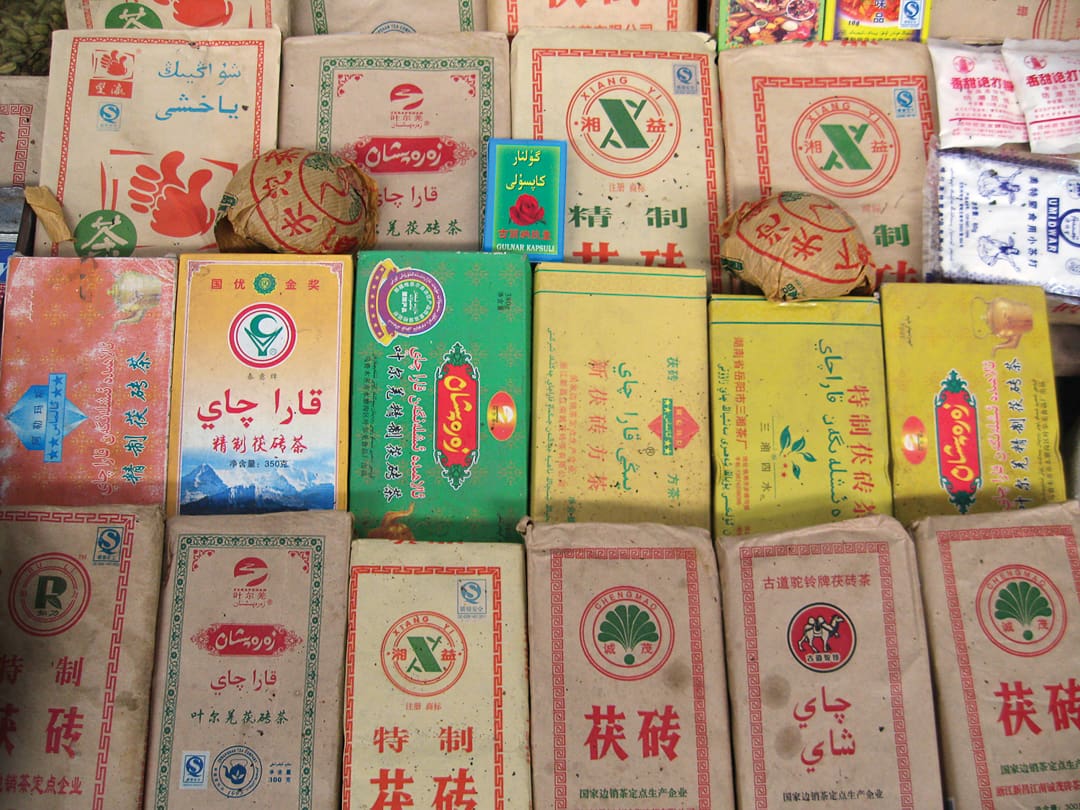
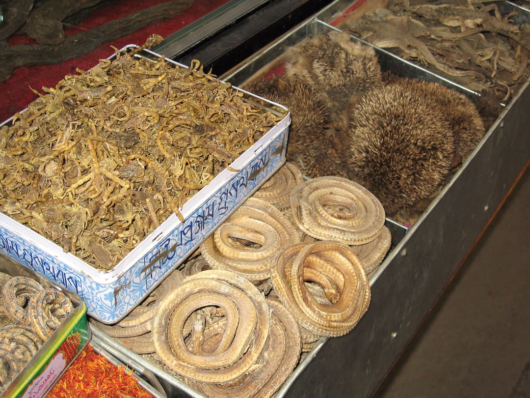
Kashgar is the end of the KKH, and a far cry from Islamabad. The former thrives in its history and is alive with 2,000 years of trade, while the latter is barely 60 years old and is defined by its clinical feel rather than any sense of culture. The lands in between change from one valley to the next: seemingly barren wastelands become verdant basins, and well-connected, developed communities lie just a few miles from hamlets utterly isolated from the outside world. The KKH has opened up northern Pakistan in ways that could never have been imagined even 50 years ago, but lifestyle and identity have, for the time being at least, been largely preserved. Now, whilst the rest of the world’s eyes are distracted and the tour buses are unable to navigate the roads, is the time to go. If and when China’s grand railway and superhighway go through, the Karakoram will never be the same again.
Note: Our passage of the Karakoram Highway is part of a larger attempt to drive the two tuk-tuks overland from Darjeeling, India, back to London. The 15,000-mile journey spans 18 countries and will be the subject of an eight-part television documentary entitled Tracing Tea. More information, video footage, and photos from the journey are online at tracingtea.com.
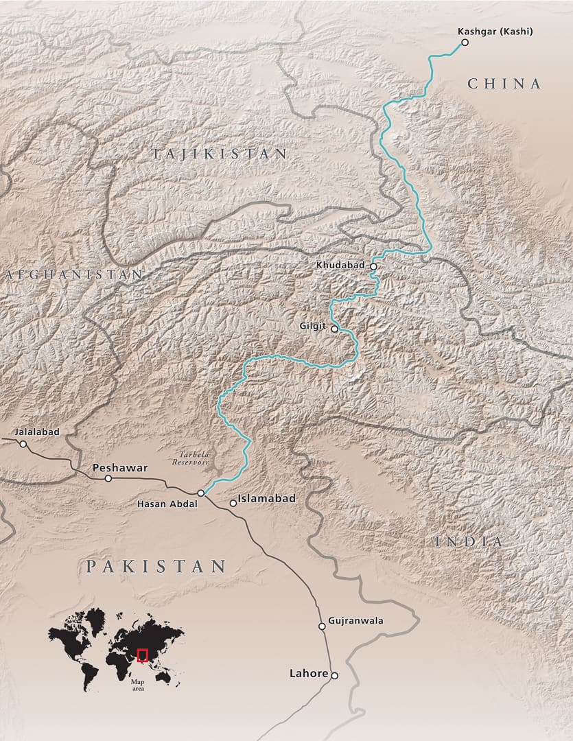
Route: Karakoram Highway Trip. Cartography by David Medeiros (mapbliss.com).
Our No Compromise Clause: We do not accept advertorial content or allow advertising to influence our coverage, and our contributors are guaranteed editorial independence. Overland Collective may earn a small commission from affiliate links included in this article. We appreciate your support.