

Editor’s note: This article was originally published in Overland Journal’s Winter 2020 Issue.
As travelers, we embrace the serendipity and randomness of travel, the paper map unfurled on a dusty hood, each direction yielding a wonder. There are also times when we get two flats in one day and just really, really want to find a campsite. Planning and technology can complement adventure, even if our romantic ideals of exploration spurns visions of the Luddite’s journey. There are tools available today that make overlanding safer and more connected than ever before, allowing us to plug in while we unplug. In the end, these apps are tools, and we can always eschew those conveniences if we choose.
NAVIGATION
The most useful of the programs are navigation applications, which allow physical progress (via GPS) to be rendered over a map layer, shown alongside XML data like waypoints, tracks, and POIs. What started as simple topographical applications that displayed 7.5-minute scanned and rastered paper maps on an iPhone 10 years ago (Topo Maps app) has now grown to feature-rich navigation and planning tools with base layers from both open and curated sources. Most importantly, they have started to become reliable for track recording, which, in our experience, has been buggy at best, or an utter failure at worst. As a result, we still bring a traditional Garmin GPS to ensure our route is securely saved.
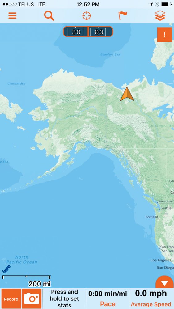
Apps like Gaia and Hema Explorer allow for planning and navigation in areas with little base map data, like the frozen MacKenzie River delta feeding out into the Arctic Ocean. We also used the apps to record tracks and share position data with other groups of logistics partners, as with this screen capture along the shoreline of Antarctica. Opening page: Applications have significantly improved confidence while exploring remote and unfamiliar corners of the globe. During my time navigating an exit glacier of the Greenland ice sheet, I watched our position as we moved between crevasse and water traps covered with a thin veil of ice and snow.
NAVIGATION APPS FALL INTO THREE CATEGORIES
THE JUGGERNAUTS – It is easy to dismiss the most popular (and even native) applications like Google Maps, Google Earth, Apple Maps, and Waze, but they are widely used for compelling reasons. Most notably, their access to user data that helps indicate traffic patterns, closed roads, or the newest routes.
The most useful of all of these is Google Maps, as favorites can be shared across devices and, critically, it allows for the downloading of off-line map data from anywhere in the world. Search for a place, click on the place name, then select the three dots on the top right. “Download Off-line Map” will be an option, and store the data locally on the phone for one year. Waze’s usefulness depends on what city has largely adopted it, but the tool can be a big help when bypassing traffic jams or local demonstrations.
TRACKING AND MAPPING – The next most valuable navigation tools are backcountry-specification applications such as Gaia, onX, Hema, Tracks4Africa, Rever, and others. Their greatest strength is access to topographical map layers, off-line satellite images, and user-contributed routes and data points. The best maps have organizational-validated tracks, which are either done with 100 percent ground truthing by mapping professionals (Hema Maps in Australia), or by aggregating user-contributed data to improve accuracy (Tracks4Africa).
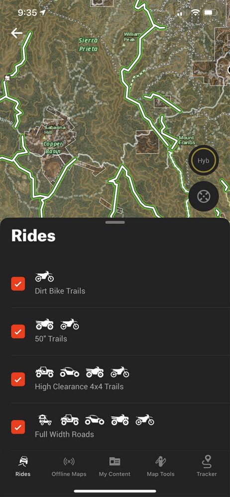
Additional features can include land designation, and route types (e.g., 50-inch or motorcycle-only trails on onX). These apps should also include reliable tracking of routes for future sharing and reference of GPX or KML files.
SUPPORT APPLICATIONS – Support applications like iOverlander are relevant for the traveler and will help solve that 2:00 a.m. campsite problem. But with great power comes great responsibility. Try to avoid using these popular and overused campsites, if possible, to distribute impact. And if you do stay at one, ensure that the campsite is a legal place to crash for the night, and do everything possible to clean up all trash (even trash left by those before you). These user-curated sharing apps are among the most significant developments in vehicle-based travel in the last decade, as they provide key insights into finding water, laundry, or that specialized Syncro Westfalia mechanic.
Editor’s Note: Support applications like iOverlander require a degree of user responsibility, including minimizing the overuse of wild campsites. As these apps have become more popular, it has resulted in significant problems, including campsite closures, agitated locals, and piles of trash and human waste. These apps should be considered travel aids, not guidebooks. As responsible travelers, we should make every effort to distribute impact to other locations, and ultimately, leave the place we stay better than we found it.
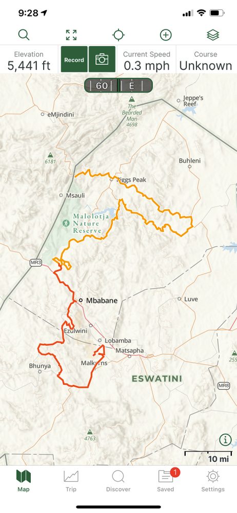
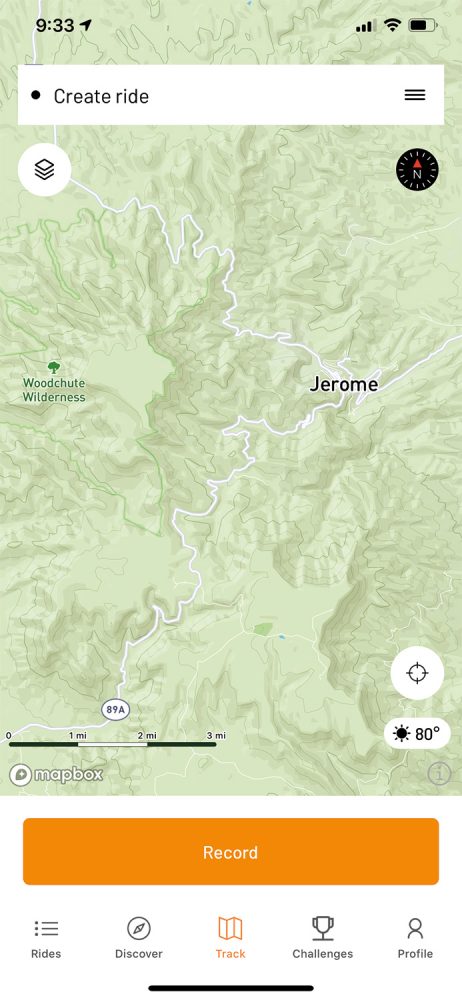
Gaia GPS
It seems as if every solution has its stalwart, and Gaia GPS is the overlanders’ map for the 21st century. Gaia GPS (not to be confused with the Gaia alternative media site for people traveling to, well, conspiracy land) has been around since 2008 and has weathered the software application minefield to become a popular and reliable tool for backcountry travel. The company was founded by Anna and Andrew Johnson and remains independent and employee-owned to this day.

KILLER APP
The crucial deliverable of the Gaia app is reliability—dead-nuts dependability of both tracking and off-line maps. While it might seem surprising, recording a reliable track without crashing or producing erroneous data appears to be a challenge in the space. Yet Gaia seems to have figured it out. I have countless tracks, waypoints, and routes saved to the app, and they all sync flawlessly across devices and the desktop browser. For the remote and international traveler, it is necessary to be able to upload track data as a breadcrumb or save a completed track as a GPX for future reference and sharing. I still remember getting hopelessly lost in a labyrinth of small streets in a Moroccan city, only to reverse my way out thanks to a reliable breadcrumb track. Bells and whistles are good, but a reliable map and track is the DNA of good navigation.
FEATURES
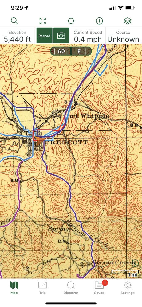
The Gaia app is feature-rich, but it (thankfully) does not look like it. The main screen is taken up almost entirely by the map, and there are a few small and recognizable buttons and pages that are easily accessible. Along the top, there is a search function (which has improved markedly in recent versions), and full-screen, current location, add, and map layer buttons. The map layer button is where the magic happens, allowing adjustments to the map overlay and which base map renders on the screen. The layers are extensive, but critically includes USGS Topo, satellite, and several land-use overlays. International sources are primarily OpenStreetMap and satellite, which is more than sufficient and generally reliable. All of these maps can be saved for off-line use, and there is even a 1900 historic topo layer which sent my explorer vibes into the stratosphere. My complaints with the application are minimal, as recent updates have greatly improved stability. Apple CarPlay is available but rudimentary, and getting the full benefits of the app does require a $40 per year investment. My wish list includes a paid option to access the National Geographic Adventure Maps (like Baja) as a map layer.
The reliable recording of a track is one of the hallmarks of a properly designed app. These tracks are essential for sharing route information, or even backtracking when lost. Gaia has one of the most reliable tracking functions of any app we tested. Gaia is a robust app with multiple base map options, including historic topo maps of areas like Prescott, Arizona. Historic maps provide interesting context to the trip, and hidden gems like old mines and townsites. Through the saved track function, it is possible to reload previous tracks into the active maps, which is helpful for finding the route back to that perfect campsite or fishing spot.
$40/PREMIUM, ANNUALLY | GAIAGPS.COM
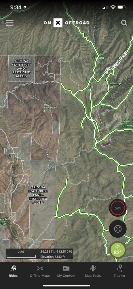
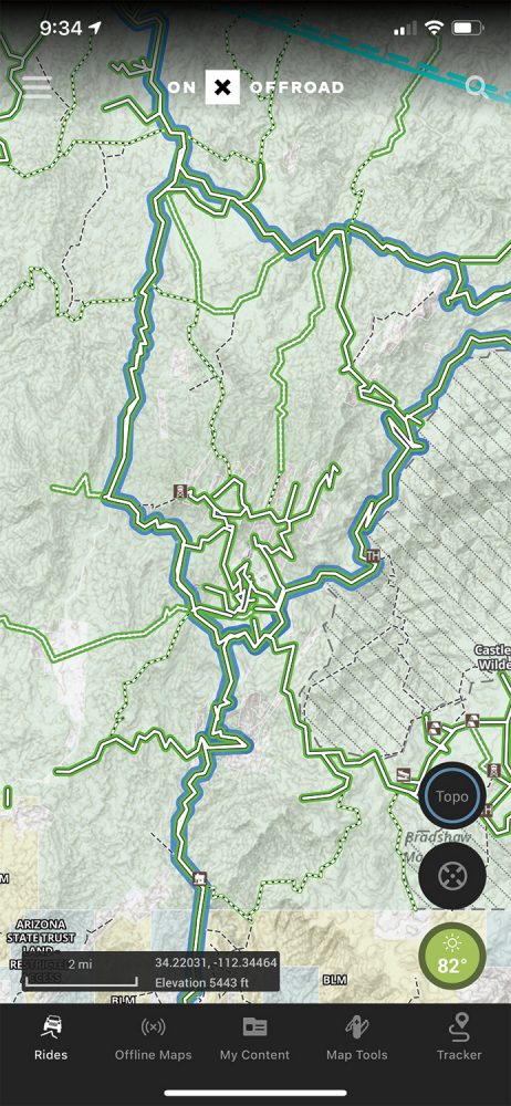
onX Offroad
Every growing industry breeds a disruptor, a company that uses a rapidly expanding market to slingshot innovation and user adoption by a factor of 10 times. And onX has become that influencer within the overland mapping segment, launching a rapid-fire release of new features. The company was started by Eric Siegfried, a hunter and overlander that noted the need for clear land designation while driving in the backcountry. The company also recently hired one of our longtime team members to manage their growing ground-truthed track dataset.
KILLER APP
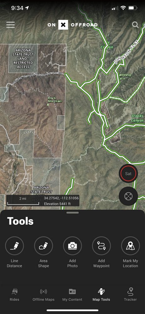
For overland travel, knowing the land designation is critical, since trespassing is just as problematic as crossing State Trust Land without a permit. The company uses a topo or satellite hybrid base map and then overlays with land designation and track data to present an up-to-date accessibility profile. State Trust, BLM, NFS, and private lands are clearly defined by both name and colored map tiles. It is important to note that these features are only usable in North America.
FEATURES
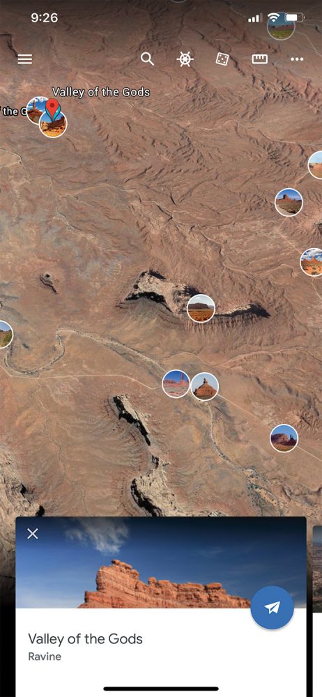
The app is thoroughly modern, with clean icons and minimalist menus. The top of the screen is occupied by a drop-down menu on the left, which accesses account information, sharing, and version data. On the right is a search icon that has proven to be adequate in use, but needs better filtering to improve efficiency (for example, a long list of churches generates when searching for Valley of the Gods in Utah). On the map, there is a toggle button for switching between a topo layer, satellite layer, and hybrid option. This is a quick and convenient feature that improves user efficiency. Below that is a locate button that quickly anchors the center of the map to your current location. At the base of the map are a few thoughtful touches, including a weather icon(which will expand to show a detailed weather forecast). Most notable is the brilliant and compact display of distance scale, current latitude/longitude, and elevation. The bottom menu accesses trail type, saving off-line maps, my content (tracks, waypoints, etc.), map tools, and the tracker. My problems with the app are entirely directed to the tracking feature,
which has proven both unreliable and buggy. The tracking will stop randomly, and it will log erroneous track points, such as in the Atlantic Ocean, near the border of Senegal. However, I suspect this will be resolved quickly, and the rest of the app and rapidly expanding trail inventory makes it all worthwhile.
Editor’s Note: While onX recently hired one of our former editors, Chris Cordes, Overland Journal has no commercial association with the company.
$30, ANNUALLY | ONXMAPS.COM
Tracks4Africa
Africa is a glorious continent, and it requires a good map. That is what prompted T4A founders to start their mapping empire in 2003, providing paper maps, GPS data cards, and now mobile applications for the backcountry explorer. The amount of ground-truthed data is expansive and represents nearly two decades of user-contributed tracks. Their app has improved considerably in recent years and now provides a reliable tool for exploring trails and remote regions of the bushveld. In use, the application is extremely rudimentary but is at least reliable and accurate. There is no tracking function, and each country or regional map must be purchased for a reasonable fee ranging from $3 to $13. Nearly the entire screen is dedicated to the map, with a top bar including an add map icon, a search bar, and filtering function. The best feature is the results icon, which will display selected POIs on the map overlay, including attractions, parks, and campsites. Despite no tracking function, the app has everything else you need.
$3-$13, DEPENDING ON THE MAP | TRACKS4AFRICA.CO.ZA
Rever Pro
Rever was cofounded by Justin Bradshaw of Backcountry Discovery Routes (BDR) fame. Justin has traveled large swaths of the world by overland vehicle, and that is reflected in the user experience. The base app has several useful features, but the value proposition dramatically improves with the Pro version (paid). Pro activates the LiveRide function, providing active ride updates via a link you can share, and also active SMS updates to your desired contacts that receive notifications of your location (uses cellular data). The overall look and feel of the app are perhaps the most attractive in the segment, but the free version does hit you with ads and a fairly heavy push toward the Pro version. Essentially, the free version is a liability for most travelers, as you cannot export GPX data or download off-line maps, so either pay for the Pro version or stay away. The app also has an emphasis on the community aspect, with a social media undertone of challenges, shared rides, friends’ rides, and upcoming meetups. Tracking has been reliable, and the Live-Ride feature and Butler Map BDR tracks are worth the price of admission.
$48/PRO, ANNUALLY | REVER.CO
Hema 4WD Maps
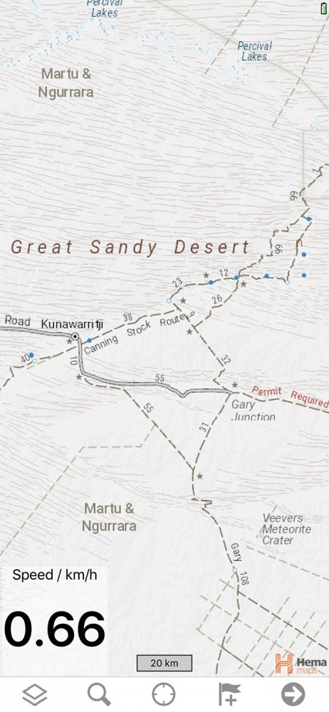
When traveling in Australia, the only serious mapping tool is Hema, and their best offering is their 4WD Maps app, which provides complete off-line maps of the country. I have used it to cross Australia from coast to coast a few times, and though somewhat primitive as an application, you are buying the data, which is the most accurate and validated for this region of the world. The app includes 1.5 gigabytes of off-line data, including dozens of detailed base maps. All of these maps render precise overland track routes, campsites, watering holes, and significant POIs. The main screen has only a few icons along the bottom, including a maps menu, search function (effective), locate button, add waypoint, and toggle to the tracking/settings screen. Tracking has proven to be reliable. The detailed maps include trail names, distances between junctions, and anticipated difficulty as represented by line thickness and dashes. Campgrounds and other services are also shown. There are a few limitations, as the maps do not allow for turn-by-turn, and additional layers come at a fee. However, there is also nothing else like it for exploring the Land Down Under.
$70/ANDROID, $100/APPLE ITUNES | HEMAMAPS.COM
iOverlander
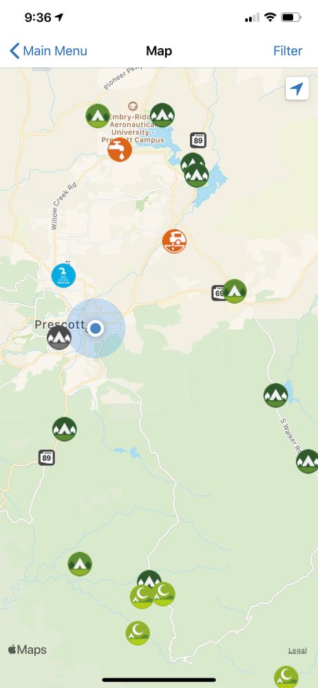
Few apps have resulted in such rapid and broad adoption as iOverlander. The app provides a collection of user-contributed campsites, campgrounds, wild sites, and traveler services. It was started as a not-for-profit by Sam Christiansen and Jessica Mans, and there are no costs associated with its use (although you can donate). The application is intentionally simple, but admittedly buggy, including frequent crashes. However, it is difficult to complain about free, and it just takes some patience to glean the most useful data. The main map screen is where all the magic happens, and its most powerful feature is the filtering menu, which allows for the display of only the service or campsite type you are looking for. I have used this to find wild camping areas throughout North America, although I rarely camp at the exact spot shown (with a few notable exceptions). Other useful features are the amenity icons, which indicate if cellular data is available, etc. It also shows details on the contributor, including the date the site was last visited. This app remains one of the most useful tools for domestic and international travelers.
FREE | IOVERLANDER.COM
Campendium
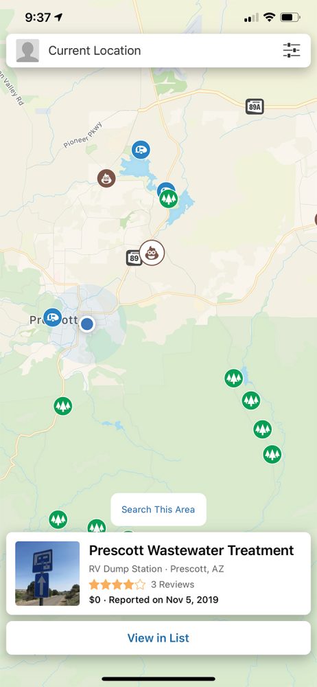
If you are living on the road in North America, Campendium is another useful tool for finding a place to boondock, stealth camp, or resupply. The app is well-curated and free, but it does feature both ads and paid content. The data favors RVers and trailer campers but does filter for dispersed camping. There are several features I like about Campendium, mostly related to the user reviews of various sites and the cell coverage reports (for those of us that work remotely). Each entry has the provision for photographs and additional information like vehicle size restrictions and amenities. All of the functionality feeds off the main map, with only a search bar along the top and filter icon. The filters are effective, but I would like for it to include a “cell coverage” selection in amenities. The map is easy to navigate, and the campsite or service icons are easy to distinguish for planning, including water and dumpsites. Once an icon is selected, a detail window opens at the bottom of the map with more information, including user ranking, cost, and when it was added to the database. While not specifically for the overlander, it is free and serves as another data source for planning.
FREE | CAMPENDIUM.COM
Google Earth
While there may no longer be blank stops on the map, there are certainly places humans rarely, if ever, visit. For those places, this is where Google Earth shines, as it allows for detailed and efficient route planning using satellite data. This is particularly useful when crossing large dune fields, or traveling in countries with poor base map data. Even on the phone (the desktop version is better for route planning), the app allows for quick pin drops, distance measurements, and, most importantly, highly detailed satellite overlays. It’s as close to ground-truthing you can get without boots on terra firma. As an app, it is both interactive and dynamic and even allows for a wonderful surprise or two. There is a randomized POI icon called “Feeling Lucky” that flies you to an obscure and fascinating location on the planet (the last one I checked being Lake Rusanda in Serbia). To get the best from the app for route planning your next crossing of the Sahara, start in the Chrome version and build a travel project. It is far more powerful than can be described here, but it allows everything from route creation to importing images to displaying POIs. Then it all syncs across your devices. In addition, it is worth checking out Google My Maps for creating detailed route files, importing and aggregating GPX tracks, and sharing these with other travelers.
FREE | EARTH.GOOGLE.COM