

Editor’s Note: Colorado’s Million Dollar Highway was originally published in Overland Journal’s Fall 2023 Issue.
They say the Million Dollar Highway begins and ends between the Colorado mountain towns of Silverton and Ouray, but traverse it, and you’ll also discover a plethora of dirt road hideaways laced with abundant scenery, lakes and streams, ample camping opportunities, and the rich history of these once bustling mining mountains.
The 24-mile stretch of US Route 550 that weaves its way from Silverton to Ouray takes about 45 minutes to travel if you don’t stop along the way, but commit to the greater San Juan Skyway National Forest Scenic Byway, and the route stretches 233 miles through the incomparable splendor that is Colorado’s San Juan Mountain Range. Add in numerous off-road jaunts by motorcycle or overland vehicle, and be prepared to explore for weeks.
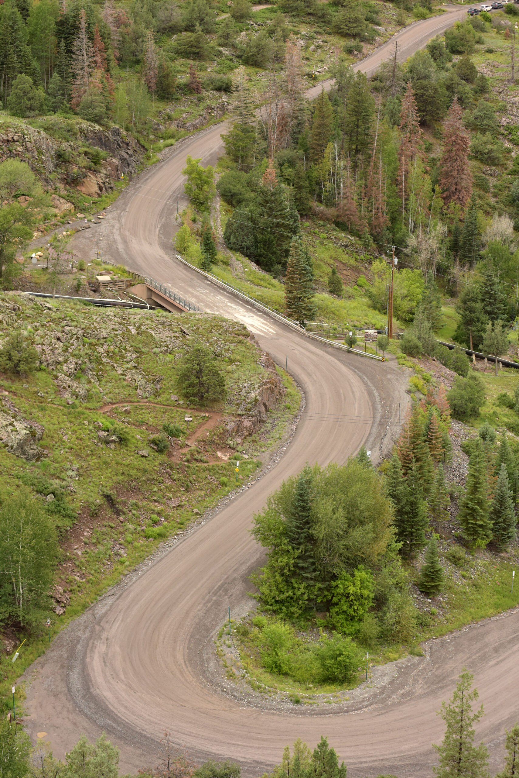
Some argue that the Million Dollar Highway actually begins farther south near Durango. From there, winding curves give way to multitudes of amazing scenery, camping spots, and lakes loaded with fish. Adventurers seeking primitive digs need only to turn off the main road to easily find dispersed camping, or, if you really want a thrill, make a right off US Route 550 a mile past Ridgway on County Road 8 to traverse 30 or more miles of a winding dirt road that arrives among stunning wilderness at Owl Creek Pass (10,118 feet) and Silver Jack Reservoir (8,926 feet).
The Million Dollar Highway has been a source of intimidation for drivers since it was completed in 1924 as an original road in the nation’s federal highway system. Its most frightening area is a narrow stretch through Red Mountain Pass. This section is perched high above the Uncompahgre Gorge. There are no guardrails over these sheer cliffsides (snow plows push the snow over the edges here), and the road is susceptible to fallen rock from more sheer cliffs on the other side. Still, the highway sees its share of 18-wheelers, massive RVs, Jeeps, and motorcycles. Although the road is described as inducing knuckle-grabbing anxiety, the hardest part about traversing the Million Dollar Highway is keeping your eyes off the stunning scenery and on the twisty roads.
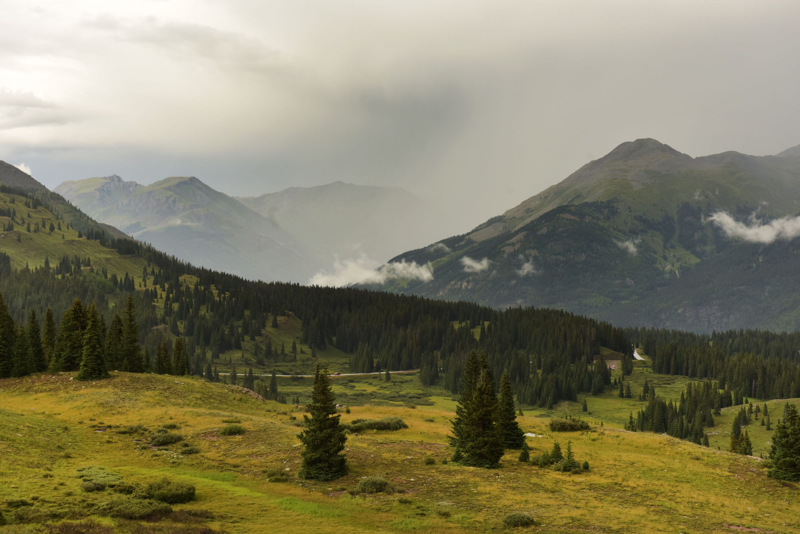
No one knows what the Million Dollar Highway was named for. Some speculate it was the cost of the road, the million-dollar views, or the rich minerals used to pave the original path. Along this route are numerous pull-offs and side journeys, evidence of old mine shafts, rickety wooden railroad tracks left from days gone by, lakes, streams, waterfalls, meadows, valleys, and, of course, great mountain peaks. Red Mountain Pass, at the route’s highest point (11,075 feet), is aptly named for the oxidized minerals that turn its cliffsides and streams red. In the fall, when the golden aspens meet the blazing redness of the hillsides, it is particularly splendorous.
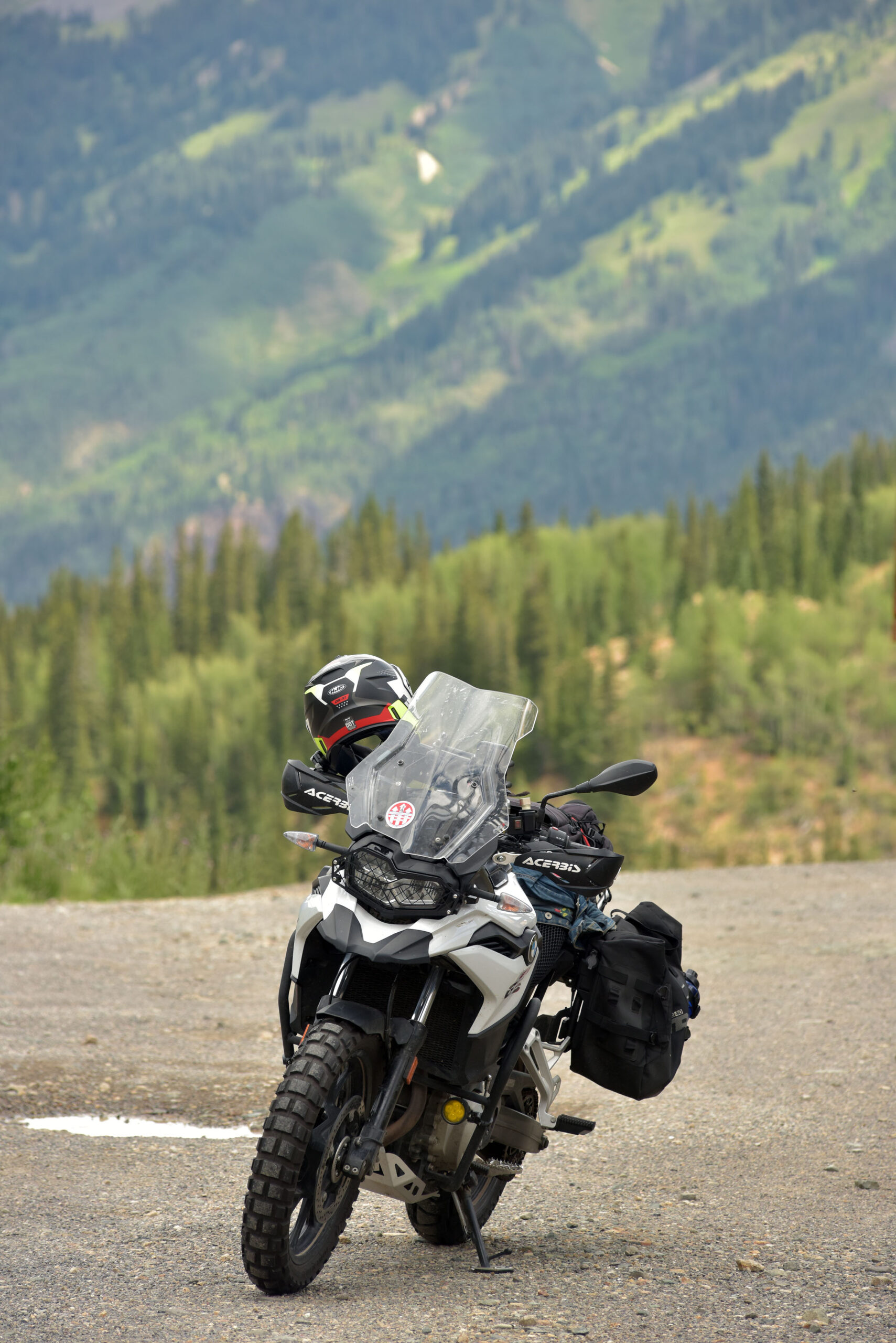
I have traveled the Million Dollar Highway in summer and fall, and the beauty here is unmatched at either time of year. On this last trip in August, I overlanded with friend Reid Hobby of Greenville, South Carolina, and his canine companion, Walter, a 4-year-old Deutsch Drahthaar, in his 2022 GMC Denali. Behind us, we pulled a BMW 1250 GSA, a BMW F 750 GS, and a Husaberg. About 20 miles north of Durango, we pulled off at Haviland Lake for a break. With Reid being a fly fishing enthusiast and Walter being a water lover, it was the perfect stop. Reid didn’t get to throw a line; Walter exacted his owner’s attention with a ball, which he swam to retrieve over and over again.
In the distance, the clouds grew dark, but that didn’t stop people from fishing, paddleboarding, or sunbathing at the water’s edge. A couple of park and wildlife officers stopped to shoot the breeze with Reid and wound up calling in a fishing boat due to an approaching storm.
Further up the road, we stopped at 10,910-foot Molas Pass, overlooking breathtaking swaths of valleys punctuated with lakes and streams and surrounded by numerous peaks. There is a sign at Molas Pass with a description from W.H. Holmes in an 1876 US geological and geographical survey. He said, “If you should, in your imagination, put together in one small group, perhaps 12 miles square, all the heights and depths, the rugged precipices and polished faces of rock, and all the sharp pinnacles and deeply-indented crests, and twenty times the inaccessible summit that both of us have ever seen, you would not have a picture equal to this.”
Of the San Juan’s numerous peaks, 13 reach above 14,000 feet. The road traverses four mountain passes and two national forests (the Uncompahgre and San Juan). The Skyway can be joined at numerous points, but we started by taking US Route 550 from Durango through Silverton, Ouray, and Ridgway, Colorado Highway 62 to Placerville, then Colorado Highway 145 to Telluride and Cortez. The loop finishes on US Route 160 from Cortez through Mancos and back to Durango.
Back at Molas Pass, gray clouds released their water, causing mists to form on the nearby peaks. Just below, a pond of lilies sparkled under the remnants of sunlight. In each direction you take in this wilderness, there is a sight to behold. The Colorado Trail cuts through here just a quarter mile to the north, connecting Durango to Denver in 576 miles of switchbacks, water crossings, wetlands, mud puddles, rocks and scree, whoopdies, and downed trees. Adventure bikes, dirt bikes, full-size 4WDs, and ATVs are allowed on various sections of this trail, amounting to about 100 miles of motorized use. Mountain bikers (allowed on 75 percent of the trail), hikers, trail runners, and horses traverse this backcountry gem as well.
I stopped to talk with a gentleman from Arizona who was also taking in the views. In a sort of karmic, serendipitous moment, we regarded one another along our journeys. He had come to spread his spouse’s ashes, and I had done so six years before, almost to the date. Complete strangers, we hugged and shared tears on Molas Pass, shrouded in the arriving mist and drizzle. Then we returned to our respective trucks to carry on life as usual.
Reid, Walter, and I journeyed that afternoon until we reached Ridgway State Park, about 14 miles north of Ouray, taking the Dutch Charlie entrance to Elk Ridge Campground. The road winds its way up until it reaches a series of campsites overlooking the 1,030-acre Ridgway Reservoir. This isn’t just any ordinary campground. From just about any vantage point, stunning views abound, especially at sunset. I spent two evenings eyeing the reservoir’s blue water and its contrast to the pink sky that appeared over Courthouse Mountain to our east. We would be taking the 1885 cattle trail to dispersed camping along that pink ridge in a matter of days, so for the night, we enjoyed hot showers, water spigots, electricity, and other amenities while we could.

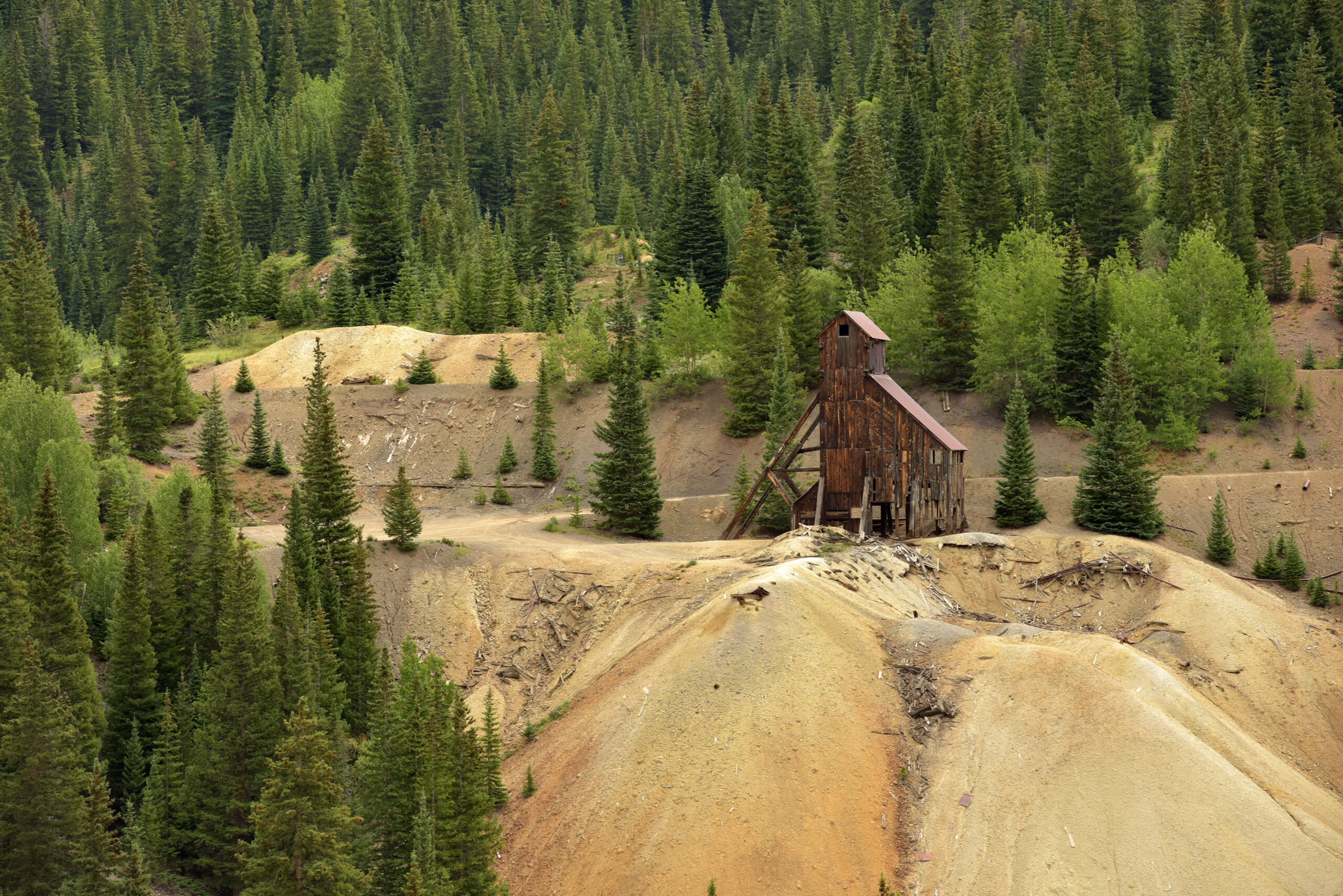
The next morning after a hearty breakfast, Reid and Walter headed to the lake to fish. I took off on my BMW F 750 GS, heading back along the Million Dollar Highway to Silverton. I stopped at a few scenic points: overlooks into valleys with waterfalls and old mine shafts left standing as a testament to the area’s history. This is really where the Million Dollar Highway got its start. In 1880, mining workers needed a way to traverse the steep cliffs here, and thus in 1883, the original dirt road was completed and paid for by a toll system.
During the throes of the famous gold rush, the towns of Ouray (pronounced yer-ā) and Silverton had become the gateway into a prosperous mining district encompassing Ironton, Chattanooga, Guston, Yankee Girl, and Red Mountain Town. It’s said that an estimated $30 million was pulled from these mountains in silver, lead, zinc, copper, and gold. Today, travelers to this area of the San Juans can visit ghosts towns like the Red Mountain Mining District or view the Old Hundred Gold Mine Tour near Silverton, which takes visitors more than 1,800 feet into Galena Mountain for a glimpse of what life was like when prospectors, miners, cooks—even saloon keepers and prostitutes—ruled the hills of the Wild West.
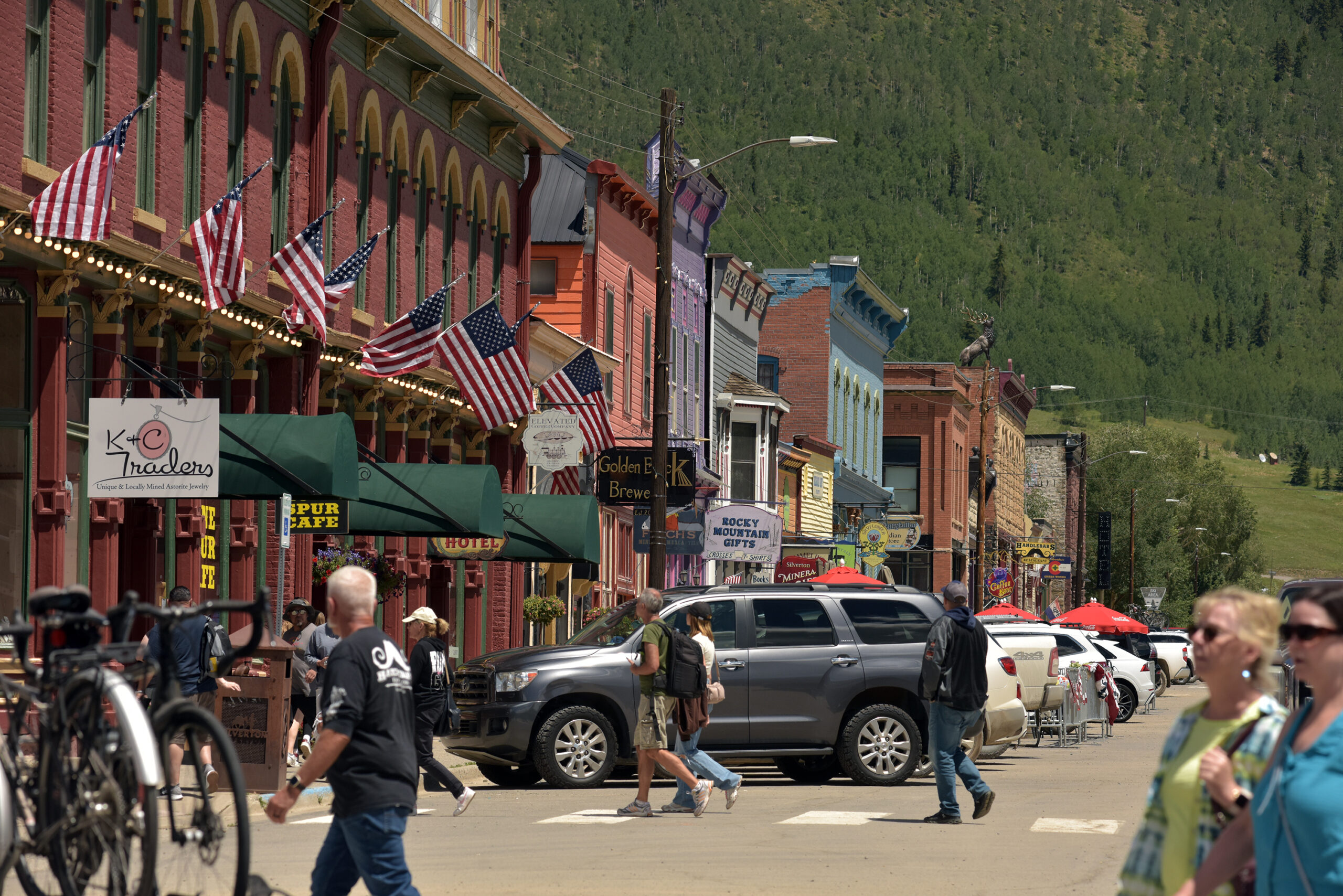
In Silverton, I stopped at the world’s highest Harley Davidson shop and ate French onion soup at the Lone Spur Cafe while Lacey Black played 1800s tunes on an old upright piano. She says she’s been playing there for 32 years. Outside, I met up with Randy Lazar and his mutt, Doc, who sported goggles in the sidecar of his owner’s BMW 1250 GS. The pair were searching out back roads, prospecting for good mining stories. They found them plentiful near Silverton, replete with history on the first railroad lines established in the rugged hills that seem to touch the sky in every direction.
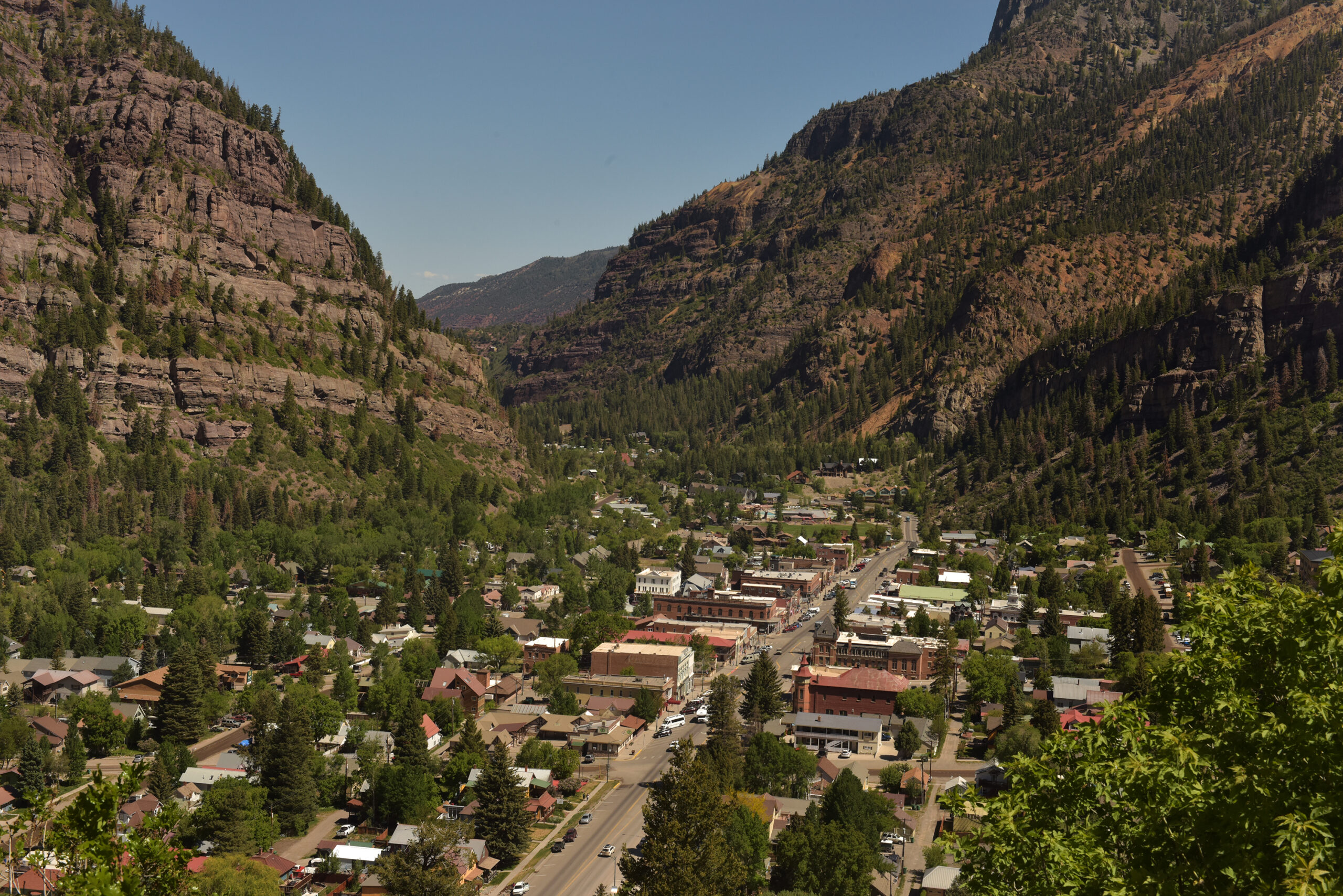
Rain accompanied my trip back to Ouray, but it didn’t seem to slow me down, nor did any of the dozen or so motorcyclists who passed by me in the dripping wet, all happily waving as they passed. As the road through Red Mountain Pass narrows, the rock walls seem to widen. The descent into Ouray is fascinating in itself, a quaint town nestled, literally, among tall peaks and pines. In this area alone, I have seen bears, moose, deer galore, and even a badger waddling across the road.
Now filled with charming shops, eateries, and a wonderful mercantile store that offers an abundance of camping gear, the town was once home to the nomadic Tabeguache Utes, who moved in and out of the area seasonally. Named after their leader, Chief Ouray, prospectors began to show up in the 1860s as diplomatic negotiations failed one by one with encroaching whites. Within 15 years, the natives were overtaken, and the Utes ceded their beloved San Juans. Thus, the Town of Ouray was established.
We opted to spend a last night at Ridgway, then head toward the long, winding dirt road and glistening peaks of Courthouse Mountain in the morning. During the night, a bear visited my tent, then returned twice. I could hear its heavy breathing and grunting close to my tent wall, so I scooted into the center to avoid a claw should a paw rip through. I knew I had no food around, and then I remembered I had washed my hair in berry-scented shampoo earlier. Not my best camping move. This area is home to a number of black bears, and I would dare say a good portion of Colorado’s estimated 20,000 strong. Signage abounds in the park, on picnic tables and posts, even in bathroom stalls, warning of putting food in provided bear safes and not leaving containers open and about.
The road to Owl Creek Pass is well-kept, the dirt and gravel covering the original 1885 aforementioned cattle drive trail, cutting past monumental peaks like Chimney Rock and Powderhorn and hillsides dotted with aspen, spruce, and fir. ATVs and dirt bikes passed us one by one, then came trucks hauling virtual houses on wheels, horse trailers, and side-by-sides. Suffice it to say this is an off-road paradise that’s solid enough for larger RVs.
Just past Owl Creek Pass at 10,114 feet, roads diverge into side trails with plenty of dispersed camping marked by stone fire rings. At one point, we came to an abrupt end and had to back the trailer down a mile or so to a turnaround point. Most of the roads parallel flowing creeks or are near other water sources, such as the 325-acre Silver Jack Reservoir a mile or so away toward south Cimarron, with 80 developed campsites, and nearby Beaver Lake, which has another 11. The water level seemed low for the season, but that didn’t stop boaters and fishermen from casting their lines or two-wheeled adventurers like Reid from exploring the beach left dry by receding water. I had opted to stay back on the bank and turn my GS around. Reid, a seasoned dirt rider, admitted the steep ride in and out was a bit hairy and said I had made a good choice to do so.
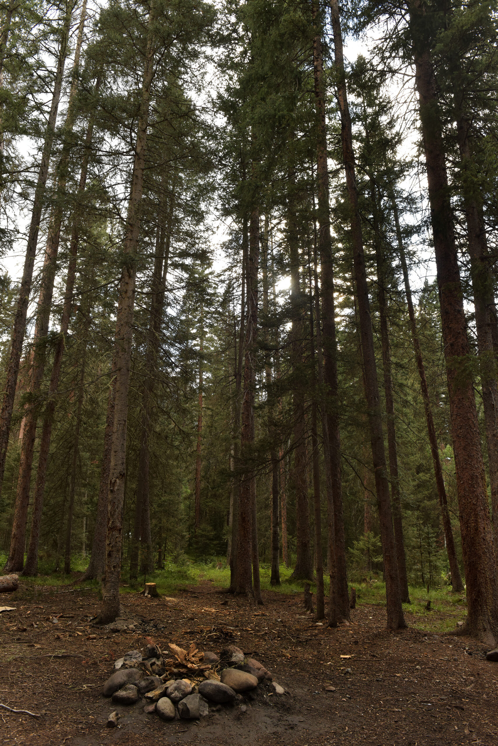
We found a campsite near the East Fork Cimarron River off County Road 861 and pitched our tents. It was a cozy spot with a smooth, earthen floor nestled under spruce trees right next to the water. Mushrooms were happily thriving with the abundance of recent heavy rains and seemed to be sprouting everywhere we looked. Reid and Walter took off immediately for the river with a fly rod. A couple camping nearby came to visit. They told us they were from Montrose and had arrived coming from the opposite direction, where the road is smoother and less steep, although it takes longer that way.
The sound of the river was a comfort and lulled me to sleep that night after spending a few pages with Richard Grant’s Dispatches from Pluto. Late-night tent reading is a wonderful tool to keep bears out of mind and home even closer.

The next morning after coffee, we geared up and headed out on the bikes. The night had been cold, and I was a bit stiff from being wrapped like a burrito in my sleeping bags, but there’s something about the sound of a BMW moto engine meeting the morning stillness that makes the blood flow faster. Like the swift current near our tent and the birds getting busy with singing, the forest here comes alive in the early morning hours, and so into the dawning sunlight we went, searching for our next adventure.
Our No Compromise Clause: We do not accept advertorial content or allow advertising to influence our coverage, and our contributors are guaranteed editorial independence. Overland International may earn a small commission from affiliate links included in this article. We appreciate your support.