upcruiser
Perpetual Transient
Well, I just got back from a spur of the moment trip to explore some new areas and routes in Michigan's Upper Peninsula. With fuel cost being so high I had changed my July trip plans and decided to do some shorter and more local trips in the region and its been absolutely awesome. So often I feel the need to drive thousands of miles to explore backcountry when I have some the best remote backcountry locations out my backdoor. Probably a case of the grass is always greener, but now that I'm spending more time locally I couldn't be happier.
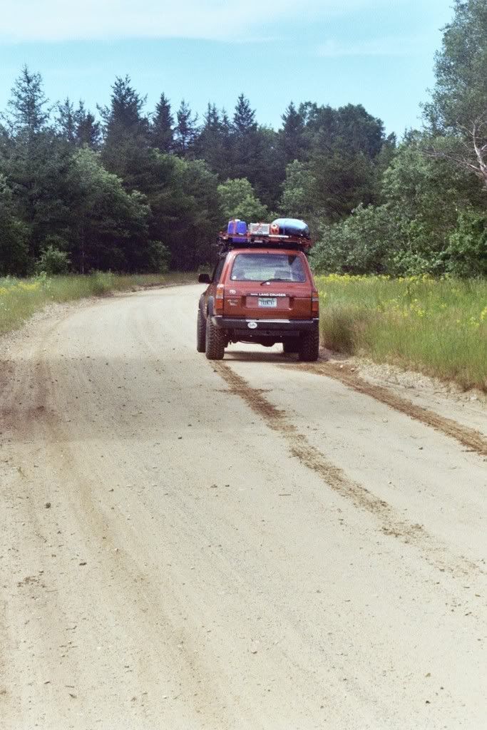
The trip came to be when I was looking over maps on a new topo/atlas I just picked up and saw some routes that looked like fun. I took two full days, just night of camping since I was a bit time constrained. The route crosses east from Marquette on highway 94 towards Munising. About 10 miles out from Munising I started down a series of forest roads, paved at first then leading me onto dirt and across a region rich with lakes, rivers, and great dirt roads where I was literally driving under a tall green canopy of trees.
I was pleased to find the bugs were nonexistant. Hopefully they are done for the summer and my scab covered legs and arms can begin the final stage of healing from black fly bites. No matter what, the ability to stand in the northwoods on a breezy day without the constant twitching motions that all native Yoopers seem to display in the months of June and July. Ahhh
I crossed a short section of highway 94 again and began a northward trek on a route I had not yet taken. 448 is the county road number but it also goes by Highwater truck trail for the first half, then Creighton truck trail for the second half. Essentially the route runs through the western edge of the Seney National Wildlife Refuge. The trail follows numerous rivers including the Manistique and the Creighton. The surface of the road is a soft, mostly packed sand surface that was recently graded and excpetionally smooth. Over the course of this 25+ mile stretch I saw only one other vehicle, a Tacoma that was near the highway outlet on the south edge. Other then that I was all alone and saw way more animal tracks on the road then vehicle.
Working my way north through the corner of the Seney National Wildlife Refuge. My tire tracks are a giveaway to the soft road surface. Note the lack of any other tracks.
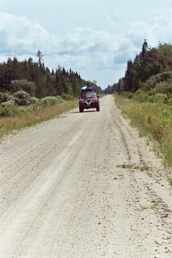
The last stetch of the Creighton Truck Trail runs dead straight.
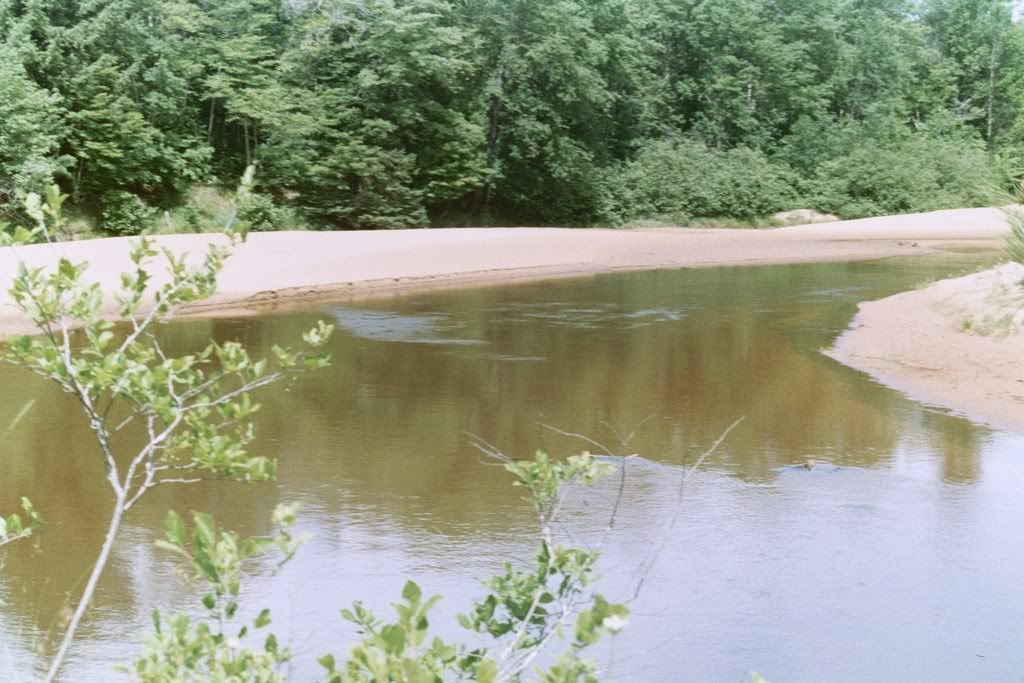
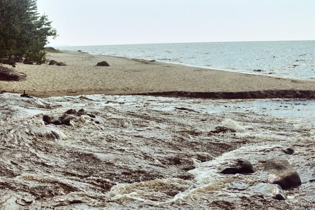
The sandy shores of a bend on the Manistique River. Adventurous souls can take a 5 day paddle from here and end up at Lake Michigan crossing some pretty remote country along the way.
Eventually I hit M28 and took a short jog west of around a mile before connecting again to dirt on county road 454. The road surface was a bit more firm with alot of loose rock and a steep crown. Again, no other vehicles till I crossed pass North Gemini Lake and onto the East/West dirt higway that is H58. H58 is the way to get from Munising across to Grand Marais and to see the majority of Picture Rocks National Lake Shore without the long detour south and around on M28 and M77. H58 is a fairly long route that crosses through old logging tracts, National Lake Shore, National Forest, and State Forest lands. In the past it had miles and miles of soft sandy holes to hard washboard surfaces. Presently they are logging the sides of the road coming from the west and look to be getting part of it ready to pave. A real shame as part of the adventure for the park visitors is overlanding it through here. With all the machinery and tourist traffic it made for an eye-rattling ride that I was happy to be off of as I turned north on to Kingston Lake Rd.
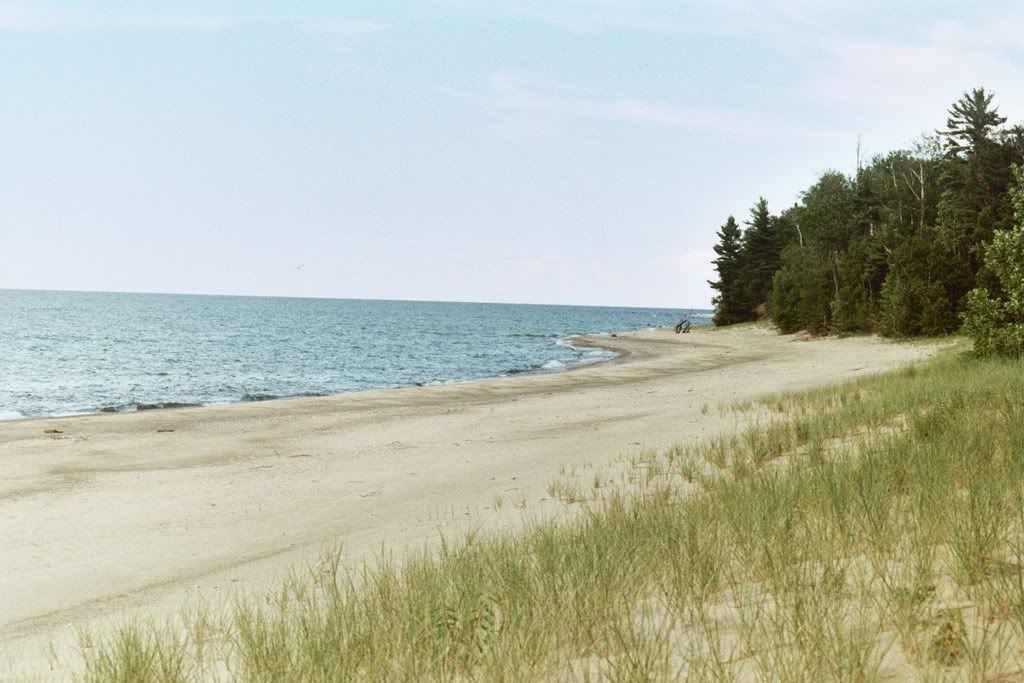
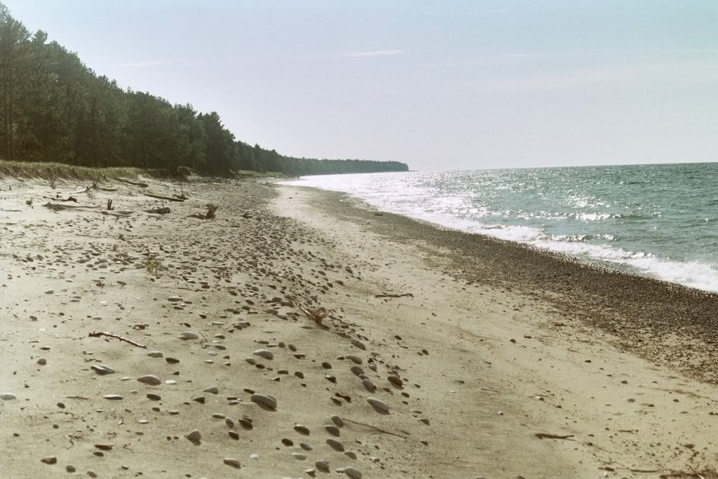
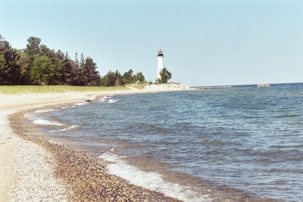
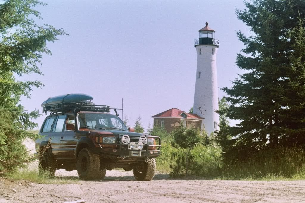
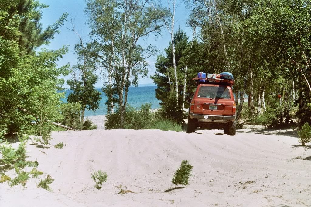
My next stop was 12 mile beach, part of the National Park. I grabbed a quick snack and marvelled in the cobalt blue waters combined with the stiff breeze blowing out of the north. Campers from one of the nearby campgrounds waddled the beaches, bent over like hunchbacks searching relentlessly for agates and cool rocks. The entire Pictured Rocks Lakeshore is beautiful but in peak tourist season, a place I really didn't care to spend much time in. I had just paddled a section of it the week before so I was keeping stops short here. Just down the road a bit I found a nice vacant stretch of beach to relax on.
Back on the road. I was anxious to set camp and still had some miles to cover. Next stop Hurricane beach, a nice little area with a campground at the mouth of the Hurricane River.
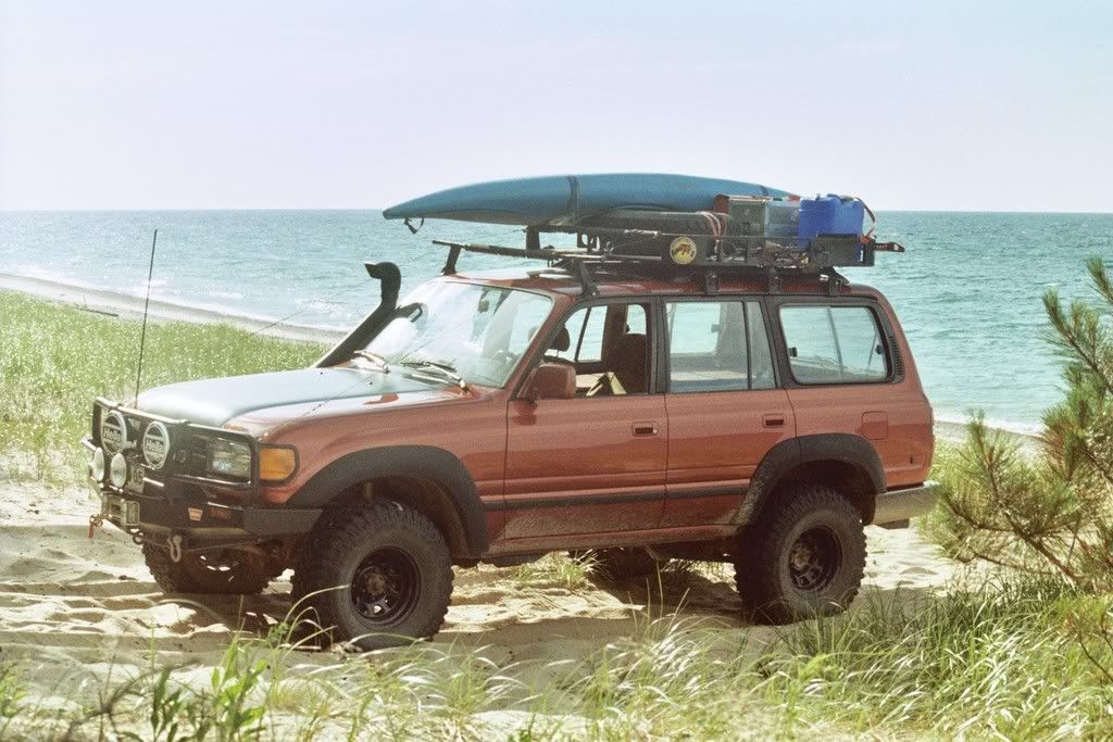
Next stop Grand Marais. I deliberatly skipped the overlook called "Devils Log Slide" on the Grand Sable dunes. Beautiful spot but I was feeling the need for sights without RV's, their occupants, and the Griswald families of the world. Grand Marais is a great little town. A Harbor of refuge, the town is little more then a half dozen business, a couple of great beaches, and a supply point for the throngs of tourist campers venturing into the National Park. I topped of the Cruiser's tank since I wouldn't be seeing fuel again for a long stretch of backcountry. A quck calculation showed that I was averaging about 14mpg. Not bad considering I convered alot of offpavement in those first 100 miles.
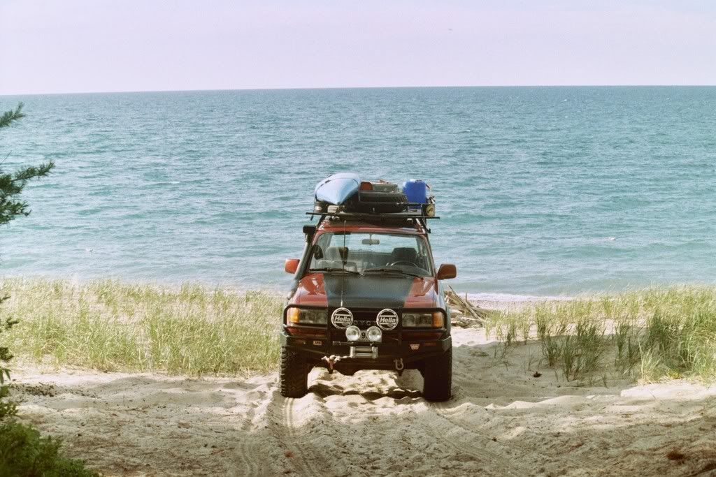
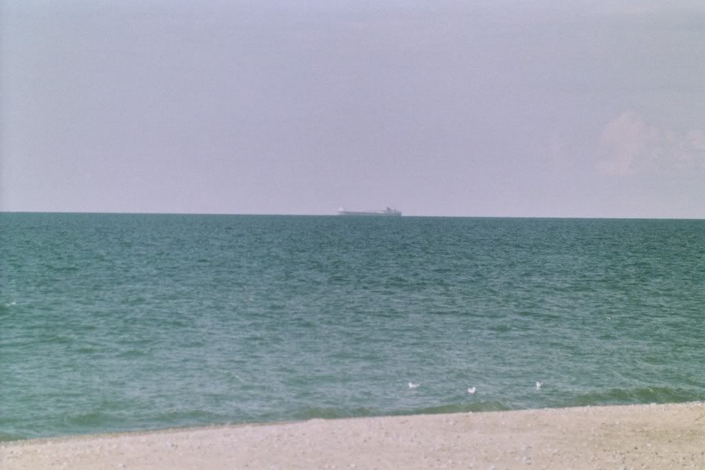
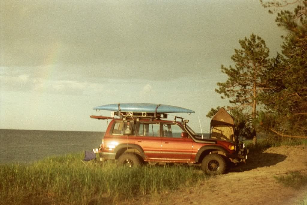
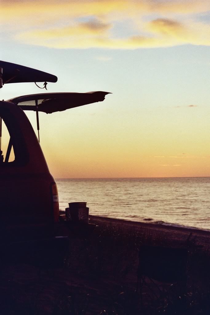
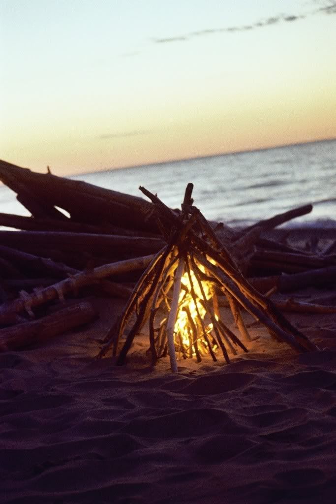
Heading out of town the route east on H58 quickly turns to dirt, thank god because that last stretch of pavement is brutal. Gnarly potholes that I think the locals keep there to ward off downstaters from wandering out into the woods. I found a nice campsite, right on the beach about 1/4 mile off the road. I was anxious to get camp set up so I could relax a bit for the rest of the evening. The great thing about the shoreline from Grand Marais east is the endless remote beaches with no one around.
The trip came to be when I was looking over maps on a new topo/atlas I just picked up and saw some routes that looked like fun. I took two full days, just night of camping since I was a bit time constrained. The route crosses east from Marquette on highway 94 towards Munising. About 10 miles out from Munising I started down a series of forest roads, paved at first then leading me onto dirt and across a region rich with lakes, rivers, and great dirt roads where I was literally driving under a tall green canopy of trees.
I was pleased to find the bugs were nonexistant. Hopefully they are done for the summer and my scab covered legs and arms can begin the final stage of healing from black fly bites. No matter what, the ability to stand in the northwoods on a breezy day without the constant twitching motions that all native Yoopers seem to display in the months of June and July. Ahhh
I crossed a short section of highway 94 again and began a northward trek on a route I had not yet taken. 448 is the county road number but it also goes by Highwater truck trail for the first half, then Creighton truck trail for the second half. Essentially the route runs through the western edge of the Seney National Wildlife Refuge. The trail follows numerous rivers including the Manistique and the Creighton. The surface of the road is a soft, mostly packed sand surface that was recently graded and excpetionally smooth. Over the course of this 25+ mile stretch I saw only one other vehicle, a Tacoma that was near the highway outlet on the south edge. Other then that I was all alone and saw way more animal tracks on the road then vehicle.
Working my way north through the corner of the Seney National Wildlife Refuge. My tire tracks are a giveaway to the soft road surface. Note the lack of any other tracks.
The last stetch of the Creighton Truck Trail runs dead straight.
The sandy shores of a bend on the Manistique River. Adventurous souls can take a 5 day paddle from here and end up at Lake Michigan crossing some pretty remote country along the way.
Eventually I hit M28 and took a short jog west of around a mile before connecting again to dirt on county road 454. The road surface was a bit more firm with alot of loose rock and a steep crown. Again, no other vehicles till I crossed pass North Gemini Lake and onto the East/West dirt higway that is H58. H58 is the way to get from Munising across to Grand Marais and to see the majority of Picture Rocks National Lake Shore without the long detour south and around on M28 and M77. H58 is a fairly long route that crosses through old logging tracts, National Lake Shore, National Forest, and State Forest lands. In the past it had miles and miles of soft sandy holes to hard washboard surfaces. Presently they are logging the sides of the road coming from the west and look to be getting part of it ready to pave. A real shame as part of the adventure for the park visitors is overlanding it through here. With all the machinery and tourist traffic it made for an eye-rattling ride that I was happy to be off of as I turned north on to Kingston Lake Rd.
My next stop was 12 mile beach, part of the National Park. I grabbed a quick snack and marvelled in the cobalt blue waters combined with the stiff breeze blowing out of the north. Campers from one of the nearby campgrounds waddled the beaches, bent over like hunchbacks searching relentlessly for agates and cool rocks. The entire Pictured Rocks Lakeshore is beautiful but in peak tourist season, a place I really didn't care to spend much time in. I had just paddled a section of it the week before so I was keeping stops short here. Just down the road a bit I found a nice vacant stretch of beach to relax on.
Back on the road. I was anxious to set camp and still had some miles to cover. Next stop Hurricane beach, a nice little area with a campground at the mouth of the Hurricane River.
Next stop Grand Marais. I deliberatly skipped the overlook called "Devils Log Slide" on the Grand Sable dunes. Beautiful spot but I was feeling the need for sights without RV's, their occupants, and the Griswald families of the world. Grand Marais is a great little town. A Harbor of refuge, the town is little more then a half dozen business, a couple of great beaches, and a supply point for the throngs of tourist campers venturing into the National Park. I topped of the Cruiser's tank since I wouldn't be seeing fuel again for a long stretch of backcountry. A quck calculation showed that I was averaging about 14mpg. Not bad considering I convered alot of offpavement in those first 100 miles.
Heading out of town the route east on H58 quickly turns to dirt, thank god because that last stretch of pavement is brutal. Gnarly potholes that I think the locals keep there to ward off downstaters from wandering out into the woods. I found a nice campsite, right on the beach about 1/4 mile off the road. I was anxious to get camp set up so I could relax a bit for the rest of the evening. The great thing about the shoreline from Grand Marais east is the endless remote beaches with no one around.
Last edited:
")