Winter 4X4 Jamboree with stop at Indecline's Gol Dome Art Exhibit

boyfester

Observer
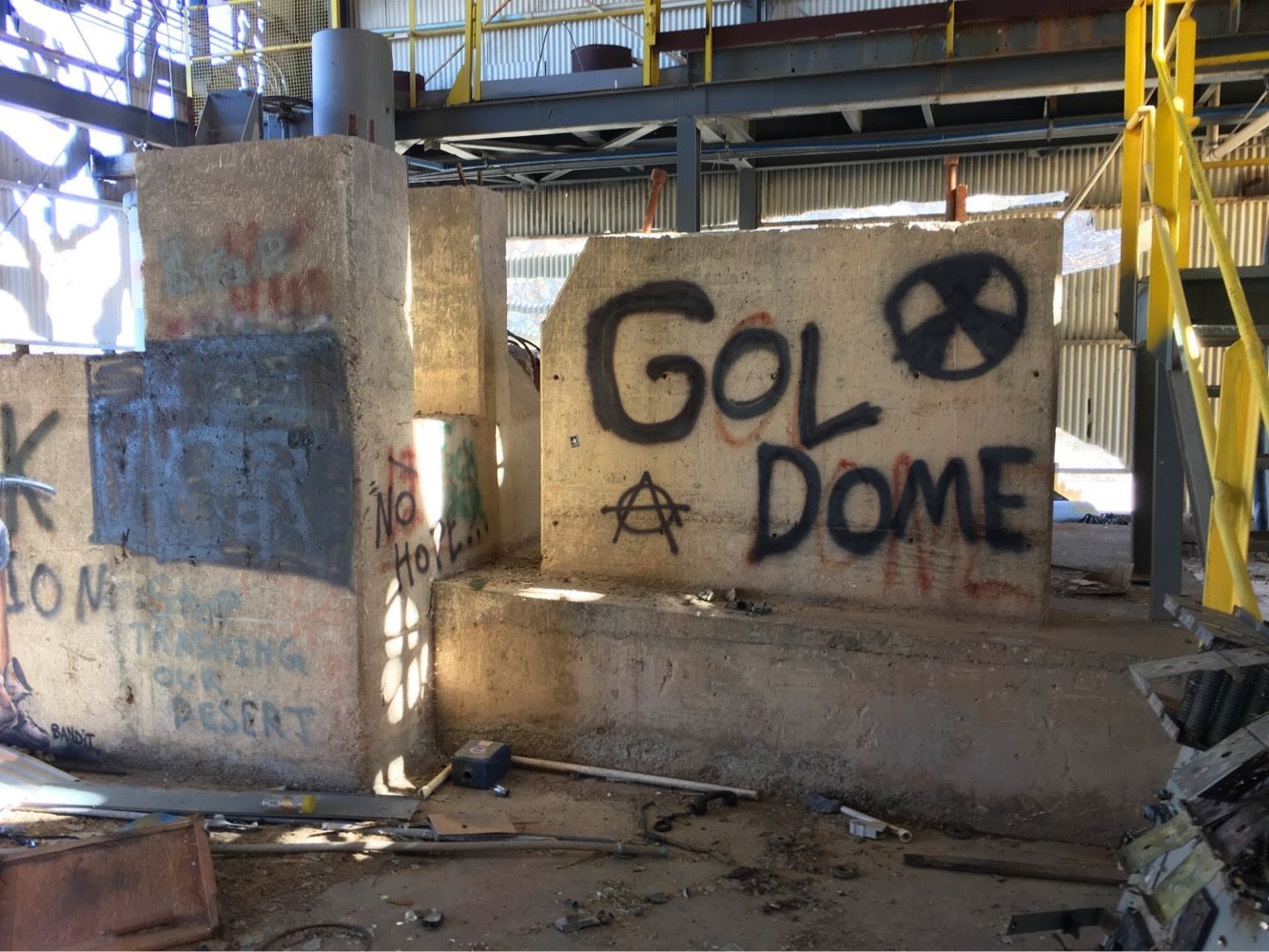
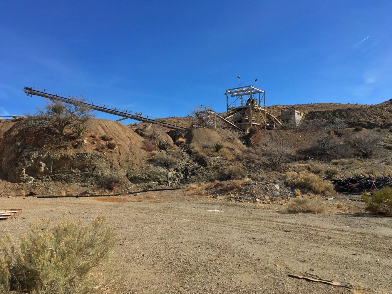
I attended the 4x4 Winter Jamboree in Sand Hollow OHV Park outside of Hurricane (pronounced 'Hurricun' to the locals), Utah last January. On the drive out from Orange County, CA I decided to visit the old GolDome mill site in the Mojave Desert. I had seen Instagram posts of the former superfund site being vandalized by a anarchy group called Indecline and wanted to see the damage. After some hours on Google Earth and clues left behind on their page, it wasn't too difficult to find. The artwork was really cool, but it was a shame to see what this rogue group did with a bunch of plasma cutters.


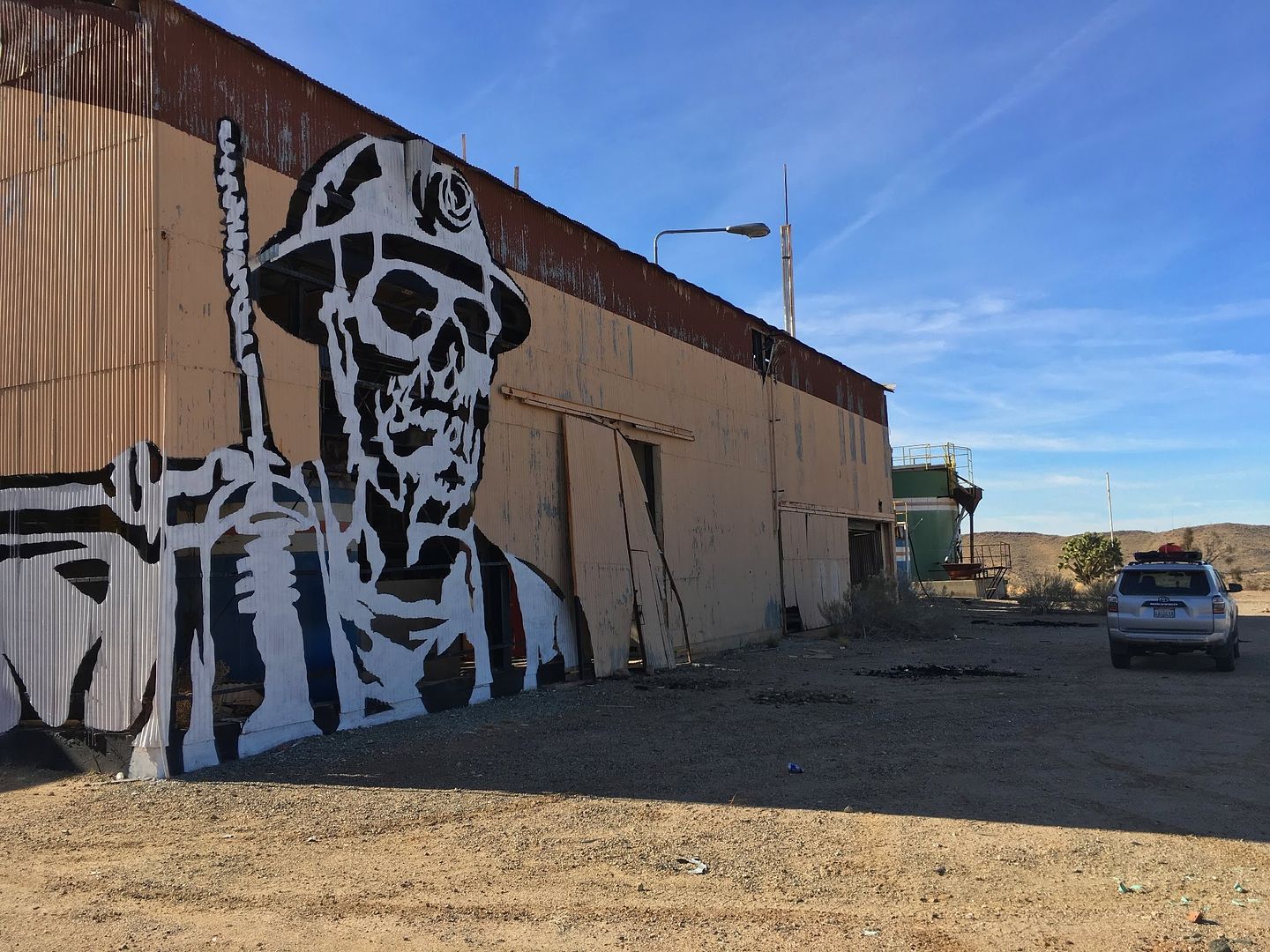
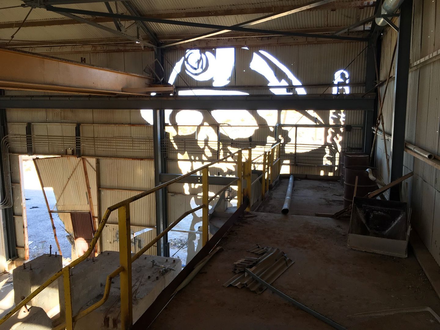
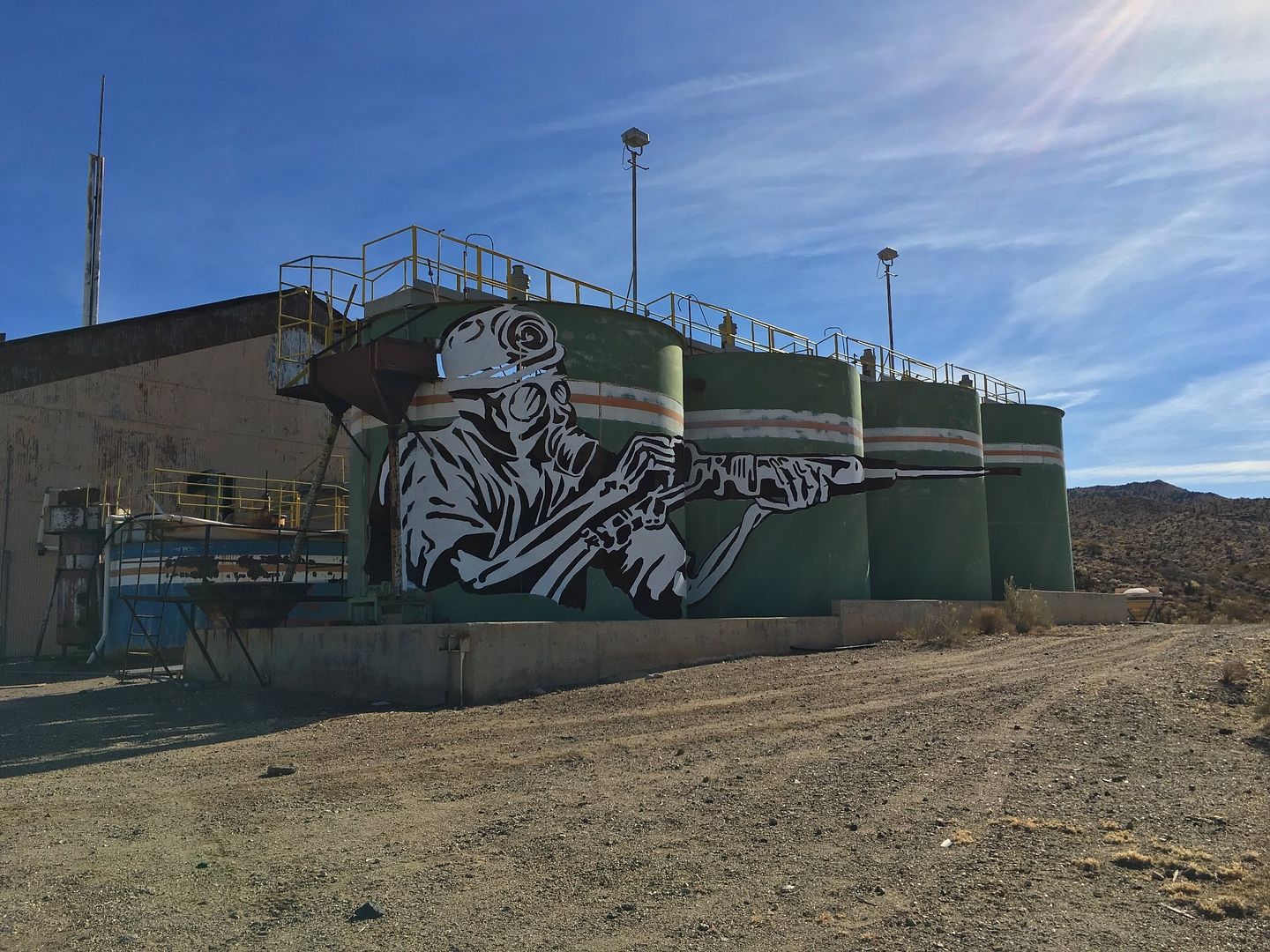
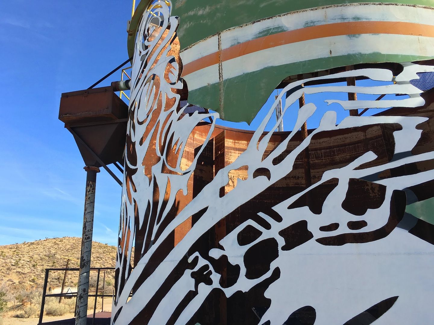
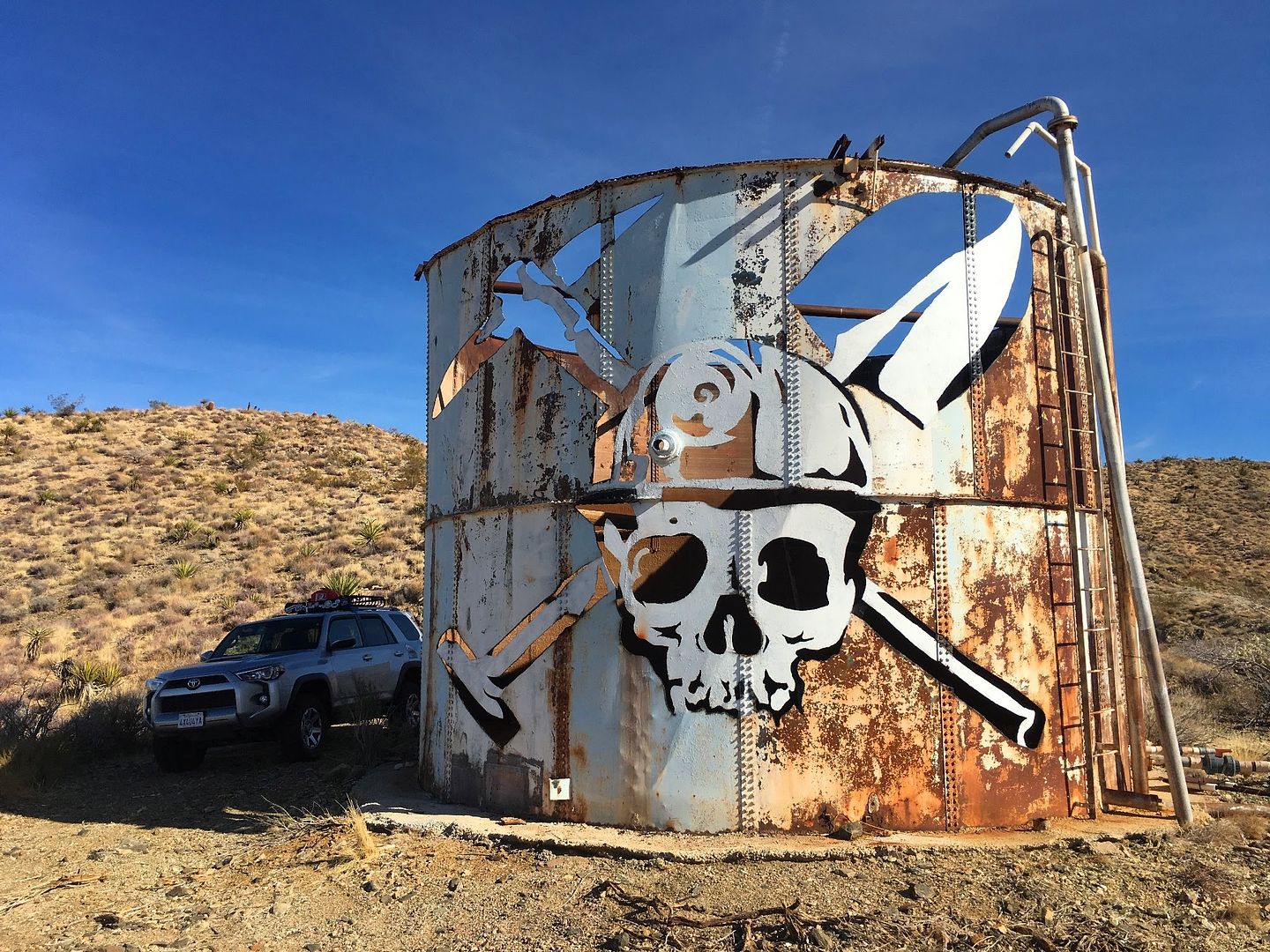
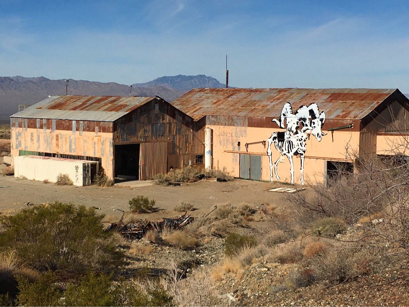
I came here about five years ago and it was a really cool, old mill to visit. It really was a shame to see it vandalized so much.


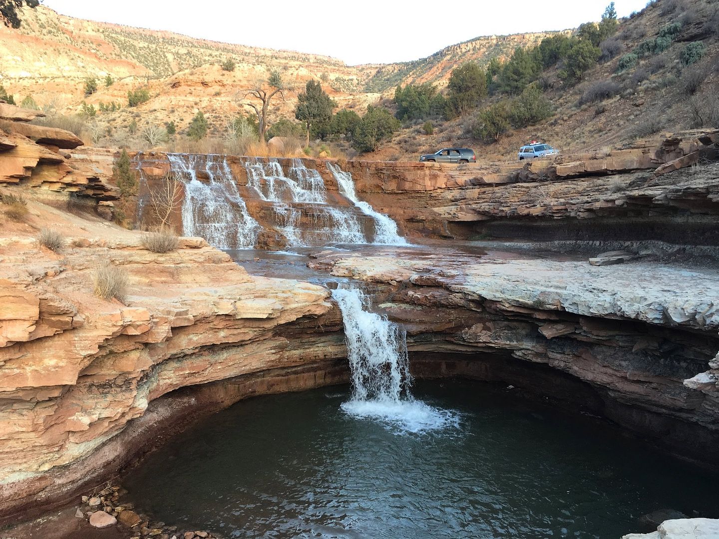
I arrived in Hurricane a little early, so I decided to take a quick trip over to Toquerville Falls which is outside of town. The road was a little rough, but nothing really worth airing down for. Once I reached the falls, it was a sight to behold.


<iframe width="640" height="360" src="" frameborder="0" allow="accelerometer; autoplay; encrypted-media; gyroscope; picture-in-picture" allowfullscreen></iframe>
 

boyfester

Observer
The first day of the Winter Jamboree started with an amazing sunrise and tons of off-roaders lined up in an assortment of columns for each of the different runs. Rigs from stock to heavily modified showed up. And, of course, with the hundreds of Jeeps came the Jeep guys saying that the few Toyotas and Nissans that showed up would have problems at this Jamboree. It was really fun showing all of them what the 5th Gen 4Runner was able to do. I can't tell you how many times I heard "I can't believe where that Toyota went today."


I signed up for the Bzzackwards Trail with a rating of "4" and it was great, except for the waiting. And there was a LOT of waiting. This was my first time attending a jamboree and I found out that waiting is pretty much the norm. I'm more used to wheeling in smaller groups where a larger distance is covered every day. We stopped a ton for each and every obstacle. At one point along a section of the trail (that was about one truck width wide), it took us about 2 hours to let another group of similar size go by in the opposite direction. Many of us were frustrated.


This was only half of our group. We had about 22 rigs in our group and so did the other group that we met going the opposite direction a few hours later.


Instead of complaining to the Trail Leader, which would amount to nothing, I started talking to another guy who was unhappy too. That night, he and his dad and I met at a pizza place and with the help of a local, garnered a ton of GPX routes of the area. It was then that we both opted to bail out of the Jamboree. We had already paid our dues and the fees were going to a good cause of keeping the trails open, so we more than happy to leave and free up some space on the trails for the other attendees. With the help of the local gent, we ended up creating our own routes for the next two days throughout southwestern Utah.
 

boyfester

Observer
With Thursday's adventure in the books, our Friday trip started at 8am as we headed to the Barracks Trail. The Barracks Trail is open year round and throws a little bit of everything at you: water crossings, sand, steep hill climbs/descents, private ranches, pin-striping, and, best of all, kick ass views of Utah's red walled mountains. We took pavement about 30 mins east to Hildale, UT and fueled up. Hildale is the home of the Fundamentalist Church of Latter Day Saints where plural marriage is still practiced. Hats and shirts were on sale at the local gas station.


The scenery is amazing as soon as you hit dirt. All of the photos below are from the Barracks Trail throughout the day.


With the two of us, we covered almost 100 miles in the same amount of time that it took us to do 7 miles the previous day. We had a great time and were ready for the next day covering many of the same miles that 4XOverland did in the Aug/Sept 2017 issue of 4WD Toyota Owners Magazine. I had replied to the author of the magazine article back in Sept 2017 and he shared all of his gpx tracks with me.


boyfester

Observer
After a killer Friday trip, we met again at night to plan our Saturday trek. We opted to check out the Hurricane Cliffs area, but wanted to check out Smithsonian Butte along the way. We ended up going from Hurricane to Grafton, then to Smithsonian Butte, before heading south to Hurricane Cliffs, and back up to Hurricane. The morning weather started with a pelting of cats and dogs which made driving along the red clay roads scarier than driving on black ice at night. A couple of times I almost wiped out when driving through some deep ruts and the steering wheel was grabbed out of my hands.

The morning started at the Grafton cemetery where we aired down and took some photos in the pouring rain.


Some weird, stacked chair art in Grafton.


We left Grafton and began to ascend the mountain of Smithsonian Butte when snow began to fall. The snow actually provided some traction instead of sliding all over the place with the wet clay. It was really cool seeing the red tire tracks underneath the white snow.


Up next was the drive south towards the Hurricane Cliffs. This was the same route the 4XOverland Toyota guys drove. The trail was full of yellow flowers and lava rocks. Very cool to see!


Next up was the descent down the Hurricane Cliffs. This was sketchy as it was wet and slippery and only a couple of pathways to go. We ended up spotting each other through this section instead of getting any photos.

The drive from the cliffs back to Hurricane was really nice and muddy.


The trail ended at the trail-head to the Sunshine Trail.


At the end of the day, we again covered almost 100 miles in about 7 hours. It was a killer day made better by making new friends and enjoying some tasty BBQ at the end.
 

boyfester

Observer
Sunday was spent driving home to Orange County. On the long drive back I decided to take a little longer and drive down Zzyzx Road. I've driven past this exit too many times without knowing what's at the end. I had heard of the springs but never checked them out personally. The place was a ghost town. I'm sure I was being watched, but there wasn't a soul in sight. It was cool to see the Traveler's Monument along the Mojave Road from the site too.


nomad661

Active member
Awesome report! Thanks!

And yea, I've been on some 15+ rig group runs that proved to be a bit frustrating. Watching some 30k+ plus rigs request a spotter on "obstacles" that could be driven by a stock Subaru Forester with a decent driver def made my eyes roll.
 

Forum statistics

Threads
185,823
Messages
2,878,599
Members
225,378
Latest member
norcalmaier
Top