unURBAN Adventures - Alaska to Argentina to AFRICA!

unURBAN

Adventurer
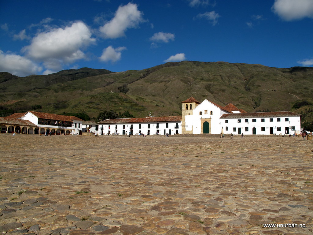
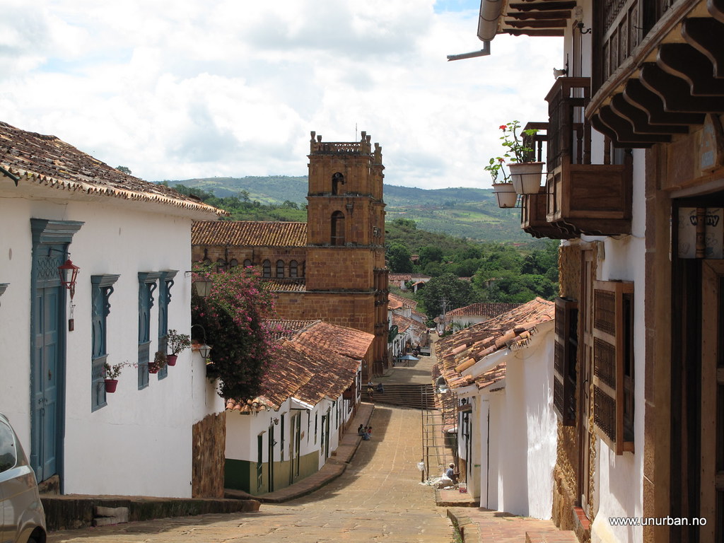
After spending too much time in heavy traffic on Highway 45, we had enough of big trucks and it was time for a detour. From San Gil we took off up to the colonial town of Barichara. It was a really picturesque town with narrow streets, white painted and well renovated houses.
.
5809135058_b14f33be74_b_d.jpg

.
5808575443_08368d2f58_b_d.jpg

.
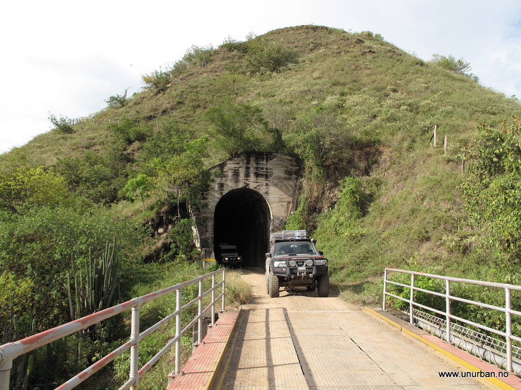
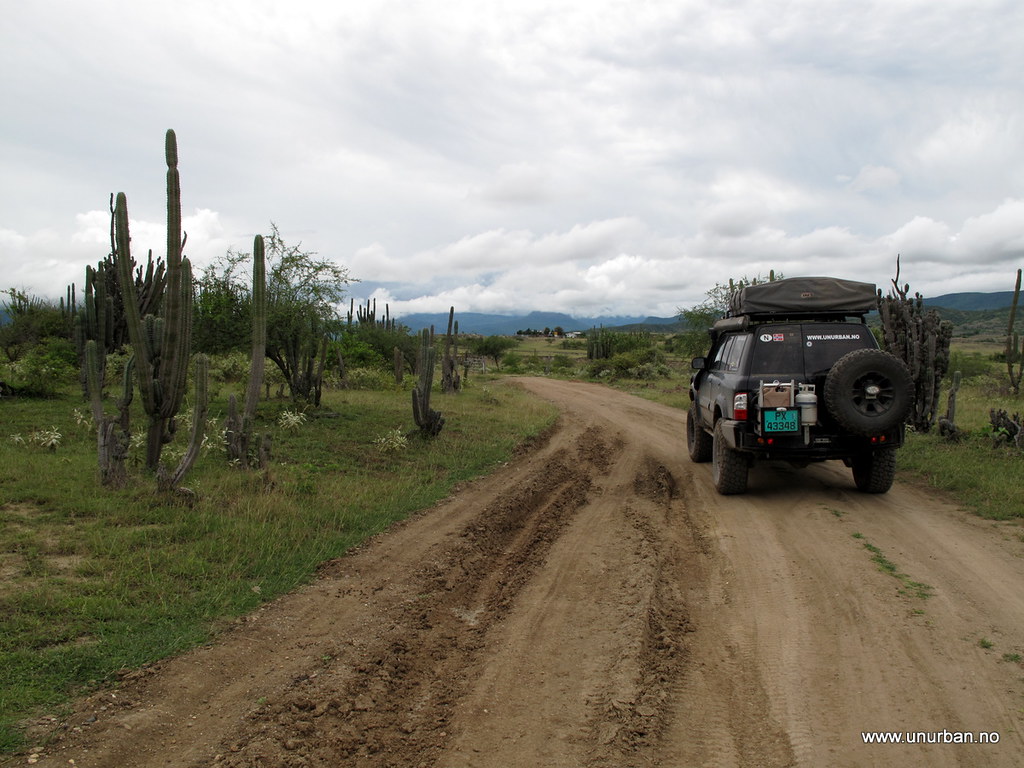
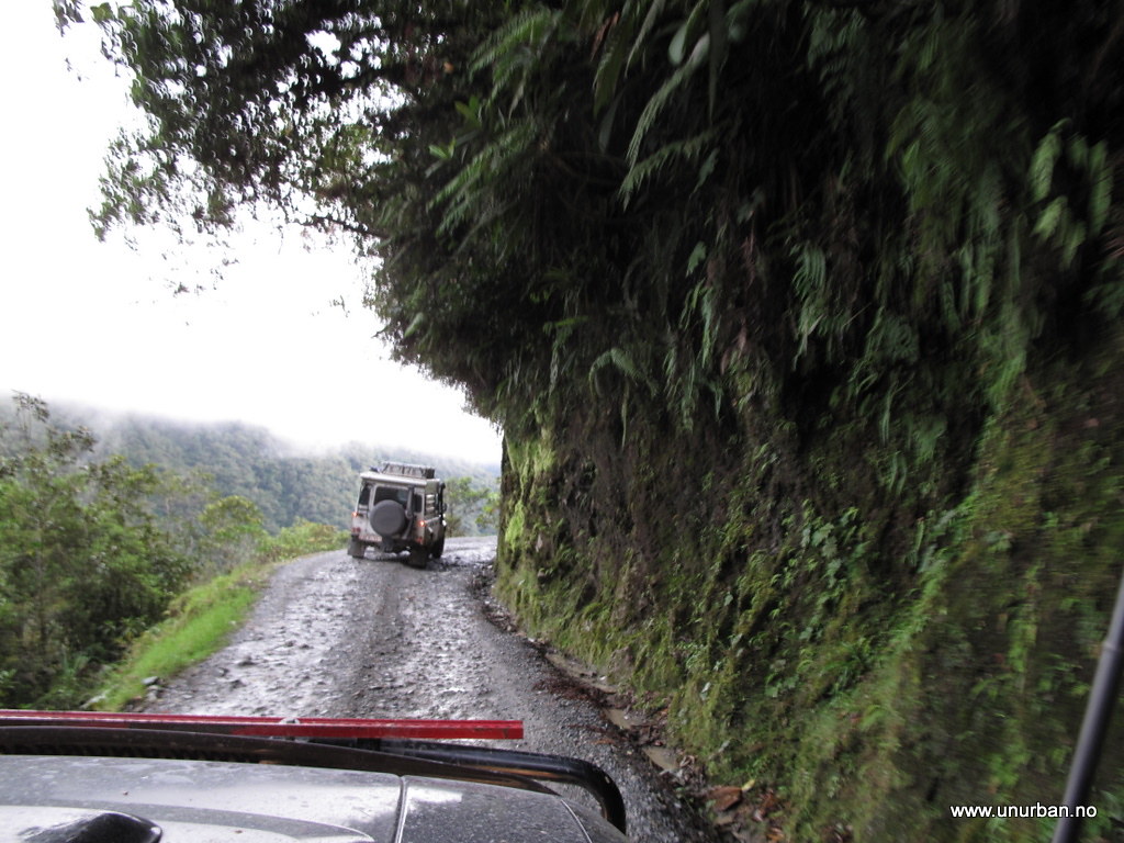
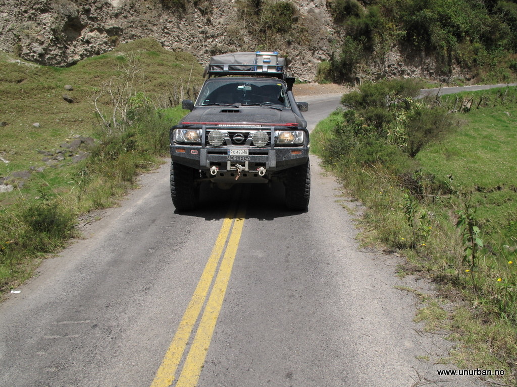
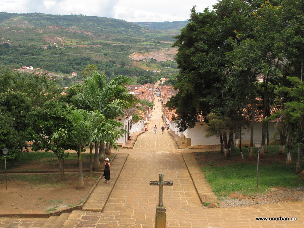
Our maps showed a road (dotted lines), or actually several, going south west from Barichara, but our GPS did not show any connecting roads. It was back to the old way of navigating where you actually have to look for roads going in the right direction and, in the end when we cannot figure it out, ask the locals for direction.
.
5808573529_d73145a835_b_d.jpg

.
The road from Barichara
.
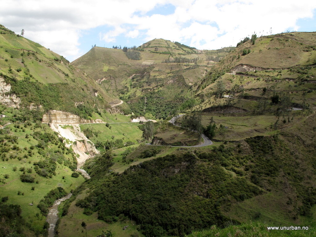
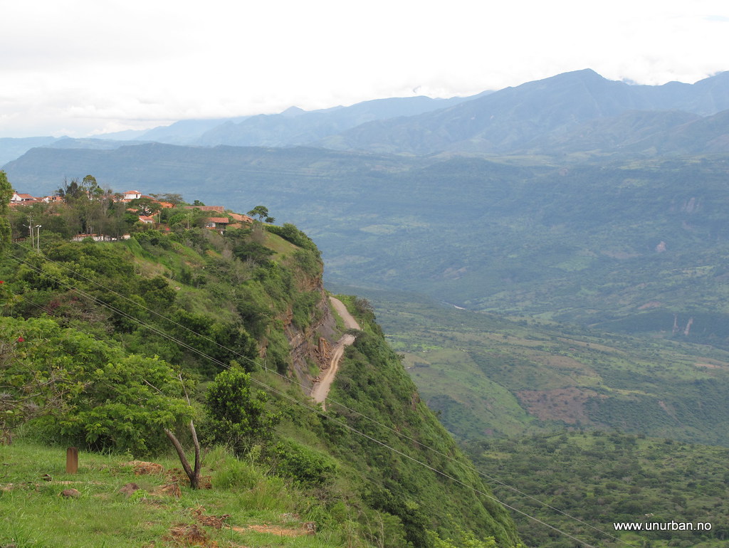
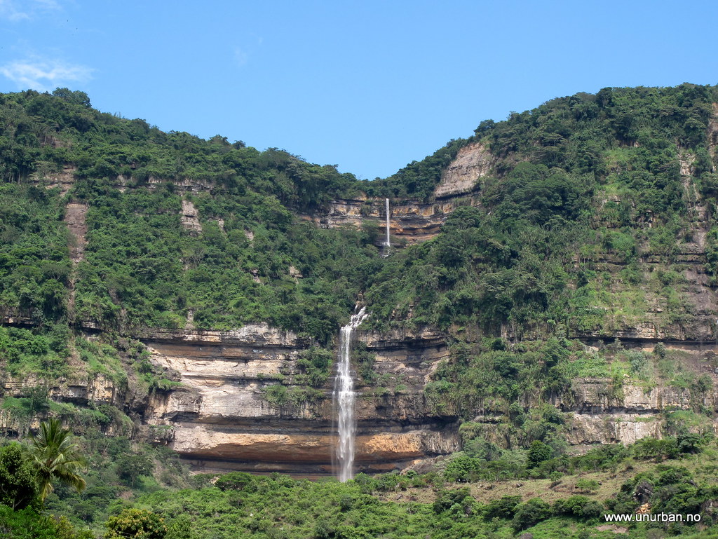
While looking for the right road we ended up in the small village of Guane that was also a nice, white, old village. With some local info saying that we had to go a bit back and take the dirt road towards Galan, we turned around, found the right dirt road, and continued the drive down the valley. Around a corner we had an amazing waterfall in front of us.
.
5809144932_d08ff8877e_b_d.jpg

.
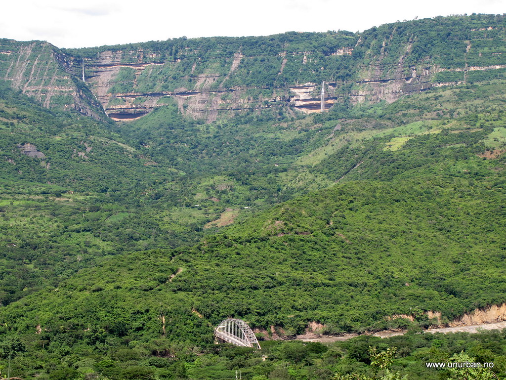
Further down the road when we looked back, we could see actually two waterfalls.
.
5809147870_f8b08bf736_b_d.jpg

.
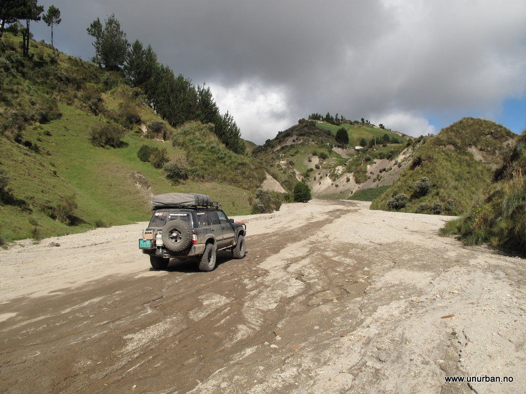
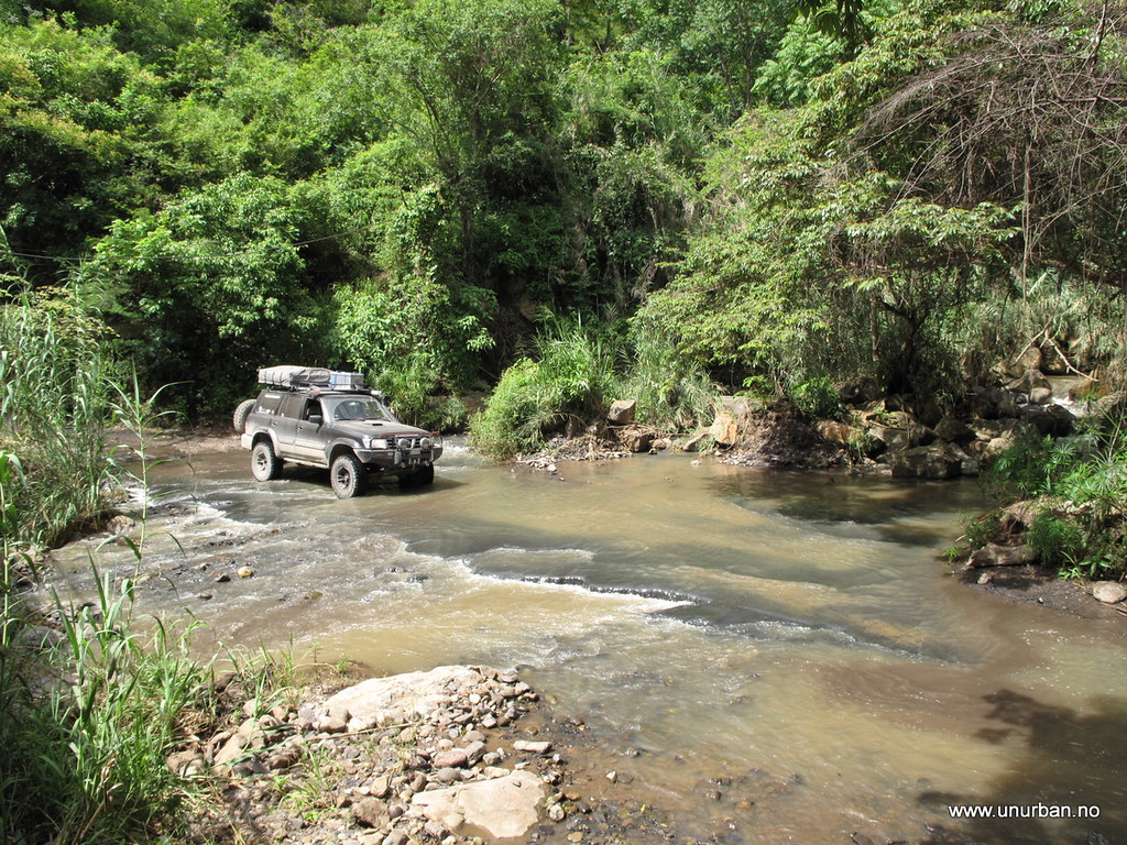
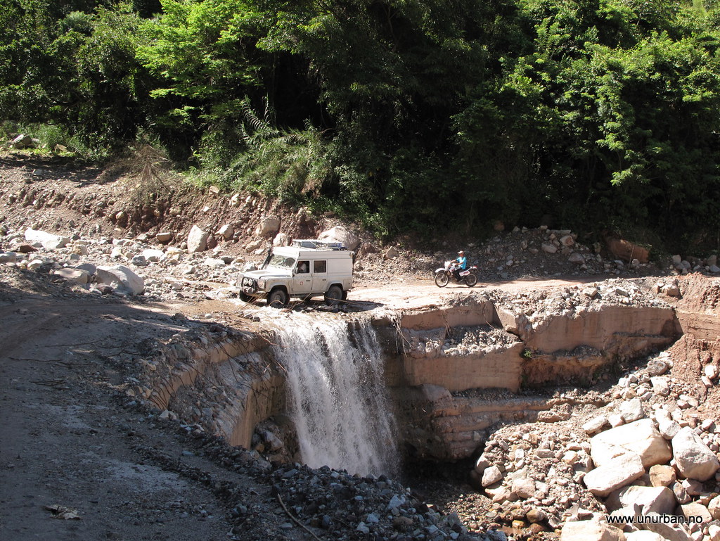
In the bottom of the valley we had to cross the big river and we could see on the amount of water in the river that there recently had been a lot of rain.
.
5808582873_68ccc836f7_b_d.jpg

.
5808585813_3a93ffd371_b_d.jpg

.
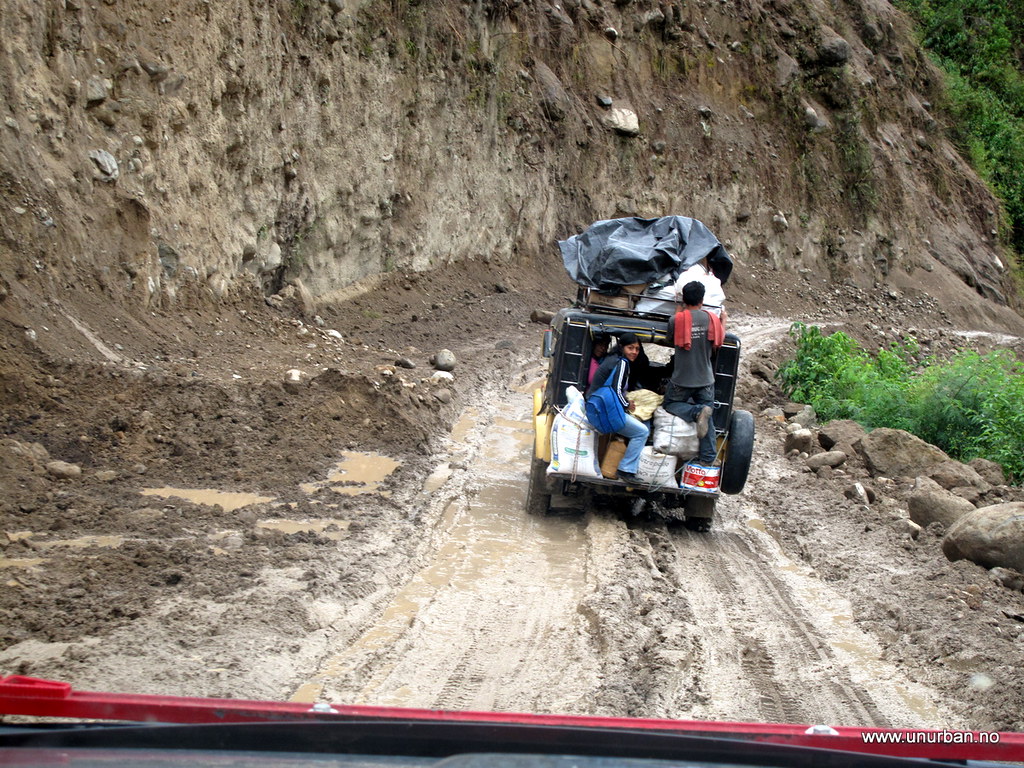
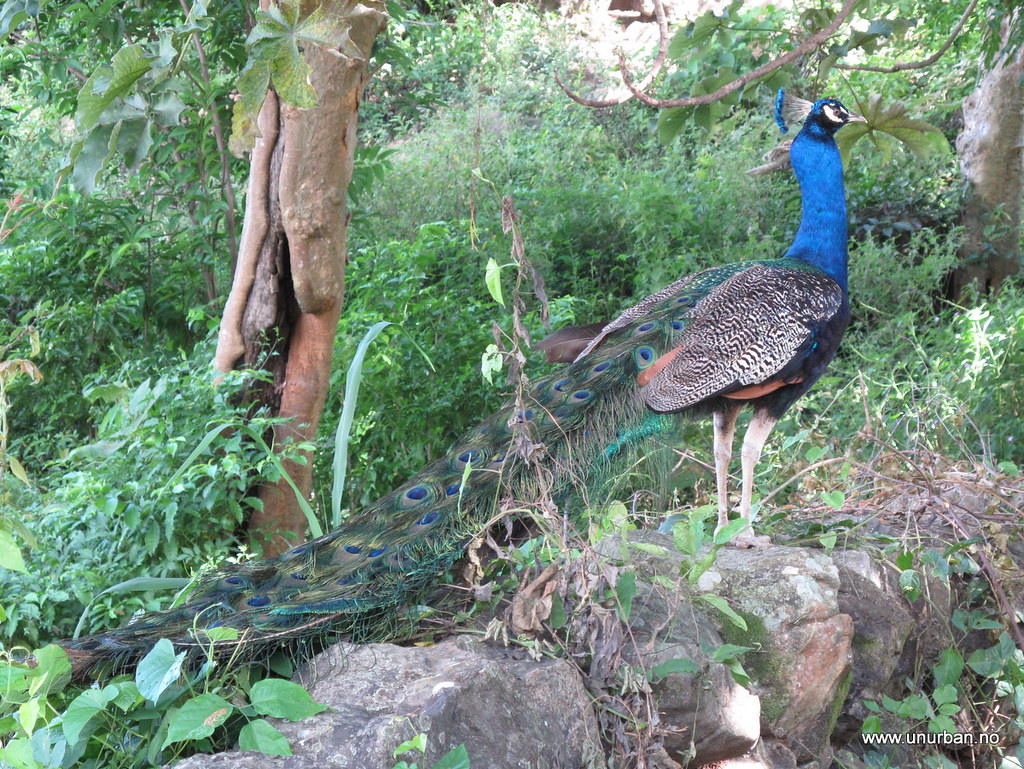
We drove through forest and then some farm land. Every now and then we had to do small river crossings, but none of them was any problem. On one of the old rock fences along the road there was a peacock looking at us.
.
5809150832_c0ed108218_b_d.jpg

.
The detour turned out to be great, and also a good reminder that we have to get off the main roads every now and then to really see this amazing country.
.
E&M
 

gr1910

Observer
Hi gr1910!
Thanks for the link! Unfortunately we have to skip Venezuela this time. We were discussing it, and some people told us it was too dangerous, and others told us it was fantastic. Our challlenge is to find our way to Ushuaia by the end of October, and it is long way to go. Therefore we have chosen a more westerly route that we think is a little faster without having to bypass all POIs. However, we would love to also do the eastern route of South America, including the Guyianas, Surinam, and Venezuela. Leving these out now only give us a very good excuse to come back!

E&M

they are both true... it is dangerous to travel alone. but in those forums you can find people in all the states of the country that will be more than happy to travel with you guys and show you around... It is also beautiful... you can enter thru the colombian border, go to caracas(the capital) and go south to the Gran Sabana (where the tepuys are)

in venezuela is just dangerous to not be venezuelan hehe... but if you are with some local, there is less chance to get robbed...
 

unURBAN

Adventurer
Trails and tombs

5832775286_6d75089197_b_d.jpg


From one nice colonial city to another. After visiting Barichara we drove to Villa de Leyva. Villa de Leyva was founded in 1572 and today it has become a weekend destination for people from Bogotá. It was a nice city to relax in for a few days.

From this quiet town we headed to Bogotá. Because we are UN-urban we seldom go to big cities, but we had to go to Bogotá because Malin’s passport was falling apart. At the immigration into Panama the officer commented on the info page that was on its way to fall out. We figured that to tape it in was not a good idea, so the solution was to get an emergency passport at the Norwegian Embassy in Bogotá. The Embassy was helpful and after filling out some papers I had a new orange emergency passport in my hands.

With the necessities out of the way we could do some sightseeing in Bogota. The Gold Museum was our first stop, and it was amazing to see all the pre-Colombian gold work and how good artists they were.

5809102632_c449984bc1_b_d.jpg


Then we looked at some more modern art at Donación Botero Museo with art from international artists like Picasso and Dali, and 123 pieces of Botero’s own work. Beside these two museums we strolled around in the streets and ate some excellent Bogotan food.

5832779878_758c8f7601_b_d.jpg


On this travel we have tried to avoid the Pan-Am Highway as much as possible. But when it comes to roads in Colombia we realized that we had more or less traveled the whole of Highway 45 from North to South - except a few detours. One was made from the highway close to Villa Nuevo, and there we were able to cross Rio Magdalena on an old railway bridge.

5832783142_26a52c42fb_b_d.jpg


Now it was a converted into a vehicle bridge, but our map still showed that it still was a railroad…… After following the “railroad” south we got to the Tataco Desert. It was definitely different from all other landscapes we have driven through in Colombia, and it was strange to see cactus again.

5832241599_1112a3a56c_b_d.jpg


5832246583_772d9a4a18_b_d.jpg


From the desert we took another detour and drove up a muddy road to Tierradentro. In Tierradentro about 100 tombs that were created from the 6th to the 9th century AD have been discovered. The tombs were scooped out of the rock and they are 3-8 meters below the surface and 2 to 10 meters in diameter. They were painted in geometric patterns in black, red and white, and it is still possible to see the paintings on the walls in some of the tombs. It was amazing to walk the stairs down into these tombs and realize all the work that it must have taken to make them to make these burial sites.

5832257401_87bce4fcca_b_d.jpg


5832805372_ffebec0982_b_d.jpg


5832258783_950b8bba37_b_d.jpg


Next stop was San Agustin, another of Colombia’s Archeological Parks. San Agustin is famous for its hundreds of stone carved sculptures that were left next to the tombs at the different burial sites in the area.

5808545549_deed16c0a3_b_d.jpg


The area has been populated since 3300 B.C., but San Agustin culture had its peak between the 6th and 14th century AD. It is presumed that the culture had vanished before the Spaniards arrived. All the different sculptures and tombs were really incredible, but what amazed me the most was the Fuente de Lavapatas, a monument carved in the stone bed of a stream.

We drove the last kilometers south on Highway 45 to Mocoa, and from there we took Highway 10 west. It crosses the Andes and it was not much out there except forest, hills and the road. It was a really impressive road carved into the mountain side climbing from 600 meters up to 3250 meters. Most of the time it was a one lane road, but luckily there were many places to meet other vehicles as we met many trucks on their way over the mountain.

5834966868_4374af526f_b_d.jpg


5834966356_03d861c214_b_d.jpg


Just before the border to Ecuador we made one last sightseeing stop at the Las Lajas Sanctuary. The church is built in the canyon of the Guáitara River which is a pretty impressive location for a church.

5834967418_da18256524_b_d.jpg


With this we were ready to leave Colombia. We could definitely have spent a lot more time here. Colombia has been the most positive surprise so far on this trip. One local girl was shocked to hear that people in USA and Europe still thinks Colombia is only about drugs and FARC. Our only excuse or explanation to that must be that all we read and hear about Colombia in the media is negative news. So we would like to say that we have had a great time in Colombia and have not had any problems. Along the road we have got more thumbs up and positive greetings than in all other countries we have traveled through. Together with nice colonial cities, great beaches, and incredible scenery, Colombia is a great country to travel in.

E&M
 

pattro

Observer
I'm really glad to hear your experience in Columbia has been positive. It is really too bad that the media puts a country which everyone who visits has positive words about in such a poor light. I can't wait to hear more of your adventures!
 

RMP&O

Expedition Leader
Did you go to the dino fossil museum in Villa de Leyva? It is pretty amazing....

I also had fresh trout there that was very good. Oh and they grow some nice tomatoes in that area!

Glad you went to the gold museum in Bogota. Did you know they only display a portion of the collection? I was told they have many more artifacts in the basement and that they rotate some items for public viewing.

main.php


If you are back in the Bogota area there is a Catherdral about an hour outside the city worth visiting. It was built into a salt mine and goes very deep into the earth. It is pretty crazy and worth a visit.

As I keep saying....really awesome stuff! I can't wait to see more of your travels in South America!
 

unURBAN

Adventurer
Did you go to the dino fossil museum in Villa de Leyva? It is pretty amazing....I also had fresh trout there that was very good. Oh and they grow some nice tomatoes in that area!

Glad you went to the gold museum in Bogota. Did you know they only display a portion of the collection? I was told they have many more artifacts in the basement and that they rotate some items for public viewing.

If you are back in the Bogota area there is a Catherdral about an hour outside the city worth visiting. It was built into a salt mine and goes very deep into the earth. It is pretty crazy and worth a visit.

As I keep saying....really awesome stuff! I can't wait to see more of your travels in South America!

South America is really an adventure. This continent is so different from North and Central, and we are really looking forward to explore more in these countries.

I had no idea that there were more gold in the museum. I thought what they had on display was overwhelming... I've never seen so much gold in one place!

And we did not stop to see the salt cathedral. At the time we were driving with two other cars, and when we found out that the original cathedral was closed and the one that is open is a newer one, it was voted for passing it. Should have stopped tho. Probably going to regret that for a while... Will definitely try to do the mines in Potosi instead (Bolivia).

Crossing into Peru in a couple of days, and will start working on the Inka world (and what was before that). Tnx for comments!!

E&M
 

unURBAN

Adventurer
Great report about Colombia.
To bad you skipped Cali and Casa Blanca Hostel:snorkel:
Nice scenery around San Agustin and Tierradentro. I do guided motorcycle tours down here and those are some of my favorite destinations!
Cheers
Mike

Fantastic area! And the roads there are quite adventurous. Heard that Colombian soldiers had been out in the mountain for several weeks now fighting FARC between San Agustin and Popayan, so be careful... But the road was open. And try the Tatacoa desert just east of Villavieja (north of Neiva)! Great scenery and interesting roads!

E
 

haven

Expedition Leader
Special thanks for the clear explanation of your experiences shipping from Panama to Colombia, and guiding us through the importation process.
 

unURBAN

Adventurer
Just curious, where did you cross from Columbia to Ecuador? Was it at Ipiales? I didn't see that mentioned anywhere...thanks!

Oups.... Thanks for letting me know. Updated the blog now.
We crossed from Ipiales to Tulcan on the Panam. The other crossing further east has a bad reputation for FARC and smuggling.

E
 

unURBAN

Adventurer
Ecuador!

Funny that our first rodeo ever was in Ecuador. Didn’t imagine that when we planned our trip, starting in North America. Unfortunately we missed Calgary Stampede by two days, so this local one in a small mountain village in Ecuador would just have to do. So it happened that we stopped by to “visit” Luis and Lacey from www.lostworldexpedition.com. We had met Luis more than 6 months earlier in San Francisco on our way through the States. He was home for some business, while their Landcruiser was parked in Costa Rica. They have spent about 2 years to get from San Francisco to Ecuador. In other words, quite a bit slower than our pace. Now, they were just back from the Galapagos (awesome pics on their website!), and were working for a hostel close to Ecuador’s second highest mountain, Cotopaxi. We found a “how to get there” on the web, and showed up unannounced together with nordsued.ch.

5848946475_3ef80a5e8b_b_d.jpg


The view from the hostel is breathtaking (and they have the same view from the toilet and the Jacuzzi!). Secret Garden is a fantastic place, and is kind of a combination of a hostel and a farm. We really got to relax here for a couple of days. They grow quite a bit of their own food, and even have animals on the farm. Unfortunately, the cuys (Ginny pigs) weren’t ready for butchering…. One day the whole hostel went down to the nearest village for the happening of the year – Rodeo!

5849491282_5c3c30e2a2_b_d.jpg


Lots of people and lots of fun! And lots of drinking… Among the locals, that was. Some, including the judge and the handlers, were quite drunk well before lunch time.

5848922513_13af7be916_b_d.jpg


Not always easy to see who is chasing who…

5849499770_8db278e295_b_d.jpg


From Secret Garden we lost track of Nordsued. They wanted a day or two more in the Cotopaxi National Park. We headed for the Quilotoa Loop. This is a round trip in the mountains, on small winding roads, and through indigenous villages. The loop has its name after a crater lake that most guidebooks describe as an absolute must. We decided to leave after a couple of pictures. Cold and too windy. There is always another crater lake…

5868016573_a3127d83a2_b_d.jpg


We don’t really know what kind of cars they normally drive on these roads, but sometimes we felt like a semi-truck.

5868015835_f833471158_b_d.jpg


Definitely Andes!

5868015105_37f6512710_b_d.jpg


And can you avoid using farmland for a road it is a plus…

5868016281_734553c84f_b_d.jpg


Drive fast…?

5868016829_8d99026466_b_d.jpg


As usual on this trip we have a weak spot for hot springs, and especially now after having left the Caribbean and warm weather behind us. The last few days we’ve mostly been higher than 3000 meters / 9000 ft., and it’s actually quite cold. The highest elevation on the loop road was 4012 meters / 13160 ft. After driving the loop we arrived in Baños in the evening. Baños means bath in Spanish. We stopped at a hotel in the town run by a French guy that let overlanders camp in his parking lot for 3 USD a night. Here there should have been several pics of the camp and of the hot springs, but for some strange reason we didn’t take a single picture in Baños. We have no idea why. Well. We took quite a few more the next couple of days. More about that in the next post!

E&M
 
Last edited:

Forum statistics

Threads
185,911
Messages
2,879,535
Members
225,497
Latest member
WonaWarrior
Top