Ruining Around Utah

turbodb

Well-known member
Part 1 - Stopped in our Tracks at The Needles

Just before our two trips to Anza-Borrego, Monte @Blackdawg reached out to see if we were interested in a late-March trip to Canyonlands and some hiking of a few nearby slot canyons - perhaps even some that we'd attempted in our F.U.Rain trip last year.

Not really realizing how close it was (5 days) to the completion of our trip, and definitely not realizing the work that would need to be done to the truck between trips, I responded in the only way I knew how.

turbodb said:
Interested.

As it turned out, it was a mad dash between trips. I had CV axles to reboot, skid plates to re-weld, and of course I wanted to get the Anza-Borrego photos and trip report as "ready to go" as I could before taking off on another adventure. I think we can all agree that it really was the definition of a tough life. ? Yes, I'm a lucky dude.

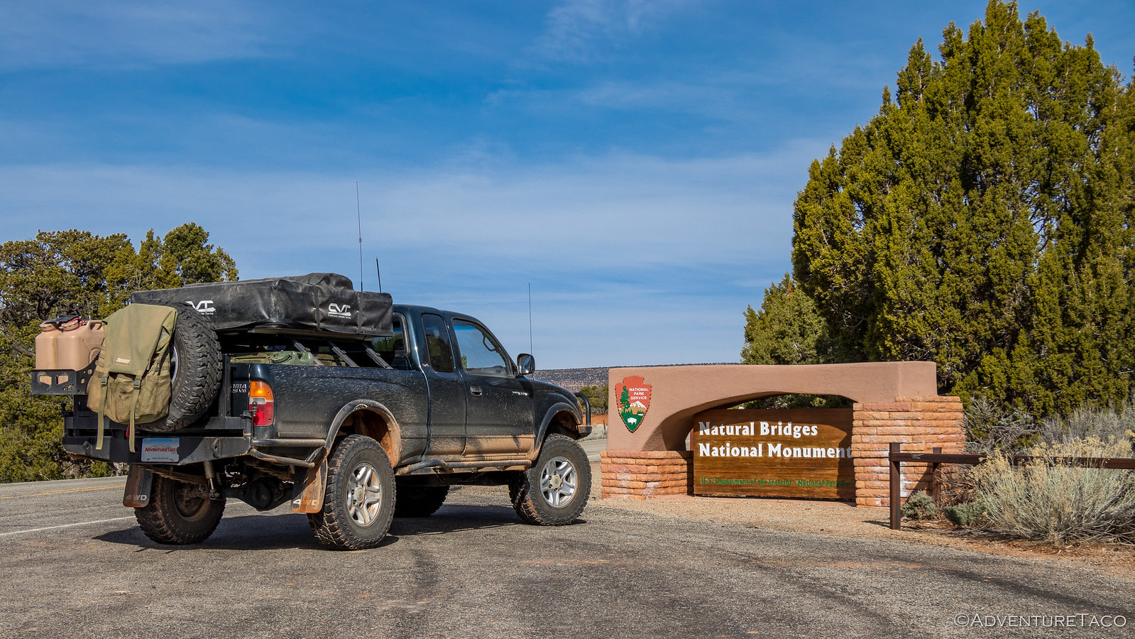
At any rate, none of those are the real story for today - so let's get right to it. On March 22, I was ready to go by about 7:30pm - the truck repaired and provisioned "enough" that I was confident that it would survive a week long adventure, and me ready to hit the sack at 8:00pm - the same time as @mini.turbodb - so I could wake up at 3:00am the next morning to get going.


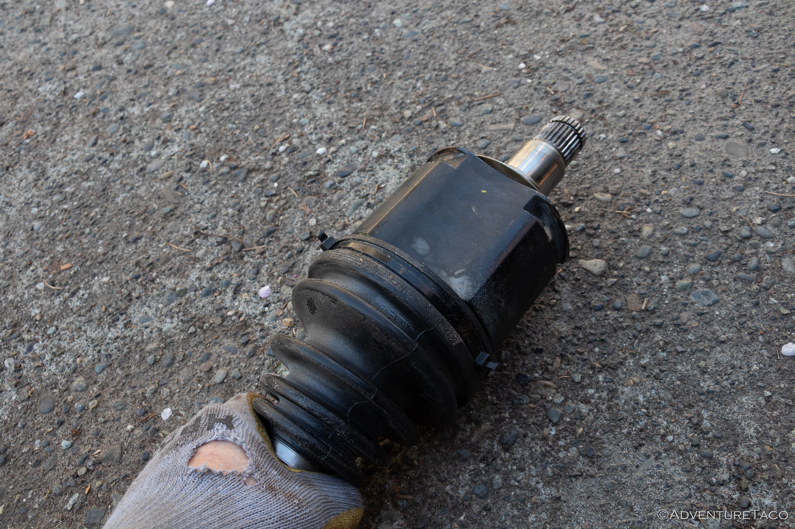
Repaired "enough." Looks "legit." ?

- - - - -​

March 23, 2019.

As somehow seems to happen, I awoke at 2:58am - two minutes before my alarm went off. Final preparations made - and more importantly my final shower taken - I was on the road south by 3:45am. I had a long drive ahead of me - my goal was to reach The Needles District of Canyonlands National Park and the rest of the gang by the end of the day - a 21-hour drive. Crazy, according to ...everyone.

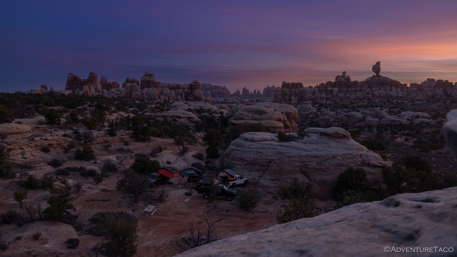
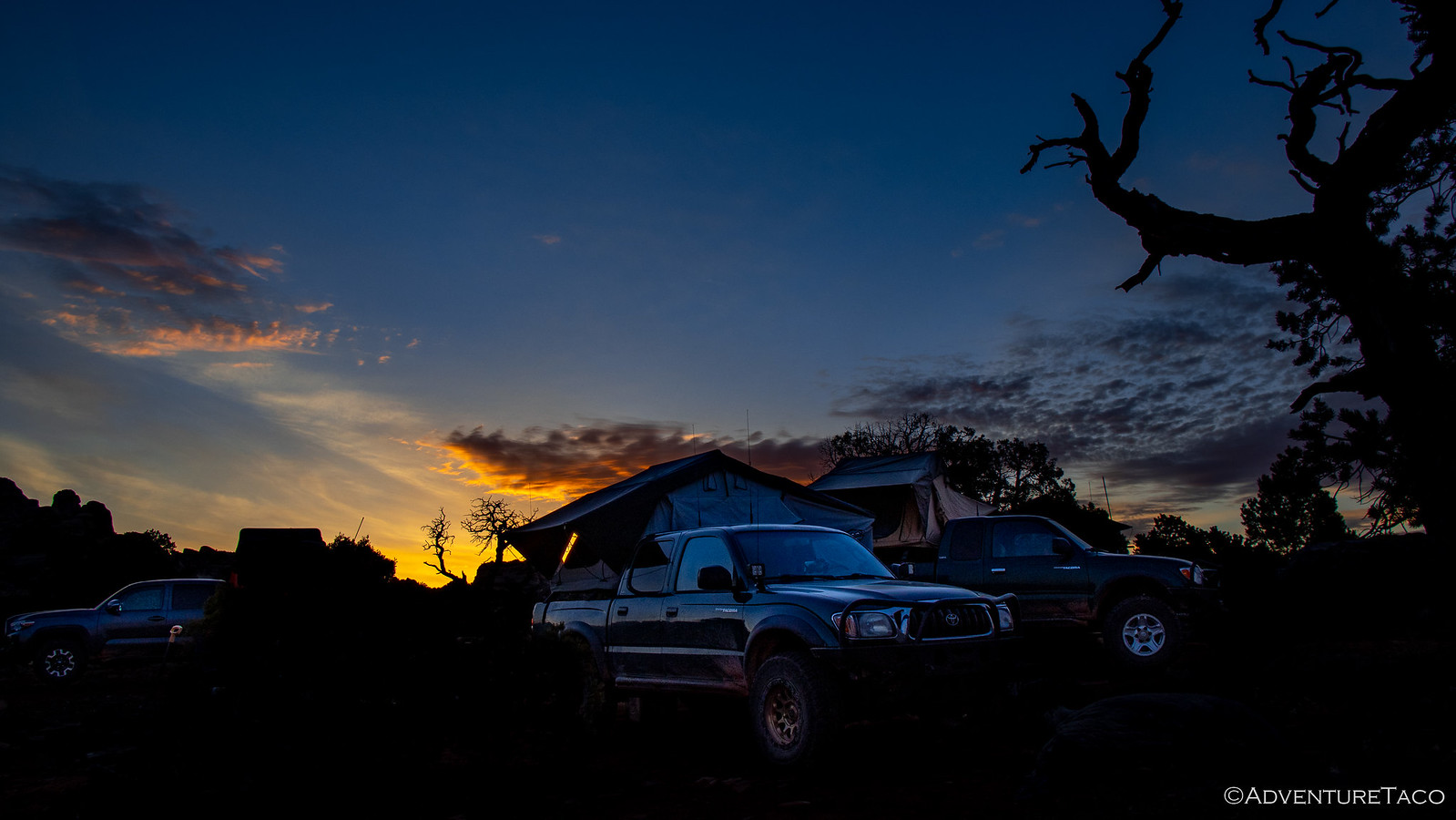
And so, when I pulled into camp at 12:30am, it was with big smiles and a "you're crazy" that I was greeted by Monte - the only one of the rest of our crew that was still awake.

We chatted and laughed for a few minutes, and then I was ready for bed - one of the best nights of sleep I think I've ever had in the tent.

- - - - -​

March 24, 2019.

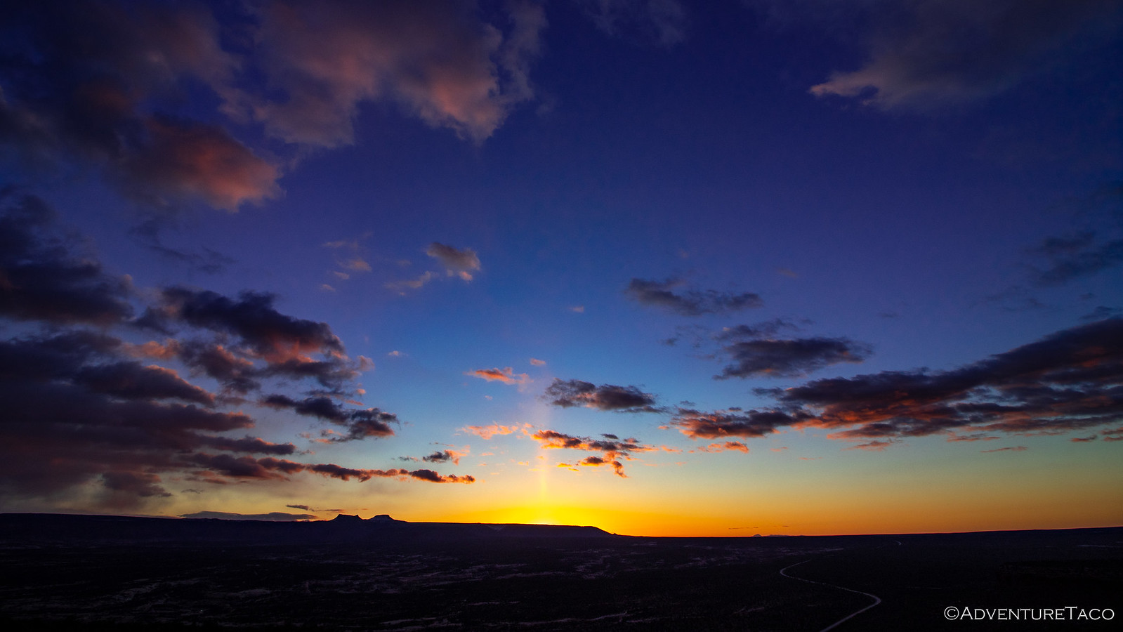
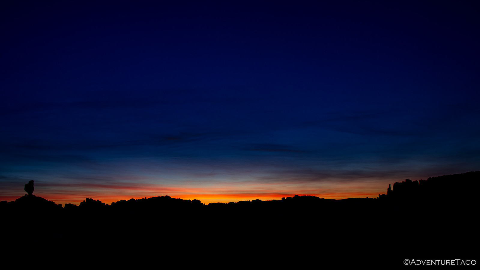
As I'd fallen asleep, I'd wondered to myself if there was any way I'd be up for sunrise. On the one hand, it's a time of day I love to see - the colors in the sky, the calm solitude of the morning as the earth wakes up; on the other, I wanted to sleep! And so, as it started to get light out, I have to admit feeling a bit of relief as I heard the light pitter-patter of rain drops on the tent.

No one likes putting a tent away wet, but for me, it meant another two hours of blissful sleep.


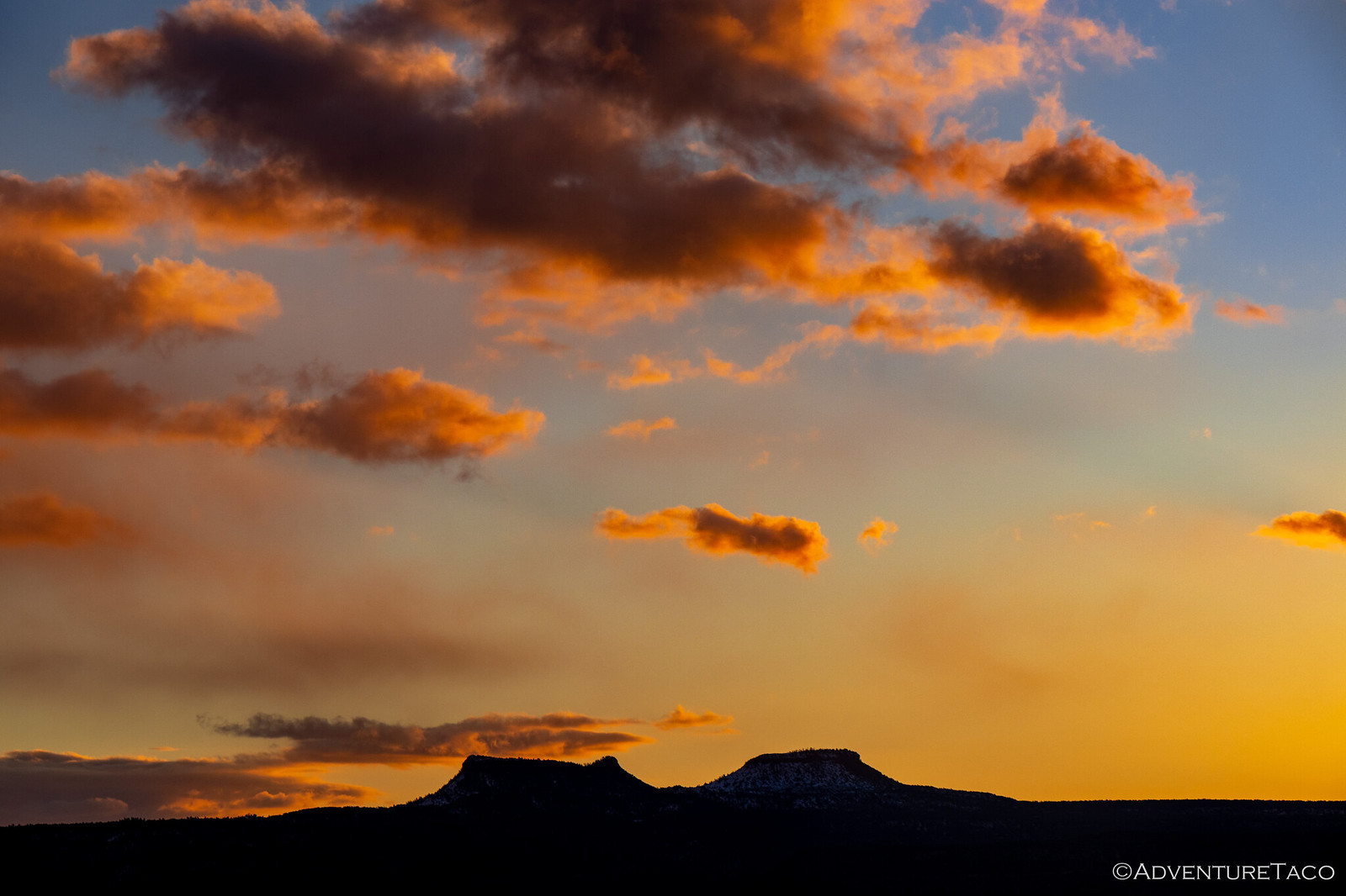
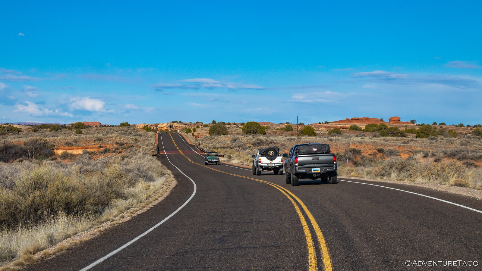
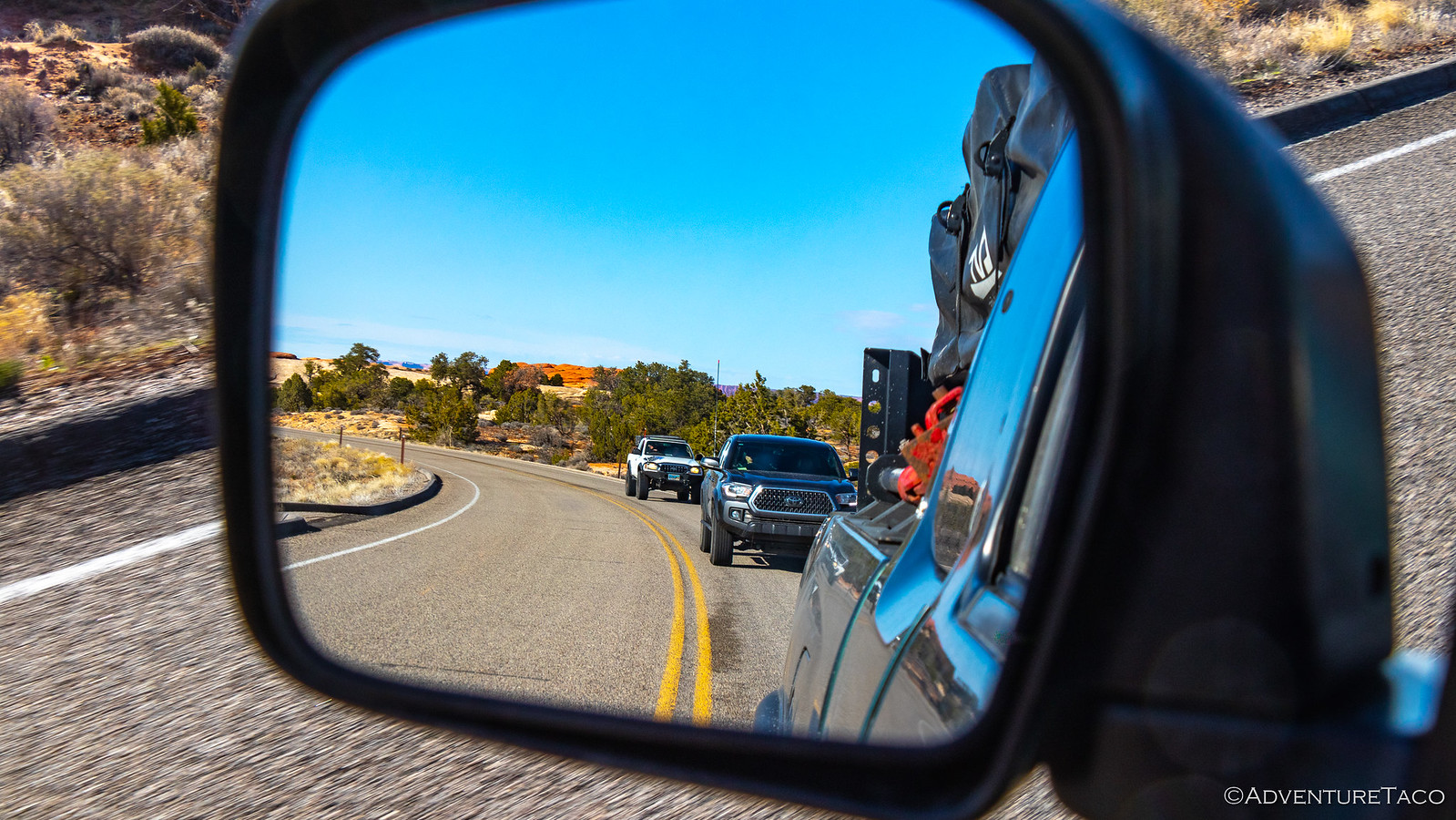
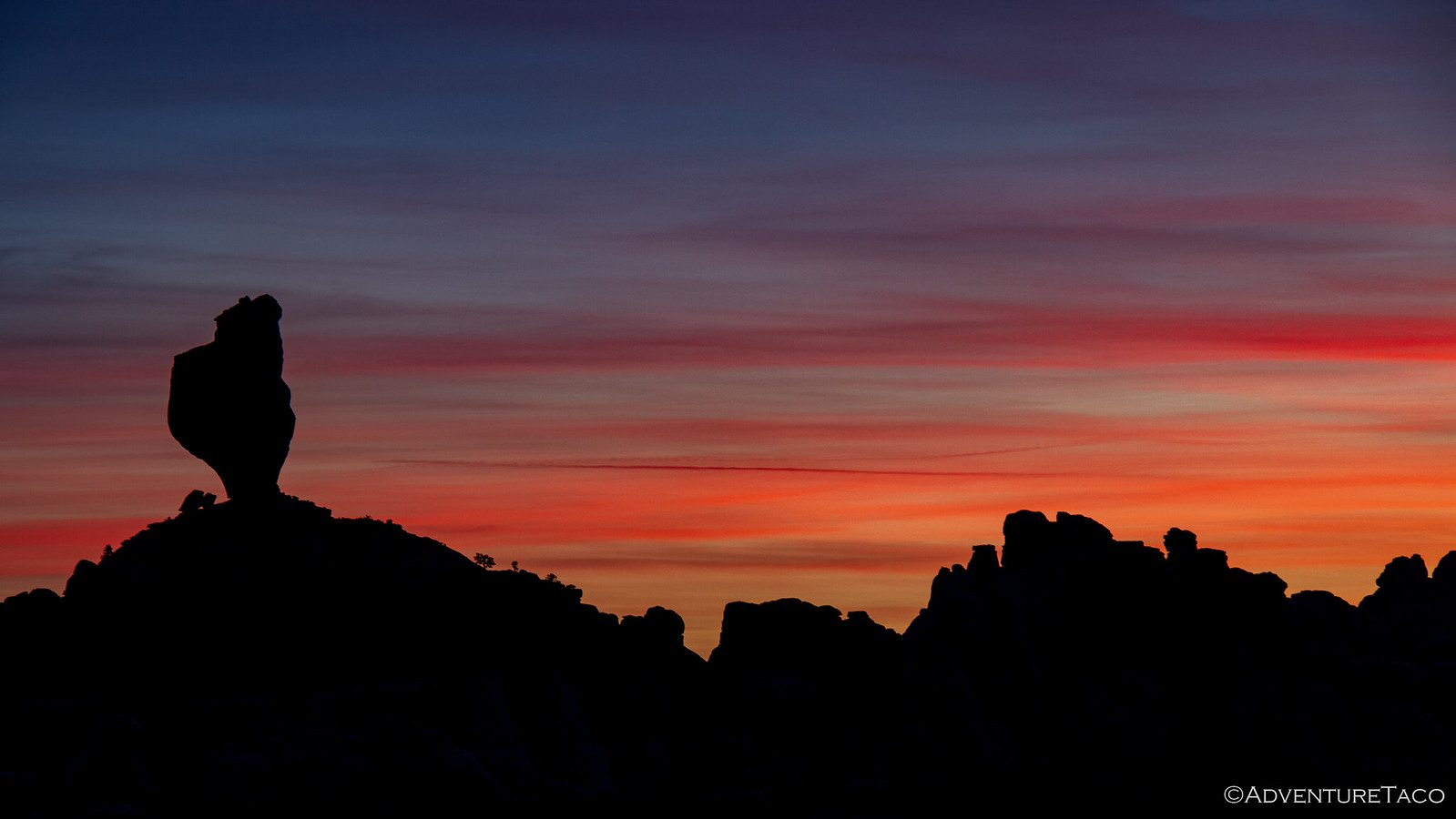
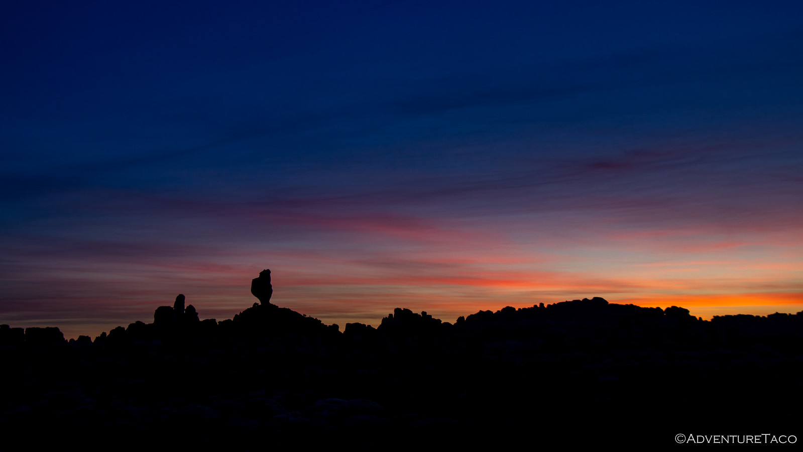
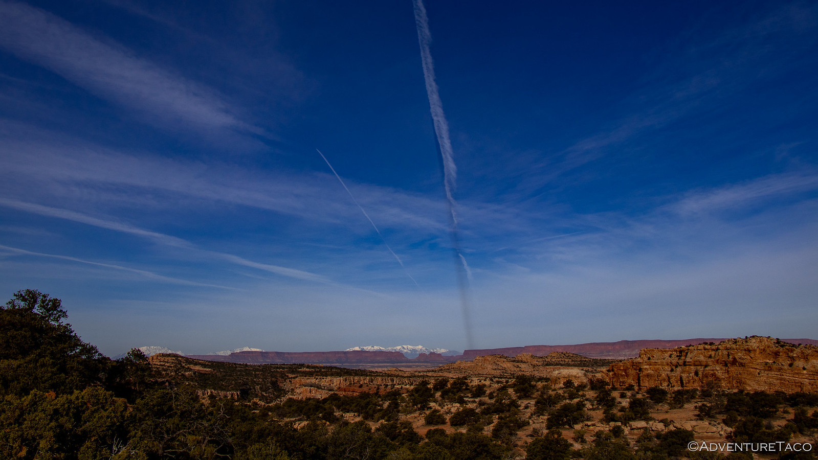
Still, by 7:30am, several of us were up and out of our tents. A round of introductions and how-do-you-dos were shared, and I got my first look at the surroundings - spectacular as ever in this part of the world. It was really too bad that I'd driven through all this in the dark the night before!


As the clouds cleared and things started to dry out a little, we got breakfasts made and camp put away - Monte having mentioned that he wanted to be at The Needles Visitor Center by 9:00am (opening) so we could get our permits and whatnot. We were right on time as we headed out.


It was when we got to the Visitor Center that we got our first several pieces of interesting news. When the Park Ranger heard where we were headed (Horse Canyon), I think his reaction was right along the lines of, "No you're not, that road is impassable quick sand." And then, to drive the point home he added, "It even says so on the web site."

Well, OK, we decided - we can just cut that part out and head south after enjoying our time in Canyonlands. To which we got a stern, "You're definitely going to hit snow on that route. Take some photos and bring them back here so we have some on had for others."

Hrmm - stopped in our tracks. This was going well already. :bananadead:

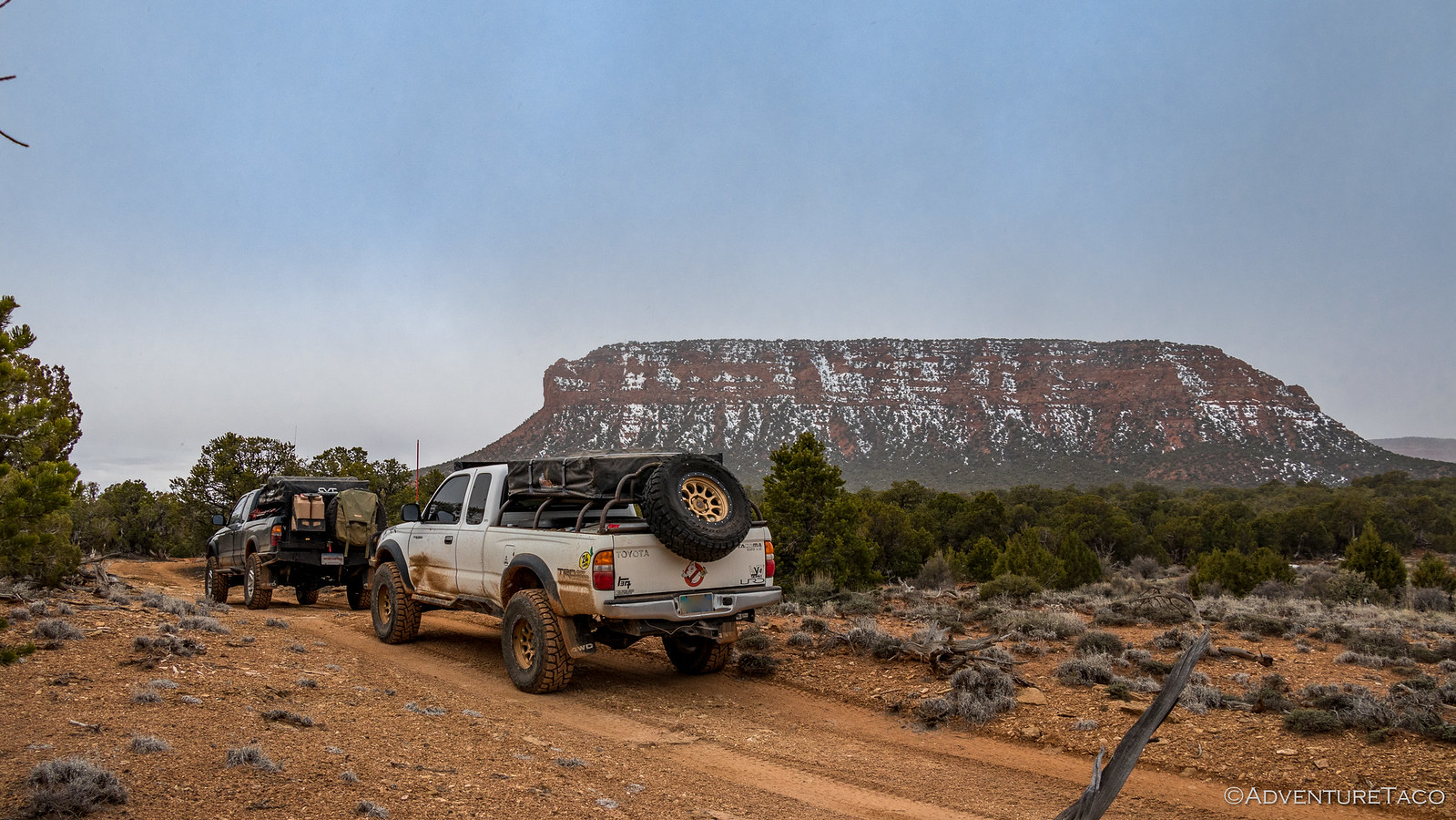
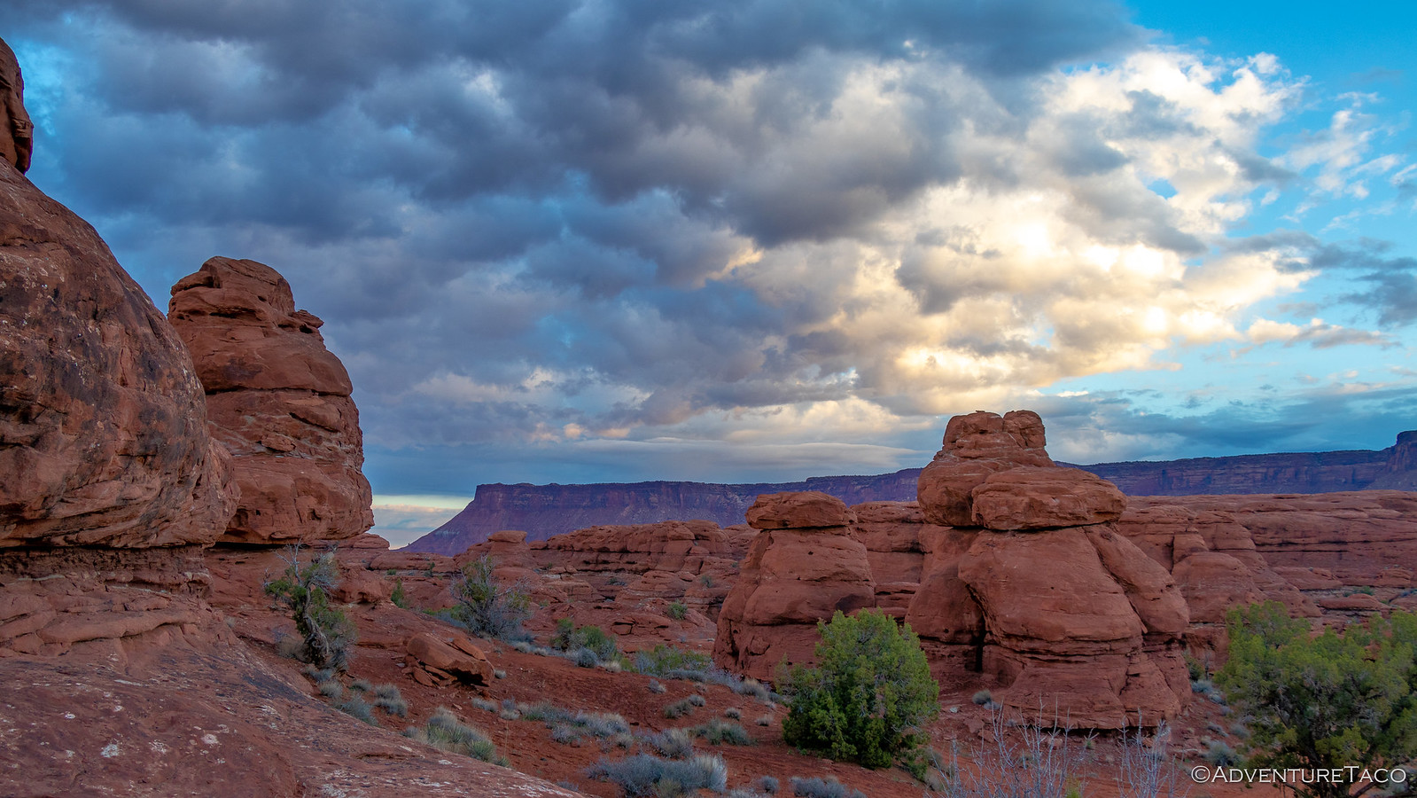
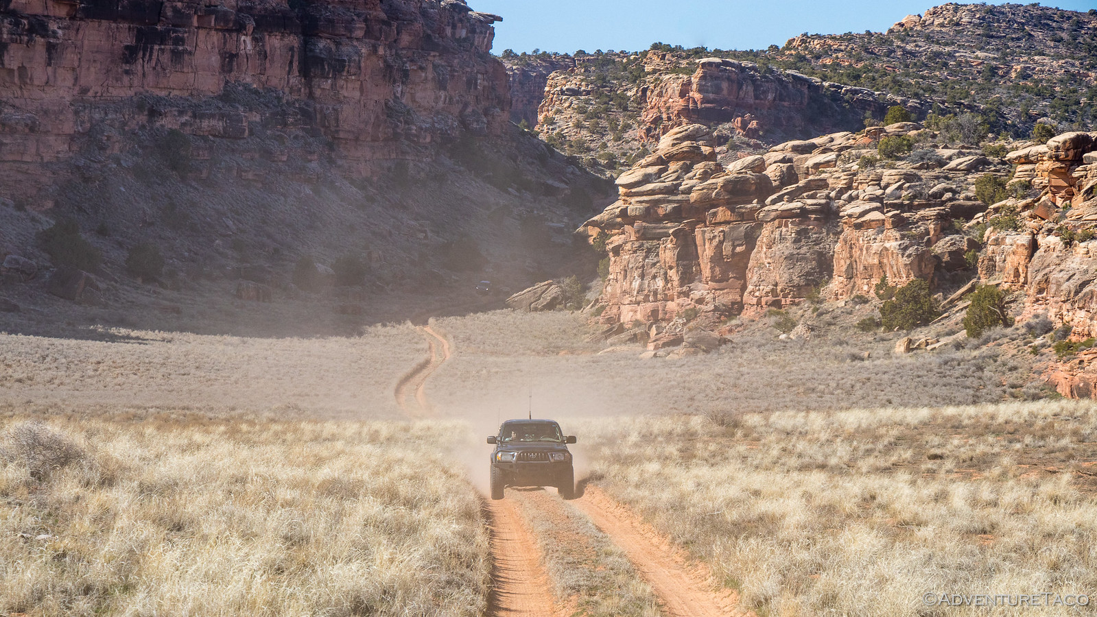
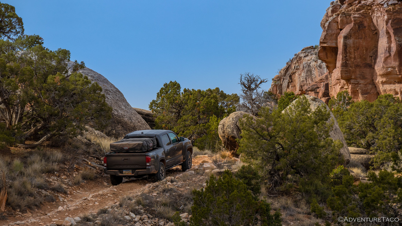
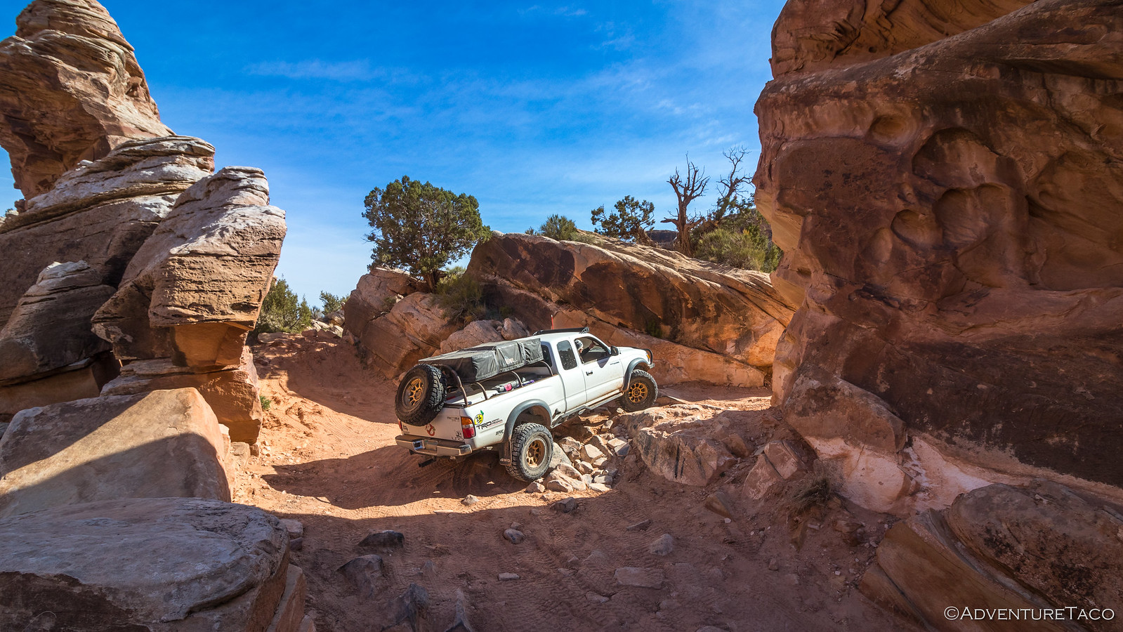
In the end, we worked out a route that we were going to give our best shot, and got our permit dates all settled for the new route, and then set off into the park and towards our first trail - Elephant Hill. On the way, a quick stop at Wooden Shoe Arch, named for obvious reasons.


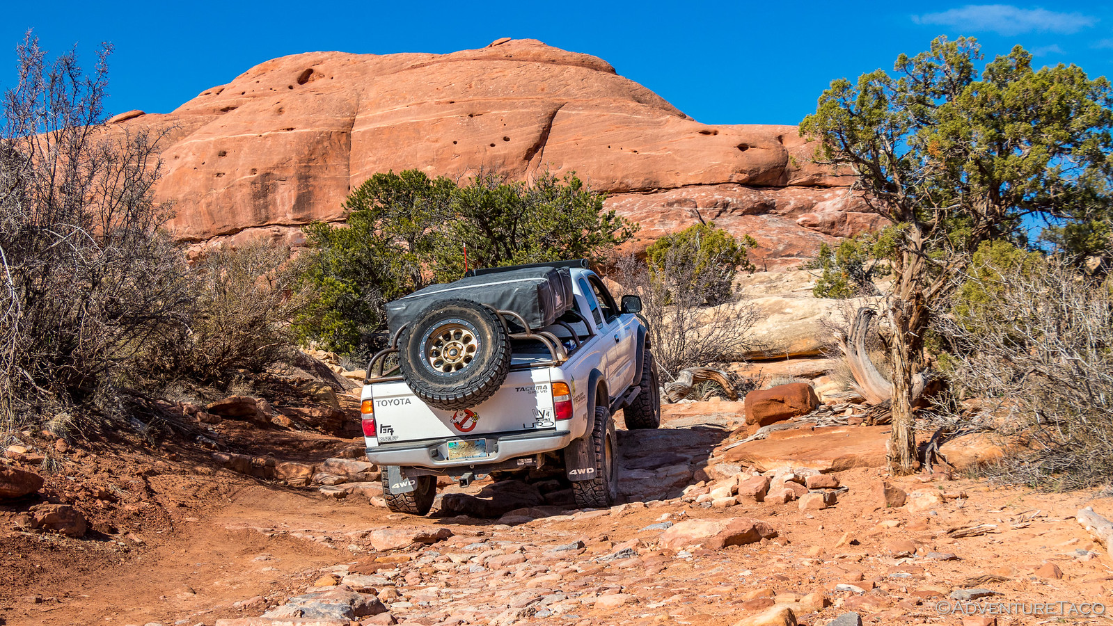
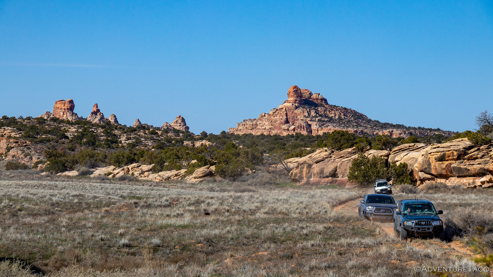
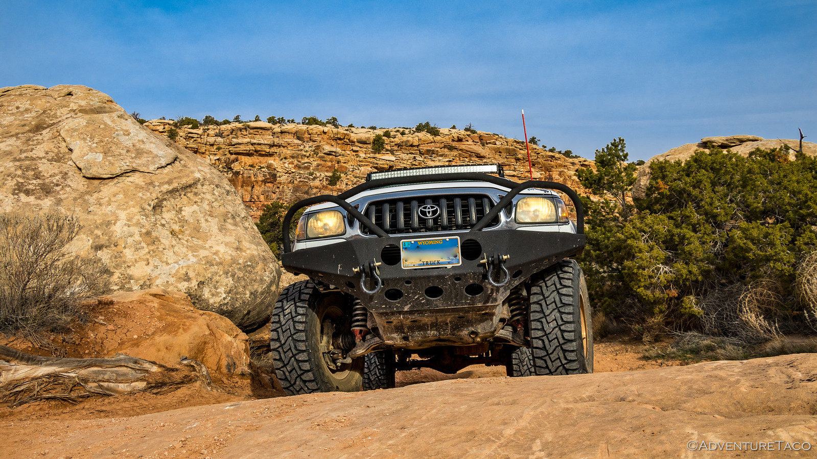
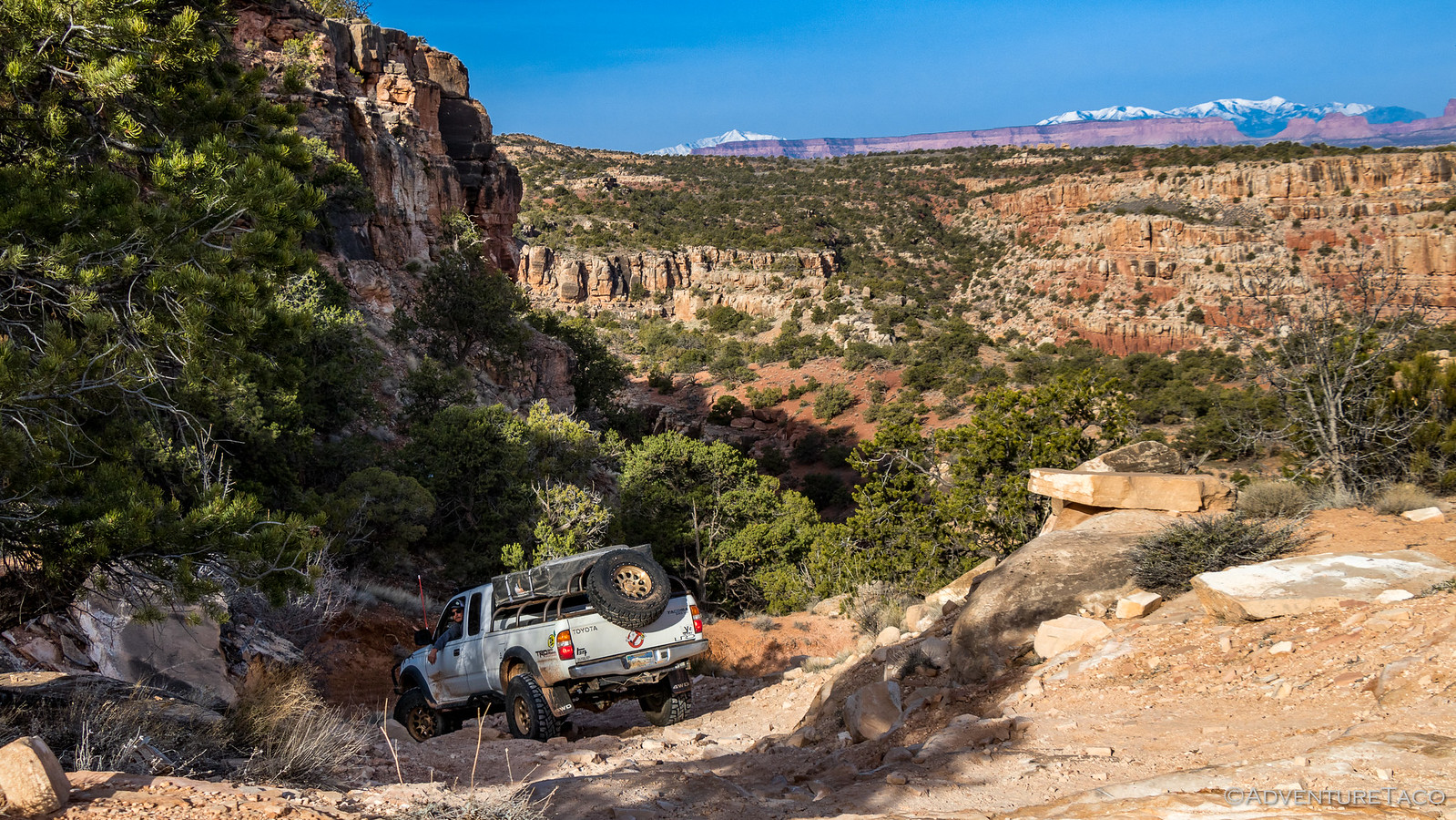
Before long, we were at Elephant Hill. We all aired down, and then set off in two groups - having been warned several times that we had to do the initial climb and descent in groups no larger than three vehicles. This is because the road begins a steep climb immediately upon leaving the Elephant Hill parking area, and is clearly suitable for 4WD vehicles only. Almost immediately, a fun-but-intense-if-you're-not-ready-for-it stretch of hill-climb leads to a small turn-around pad some 150 feet above the parking area. This small, strategically placed flat area serves two vital purposes: it allows the vehicle to make a 180-degree turn before heading into the next switchback, and it provides an opportunity for anyone who might have second thoughts about continuing to turn around and make a hasty retreat back to 2WD land.


At any rate, it was a good thing that we split into groups, because while Monte and Brent (@PcBuilder14) were on their way up, another ranger came over to check Brett, Heather (@BossFoss and @MrsFoss) and my permits and "meter" us up the trail.


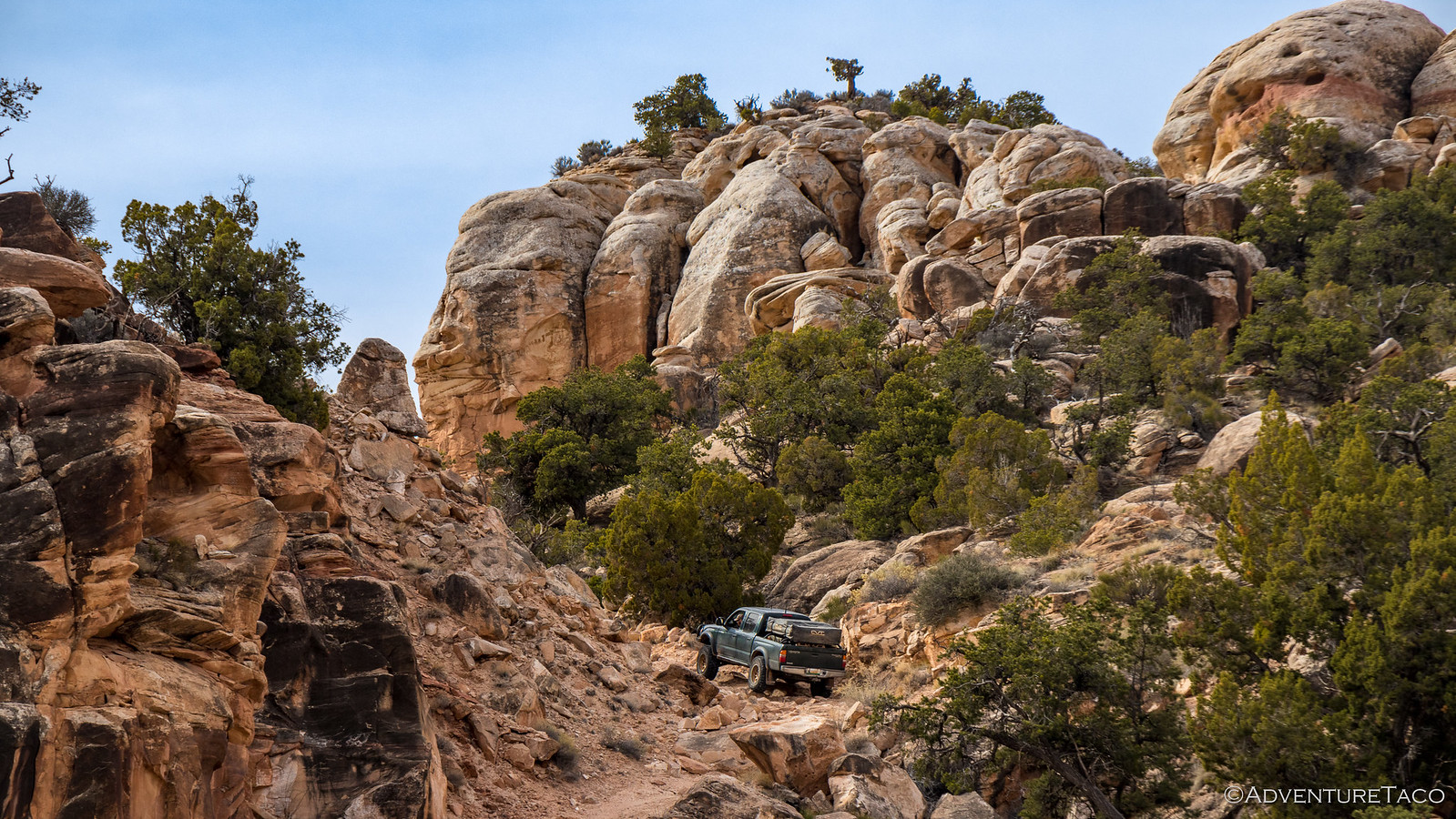
Being the first group(s) of the day, and clearly more prepared than other groups they encountered, we were released relatively quickly and it wasn't long before we were all back together again near the top of the first hill. It'd been a fun climb and a great "intro" to dirt - nothing too difficult, but still with lots of ledges and bumps, exercising our rigs from the get-go.


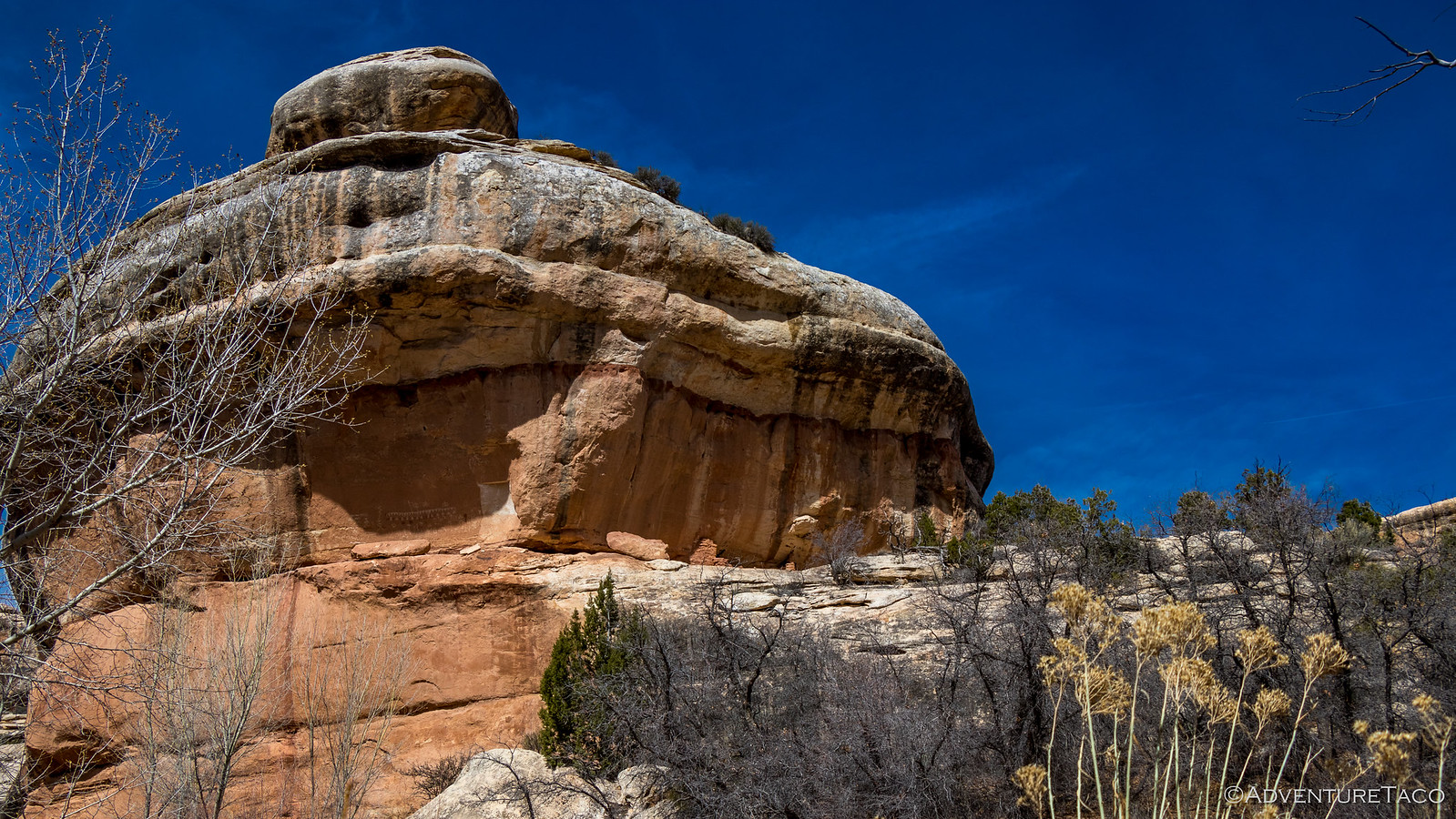
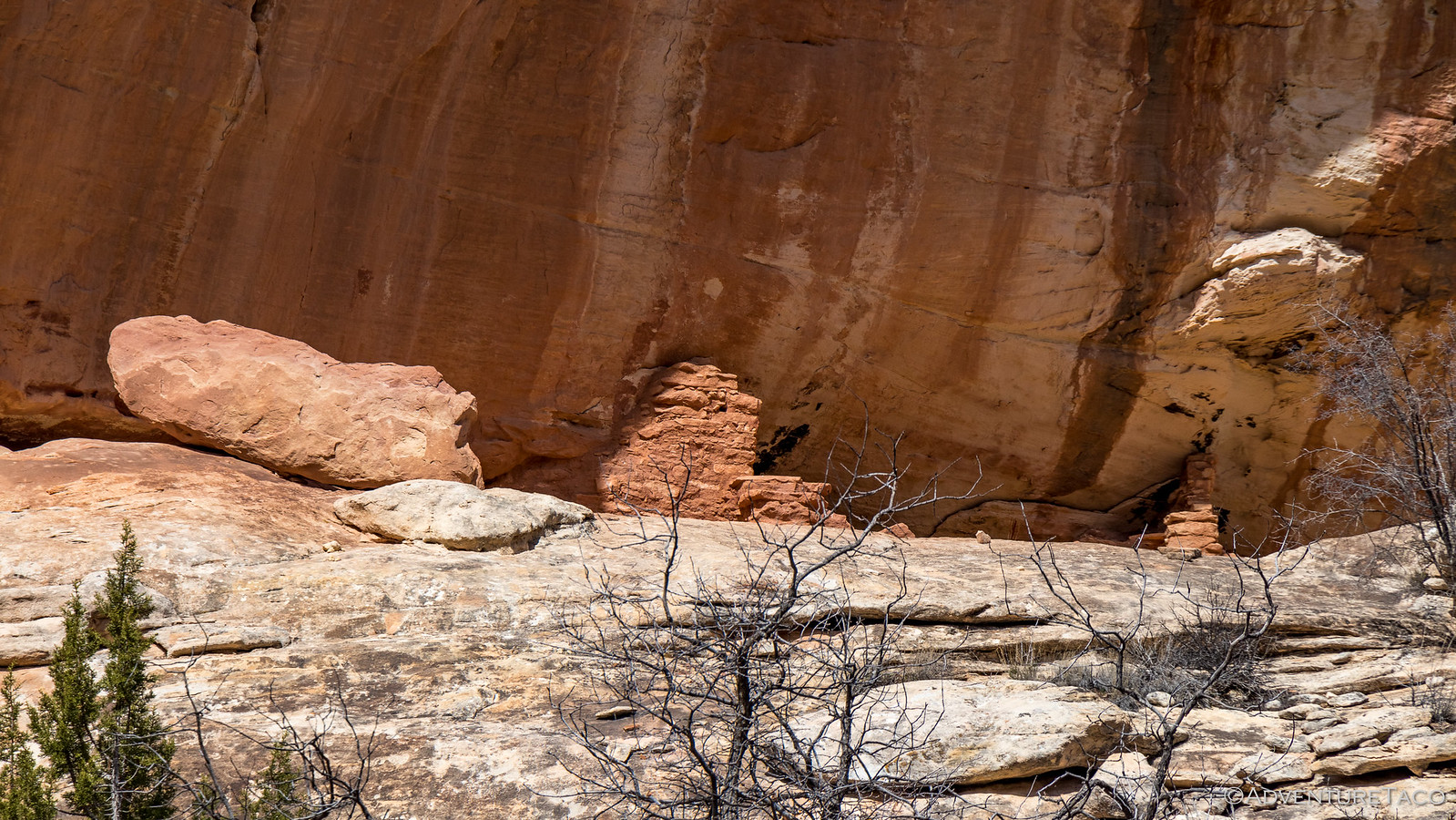
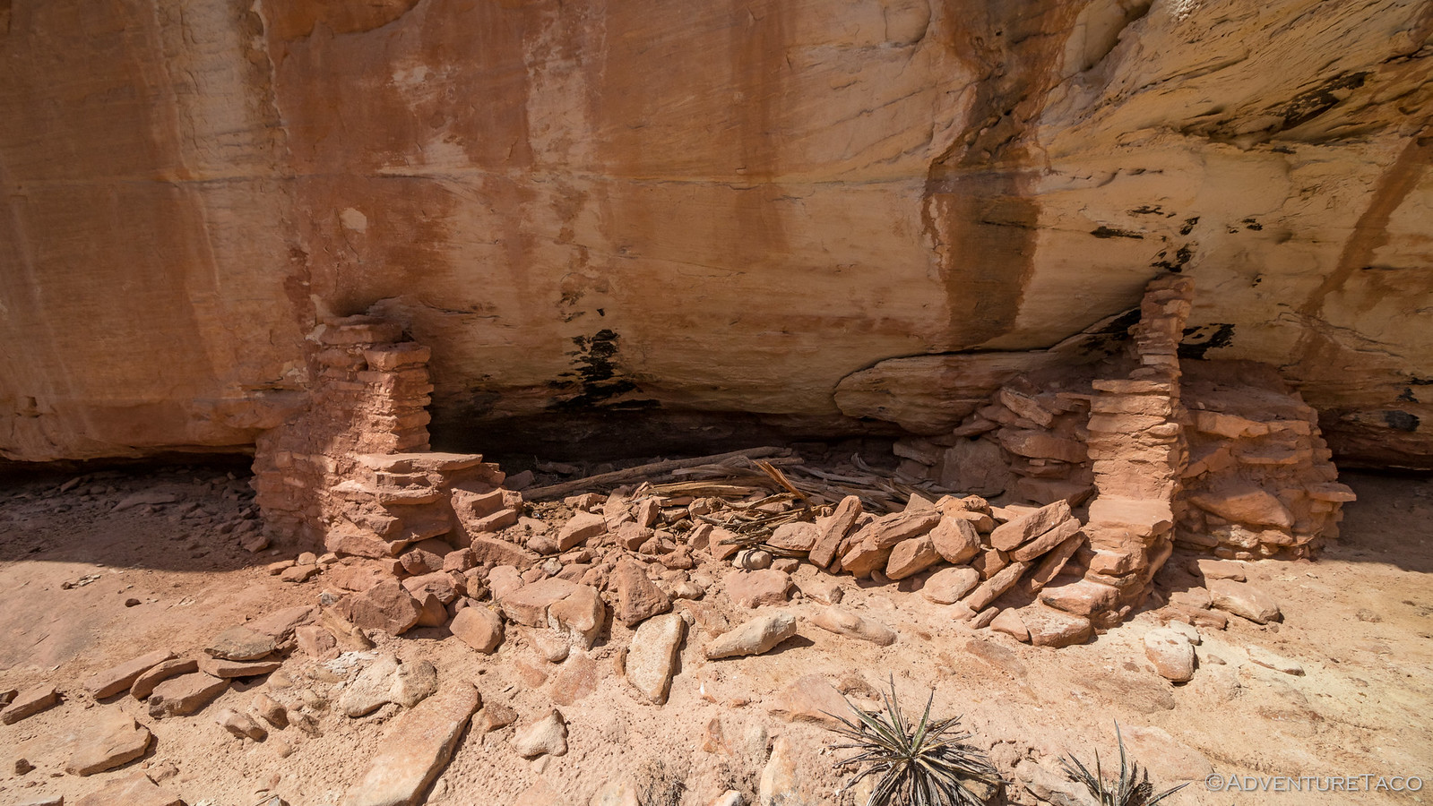
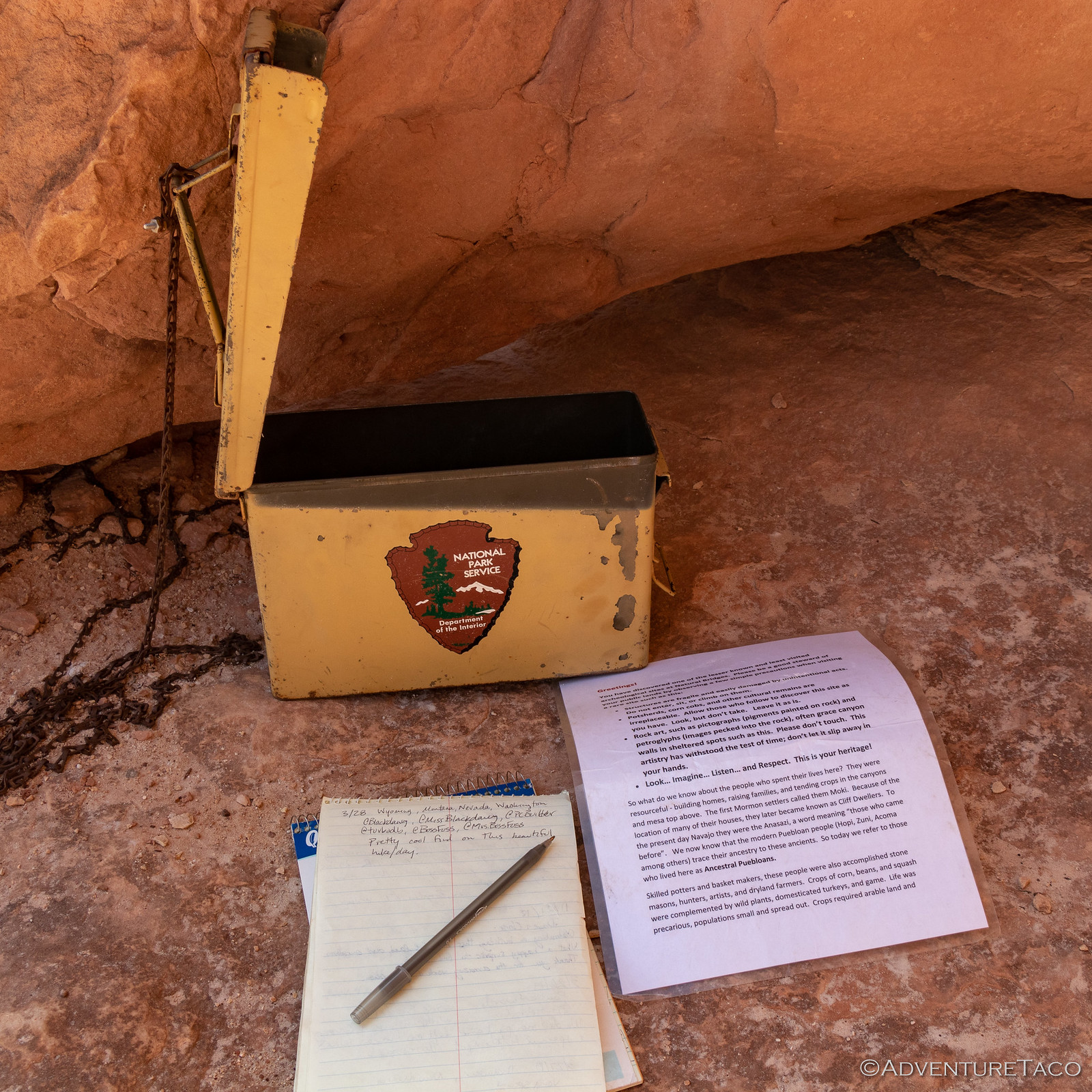
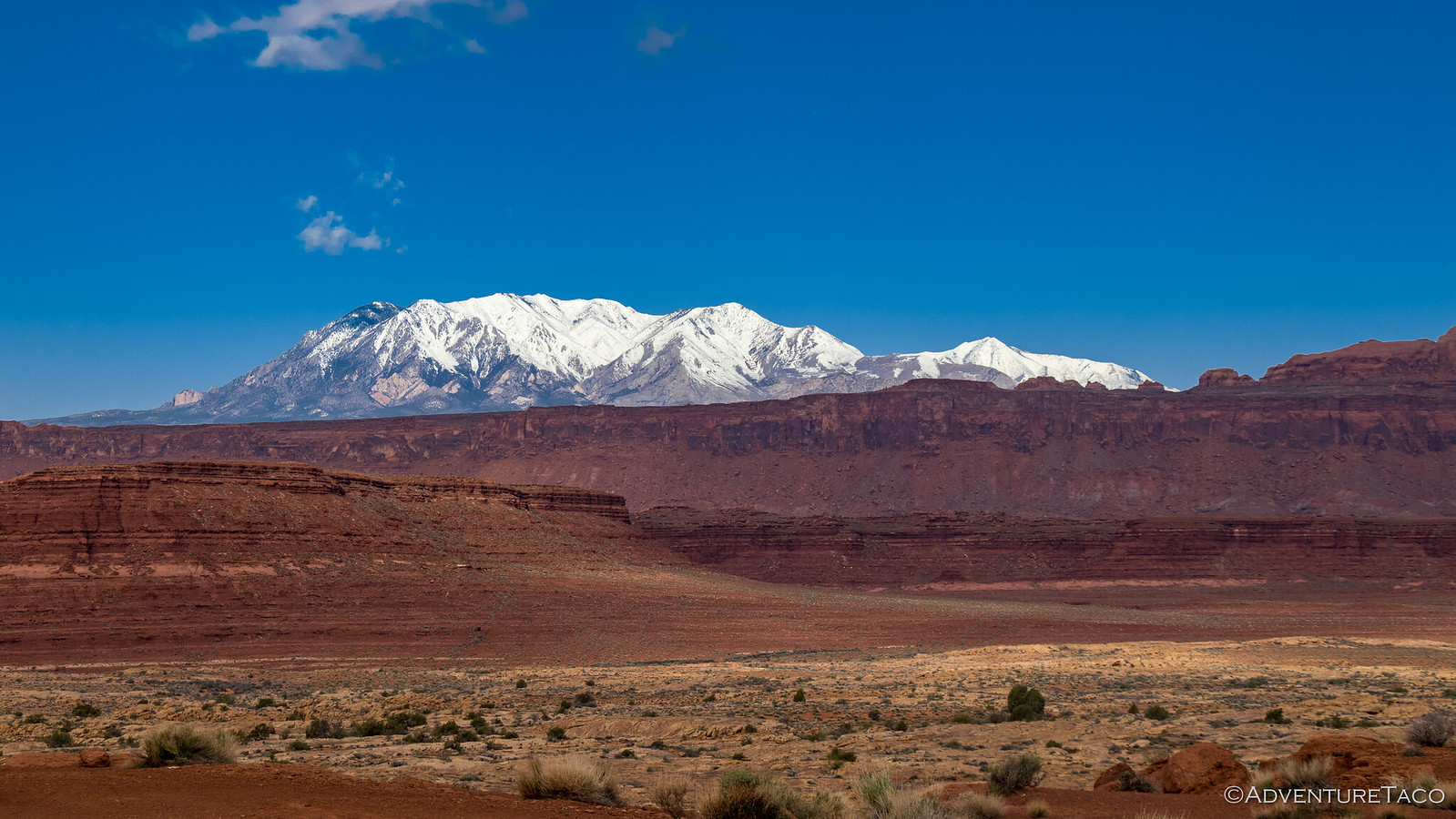
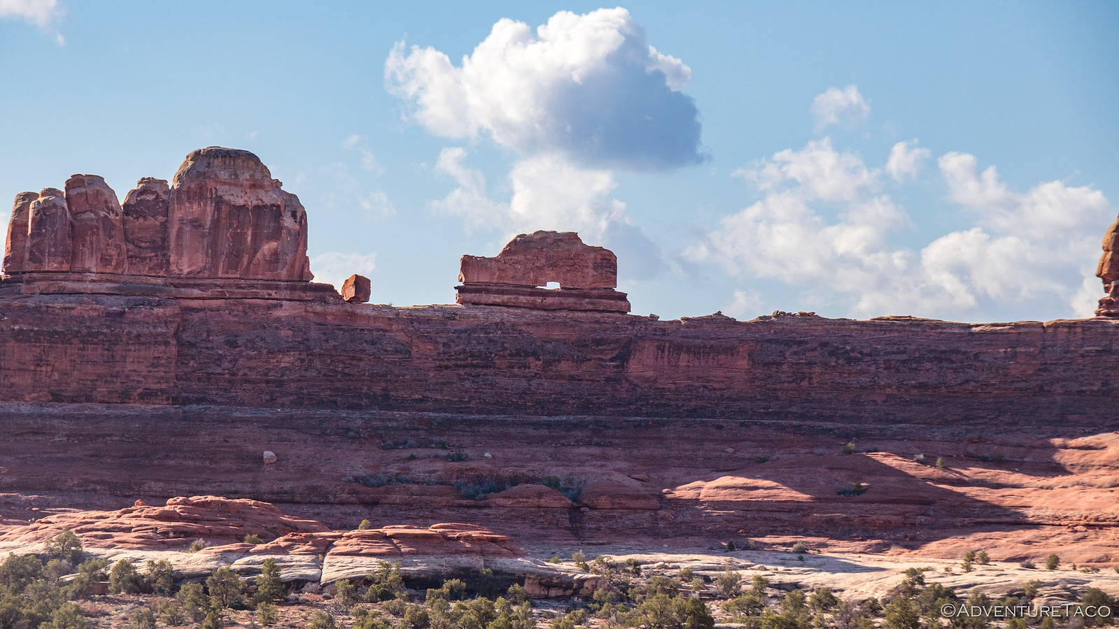
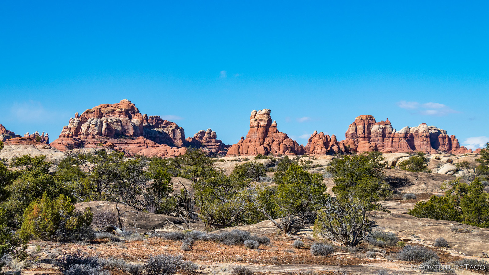
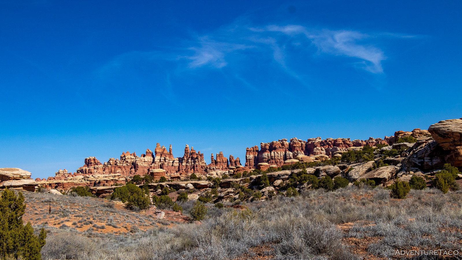
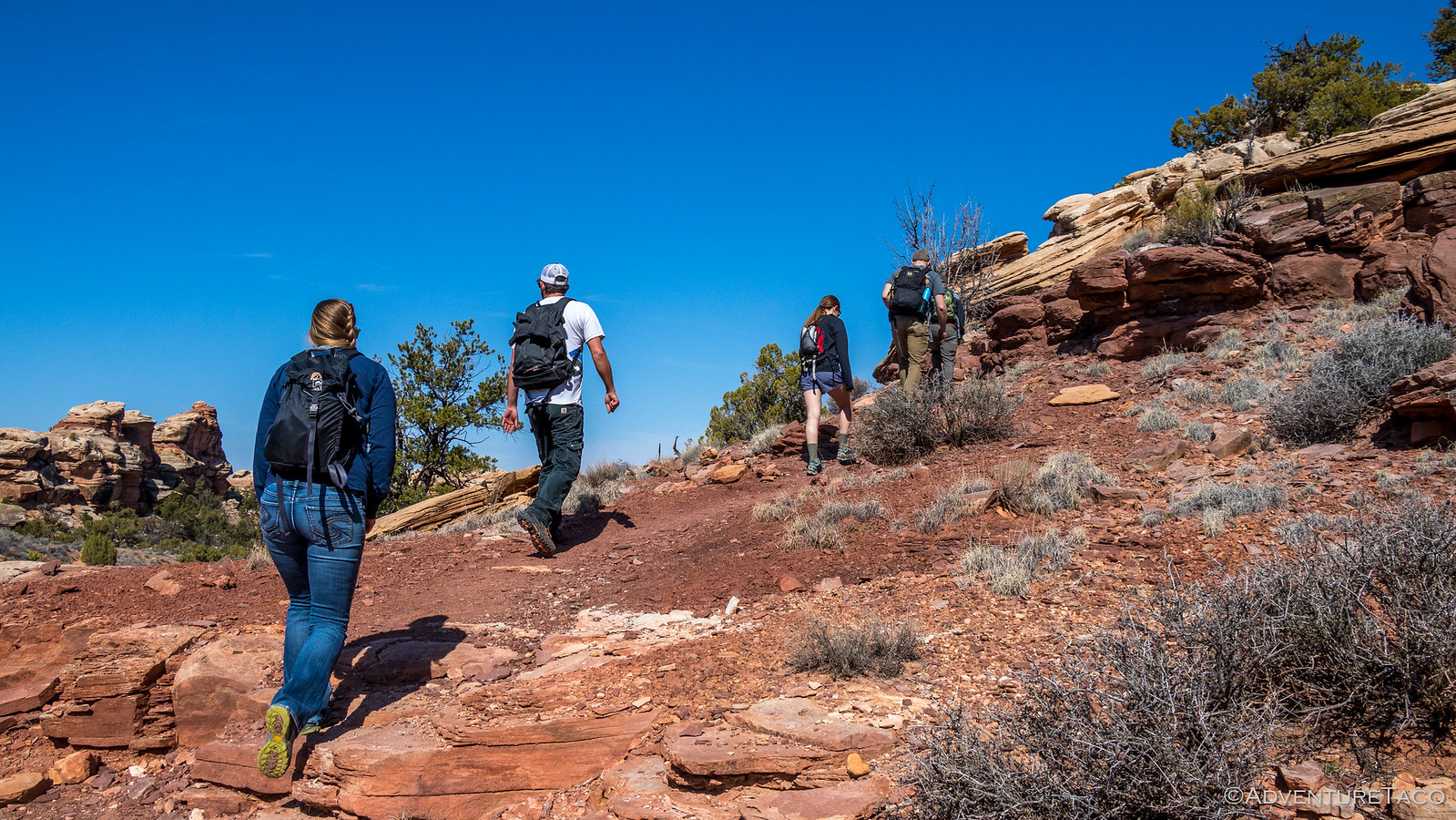
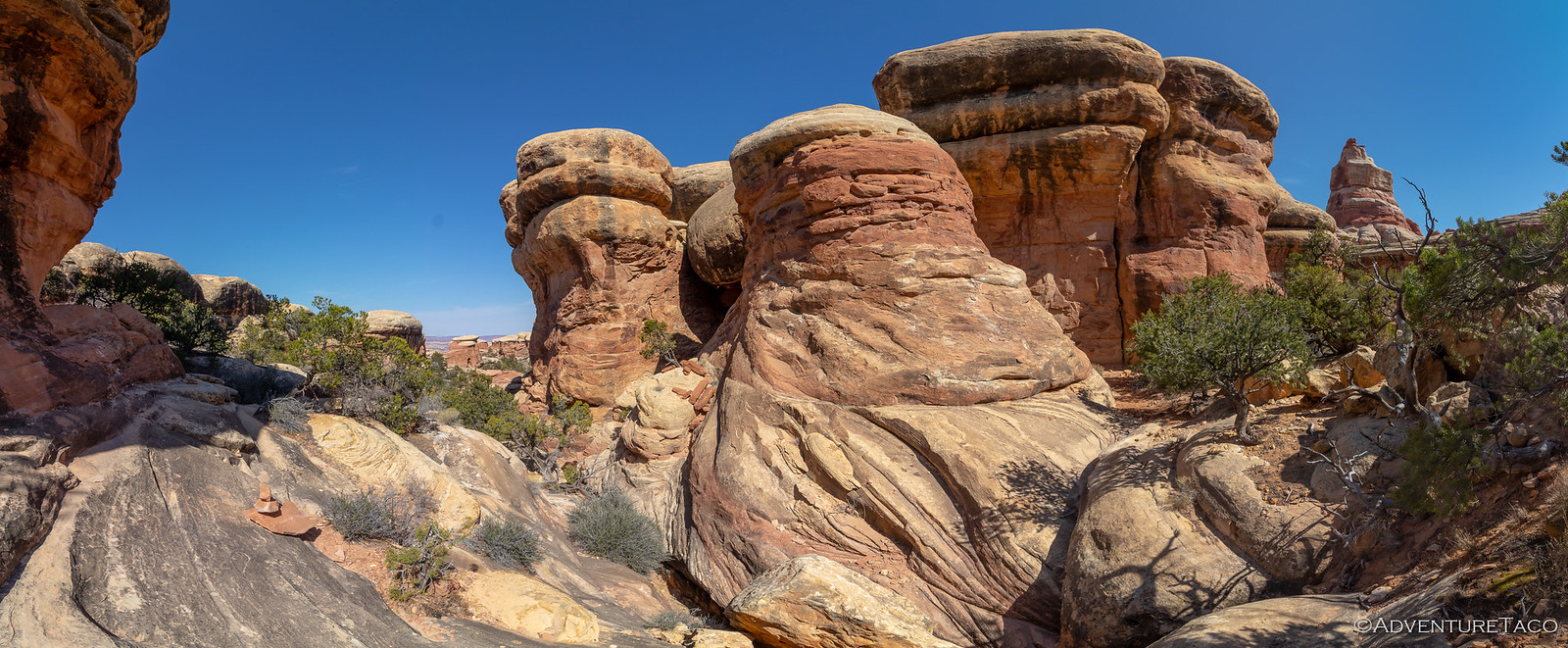
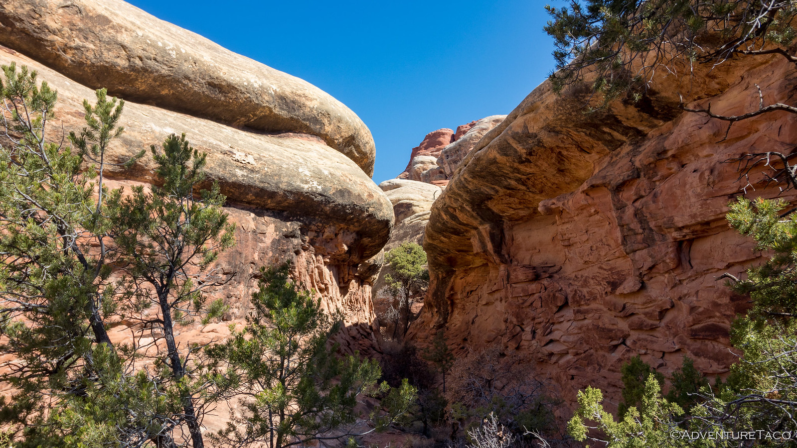
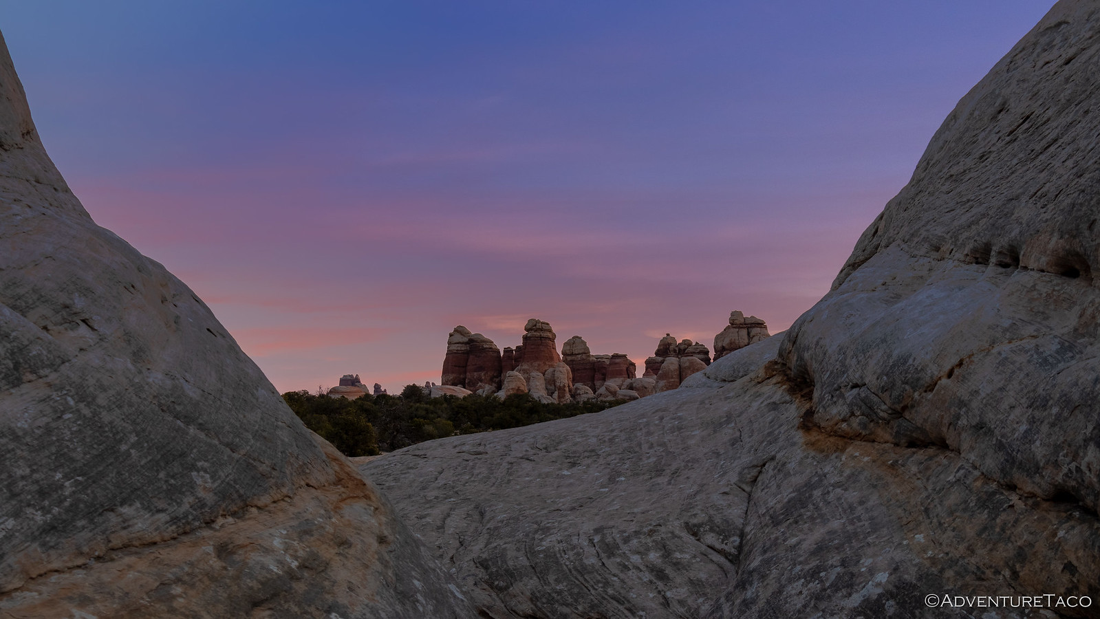
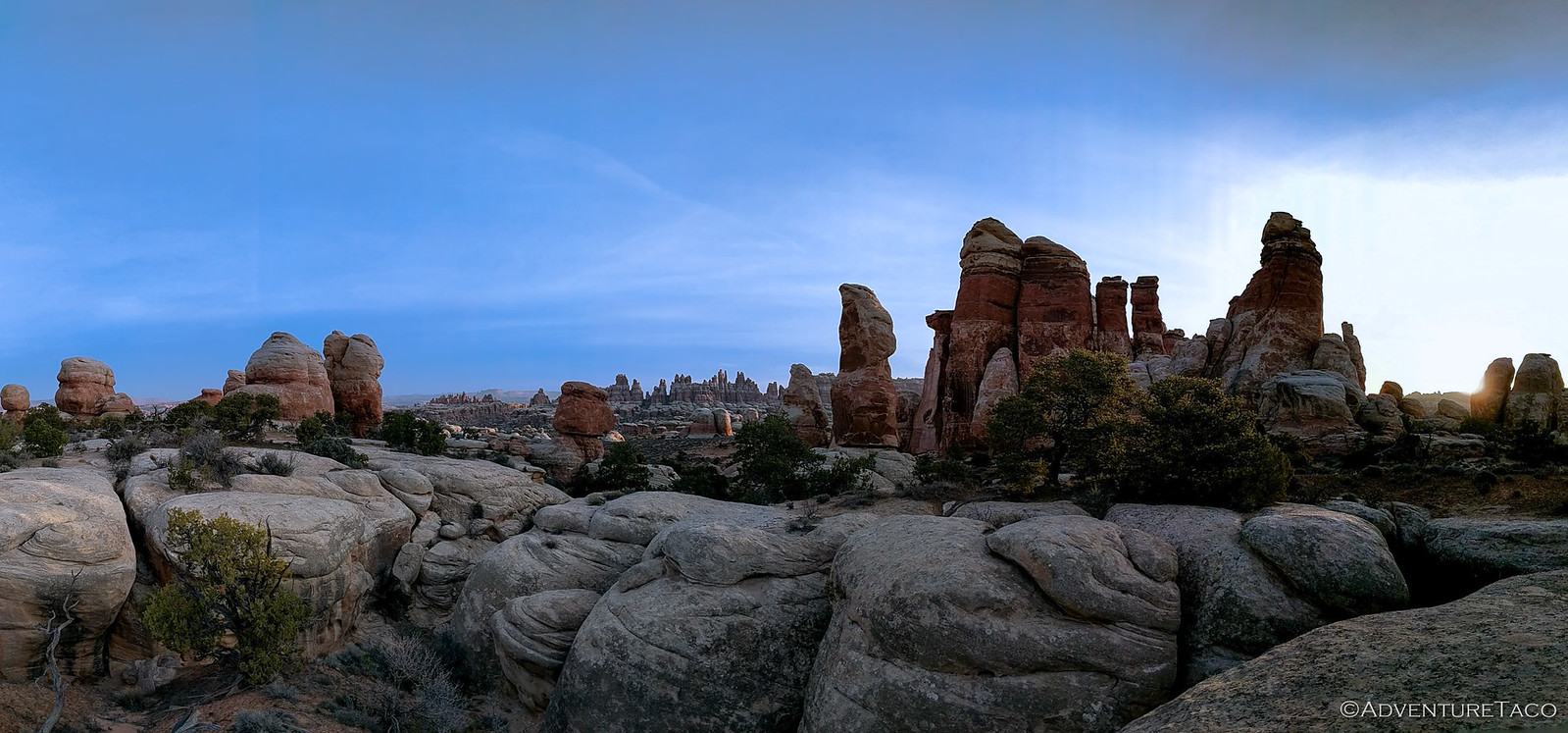
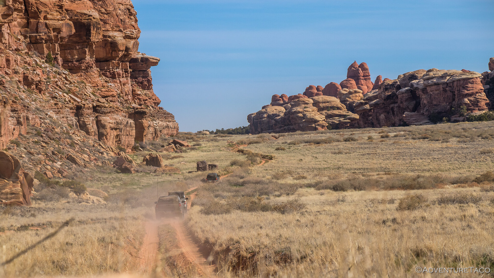
And the views from the top - breathtaking. Having never been to The Needles District of Canyonlands before, it nearly caught me off guard. It was like being surrounded by the Doll House from The Maze - needles everywhere in the distance, and colorful canyons in the foreground as we started down the back-side of the first hill.


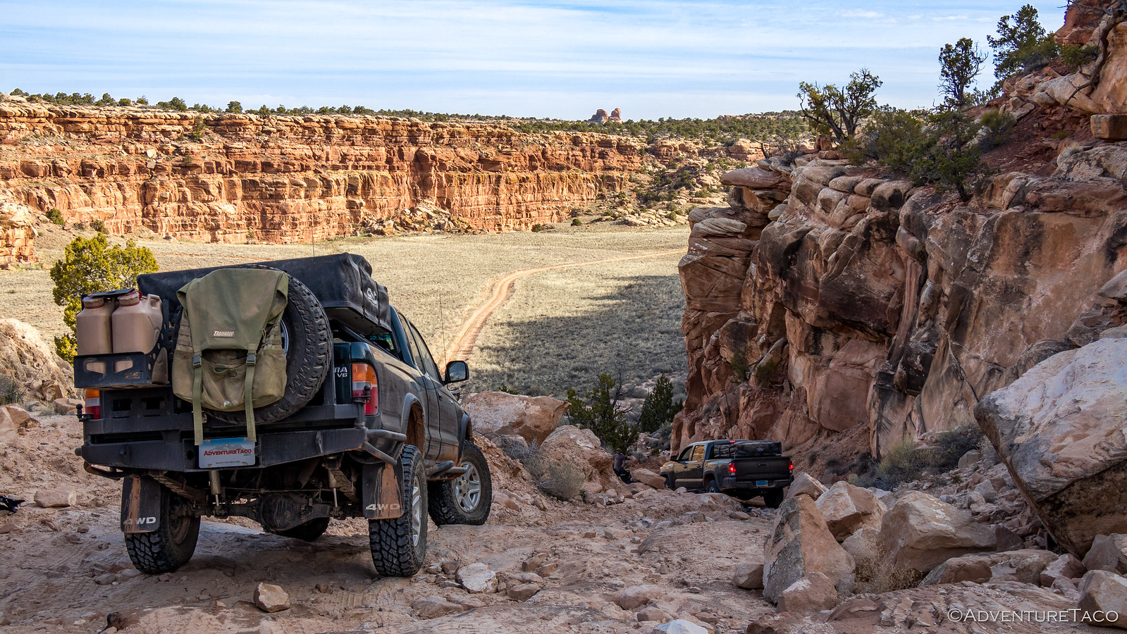
Now, it turns out that this back-side descent is a bit interesting. See, the switchbacks are so tight that you can't actually make the turns in the forward direction - so you take the first one forward, then back down the next one, and finally take the last one forward again....


Don't miss the rest of the story, and all the remaining photos that don't fit here (due to max post size). Hopefully that can change in the future, but until then...


.
 

turbodb

Well-known member
Ruining Around Utah 2 - Don't Miss Druid Arch

Before heading to bed, Monte (@Blackdawg) tried his best to prep us for what lay ahead. "It's a long hike." he said. "We can make it 10 miles or even 14, depending on the route we take. But don't worry, it's mostly flat."

Well, it wasn't mostly flat - except maybe on his computer screen. But of course, I'm getting ahead of myself.

Nestled in our little alcove on BLM land just west of Canyonlands National Park, it was obvious when we went to bed that there wasn't going to be any spectacular sunrise - the landscape just didn't lend itself to the morning sun. So we all slept in reasonably late - I was the first one up (barely) at 8:00am - the sun already high enough to light the far side of the valley.


In no huge rush, we spent the morning lounging in our chairs, chatting, and continuing our climbing adventures on the rocks around us - enjoying the sun as it warmed us and our camp after a chilly night. Breakfasts were made, and lunches were prepped for the hike ahead - we knew it would be long and we were told that the view at the end (Druid Arch) was worth it, but we really had no idea how long and none of us knew how cool the scenery along the way would be.

And so, it was nearly 10:30am when we finally pulled out of camp - headed east, back into the park and towards the Joint Trail trailhead.


I'd somehow ended up in the lead this time - something I generally try to avoid given my propensity for photos - but let me tell you, it was a nice change. Gone was the dust that I generally have to endure, and this section of trail happened to be one that was nearly perfect for my new suspension setup - wavy and whoops-y, but not too rocky - making for a fast, fun romp towards the needles.

There's a definite possibility that if I find myself in this situation too often, that I may feel the need for more speed. And in these situations, speed is generally the expensive option.


It wasn't long before we entered the edge of the needles - a section of road that would become very familiar over the few days that we'd be in the area. And it wasn't the last time that we'd stop for photos - each time, the light just a bit different; a rock here or there that we hadn't perfectly captured before - you know, all the standard excuses.


From there, the Joint Trail was only a short distance to our south - a half mile or so that we covered quickly before arriving at a small parking lot and restroom where we parked the trucks and got ourselves ready to go. Luckily, Devin (@MissBlackdawg) had brought sunscreen - the rest of us completely forgetting that critical bit of gear on this trip.


We set out up the Joint Trail around 11:30am, sure that it wouldn't be long until we reached the apex of our hike, where we'd break out our tasty sandwiches and enjoy the view.


Perhaps the most famous day hike in the Needles, the Joint Trail is one of the most difficult to access for most people. But once you're there, it's a relatively short mile-long trail with lots to see. There are views of The Needles of course, but there are also caves and caverns, long narrow passages between enormous granite blocks, and scrambles to viewpoints that nearly knocked our socks off. Oh, and for us it was also the first leg on our longer journey - meeting up with the Druid Arch trail at it's terminus.

The trail started predictably, with views of well-worn needles and the many canyons that wove their way around the bottoms of the pillars. If anything was clear, it was that we were going to be getting a lot of use out of our wide-angle lens' - the walls around us rising up beyond what we could capture in any other way.


And then - ahead of us - the trail seemed to disappear. As we approached, we were presented with the first of what would ultimately be several staircases between the rocks, leading us up towards the unknown. Exciting.


Being the last one up the stairs, it was fun to hear everyone else as they crested the top. Oooohs and aaaahhhs were plentiful, and added to the anticipation as I made my way up. At the top and through a tunnel, there was a large cavern - rocks surrounding us on all sides, light rays streaming in and giving everything a warm glow. Cairns, plentiful.


Don't miss the rest of the story, and all the remaining photos that don't fit here (due to max post size). Hopefully that can change in the future, but until then...

Keep reading the rest here
Ruining Around Utah 2 - Don't Miss Druid Arch


.
 

turbodb

Well-known member
Ruining Around Utah 3 - Stymied by Snow in Beef Basin
March 26, 2019.

Bobby Jo camp couldn't have provided a more pleasant place for us to sleep for the night - temperatures just right and only a light breeze to keep the air moving around within the tent.

Having hit the sack relatively early, I'd been sure to set my alarm for sunrise - hopeful for just a few clouds, I was keen to catch the needles silhouetted in the morning light.

As I climbed up onto one of the house-sized rocks around camp, it was clear that we were going to have a great day, but I wasn't sure what sunrise would bring - not many clouds in the sky to catch the light.


Of course, the most dramatic sunrises always have a tendency to take me by surprise, and so as I sat above camp enjoying the new day, the color started creeping up above the horizon.


Pretty soon, it was clear that I was in for quite the show - the yellows turning to orange and the oranges to pink and purple - the deep blue morning sky, a perfect backdrop for the canvas.


Eventually the entire sky was covered in a soft light, the sun now high enough to illuminate camp below, and to start bringing out the color in some of the needles to our west.


I hung out a while longer as I heard a few zippers and some rustling from camp - Brett and Heather (@BossFoss and @MrsFoss) who are also relatively early risers, having enjoyed the colorful display from the comfort of their cozy sleeping bags.

Eventually I decided that a bit more exploration was in order. It turns out that besides Bobby Jo camp, another site - Horsehoof camp - departs the main road less than 100 feet away, and Monte (@Blackdawg) had mentioned the night before that it had a nice overlook of the needles. Unfortunately, unlike Bobby Jo, it had very little flat ground, making it less ideal for our rigs. As I strolled along towards the site, it was clear that though we hadn't seen any wildlife beyond lizards and spiders, we weren't the only ones out here - deer tracks abundant along the road.


When I finally reached Horsehoof, the view really was spectacular. This would definitely have been a great place to camp as a single vehicle, or in a ground tent - and a good place to remember for a future trip. On this night, a single - nearly stock - Nissan Pathfinder was parked in camp, it's occupants just starting to stir and take in their surroundings on this new day.


Not wanting to disturb them, I turned around and headed back the way I'd come, my stomach reminding me that it was getting on breakfast time as I spotted Brent (@PcBuilder14) in the distance, his camera out and clicking away.

We all enjoyed our breakfasts in the morning sun - cereal for me, hot oatmeal for Brett and Heather, Donettes for Monte and Devin (@MissBlackdawg), and bacon and eggs for Brent. And once again, we lazied around - the pace of this trip more relaxed, and something I think we all appreciated more than we thought we would.

As we lounged around, talk eventually turned to the day's agenda - the plan was to continue west into Beef Basin, but that assumed that we'd make it through Bobby's Hole - a hill climb that the park ranger had warned us could be impassable, despite work that the local Jeep club had done before winter in order to try and slow down some of the erosion. From there, the plan was to visit a couple of Native American Indian ruins in Beef Basin before continuing south where we had a few options depending on the road conditions.

In the end, we realized that we couldn't really make any plans until we discovered what lay ahead - knowing that whatever that was, one thing was certain - we were likely to enjoy ourselves no matter what.


On our way - and travelling a section of road that we'd traversed three times already on the west end of the park - we made (and had) a good time, Brent commenting that, "Even though we've done this section before, I feel like there's always some rock or obstacle I didn't remember."


Soon, we were through the gate and back into BLM land - new ground in front of us and a great place to stretch our truck's legs with a bit of speed as we wound our way through the valley floor, canyon walls rising around us.


But we couldn't stay in the valley forever - we had to get up and over the southern pass in order to enter Beef Basin - and Bobby's Hole was the gatekeeper to that stage of our adventure.

As we neared, it was clear that most of the work done by the Jeep club the fall before had been undone by nature - the trail rocky, and the water diversion mats tossed to the side. It looked very fun!

...and a bit interesting for a nearly-stock 3rd gen Tacoma.

Monte made his way up first - carefully picking a line over the rocks and up the ledges - Devin hopping out of the truck at one point to spot and capture one of the more exciting sections, that required him to re-evaluate his line, on camera.


Next up was Brent. With lots of loose dirt, OEM tires, and a long wheel base, Brett and I looked on from below - curious to see how his truck handled this section of road.

As is often the case, his Tacoma impressed us all. With some spotting from Monte, he pointed his nose up and crawled up with little fanfare, the capability of his stock truck the perfect example of why I always tell people that they shouldn't wait to get out and see the sights - there's no need to "build" a rig to get through most of what you'll encounter in our vast land.


Don't miss the rest of the story, and all the remaining photos that don't fit here (due to max post size). Hopefully that can change in the future, but until then...


.
 

turbodb

Well-known member
Ruining Around Utah 4 - Over-Under & Saving a Jeep
March 27, 2019.

Unlike basically every other night where wind and snow were possible in the forecast, this night turned out to be just as pleasant as the last :woot:, and when my alarm went off for sunrise, I was well-rested and ready to see what the day had in store.

I wasn't disappointed.


And, I was lucky. After snapping a few photos around camp, a high cloud cover began to develop, and I took the cue to climb back into bed for a couple more hours of shut-eye. That turned out to be a great thing since - as we all got up, had breakfast, and got ready to go - the cloud cover was already burning off, another day of blue sky on order.

Just as we were about to go, the shadow of a contrail catching our eye.


Back in our trucks and our path to the south blocked, we headed east - back the way we'd come - through Bobby's Hole and towards Elephant Hill. We had quite a few miles to cover, but we are all looking forward to it - the landscape something we could take in again and again.


Back in Canyonlands, we made good time, knowing that we had a lot of ground to cover before we'd see new trail - the second half of Elephant Hill, the only bit we hadn't run when we came in a few days earlier. Still, as we approached the needles, we did pause to take a quick photo here and there.


And of course, whenever we can, we do our best to be good stewards of the environment - Monte (@Blackdawg) hopping out and carefully navigating around the desert crust to pick up a stray Mylar balloon.


A seemingly small action - we'd all picked up stray trash on this trip - it turned out that we were all in for a surprise. We'll never know if it was his or Devin's (@MissBlackdawg) idea, but the strangest voice came over the CB a minute or so later. It was high-pitched and squeaky, and we could tell that Monte was as surprised as the rest of us when he informed us, "This helium is really stale. It tastes terrible. What was I thinking?"

LOL. ? I found myself wondering what he was planning to say before sucking in that stale air!

A good laugh all around, we continued on - eventually reaching SOB Hill - the only place where there'd been any paint left on the trail so far. Not sure if going up would be harder than coming down, I jogged up to capture each of our attempts at the ledge-y turn.

Monte was up first, making his way through with a bit of tire spin - the lack of lockers not causing him any real trouble.


Brett and Heather (@BossFoss, @MrsFoss) were up next - a 3-point turn and strategic tire positioning making quick work of the situation.


Brent (@PcBuilder14) followed suit - his longer 3rd gen needing a couple more pivots to clear the corner, but once again performing amazingly well for a stock Tacoma. Everyone should really take note as to how capable this truck is, right out of the showroom.


I brought up the rear, taking a similar line to Brett, with a similar result. The truck performed admirably, though tight turns like this make it obvious that I need to do something with the placement of the remote resis for the new ADS coilovers - the 4Runner wheels bringing the tires inboard enough that they rub when I'm near full lock.


And with that, we sped off - a nice little stretch of smooth, dusty trail leading us towards the Confluence Overlook and our turn back towards Elephant Hill.


Now closer to that trail, someone - I don't recall who - asked why the trail was called Elephant Hill. None of us knew, but it got us all thinking - is there some elephant we should be seeing in the needles or hoodoos around us?

Not long after, Devin spotted this guy. Some internet research upon my return suggested that the trail is named either for the initial climb and descent or for a series of three elephants that can be seen in rock formations with the right lighting conditions, but I think this rock formation is quite clearly a better icon - a clearer elephant head+truck would be harder to find.


Don't miss the rest of the story, and all the remaining photos that don't fit here (due to max post size). Hopefully that can change in the future, but until then...


.
 

1leglance

2007 Expedition Trophy Champion, Overland Certifie
I might just give up going on my own trip and just enjoy the adventuretaco blog :)
Even though I just got home from El Camino del Diablo I want to head out the door after seeing all these pics, oh and your writing is as good as always.
Thanks for taking the time, I know it is a pain but we here are grateful.
 

turbodb

Well-known member
The pictures and descriptions on your site/blog truly are worth the time spent enjoying along with your trip.
I might just give up going on my own trip and just enjoy the adventuretaco blog :)
Even though I just got home from El Camino del Diablo I want to head out the door after seeing all these pics, oh and your writing is as good as always.
Thanks for taking the time, I know it is a pain but we here are grateful.
Amazing pics!
Thanks to all of you! Super glad you're enjoying the story, that's what it's all about! :)
 

turbodb

Well-known member
Ruining Around Utah 5 - Canyoneering Natural Bridges National Monument
March 28, 2019.

It was a chilly night - at least compared to the last - our tents covered in a layer of frozen dew when I awoke in the morning. A quick glance out the window was enough for me to realize that no spectacular sunrise would be visible from our location, so I pulled out my Kindle and finished reading whatever action-thriller I'd been in the middle of at the time.

That didn't take long - there hadn't been much left, so I pulled on a couple layers of clothes and climbed into the truck to finish writing the last chapter of the recent Anza-Borrego trip. :typing: As usual, it was a fun experience but one that took longer than I'd anticipated, and I wasn't completely done before I heard the zipper of Brett (@BossFoss) and Heather's (@MrsFoss) tent - the morning sun having warmed them sufficiently to get up and started on breakfast.


At any rate, that was my cue to wrap things up - my own Cheerios and blueberries waiting to be eaten in the sun. And of course, our ruckus was enough to wake up the rest of the crew, all them them pouring out of their tents in the next 20 minutes or so and pulling up their chairs to enjoy the warmth of the sun's rays.

Which meant it - as was normal by now - it was 10:15am before we got out of camp and on our way to Natural Bridges National Monument. That was fine today - our agenda clear except for a hike through this special place - something Monte (@Blackdawg) and I had added to our bucket list last fall when we'd visited as part of the F.U.Rain trip.


The plan was to hike the full loop - some 9.8 miles - through three natural bridges: Owachomo, Kachina, and Sipapu. It would be a trek for Brett, who's knee was giving him a bit of grief after our earlier hike to Druid Arch, but he was a trooper and plowed ahead with the help of a bit of Advil and Tylenol.

Plus we thought - this hike would be easier, right? I mean we were just walking along the bottom of a wash the entire way.

Mmm, nope. By the time we were done, we'd covered some 14 miles according to our GPSs, and the elevation change was nearly twice what we'd hiked through a couple days before.

But I'm getting ahead of myself.

We dropped down into the canyon on the south end of the loop, near Owachomo bridge. I don't know if this was the most spectacular bridge of the three for everyone, but it was for me. Towering above us as we made our way down, the angles of it's arch, and the views it framed were breath taking.


So distracted were we by the bridge itself that we lost the trail for a short period of time, having entirely missed a reasonably obvious sign that should have kept us on track. Not a problem for us though - that meant another view before heading the right direction down the canyon.


Before we'd set off on the hike, we'd stopped in at the visitor center to make sure we were squared away with our fees, and to inquire about the conditions of the trail. We'd been told that there was more water this year that normal, and that the trail had been quite muddy just four days before. With warmer weather this week, we hoped that we'd have no trouble - and for the most part that turned out to be exactly what we got.

In fact, I think we hit the hike at exactly the right time of year - water flowing along the wash next to us, cascading over rocky areas, it's sound rhythmic and peaceful - but the trail dry and the day warm. We couldn't have asked for more, really.


And then, as we were making our way around a bend in the wash - looking for a way to cross without getting wet, Brett turned around and pointed up on the side of a cliff. "Are those petroglyphs?" he asked, catching us all off-guard.

As it turns out, Monte had marked some ruins on his original route, but of course none of the rest of us had looked at that before setting out - so we had no idea that we might continue our record ruin run. And, even better - these petroglyphs weren't ones that Monte had marked. Without Brett's keen eye, we'd have walked right by, like so many other hikers must every day.


Keen to get a closer look, we found our way up (these side trips are what would turn our 9.8 mile hike into some 14 miles) and were greeted with some of the best petroglyphs we'd seen yet, and a ruin to boot.


We also found an ammo box - something we initially thought must be a geocache, but instead turned out to be a congratulatory note from the National Park Service, letting us know that we'd found a secret ruin - one of many throughout the monument.

One of many you say? Challenge accepted.


We continued on, meandering along with the wash, eventually making our way north, but not without a lot of east and west thrown in the mix. Having gotten a bit of a late start, we were all starting to get a bit hungry, and we looked for a nice place to stop for lunch - our criteria as simple as a nice view, a bit of shade, and a bit of sun.

- - - - - - - - - - - - - - - - - - - - - - - - - - - - - - - - - - - - - - - - - - - - - - - - -

Don't miss the rest of the story, and all the remaining photos that don't fit here (due to max post size). Hopefully that can change in the future, but until then...


.
 

turbodb

Well-known member
Ruining Around Utah 6 - Hite to Home
I was sure to get up early for our last morning in Utah - our location on the top of a plateau ideal for capturing the sunrise over Bears Ears.


As it does, the light started subtly, working it's way to brilliant oranges and pinks above the horizon - one of the best sunrises we'd had all trip.


But, that was seriously misleading. Behind me to the south west, a south westerly breeze was pushing clouds on the horizon closer. They were far enough away that I didn't even take notice as I climbed back into my tent to enjoy a couple more hours of still-warm comforters, before getting up for our always-delicious shared breakfast.

Having dozed off to sleep, I was awoken by an unusual sound about an hour later. It sounded like small grains of sand landing on the tent and rolling down the rain fly. Rain? No - it definitely didn't sound like rain, which lands with a single drop. A squirrel in a tree above, dropping pieces of pine cone on the tent? I didn't think I'd parked under a tree...

I decided it was worth opening my eyes to check it out - and I couldn't believe it - snow! Rather, a sort of snow-hail hybrid, pinhead sized balls of snow falling on the rain fly and rolling down the fly onto the ground. That sure didn't bode well for breakfast!

These flurries lasted for an hour or so - a break allowing us to climb out of our tents and get everything mostly dried off and put away - the temperature and breeze helping to keep the snow mostly frozen until it sublimated back into the air.

A quick pow-wow, and we confirmed that breakfast was off - we had no idea how much snow was in the forecast, and we preferred to not find out. Instead, we headed out - our usual breakfasts consumed quickly so we could get down off the hill.


Back on the highway, we headed north towards Hite and back into sunny weather - the Henry Mountains that we'd seen all trip now much closer and warranting a bit of admiration at a road-side pullout. That also gave Monte (@Backdawg) the opportunity to mess around with his CB antenna a bit - it's incessant screeching when he keyed down, more than any of us could bear.


Having found the issue - a frayed coax cable to the antenna - and jiggled things a bit, he was good to go for the time being, and we got back on the highway, passing over the bridge between Hite and the Hite Overlook. The bridge - the only automobile passage over the Colorado River between Glen Canyon Bridge (185 miles downstream) and US 191 near Moab (110 miles upstream) and was built in 1962. It marks the upstream limit of Lake Powell and the end of the <a title="Cataract Canyon" href="https://en.wikipedia.org/wiki/Cataract_Canyon">Cataract Canyon</a> of the Colorado River.

Oh, and it looks pretty cool, especially with a couple Tacomas about to cross.


We made a quick stop at the Hite Overlook as we passed by. I was glad I'd seen it not too long before - the clouds covering the sky in front of us today, and the sun to the south making for a harsh view of the vast landscape. Of course, it was still a beautiful view - so here's what it looked like the last time we visited. ::):


From there, we continued north - one more stop before we'd planned to part ways - to Hog Canyon. There was one last set of pictographs we wanted to visit, a fitting end to an amazing trip. As we explored along the canyon walls, we finally spotted what we were looking for - so close to everything, and yet so obviously rarely visited!

And it was amazing. The largest drawing we'd seen, the level of detail was much more intricate than the other art we'd seen - different color pigments and carving all used together to create a clearly royal work.


And with that, we were mostly done - there was gas to get in Hanksville, and we didn't actually part ways with Brett and Heather (the @BossFoss's) and Brent (@PcBuilder14) until Green River - but our off-pavement adventures were behind us.


Smiles and see-you-laters all around, I, Monte, and Devin headed north towards Salt Lake City, where they'd head eastward toward home at that point as I continued north and west.

Having gotten a late start, it was dinner time when we parted ways - on the one hand, wishing we could camp one more night; on the other, knowing there'd be another trip to come.


Through Idaho as the sun set, I had another 9 hours or so to go. It'd be 4:00am when I finally pulled into the garage, my third 20-hour drive in two weeks complete - and totally worth it!


Get out there and explore - it's more fun than you can imagine. ?
 

turbodb

Well-known member
If you're interested in following all the trips as they happen, feel free to sign up here:

1588447004283.png
 

Forum statistics

Threads
185,815
Messages
2,878,493
Members
225,378
Latest member
norcalmaier
Top