Northern Death Valley Road Conditions 2023 ???

ToyotaRocha

New member
I am wondering if there are any recent trip reports of backcountry travel throughout Northern Death Valley NP. Such as Saline Valley, Eureka Valley, Titus Canyon, and the Racetrack area. Wondering road conditions after last summer's floods and this years wet winter. Any current beta would be much appreciated!
 

deserteagle56

Adventurer
You'll find the latest updates in the link below. Most of the roads you are talking about are closed - even the paved road through Grapevine Canyon, location of Scotty's Castle.

If these washed-out roads were maintained by a Nevada county government the roads would have been repaired within a week after being washed out. But we're talking the Federal government here...it will take a couple years or so of bureaucratic red tape before anything is done.

Actually, from my experience with roads in the National Parks in the western states, I think the prevailing sentiment of National Park management is to close as many roads as possible and do minimal maintenance on the rest.


JayOtheMountains

Active member
You'll find the latest updates in the link below. Most of the roads you are talking about are closed - even the paved road through Grapevine Canyon, location of Scotty's Castle.

If these washed-out roads were maintained by a Nevada county government the roads would have been repaired within a week after being washed out. But we're talking the Federal government here...it will take a couple years or so of bureaucratic red tape before anything is done.

Actually, from my experience with roads in the National Parks in the western states, I think the prevailing sentiment of National Park management is to close as many roads as possible and do minimal maintenance on the rest.

Considering that DVNP resides mostly in CA, you're right about NDOT not doing squat. The park service is working on critical infrastructure and main thoroughfares first. INYO county is busy with other repairs and has been working with NPS to ensure roads with MOAs are open; however NPS personnel are working diligently to clear roads again. Red Tape was removed after this summer's late storms with massive influx of relief funds, I don't know where you're getting your misinformation, but the park has multiple crews from several other park units working on roadways. Dirt/unimproved roadways are way down the list, otherwise for both DVNP and INYO.

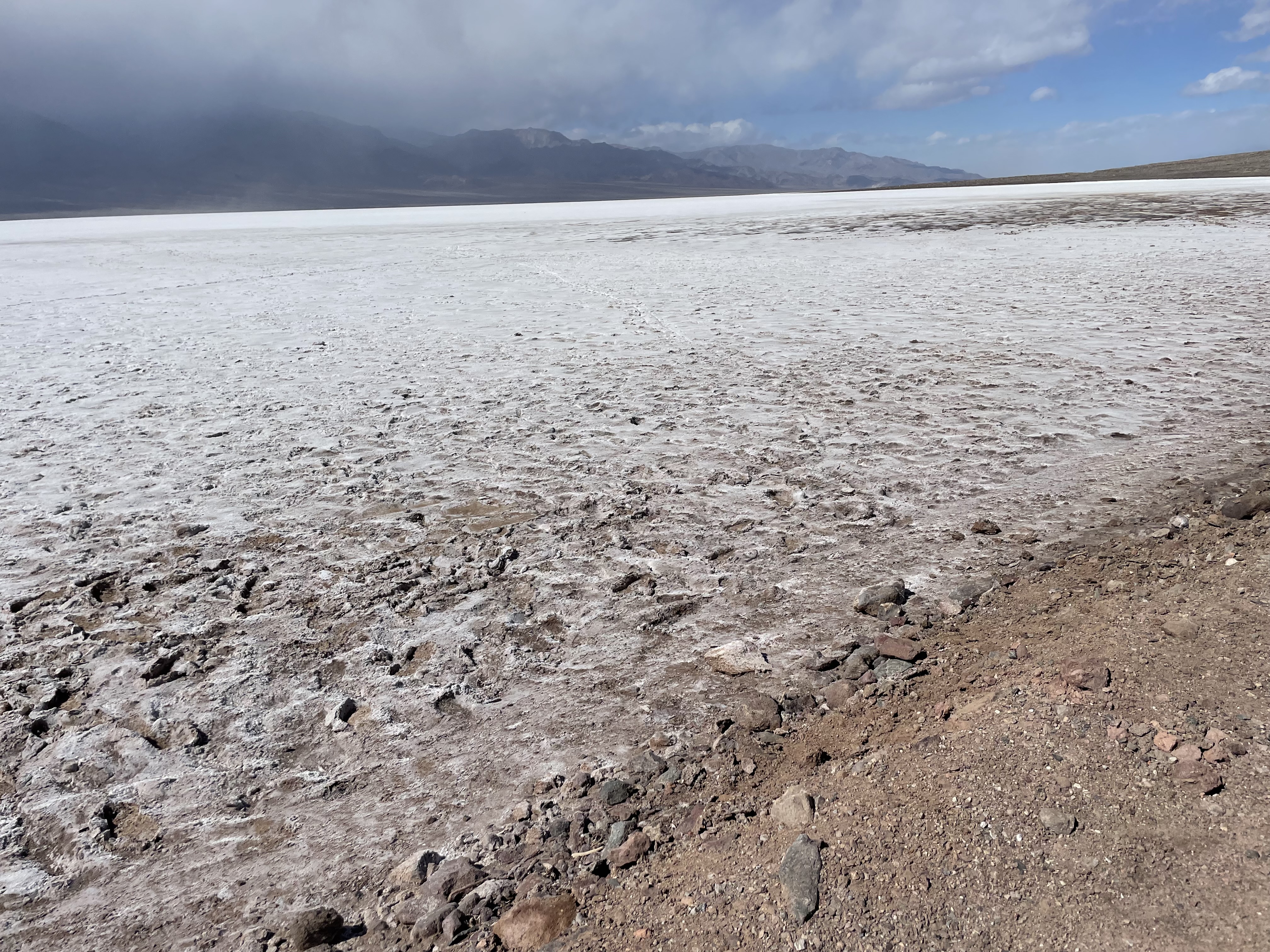
Conditions are always changing and after I hit post on this it will change again because there's a storm hitting currently.

4x4 & high clearance required pretty much everywhere at the moment away from pavement.

Death Valley - Big Pine Road is technically closed, along with signs, from Ubehebe to SR 168. However, Eureka Dunes is accessible. Eureka Valley Road between dunes and Ubehebe rough.
Racetrack is accessible (degraded) from Ubehebe. Road may be garbage after this week's storms.
Hunter Mtn Road had a bad washout at Lost Burro - heard 4x4 are making it.
Lipencott is passable - it's in normal condition.
SV Road is passable - extremely rough shape. N. Pass has snow (chains are a good insurance policy)
Steel is doable, but rough in SV above the upper spring. Steps look to be in okay condition. Silt pan in Eureka is silty - muddy after this week.

If you must go, be prepaired to 1) Turn around; or 2) deal with the conditions.

Source FB posts, various DV Forums. Experience in past 3 weeks on quick trip.
 
Last edited:

JayOtheMountains

Active member
I stand by my statement. I live out in the middle of nowhere, with mainly dirt roads. They get washed out frequently. Within a few days they are repaired. Why does it take weeks or months to repair a road in Death Valley?
Not to hijack this thread further, for which we've already done...

I'm curious about your question. There is a significant difference in how the federal government land managers (road managers) and state agencies work. This is by design and principal. State agencies are inclined to keep the taxpayer happy and commerce open. Aside from a few select thoroughfares in Death Valley, most of the paved roads are in place only for recreational purposes (Artist's drive, anyone??). I.e. they serve no revenue-making purpose and freight operations usually take the most direct route from hub-to-hub avoiding other areas of the park. The statement that roads in your rural area are fixed in a matter of days is telling to you as you're present in the area. You likely have a county maintenance shed with a few employees who live nearby who also have a vested interest in the roadways being navigable. Their budget is already allocated to include urgent road repairs to the dirt tracks you gleefully describe. The burden is spread across more available workers, probably with a pre-approved and accounted-for overtime budget for maintenance work. Your road crews are adept in gravel road repairs and tend to be ready to remedy issues of this nature quickly. In the case of the storms we're talking about, I do recall that the area including and adjacent to DVNPS was hit worse than even areas near Tonopah/Goldfield areas. For critical roads in the park these were open for use within 3-5 weeks of each storm cycle. Granted, the amount of destruction was also of a scale larger than a few blown out culverts or perhaps a washed out shoulder. Entire sections of HWY 190 and HWY 374 were obliterated that needed rebuilding from scratch - elevated road bed, road base, and asphalt. That's a large scope of work with minimal crews far away from agregate and asphalt production facilities; of course there were delays.

Which loops back to the park. DVNP saw 1.15M visitors in 2021, most of which congregated along the HWY 190/HWY 374 cooridors including Stovepipe Wells and Furnace Creek; 2022 may be nearer to prevous years visitation ~1.6M people. Still, this is no insignificant number. The real attractions have paved roads to them. These were cleared and repaired quite quickly following the storms in July/August and the Fall by both INYO county and NPS personnel. In-fact there were at one point enough NPS road crews in the park that INYO county was not reqired and they caught up on the repair/maintenance log for other roads in the county. Backcountry roads in DVNP are by nature not maintained (a few exceptions with jeep clubs); and only a handful of dirt roads are maintained (such as Death Valley Road north of Ubehebe to Eureka Dunes; West-Side Road; the entrance to Titus; the main road to Telescope Peak; and SV Road for which INYO takes care of. Only one is exclusively state-taxpayer funded and county maintained - SV road - and that is due to a few properties in there providing state tax revenue, thus the county requirement to keep it clear.) Aside from residences in Panament Springs, Stovepipe Wells, Furnace Creek, and SV the taxpayer base is non-existant in the park. Thus there is no requirement to keep a road open. Is why Scotty's has been closed for a bit as it exists solely for recreation and history.

For the most part, dirt roads in Death Valley are navigable at the moment by most 4x4 equipped vehicles. Some will require high-clearance and/or modification to navigate obsticals. Them roads ain't closed, your vehicle is just not suited to that particular style of travel.

I'm not here to argue why your county is better than the national park; however there are many reasons why the local, county, and state agencies are quicker than some federal agencies. A lot of it comes down to budget authority and allocations to account for emergency repairs. Death Valley isn't exactly known for it's rain....
 
Last edited:

JayOtheMountains

Active member
Staff housing, Park provided housing. Not a private residence, thus no tax taken. It's been generally accepted that the quickest trucking route from E <-- --> W in the park is 374/190 via Lone Pine/Beatty. It's why pressure on Scotty's Castle road hasn't been too great; even before the summer storms occurred. The park maintains access for their employees; but since the castle isn't open yet from the last 100-year flood restorations, there is no need to have the road in shape for general public use.

A different and slightly more complicated situation occurs at Furnace Creek. Xanterra Parks leases the land from the govt and pays CA taxes for the properties at the visitor center and their resort. Staff housing is either Xanterra leased-to employees or all govt/park provided for NPS personnel. The Tishimba also are supported by NPS, BIA, as well as the State; so there's a resource that has to be supported as well. It takes a weird understanding of how funding allotments are garnered and distributed to better understand the roads situation. The Park has interest in maintaining access to areas in the park. Those areas are given priority based on various factors. Those with services or infrastructure improvements are prioritized over unimproved spots. DV is a large landscape to manage as well. Throw in cultural resource management, EIS necessitation, and those pesky tourists and it becomes a complicated ordeal. When recovery funds were allocated after last summer's storms some of the requirements were waived as the scope was no longer maintenance or new work, it was emergent restoration and rehabilitation of critical infrastructure. Lots of changes to how business is conducted when Federal emergencies are called.
 

BOHICA

Adventurer
I am wondering if there are any recent trip reports of backcountry travel throughout Northern Death Valley NP. Such as Saline Valley, Eureka Valley, Titus Canyon, and the Racetrack area. Wondering road conditions after last summer's floods and this years wet winter. Any current beta would be much appreciated!
To answer your question...I recently traveled through DV from Shoshone in the south to Lone Pine in the north via Furnace Creek and Saline Valley. Roads were open...a little snow lingering in the north pass. This was last week, 12-16 Feb.
 

NMC_EXP

Explorer
Actually, from my experience with roads in the National Parks in the western states, I think the prevailing sentiment of National Park management is to close as many roads as possible and do minimal maintenance on the rest.

I agree but would add all federal land management agencies seem to have the objective of curtailing vehicular travel on federal land.
 

unsung

Active member
Blocking roads is something that they certainly do, along with destroying structures that have been standing for decades.
 

sixD9er

New member
Hi there,

Is anyone able to provide any intel regarding butte valley - Warm Springs Road? The NPS site's map shows"No access to warm springs camp" but it is absent from the closure list.

Is it passable to west side road?


1678220112051.png

1678220294954.png
 

Hegear

Active member
I was there last week and everything north of the 190 was closed. Still had a good time but really everything wanted to see including the warm springs was closed.
 

sixD9er

New member
I was there last week and everything north of the 190 was closed. Still had a good time but really everything wanted to see including the warm springs was closed.

I think we are on opposite ends of the park. I am wondering about Warm Springs camp between striped butte and west side road on the south end of the park.
 

Hegear

Active member
I’m not positive on that area. I did head out towards telescope peak, and didn’t run into any closures. I spent about 10 min with a park ranger and a map, they didn’t indicate anything closed out that way. Sorry I can’t be more help.
 

calicamper

Expedition Leader
Just don’t get caught out there in the flats if this next Atmospheric River really kicks our butt. Could be a gully washer out in the desert and at this point theres been plenty of warnings. Just picked up sand bags a little bit ago my self
 

AMMO461

Member
Goler wash, Mengel Pass, Striped Butte and Warm Springs to West Side Road ARE passable at this current time (9 March). They have been washed out/rutted/and some minor re-routing by Mother Nature recently but Jeeps, FJ's (us) have traversed it. West Side road is open but is pretty rutted up. The National Park does not post conditions of the route due to it being a back country off road route, they do not regularly send rangers to survey the route and rely on information from trekkers and off roaders. When we asked the rangers about the condition of Titus Canyon they frowned and said it could possibly be the end of the season before its officially declared open due to the back to back storms and wash outs. Hope this helps.
 

Forum statistics

Threads
185,833
Messages
2,878,703
Members
225,393
Latest member
jgrillz94
Top