ExpoScout
Explorer
Well this weekend I decided to go up and see family that live near Grandfather Mtn. and I figured I would get a trip in while the weather was so awesome.

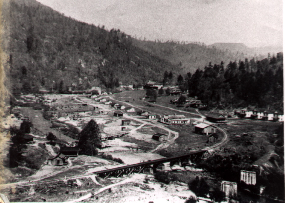
At part of what's left of the old Mortimer mill complex and my '95 5spd D1 which can be seen here: http://www.expeditionportal.com/forum/threads/55474-Project-quot-Oscar-quot-5spd-D1
Here is a portion of the US Forest Service motor vehicle use map of the Grandfather District that I have cropped and crudely drawn our route on: (I apologize in advance for the awfulness of this map, I need some fancy software that can highlight routes. I would have used Google maps but I couldn't zoom out enough to get the little roads I was on to show up)

Here is a link to the entire map that you can zoom in on and see the intricacies of where we explored:
https://fs.usda.gov/Internet/FSE_DOCUMENTS/stelprdb5188497.pdf
It was a good time. But basically to sum it up; We live in the Triad area and came up 40 to Morganton. We then took 181 to Brown Mountain Beach Rd, up Wilsons Creek to Mortimer. We then went Northeast to FR 4068 and took that up towards Schoolhouse Rock. From there we went North towards Globe and ended up taking SR 1514 all the way to Hwy 221 (pops out just East of the Grandfather Mtn entrance gate). After that we went to the family cabin and relaxed for the night.
Got up this morning and sat around by the fire and drank more that my share of a pot of coffee, then packed up the wife and dogs and headed back out.
If you are familiar with the area you know where Pineola and Jonas Ridge are at. If not they are a little ways North of the area labeled as Linville Gorge Wilderness Area. I started there today and came down SR 1265 on the Eastern rim of the Linville Gorge. Once we got down and intersected with FR 496 we took it North-Northeast and followed it until it hit Hwy 181. It popped out just North of the Brown Mtn. Overlook.
From there we went back down 181 to Brown Mtn. Beach Rd. and followed it towards Wilson's Creek like we did yesterday. However, this time we passed Wilson's Creek and turned on our next road to the left. On the map it's not labeled well, but you can see it is labeled as 187 if you look on up the road (on the map). On the road it was labeled as Maple Sally Rd.
This ended up turning into a no-name road and eventually into Maple Grove Church Rd. This was 28 miles of switch backs and almost nothing but wilderness. It was actually really cool and I'm glad that I got to check it out.
Once out at the top there we came back down through Mortimer and back out by Wilson's Creek, eventually heading back down to Morganton and on towards home.
I like this area a lot as I've spent a lot of time here growing up. I can't even count the days I spent up on Harper's Creek as a kid trout fishing. As I got older Mortimer was a common spot for me to stop in as I was exploring the area with friends, whether camping, hunting, fishing, hiking or a combination of all of the above. It was nice to get back out there as I've started to do more often. There really are a lot of places up there hidden in coves that I've yet to see, so there will probably be more time spent there in the near future.
That's an abridged version of the trip. I've got a lot of pictures that are on the way and I will narrate and explain the trip a little better that way.
Thanks for checking it out.
At part of what's left of the old Mortimer mill complex and my '95 5spd D1 which can be seen here: http://www.expeditionportal.com/forum/threads/55474-Project-quot-Oscar-quot-5spd-D1
Here is a portion of the US Forest Service motor vehicle use map of the Grandfather District that I have cropped and crudely drawn our route on: (I apologize in advance for the awfulness of this map, I need some fancy software that can highlight routes. I would have used Google maps but I couldn't zoom out enough to get the little roads I was on to show up)
Here is a link to the entire map that you can zoom in on and see the intricacies of where we explored:
https://fs.usda.gov/Internet/FSE_DOCUMENTS/stelprdb5188497.pdf
It was a good time. But basically to sum it up; We live in the Triad area and came up 40 to Morganton. We then took 181 to Brown Mountain Beach Rd, up Wilsons Creek to Mortimer. We then went Northeast to FR 4068 and took that up towards Schoolhouse Rock. From there we went North towards Globe and ended up taking SR 1514 all the way to Hwy 221 (pops out just East of the Grandfather Mtn entrance gate). After that we went to the family cabin and relaxed for the night.
Got up this morning and sat around by the fire and drank more that my share of a pot of coffee, then packed up the wife and dogs and headed back out.
If you are familiar with the area you know where Pineola and Jonas Ridge are at. If not they are a little ways North of the area labeled as Linville Gorge Wilderness Area. I started there today and came down SR 1265 on the Eastern rim of the Linville Gorge. Once we got down and intersected with FR 496 we took it North-Northeast and followed it until it hit Hwy 181. It popped out just North of the Brown Mtn. Overlook.
From there we went back down 181 to Brown Mtn. Beach Rd. and followed it towards Wilson's Creek like we did yesterday. However, this time we passed Wilson's Creek and turned on our next road to the left. On the map it's not labeled well, but you can see it is labeled as 187 if you look on up the road (on the map). On the road it was labeled as Maple Sally Rd.
This ended up turning into a no-name road and eventually into Maple Grove Church Rd. This was 28 miles of switch backs and almost nothing but wilderness. It was actually really cool and I'm glad that I got to check it out.
Once out at the top there we came back down through Mortimer and back out by Wilson's Creek, eventually heading back down to Morganton and on towards home.
I like this area a lot as I've spent a lot of time here growing up. I can't even count the days I spent up on Harper's Creek as a kid trout fishing. As I got older Mortimer was a common spot for me to stop in as I was exploring the area with friends, whether camping, hunting, fishing, hiking or a combination of all of the above. It was nice to get back out there as I've started to do more often. There really are a lot of places up there hidden in coves that I've yet to see, so there will probably be more time spent there in the near future.
That's an abridged version of the trip. I've got a lot of pictures that are on the way and I will narrate and explain the trip a little better that way.
Thanks for checking it out.
Last edited: