Michigan's Upper Peninsula Fall 2010

grahamfitter

Expedition Leader
Destination Michigan! We planned this trip for several hours the night before leaving which is uncharacteristic of us; usually we get at least half way there before thinking about where we're going.

Friday 9/18. A somewhat circuitous route from Massachusetts via West Virginia on the weekend of the Gauley River Festival. The water was white and the many spectators who made the trecherous descent into the gorge to watch the carnage at Pillow Rock certainly got what they came for. At the festival ground most vendors were giving away beer and the paddlers got what they came for, too.

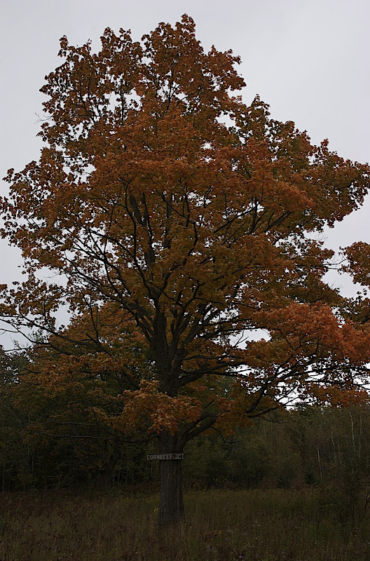
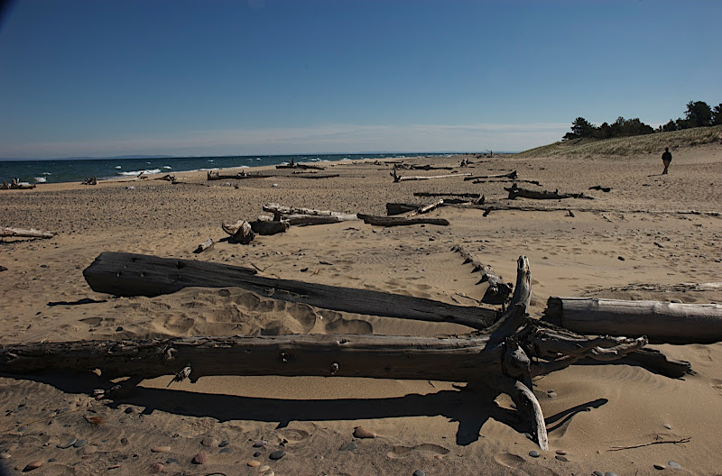
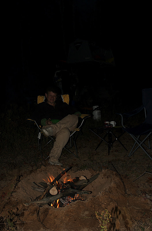
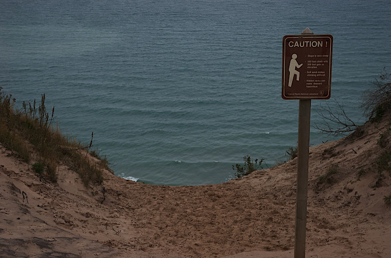
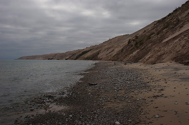
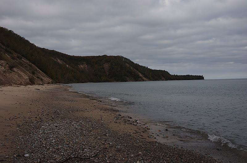
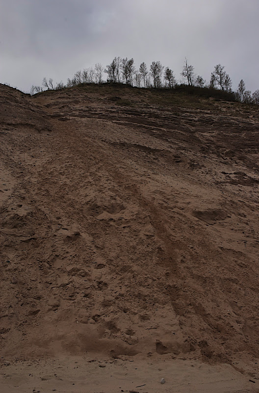
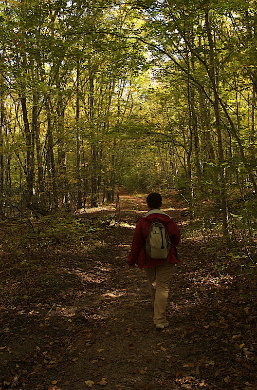
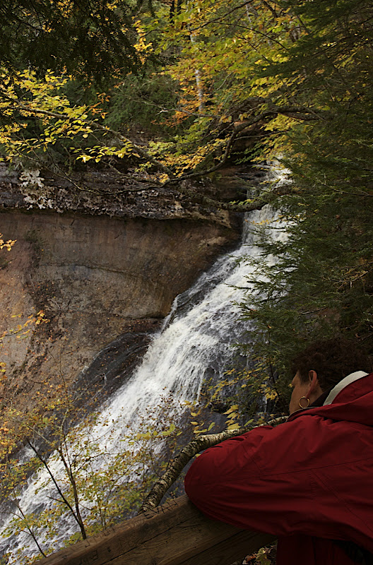
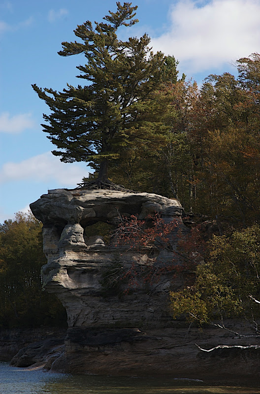
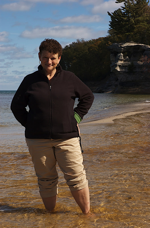
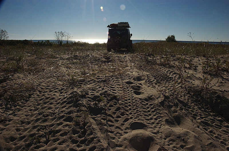
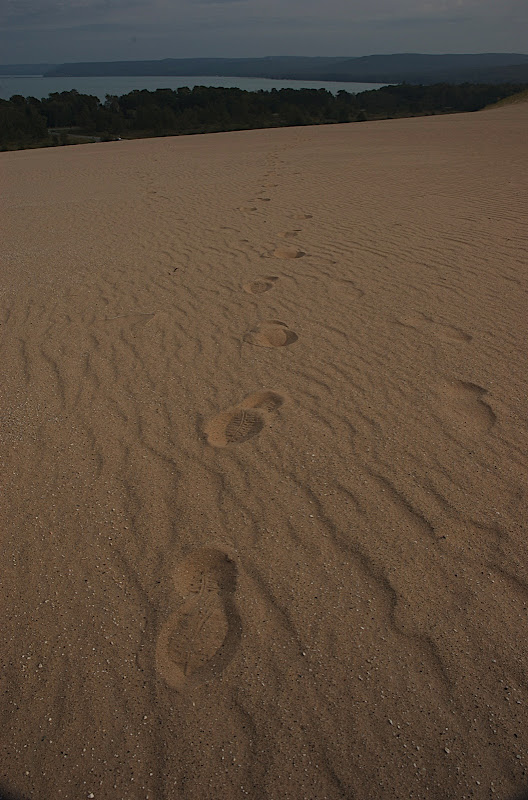
Tuesday 9/21. The West Coast of Michigan in the vicinity of Sleeping Bear Dunes National Lakeshore and the various sandy floored forests thereabouts. The trees hinted fall would soon be on the way but the daylight sun was warm as was the constant breeze off Lake Michigan which was a pleasant surprise. We climbed dunes, swam in the lake and generally relaxed after the long drive.

DSC_3713.jpg

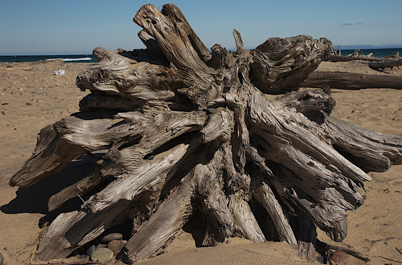
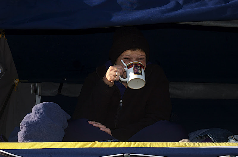
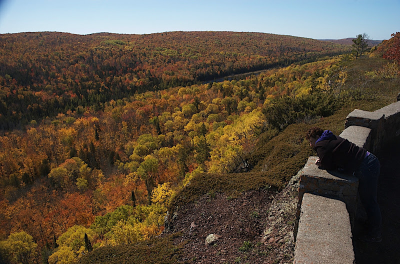
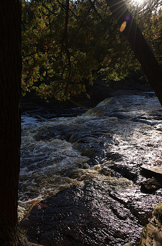
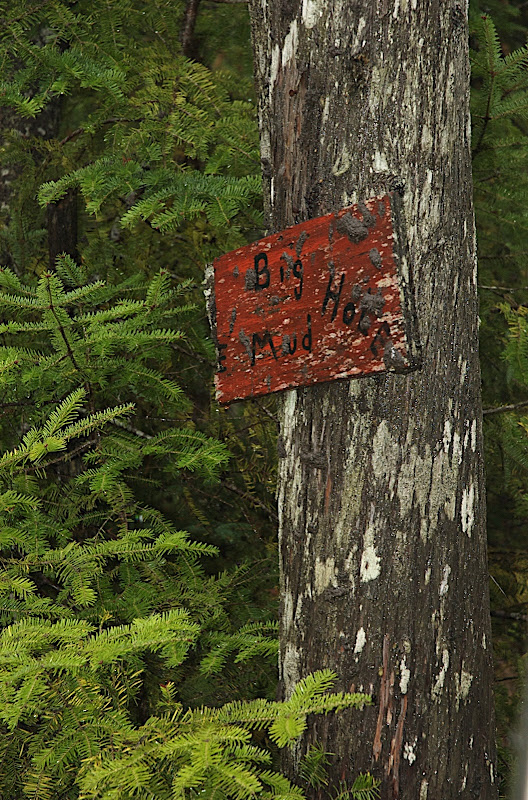
Generally a sign of good things to come. In this case, a sign of extreme bushwacking.

DSC_3714.jpg

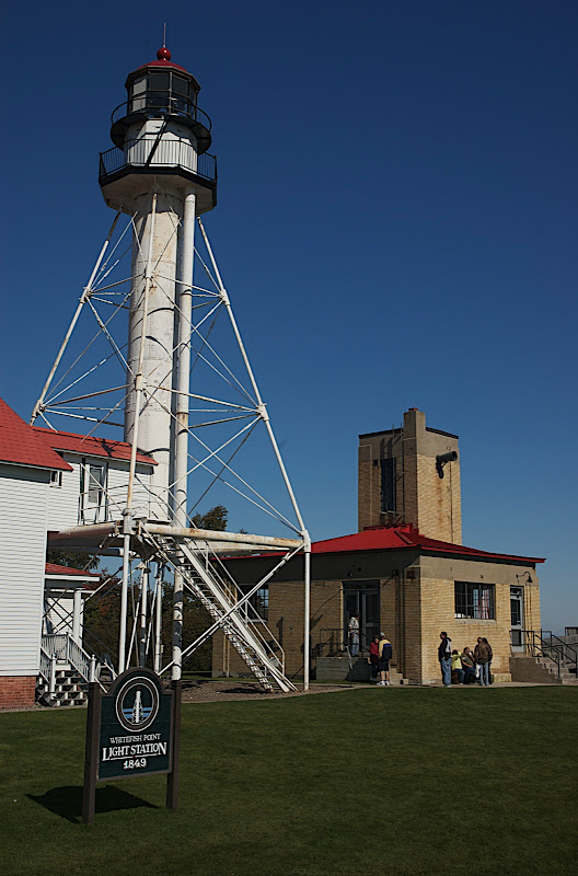
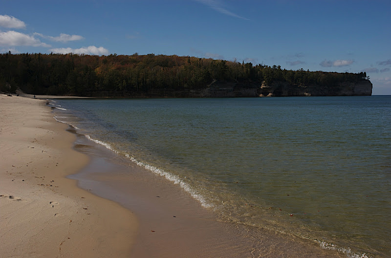
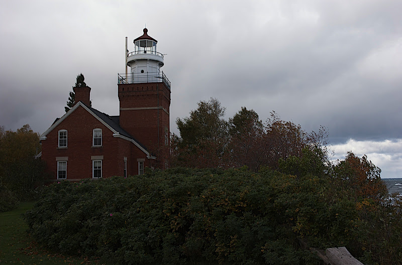
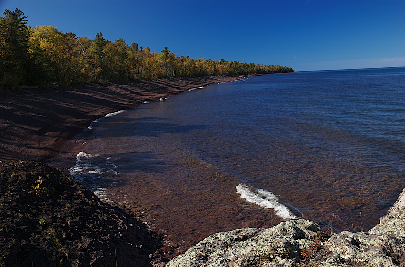
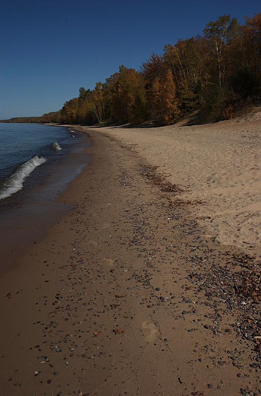
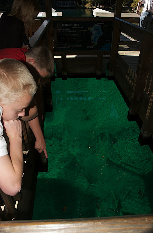
Like Cape Cod in Massachusetts without the crowds?

DSC_3732.jpg

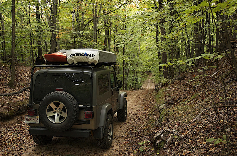
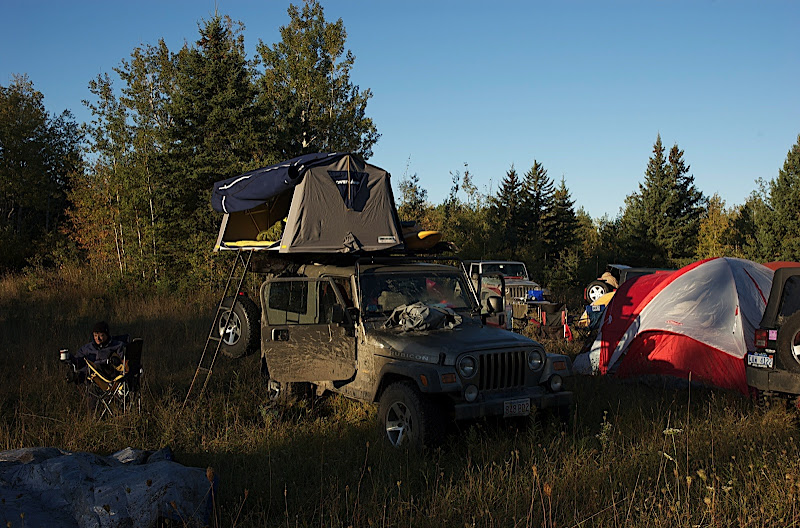
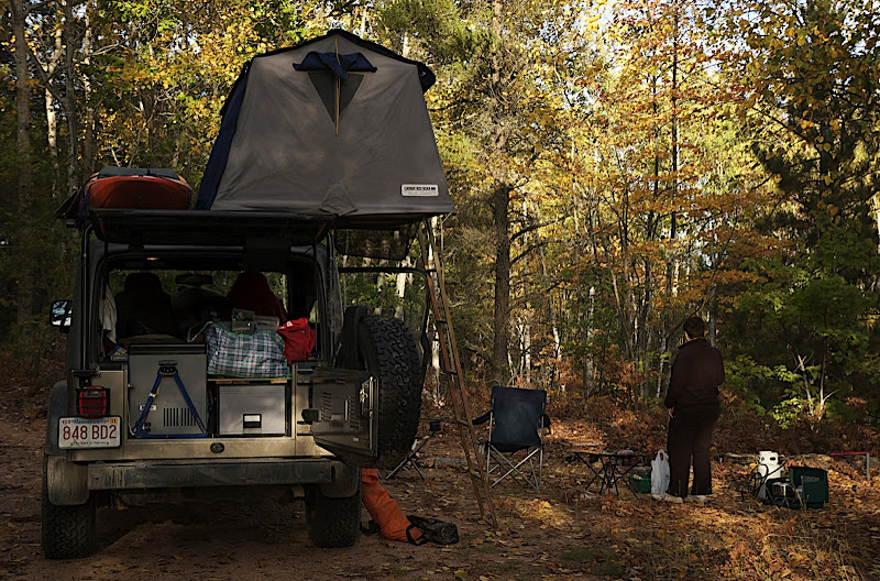
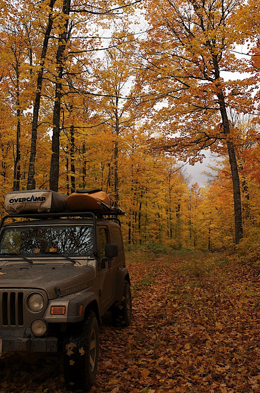
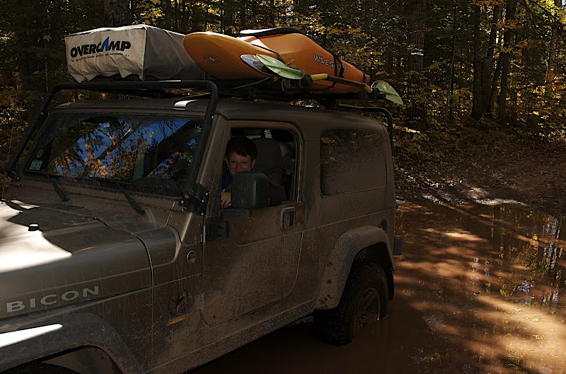
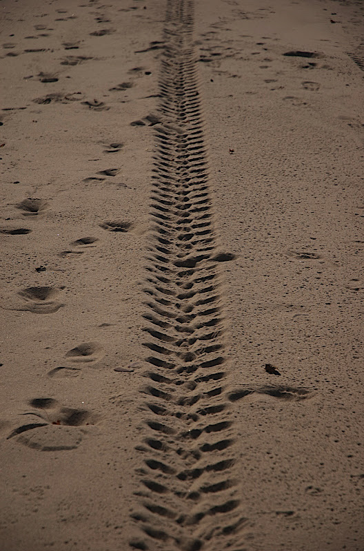
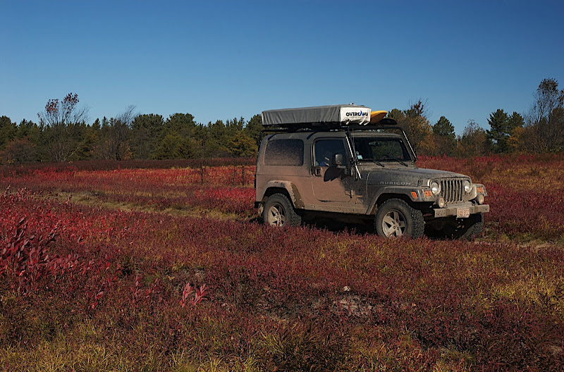
Green trees and clean Jeep. Neither will last for long.

DSC_3734.jpg

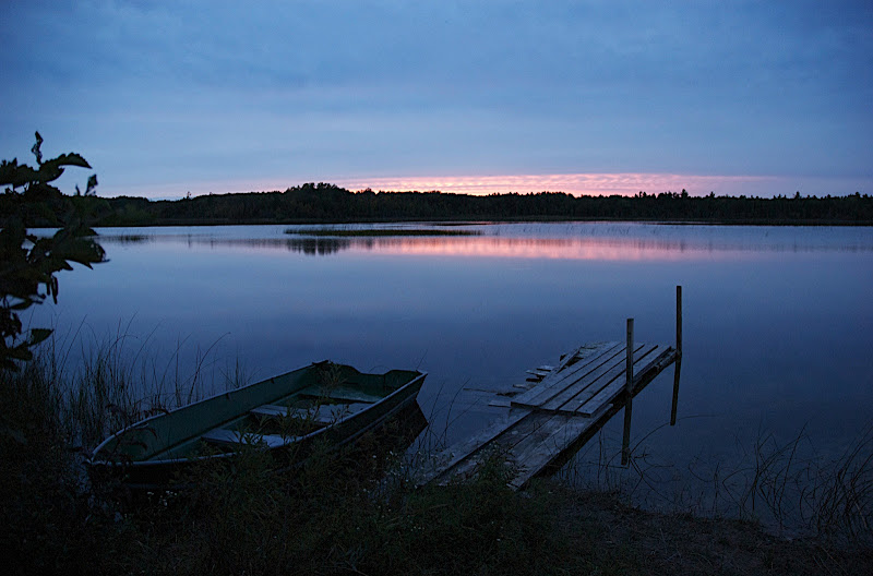
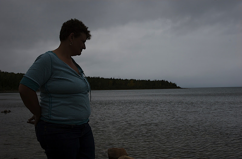
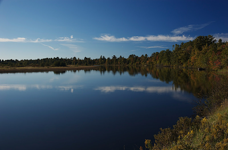
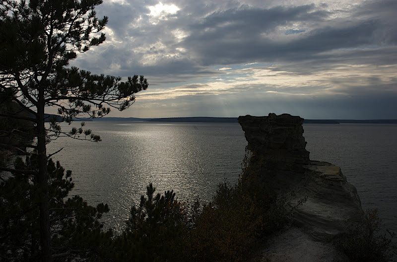
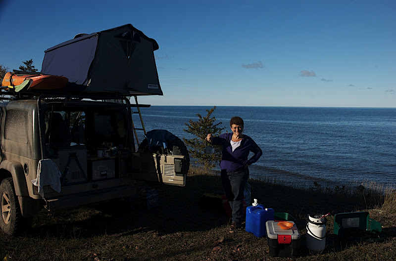
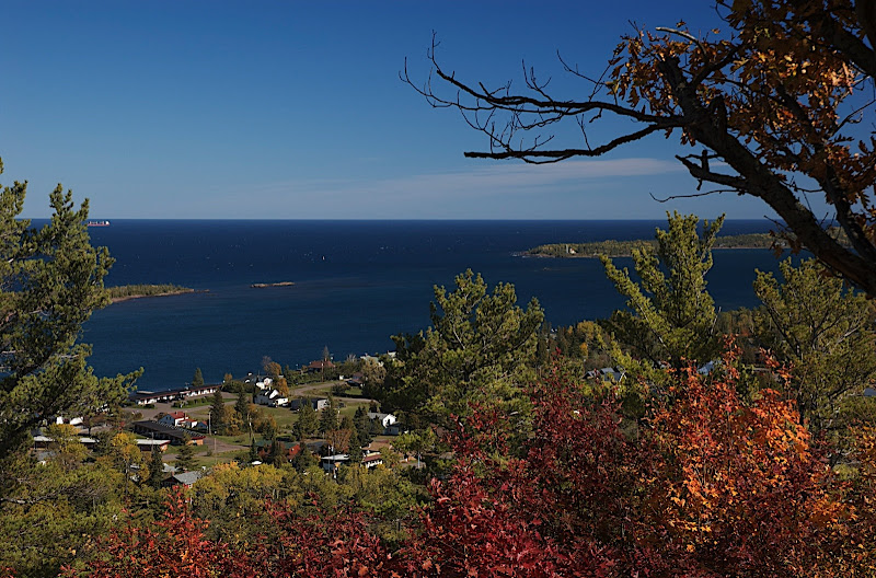
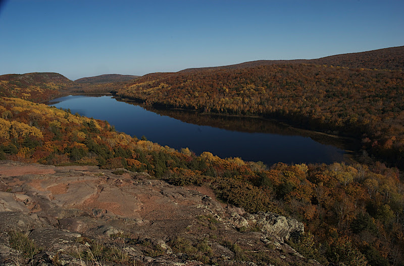
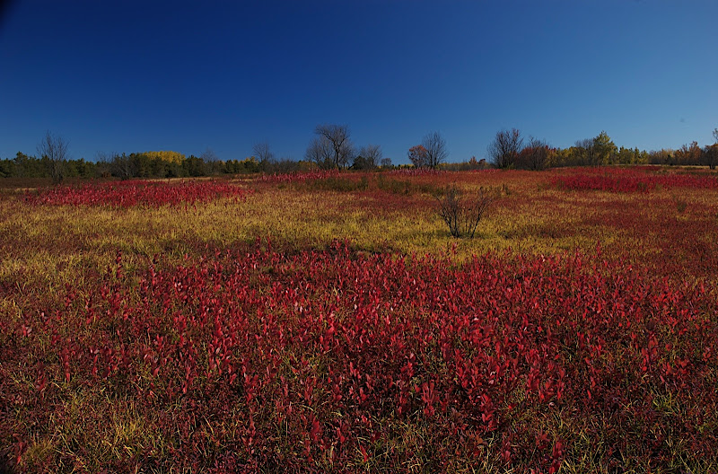
A last look at a clear sky.

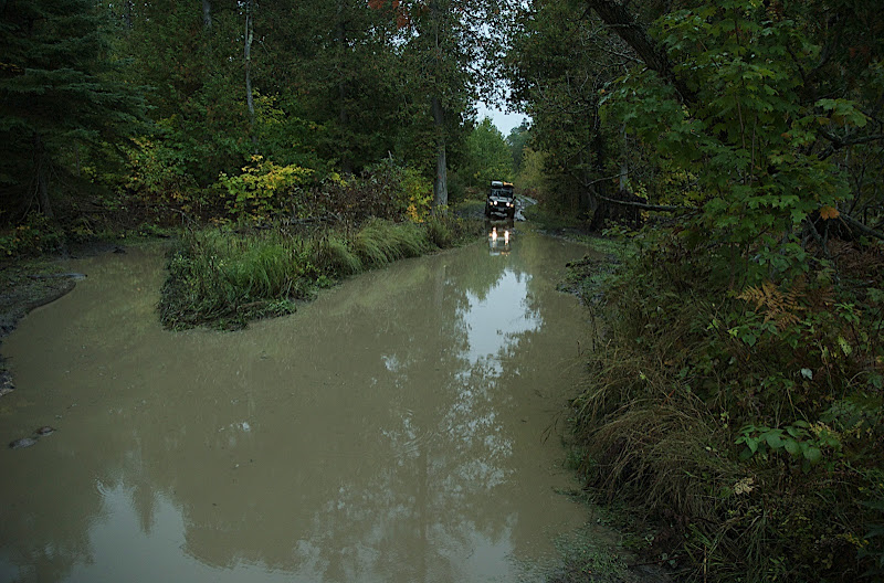
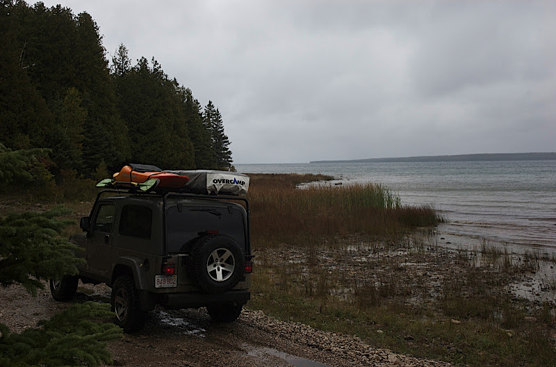
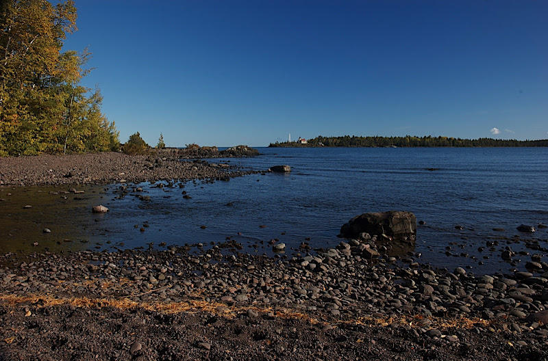
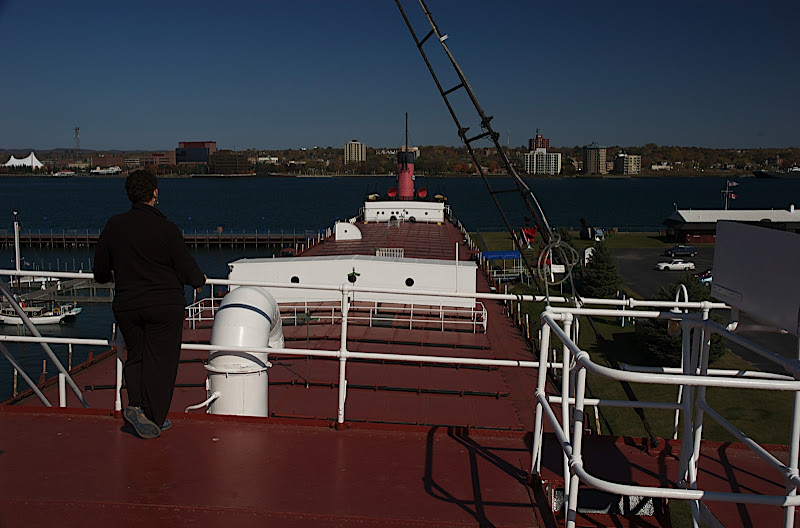
Thursday 9/23. Heavy rain prevented sunbathing on Mackinac Island so after a long bridge and an equally short ferry we found ourselves on Drummond Island for some car touring on interesting looking roads found in the gazeteer. More heavy rain and the road ahead became a canal but the surface was mostly rock ledge and easy going. I tempted fate by by joking “The number of people who know we're here: zero.”

DSC_3735.jpg

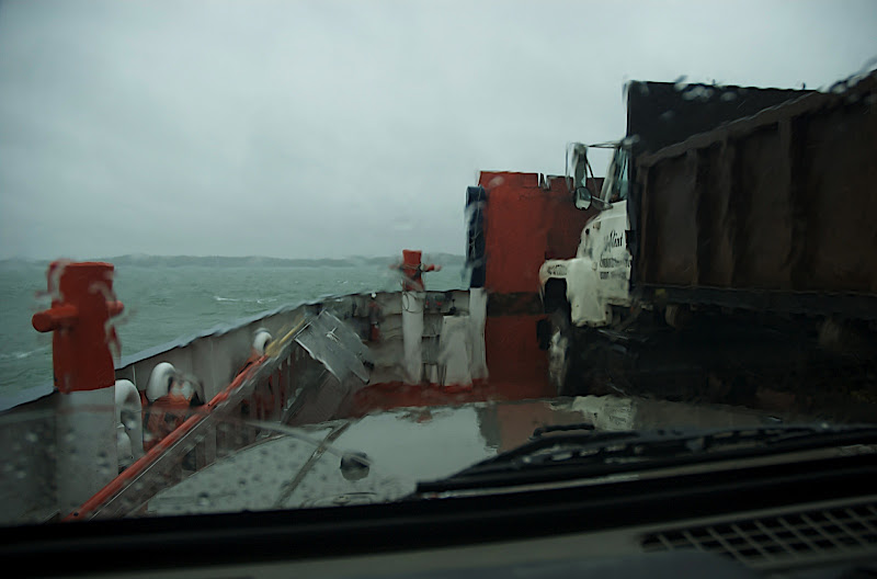
Fortunately when it was time to pay the deck hand, he was standing at the leeward side of the Jeep.

DSC_3738.jpg

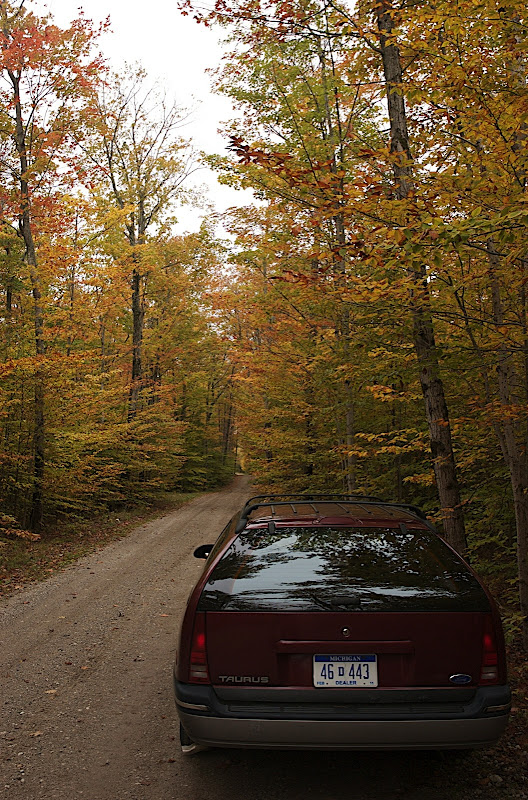
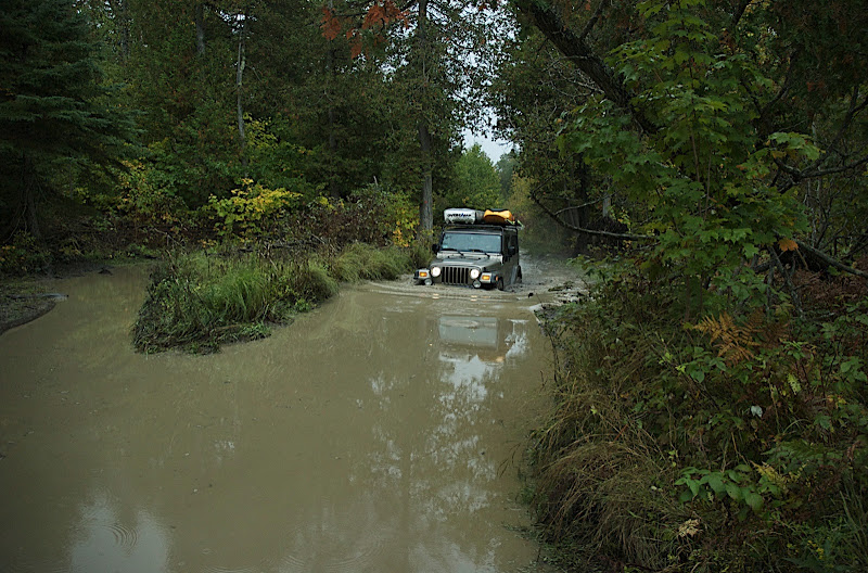
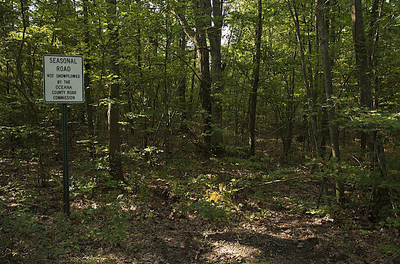
According to the map, this turned from a "major street" into a "trail or railroad grade". We didn't notice much difference.

DSC_3740.jpg

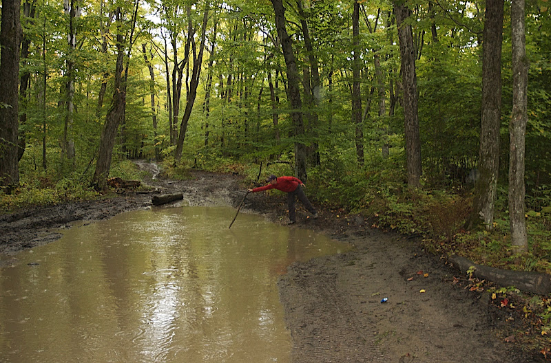
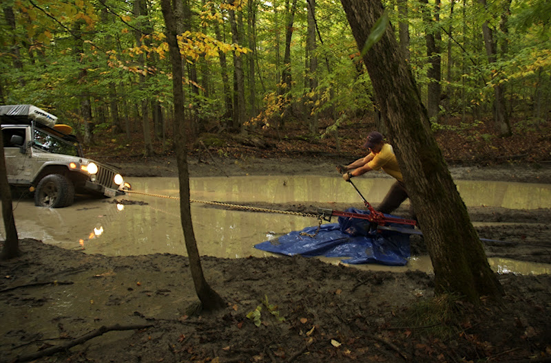
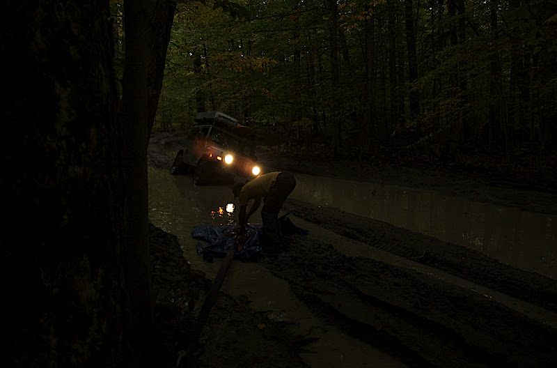
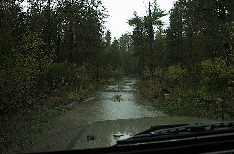
The mud must have been washed away because there was none to be seen.

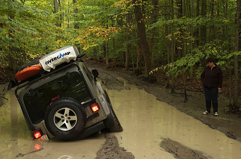
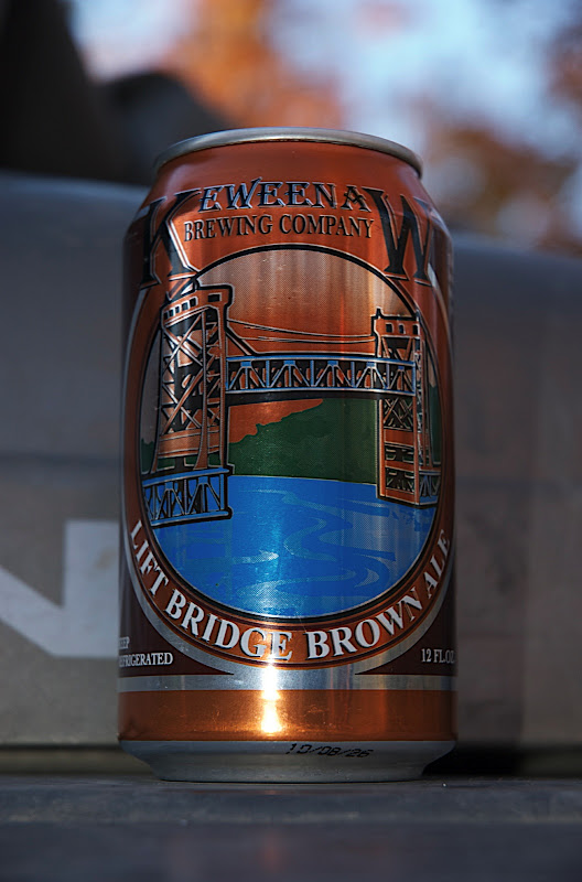
3pm. A road on the map turned out to be a squelchy ORV trail twisting gently through trees. After several hundred yards the Jeep's fuel pump decided to call it quits which provided some diversion from the rain. Fortunately we weren't ten miles in so by 5pm, having hiked and hitched back to town and got a tow, we were sitting drinking can after can of beer with James the older the mechanic and some other colorful locals.

Friday 8/24. Despite a healthy hangover we ate breakfast in town before confirming the diagnosis, that a new fuel pump was awaiting collection by James the younger the mechanic, son of James the older, on the mainland on Saturday and would be installed promptly on Monday morning. I suspect more braincells will be sacrificed before then...
 
Last edited:

grahamfitter

Expedition Leader

grahamfitter

Expedition Leader
Saturday 9/25. The Jameses had loaned us a Ford Tourus wagon for the weekend and we had planned to sleep in the back of it while exploring the rest of the island. When we went to pick up some camping stuff from the Jeep, James the older the mechanic gave us the news that the fuel pump wouldn't be arriving as planned but if we could pick it up from the mainland it could be installed today. Woo hoo! So we did and he did. After a pasty for lunch (google it if you don't know what a Cornish Pasty is – Michigan does a good facsimile) we went back to where we got stranded to take a photo, missed the spot and kept going. The trail was squelchy with the occasional gentle rock garden and plenty of long, deep, puddles.

DSC_3742.jpg

If four wheel drive wasn't important, a Taurus would be the perfect overland vehicle: huge, easy to maintain and unlikely to be stolen.

DSC_3744.jpg

A number of people asked us if we'd been to Cornbeef junction which wasn't marked on our map. We found it accidentally!

DSC_3746.jpg

One of many photos of Debbie. She doesn't use the camera much but somehow she did so today.

DSC_3751.jpg

I should have done more of this later.

DSC_3753.jpg


DSC_3757.jpg

Long, deep puddles.

5pm. Shoals Beach on the east coast of Drummond Island. This would have been a great place to camp. Our new resolution is to stop at 5pm if we find somewhere really pleasant to camp. Not having made that resolution yet, we kept going through the familiar puddles and rock gardens. Earlier in the day we had met a group of Jeeps from the JK forum who were going in the same direction and had warned us about an avoidable 5 foot deep mud hole. They were grilling lunch so we had headed on. Fortunately we avoided the 5 foot deep mud hole. Unfortunately an abundance of pilot error had me slide off a muddy rib and almost capsize the Jeep right in front of it. The water started trickling in through the drivers door but the passenger side was high and dry between two big puddles. To escape one just needed climb onto the back wheel and jump.

DSC_3759.jpg

Canada in the background. Oh, Canada, would have made a fine campground view.

DSC_3762.jpg

How on earth did I end up over here instead of in the shallow (knee deep) water on the right? Must be after the 5pm witching hour.

DSC_3766.jpg

Hi Lift Jack Winching Tip One: Mud does not provide an environment conducive to keeping the mechanism working.

DSC_3768.jpg

Hi Lift Jack Winching Tip Two: Just in case it doesn't work out as planned, arrange to have a group of well provisioned Jeeps follow you down the trail.

Debbie went to summon the cavalry who were suffering from navigational difficulties but found them anyway and as darkness fell I was winched out much to my relief. We all camped somewhere near Marble Head under cloudy but not rainy skies for once and ate well and drank better.

Sunday 9/26. With drain plugs back in we left Drummand Island feeling rather soggy for ourselves and headed to Taquamenon Falls (like Niagara just smaller) for some drying out. The water is strong tea brown and probably navigable by kayak but I was persuaded not to try it. The gazeteer marks plenty of towers, presumably fire towers, but we haven't found a single one despite some persistance. We did camp next to some remains, though. Its getting colder and we can see our breath in the evenings. A Lesson learned, either from our own mistakes or watching others, is that pay-for campgrounds and roadside vendors like to sell wet safety firewood. There is plenty of dry wood in the forest so we've been comfy enough camping there. The nice thing about sand is its easy to dig a fire pit without the shovel that is still in a Massachusetts garage.

DSC_3770.jpg

Drying out, on several fronts.

DSC_3775.jpg

The Taquamenon Estuary, if estuary is the right word.

DSC_3779.jpg

Still drying out.

DSC_3785.jpg

Taquamenon Falls. Definitely runnable by kayak. Fortunately I brought the wrong one with me.

DSC_3790.jpg

But I can dream about it anyway.

DSC_3794.jpg

Beer brewed on-site. I wonder what makes it brown?

DSC_3796.jpg

The map and the ground sometimes don't have much in common. There is a lookout tower here, right in front of the Jeep.

Tuesday 9/28. The Shipwreck Museum at Whitefish Point (a worthwhile excursion) is a testimony to the surprising stormy nature of Lake Superior. Its a shame that most of the ships wrecked were due to avoidable collisions.

DSC_3801.jpg

Witness to countless misses, near misses and not so near misses.

DSC_3806.jpg

Driftwood on the beach suggests something more sombre.

DSC_3809.jpg

For some reason I like taking pictures of gnarled up wood.

DSC_3822.jpg

Another great campsite way back there in the woods far from anybody. We thought, anyway; at 5am hunters drove past to see whether the bear had taken the bait. We should have wrapped the whole Jeep in orange tape!

Wednesday 9/29. More dune climbing, hiking and tea drinking at the Pictured Rocks National Seashore.

DSC_3821.jpg

Another sign says to expect several minutes of descent and an hour of ascent.

DSC_3829.jpg


DSC_3830.jpg

Pictured Rocks from the bottom.

DSC_3831.jpg

One hour to climb 300 vertical feet? Well the people at the top do look rather small. Anyway it took me seven minutes but I will admit to being a bit puffed at the top.

5pm. It starts to rain. “AAA? We're on vacation in Michigan and our car has broken down ... I think its the five day old fuel pump ... We're in the Miner's Castle parking lot.” Thank goodness this didn't happen when we were looking for a fire tower to camp by in the boonies last night! Laundry day in Munising tomorrow, then...
 
Last edited:

Danimal

Adventurer
Thanks for the report, and keep it coming! Hope you get the fuel pump issues figured out. Can't wait for the pictures, and can't wait to explore Drummond some day with my family.

-Dan
 

suntinez

Explorer
<snip> a Ford Tourus wagon </snip>

Laundry day in Munising tomorrow, then...

Love it! They should've named it the tour-us.

If it's still possible, take the Pictured Rocks cruise ship. I skipped it cause of my pup, and am still kicking myself - they have a kennel! There's just no way to see it all from the land side. I did however buy the $5 CD at the cruise terminal, so I can continue to kick myself at home. :costumed-smiley-007

Oh well, I know I'm going back to the UP, it'll just have to wait I guess.

Looking forward to pics. Good luck with the fuel pump.
 

grahamfitter

Expedition Leader
More photos from Pictured Rocks which didn't fit in the previous post. Lesson to self: post more, shorter messages.

DSC_3832.jpg

Trees here are still greenish.

DSC_3836.jpg

Wishing for a reliable vehicle? Debbie doesn't get phased by breakdowns or puddles; she's used to traveling in a VW camper!

DSC_3841.jpg

Chapel Rock, presiding over our deserted beach.

DSC_3843.jpg

No! That's OUR deserted beach. Get off it!

DSC_3845.jpg

Lake looks Superior. Lake feels Siberia.

DSC_3852.jpg

Miners Castle.

DSC_3854.jpg

Road signs in Munising had me laughing.

Friday 10/1. On the road again. The first replacement fuel pump was a NAPA one and the mechanic didn't have too many good things to say about NAPA parts but replaced it with another one because it seemed to make the most monetary sense. Keewinaw Peninsula here we come! Curiously the Huron Mountains are surrounded by Lake Superior while the Superior National Forest is surrounded by Lake Huron.

Saturday 10/2. Given the recent mechanical trauma, the “Triple A Road” between Great Bay and Skanee seemed like an appropriate way to go. The lady at the gas station in Great Bay must have thought we needed help because she gave us some photocopied directions. She certainly thought we were crazy for camping. She's probably right on at least one count. The trees are even more spectacular further North and now the sun is shining and the sky is blue and life is good now that all our mechanical problems are behind us.

DSC_3858.jpg

Obsolete lighthouses become B&Bs. This one was blustery.

DSC_3859.jpg

The trees complement my kayak nicely.

DSC_3865.jpg

We bought this Cadac Safari Grill for this trip and wrote a short review here.

DSC_3868.jpg

A low ceiling in Boston Logan airport required some redneck surgery on the RTT cover. Low trees in Michigan opened the wound.

DSC_3877.jpg

In the absence of photos of interesting trails or scenery, try the old distraction trick.

Sunday 10/3. The coldest night so far – in the 30s – but more blue skies. A short day visiting Fort Wilkinson (setup to police the early mining colony but disbanded soon after because of a war in Mexico) and setting up camp in the early afternoon on a remote beach within sight of two island lighthouses. Swimming and sunbathing. Wine, leftover curry, cards, wine, read some
more 1984, drank more wine by the campfire.

DSC_3879.jpg


DSC_3881.jpg


DSC_3882.jpg

Its hard to imagine this place being isolated during the winter months when the lake was frozen. It must have been miserable!

DSC_3888.jpg

Are we really in Michigan?

DSC_3892.jpg

Tea? At one of the best beachfront campsites of the trip.

Monday 10/4. More gentle trails and rural roads past nice trees and shoreline followed by the disturbing and all-to-familiar choppy engine that signifies a night in a motel. This is frustrating beyond belief. We stop within 100 yards of the mechanic in Allouez who confirms the second NAPA fuel pump is dead and orders a Delco one. We'll find out in the morning whether anything else could be found that might be causing it.

DSC_3895.jpg

More tea, at one of the best beachfront campsites of the trip.

DSC_3887.jpg

Driving chores are shared.

DSC_3904.jpg

Big freighters always arrive at the wrong time for the best placement in a photo.

DSC_3906.jpg

Ooh. Ah.
 
Last edited:

Danimal

Adventurer
I went through a similar situation with a fuel pump on an early 90's Ford Thunderbird. Pretty maddening, but I can only imagine this on a long distance road trip. Hope the Delco unit does the trick!

-Dan
 

upcruiser

Perpetual Transient
Just saw this thread, damn, wish I would have caught it earlier. Would have loved to catch up. Hope things are going smoother. Looking forward to some pictures, don't be afraid to shoot a line to any of us Yoopers if you need any advice on spots. Lots of great spots, most are off the beaten path and not labelled.
 

grahamfitter

Expedition Leader
Quick update: fuel pump issues are finally fixed; there was a hole in the hose between the fuel pump and the sender unit causing the pump to run continually while trying in vain to maintain pressure in the fuel line. We're just about to cross into Ontario at Sault Saint Marie, headed for some whitewater on the Ottawa river.
 

grahamfitter

Expedition Leader
Tuesday 10/5. Back on the road again, again, again! This time is different. After looking for agate at Agate Beach and not finding any, we didn't bother tempting fate at Misery Beach. A mysteriously named “Camp 18 Road” leads West – a nice shortcut to Octonagon and the Porcupine Mountains. After passing the equally mysterously named “Camp 17” the road disappeared down a big rut and into a river. Completely doable but no group of Jeeps behind us this time and the number of people who know we're here: really zero. After digging out the GPS for the first time this trip to confirm our location we drive the long way round and camp on the flanks of Porcupine Mountain.

DSC_3907.jpg

No agates in sight.

DSC_3908.jpg

They must have been scared off by the ATVs.

DSC_3914.jpg

Porcupine Mountains.

Wednesday 10/6. Strolling round the Porcupines under clear blue skies. The weather couldn't be better, unless of course one kayaks and lusts after the many waterfalls on the map, mostly on the Presque Isle River which needs a good dousing of rain. A return trip may be required. We found a nice campsite on the dunes of Lake Michigan on the Garden Peninsula.

DSC_3918.jpg

Must resist the urge. Fortunately the rivers have dropped since last week and are getting a little shallow.

DSC_3927.jpg

Another rather pleasant beachfront campsite.

Thursday 10/7. Meandering through forests and pastures past Kitch-Iti-Kipi Spring where the water bubbles out through the sand seemingly everywhere and on to Sault Saint Marie.

DSC_3928.jpg

Looking for a way across the train tracks.

DSC_3929.jpg

Maybe over there, somewhere.

DSC_3934.jpg

Floating platform at Kitch-Iti-Kipi Spring.

Friday 10/8. A one-time steamer has a second life as a floating museum at Sault Saint Marie. The Michigan side, that is. Worth the time and a good break before crossing the border and the long drive to...

DSC_3937.jpg


Saturday 10/9. The Ottawa River in Beachburg, Ontario. One of the big whitewater destinations located, somewhat surprisingly, in rural farmland. Normally these things happen in mountains but the Canadians like to do things differently.

Sunday 10/10. After another long drive, home sweet home!
 
Last edited:

grahamfitter

Expedition Leader
Just saw this thread, damn, wish I would have caught it earlier. Would have loved to catch up. Hope things are going smoother. Looking forward to some pictures, don't be afraid to shoot a line to any of us Yoopers if you need any advice on spots. Lots of great spots, most are off the beaten path and not labelled.

Yeah likewise. I think we did a pretty good job of finding things -- mostly by looking for places on the map that "showed promise" and sniffing around when we got there. We weren't disappointed one bit but it would be interesting to see what else is out there for when we come back.

Time to sort out photos. I'm not a particularly enthusiastic, or good, photographer but I think there are probably some worth posting...
 
Last edited:

Forum statistics

Threads
185,813
Messages
2,878,464
Members
225,352
Latest member
ritabooke
Top