HenryJ
Expedition Leader
Our plan was to take the bikes and do a nice days ride in the Succor Creek/Leslie Gulch area.
The forecast was for a 70% chance of thunderstorms. That proved to be true as the morning was very overcast and the rain showers starting. It is no fun riding in the cold and rain, so we went with plan "B". Drop the bikes and just take the drive.
This trip was not our idea, we were invited by "G" and "V". They ride ATV and do enjoy the outdoors.
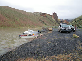
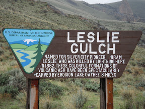
Once we all made changes and unloaded stuff , we gathered at our house and left about 9:00am. The new plan was to take Succor Creek road in the the Junction and to Leslie Gulch from there. Hopefully we would eat lunch at the Leslie Gulch Campground.

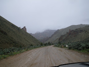
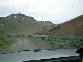
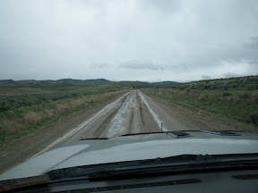
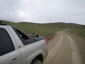
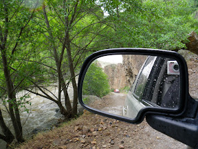
The roads were not bad. Wet with a light sprinkle. We made pretty good time headed for Succor Creek canyon.
We lost them? Oh, wait! L has them on the FRS radio. They are ahead of us?
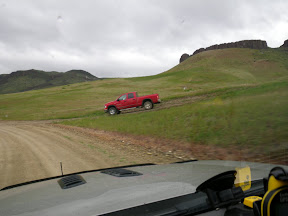
"G" took a short cut down the hill.
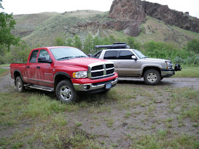
Up ahead we see a geocache on our map so we stop for a quick look.
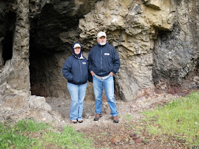
G-n-V pose for a reluctant photo? This little cave went in may fifty feet or so. Someone had used straw to smoke it out pretty well. It still wreaked of burnt straw. I don't know why for sure. With the low ceiling we only went in about half way. None of were equipped for crawling into a cozy spot snakes might be holed up for the lousy weather.
Skunked on the cache. The pile of rocks marked the spot, but we were not hardcore enough to spend lots of time in the rain searching. Moving on and now into the canyon.

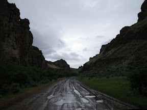
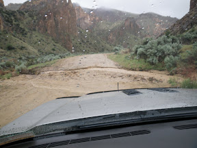
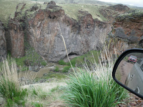
Lots of water flowing. It is now raining pretty good. You can normally step right over this little creek at this point. Not today. The roads are still pretty good with just a few ruts and holes.
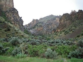
Things are very green all the way in to Succor Creek Campground. We stopped for a brief potty break and moved on as it was still raining enough to spur us on.
Not many pictures of the climb up and out to the junction. There were some very muddy and off camber roads. One section driven sideways as I just could not get the back end to come around to following the front.
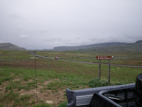
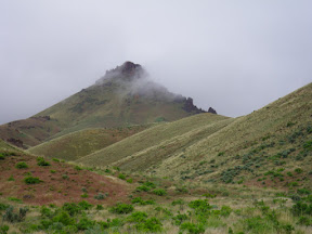
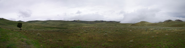
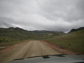
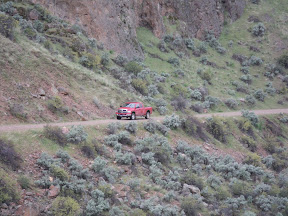
Once out to the junction, the roads improved greatly. The first leg is a pretty good climb. We gain nearly 3000 ft in this journey. 1500 feet of that in this short section. We top out just over 4800 feet.
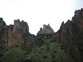
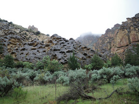
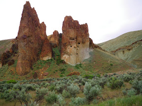
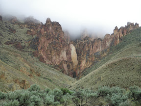
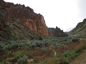
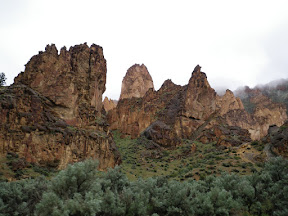
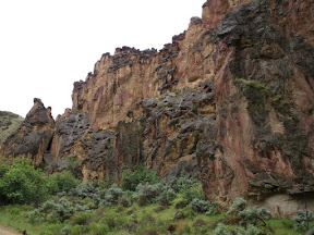
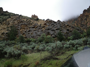
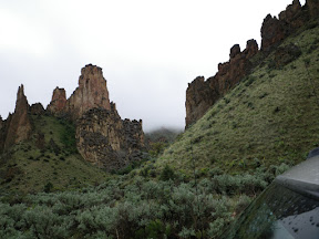
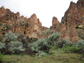
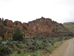
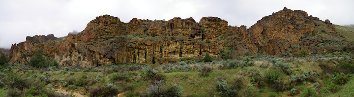
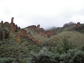
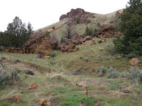
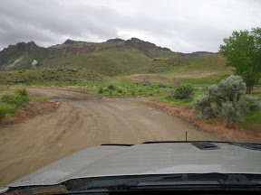
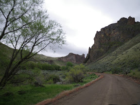
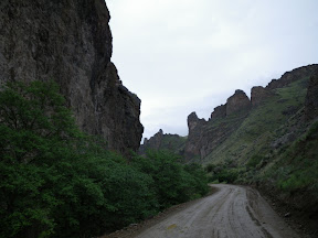
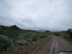
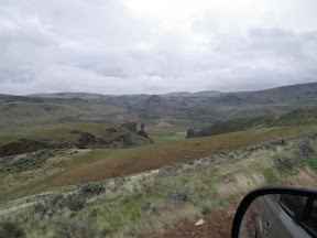
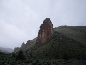
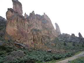
Once over the top we start to drop into the canyon and the sights just get better and better.
The forecast was for a 70% chance of thunderstorms. That proved to be true as the morning was very overcast and the rain showers starting. It is no fun riding in the cold and rain, so we went with plan "B". Drop the bikes and just take the drive.
This trip was not our idea, we were invited by "G" and "V". They ride ATV and do enjoy the outdoors.
Once we all made changes and unloaded stuff , we gathered at our house and left about 9:00am. The new plan was to take Succor Creek road in the the Junction and to Leslie Gulch from there. Hopefully we would eat lunch at the Leslie Gulch Campground.
The roads were not bad. Wet with a light sprinkle. We made pretty good time headed for Succor Creek canyon.
We lost them? Oh, wait! L has them on the FRS radio. They are ahead of us?
"G" took a short cut down the hill.
Up ahead we see a geocache on our map so we stop for a quick look.
G-n-V pose for a reluctant photo? This little cave went in may fifty feet or so. Someone had used straw to smoke it out pretty well. It still wreaked of burnt straw. I don't know why for sure. With the low ceiling we only went in about half way. None of were equipped for crawling into a cozy spot snakes might be holed up for the lousy weather.
Skunked on the cache. The pile of rocks marked the spot, but we were not hardcore enough to spend lots of time in the rain searching. Moving on and now into the canyon.
Lots of water flowing. It is now raining pretty good. You can normally step right over this little creek at this point. Not today. The roads are still pretty good with just a few ruts and holes.
Things are very green all the way in to Succor Creek Campground. We stopped for a brief potty break and moved on as it was still raining enough to spur us on.
Not many pictures of the climb up and out to the junction. There were some very muddy and off camber roads. One section driven sideways as I just could not get the back end to come around to following the front.
Once out to the junction, the roads improved greatly. The first leg is a pretty good climb. We gain nearly 3000 ft in this journey. 1500 feet of that in this short section. We top out just over 4800 feet.
Once over the top we start to drop into the canyon and the sights just get better and better.