Cold Day in Hell('s Canyon)

turbodb

Well-known member
Summer in the Pacific Northwest is hard to beat. So, I wouldn't blame you for wondering why - with a week of sun and 75°F in store before Memorial Day - we were headed for the inclimate weather of the Oregon-Idaho border and Hells Canyon.

So let's start there.

In what I believe to be a tradition that I've stumbled into, Monte @Blackdawg and Mike @Digiratus generally get together for a trip every Memorial Day, and this year the plan was go meet up in Lewiston, ID for a few days of puttering around and enjoying ourselves in the outdoors.

And - always looking for a way to get the most value for the mile we can - @mrs.turbodb and I decided that we'd head over a few days early to explore a place that she'd been bugging me to go for quite some time.

And that's why we were headed to Hells Canyon - where the forecast was iffy - our fingers crossed as we pulled out of the garage; our craziness confirmed.


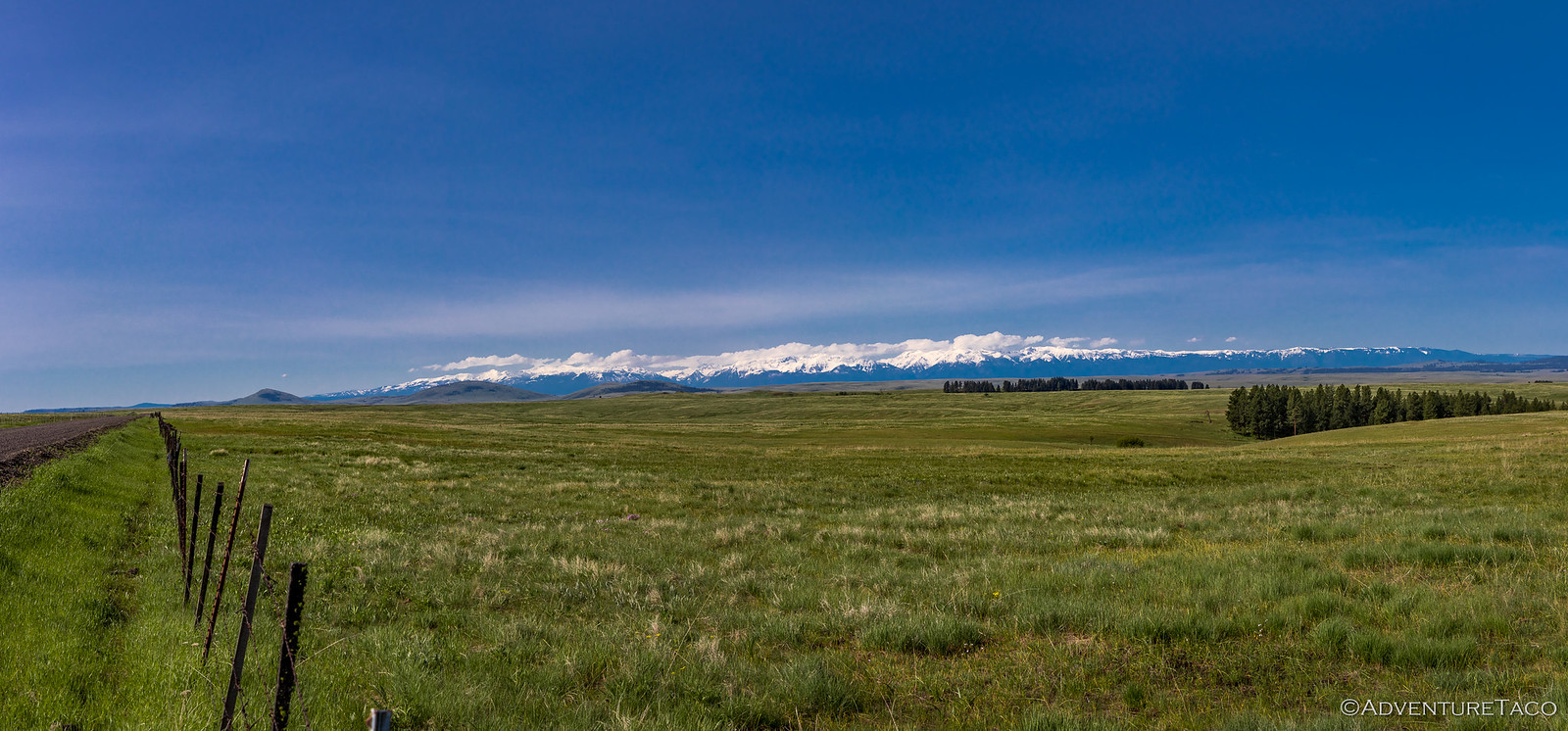
As it turns out, this was by far our closest destination in a long time - the entire drive doable in 7-8 hours, even at the great-grandpa speeds we'd be travelling. Along the way we passed through the Palouse - a land of rolling hills reminiscent of Windows desktop backgrounds.


We eventually found ourselves on the outskirts of Starbuck, WA, at the Lyons Ferry crossing. There, built in 1914 was what was once billed as the highest (240'), longest (3920') trestle in the world - and it was spectacular.


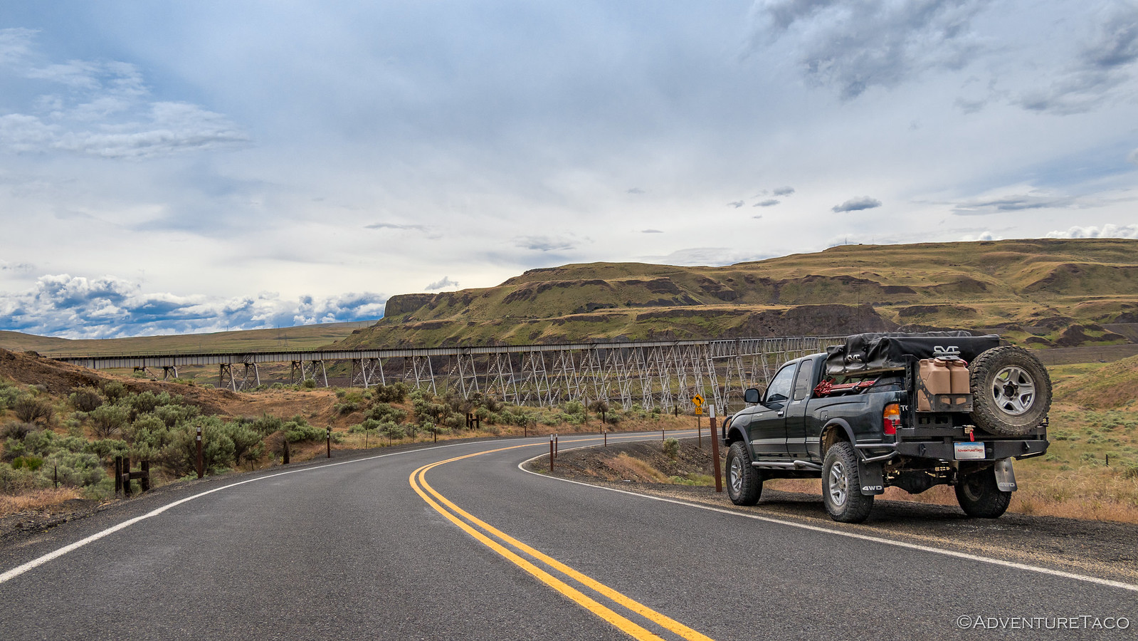
Was it as amazing as what we'd seen in Anza-Borrego? Well, size isn't everything - the wooden trestle there still takes the cake in my opinion - but this one was definitely worthy of a stop for a few photos.


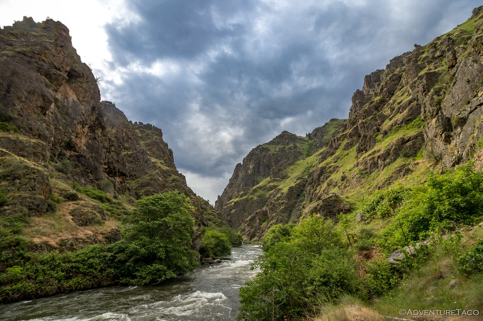
Even having departed reasonably late in the morning, it wasn't quite 4:00pm when we pulled off the highway and onto a scenic byway that ran along the Grande Ronde (pronouced "Grand Rond") river. Expecting the road to turn to dirt any second we were caught a little off-guard when the pavement continued for the first several miles.

Not that we had anything to complain about - the views were still stunning - and perhaps more importantly, the temps were in the mid-70's, and despite the clouds in the sky, it looked like we weren't at any risk of rain...at least for the time being.


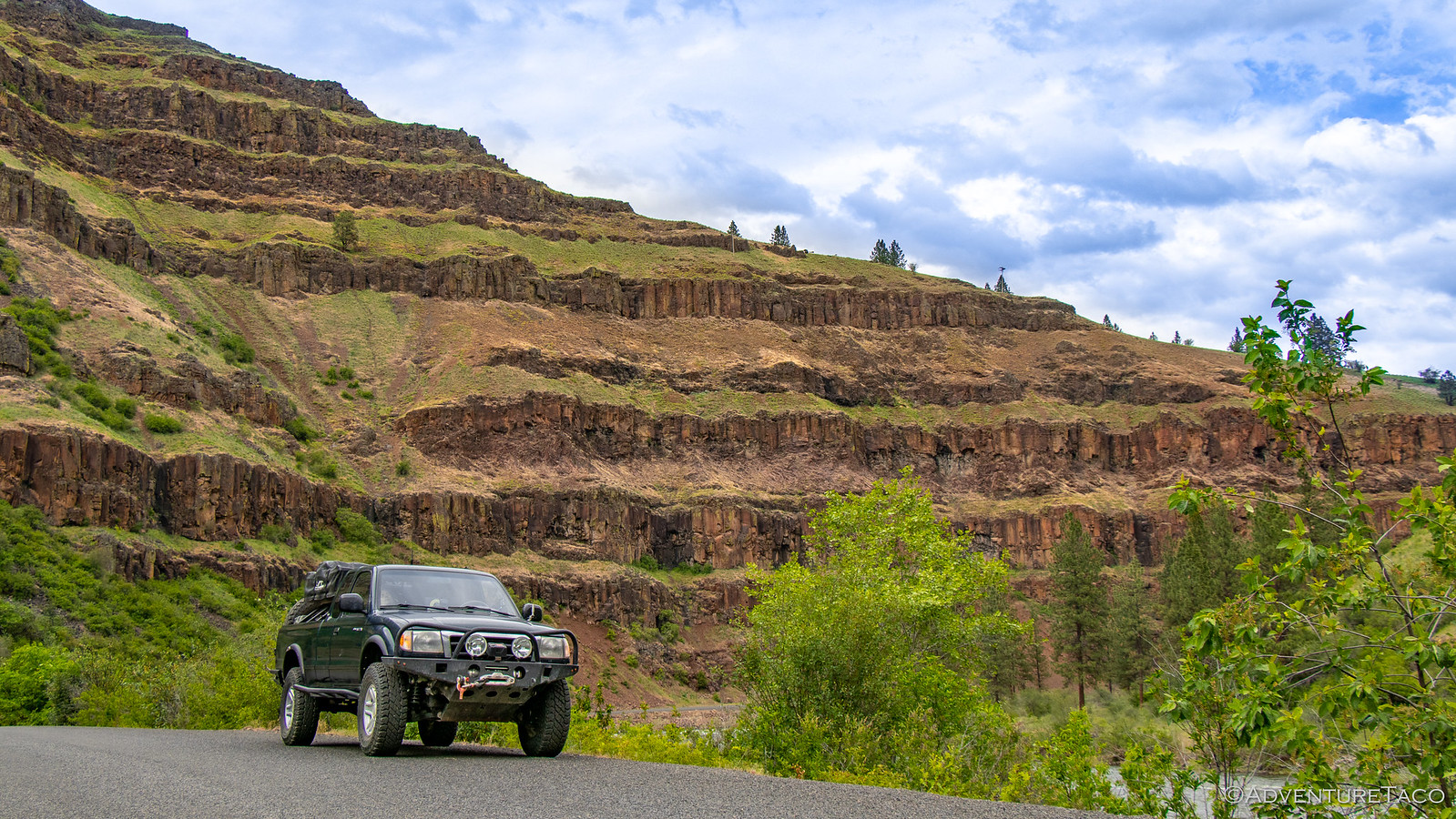
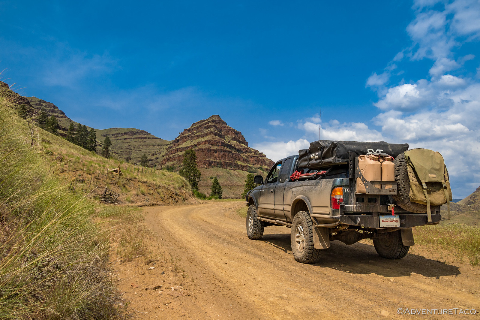
Our departure from the Grande Ronde came just before the town of Troy, OR - and as we turned east towards Hells Canyon, we finally hit well-graded dirt for a short stint up and out of the canyon and past what was quite clearly becoming the ghost town of Flora, OR.


It was at this point that we found ourselves in a very unfamiliar situation. It was the same day we'd left home, we'd reached the location we were going to spend a few days exploring, and it wasn't dark. In fact, not only was it not dark, but we had a few hours until sunset.

Should we just find camp and wait until the next morning - when we'd planned to head up Forest Road 46 - or should we just plow ahead now? It was decisions like this that we were unaccustomed to, with most trips being 17-20 hours away from home; our arrival after midnight an expectation.


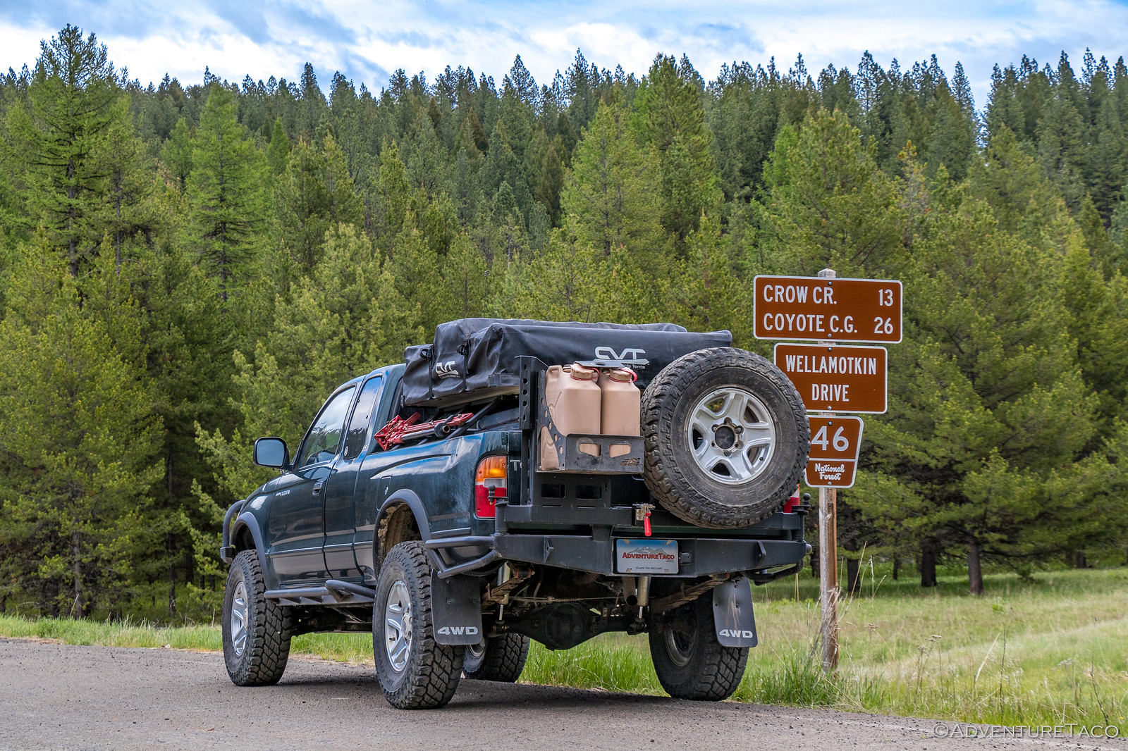
Flush with our new-found time, we pushed forward. Surely - we thought - we wouldn't travel very far before we found camp for the night. And then tomorrow we'd continue to Buckhorn Lookout - the reason we'd taken this road in the first place.

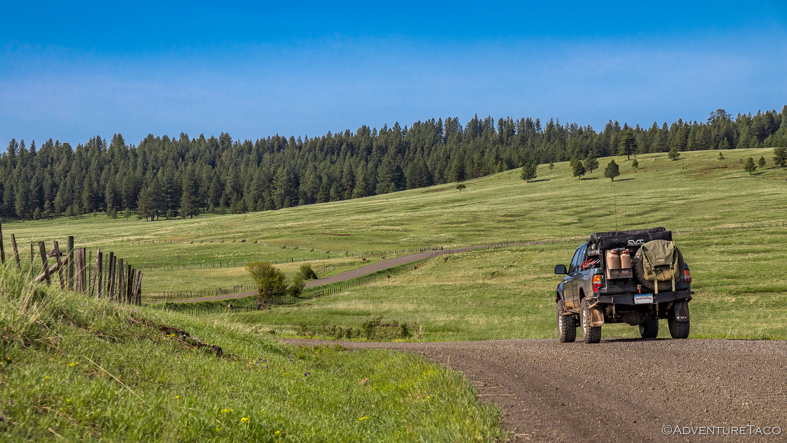
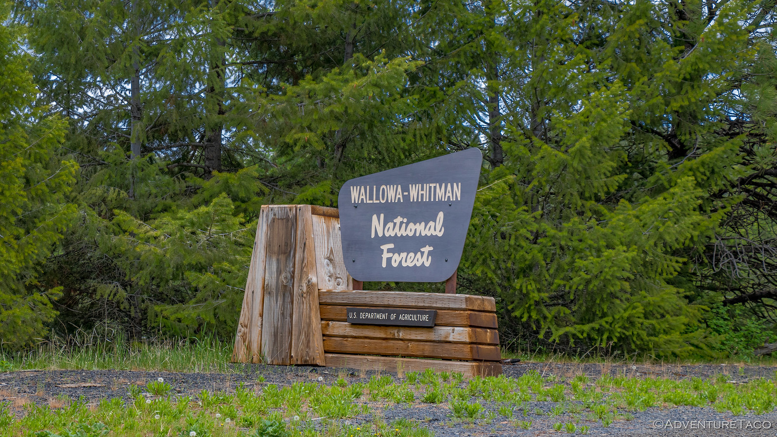
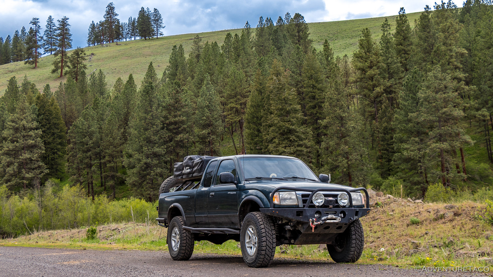
Into Wallowa-Whitman National Forest and up in elevation we climbed. The clouds were actually getting thinner here - a great sign - though the winds were picking up and the elevation seemed to cool things off rather dramatically.


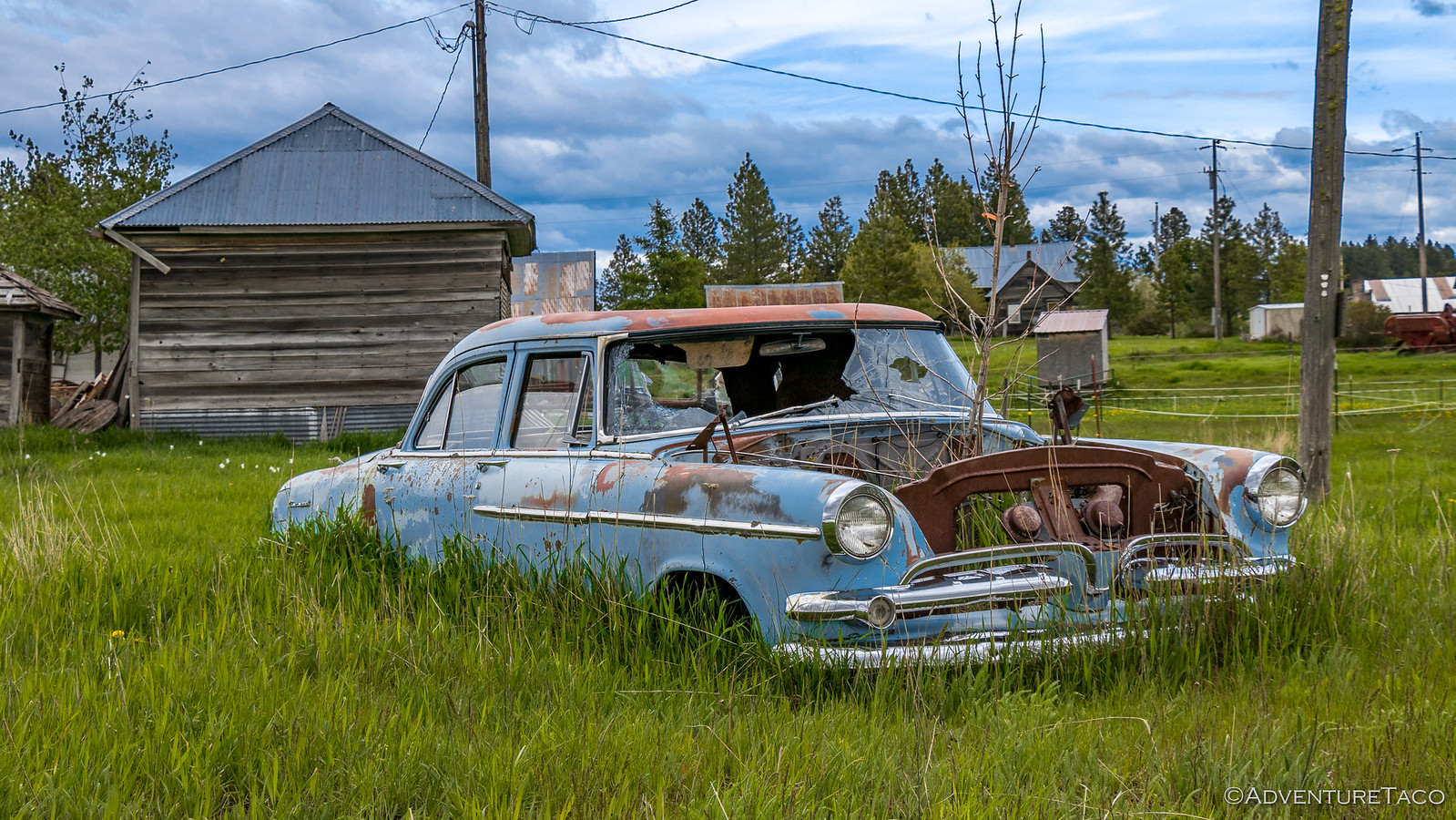
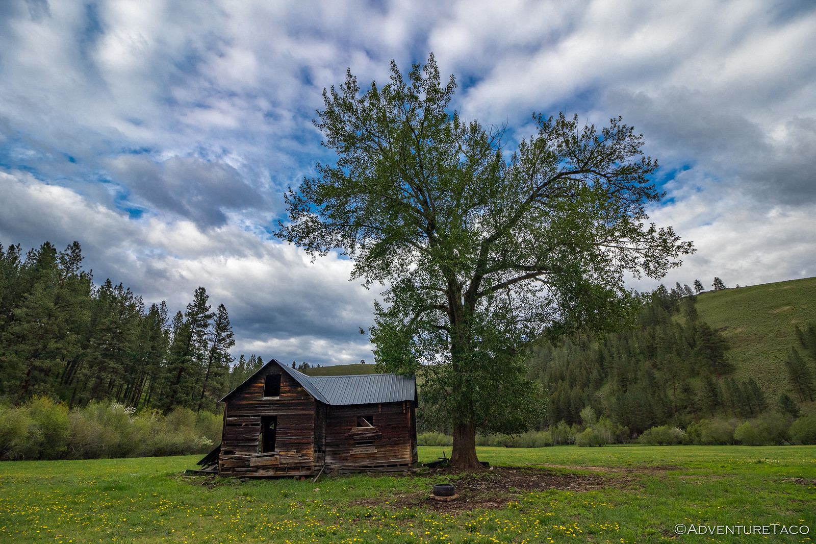
Still feeling a bit out of place - or like we needed to find a place to stop for the night - I realized at some point we were just driving by things that we'd normally stop to explore or enjoy. And we nearly did it again with an old barn along the side of the road - likely private, but un-fenced and beckoning us to see what was inside.


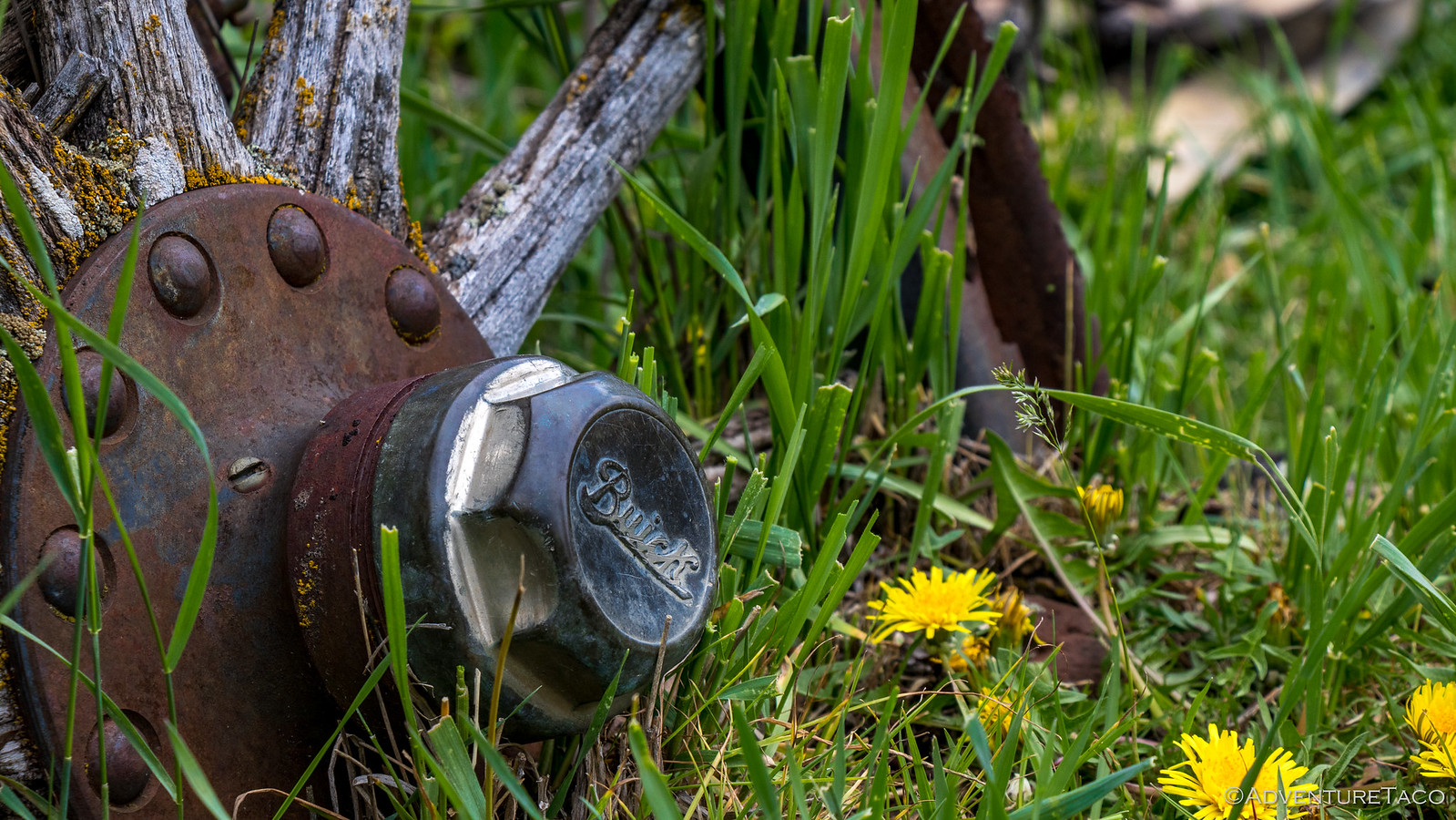
Turned out to be not much, but along a small creek just behind it, and something had caught my eye.

A wheel. One that looked like it might be connected to an axle of some sort. And one that didn't have the normal construction I think of when I think of a wagon wheel. And as it turned out, this was no wagon wheel.

This was an early Buick. Constructed of wooden spokes between a steel hub and steel rim, a little research after-the-fact showed this to be from a 1920's vintage machine, the differential just visible under the "pile of wood."


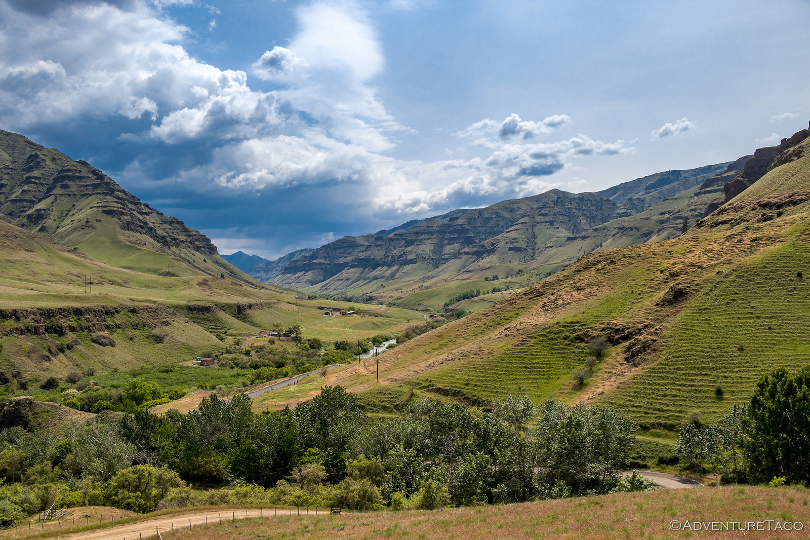
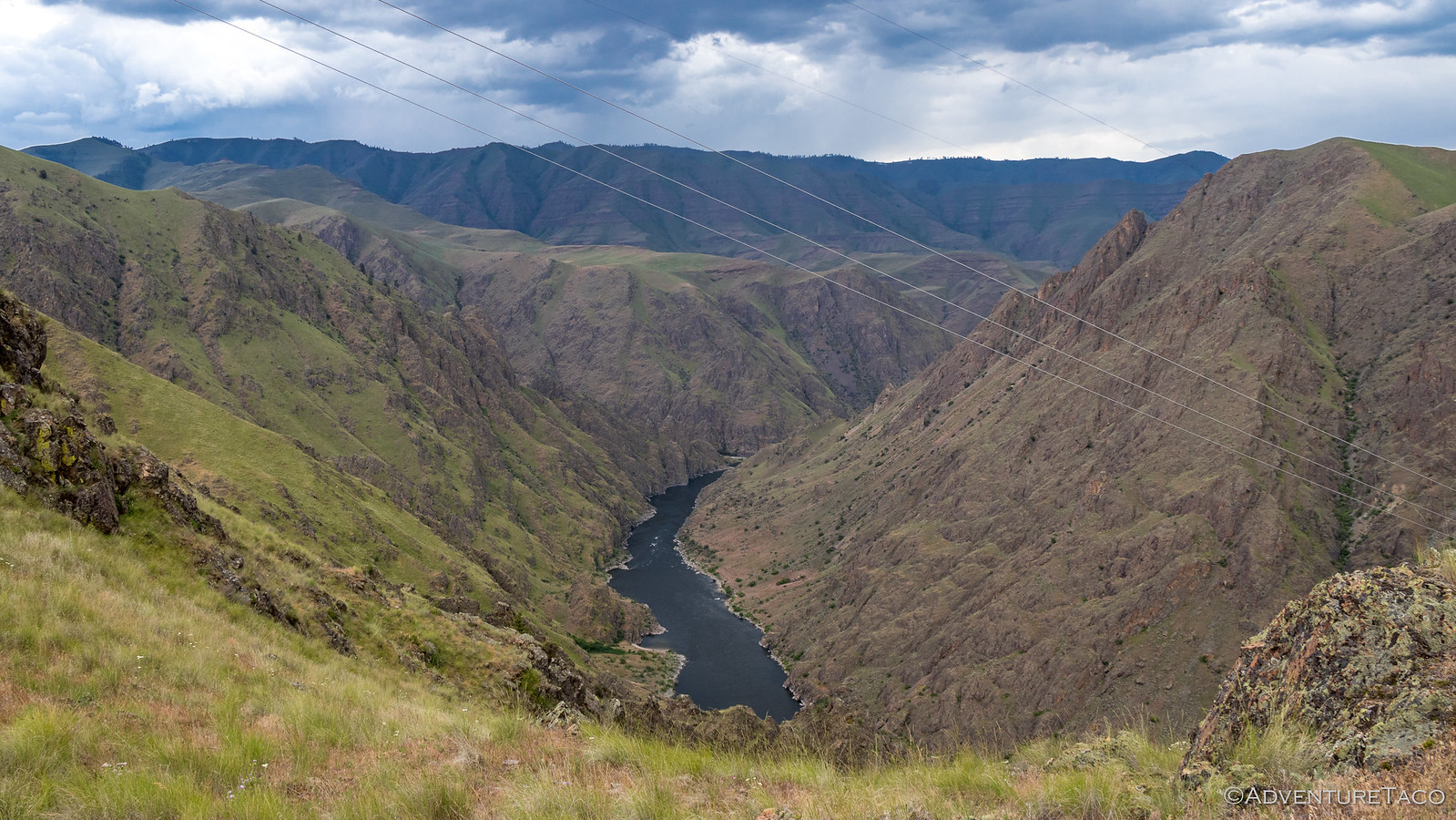
Excited with the find, we headed back to the truck and continued our climb to the top of the ridgeline - full of anticipation of what we'd see when we got there - sure that the views of Hells Canyon, the deepest gorge in North America - would be jaw-dropping.

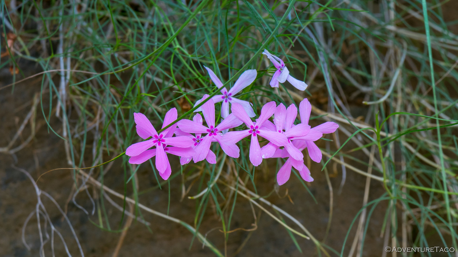
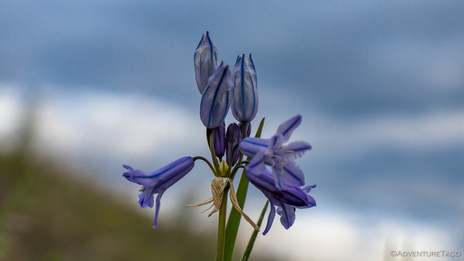
As we did, we admired spring all around us - the hills green, the flowers plentiful.


- - - - -

Don't miss the rest of the story, and all the remaining photos that don't fit here (due to max post size). Hopefully that can change in the future, but until then...

Keep reading the rest here
Cold Day in Hell('s Canyon) Part 1 (May 2019)


.
 

turbodb

Well-known member
Hells Canyon Part 2 - Zumwalt Prairie to Hat Point
It was a chilly night at 5300', but our strategic position behind the ridge line meant that we were unaffected by the bulk of the wind - a knit cap enough to keep me cozy, and @mrs.turbodb wanting only for her earplugs in the morning when the birds started singing.

And it was early when they did - sunrise was at 5:07am, and the first light on the horizon started well before 4:30am, spreading across the sky in its glorious trek.


Eventually, there was enough light to illuminate Imnaha Canyon below us - the hills and valleys unfolding into the distance. It was the perfect time to climb back into the tent for another couple hours of sleep.

As one does.


It was closer to 7:30am when we finally pulled ourselves out of the tent for breakfast and a bathroom break, the tent now warm from the morning sun hitting it on three sides. As usual, we split up the morning tasks of breakfast and camp break-down, so it wasn't long before we bid farewell to what I can only imagine was the best camp site on the ridge, and headed back towards Buckhorn Lookout, the Wallowa mountains rising in the distance.


Having spent a few minutes at the lookout the evening before, there was no great surprise when we pulled up to the unassuming 14-foot-square building placed only a couple feet above the ground when it was built in the 1930s. Unlike most lookouts, Buckhorn is perched on the edge of Hell's Canyon - giving it commanding views of its surroundings - the Seven Devils, Hat Point, Zumwalt Prairie, and Wallowa Mountains, all visible along the horizon.

Still, unlike the evening before, the sun was out in full force and though the lookout is no longer staffed, it wasn't hard to imagine what it'd be like to spend a spring and summer here, amongst the wildflowers and views.


A bit of exploration - @mrs.turbodb reading the signs and the great descriptions in 100 Hikes / Travel Guide: Eastern Oregon, me checking to see if any of the boarded-up windows were loose so we could get a peek into the lookout ? - and we decided it was time to move on. All of our progress the previous day meant that today was going to be a little awkward - and either very short or a tad long as we tried to get back into a routine.

And we generally have a hard time with short days, a habit we've developed as we try to squeeze as much as we can into our long jaunts from home. Our next destination was the little town of Imnaha - south, and some 3500' lower than our current elevation - where we planned to turn north again on our way to Dug Bar.

I'd put together a track for this portion of the trip, and unknown to me at the time, it took us through the vast Zumwalt Prairie. When I say vast, I mean seriously vast - 330,000 acres. And to see it when we did - at the height of spring - was something special. Green grass as far as the eye could see.


Elk at the treeline.


Halfway or so through the prairie, we came to the road I'd marked that would take us down into Imnaha. A fence-line road, it was clearly less traveled than the well-graded FR-46 that we'd been on to this point, but that wasn't what caught our eye as we pulled up to the gate. Rather, it was the lock that had us pondering our next move.


This of course is one of the drawbacks of using Google Maps/Earth to create a track - the work you do can look great from a satellite image taken years earlier, but who really knows what you'll find on the ground! While we were unsure wheather this was a new lock (which it looked to be) or if this was never a passable route, we took a look at our maps and decided we could take a reasonable re-route through the Zumwalt Prairie Preserve, so we headed that direction.


This reroute - it turned out - had a few highlights in store for us. With plenty of recent rain and snow melt, there were some reasonably sized puddles on the road - a temptation that few truck owners would be able to pass up.

And I'm not one of them.


Don't miss the rest of the story, and all the remaining photos that don't fit here (due to max post size). Hopefully that can change in the future, but until then...


.
 

turbodb

Well-known member
Hells Canyon Part 3 - Dug Bar, "Gold Mines," and Horses

Had we blinked as we passed through Imnaha, we might have missed it as we set out down Lower Imnaha Road. The first six miles of this road are paved, but we'd been warned by 100 Hikes / Travel Guide: Eastern Oregon that beyond that point we were in for a whole different experience...

[i said:
100 Hikes / Travel Guide: Eastern Oregon[/i]]At this point the Lower Imnaha Road suddenly becomes a rutted, steep one-lane dirt road strewn with rocks. Turn back if you don’t like the first 100 yards, because this typifies the 25.4 miles ahead. Vehicles must be driven so slowly on this rugged track that the first 14 miles to the Cow Creek Bridge over the Imnaha River will take you a full hour. Beyond this bridge, the 11.4 miles to Dug Bar are slightly worse, requiring another full hour to drive.

Perfect!

Looking forward to finally airing down - we'd made it at a full 42psi so far - we pulled over on the first switchback to admire the view up the Imnaha Valley as the tire deflators - which I highly recommend for anyone who airs down regularly - did their job, taking the truck down to 18psi in no time.


And then, we were off - the ride now more comfortable as we floated along on our little cushion-y tubes of air.


As we ticked away the miles, there were two things going through our minds: first - how beautiful it was down here at bottom of the canyon. A bit further north, the sun was now out again, the temperatures were in the 80°F's, and the many-greens-of-spring were all around us. Second - where was this horrible road that we'd been warned - and become so excited - about?!


Really though, we didn't mind the calm trail, and given our fuel situation - no stations around us for many miles and our tank already down to ¼ full - it was probably better that we weren't crawling along in 4Lo. Instead - as the trail followed the bottom of the canyon - we spent our time enjoying the amazing geology of the Imnaha - towering columns of Grande Ronde basalt, alternating with chaotic Imnaha flows. To say that @mrs.turbodb was in her element would be an understatement.


Before long - and in well under the hour we'd been led to believe it would take, we arrived at the poorly named Cow Creek Bridge, spanning the Imnaha River. There, we were surprised to see a reasonably permanent shelter setup next to the river, along with a crazy-floating-barge contraption churning away in the main flow of water.


Neither of us sure what it was, I used my I'm-a-guy-so-I-make-things-up super power to authoritatively state that it was a power generator for what must be a mining operation - the tent obviously a gold room where the miners would clean up their concentrate. @mrs.turbodb wondered out loud if it had to do with fishing. This is worth remembering, for later in the story. :anonymous:


We also took the time to check out what was clearly the first version of the bridge - now just a couple of rock pilings on either side of the river - before continuing on our way north to Dug Bar, where we hoped to find a nice spot to camp for the night.


A few miles down the road, we crossed another bridge - this one unnamed - over Cow Creek (what?!), and I think it was at this point that I may have mentioned our fuel situation to @mrs.turbodb. It's not that we were in any trouble - after-all, we had 10 gallons of spare fuel in the jerry cans - but it did mean we were likely to have to transfer some of that to the tank once we reached camp, and it meant that we'd need to find fuel the next day in order to continue our adventure.

Perhaps halfway between the "mining operation" and Dug Bar - which is, notably, the only place where vehicles can drive to the Oregon shore of the Snake, we turned off the main road and onto a short power-line road spur that I hoped would take us to an overlook of the confluence of the Snake and Imnaha Rivers.


Weeving it's way along ridgelines, and ending at a pad @mrs.turbodb felt was "just large enough to turn around, but not with her in the truck," this was a fun mile or so of driving for me, and the views at the end were amazing, even if the confluence was - if we're being honest - not really all that visible.


It was now right around 4:00pm - mid-afternoon - and as I got the truck turned around and headed back down from the overlook, we set our sights on Dug Bar - now just a few miles away.


The story goes that when the U.S. Army forced Chief Joseph to leave Oregon in 1877, he led his Nez Perce band through Hells Canyon on a difficult trail that crossed the raging Snake River at Dug Bar. My understanding is that additional research now leads historians to believe that they crossed several miles downstream at the mouth of Big Canyon (Hells Canyon: the Deepest Gorge on Earth).

Today, as we rolled onto the bar, we were greeted by the sight of a grass airstrip and a herd of wild horses - a strange sight, here in the middle of nowhere!

48002706362_e8670cb973_h.jpg


48002739313_b0e6c16370_h.jpg

Keen to be out of the truck and do a bit of exploring, found ourselves an unassuming, low-profile, parking spot in the single-site, primitive campground on the edge of the Snake River. As one does.


Hopping out our of the truck, we were greeted by literal swarms of gnats. I mean, there were thousands of the little buggers. Hundreds of thousands probably. The wet ground of spring, combined with the warm air of the valley floor must have been the perfect combination for these little terrors. Every step we took kicked up hundreds more, every bush we brushed through, thousands.

And then, as if that wasn't enough to convince us that this might not be the right place to start cooking dinner, it started to rain. It was clearly just an afternoon shower - again a combination of the moisture in the air and the warm temperatures, but it really started coming down, and we high-tailed it back to the truck to take shelter, read our Kindle Paperwhite's, and perhaps doze off for a couple minutes. Allegedly.

At any rate - just as I was allegedly resting my eyes...

Don't miss the rest of the story, and all the remaining photos that don't fit here (due to max post size). Hopefully that can change in the future, but until then...


.
 
  • Like
Reactions: MCX

turbodb

Well-known member
Hells Canyon Part 4 - Eureka Bar and a Miscalculation

We once again slept well - the rushing river providing a nice white noise through the dry night. In a canyon, I knew there was no rush to get up for the sunrise, and it was late (for us) before we even considered pulling ourselves out of bed.


One of the great things about this particular camp site was that it happened to be across the Imnaha River from a trailhead that had the potential to be quite amazing - a trail that followed the river downstream to its confluence with the Snake - the same confluence we'd been perched high above the day before, and the site of Eureka Bar! (More on that later.)


With cloudy skies overhead, we decided it was in our best interest to set out as quickly as possible - hopefully avoiding the any rain. So a quick breakfast and camp tear-down ensued, and we crossed the Imnaha to the trailhead just after 8:15am.

It was at that point that we were waylaid by the fishery folks who were back at the tent we'd investigated the night before - there to count how many fish they'd caught in their Archimedes-screw trap during the night. We chatted each other up for a few minutes - us curious about their operation; they curious how we even found this place - before setting off downstream.


We knew from both the book that @mrs.turbodb had as well as the fishery guys that there was going to be poison ivy along the trail, but we didn't know how much or how overgrown it would be. What we did know was that it was a pleasant 72°F and the 9 mile hike was mostly flat, since it dropped only as far as the Imnaha River over its entire length.

Almost immediately I was glad we'd decided to do this hike. Even if we hadn't had plenty of time, the canyon walls rising up around us were so stunning that it would have been a shame to miss it - it was, I think, my favorite experience in Hells Canyon.


Half-a-mile or so into the hike, we hit our first poison ivy. Fully leafed out, it was easy to identify - and there was plenty of it. Luckily for us, most of it - but not all - was off the side of the trail, and we did our best to avoid it. Only @mrs.turbodb got a bit of a rash - on her stomach somehow. :notsure:


We pushed forward at a steady pace, the trail in what I could only call great shape for its remoteness - something that we could thank a group of guys who'd come through a month or so earlier to cut back and spray the Himalayan blackberries that sometimes cover the trail.


As we reached the 2.8 mile mark, a large stone pillar on the other side of the river - and a geological marker on our side - let us know that we were on the right track. As if there was any option.


And here, as with the entire trail, tens- or hundreds-of-thousands of stacked rocks supported the trail next to the river, keeping it from washing out for over more than 100 years since it was originally built by the early settlers of Eureka Bar, at the confluence of the two rivers.


[B said:
100 Hikes / Travel Guide: Eastern Oregon[/B]]In 1899 a group of cagey local miners announced they had found copper ore in the granite of Hells Canyon’s inner gorge. They made good money for two or three years, selling shares of stock back East. When investments lagged, the miners claimed the copper ore contained gold. Bedazzled stockholders financed a 125-foot sternwheeler that could claw its way up the Snake River rapids from Lewiston to the new El Dorado. A town of 2000 sprang up on this remote gravel bar to build a huge gold processing mill. But on the day the steamer sailed upriver with the machinery that would finally enable Eureka to begin shipping gold, the ship lost control in the rapids, bridged the canyon, broke in two, and sank. The eastern investors lost their money. And the city of Eureka vanished as swiftly as a stranger who writes bad checks.

Less than 90 minutes after we'd set out, we found ourselves at three wooden bridges that signaled - at least to us - the gateway to Eureka Bar. We'd spotted these bridges the previous day from our overlook of the confluence, and it was exciting to cross them - knowing that few people ever experience them from both vantage points.


And there in front of us - just beyond the last bridge - the confluence of the Imnaha and Snake Rivers.


Don't miss the rest of the story, and all the remaining photos that don't fit here (due to max post size). Hopefully that can change in the future, but until then...


.
 

IdaSHO

IDACAMPER
Sweet shots.

Im right up the road in Moscow.

Our spring has been pretty epic this year.
Lots of moisture, and crazy thunderstorms.
 

turbodb

Well-known member
Sweet shots.

Im right up the road in Moscow.

Our spring has been pretty epic this year.
Lots of moisture, and crazy thunderstorms.
Nice! Bet that's got everything super green even now.

I love it when you go on a trip. You've become my favorite trip writer upper.
LOL, thanks very much. I have a great time on the trips, and I figure it's the least I can do to write them up and give others at least a little taste. Maybe help some get out there as well!
 

Forum statistics

Threads
185,829
Messages
2,878,649
Members
225,393
Latest member
jgrillz94
Top