suntinez
Explorer
Sequoia NP and (not) Mineral King
I was supposed to meet someone near Yosemite and go back to the coast, but that didn't work out so I headed to Sequoia NP instead. I wanted to check out Mineral King in the southern end of the park.
In the 1960s Disney had eyed this isolated southern Sierra Nevada valley for a massive ski resort. The proposal set off a battle that led to Mineral King's annexation to Sequoia NP. Despite national park status, the area was managed as a potential wilderness but without guarantee it would be protected. Then in the spring of 2009, Congress designated 2 million more acres, including Mineral King, as forever off limits to development. The pictures I've seen are stunning and I wanted to see it and check out the old buildings. This is from the Mineral King website:

Mineral King road with Timber Gap in the distance (photo by Sharon Devol)

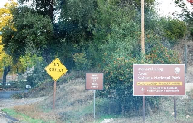
But the road had closed just a few days before on Nov 1, drat! Guess I'll try again in the spring.
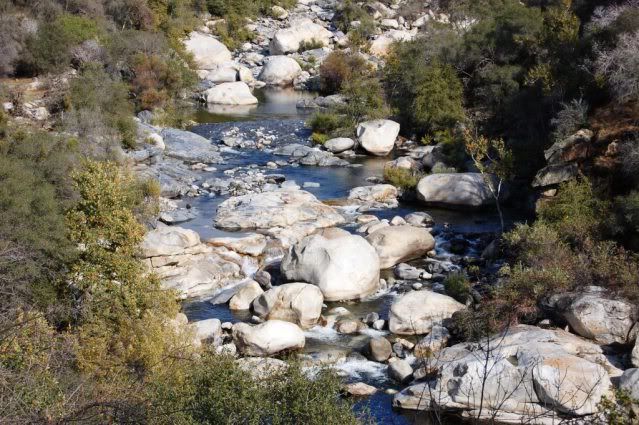
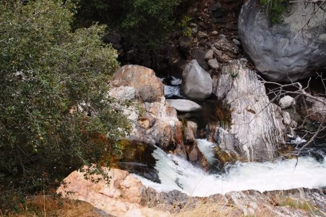
I showed my annual pass and headed into the park, snow was falling in upper elevations but I have BFG ATs on the Tiger and wasn't worried. Besides, the Kings Hwy (198) is a really fun road, and there were a couple CGs on the way up towards Kings Canyon. This is the Kaweah river:
Just past here they had the road closed, with 2 hour delays to pass for road construction and length restrictions. That's never a problem for Tiger at 16 ft long, so we waited, then passed, then came up to snow on the ground. Had snow tires on, but they changed the chain requirements from R1 to R2 while enroute and turned us around at an inspection station.
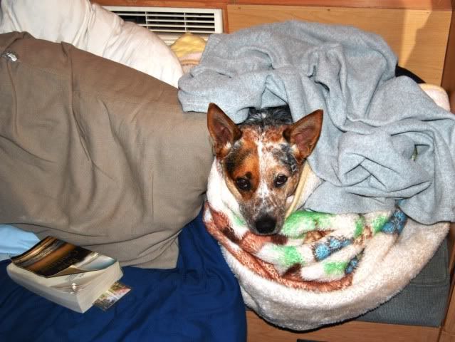
After waiting for the next road opening to head back down the day was shot, so we found a spot in the park for the night. It was getting chilly so I bundled Pepper up while I read.
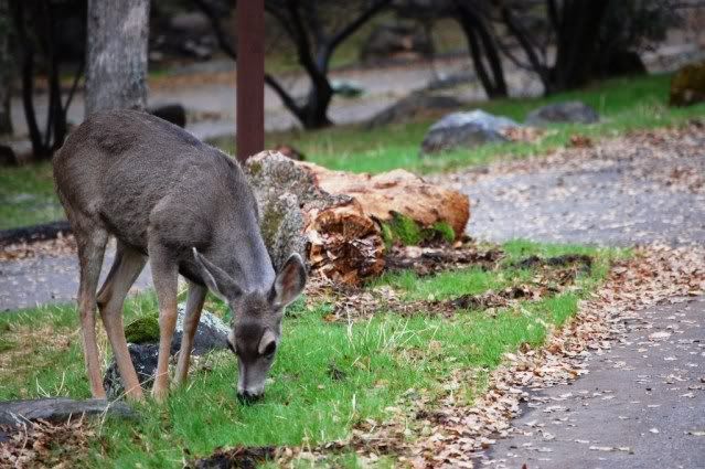
In the morning a couple visitors came through the CG, obviously a little too acclimated to humans. This one came right up to the cracked window in the back of Tiger and tried to stick her head through the window. Ripped the screen with Pepper going nuts, it wasn't pretty. And then hung around like nothing had happened.
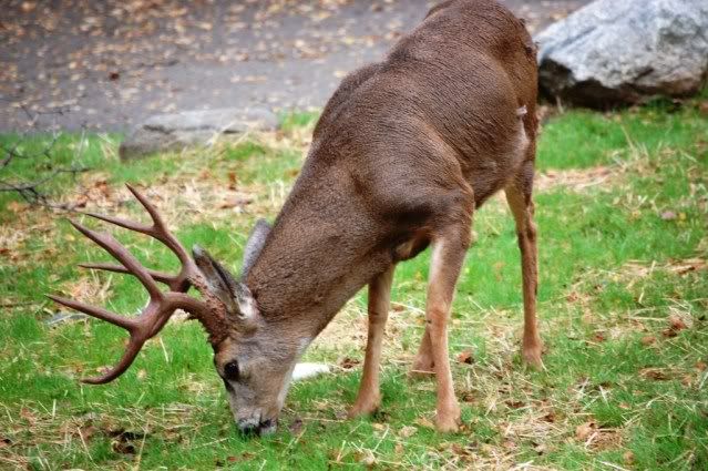
Her buddy ignored the whole incident, really glad he didn't stick his head in!
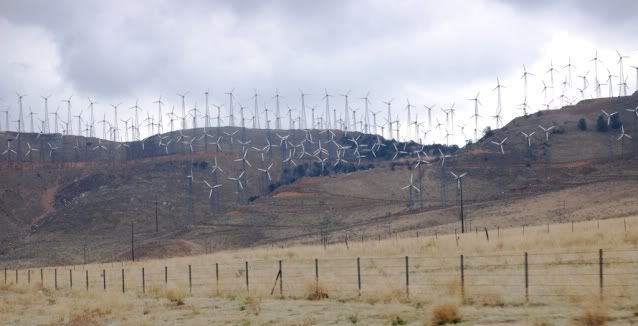
I was definitely bombing out in Sequoia NP, so we headed home. I took 65 instead of 99 south, then onto 58 past Tehachapi, passing these windmills along the way.
So it turned out not to be a coastal CA loop after all, but I saw a lot of new things. I'll definitely give Mineral King another try when the road re-opens, just east of that glacial valley is Mt Whitney on the other side of the Sierras.
I was supposed to meet someone near Yosemite and go back to the coast, but that didn't work out so I headed to Sequoia NP instead. I wanted to check out Mineral King in the southern end of the park.
In the 1960s Disney had eyed this isolated southern Sierra Nevada valley for a massive ski resort. The proposal set off a battle that led to Mineral King's annexation to Sequoia NP. Despite national park status, the area was managed as a potential wilderness but without guarantee it would be protected. Then in the spring of 2009, Congress designated 2 million more acres, including Mineral King, as forever off limits to development. The pictures I've seen are stunning and I wanted to see it and check out the old buildings. This is from the Mineral King website:
Mineral King road with Timber Gap in the distance (photo by Sharon Devol)
But the road had closed just a few days before on Nov 1, drat! Guess I'll try again in the spring.
I showed my annual pass and headed into the park, snow was falling in upper elevations but I have BFG ATs on the Tiger and wasn't worried. Besides, the Kings Hwy (198) is a really fun road, and there were a couple CGs on the way up towards Kings Canyon. This is the Kaweah river:
Just past here they had the road closed, with 2 hour delays to pass for road construction and length restrictions. That's never a problem for Tiger at 16 ft long, so we waited, then passed, then came up to snow on the ground. Had snow tires on, but they changed the chain requirements from R1 to R2 while enroute and turned us around at an inspection station.
After waiting for the next road opening to head back down the day was shot, so we found a spot in the park for the night. It was getting chilly so I bundled Pepper up while I read.
In the morning a couple visitors came through the CG, obviously a little too acclimated to humans. This one came right up to the cracked window in the back of Tiger and tried to stick her head through the window. Ripped the screen with Pepper going nuts, it wasn't pretty. And then hung around like nothing had happened.
Her buddy ignored the whole incident, really glad he didn't stick his head in!
I was definitely bombing out in Sequoia NP, so we headed home. I took 65 instead of 99 south, then onto 58 past Tehachapi, passing these windmills along the way.
So it turned out not to be a coastal CA loop after all, but I saw a lot of new things. I'll definitely give Mineral King another try when the road re-opens, just east of that glacial valley is Mt Whitney on the other side of the Sierras.
Last edited:


