AdventureTaco - turbodb's build and adventures

turbodb

Well-known member
Getting High in Idaho

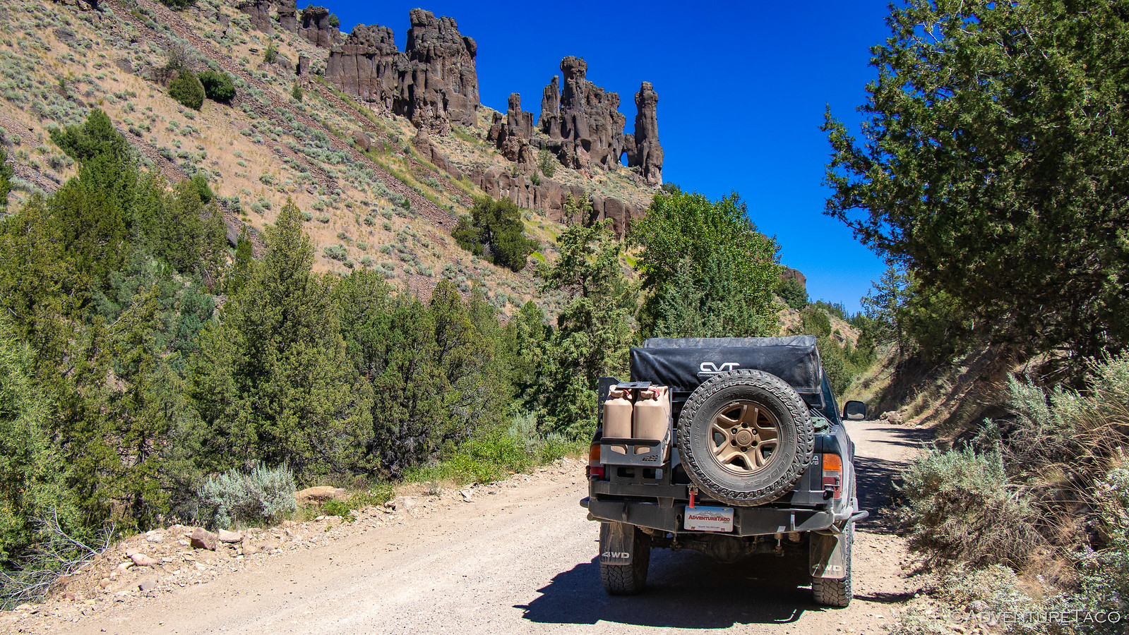
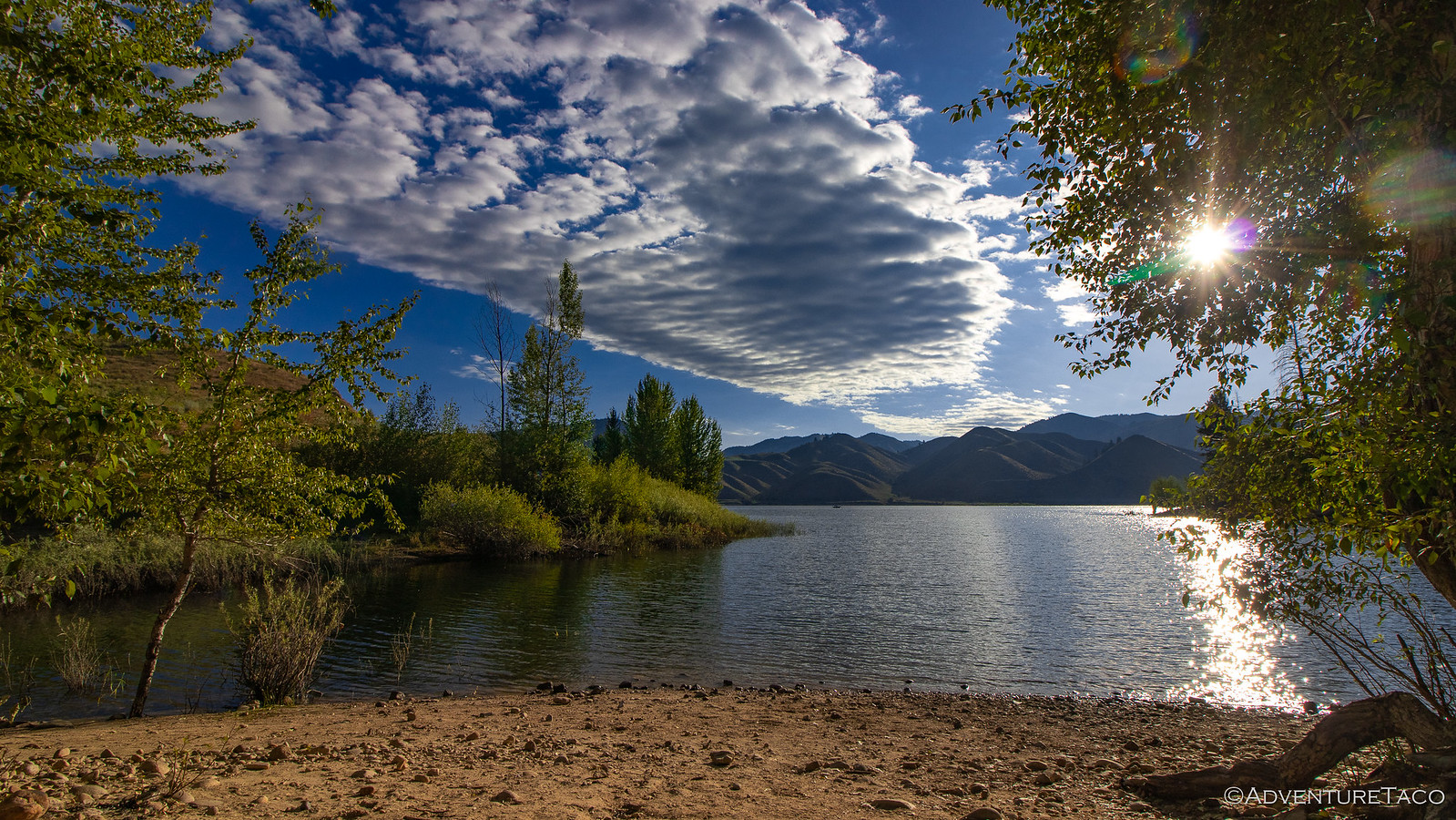
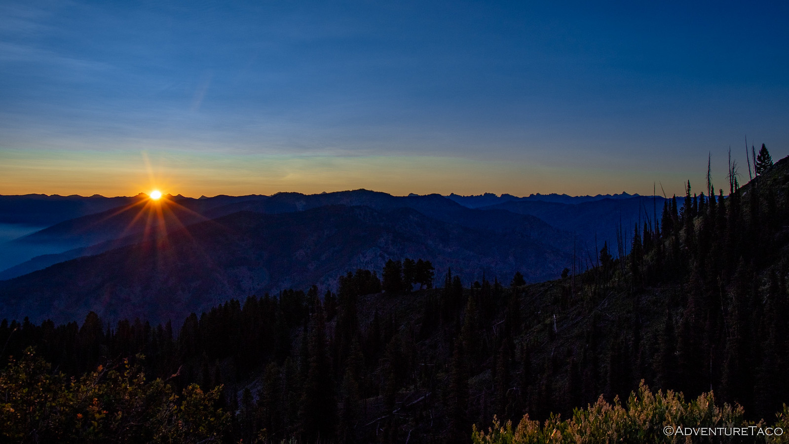
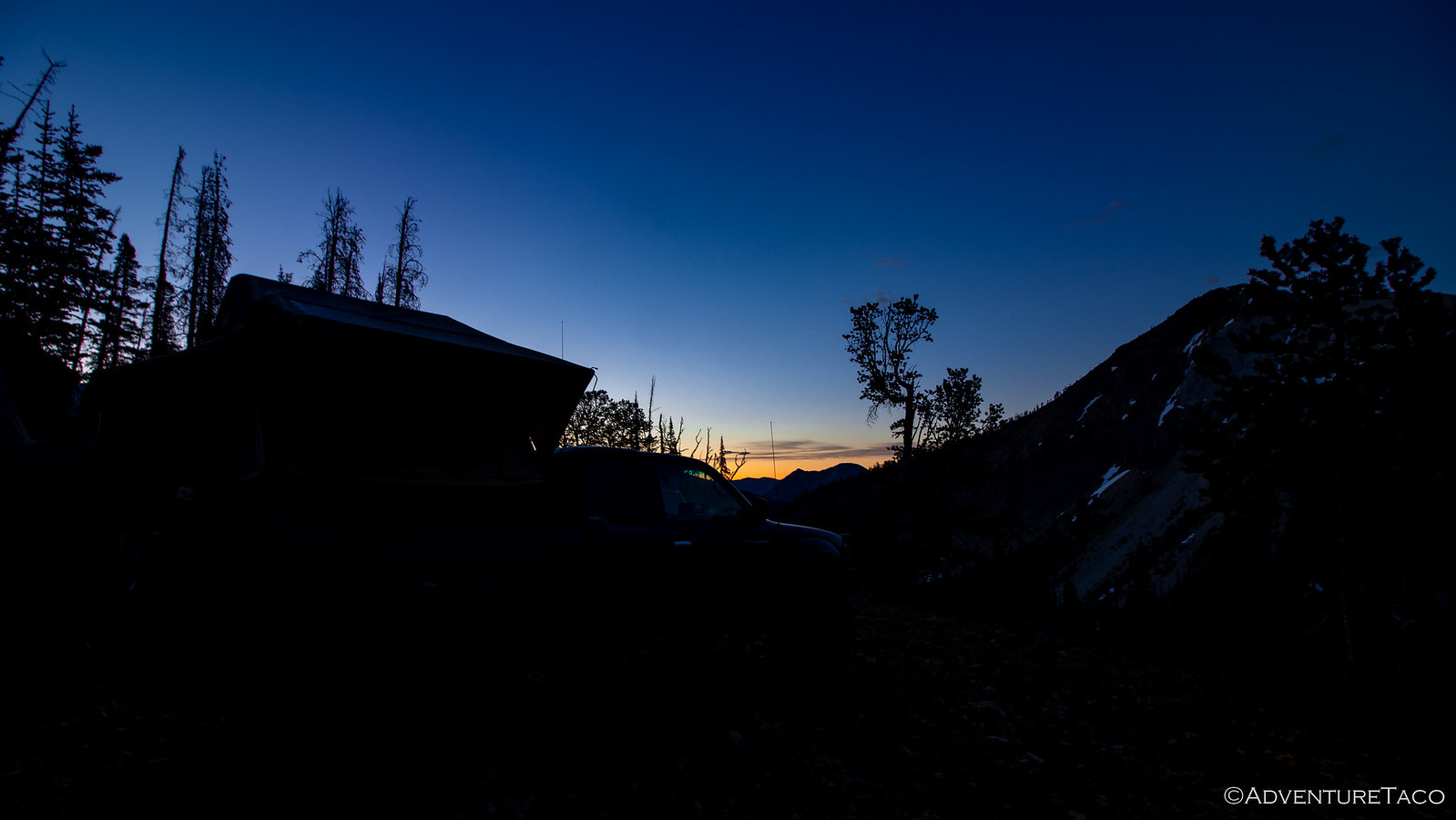
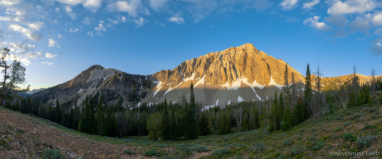
I went to bed hoping that our position on the ridge would result in some stupendous sunrise photos, but as morning rolled around, it was clear that ridges around us had been inappropriately placed by the Earth, and that all I was going to get was a little bit of orange on the horizon and a view of Croesus Peak out the window.

Thanks a lot, Earth.


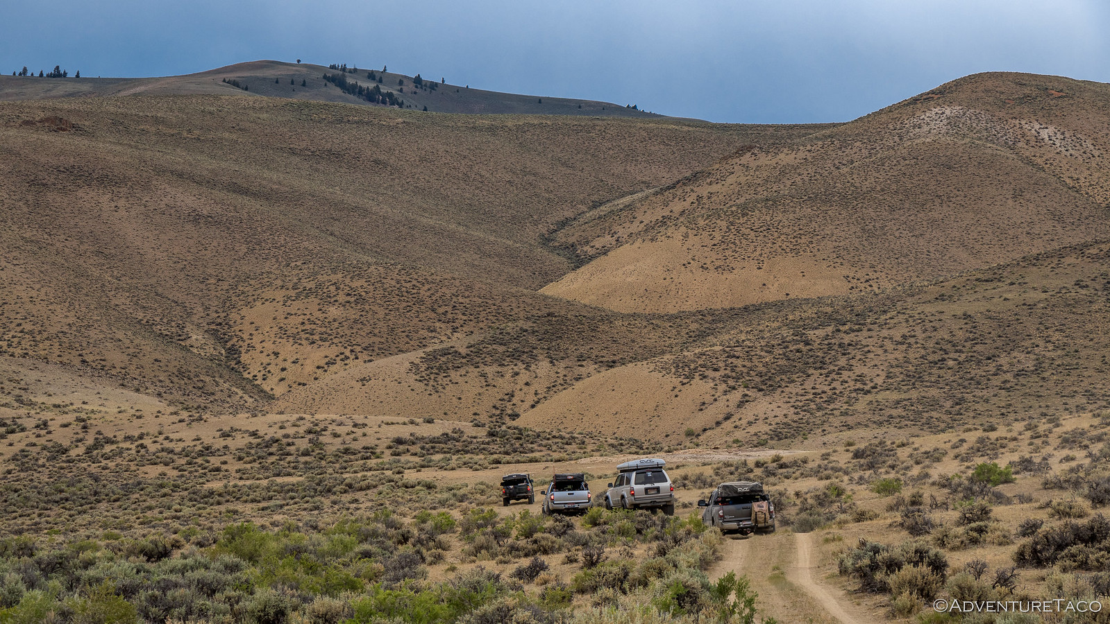
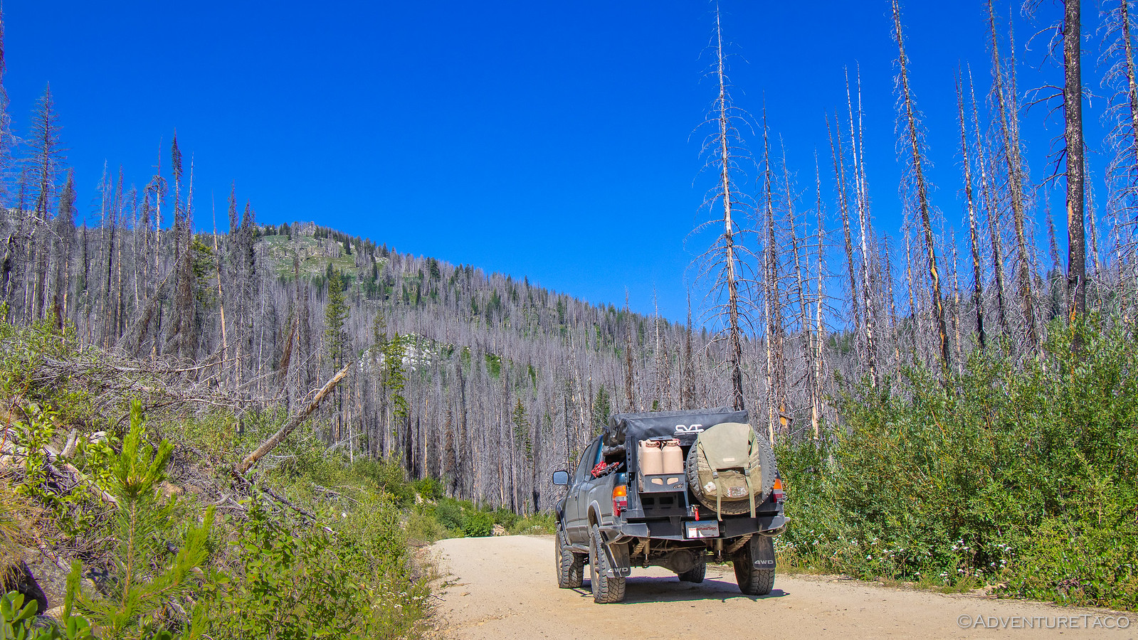
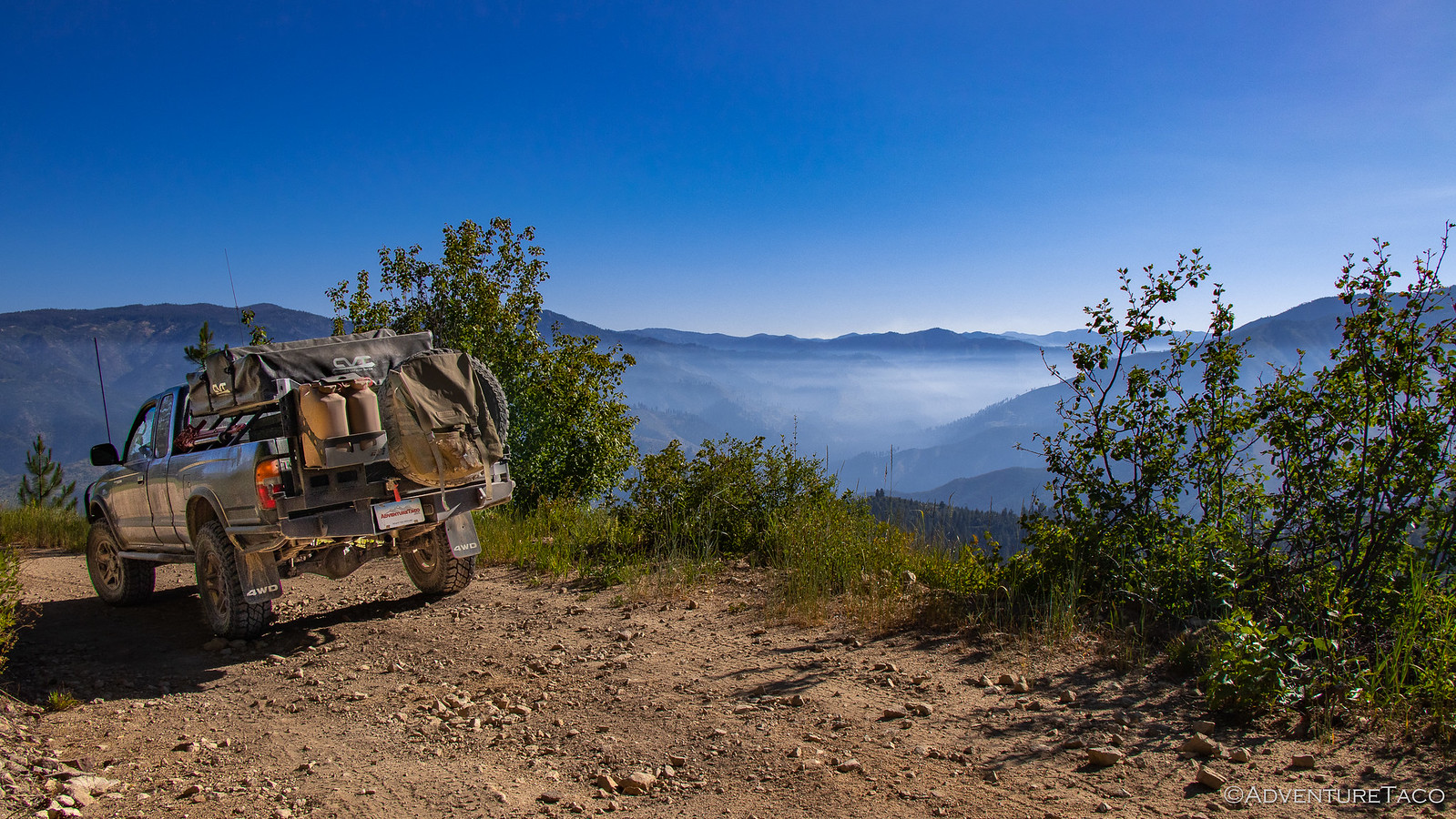
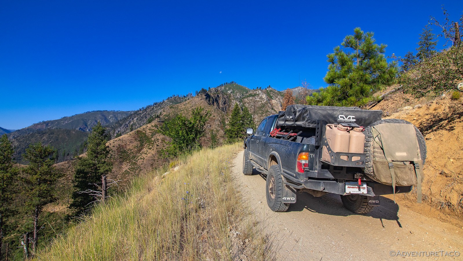
Like the previous morning, our plan was to meet another truck before setting out on our next adventure, but this morning we were set to meet much earlier in Stanley - 10:00am - necessitating a much earlier departure from camp, our last view of what had been one of my favorite camp sites coming just before 8:00am.


Heading back down the hill, chatter on the CB was high. Ben @m3bassman, Will @willhaman21 , and Mikey @pizzaviolence were calling out all kinds of weird things in search of their buddy Kyle @KP907 on the off-chance that he and Nicole had found a place to camp up the Washington Basin road the previous evening. I turned down the volume and @mrs.turbodb and I enjoyed the scenery.


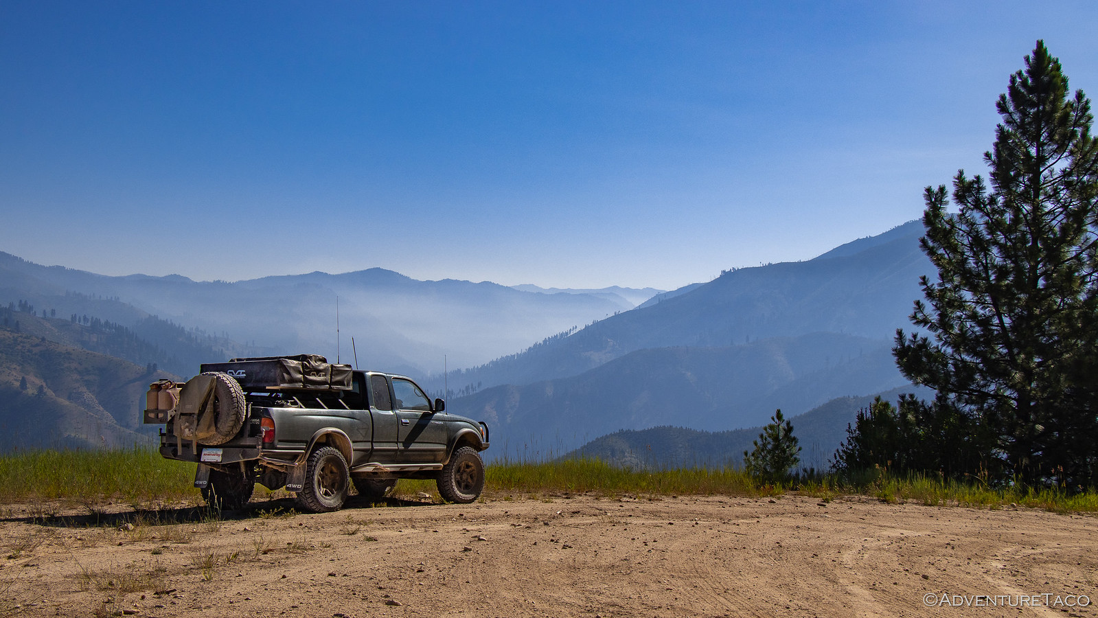
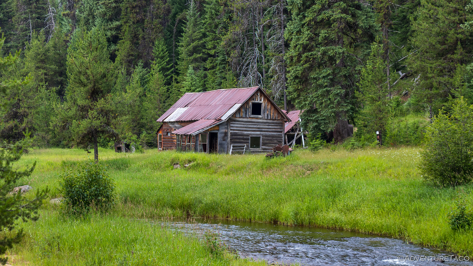
Honest ranching here.


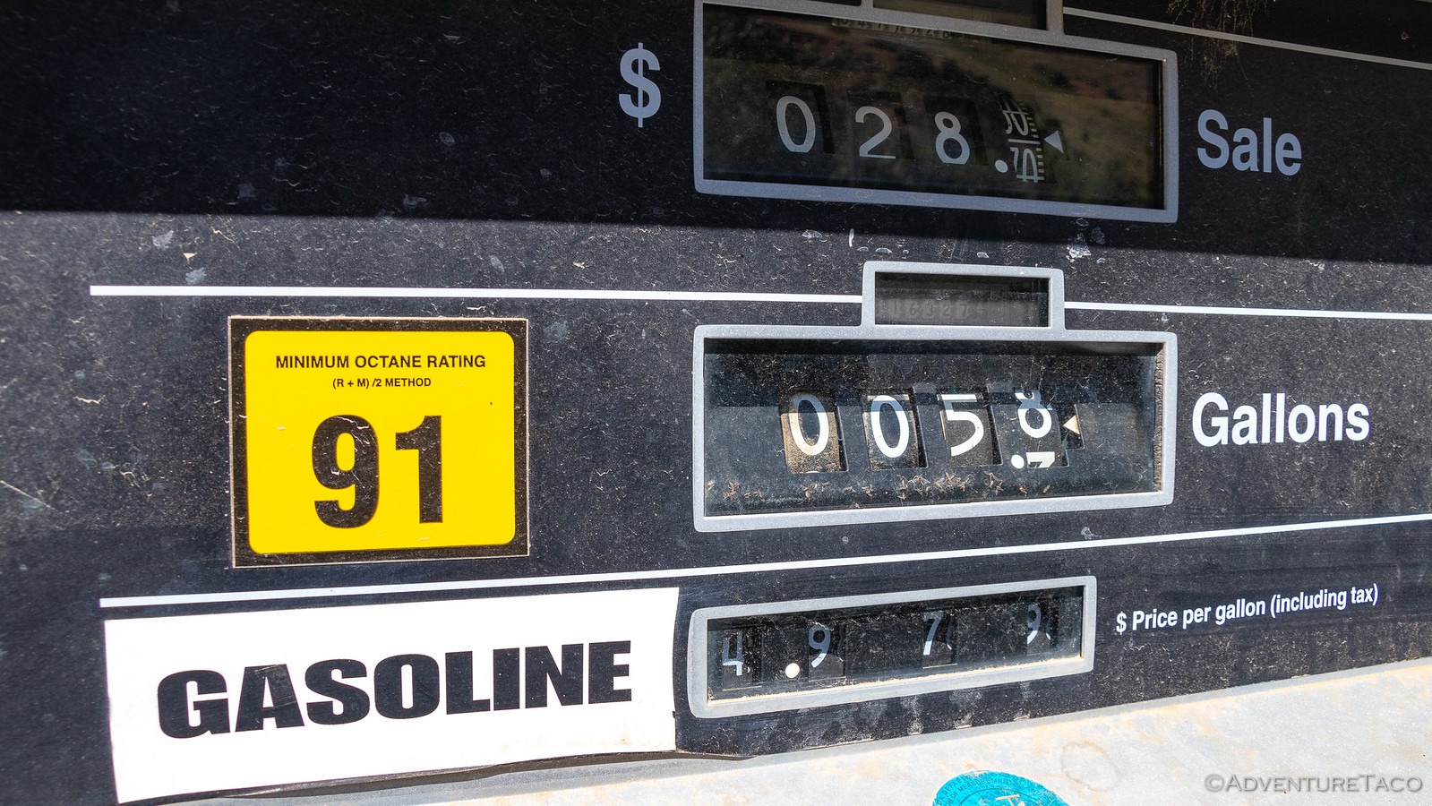
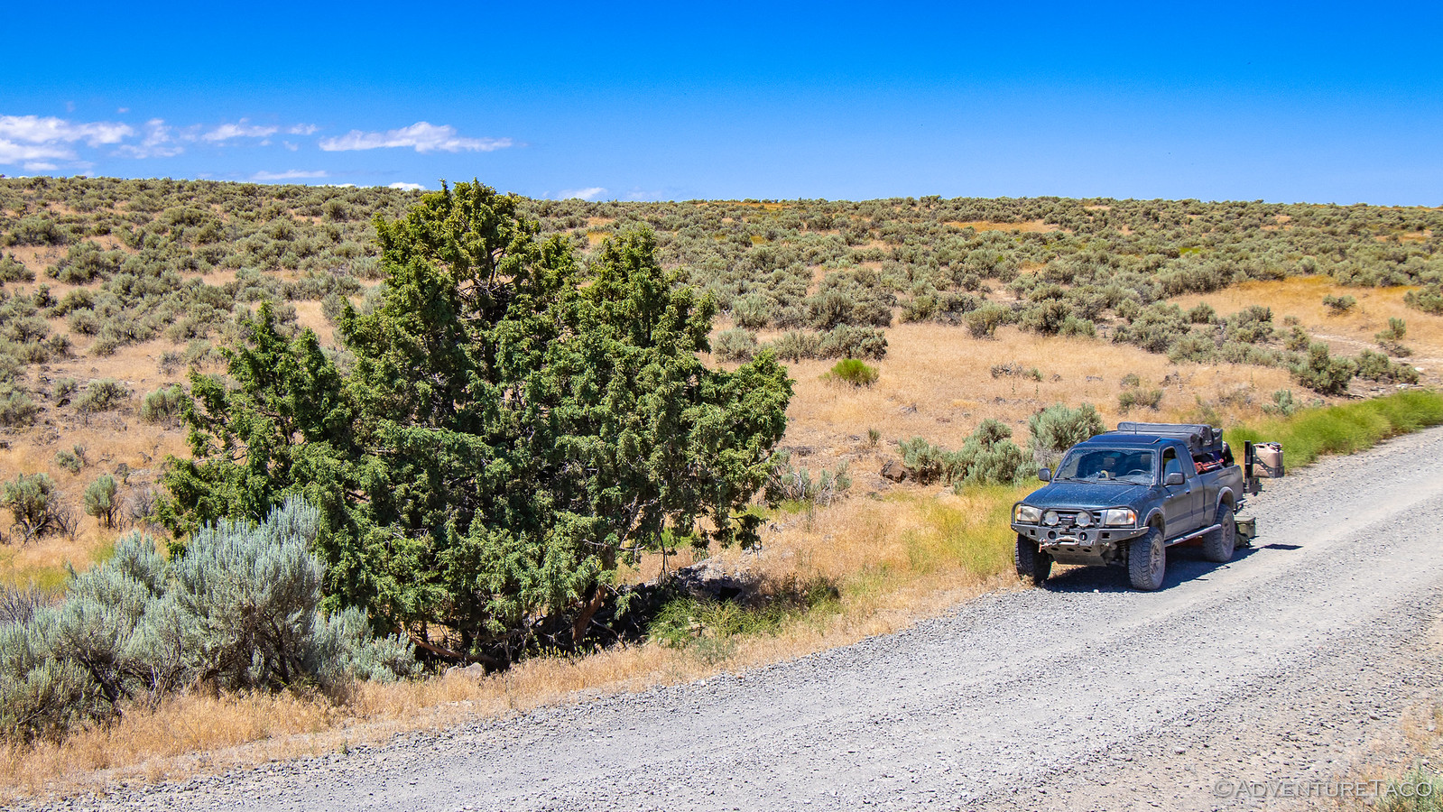
We arrived in Stanley right on time, performing the same dance we had with fuel the day before, and then headed out west on ID-75, with a second, 2nd gen Tacoma now in tow.


One might say "of course," but with several non-1st gen Tacoma's, it wasn't long before Will - who was now tail-gunning for the group - called out over the CB that Angie had noticed the rear tire on Mikey's truck was dangerously low. We weren't sure what caused it on the way down the mountain, but something had clearly started a slow leak, and we immediately pulled over to the side of the highway and set to work installing the spare - a quick change with the help of a mid-torque Milwaukee Impact Wrench, seen here working the lug nuts off by itself while Mikey lowered the spare and the rest of us just stood around watching.


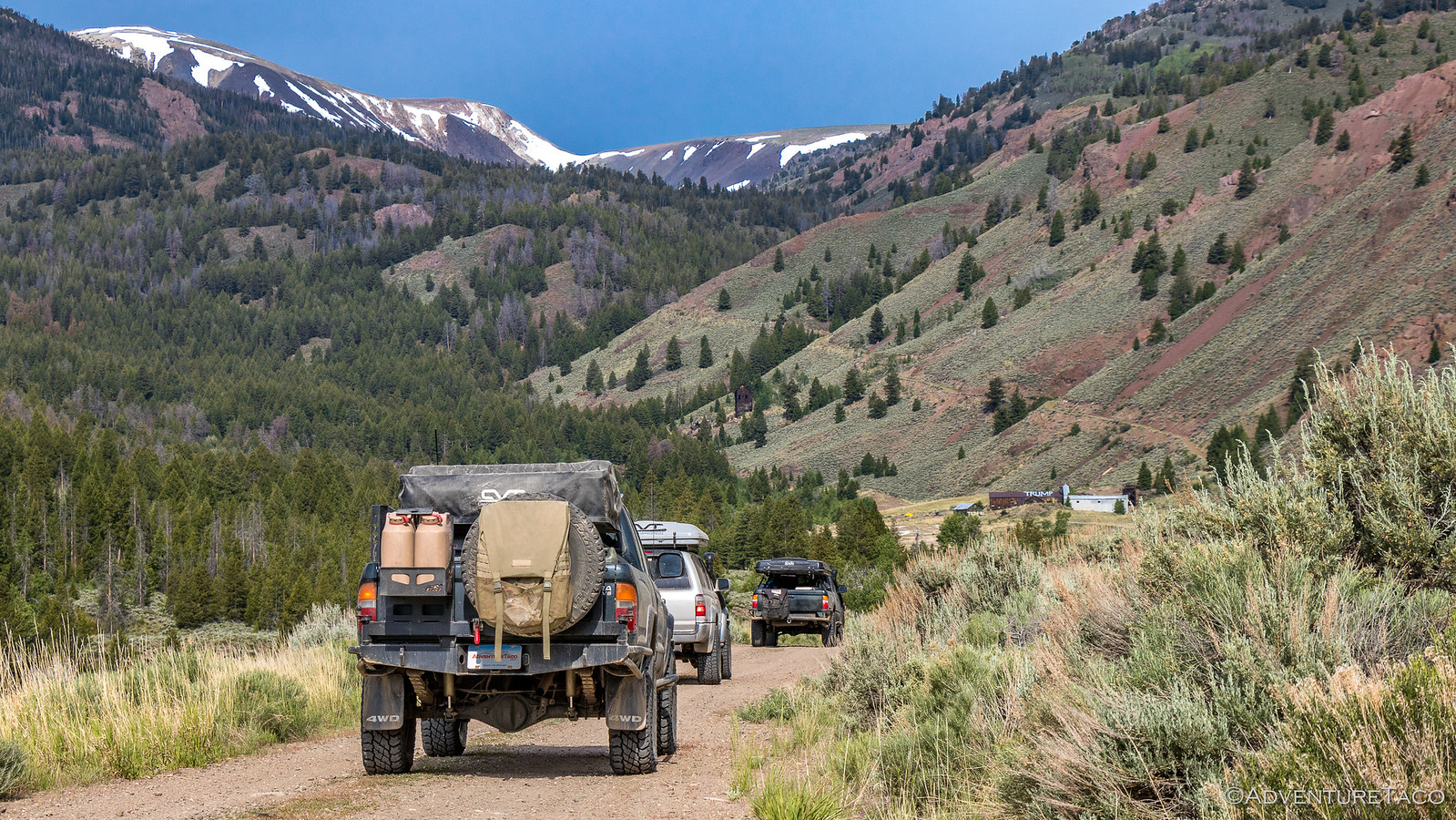
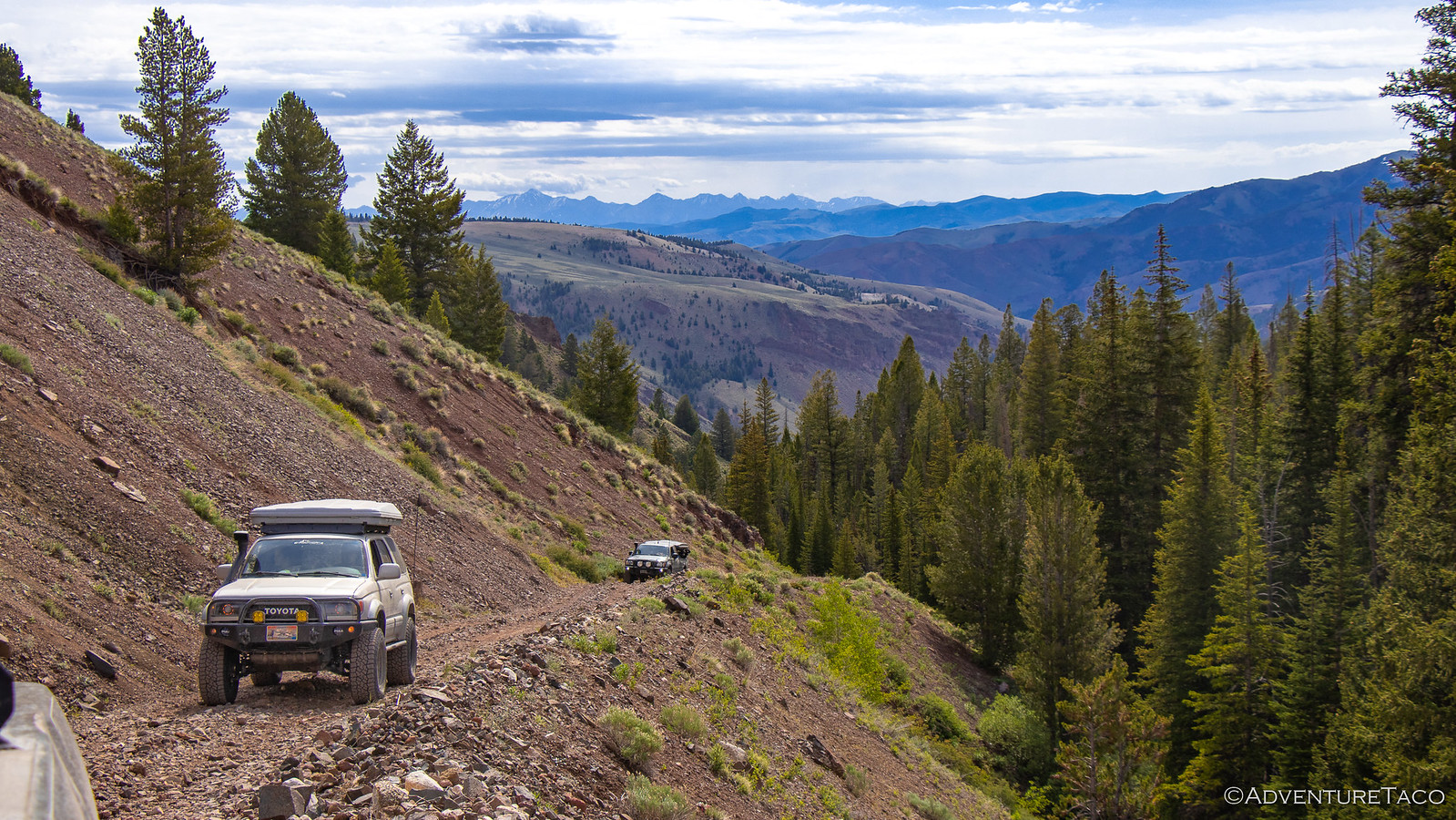
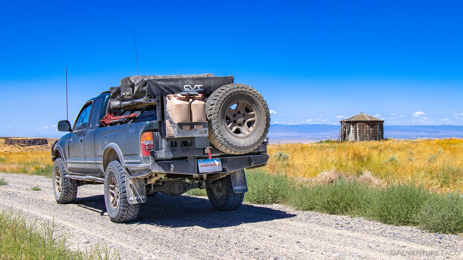
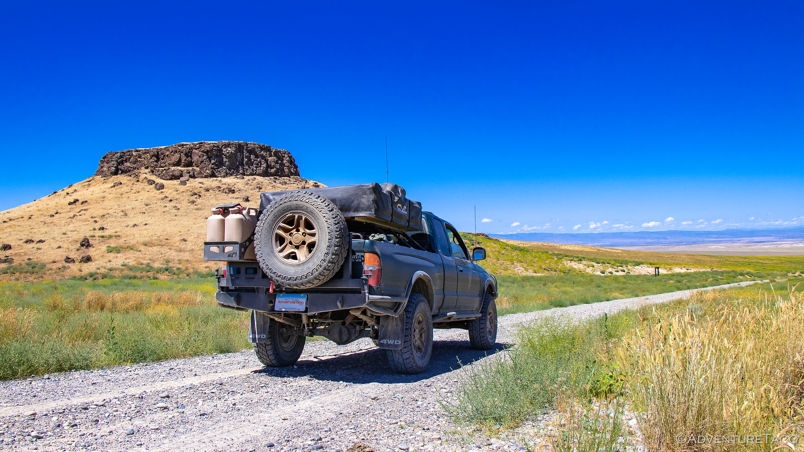
Tire repaired, it was time to get back on dirt - this time on Yankee Fork Rd (the Old Custer Motorway). That meant airing down for Kyle (and Mikey's spare), so we pulled over and joked that perhaps the rest of us should also let out a bit of air for what was clearly a gravel highway fit for Civic's.


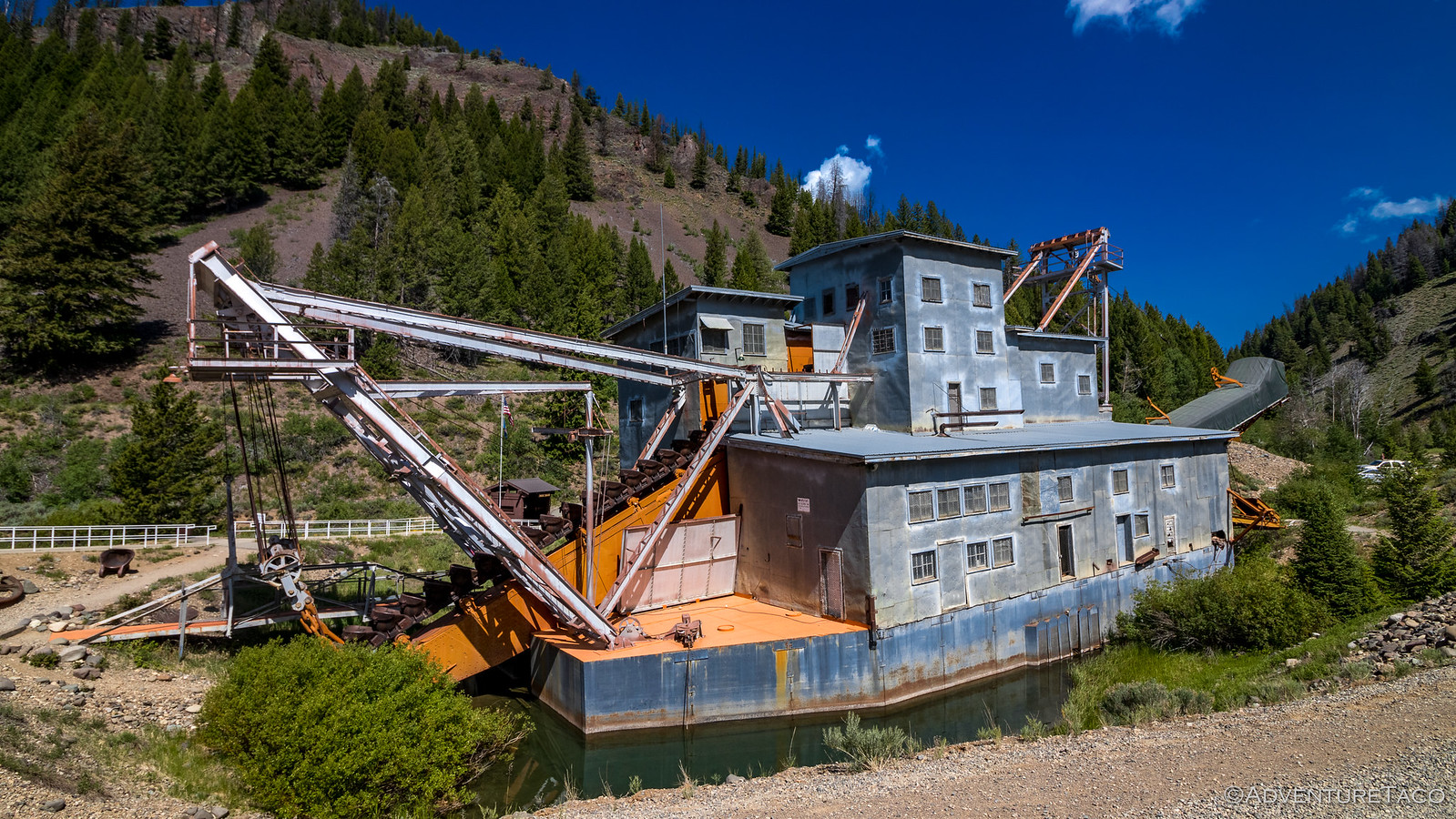
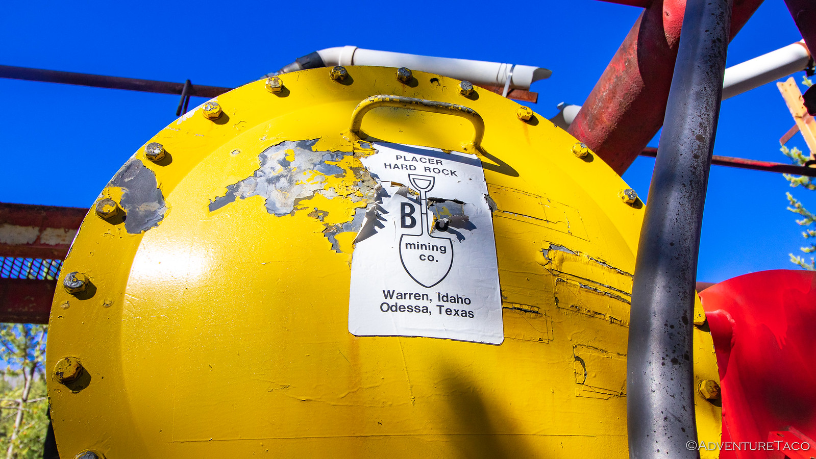
Driving comfort at an all-time high, we proceeded upstream, past millions of cubic feet of dredge tailings until we found ourselves at the Yankee Fork dredge - the largest in-tact dredge in the lower 48 states; 3-4 times larger than Tony Beets dredges on Gold Rush. Built between April and August 1940 (fast!), the dredge is 54 feet wide by 112 feet long, requiring 8 feet of water to float on its pontoons.


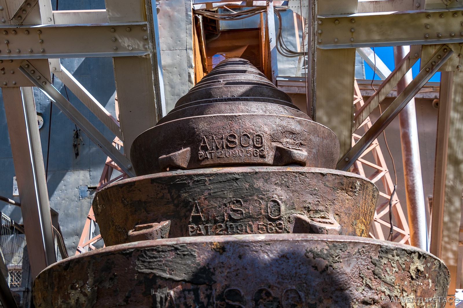
Each of the 71, 8 cubic foot buckets, weigh in at a cool 2,000 lbs - capable of processing 26 cubic feet of material per minute.


Active for only a few years, the dredge was in service until 1942, then out of service during WWII, and back in service for a few years until 1952 when it was finally shut down for good and eventually donated to the state of Idaho, destined to become the mining museum we were experiencing today.

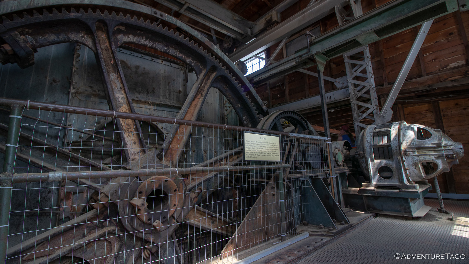
Inside, two older gentlemen who had worked on the dredge were giving tours, and we soaked in the stories of the winch room, control room, trammel, sluices, and engine. As a fan of Gold Rush, it was - I have to say - a pretty cool experience!


48287665967_b8a398e17b_h.jpg


48287665727_5dd70c341b_h.jpg


48287567586_2e96e0003c_h.jpg

- - - - -

Don't miss the rest of the story, and all the remaining photos that don't fit here (due to max post size). Hopefully that can change in the future, but until then...

Keep reading the rest here
Getting High in Idaho


.
 

turbodb

Well-known member
Getting Even Higher in Idaho, Again

It rained on and off through the night, but it was warm enough that the tents dried off quickly each time it did. And of course, cloudy skies meant no sunrise - and for me, more sleep!

Having circled the trucks in camp, things were reasonably peaceful save a single growl from Venice at some point during the night. The next morning, Kyle @KP907 noted that he'd seen a coyote just a couple hundred feet from camp - the likely impetuous for the verbal warning.


The on-again-off-again rain continued as breakfasts were prepared, and we all took advantage of a short break in the weather to get our tents semi-dried and put away before getting on the road just before 9:00am. As it turns out, our trip to the main road would be our last few minutes together - Mikey @pizzaviolence and Kyle and Nicole deciding to head home rather than continue on with the day's excursion.


That of course meant that it was time for a final group shot - a shot that shows one truck clearly doesn't belong - Ben having trained his fellow Idaho brethren well. #ka-chow fellas! :p


Now down to three trucks - Ben and Kirsten, Will @willhaman21 and Angie, and @mrs.turbodb and I - headed to a pair of destinations that would be the perfect cap to this wondiferous trip: Livingston Mine and Railroad Ridge.


These were also the last two places that we'd visited on last year's trip, and if we're being honest, we had some unfinished business at the Livingston Mine. See, last year the mine had thoroughly creeped us out - our retreat initiated when a local resident scared the bejeezus out of Kirsten as they pulled into the camp.

This year, things would be different. and by different, I mean that Ben suggested I lead the way into the mine! ? Just fine by me.


The mine was quite clearly just as weird as it'd been the year before. The paint may have faded slightly, and there might have been an additional "TRUMP" or two painted here and there, but by and large it was unchanged. Including the cairn field - it's meaning still unknown, our imaginations racing.

"Any idea what the names carved into the rocks might mean?" I asked over the radio, followed by an evil laugh! (There were no names on any of the rocks.)


Last year, we never got any further than this - so as we pulled into what I can only call the parking area of the old mine, I was as curious as could be. And, as I pulled up to the front door of the main house, I had to admit - it was a little "off" - especially if you were named "Everett."


We'd hoped to get a tour at this point - so we all dismounted and gave the crazy-people-eaters plenty of time to descend on us - but in the end, no one showed up. Eventually - knowing that the mine was still private - we decided it was time to move on, and we made our way out the way we'd come.

Along the way, we noted the presence of a 2nd gen Tacoma. Left over from the last visitor, or a sign that the residents were pretty cool? :notsure:


We continued up the hill - past the old mill - the beginning of our 3500' climb falling behind us; our snow-capped destination in the distance.


The climb - while high and fast at just over 7 miles - doesn't seem bad when you're doing it. I'm not sure why - perhaps the fact that the road is cut well into the mountain, or the fact that you're distracted by the views as you progress - but it doesn't really matter, because as you start to reach the top, everything changes.

Trees disappear completely. Mountain tops show themselves. It gets windy. And the smells are sublime - the wind carrying the scent of the tiny wildflowers quickly over the mountains summit.

But there's still 1000' to go!

48296161921_d5de707159_h.jpg


48296161671_96dcdbdf66_h.jpg


Don't miss the rest of the story, and all the remaining photos that don't fit here (due to max post size). Hopefully that can change in the future, but until then...

Keep reading the rest here
Getting Even Higher in Idaho, Again


.
 

turbodb

Well-known member
Excel in the Wild
Every year, during the month of October, a really great thing happens at Microsoft. Teams of all sizes - from just a few folks, to organizations thousands strong - rally around a common cause. Every year, that rallying cry gets stronger - millions of dollars stronger than just the year before. And every one of those millions is matched by the company - dollar for dollar, as high as it can go. Last year, over $163 million dollars and 760,000 volunteer hours were donated to various charities and causes that employees cared about.

That is the power of the Microsoft Giving Campaign.

And, while some may say, "They get paid so much, it's no big deal." Just remember - like votes, every dollar counts - and this many millions can do a lot of good.

Of course, that's all fine and dandy - but what the heck does it have to do with my adventures? Well, last year - for the first time - one of the members of the Excel team auctioned off a day-long offroad adventure for three lucky bidders. Another team member jumped in as well, auctioning off another three seats, and when it was all said and done, several thousand dollars had been earmarked for charity.

The two awesome folks were Joe and Dave. You may recall them from an earlier story - where I took them, and their "Stormtrooper" 4Runners, on their first offroad adventure. This time, I was the one who was thrilled when I was asked to tag along!

As happens with any large team like Excel, finding a date took some coordination. Like, 7 months worth. Eventually, schedules aligned and we figured that the middle of July would provide perfect weather for such an outing. And, on the morning of July 15, at 7:45am, we all showed up in the Microsoft parking lot, ready to show a bunch of the team what it was like to crawl up a trail, to a lake, for lunch!

48385072052_0c125006d2_h.jpg

Of course, being that this was Seattle, the day was overcast - Julyuary, as it were - and as we set out east to Fortune Creek, it started to rain. Perfect.


No matter, it was another hour to the trail head outside of Roslyn, WA, where we'd be airing down - plenty of time to drive out of the rain and into the sun. Which is exactly what didn't happen by the time we arrived. Instead, we all go wet in our shorts and flip-flops as we lowered our tire pressures to between 15 and 22 lbs.


Now would also probably be a good time to 'splain the trucks. So, there's of course me with my green 1st gen Tacoma. Next, there's Joe with his white 5th gen 4Runner - he's the guy who got this whole thing rolling, so kudos to Joe. Then, Dave - he's got the blue TRD Pro 4Runner. As you may expect, there's a story to the transition from his Stormtrooper TRD Offroad 4Runner to this one, but that's not for me to tell. And last (exactly because it's not a Toyota) is the Jeep Rubicon - driven by Stacy and her husband Scott; also thrilled to to be invited in the same way I was.

All aired down, we were off. With varying skill levels - and a bunch of passengers who'd never been offroad - the first few miles were a nice introduction - well graded, forest service road. And then, we turned off onto the Fortune Creek trail.


The going was slow, but fun - for the most part, the trail well-traveled enough that we pointed our trucks up, and there we went. Only one place did a little pruning need to occur - and there, only because the shrub was weighed down by the recent rain. Oh, and because Dave doesn't have any pinstripes on his shiny blue 4Runner yet! ?


This trail, it turns out, is a good one for reasonably new offroaders. There are a few places where choosing the right line can make things a lot easier, but choosing the wrong line won't lead to any real harm. Of course, for Scott and Stacy in their Rubicon with 35" tires, lines weren't an issue at all.


Joe - group leader for the day - has also been getting a bit of experience under his belt, and it showed. Where this trail was pushing his limits the first time he ran it, it was clear that he was having a much better - and slightly more relaxed - time the second time around.


Dave, the "rookie" of the bunch (in as much as "rookie" can ever be used to describe Dave) was perhaps a bit out of his element, but was nonetheless a quick learner. A bit of guidance on lines, and he too was churning his way up the mountain - the stock 4Runner doing everything he asked and more.


Don't miss the rest of the story, and all the remaining photos that don't fit here (due to max post size). Hopefully that can change in the future, but until then...

Keep reading the rest here
Excel in the Wild


.
 

turbodb

Well-known member
Idaho Backcountry Discovery Route (IDBDR) - Introduction

We've run two Backcountry Discovery Routes (BDRs) in the past - Oregon in 2017 and Washington in 2018. So, when it came to planning for this year, we decided that we'd run what we thought would be one of the coolest BDRs out there - Idaho.


<p class="full-width-container"><img style="float: right; width: 33%; max-width: 620px; padding: 0em .5em .5em 2em;" src="https://live.staticflickr.com/65535/48411137387_a66e01c709_n.jpg" data-srcset="https://live.staticflickr.com/65535/48411137387_a66e01c709_n.jpg 320w" data-largesrc="https://live.staticflickr.com/65535/48411137387_7a63896e5a_o.jpg" /></p>

Little did we realize that it would mean spending most of July in the beautiful state - we had, after all, just finished exploring the southeast and then the central parts of Idaho a couple weeks before we'd planned to embark on this south-to-north traverse of the state.

Not that we were complaining - this was clearly, our year to explore Idaho!

As far as the route itself goes, at 1,250 miles the IDBDR is much longer than either Oregon or Washington - understandable given that Idaho is as tall as the other two states combined.

Over the eight stages, we'd have the chance to traverse both the historic Macgruder Corridor and the Lolo Motorway; to experience highs and lows - the route rising and falling from 1500' to over 8600' above sea level; to see and experience much that the state has to offer - from dry desert to temperate rain forest.

Of course, through it all, we knew we'd encounter some obstacles - we just didn't know what they'd be. Like Oregon had been, we'd be going solo; unlike Oregon, we and the truck were significantly more prepared and capable.

We'd allotted up to 11 days to complete the trip - unsure whether the roads would be fast (like Washington) or slow (like Oregon) - hoping that we could cover a section each day, with a couple days travel to-and-from home.

We'd start in the historic town of Jarbidge, NV as we made our way north - mostly on dirt roads - towards Canada and the Rykerts crossing. We'd surely pass countless fire lookouts and hot springs. If we were lucky, we'd see a wide array of wildlife - deer, elk, moose, perhaps even a bear or mountain lion.

And so it was, that on a Wednesday in the middle of the month, we packed up our passports, a few changes of clothes, and enough food for most of our trip, and headed east - a cool 717 miles standing between us and the beginning of our IDBDR adventure.

It was midnight when we finally found camp a few miles outside of Jarbidge, having just missed hitting a cow calf who wandered into the road in front of the truck. Exhausted, we climbed into the tent and were asleep within minutes, excited for what the next day had in store!
 

turbodb

Well-known member
IDBDR Pt. 2 - Across the Snake River Plain

Having arrived late the night before, we were not up early. We'd slept well next to the East Fork of the Jarbidge River just outside Murphy Hot Springs, and it was a little after 10:00am when we rolled into Jarbidge, NV - the official start of the Idaho Backcountry Discovery Route.


Our first order of business was to fill up with fuel. I wasn't sure that we really needed to do this (it turns out we didn't), but I wanted to make sure we at least started off on the right foot for this trip. Plus, we'd filled up recently so even at $4.98/gal, the total cost wasn't all that expensive.


Having contributed our small fortune to the Nevada economy, we set out to look around this little gold-mining town - a town that likely now sees more BDR adventurers than folks looking for the shiny yellow stuff. It was quite the time capsule, and we soaked it in. A community park houses a bunch of cool machinery from the early 1900's including an old headframe - used to raise and lower miners inside vertical shafts, and this "one-lunger" - an old single cylinder engine, which legend has it gained 2 hrsprs when it was painted green with pink flowers.


The last bit of memorabilia we spent a few minutes at was much newer. It was a shovel - of the short-and-stubby variety - that had been enlarged a few dozen times, for what reason we had no idea. But, the plaques on it said that a bunch of offroad and 4x4 clubs had participated in it's construction, making us wonder - where were its beaver teeth? #NotBigEnoughForInsta ?


Our tour of the town behind us, it was time to start our trek north. Having driven the same road south just a few minutes earlier to get to Jarbidge, you might think this would be something we weren't exactly looking forward to. In our case, it was quite the contrary - knowing we were headed back, we hadn't really stopped on the way down - but we had gotten a few glimpses of the canyon, and it was super cool!

I mean, for geology goobers such as ourselves.


Add to that a bit of graffiti we found painted along the side of the river - and subtract out the "seriously, why would someone do that?" - and it made for a quite enjoyable start to the trip.


Soon though, we were out of the canyon carved by the Jarbidge River, and into what I can only call the flats of Idaho. It was just a few short weeks ago that we'd found ourselves in these same flats as we'd explored our way to Indian Hot Springs - and we figured that fact entitled us to make good time through this section.


Even making good time, there was a lot of flat - enough that we got hungry somewhere in the middle of it and decided that a lone tree along the side of the road for us to sit under was probably as good an opportunity as we'd get to stuff our faces with some delicious sandwiches that @mrs.turbodb whipped up out of the back of the truck - turkey (and the fixings) for me, and some sort of roast-veggie-and-hummus concoction for herself.

Oh, and freshly picked cherries. Yes, we were off to a good start.


Of course, we could only drag lunch out so long before it was back onto the flats, many of which we continued to recognize from our previous trip. But then - as we drove along the edge of the Air Force bombing range - a change. To the driver side (away from the range), everything was normal; to the passenger side, black and burned. Guess some of the runs got a little out of control sometime in the couple weeks we'd been gone!


We pushed forward, our speeds on these well-graded gravel roads never really dropping below 40mph, and I found myself wondering if we'd complete the first section of the BDR early, despite our late start at the beginning of the day. Over the next couple hours, we saw a few things here and there - an pronghorn, a water tower, even Sailor Cap Butte - but we started to joke that perhaps BDR stood for "Boring, Don't Run."


But, at those speeds, we eventually found our way nearer to Hammett and Glenns Ferry, where the landscape got at least a bit more interesting - some amazing sunflowers lining the road, the green of irrigation stretching out before our eyes.

48422758737_0485d0e213_h.jpg


Don't miss the rest of the story, and all the remaining photos that don't fit here (due to max post size). Hopefully that can change in the future, but until then...

Keep reading the rest here
IDBDR Pt. 2 - Across the Snake River Plain


.
 

turbodb

Well-known member
IDBDR Pt. 3 - Stymied By Gates

The night passed uneventfully - a cool breeze blowing off the lake, a refreshing relief from the heat of the day. Now technically in Mountain time, I'd set my alarm for the absurd hour of 5:30am to catch sunrise - hoping that I'd be able to catch a bit of light despite our position relative to the horizon.


It wasn't long, I was a bit too late even at 5:30am, and we've surely seen more dramatic sunrises, but it was still an enjoyable few minutes of color to see splashed across the sky. Plus, it was still early enough that I knew there were at least a couple more hours of sleep to be had once I climbed back into the tent, the moon still high in the early morning sky.


Having enjoyed our more leisurely start the day before, we stayed in bed reading until just after 8:00am when an engine-revving, tire-spinning, ruckus outside the tent caught our attention. Contorting ourselves so we could see out one of the side windows, we looked up the trail towards the main road to see a pickup precariously perched sideways, completely stuck as it tried to turn around. Seems that he'd started down towards our camp before seeing that it was occupied. At that point, he made the poor decision to turn around on the rutted, off-camber, road and was now unable to get the purchase necessary in order to free himself. Luckily for him, another truck just happened to be passing along the main road, and with the help of a rope that seemed much too small for the task, they were able to get him pulled out and to safety - at which point he sped off without so much as a "Thanks." Strange dude.

It was enough excitement to get us up and moving - probably a good thing given what lay ahead for the day. Breakfast was a simple one for us as we got packed up - cereal with fresh blueberries from our garden, enjoyed at the lake's edge.


Soon, camp was packed and we were back on the road, our half-loop around Anderson Ranch Reservoir complete, our route taking us through the small town of Pine - where we stopped to fuel up - before heading north into the mountains, where we played leap-frog with a pair of motorcycles we'd shared the pumps with a few minutes before - each of us enjoying the views as we wound our way up the IDBDR.


The game could have gone on much longer - each of us likely wanting to be out in front to avoid the dust - but @mrs.turbodb and I were soon distracted by a couple of side trips, allowing the bikes to pull far enough ahead that we wouldn't see them for the rest of the trip. The first was a short jaunt up to the Trinity Mountain warming hut - one of the nicest I've seen, sure to be a nice relief for snowmobilers out on a cold winter run!


Unfortunately, it was locked this time of year - so after a short investigation of the perimeter, we were back on the road and headed to our next - much longer - detour, just visible on the most distant mountaintop: Trinity Mountain Fire Lookout.


If you're running the IDBDR, this is most definitely a side trip that I'd recommend. In fact, I'd say it was one of the coolest places we ended up over the entire excursion - though now I'm getting a bit ahead of myself. First, we had to make our way up through the Trinity Lakes area - several roads to remote campgrounds and trailheads (that looked to be great getaways) leading off the side of the road. Eventually, we found ourselves at just over 8000', our path blocked by a locked gate, still two miles from the lookout.

Where was our ATV when we needed it?!


Undeterred, we decided that given the beauty of our surroundings, we might as well hike the two miles and 1500' to the lookout - after all, what's the point of an adventure through Idaho without actually seeing what it has to offer?

Oh, and it was immediately clear why the road was closed. I mean, with the right tools, these rocks could have been cleared, but as it was - no trucks were getting around.


As we steadily climbed higher, we couldn't have been happier to see our surroundings. At this elevation, it was still spring. Snow was melting into alpine lakes, everything alive under the warm summer sun.


Several switchbacks and 45 minutes later, we reached the top. The lookout was unstaffed but plenty accessible, and we spent a good amount of time taking in the expansive views.


Don't miss the rest of the story, and all the remaining photos that don't fit here (due to max post size). Hopefully that can change in the future, but until then...

Keep reading the rest here
IDBDR Pt. 3 - Stymied By Gates


.
 

1leglance

2007 Expedition Trophy Champion, Overland Certifie
Excellent, I have 3 long days coming at work and these trip reports will get me through !
 

turbodb

Well-known member
IDBDR Pt. 4 - We're Recognized on the Trail

Hard at work as we slept, the fire fighters working on the Vader fire had it contained - as far as we could tell given the complete lack of rising smoke - by the time my alarm went off at 4:00am. As fires go, it hadn't been a huge, but at 443 acres, it had taken a crew of two Type 6 Engines, one Type 4 Engine, one Type II Initial Attack Fire Crew, a plane load of smokejumpers, two Type I Helicopters, four Type III Helicopters, an air‐attack, two Interagency Hotshot crews, and 2 dozers to rein it in. All that was left now was a blanket of smoke in the valley below.

Thanks all!


As the sun rose, we didn't - opting, for a while at least - to enjoy its warmth streaming in through the tent door. Still, we knew we had a lot of ground to cover - we'd only completed about 40% of the second stage of the IDBDR the day before, and we had a 20+ mile detour to get back on track due to the closure of FS-385. So, by 7:30am or so, we climbed down the ladder to another beautiful morning and another round of juicy, home-grown blueberries for breakfast.


Soon enough, the tent was stowed and we were on our way - Jackson Peak now in our rear view mirrors, the Tacoma making quick work of the dirt roads back to Highway 21. Having found a turn-off less than five miles up the road that seemed to bypass the closure, we didn't spend long on pavement - something that I'm sure other travelers appreciated.

:turtleride:​

Back on dirt, we climbed up onto the ridgeline above Bannock before starting our descent east of Lowman. It was a twisty, fun section of the route - one that reaffirmed our decision to find our way back as quickly as possible instead of simply following Highway 21 (also beautiful) straight into Lowman.


As we wound our way down the mountain, we were descending into the smoke we'd seen from our vantage point atop Jackson Peak - high above the inversion zone we now found ourselves driving through.


Below us, the Payette River - snaking its way through the valley, marking the point at which we'd come out of the mountains.


Even taking the scenic route, we continued to make good time - in general, the roads on the IBDR are in reasonably good shape. Comparable to (perhaps slightly worse than) what we experienced on the WABDR, and much better than the bone-rattling rockiness of the OBDR. Before long, we found ourselves out of the woods - much of it burnt - and just east of Lowman, where we'd be stopping for fuel.


It was here that we came across a reasonably informative USFS information station that used a single graphic to explain what we were seeing around us - namely, charred trees and a general lack of forest. What we were seeing was nature doing it's best to recover from the 1989 Lowman fire, which burned 72 square miles of forest - an area larger than the Boise metropolitan area. Over the month that it took to contain the blaze, and despite the efforts of more than 2,300 firefighters, 26 structures in the community of Lowman were destroyed.


Of course, it didn't have to happen this way.

USFS info board said:
For millions of years, fires have helped to maintain the forests of the world, severe fires historically occurring every 13-16 years in this area. However, over the last 100 years, this natural cycle has been altered by humans fighting fires to "save" the forest. As a result, unnaturally abundant fuels built up in the Lowman area and In 1989 - with high fuel levels and low precipitation - normal summer rains were replaced by dry lightning storms. These storms started 157 fires (36 in one day) in July of 1989, across the Boise National Forest.

Making seemingly slower progress on pavement than dirt - it's amazing how sluggish the truck feels when aired down on the highway - we tootled our way along until we reached Lowman and our pit stop for gas. While filling up, I had a chat with the station owner about the next leg of our journey. See, the BDR website had a warning for a water crossing in this section, saying that it was "dangerous" with "water levels so high." So, I asked if he knew the roads in the area and was familiar with this crossing they were talking about.

"You'll be just fine." He chuckled, "But you're wasting your time. That's an old logging road that they should really just take out - the new road they put in is a lot quicker."

I laughed and thanked him for the info - we were of course going the "waste of time" way. And can I just say how much I appreciate the little middle-of-nowhere stations like the Lowman Hitching Post that still let you pump your gas before going inside to pay. Without requiring multiple trips to first leave a credit card or the SSN of your first born child. Assuming the best in people, rather than the worst. It's refreshing.

Still only mid-morning, we began the climb out of Lowman on FS-582. Once again through forest burned some 30 years ago, it was hard to argue that there's something to be said for the views afforded by such a landscape.


And it wasn't just the distant vistas that we enjoyed. @mrs.turbodb also enjoyed a nap or two, my frequent photo stops to capture the wildflowers that were in full bloom at these elevations, interrupting her slumber.

48447091267_eccac98655_h.jpg

48446929051_8974340fa4_h.jpg

48446928866_5afd2cf66e_h.jpg

And then, as we descended towards a water-crossing that we were both looking forward to - a bit of excitement! There, across the road - a fallen tree. An old burn, this one quite clearly came down as a result of an unstable base and perhaps just the right gust of wind - it had blocked just enough of the road that ATVs and motorcycles could get by, but trucks were a no-go.


Don't miss the rest of the story, and all the remaining photos that don't fit here (due to max post size). Hopefully that can change in the future, but until then...

Keep reading the rest here
IDBDR Pt. 4 - We're Recognized on the Trail


.
 

turbodb

Well-known member
IDBDR Pt. 5 - (No More) Gold in Them There Hills

Camped deep in the valley next to the South Fork of the Salmon River, getting up for sunrise wasn't even an option for us. The dual-sport bikers had we'd met the night before were surely later to bed and earlier to rise than we were, but that was just fine by us - we needed our beauty rest, bad.

So it was that when the sun finally did start warming the tent that we figured we might as well continue on our route - I mean, it was either that or go back the way we'd come - we were after all, a long way from home.


As was becoming routine, we breakfasted and broke down camp before setting off across the river - this time, with the assistance of a bridge, the water levels too high, even for a Tacoma.


Almost immediately - yep, you guessed it - we started to climb. Up and out of the canyon, two male deer watching as we negotiated the switchbacks - something we'd been warned was extremely dangerous by one of the riders.


Turns out, it was the same way that the water crossing the day before was dangerous - which is to say, compared to eating tacos. ?

This morning, the easy road was just fine with us - we still had a good 150+ miles to go, and not a lot of fuel, so any roads that were well-graded and easy to travel were a plus. We made our way along the ridge and were just west of China Mountain when we started noticed the beginnings of civilization - we'd reached the outskirts of Warren, Idaho.


Totally within the Taco's towing capacity.

An old mining town, Warren's (named for James Warren who discovered gold in the area) current full-time population of 12 residents pales in comparison to the 2,000+ residents who called it home in the gold rush of 1862. Then in the Washington Territory, it is one of the oldest settlements in present-day Idaho. At the time of it's founding, the impending Civil War resulted in northerners calling the town "Washington" and southerners, "Richmond." Eventually, it was known for its Chinese population, before being dredged in the 1930's - miles and miles of dredge tailings still prominent in the valley to this day.


Many of the buildings still intact - and a "walking tour" of Main Street available at the now-a-museum guard station to supplement what we'd read in Roadside History of Idaho - we set out to explore, a bit perplexed by some of the sights we saw initially, the town seemingly abuzz with people.


Having passed the old Warren School, with its backwards 'N', and the holds-up-the-radio-antenna Hotel, we found ourselves at the Dance Hall and old Saloon. It was here that we finally realized why the town seemed so alive - there'd been a wedding the day before, many of the old buildings still used for the momentous occasion. Now nearly 10:00am, everyone was just waking up, to clean up after the festivities.

48451159196_ba481a6e82_h.jpg


48451158661_7893b1350e_h.jpg


48451158336_587802b471_h.jpg

On our way out of town, we passed one last relic - an old excavator - surely an engineering marvel in its time, now rendered obsolete by much more capable machines.


Unlike our trip so far - where traffic had been light - leaving Warren was a traffic jam, wedding attendees in their full-size trucks and 40' RV trailers making their way slowly out of the mountains. Luckily for us, they were reasonably attentive to their mirrors and we were able to quickly zoom by and out of their dusty wake.

Speeding along on what was effectively a gravel superhighway, it was less than 15 miles before we reached a site that was high on @mrs.turbodb's list of stops we had to make - Burgdorf Hot Springs. Not because it was historically interesting, but because it would allow us a dip in the warm goodness.

48451157771_7fb1553bf9_h.jpg


Don't miss the rest of the story, and all the remaining photos that don't fit here (due to max post size). Hopefully that can change in the future, but until then...


.
 

turbodb

Well-known member
IDBDR Pt. 6 - Macgruder Corridor and Hell's Half-Acre

Wanting to get an early start to the day so we could try to get ourselves through all of the Idaho Backcountry Discovery Route's Stage 4 from Elk City to Darby along the Macgruder Corridor, we were both up and out of the tent right around 7:00am - the plan to show up at the awesome Elk City General Store right as they opened at 8:00am.

Or so we thought. But now I'm getting ahead of myself. So let's back up for just a minute...

As usual, I set my alarm for o-dark-thirty to see if I could catch the orange glow before sunrise. I think it was technically 4:00am that I figured was the right time, since my phone was still on Pacific Time, and I figured 5:00am Mountain Time would be about 30 minutes before the sun crested the horizon.

I was a bit worried that the trees to our east would block the view, but it they turned out to be a great foreground for the orangey-purpley-bluey show - the best we'd had on the trip so far.


Of course, after a few minutes I decided that - as usual - bed was a cozier place to be and I crawled back in for another couple hours - content with the knowledge that it was going to be another beautiful day. But nature's a cruel beast, and when I awoke from my pre-breakfast nap and looked to the west, I knew we needed to get a move on - because even though there was still sun streaming in under them from the horizon, those were some dark clouds!


We were dressed, the tent was stowed, and breakfast was made in just under 15 minutes - if not a record, dang close for us doddlers. And just in time too - because as we ate breakfast, the first few rain drops started to fall. These weren't just any drops, they were enormous drops.

Not that it really matters one way or the other - they were just water, and only lasted about 5 minutes. But hey, it got us up and moving, and that was a good thing.


We headed back into Elk City where our first stop was at the Station Cafe to refill both the tank and Jerry Cans from the last few days and couple of sections of the IDBDR. The place - as usual - was buzzing with customers in for breakfast, its menu something of a legend around these parts.


Then, we hopped up the street to the General Store where we needed to pick up just two things for the rest of the trip - some tortillas, for breakfast burritos and some sandwich bread, for making sandwiches. As we pulled up, things looked a little off - we could see people walking around inside, but the OPEN sign was off, and the lights looked dim. A quick glance at my phone and yep - sure enough - it was 7:30am Pacific Time, so 8:30am Mountain - we should be just fine; they probably just forgot to turn on the sign.


I pushed open the door and said good morning - a greeting that was enthusiastically returned by all three employee's. It was then followed by a, "Can we help you - we're not open yet." Obvious that they'd caught me off-guard, they immediately knew what the issue was. Turns out, this far north, Idaho is in Pacific Time - even though directly south, it's in Mountain time.

So yeah, the time zone isn't split vertically. Weird.

But, in a show of awesome, they were happy to have us come in and pick up a couple things early so we could get on our way - and five minutes later we were headed out of town - out along Red River Road to our first stop - one that I'd clearly passed the last time I was out this way, but don't remember at all. Gold Point Mine.


Still in good shape, the mine is across the river from the road, so it doesn't get many visitors to hasten its demise. In service for only a short time - due to a lack of gold ore to process - the mess hall and mill were left intact, and are a great reflection of the 1930s boom in lode mining in Idaho County.

Unable to make our way across the Red River without getting wet, we decided that a closer investigation would have to take place on a later trip. We continued on to the start of the Macgruder Corridor, marked only by an 11"x17" printout stapled to a wooden board. Classy.


The Macgruder - by and large - is a narrow corridor situated between the Selway-Bitterroot Wilderness and the Frank Church River of No Return Wilderness. 115 miles long, much of the route has been burned over the years - as a result and indication of it's remoteness. That of course makes for a two-edged sword, the lack of foliage offering plenty of views; the views perhaps somewhat stark.


Cruising along and making good time, it wasn't long before we happened on a sign advertising Green Mountain lookout. Unsure if it'd be open given our last several (failed) attempts at lookouts, we ultimately looked at each other and decided it was worth a shot - after all, we were here and who knows when we'd ever get a chance to return.

And let me tell you - we were glad we did. Green Mountain lookout is a great, old, wooden lookout. It was unstaffed, but the gate was open - as was the lookout itself... though, in the case of the lookout, it was unlikely that it had been left open purposely.


The views - as you can imagine, and perhaps by definition at a fire lookout - were vast and magnificently dramatic under the cloudy skies.


Lookouts - little did we know at this moment - would be the highlight of the day, helping to break up the long trail, and providing surprises that we'd never imagine. And so it was that as we kept up a reasonably good clip back to the Macgruder from this first lookout, that we ran into the dual sport riders we'd encountered in camp just a couple days before.

"Hey, we know you guys!" one of them said, a smile apparent under his helmet. "You're making great time in that truck. We thought we'd be way ahead of you!"

Smiling, we shared a joyous greeting as well, politely refrained from mentioning that this trail was perhaps the definition of perfect terrain for our Tacoma, and recommended that they absolutely make the side trip up to Green Mountain. With that, smiles, and safe trips, we parted ways once again; not for the last time.

- - - - -​

Don't miss the rest of the story, and all the remaining photos that don't fit here (due to max post size). Hopefully that can change in the future, but until then...


.
 

turbodb

Well-known member
IDBDR Pt. 7 - The Curse of the Lolo Motorway

We couldn't have chosen a better spot to setup camp when we pulled up to Rocky Point lookout. Our view east was spectacular, and the clouds and lightning storms from the night before had cleared out, leaving just enough moisture in the air for an amazing sunrise - the orange on the horizon slowly emanating out to a pink before transitioning once again to the deep blue of the clear sky.

48477961682_b4c0936973_h.jpg

48477812061_f6dfdfcd62_h.jpg

Unlike most mornings where a few shots of the glow™ are enough for me and I climb back into bed, this morning was something special. I grabbed my chair and went to enjoy it from the helipad, where we'd spent the evening before watching distant lightning. An already-warm breeze and my current action-thriller (In the Crosshairs) on my Kindle Paperwhite making the morning even more enjoyable.

48477961442_75cf53f837_h.jpg

Eventually, splitting my attention between reading and what was going on around me was more than I could stand. The woman staffing the lookout had come down to say good morning before letting me know that she was off to pick wild huckleberries, and so I made my way back up the hill to capture the scene from a different perspective.


Lookouts it seems are always captivating, but silhouetted by sunrise makes them - for me - irresistible. As the sun worked its way closer to the horizon, I was madly hopping around to different vantage points, trying to capture the moment - always a futile effort.


Finally, as the sun crested the horizon, I took my final shot. Well placed logo there, @Cascadia Tents. ;)


Excited to finally run the Lolo Motorway, I woke @mrs.turbodb (well, not wake as much as suggest she get up so we could get going). We prepped a breakfast of instant oatmeal and fresh blueberries. We'd had the oatmeal on a previous trip and felt it was too sweet, so this time we mixed in a bit of plain oatmeal with the package of Maple and Brown Sugar.

It was a bad idea. One not even rescuable by fresh blueberries.

Deciding to skip breakfast in favor of tent deconstruction, we were soon ready to go - the Lolo Motorway at our finger tips. Pulling out of our parking spot, I asked where my hat was - and that's when we realized that we'd forgotten it at Lolo Hot Springs.

Dang!

But soon, we'd realize - leaving my hat behind wasn't such a big deal. As we started down from the lookout, we noticed a squealing. Thinking it was just something caught in the driver front brake dust shield, I assured @mrs.turbodb that we'd be fine and we continued on - rounding a corner to see the our lookout host headed back up the trail. We shared "good mornings" all around, and marveled at the berries she'd found on the hillside. We thanked her for her hospitality, and graciously thanked her again for her offer to "come back any time," even though our plans would take us hundreds of miles away by nightfall.

And with that, we were off - our plan to back-track a little bit on the Lolo to the point that Mike @Digiratus and I had entered the previous year, and then head west - along a route that many had traveled before us. Except that within a few hundred feet, it was clear that this section of the FS-500 road hadn't been driven in many years. In fact, to suggest that it was a road was giving it a lot more credit than it deserved!


Later, we'd discover that last year's route - which I never ended up running - actually parallels the official Lolo Motorway for several miles before joining up with it in the same place we'd entered it the night before. So, we got turned around and continued on our way...to the sound of a squeaking front driver brake.


Wanting to make sure that everything was going to be OK, it was at this point that I decided it would be good to check things out a little bit. I mean, we'd had no trouble at all leading up to this point, but I cycled the truck into forward/reverse a couple times and pumped the brakes to try and clear up any bit of debris that may have gotten lodged in there and started to squeak.

To no avail - the squeaking continued.

Then, I figured I should check the temps of the brakes - you know, just to see if there was any extra friction. And boy, was there ever. A bit of water sprayed on the passenger side rotor just spilled off onto the ground, while on the driver side - it immediately boiled upon hitting the hot metal. This was clearly not good.

I found a spot to pull over and into the shade and proceeded to jack up the front of the truck, the @relentless Fab bumper having - unnoticed to me before this incident - strategically placed cutouts for the Hi-Lift. ?


It was quite clear after removing the wheel and tire that my driver side brake caliper had seized. The outer pad was significantly worn, and I was unable to compress one of the pistons into an open position at all. Houston, we have a problem.


Knowing that we couldn't continue with things as they were, we ultimately decided to descend from the Lolo back down to Highway 12 and to the Lochsa Lodge, where we hoped to use their phone to call Napa in Missoula in order to get a new caliper. So I pried the caliper as far open as I could, reinstalled the wheel, and used only engine braking to make our way back.

Upon arriving at the lodge, they were extremely accommodating - allowing us to use both their land line phone and WiFi to coordinate the parts. I gave Napa a call, and was assured that - while they no longer carried the Eclipse brand 13WL calipers that I'd installed when I'd done the Tundra brake upgrade, they did carry 13WL calipers from a new vendor, and they had one in stock.

Knowing that it would be less-than-ideal and possibly disastrous to drive the 55 miles to Napa with my caliper seized, a quick text-exchange with Zane @Speedytech7 confirmed my plan to zip tie the caliper into the wheel well and drive back using engine braking and the e-brake was the right plan (to avoid cooking things like my wheel bearing). So - once again, this time in the Lochsa parking lot - I pulled out the Hi-Lift and got to work.

Fashioning a spacer with a piece of one of my 2x6 levelers, and with what seemed like several billion zip ties, I got the caliper secured well enough that I felt safe driving.


48477809266_8796ff90c8_h.jpg

Safe enough was of course relative, and it assumed that...

Don't miss the rest of the story, and all the remaining photos that don't fit here (due to max post size). Hopefully that can change in the future, but until then...

Keep reading the rest here
IDBDR Pt. 7 - The Curse of the Lolo Motorway


.
 

Forum statistics

Threads
185,833
Messages
2,878,704
Members
225,393
Latest member
jgrillz94
Top