
Whenever you read the word “Mojave” on the Portal, it’s typically the meat of a sandwich between “The” and “Road”. It happens so frequently these days, it’s easy to believe there is nothing but The Road in the Mojave Desert. In truth, the Mojave is vast, extending from the foothills outside Prescott, Arizona to the Tehachapi-San Gabriel-San Bernardino mountain ranges in the west, from well north of Death Valley to the southern border of Joshua Tree National Park, and even into southwestern Utah. What follows is a short list of trip-worthy regions to get you started in your own exploration of all the Mojave has to offer—I leave the rest for you to discover.
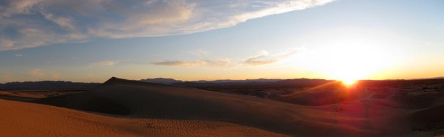
Some words of caution: though full of life, the Mojave is one of the harsher deserts in North America. Temperatures range from below freezing to well over 120°F, and a single day’s hi and low can span 50°F (or more, if traveling between higher and lower elevations). This desert is also home to some very dangerous wildlife, including deadly-poisonous bugs, spiders, reptiles, bobcat, mountain lions, and some very mean plants. The infamous jumping Cholla lives here, and has claimed many a shoe, pant leg, and truck tire (not to mention it’s taste for human blood). When in doubt, keep your distance. And please pack ample water, food, fuel, and proper navigation tools—and know how to use them!
The Southern Mojave
My own favorite stretch of desert, this region is often forgotten by all but the most adventurous spirits—if isolation is your thing, this is the place. Extending south from Interstate 40 to a stone’s throw from Interstate 10, and east from Interstate 15 to just shy of Phoenix, the Southern Mojave is a land of open valleys, rugged peaks, and unspoiled remnants of history.
Joshua Tree NP: the Old Dale Mining District
For those of you already familiar with the seemingly-endless piles of sculpted granite that make up the most popular areas of the park, Joshua Tree may seem like an unusually tame suggestion. Rest assured, the tourist-saturated tarmac of Loop Road encircles less than one-tenth of this area. In fact, there is only one paved road in the entire eastern two-thirds of the park. The Old Dale area lies mostly outside of the park boundary (making it exempt from the entry fees), and features mines, ruins, stunning vistas, and some great campsites.


Access from the north is via Highway 62 on Gold Crown Road or Ironage Road. From the south you can get there by entering Joshua Tree NP via Interstate 10, and turning right on Mecca Dale Road (take the left fork, which becomes Gold Crown Road). If you haven’t driven the popular Loop Road and have the time, it’s worth the extra few hours to do so on the way home.
- Trip time: 2-3 days
- Difficulty: moderate to difficult, rocks will challenge stock vehicles, and some roads may give you pause if you’re sensitive to heights
- Best time of year: late Fall and early Spring… though I am particularly fond of this area in the heat of Summer
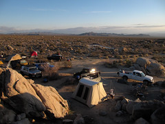
- Camping: anywhere there is an existing fire ring outside JTNP, contact the BLM Field Office in Barstow to obtain a campfire permit at 760-252-6000
- Resources: fuel can be found off of Interstate 10 in Indio and Chiriaco Summit to the south, and off Highway 62 in Joshua Tree and Twentynine Palms to the north
- Easily-combined with: the Old Woman Mountains, Burns Canyon (Yucca Valley to Big Bear)
- Additional reading: Old Dale Mining District on ExPo, More photos: Flickr and Flickr
The Old Woman Mountains and Surrounding Area
The Old Woman Mountains lie just one ridge north of the Old Dale Mining District, but feature a drastically different landscape. Here you’ll find vast open valleys and jagged mountains dotted with remnants from the region’s mining heyday and (still active) ranching operations. Some of the most isolated and well preserved scenery in the Mojave lies in this remote area, and you will typically go an entire trip without seeing another soul.


Access to the region is best from Route 66 by heading southeast on Danby Road (stop to explore Old Danby on the way), then turning east on the pipeline road and following it to Sunflower Springs Road (turn right at 34.663852, -115.14204). From there, just follow the road and keep turning right to stay near the mountains. It can also be reached via Cadiz Road, which skirts the southern edge of the Old Woman Mountains, from either Route 66 or Highway 62; be prepared for a longer (worthwhile) drive.
- Trip time: 2 days
- Difficulty: easy, though the remoteness should not be taken lightly
- Best time of year: Fall, Winter (dry weather) and Spring
- Camping: anywhere there is an existing fire ring, contact the BLM Field Office in Barstow to obtain a campfire permit at 760-252-6000 (there is a particularly good campsite at 34.548836, -115.114368)
- Resources: fuel can be obtained on Interstate 40, or closer in Amboy at Roy’s Cafe (expensive)
- Easily combined with: Old Dale Mining District, Route 66, Cadiz Dunes, Bristol Dry Lake
- Additional reading: Old Woman Mountains on ExPo, The Silence and The Sun, More photos: Flickr and Flickr
Swansea, Arizona
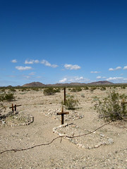
This isolated ghost town lies about half way between Lake Havasu and Alamo Lake along the Bill Williams River, with roughly 20 miles of dirt protecting it from the nearest tarmac. Most of the crumbling buildings of this once booming mining town are open to walk through on a self-guided tour, and plenty of side roads lead to other ruins and geologic points of interest. There are also five fire rings right in the middle of town, which are my recommendation for an overnight stay—there’s nothing like the creaking ruins of a ghost town to fill your dreams with… adventure!


The best access to Swansea is taking Shea Road north from Parker, Arizona (watch for the well-signed right turn to Swansea). Stop by the kiosk next to the pit toilets on arrival for a map of the ghost town and a brief overview of its history. If combining this with a Hualapai Mountains trip, connect via Planet Ranch Road and Alamo Road (cross the Bill Williams river at the pipeline and follow it north).
- Trip time: 2 days (3-4 if combined with the Hualapai Mountains)
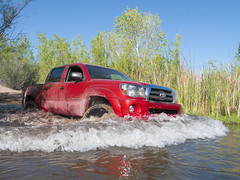
- Difficulty: easy to moderate, depending on where you explore and if you cross the Bill Williams River
- Best time of year: anytime except Summer and when it rains
- Camping: anywhere there is an existing fire ring
- Resources: fuel up in Bouse or Parker
- Easily combined with: Hualapai Mountains
- Additional reading: Aaron’s write-up, a more difficult approach, my most recent trip, More photos: Flickr and Flickr
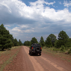
The Hualapai Mountains
The Hualapais are one of many “sky islands” in the middle of Arizona’s desert. At the higher elevations you’ll find an isolated and thriving pine forest reminiscent of the San Bernardino mountains in Southern California, sans crowds and National Forest restrictions. One road winds it’s way from the town of Yucca in the valley floor past mines, excellent camping and hiking, and views that extend well into California and Nevada. On your way out, stop at the Dam Bar in Kingman on the corner of Hualapai Mountain Road and Route 66 for some excellent grub.


Access is best taking Alamo Road (County Highway 15) from the town of Yucca to Boriana Mine Road, or by taking Hualapai Mountain Road to Flag Mine Road from the city of Kingman (via Route 66)—same road, different name. If combining this with a Swansea trip, connect via Alamo Road and Planet Ranch Road (follow the pipeline south to a good Bill Williams river crossing).
- Trip time: 2 days (3-4 if combined with Swansea)
- Difficulty: moderate (mostly easy, except for the boulder climb leaving Boriana); shelf roads may be a challenge for those with an aversion to heights
- Best time of year: anytime (avoid snow/rain)
- Camping: anywhere there is an existing fire ring; excellent spots can be found at Boriana and Wild Cow
- Resources: fuel up in Yucca or Kingman
- Easily combined with: Swansea
- Additional reading: Old Iron Run on ExPo, More photos: Flickr
Route 66
The longest continuous portions of original Mother Road still in existence reside in the Mojave Desert and the adjacent mountain regions of Northern Arizona. This portion of Route 66 is litered with ruins, ghost towns, and other historical points of interest dating all the way back to it’s early life as a network of trade routes used by Native American Indians. Keep your eyes open for faint sections of the original pavement from the old road, and when in doubt, take the path less traveled—it may lead to your next adventure.


Route 66 is easy to get to from just about anywhere in the Southwest, the challenge is found in staying on the “true” Route. The course of the road will take you through ample opportunities for fuel and food, so relax and enjoy the scenery. Note: this is a fantastic place for exploration—if you spot a dirt road disappearing into the horizon, go for it! Many of my longer trips in the Mojave began by aimlessly wandering down the Mother Road.
- Trip time: 2-7+ days (depending on how adventurous you are)
- Difficulty: easy (side explorations range from easy to difficult; beware of big-rig-sized holes in some of the original pavement—yes, seriously)
- Best time of year: anytime
- Camping: anywhere there is an existing fire ring on BLM lands
- Additional reading: NPS’s Route 66 Guide, numerous books you’ll find in general stores along the way
Tune in next week for Part Two: Destinations in the Northern Mojave Desert.

Chazz Layne is an adventurer, designer, and photographer based in Prescott, Arizona. Since early childhood he’s had a passion for travel and exploration, a passion which continues to fuel both his creativity and modern nomadic lifestyle. In addition to his work in design and photography, Chazz is a regular contributor to Expedition Portal and Overland Journal. You can connect with Chazz or learn more about his activities at chazzlayne.com.